Berrygrove

Wood, Forest in Hertfordshire Hertsmere

England

Berrygrove

The Mercure Hotel, Watford
The Mercure Hotel, Watford Credit: David Howard

Berrygrove is a picturesque woodland area located in Hertfordshire, England. Situated just a few miles from the bustling town of Watford, Berrygrove is a haven for nature enthusiasts and outdoor lovers. The area is known for its dense forests, scenic walking trails, and tranquil atmosphere.

Covering an area of approximately 100 hectares, Berrygrove is home to a rich variety of flora and fauna. The woodland is primarily composed of deciduous trees such as oak, beech, and birch, which create a vibrant and colorful landscape throughout the year. The forest floor is adorned with an array of wildflowers, including bluebells, primroses, and foxgloves, adding to the area's natural beauty.

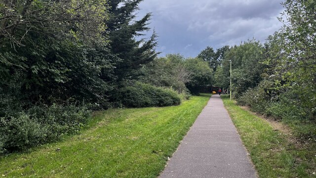
The woodland is crisscrossed by a network of well-maintained walking trails, allowing visitors to explore the area at their own pace. These paths lead to hidden glades, babbling brooks, and scenic viewpoints, providing ample opportunities for peace and solitude in the heart of nature. Berrygrove is also a popular spot for birdwatching, with a variety of species including woodpeckers, nuthatches, and owls frequently spotted amongst the treetops.

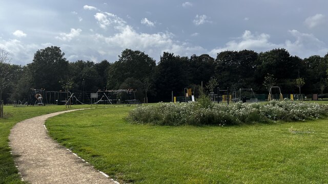
While Berrygrove primarily serves as a natural retreat, it also offers a range of amenities for visitors. The woodland has a designated picnic area with benches, making it an ideal spot for a leisurely lunch surrounded by nature. Additionally, there are several information boards scattered throughout the forest, providing educational insights into the local wildlife and history of the area.

Overall, Berrygrove in Hertfordshire is a true gem for nature lovers, offering a serene escape from the hustle and bustle of everyday life. With its enchanting woodland, picturesque trails, and diverse wildlife, it is a must-visit destination for anyone seeking a peaceful and immersive outdoor experience.

If you have any feedback on the listing, please let us know in the comments section below.
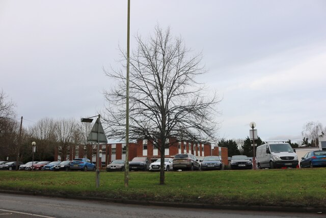
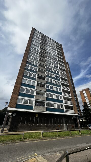
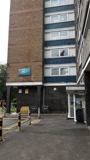
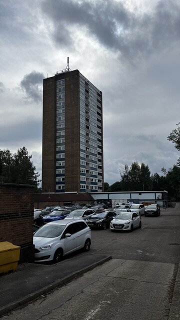
Berrygrove Images

Images are sourced within 2km of 51.66965/-0.36710363 or Grid Reference TQ1398. Thanks to Geograph Open Source API. All images are credited.

The Mercure Hotel, Watford
Watford Reeds Chapel, now converted to residential accommodation.
Watford
Reeds Chapel, now converted to residential accommodation.
Watford Housing development on the former orphanage site.
Watford
Housing development on the former orphanage site.
Topgolf Watford driving range, Bushey Mill Lane
Abbey View flats post-fire, Garston, Watford
RAF memorial plaque, Homefield Road
Munden View, Garsmouth Way
Abbey View, Garsmouth Way
Munden View, Garsmouth Way
Abbey View, Garsmouth Way
Meriden Community Centre, Garsmouth Way
Cow Lane, Meriden
Cow Lane, Meriden
Munden View, Garsmouth Way
Abbey View entrance, Garsmouth Way
Meriden Park Playground path
Watford FC's Community Sports Pitch
York Way, Meriden
York Way, Meriden
Meriden Fish Bar and Chiqizza Persian Grill, York Way
Show me another place!

Berrygrove is located at Grid Ref: TQ1398 (Lat: 51.66965, Lng: -0.36710363)

Administrative County: Hertfordshire

District: Hertsmere

Police Authority: Hertfordshire

What 3 Words

///move.audit.melon. Near Watford, Hertfordshire

Nearby Locations

Berrygrove Aldenham

Related Wikis

Aldenham

Aldenham is a village and civil parish in the borough of Hertsmere in Hertfordshire, England. The parish includes Radlett and Letchmore Heath as well as...

Purcell School for Young Musicians

The Purcell School for Young Musicians is a specialist music school for children, located in the town of Bushey, south Hertfordshire, England, and is the...

Bushey Hall

Bushey Hall was a historic house built in 1428 for Thomas Montacute, 4th Earl of Salisbury. It was also the home of Sir John Marsham, 1st Baronet. By 1883...

Queens' School

Queens' School, near Watford, Hertfordshire, is a partially selective secondary school and sixth form with academy status. It currently is a specialist...

The Watford UTC

The Watford UTC was a 14–19 University Technical College (UTC) in Watford, England that opened in September 2014. The UTC specialised in Event Management...

Wall Hall

Wall Hall, originally known as Aldenham Abbey, is a country house at Aldenham in Hertfordshire, England. The main house and several ancillary buildings...

North Watford

North Watford is an area in the town of Watford, Hertfordshire, in the United Kingdom. It is now primarily a residential area which developed as a result...

Edge Grove School

Edge Grove School, simply Edge Grove, is a 3–13 mixed, private, day preparatory school in Aldenham, Watford, Hertfordshire, England. It was established...

Nearby Amenities

Located within 500m of 51.66965,-0.36710363
Motorway Junction
Berrygrove
Destination: Watford A4008;Aylesbury A41
Ref: 5
Lat/Long: 51.6685842/-0.3631767
Motorway Junction
Berrygrove
Lat/Long: 51.6677582/-0.3658233
Traffic Signals
Lat/Long: 51.6703435/-0.3712781
Traffic Signals
Traffic Signals Direction: forward
Lat/Long: 51.6713773/-0.3709398
Traffic Signals
Traffic Signals Direction: forward
Lat/Long: 51.6724264/-0.3692734
Source: Local knowledge
Traffic Sign: GB:2901[M1]
Lat/Long: 51.6718948/-0.3701533
Speed Camera
Maxspeed: 70 mph
Maxspeed Type: GB:motorway
Lat/Long: 51.6721206/-0.3698587
Traffic Signals
Traffic Signals Direction: forward
Lat/Long: 51.6708667/-0.3684516
Power: tower
Lat/Long: 51.6666983/-0.3634473
Power: tower
Lat/Long: 51.6685535/-0.3662517
Power: tower
Lat/Long: 51.6702453/-0.3687527
Power: tower
Lat/Long: 51.66901/-0.3712499
Traffic Signals
Traffic Signals Direction: forward
Lat/Long: 51.6712141/-0.3707699
Turning Circle
Lat/Long: 51.6668548/-0.3718159
Source: Local knowledge
Traffic Sign: GB:642;2931
Lat/Long: 51.670857/-0.3683699
Traffic Signals
Traffic Signals Direction: forward
Lat/Long: 51.6722323/-0.3691721
Traffic Signals
Traffic Signals Direction: forward
Lat/Long: 51.6709791/-0.3686099
Traffic Signals
Traffic Signals Direction: forward
Lat/Long: 51.6702103/-0.3697126
Traffic Signals
Traffic Signals: signal
Traffic Signals Direction: forward
Lat/Long: 51.670085/-0.369768
Traffic Signals
Lat/Long: 51.6704122/-0.3716072
Traffic Calming: choker
Lat/Long: 51.6704079/-0.3704905
Source: Local knowledge
Traffic Sign: GB:642;2931
Lat/Long: 51.6724667/-0.36936
Inscription: Public Footpath 1 - Bushey Mill Lane (1/4 mile)
Marker Type: signpost
Lat/Long: 51.6698556/-0.3698305
Otterspool
Place: neighbourhood
Lat/Long: 51.6682906/-0.3651527
Give Way
Direction: forward
Lat/Long: 51.667142/-0.3654136
Street Lamp
Lamp Model: Philips SGS203
Lamp Type: SON
Source: Local knowledge
Lat/Long: 51.670449/-0.3675834
Street Lamp
Lamp Model: Philips SGS203
Lamp Type: SON
Source: Local knowledge
Lat/Long: 51.6702593/-0.3671414
Street Lamp
Lamp Model: Philips SGS203
Lamp Type: SON
Source: Local knowledge
Lat/Long: 51.669895/-0.3663126
Street Lamp
Lamp Model: Philips SGS203
Lamp Type: SON
Source: Local knowledge
Lat/Long: 51.6694994/-0.3654185
Man Made: surveillance
Ref: 52279
Source: Personal memory
Surveillance: outdoor
Surveillance Zone: traffic
Lat/Long: 51.671145/-0.3685653
Street Lamp
Lamp Model: Philips SGS203
Lamp Type: SON
Source: Local knowledge
Lat/Long: 51.6685413/-0.3633537
Street Lamp
Lamp Model: Philips SGS203
Lamp Type: SON
Source: Local knowledge
Lat/Long: 51.6710698/-0.3668028
Street Lamp
Lamp Model: Philips SGS203
Lamp Type: SON
Source: Local knowledge
Lat/Long: 51.668844/-0.3629997
Street Lamp
Lamp Model: Philips SGS203
Lamp Type: SON
Source: Local knowledge
Lat/Long: 51.6708385/-0.3664409
Street Lamp
Lamp Model: Philips SGS203
Lamp Type: SON
Source: Local knowledge
Lat/Long: 51.6700797/-0.3667248
Street Lamp
Lamp Model: Philips SGS203
Lamp Type: SON
Source: Local knowledge
Lat/Long: 51.6681637/-0.3625946
Street Lamp
Lamp Model: Philips SGS203
Lamp Type: SON
Source: Local knowledge
Lat/Long: 51.6684216/-0.3622111
Street Lamp
Lamp Model: Philips SGS203
Lamp Type: SON
Source: Local knowledge
Lat/Long: 51.6701533/-0.3653037
Street Lamp
Lamp Model: Philips SGS203
Lamp Type: SON
Source: Local knowledge
Lat/Long: 51.6677311/-0.3617845
Street Lamp
Lamp Model: Philips SGS203
Lamp Type: SON
Source: Local knowledge
Lat/Long: 51.6697007/-0.3658826
Street Lamp
Lamp Model: Philips SGS203
Lamp Type: SON
Source: Local knowledge
Lat/Long: 51.6679408/-0.3621923
Street Lamp
Lamp Model: Philips SGS203
Lamp Type: SON
Source: Local knowledge
Lat/Long: 51.6699271/-0.3649308
Street Lamp
Lamp Model: Philips SGS203
Lamp Type: SON
Source: Local knowledge
Lat/Long: 51.6697041/-0.3645607
Street Lamp
Lamp Model: Philips SGS203
Lamp Type: SON
Source: Local knowledge
Lat/Long: 51.6714074/-0.3676235
Street Lamp
Lamp Model: Philips SGS203
Lamp Type: SON
Source: Local knowledge
Lat/Long: 51.6691148/-0.3645791
Street Lamp
Lamp Model: Philips SGS203
Lamp Type: SON
Source: Local knowledge
Lat/Long: 51.6675248/-0.3614143
Street Lamp
Lamp Model: Philips SGS203
Lamp Type: SON
Source: Local knowledge
Lat/Long: 51.6689339/-0.3641718
Street Lamp
Lamp Model: Philips SGS203
Lamp Type: SON
Source: Local knowledge
Lat/Long: 51.6709285/-0.3684499
Street Lamp
Lamp Model: Philips SGS203
Lamp Type: SON
Source: Local knowledge
Lat/Long: 51.6712029/-0.3673261
Street Lamp
Lamp Model: Philips SGS203
Lamp Type: SON
Source: Local knowledge
Lat/Long: 51.6694828/-0.3641637
Street Lamp
Lamp Model: Philips SGS203
Lamp Type: SON
Source: Local knowledge
Lat/Long: 51.6708469/-0.36812
Street Lamp
Lamp Model: Philips SGS203
Lamp Type: SON
Source: Local knowledge
Lat/Long: 51.6706091/-0.366052
Street Lamp
Lamp Model: Philips SGS203
Lamp Type: SON
Source: Local knowledge
Lat/Long: 51.6687309/-0.363748
Street Lamp
Lamp Model: Philips SGS203
Lamp Type: SON
Source: Local knowledge
Lat/Long: 51.6690603/-0.3633886
Street Lamp
Lamp Model: Philips SGS203
Lamp Type: SON
Source: Local knowledge
Lat/Long: 51.6683566/-0.3629862
Street Lamp
Lamp Model: Philips SGS203
Lamp Type: SON
Source: Local knowledge
Lat/Long: 51.6679974/-0.3614573
Street Lamp
Lamp Model: Philips SGS203
Lamp Type: SON
Source: Local knowledge
Lat/Long: 51.6693136/-0.3649841
Street Lamp
Lamp Model: Philips SGS203
Lamp Type: SON
Source: Local knowledge
Lat/Long: 51.6706135/-0.3679406
Street Lamp
Lamp Model: Philips SGS203
Lamp Type: SON
Source: Local knowledge
Lat/Long: 51.667779/-0.3610521
Street Lamp
Lamp Model: Philips SGS203
Lamp Type: SON
Source: Local knowledge
Lat/Long: 51.6703845/-0.3656926
Street Lamp
Lamp Model: Philips SGS203
Lamp Type: SON
Source: Local knowledge
Lat/Long: 51.6686362/-0.3626081
Street Lamp
Lamp Model: Philips SGS203
Lamp Type: SON
Source: Local knowledge
Lat/Long: 51.66927/-0.3637694
Street Lamp
Lamp Model: Philips SGS203
Lamp Type: SON
Source: Local knowledge
Lat/Long: 51.6682053/-0.3618409
Street Lamp
Lamp Model: Philips SGS253
Lamp Type: SON
Source: Local knowledge
Lat/Long: 51.672329/-0.3706596
Street Lamp
Lamp Model: Philips SGS203
Lamp Type: SON
Source: Local knowledge
Lat/Long: 51.6717863/-0.3702468
Street Lamp
Lamp Model: Philips SGS253
Lamp Type: SON
Source: Local knowledge
Lat/Long: 51.6721532/-0.3701744
Street Lamp
Lamp Model: Philips SGS203
Lamp Type: SON
Source: Local knowledge
Lat/Long: 51.6719721/-0.3700779
Street Lamp
Lamp Model: Philips SGS203
Lamp Type: SON
Source: Local knowledge
Lat/Long: 51.6730658/-0.3715582
Street Lamp
Lamp Model: Philips SGS203
Lamp Type: SON
Source: Local knowledge
Lat/Long: 51.6728113/-0.3712712
Street Lamp
Lamp Model: Philips SGS203
Lamp Type: SON
Source: Local knowledge
Lat/Long: 51.6725651/-0.3709761
Street Lamp
Lamp Model: Philips SGS203
Lamp Type: SON
Source: Local knowledge
Lat/Long: 51.6725216/-0.3696112
Street Lamp
Lamp Model: Philips SGS203
Lamp Type: SON
Source: Local knowledge
Lat/Long: 51.6730525/-0.3701554
Street Lamp
Lamp Model: Philips SGS203
Lamp Type: SON
Source: Local knowledge
Lat/Long: 51.6723539/-0.3692837
Street Lamp
Lamp Model: Philips SGS203
Lamp Type: SON
Source: Local knowledge
Lat/Long: 51.6733019/-0.3704826
Street Lamp
Lamp Model: Philips SGS203
Lamp Type: SON
Source: Local knowledge
Lat/Long: 51.672803/-0.3697906
Direction: 160
Generator Method: photovoltaic
Generator Output Electricity: yes
Generator Solar Modules: 16
Generator Source: solar
Generator Type: solar_photovoltaic_panel
Location: roof
Power: generator
Lat/Long: 51.666659/-0.3717568
Traffic Calming: table
Lat/Long: 51.6653657/-0.3666274
Traffic Calming: table
Lat/Long: 51.6652905/-0.3654753
Source: Local knowledge
Traffic Sign: GB:2901[M1]
Lat/Long: 51.6714956/-0.3676115
Milestone
Distance: 27.9
Ref: A
Lat/Long: 51.6717594/-0.3692473
Milestone
Distance: 27.6
Ref: A
Lat/Long: 51.6700604/-0.3660141
Speed Camera
Maxspeed: 70 mph
Maxspeed Type: GB:motorway
Lat/Long: 51.6678117/-0.3616892
Crossing
Lat/Long: 51.6654093/-0.3680919
Traffic Calming: bump
Lat/Long: 51.6680279/-0.3683168
Traffic Calming: bump
Lat/Long: 51.6679872/-0.3685308
Traffic Calming: bump
Lat/Long: 51.668024/-0.3680356
Barrier: bollard
Lat/Long: 51.6668406/-0.3651763
Barrier: bollard
Lat/Long: 51.6670766/-0.3654533
Direction: backward
Traffic Calming: table
Lat/Long: 51.6653529/-0.3679505
Direction: forward
Traffic Calming: table
Lat/Long: 51.6652835/-0.368223
Crossing
Lat/Long: 51.6652407/-0.3680878
The data included in this document is from www.openstreetmap.org. The data is made available under ODbL.

Have you been to Berrygrove?

Leave your review of Berrygrove below (or comments, questions and feedback).