Aldenham

Settlement in Hertfordshire Hertsmere

England

Aldenham

The Mercure Hotel, Watford
The Mercure Hotel, Watford Credit: David Howard

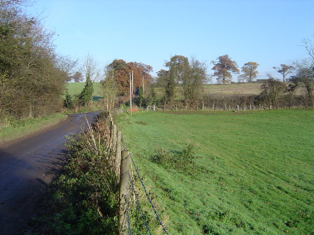
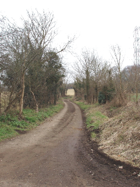
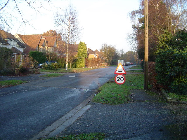
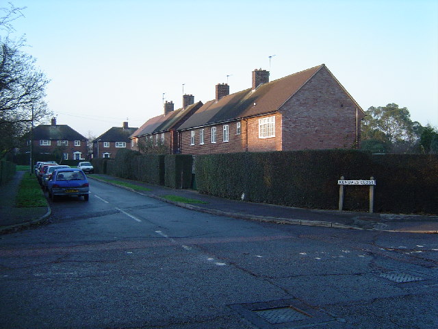
Aldenham is a picturesque village located in the county of Hertfordshire, England. Situated approximately 12 miles northwest of central London, it offers a peaceful and idyllic setting for its residents. The village is surrounded by beautiful countryside, with rolling hills and sprawling fields that provide a sense of tranquility.

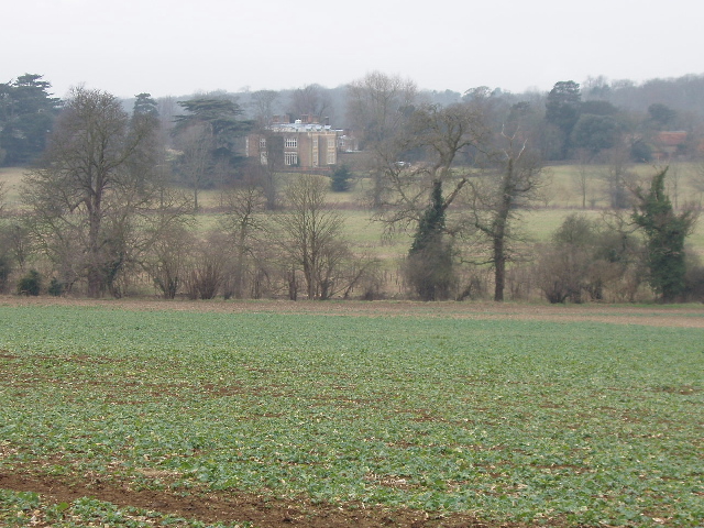
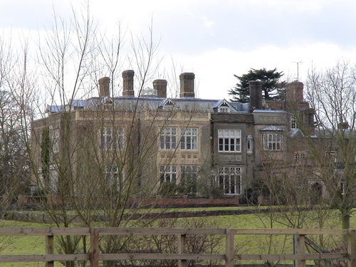
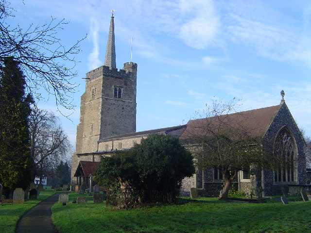
Aldenham boasts a rich history that dates back centuries. The village is home to the historic Aldenham House, a Grade II listed building that was built in the 18th century. The house is surrounded by well-manicured gardens, adding to its charm and elegance.

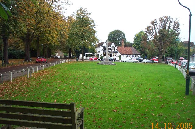
The village center is characterized by its quaint and traditional architecture, with many buildings dating back to the 16th and 17th centuries. There are a few local shops, including a post office and a village store, catering to the needs of the community.

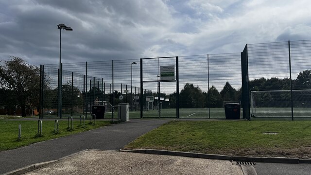
For nature enthusiasts, Aldenham offers various outdoor activities. Aldenham Country Park is a popular destination, featuring 175 acres of woodlands, reservoirs, and open spaces. Visitors can enjoy walking trails, wildlife spotting, and even fishing in the reservoirs.

Aldenham is also known for its excellent schools, including Aldenham School, an independent boarding and day school with a history dating back to 1597. The school is renowned for its academic excellence and offers a wide range of extracurricular activities.

Overall, Aldenham is a charming village that combines its rich history with natural beauty, making it an attractive place to live or visit.

If you have any feedback on the listing, please let us know in the comments section below.
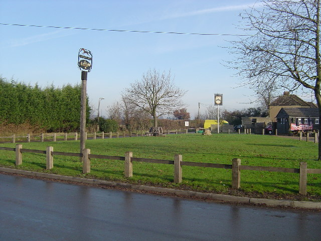
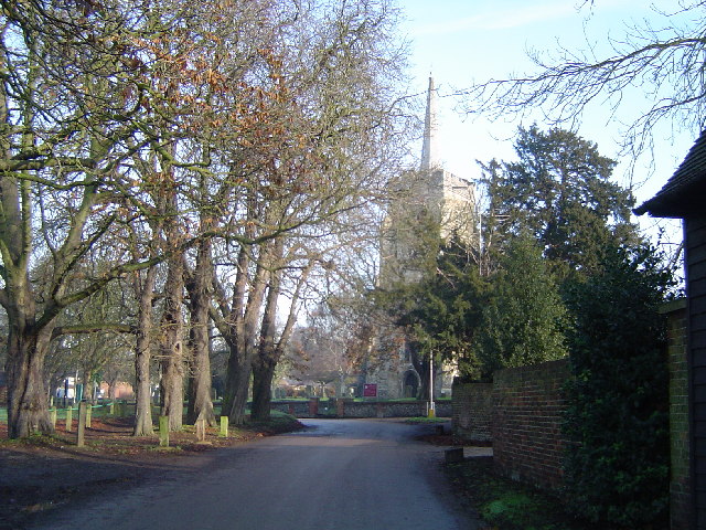
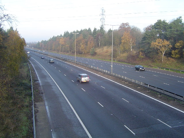
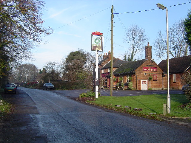
Aldenham Images

Images are sourced within 2km of 51.673287/-0.353534 or Grid Reference TQ1398. Thanks to Geograph Open Source API. All images are credited.

The Mercure Hotel, Watford
Topgolf Watford driving range, Bushey Mill Lane
Meriden Community Centre, Garsmouth Way
Watford FC's Community Sports Pitch
High Cross: Oakridge Lane Hill Farm is the only destination on the road beyond here, viewed looking northwards.
High Cross: Oakridge Lane
Hill Farm is the only destination on the road beyond here, viewed looking northwards.
Crops and view to Munden House, near Watford View west from road used as public path
Crops and view to Munden House, near Watford
View west from road used as public path
Water company valve sign, near Watford The sign has a grid reference of the 1km square it is in, followed by a sequential number within the square.
Water company valve sign, near Watford
The sign has a grid reference of the 1km square it is in, followed by a sequential number within the square.
Road Used as a Public Path (RUPP), near Watford View south-east towards Blackbirds Farm, from junction with bridleway
Road Used as a Public Path (RUPP), near Watford
View south-east towards Blackbirds Farm, from junction with bridleway
Munden House Munden House the home of The Hon. Henry Holland-Hibbert - Lord of the Manor of Bricket Wood Common.
Munden House
Munden House the home of The Hon. Henry Holland-Hibbert - Lord of the Manor of Bricket Wood Common.
Letchmore Heath Viewed looking northwards across The Green towards the Three Horseshoes public house. Unfortunately the village pond was being dredged at the time of the photography and was surrounded by unsightly fencing.
Letchmore Heath
Viewed looking northwards across The Green towards the Three Horseshoes public house. Unfortunately the village pond was being dredged at the time of the photography and was surrounded by unsightly fencing.
Watford: Stephenson Way Built in 1993 this dual carriageway road (the A4008) links the M1 motorway with the centre of Watford. This view was taken looking eastwards from the Bushey Mill Lane overbridge towards the roundabout at the M1 Junction 5 / A41 interchange.
Watford: Stephenson Way
Built in 1993 this dual carriageway road (the A4008) links the M1 motorway with the centre of Watford. This view was taken looking eastwards from the Bushey Mill Lane overbridge towards the roundabout at the M1 Junction 5 / A41 interchange.
Patchetts Green The village sign is the nearer of the two, the far one being for The Three Compasses Public House. View taken looking eastwards from Hilfield Lane towards Pegmire Lane.
Patchetts Green
The village sign is the nearer of the two, the far one being for The Three Compasses Public House. View taken looking eastwards from Hilfield Lane towards Pegmire Lane.
Aldenham Church Lane, Aldenham, with the Church of St John The Baptist visible through the trees.
Aldenham
Church Lane, Aldenham, with the Church of St John The Baptist visible through the trees.
M1 Motorway Viewed looking north westwards towards Junction 5 from the Sandy Lane overbridge.
M1 Motorway
Viewed looking north westwards towards Junction 5 from the Sandy Lane overbridge.
Round Bush Centre of this small village with the eponymous pub in view.
Round Bush
Centre of this small village with the eponymous pub in view.
Radlett: The Ridgeway Viewed looking eastwards.
Radlett: The Ridgeway
Viewed looking eastwards.
Radlett: Kendals Close Viewed looking north from Battlers Green Drive.
Radlett: Kendals Close
Viewed looking north from Battlers Green Drive.
Aldenham: Church of St John the Baptist There is an excellent active website for the Church here <span class="nowrap"><a title="http://www.aldenhamchurch.com/index.html" rel="nofollow ugc noopener" href="http://www.aldenhamchurch.com/index.html">Link</a><img style="margin-left:2px;" alt="External link" title="External link - shift click to open in new window" src="https://s1.geograph.org.uk/img/external.png" width="10" height="10"/></span>
Aldenham: Church of St John the Baptist
There is an excellent active website for the Church here LinkExternal link
Show me another place!

Aldenham is located at Grid Ref: TQ1398 (Lat: 51.673287, Lng: -0.353534)

Administrative County: Hertfordshire

District: Hertsmere

Police Authority: Hertfordshire

What 3 Words

///gains.noises.native. Near Radlett, Hertfordshire

Nearby Locations

Aldenham Berrygrove

Related Wikis

Aldenham

Aldenham is a village and civil parish in the borough of Hertsmere in Hertfordshire, England. The parish includes Radlett and Letchmore Heath as well as...

Edge Grove School

Edge Grove School, simply Edge Grove, is a 3–13 mixed, private, day preparatory school in Aldenham, Watford, Hertfordshire, England. It was established...

Wall Hall

Wall Hall, originally known as Aldenham Abbey, is a country house at Aldenham in Hertfordshire, England. The main house and several ancillary buildings...

Letchmore Heath

Letchmore Heath is a village in Hertfordshire in England, situated about three miles east of Watford. == General == The village, consisting of about 150...

Related Videos

Escape London - Wilderness Adventure Hiking Near London

Just a short distance from London in the northwest suburbs, you can go on an amazing, short hike within the Merry Hill Woodlands ...

90 Year Old Walking 390 laps in 10 days - Fundraising for the NHS

In celebration of his 90th birthday: to thank the NHS, George will be walking 390 laps in ten days starting 1st September.

Beautiful Bushey Rose Garden πŸŒΉπŸŒΏπŸ‡¬πŸ‡§ #youtubeshorts #trending #shorts #uksummer #travel #london

Beautiful Bushey Rose Garden #youtubeshorts #trendingshorts #shortsvideo #london #uksummer.

Nearby Amenities

Located within 500m of 51.673287,-0.353534
Power: tower
Lat/Long: 51.676215/-0.3492194
Traffic Calming: island
Lat/Long: 51.672981/-0.3491739
Bus Stop
St John's Church
Bus: yes
Naptan AtcoCode: 210021007560
Naptan Bearing: SW
Naptan CommonName: St John's Church
Naptan Crossing: The Dell
Naptan Indicator: o/s
Naptan Landmark: The Dell
Naptan NaptanCode: hrtgmpjt
Naptan PlusbusZoneRef: RADLETT
Naptan ShortCommonName: NA
Naptan Street: Church Lane
Naptan Verified: no
Public Transport: platform
Source: naptan_import
Lat/Long: 51.6739538/-0.3529805
Bus Stop
Morgan Gardens
Naptan AtcoCode: 210021007570
Naptan Bearing: SW
Naptan CommonName: Morgan Gardens
Naptan Crossing: opp Country Club
Naptan Indicator: adj
Naptan Landmark: opp Country Club
Naptan NaptanCode: hrtgmpjw
Naptan PlusbusZoneRef: RADLETT;WATFDJ
Naptan ShortCommonName: NA
Naptan Street: Radlett Road
Naptan Verified: no
Public Transport: platform
Source: naptan_import
Lat/Long: 51.6724372/-0.3545499
Bus Stop
Morgan Gardens
Naptan AtcoCode: 210021007620
Naptan Bearing: NE
Naptan CommonName: Morgan Gardens
Naptan Crossing: The Crescent
Naptan Indicator: opp
Naptan Landmark: The Crescent
Naptan NaptanCode: hrtgmpda
Naptan PlusbusZoneRef: RADLETT;WATFDJ
Naptan ShortCommonName: NA
Naptan Street: Radlett Road
Naptan Verified: no
Public Transport: platform
Source: naptan_import
Lat/Long: 51.6726079/-0.3546205
Bus Stop
St John's Church
Bus: yes
Naptan AtcoCode: 210021007630
Naptan Bearing: NE
Naptan CommonName: St John's Church
Naptan Crossing: Church Cottages
Naptan Indicator: opp
Naptan Landmark: Church Cottages
Naptan NaptanCode: hrtgmpdg
Naptan PlusbusZoneRef: RADLETT
Naptan ShortCommonName: NA
Naptan Street: Church Lane
Naptan Verified: no
Public Transport: platform
Source: naptan_import
Lat/Long: 51.6741861/-0.3526572
Aldenham
Place: village
Wikidata: Q19923
Lat/Long: 51.6735426/-0.3520014
Bench
Source: gps
Lat/Long: 51.6753848/-0.3575641
Stop
Direction: backward
Lat/Long: 51.6738477/-0.3534561
Traffic Calming: island
Lat/Long: 51.6710167/-0.355284
Direction: 180
Generator Method: photovoltaic
Generator Output Electricity: yes
Generator Solar Modules: 15
Generator Source: solar
Generator Type: solar_photovoltaic_panel
Location: roof
Power: generator
Lat/Long: 51.671748/-0.3536217
Traffic Calming: island
Lat/Long: 51.6731444/-0.3489663
Crossing
Crossing: unmarked
Lat/Long: 51.6732561/-0.3490896
Barrier: kissing_gate
Lat/Long: 51.674758/-0.3482933
The data included in this document is from www.openstreetmap.org. The data is made available under ODbL.

Have you been to Aldenham?

Leave your review of Aldenham below (or comments, questions and feedback).