Alder Forest

Settlement in Lancashire

England

Alder Forest

Newly Renovated Tow Path of the Bridgewater Canal
Newly Renovated Tow Path of the Bridgewater Canal Credit: Anthony Parkes

Alder Forest, located in Lancashire, England, is a captivating woodland area known for its natural beauty and rich biodiversity. Spanning approximately 160 hectares, the forest is situated within the larger Alder Grange Park, and is a popular destination for nature enthusiasts and outdoor adventurers alike.

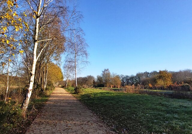
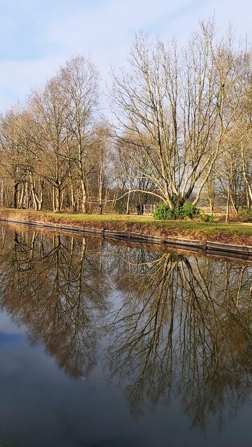
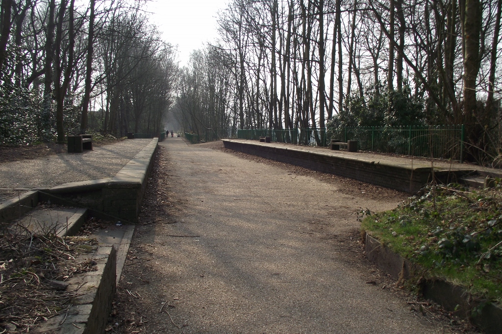
The forest is primarily composed of a mix of broadleaf and coniferous trees, including species such as alder, birch, oak, and pine. These towering trees create a dense canopy that filters sunlight, creating a tranquil and shaded atmosphere within the forest. Numerous walking trails wind through the woodland, providing visitors with the opportunity to explore its diverse flora and fauna.

Alder Forest is home to a wide range of wildlife, with many species finding sanctuary within its boundaries. Birdwatchers are often rewarded with sightings of species such as woodpeckers, owls, and various songbirds. Meanwhile, small mammals such as foxes, squirrels, and badgers can be spotted by those with a keen eye.

In addition to its natural features, Alder Forest offers recreational facilities for visitors. There are picnic areas where families can enjoy a meal surrounded by nature, as well as designated spaces for barbecues. The forest also has a children's playground and a visitor center, providing information on the local flora and fauna, as well as the history and conservation efforts of the area.

Overall, Alder Forest in Lancashire is a haven for those seeking a serene and picturesque escape into nature. With its diverse wildlife, well-maintained trails, and family-friendly amenities, it offers a memorable experience for all who venture into its embrace.

If you have any feedback on the listing, please let us know in the comments section below.

Alder Forest Images

Images are sourced within 2km of 53.495018/-2.377714 or Grid Reference SJ7599. Thanks to Geograph Open Source API. All images are credited.

Newly Renovated Tow Path of the Bridgewater Canal
Reflections in The Bridgewater Canal
Franklin St
Franklin St
Kay's Corner
Kay's Corner
Nelson St
Nelson St
Police St
Police St
Queen Victoria St
Queen Victoria St
Queen Victoria St
Queen Victoria St
Cromwell Rd, Green lane junction
B5231 The B5231 runs 3 miles from Patricroft to Pendlebury.
<span class="nowrap"><a title="https://www.sabre-roads.org.uk/wiki/index.php?title=B5231" rel="nofollow ugc noopener" href="https://www.sabre-roads.org.uk/wiki/index.php?title=B5231">Link</a><img style="margin-left:2px;" alt="External link" title="External link - shift click to open in new window" src="https://s1.geograph.org.uk/img/external.png" width="10" height="10"/></span>
B5231
The B5231 runs 3 miles from Patricroft to Pendlebury. LinkExternal link
Railway Bridge, B5231 The B5231 runs 3 miles from Patricroft to Pendlebury.
<span class="nowrap"><a title="https://www.sabre-roads.org.uk/wiki/index.php?title=B5231" rel="nofollow ugc noopener" href="https://www.sabre-roads.org.uk/wiki/index.php?title=B5231">Link</a><img style="margin-left:2px;" alt="External link" title="External link - shift click to open in new window" src="https://s1.geograph.org.uk/img/external.png" width="10" height="10"/></span>
Railway Bridge, B5231
The B5231 runs 3 miles from Patricroft to Pendlebury. LinkExternal link
Patricroft Station
Patricroft Station
Narrow footpath
Narrow footpath
Bridgewater Canal Often considered to be the first "true" canal, the Bridgewater Canal was commissioned by Francis Egerton, 3rd Duke of Bridgewater, to transport coal from his mines in Worsley. The section from Worsley to Manchester opened on 17th July 1761; it was later extended from Manchester to Runcorn, and then from Worsley to Leigh. Coal was needed in large quantities to fuel the industrial revolution and the canal enabled coal and other goods to be transported efficiently and cheaply to the rapidly expanding towns and cities. Its success helped inspire a period of intense canal building although it later faced intense competition from the Liverpool and Manchester Railway and the Macclesfield Canal.

The canal is connected to the Rochdale Canal (<a title="https://www.geograph.org.uk/snippet/1707" href="https://www.geograph.org.uk/snippet/1707">Link</a> ) in Manchester, the Trent and Mersey Canal at Preston Brook, south-east of Runcorn, and to the Leeds and Liverpool Canal at Leigh. It once connected with the River Mersey at Runcorn but has since been cut off by a slip road to the Silver Jubilee Bridge.

Navigable throughout its history, it is one of the few canals in Britain not to have been nationalised, and remains privately owned. Commercial traffic continued on the canal until 1974. By this time, canals were becoming more important as a leisure facility and pleasure craft now use the canal which forms part of the Cheshire Ring circular canal route.

For many years, the canal around Worsley was noted for the distinctive bright orange colouring of the water. This was a result of iron oxide from the mines tainting the water as the canal passes through Worsley. A £2.5 million remedial scheme was undertaken in 2013 to remove this colouration.

The Bridgewater Canal is owned and operated by the Manchester Ship Canal Company in conjunction with the Bridgewater Canal Trust.

<span class="nowrap"><a title="http://www.bridgewatercanal.co.uk/" rel="nofollow ugc noopener" href="http://www.bridgewatercanal.co.uk/">Link</a><img style="margin-left:2px;" alt="External link" title="External link - shift click to open in new window" src="https://s1.geograph.org.uk/img/external.png" width="10" height="10"/></span> Bridgewater Canal Company
<span class="nowrap"><a title="http://www.penninewaterways.co.uk/bridgewater/bri2.htm" rel="nofollow ugc noopener" href="http://www.penninewaterways.co.uk/bridgewater/bri2.htm">Link</a><img style="margin-left:2px;" alt="External link" title="External link - shift click to open in new window" src="https://s1.geograph.org.uk/img/external.png" width="10" height="10"/></span> Pennine Waterways
<span class="nowrap"><a title="http://en.wikipedia.org/wiki/Bridgewater_Canal" rel="nofollow ugc noopener" href="http://en.wikipedia.org/wiki/Bridgewater_Canal">Link</a><img style="margin-left:2px;" alt="External link" title="External link - shift click to open in new window" src="https://s1.geograph.org.uk/img/external.png" width="10" height="10"/></span> Wikipedia
Bridgewater Canal
Often considered to be the first "true" canal, the Bridgewater Canal was commissioned by Francis Egerton, 3rd Duke of Bridgewater, to transport coal from his mines in Worsley. The section from Worsley to Manchester opened on 17th July 1761; it was later extended from Manchester to Runcorn, and then from Worsley to Leigh. Coal was needed in large quantities to fuel the industrial revolution and the canal enabled coal and other goods to be transported efficiently and cheaply to the rapidly expanding towns and cities. Its success helped inspire a period of intense canal building although it later faced intense competition from the Liverpool and Manchester Railway and the Macclesfield Canal. The canal is connected to the Rochdale Canal (Link ) in Manchester, the Trent and Mersey Canal at Preston Brook, south-east of Runcorn, and to the Leeds and Liverpool Canal at Leigh. It once connected with the River Mersey at Runcorn but has since been cut off by a slip road to the Silver Jubilee Bridge. Navigable throughout its history, it is one of the few canals in Britain not to have been nationalised, and remains privately owned. Commercial traffic continued on the canal until 1974. By this time, canals were becoming more important as a leisure facility and pleasure craft now use the canal which forms part of the Cheshire Ring circular canal route. For many years, the canal around Worsley was noted for the distinctive bright orange colouring of the water. This was a result of iron oxide from the mines tainting the water as the canal passes through Worsley. A £2.5 million remedial scheme was undertaken in 2013 to remove this colouration. The Bridgewater Canal is owned and operated by the Manchester Ship Canal Company in conjunction with the Bridgewater Canal Trust. LinkExternal link Bridgewater Canal Company LinkExternal link Pennine Waterways LinkExternal link Wikipedia
Railway bridge over Bridgewater Canal Often considered to be the first "true" canal, the Bridgewater Canal was commissioned by Francis Egerton, 3rd Duke of Bridgewater, to transport coal from his mines in Worsley. The section from Worsley to Manchester opened on 17th July 1761; it was later extended from Manchester to Runcorn, and then from Worsley to Leigh. Coal was needed in large quantities to fuel the industrial revolution and the canal enabled coal and other goods to be transported efficiently and cheaply to the rapidly expanding towns and cities. Its success helped inspire a period of intense canal building although it later faced intense competition from the Liverpool and Manchester Railway and the Macclesfield Canal.

The canal is connected to the Rochdale Canal (<a title="https://www.geograph.org.uk/snippet/1707" href="https://www.geograph.org.uk/snippet/1707">Link</a> ) in Manchester, the Trent and Mersey Canal at Preston Brook, south-east of Runcorn, and to the Leeds and Liverpool Canal at Leigh. It once connected with the River Mersey at Runcorn but has since been cut off by a slip road to the Silver Jubilee Bridge.

Navigable throughout its history, it is one of the few canals in Britain not to have been nationalised, and remains privately owned. Commercial traffic continued on the canal until 1974. By this time, canals were becoming more important as a leisure facility and pleasure craft now use the canal which forms part of the Cheshire Ring circular canal route.

For many years, the canal around Worsley was noted for the distinctive bright orange colouring of the water. This was a result of iron oxide from the mines tainting the water as the canal passes through Worsley. A £2.5 million remedial scheme was undertaken in 2013 to remove this colouration.

The Bridgewater Canal is owned and operated by the Manchester Ship Canal Company in conjunction with the Bridgewater Canal Trust.

<span class="nowrap"><a title="http://www.bridgewatercanal.co.uk/" rel="nofollow ugc noopener" href="http://www.bridgewatercanal.co.uk/">Link</a><img style="margin-left:2px;" alt="External link" title="External link - shift click to open in new window" src="https://s1.geograph.org.uk/img/external.png" width="10" height="10"/></span> Bridgewater Canal Company
<span class="nowrap"><a title="http://www.penninewaterways.co.uk/bridgewater/bri2.htm" rel="nofollow ugc noopener" href="http://www.penninewaterways.co.uk/bridgewater/bri2.htm">Link</a><img style="margin-left:2px;" alt="External link" title="External link - shift click to open in new window" src="https://s1.geograph.org.uk/img/external.png" width="10" height="10"/></span> Pennine Waterways
<span class="nowrap"><a title="http://en.wikipedia.org/wiki/Bridgewater_Canal" rel="nofollow ugc noopener" href="http://en.wikipedia.org/wiki/Bridgewater_Canal">Link</a><img style="margin-left:2px;" alt="External link" title="External link - shift click to open in new window" src="https://s1.geograph.org.uk/img/external.png" width="10" height="10"/></span> Wikipedia
Railway bridge over Bridgewater Canal
Often considered to be the first "true" canal, the Bridgewater Canal was commissioned by Francis Egerton, 3rd Duke of Bridgewater, to transport coal from his mines in Worsley. The section from Worsley to Manchester opened on 17th July 1761; it was later extended from Manchester to Runcorn, and then from Worsley to Leigh. Coal was needed in large quantities to fuel the industrial revolution and the canal enabled coal and other goods to be transported efficiently and cheaply to the rapidly expanding towns and cities. Its success helped inspire a period of intense canal building although it later faced intense competition from the Liverpool and Manchester Railway and the Macclesfield Canal. The canal is connected to the Rochdale Canal (Link ) in Manchester, the Trent and Mersey Canal at Preston Brook, south-east of Runcorn, and to the Leeds and Liverpool Canal at Leigh. It once connected with the River Mersey at Runcorn but has since been cut off by a slip road to the Silver Jubilee Bridge. Navigable throughout its history, it is one of the few canals in Britain not to have been nationalised, and remains privately owned. Commercial traffic continued on the canal until 1974. By this time, canals were becoming more important as a leisure facility and pleasure craft now use the canal which forms part of the Cheshire Ring circular canal route. For many years, the canal around Worsley was noted for the distinctive bright orange colouring of the water. This was a result of iron oxide from the mines tainting the water as the canal passes through Worsley. A £2.5 million remedial scheme was undertaken in 2013 to remove this colouration. The Bridgewater Canal is owned and operated by the Manchester Ship Canal Company in conjunction with the Bridgewater Canal Trust. LinkExternal link Bridgewater Canal Company LinkExternal link Pennine Waterways LinkExternal link Wikipedia
Port Salford Greenway
Worsley Rd The B5211 runs 4 miles from Worsley to Stretford.
<span class="nowrap"><a title="https://www.sabre-roads.org.uk/wiki/index.php?title=B5211" rel="nofollow ugc noopener" href="https://www.sabre-roads.org.uk/wiki/index.php?title=B5211">Link</a><img style="margin-left:2px;" alt="External link" title="External link - shift click to open in new window" src="https://s1.geograph.org.uk/img/external.png" width="10" height="10"/></span>
Worsley Rd
The B5211 runs 4 miles from Worsley to Stretford. LinkExternal link
Show me another place!

Alder Forest is located at Grid Ref: SJ7599 (Lat: 53.495018, Lng: -2.377714)

Unitary Authority: Salford

Police Authority: Greater Manchester

What 3 Words

///cuddling.contexts.paving. Near Swinton, Manchester

Related Wikis

Nearby Amenities

Located within 500m of 53.495018,-2.377714
Motorway Junction
Worsley Interchange
Ref: 13
Lat/Long: 53.495278/-2.3840239
Motorway Junction
Eccles Interchange
Ref: 12
Lat/Long: 53.4910737/-2.3790968
Bus Stop
Barton Road/Worsley Court House (Stop D)
Bus: yes
Local Ref: D
Naptan AtcoCode: 1800NF28791
Naptan Bearing: NW
Naptan CommonName: Barton Road/Worsley Court House (Stop D)
Naptan Indicator: Stop D
Naptan Landmark: TEA ROOM
Naptan NaptanCode: mangmdmt
Naptan PlusbusZoneRef: MNCRPIC
Naptan ShortCommonName: Worsley Court Hse
Naptan Street: BARTON ROAD
Naptan Verified: no
Network: TfGM
Public Transport: platform
Source: naptan_import
Lat/Long: 53.4990558/-2.3809363
Bus Stop
Barton Road/Granary Lane
Bus: yes
Naptan AtcoCode: 1800NF28801
Naptan Bearing: SE
Naptan CommonName: Barton Road/Granary Lane
Naptan Indicator: Warehouse
Naptan Landmark: OFFICES
Naptan NaptanCode: mangmdmw
Naptan PlusbusZoneRef: MNCRPIC
Naptan ShortCommonName: Granary Lane
Naptan Street: BARTON ROAD
Naptan Verified: no
Network: TfGM
Public Transport: platform
Source: naptan_import
Lat/Long: 53.4980112/-2.3786958
Bus Stop
Barton Road/Granary Lane
Bus: yes
Naptan AtcoCode: 1800NF28811
Naptan Bearing: NW
Naptan CommonName: Barton Road/Granary Lane
Naptan Indicator: House 59
Naptan Landmark: HOUSE 59
Naptan NaptanCode: mangmdpa
Naptan PlusbusZoneRef: MNCRPIC
Naptan ShortCommonName: Granary Lane
Naptan Street: BARTON ROAD
Naptan Verified: no
Network: TfGM
Public Transport: platform
Source: naptan_import
Lat/Long: 53.4976712/-2.3782104
Bus Stop
Worsley Road/Walker Road
Bus: yes
Naptan AtcoCode: 1800NF28821
Naptan Bearing: NW
Naptan CommonName: Worsley Road/Walker Road
Naptan Indicator: Norweb Sub Stn
Naptan Landmark: Winton Cricket Club
Naptan NaptanCode: mangmdpd
Naptan PlusbusZoneRef: MNCRPIC
Naptan ShortCommonName: Walker Road
Naptan Street: WORSLEY ROAD
Naptan Verified: no
Network: TfGM
Public Transport: platform
Source: naptan_import
Lat/Long: 53.4939396/-2.3757655
Bus Stop
Worsley Road/Walker Road
Bus: yes
Naptan AtcoCode: 1800NF28831
Naptan Bearing: SE
Naptan CommonName: Worsley Road/Walker Road
Naptan Indicator: Texaco Garage
Naptan Landmark: CAR WASH
Naptan NaptanCode: mangmdpg
Naptan PlusbusZoneRef: MNCRPIC
Naptan ShortCommonName: Walker Road
Naptan Street: WORSLEY ROAD
Naptan Verified: no
Network: TfGM
Public Transport: platform
Source: naptan_import
Lat/Long: 53.493627/-2.3751296
Bus Stop
Worsley Road/Hartington Road
Bus: yes
Naptan AtcoCode: 1800NF28841
Naptan Bearing: NW
Naptan CommonName: Worsley Road/Hartington Road
Naptan Indicator: O/s House 445
Naptan Landmark: HOUSE 445
Naptan NaptanCode: mangmdpj
Naptan PlusbusZoneRef: MNCRPIC
Naptan ShortCommonName: Hartington Road
Naptan Street: WORSLEY ROAD
Naptan Verified: no
Network: TfGM
Public Transport: platform
Source: naptan_import
Lat/Long: 53.4919241/-2.3735169
Pub
The Barton Arms
Brand: Ember Inns
Brand Wikidata: Q116272278
Contact Website: https://www.emberinns.co.uk/nationalsearch/northwest/the-barton-arms-worsley
Lat/Long: 53.4974166/-2.3768939
Crossing
Bicycle: yes
Crossing: marked
Crossing Markings: yes
Tactile Paving: yes
Traffic Calming: table
Lat/Long: 53.4983668/-2.3798751
Turning Circle
Lat/Long: 53.491573/-2.3740779
Mini Roundabout
Lat/Long: 53.4956603/-2.3723983
Phone
Emergency: phone
Ref: 9204 A
Lat/Long: 53.4932561/-2.3822616
3rd Duke of Bridgewater's monument
Access: yes
Historic: monument
Inscription: Latin: "I was a lofty column, where panting nostrils were made by the skill of the Cyclops, the glory of the smith”
Listed Status: Grade II
Start Date: 1905
Wikidata: Q26509903
Lat/Long: 53.4990207/-2.3785042
Power: tower
Lat/Long: 53.4975911/-2.3737496
Power: tower
Lat/Long: 53.4955648/-2.3781001
Power: tower
Lat/Long: 53.4932862/-2.3830032
Phone
Emergency: phone
Ref: 9204 B
Lat/Long: 53.492928/-2.3811433
Phone
Emergency: phone
Lat/Long: 53.4953115/-2.3835955
Crossing
Crossing: traffic_signals
Crossing Ref: pelican
Tactile Paving: yes
Lat/Long: 53.4989002/-2.3806538
Lcn Ref: 239
Lat/Long: 53.498663/-2.3797432
Noexit: yes
Lat/Long: 53.498113/-2.3756096
Noexit: yes
Lat/Long: 53.498174/-2.3770348
Noexit: yes
Lat/Long: 53.4983378/-2.3773921
Noexit: yes
Lat/Long: 53.4982133/-2.3780177
Noexit: yes
Lat/Long: 53.4989504/-2.3747662
Noexit: yes
Lat/Long: 53.4989488/-2.3750988
Noexit: yes
Lat/Long: 53.4988372/-2.3755226
Noexit: yes
Lat/Long: 53.4981639/-2.3741224
Noexit: yes
Lat/Long: 53.4986274/-2.3783362
Give Way
Lat/Long: 53.4986335/-2.3733519
Direction: 325
Traffic Sign: variable_message
Lat/Long: 53.4911515/-2.379076
The data included in this document is from www.openstreetmap.org. The data is made available under ODbL.

Have you been to Alder Forest?

Leave your review of Alder Forest below (or comments, questions and feedback).