Severells Copse

Wood, Forest in Surrey Mole Valley

England

Severells Copse

Wolvens Lane Byway between Coldharbour and Wotton.
Wolvens Lane Credit: Ian Capper

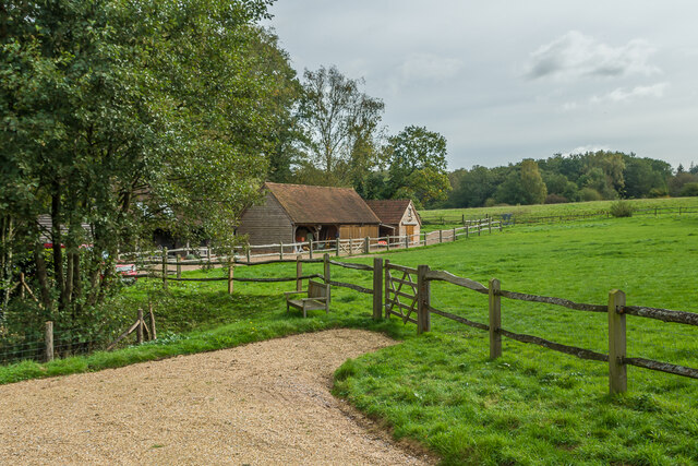
Severells Copse is a picturesque woodland located in the county of Surrey, England. Covering an area of approximately 50 acres, this enchanting forest is a popular destination for nature lovers and outdoor enthusiasts.

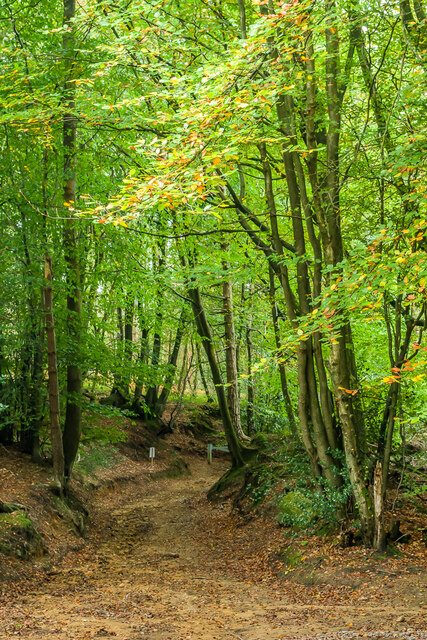
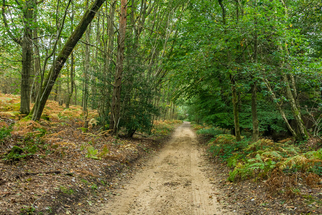
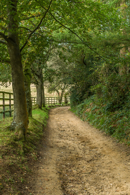
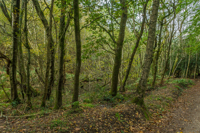
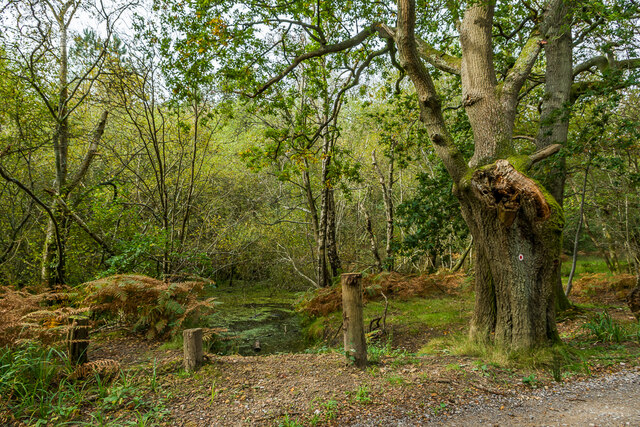
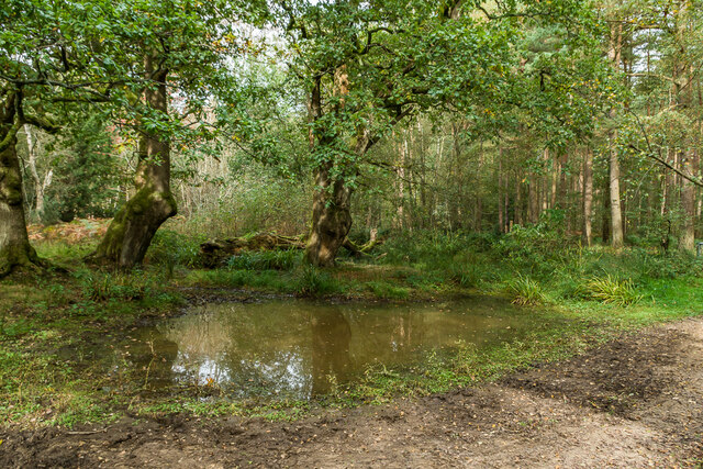
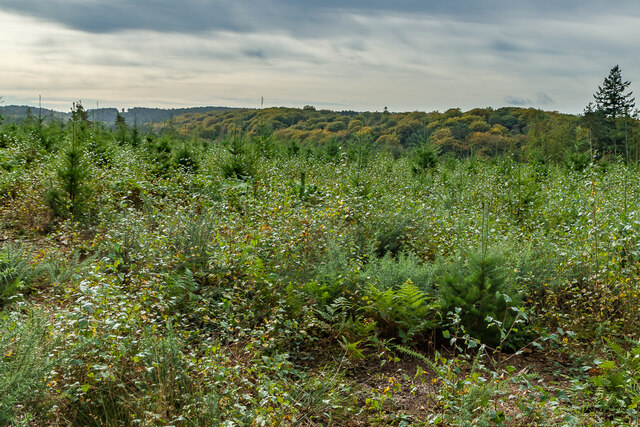
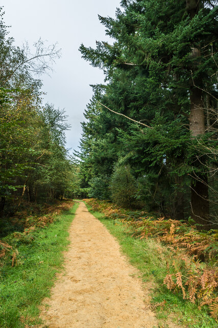
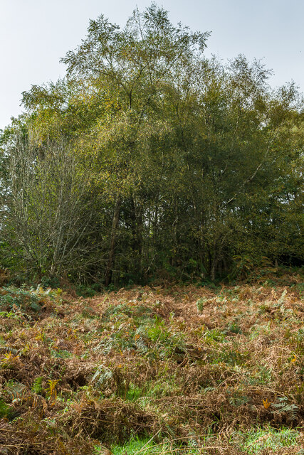
The copse is characterized by its diverse range of tree species, including oak, beech, and birch. The towering trees create a dense canopy, allowing only dappled sunlight to filter through, creating a serene and tranquil atmosphere. The forest floor is covered with a thick carpet of moss, ferns, and wildflowers, providing a vibrant burst of color throughout the year.

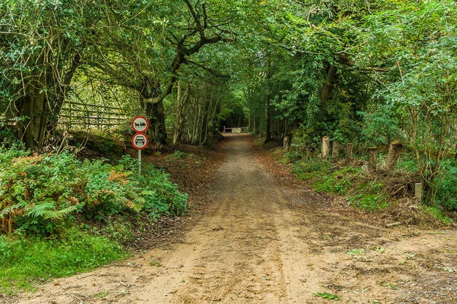
As visitors explore the winding pathways, they may encounter an array of wildlife that call Severells Copse home. From squirrels and rabbits to a variety of bird species, the copse provides a haven for many creatures. The peacefulness of the woodland also makes it an excellent spot for birdwatching.

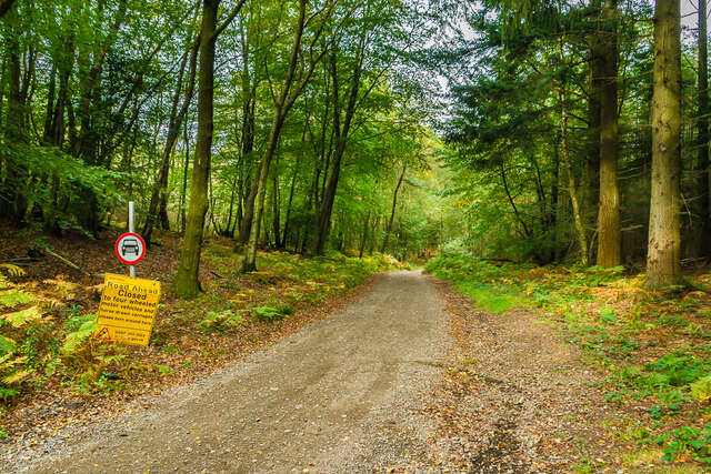
Severells Copse is not only a place of natural beauty but also holds historical significance. It is believed that the woodland has existed for centuries, providing a habitat for wildlife and a source of timber for local communities. The copse has been managed by the Surrey Wildlife Trust since the 1980s, ensuring its preservation for future generations to enjoy.

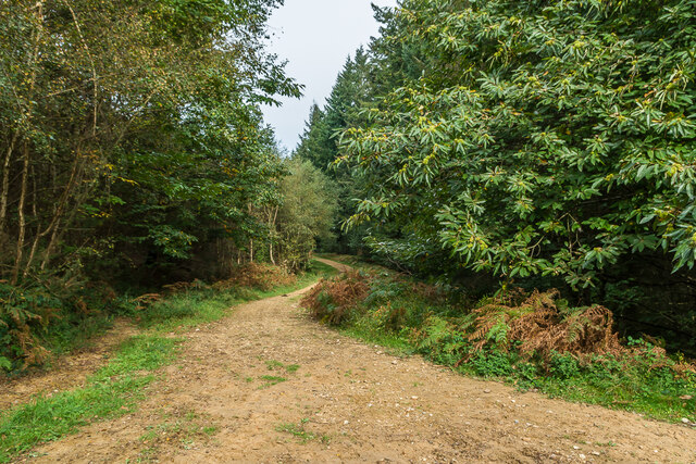
Visitors can fully immerse themselves in the beauty of Severells Copse by following the well-marked trails that wind through the forest. Whether it's a leisurely stroll or a more challenging hike, the woodland offers something for everyone. With its serene ambiance, diverse flora and fauna, and rich history, Severells Copse is truly a hidden gem in the heart of Surrey.

If you have any feedback on the listing, please let us know in the comments section below.

Severells Copse Images

Images are sourced within 2km of 51.196889/-0.38420186 or Grid Reference TQ1245. Thanks to Geograph Open Source API. All images are credited.

Wolvens Lane Byway between Coldharbour and Wotton.
Wolvens Lane
Byway between Coldharbour and Wotton.
Wolvens Lane Byway between Coldharbour and Wotton.
Wolvens Lane
Byway between Coldharbour and Wotton.
Wolvens Lane Byway between Coldharbour and Wotton.  Although it is a "BOAT" (Byway open to all traffic), the sign refers to a temporary closure to four wheel drive vehicles, to avoid damage to recent repairs, and a consultation is currently under way to make the closure permanent.
Wolvens Lane
Byway between Coldharbour and Wotton. Although it is a "BOAT" (Byway open to all traffic), the sign refers to a temporary closure to four wheel drive vehicles, to avoid damage to recent repairs, and a consultation is currently under way to make the closure permanent.
Field Field off Wolvens Lane, a byway between Coldharbour and Wotton.  A couple of Roe Deer can be seen towards the right of the photo.  In the far distance are the North Downs.
Field
Field off Wolvens Lane, a byway between Coldharbour and Wotton. A couple of Roe Deer can be seen towards the right of the photo. In the far distance are the North Downs.
Wolvens Lane Byway between Coldharbour and Wotton.
Wolvens Lane
Byway between Coldharbour and Wotton.
Upper Merriden Cottage Remote house on Wolvens Lane, a byway between Coldharbour and Wotton.  The current building dates from the early 2000s, replacing an earlier slightly smaller forester's cottage on the same site but nearer the lane, which had been damaged by fire.
Upper Merriden Cottage
Remote house on Wolvens Lane, a byway between Coldharbour and Wotton. The current building dates from the early 2000s, replacing an earlier slightly smaller forester's cottage on the same site but nearer the lane, which had been damaged by fire.
Wolvens Lane Byway between Coldharbour and Wotton.  Although it is a "BOAT" (Byway open to all traffic), there is currently a temporary closure to four wheel drive vehicles (and horses and carts!), to avoid damage to recent repairs, as indicated by the signs here).  A consultation is currently under way to make the closure permanent.
Wolvens Lane
Byway between Coldharbour and Wotton. Although it is a "BOAT" (Byway open to all traffic), there is currently a temporary closure to four wheel drive vehicles (and horses and carts!), to avoid damage to recent repairs, as indicated by the signs here). A consultation is currently under way to make the closure permanent.
Tankards Pond Partly overgrown pond alongside Wolvens Lane, a byway between Coldharbour and Wotton.
Tankards Pond
Partly overgrown pond alongside Wolvens Lane, a byway between Coldharbour and Wotton.
Tankards Pond Partly overgrown pond alongside Wolvens Lane, a byway between Coldharbour and Wotton.
Tankards Pond
Partly overgrown pond alongside Wolvens Lane, a byway between Coldharbour and Wotton.
Pond A small pond just north of the larger Tankards Pond, alongside Wolvens Lane, a byway between Coldharbour and Wotton.
Pond
A small pond just north of the larger Tankards Pond, alongside Wolvens Lane, a byway between Coldharbour and Wotton.
Replanted woodland Replanted woodland off Wolvens Lane, a byway between Coldharbour and Wotton.  In the left distance can be seen the tower on the summit of Leith Hill.
Replanted woodland
Replanted woodland off Wolvens Lane, a byway between Coldharbour and Wotton. In the left distance can be seen the tower on the summit of Leith Hill.
Squire's Great Wood Path through Squire's Great Wood.
Squire's Great Wood
Path through Squire's Great Wood.
Squire's Great Wood Path through Squire's Great Wood.
Squire's Great Wood
Path through Squire's Great Wood.
Bracken slope A bracken covered slope near Logmore Farm.
Bracken slope
A bracken covered slope near Logmore Farm.
Logmore Farm Track outside Logmore Farm.
Logmore Farm
Track outside Logmore Farm.
Logmore Farm Farm near Logmore Green.
Logmore Farm
Farm near Logmore Green.
Logmore Farm Paddocks at Logmore Farm near Logmore Green.
Logmore Farm
Paddocks at Logmore Farm near Logmore Green.
Meadow House and April Cottage Pair of semi-detached cottages on Logmore Lane.
Meadow House and April Cottage
Pair of semi-detached cottages on Logmore Lane.
Show me another place!

Severells Copse is located at Grid Ref: TQ1245 (Lat: 51.196889, Lng: -0.38420186)

Administrative County: Surrey

District: Mole Valley

Police Authority: Surrey

What 3 Words

///crowds.slip.fault. Near Westcott, Surrey

Related Wikis

Friday Street

Friday Street is a hamlet on the gentle lower north slope of Leith Hill in Surrey, England. It is in a wooded headwater ravine, just to the south of Wotton...

Wotton and Abinger Commons

Wotton and Abinger Commons is a 324-hectare (800-acre) nature reserve south-west of Dorking in Surrey. It is managed by the Surrey Wildlife Trust. Part...

Abinger

Abinger is a large, well-wooded and mostly rural civil parish that lies between the settlements of Dorking, Shere and Ewhurst in the district of Mole Valley...

Goddards

Goddards is a Grade II*-listed house in Abinger Common, Surrey, England. It was designed by Edwin Lutyens in 1898–1900 in the ideals of the Arts and Crafts...

Leith Hill SSSI

Leith Hill SSSI is a 337.9-hectare (835-acre) biological Site of Special Scientific Interest south-east of Dorking in Surrey. The SSSI consists of four...

Abinger Common War Memorial

Abinger Common War Memorial is a First World War memorial in the village of Abinger Common in Surrey, south-eastern England. The memorial was destroyed...

St James's Church, Abinger Common

St James's Church stands on Abinger Lane in Abinger Common, a small village within the civil parish of Abinger in Surrey, south-eastern England. The church...

Belmont School, Surrey

Belmont is an independent co-educational school in Surrey which takes pupils from the ages of 3 to 16. The school is a charitable trust, administered...

Nearby Amenities

Located within 500m of 51.196889,-0.38420186
Broadmoor
Building: yes
Source: npe
Lat/Long: 51.1976813/-0.3777505
Friday Street
Place: hamlet
Source: TMJ-Mobile_0.6.2
Wikidata: Q5503552
Lat/Long: 51.1994439/-0.3874714
Severell's Copse
Natural: wood
Source: TMJ-Mobile_0.6.2
Lat/Long: 51.1992826/-0.3837617
Bench
Lat/Long: 51.1996232/-0.387067
Post Box
Collection Times: Mo-Fr 09:00; Sa 07:00
Not Operator Wikidata: Q638098
Operator: Royal Mail
Post Box Type: wall
Ref: RH5 44D
Royal Cypher: EVIIR
Lat/Long: 51.2003112/-0.3872474
Broadmoor
Place: hamlet
Lat/Long: 51.1981585/-0.3774837
Post Box
Collection Times: Mo-Fr 16:15, Sa 10:45
Operator: Royal Mail
Ref: RH5 88
Royal Cypher: EIIR
Royal Cypher Wikidata: Q33102113
Lat/Long: 51.1977336/-0.3772384
The data included in this document is from www.openstreetmap.org. The data is made available under ODbL.

Have you been to Severells Copse?

Leave your review of Severells Copse below (or comments, questions and feedback).