Abinger Common

Wood, Forest in Surrey Mole Valley

England

Abinger Common

Direction Sign – Signpost on the B2126 in Sutton Abinger Located in Sutton Abinger on a grass triangle in the centre of the junction of the B2126 Horsham Road and Radnor Lane, Shere parish. 3 arms and cap finial.

Milestone Society National ID: SY_TQ1045
Direction Sign – Signpost on the B2126 in Sutton Abinger Credit: John V Nicholls

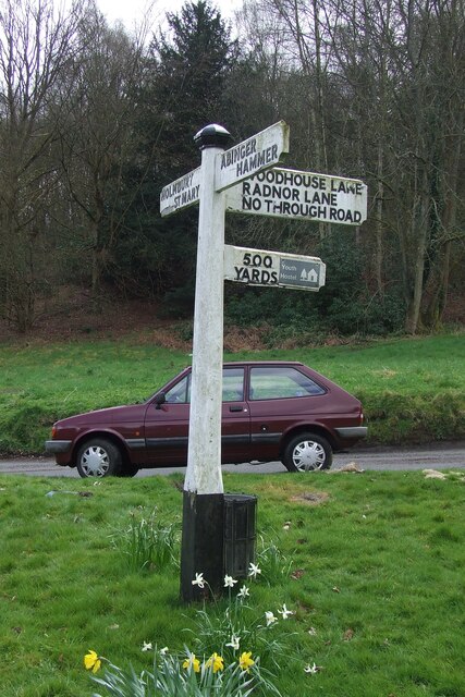
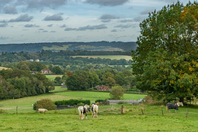
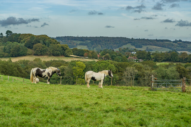
Abinger Common is a picturesque village located in the county of Surrey, England. Situated within the Surrey Hills Area of Outstanding Natural Beauty, it is surrounded by lush woodlands and enchanting forests, making it a haven for nature lovers and outdoor enthusiasts.

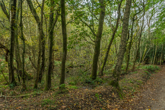
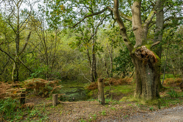
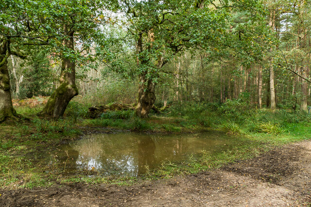
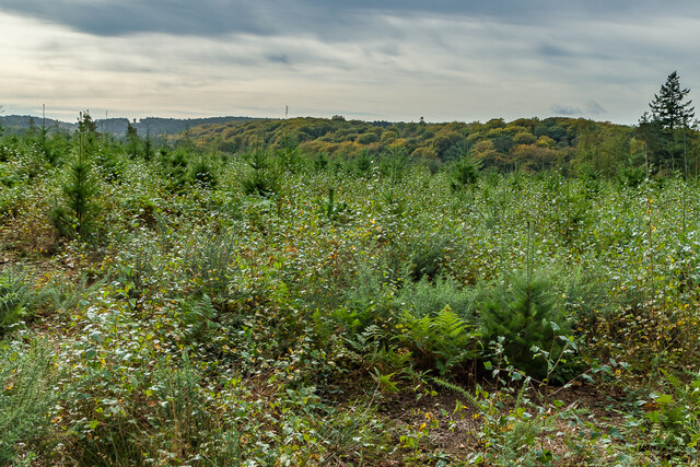
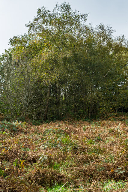
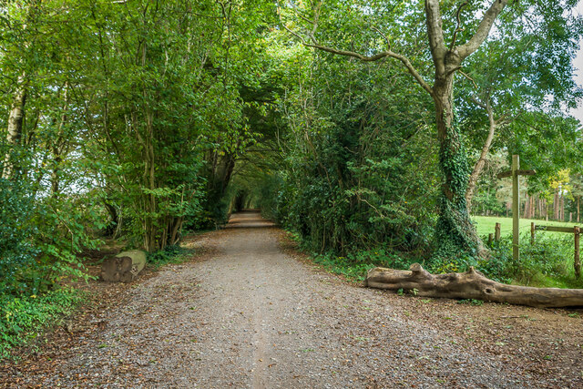
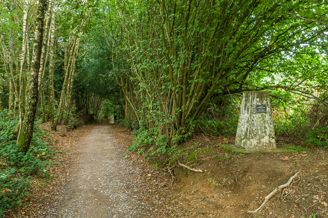
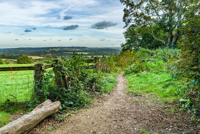
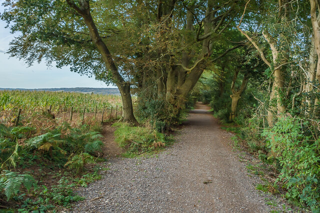
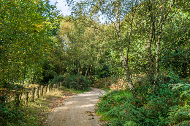
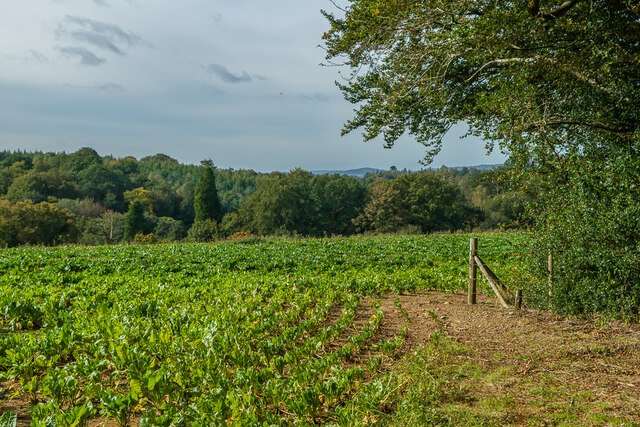
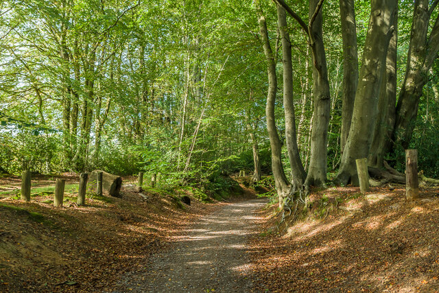
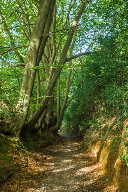
The common itself covers an area of approximately 200 hectares, with its landscape characterized by rolling hills, open heathland, and ancient woodland. The woodlands are predominantly composed of oak, beech, and pine trees, creating a diverse ecosystem that supports a wide array of flora and fauna.

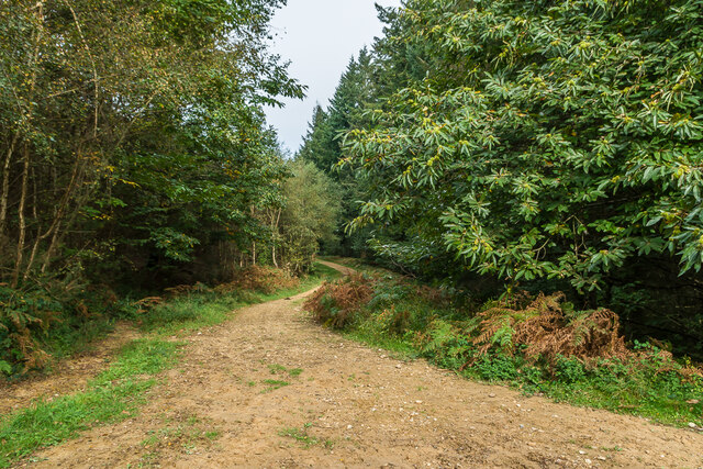
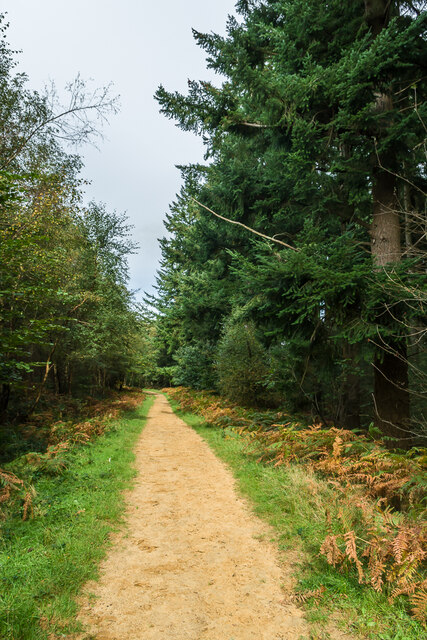
Abinger Common is popular among hikers and walkers, offering numerous footpaths and trails that wind through the woodlands and provide breathtaking views of the surrounding countryside. The area is also home to several well-known landmarks, such as Abinger Hammer, a historic village known for its 18th-century ironworks and charming cottages.

In addition to its natural beauty, Abinger Common boasts a strong sense of community. The village has a close-knit population and is home to a range of local amenities, including a primary school, a village hall, and a traditional pub. Residents often gather for social events and activities, fostering a sense of camaraderie and belonging.

Overall, Abinger Common is a tranquil and idyllic destination, offering a perfect blend of natural beauty, outdoor recreation, and community spirit. Whether one seeks to explore the woodlands, immerse themselves in the local history, or simply enjoy the peaceful surroundings, Abinger Common has something to offer for everyone.

If you have any feedback on the listing, please let us know in the comments section below.

Abinger Common Images

Images are sourced within 2km of 51.197776/-0.39315931 or Grid Reference TQ1245. Thanks to Geograph Open Source API. All images are credited.

Direction Sign – Signpost on the B2126 in Sutton Abinger Located in Sutton Abinger on a grass triangle in the centre of the junction of the B2126 Horsham Road and Radnor Lane, Shere parish. 3 arms and cap finial.

Milestone Society National ID: SY_TQ1045
Direction Sign – Signpost on the B2126 in Sutton Abinger
Located in Sutton Abinger on a grass triangle in the centre of the junction of the B2126 Horsham Road and Radnor Lane, Shere parish. 3 arms and cap finial. Milestone Society National ID: SY_TQ1045
Tankards Pond Partly overgrown pond alongside Wolvens Lane, a byway between Coldharbour and Wotton.
Tankards Pond
Partly overgrown pond alongside Wolvens Lane, a byway between Coldharbour and Wotton.
Tankards Pond Partly overgrown pond alongside Wolvens Lane, a byway between Coldharbour and Wotton.
Tankards Pond
Partly overgrown pond alongside Wolvens Lane, a byway between Coldharbour and Wotton.
Pond A small pond just north of the larger Tankards Pond, alongside Wolvens Lane, a byway between Coldharbour and Wotton.
Pond
A small pond just north of the larger Tankards Pond, alongside Wolvens Lane, a byway between Coldharbour and Wotton.
Replanted woodland Replanted woodland off Wolvens Lane, a byway between Coldharbour and Wotton.  In the left distance can be seen the tower on the summit of Leith Hill.
Replanted woodland
Replanted woodland off Wolvens Lane, a byway between Coldharbour and Wotton. In the left distance can be seen the tower on the summit of Leith Hill.
Squire's Great Wood Path through Squire's Great Wood.
Squire's Great Wood
Path through Squire's Great Wood.
Squire's Great Wood Path through Squire's Great Wood.
Squire's Great Wood
Path through Squire's Great Wood.
Bracken slope A bracken covered slope near Logmore Farm.
Bracken slope
A bracken covered slope near Logmore Farm.
Above Logmore Farm Looking across paddocks near Logmore Farm with Old Cottage in Logmore Green right of centre, Logmore Green Cottages beyond on the left and Box Hill in the background.
Above Logmore Farm
Looking across paddocks near Logmore Farm with Old Cottage in Logmore Green right of centre, Logmore Green Cottages beyond on the left and Box Hill in the background.
Above Logmore Farm Looking across paddocks near Logmore Farm with Ranmore on the North Downs in the background.
Above Logmore Farm
Looking across paddocks near Logmore Farm with Ranmore on the North Downs in the background.
Wolvens Lane Byway between Coldharbour and Wotton.  The bridleway on the right leads down to Logmore Green.
Wolvens Lane
Byway between Coldharbour and Wotton. The bridleway on the right leads down to Logmore Green.
Trig point Trig point alongside Wolvens Lane, a byway between Coldharbour and Wotton.  A plaque on the pillar reads: "In memory of Margaret Loveless and Tony Parker, founder members of Kingston Ramblers".
Trig point
Trig point alongside Wolvens Lane, a byway between Coldharbour and Wotton. A plaque on the pillar reads: "In memory of Margaret Loveless and Tony Parker, founder members of Kingston Ramblers".
Bridleway Bridleway off Wolvens Lane, leading down to Logmore Green.  In the distance is Box Hill.
Bridleway
Bridleway off Wolvens Lane, leading down to Logmore Green. In the distance is Box Hill.
Wolvens Lane Byway between Coldharbour and Wotton.
Wolvens Lane
Byway between Coldharbour and Wotton.
Wolvens Lane Byway between Coldharbour and Wotton.
Wolvens Lane
Byway between Coldharbour and Wotton.
Off Wolvens Lane A field off Wolvens Lane, a byway between Coldharbour and Wotton.
Off Wolvens Lane
A field off Wolvens Lane, a byway between Coldharbour and Wotton.
Wolvens Lane Byway between Coldharbour and Wotton.
Wolvens Lane
Byway between Coldharbour and Wotton.
Wolvens Lane Byway between Coldharbour and Wotton.
Wolvens Lane
Byway between Coldharbour and Wotton.
Show me another place!

Abinger Common is located at Grid Ref: TQ1245 (Lat: 51.197776, Lng: -0.39315931)

Administrative County: Surrey

District: Mole Valley

Police Authority: Surrey

What 3 Words

///socket.will.hired. Near Westcott, Surrey

Related Wikis

Abinger

Abinger is a large, well-wooded and mostly rural civil parish that lies between the settlements of Dorking, Shere and Ewhurst in the district of Mole Valley...

Goddards

Goddards is a Grade II*-listed house in Abinger Common, Surrey, England. It was designed by Edwin Lutyens in 1898–1900 in the ideals of the Arts and Crafts...

Friday Street

Friday Street is a hamlet on the gentle lower north slope of Leith Hill in Surrey, England. It is in a wooded headwater ravine, just to the south of Wotton...

Wotton and Abinger Commons

Wotton and Abinger Commons is a 324-hectare (800-acre) nature reserve south-west of Dorking in Surrey. It is managed by the Surrey Wildlife Trust. Part...

Abinger Common War Memorial

Abinger Common War Memorial is a First World War memorial in the village of Abinger Common in Surrey, south-eastern England. The memorial was destroyed...

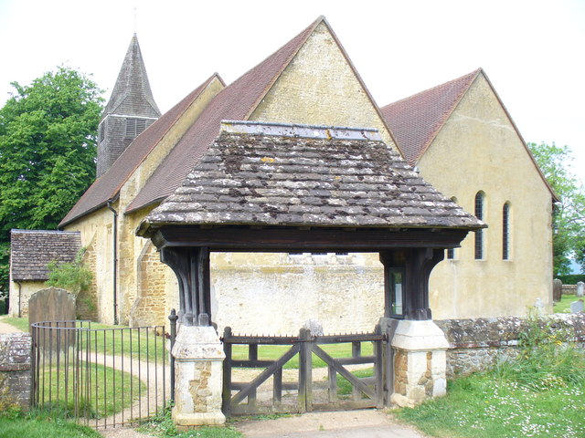
St James's Church, Abinger Common

St James's Church stands on Abinger Lane in Abinger Common, a small village within the civil parish of Abinger in Surrey, south-eastern England. The church...

Belmont School, Surrey

Belmont is an independent co-educational school in Surrey which takes pupils from the ages of 3 to 16. The school is a charitable trust, administered...

Wotton House, Surrey

Wotton House is a hotel, wedding venue, conference centre and former country house in Wotton near Dorking, Surrey, England. Originally the centre of the...

Nearby Amenities

Located within 500m of 51.197776,-0.39315931
Friday Street
Place: hamlet
Source: TMJ-Mobile_0.6.2
Wikidata: Q5503552
Lat/Long: 51.1994439/-0.3874714
Bus Stop
Friday Street Turning
Naptan AtcoCode: 40004408093B
Naptan Bearing: S
Naptan CommonName: Friday Street Turning
Naptan Indicator: adj
Naptan Landmark: Friday Street Turning
Naptan NaptanCode: surdadmw
Naptan Street: Hollow Lane
Naptan Verified: no
Public Transport: platform
Source: naptan_import
Lat/Long: 51.1979893/-0.3976841
Historic: memorial
Lat/Long: 51.1970013/-0.3977759
Bench
Lat/Long: 51.1996232/-0.387067
Post Box
Collection Times: Mo-Fr 09:00; Sa 07:00
Not Operator Wikidata: Q638098
Operator: Royal Mail
Post Box Type: wall
Ref: RH5 44D
Royal Cypher: EVIIR
Lat/Long: 51.2003112/-0.3872474
Abinger Common
Natural: wood
Lat/Long: 51.1969344/-0.3941568
Bus Stop
Friday Street Turning
Naptan AtcoCode: 40004408093A
Naptan Bearing: N
Naptan CommonName: Friday Street Turning
Naptan Indicator: Just Before
Naptan Landmark: Abinger Common
Naptan NaptanCode: surdadmt
Naptan Street: Hollow Lane
Naptan Verified: no
Public Transport: platform
Source: naptan_import
Lat/Long: 51.1976653/-0.3978458
Post Box
Collection Times: Mo-Fr 09:00; Sa 07:00
Operator: Royal Mail
Post Box Mounting: pier
Post Box Type: lamp
Ref: RH5 74D
Royal Cypher: EIIR
Royal Cypher Wikidata: Q33102113
Lat/Long: 51.1981548/-0.3998403
The data included in this document is from www.openstreetmap.org. The data is made available under ODbL.

Have you been to Abinger Common?

Leave your review of Abinger Common below (or comments, questions and feedback).