Millpond Copse

Wood, Forest in Surrey Mole Valley

England

Millpond Copse

Direction Sign – Signpost on the B2126 in Sutton Abinger Located in Sutton Abinger on a grass triangle in the centre of the junction of the B2126 Horsham Road and Radnor Lane, Shere parish. 3 arms and cap finial.

Milestone Society National ID: SY_TQ1045
Direction Sign – Signpost on the B2126 in Sutton Abinger Credit: John V Nicholls

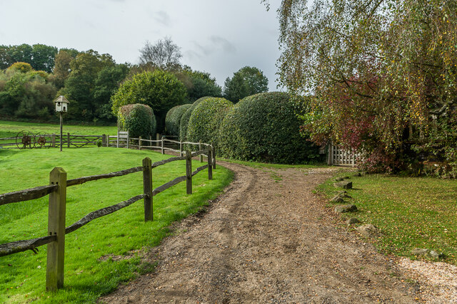
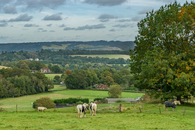
Millpond Copse is a picturesque woodland located in the county of Surrey, England. Covering an area of approximately 20 acres, this enchanting copse is situated near the village of Millpond, nestled amidst the rolling hills and verdant landscapes of the Surrey Hills Area of Outstanding Natural Beauty.

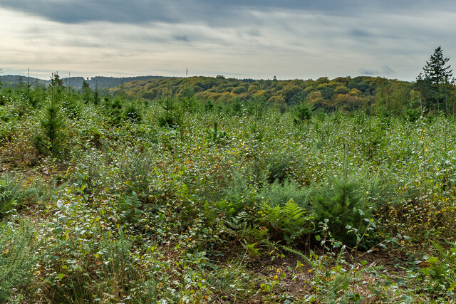
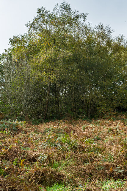
The copse is predominantly made up of a diverse range of deciduous trees, including oak, ash, beech, and birch, which create a rich tapestry of colors throughout the seasons. The forest floor is adorned with a carpet of wildflowers, such as bluebells, primroses, and wood anemones, adding to the beauty and biodiversity of the area.

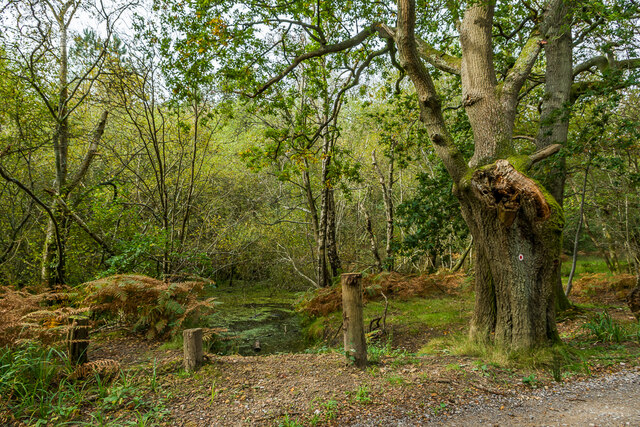
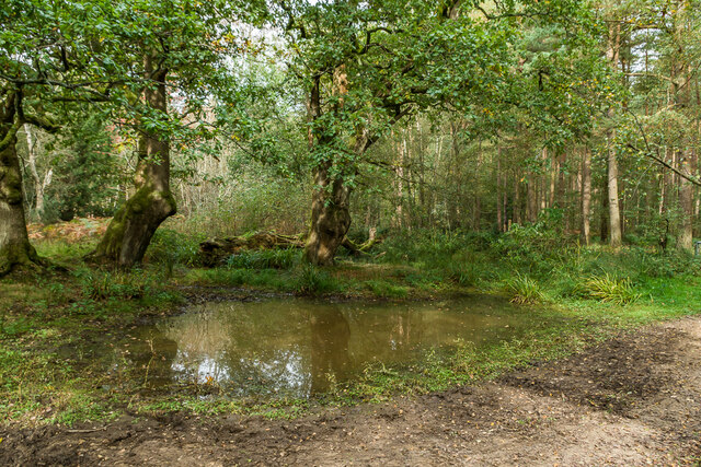
A notable feature of Millpond Copse is the presence of a tranquil millpond, from which the copse takes its name. The millpond is fed by a small stream that meanders through the woodland, providing a serene and calming atmosphere.

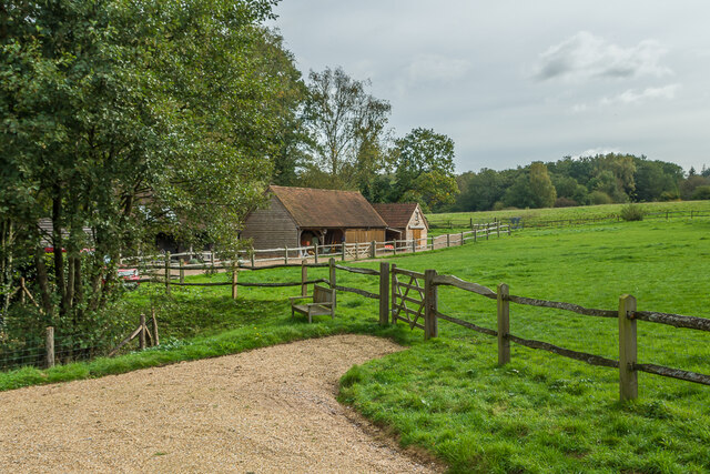
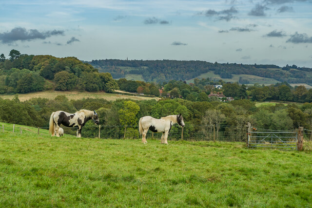
Millpond Copse is a haven for wildlife, offering a sanctuary for a variety of species. Visitors may spot a range of bird species, including woodpeckers, jays, and various songbirds. Squirrels can be seen darting through the trees, and if one is lucky, glimpses of deer and foxes may be caught.

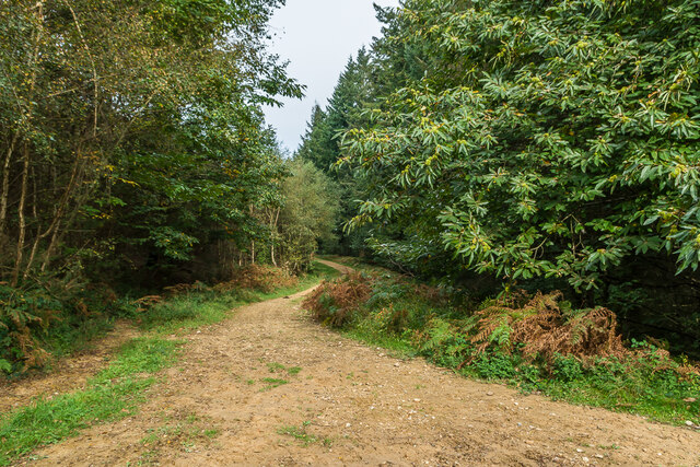
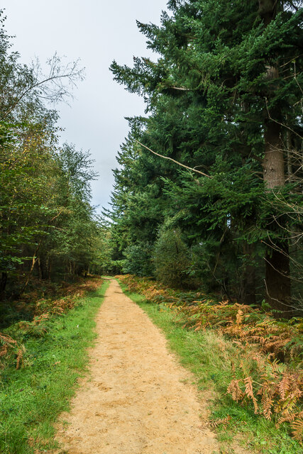
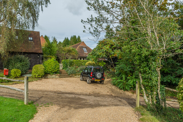
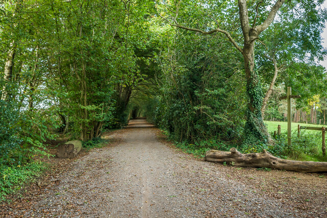
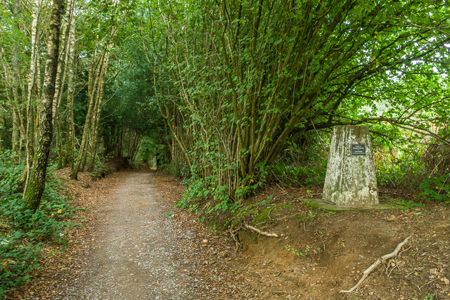
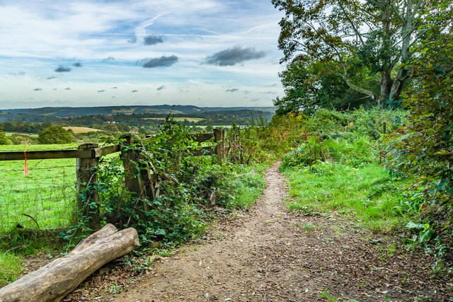
The copse is a popular destination for nature lovers, walkers, and photographers, who are drawn to its natural beauty and peaceful ambiance. It provides a perfect setting for leisurely strolls, picnics, and exploration of the surrounding area.

In summary, Millpond Copse in Surrey is a stunning woodland, offering a harmonious blend of trees, flowers, wildlife, and a serene millpond, making it a cherished natural gem in the heart of the Surrey Hills.

If you have any feedback on the listing, please let us know in the comments section below.

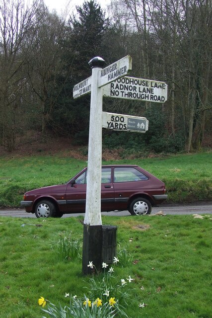
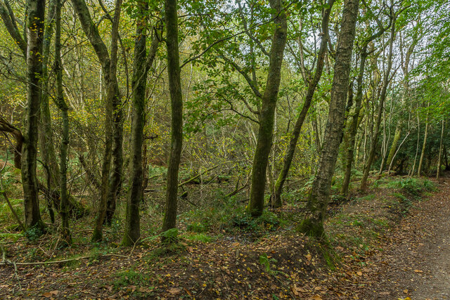
Millpond Copse Images

Images are sourced within 2km of 51.201646/-0.39140718 or Grid Reference TQ1245. Thanks to Geograph Open Source API. All images are credited.

Direction Sign – Signpost on the B2126 in Sutton Abinger Located in Sutton Abinger on a grass triangle in the centre of the junction of the B2126 Horsham Road and Radnor Lane, Shere parish. 3 arms and cap finial.

Milestone Society National ID: SY_TQ1045
Direction Sign – Signpost on the B2126 in Sutton Abinger
Located in Sutton Abinger on a grass triangle in the centre of the junction of the B2126 Horsham Road and Radnor Lane, Shere parish. 3 arms and cap finial. Milestone Society National ID: SY_TQ1045
Tankards Pond Partly overgrown pond alongside Wolvens Lane, a byway between Coldharbour and Wotton.
Tankards Pond
Partly overgrown pond alongside Wolvens Lane, a byway between Coldharbour and Wotton.
Tankards Pond Partly overgrown pond alongside Wolvens Lane, a byway between Coldharbour and Wotton.
Tankards Pond
Partly overgrown pond alongside Wolvens Lane, a byway between Coldharbour and Wotton.
Pond A small pond just north of the larger Tankards Pond, alongside Wolvens Lane, a byway between Coldharbour and Wotton.
Pond
A small pond just north of the larger Tankards Pond, alongside Wolvens Lane, a byway between Coldharbour and Wotton.
Replanted woodland Replanted woodland off Wolvens Lane, a byway between Coldharbour and Wotton.  In the left distance can be seen the tower on the summit of Leith Hill.
Replanted woodland
Replanted woodland off Wolvens Lane, a byway between Coldharbour and Wotton. In the left distance can be seen the tower on the summit of Leith Hill.
Squire's Great Wood Path through Squire's Great Wood.
Squire's Great Wood
Path through Squire's Great Wood.
Squire's Great Wood Path through Squire's Great Wood.
Squire's Great Wood
Path through Squire's Great Wood.
Bracken slope A bracken covered slope near Logmore Farm.
Bracken slope
A bracken covered slope near Logmore Farm.
Logmore Farm Track outside Logmore Farm.
Logmore Farm
Track outside Logmore Farm.
Logmore Farm Farm near Logmore Green.
Logmore Farm
Farm near Logmore Green.
Logmore Farm Paddocks at Logmore Farm near Logmore Green.
Logmore Farm
Paddocks at Logmore Farm near Logmore Green.
Above Logmore Farm Looking across paddocks near Logmore Farm with Old Cottage in Logmore Green right of centre, Logmore Green Cottages beyond on the left and Box Hill in the background.
Above Logmore Farm
Looking across paddocks near Logmore Farm with Old Cottage in Logmore Green right of centre, Logmore Green Cottages beyond on the left and Box Hill in the background.
Above Logmore Farm Looking across paddocks near Logmore Farm with Ranmore on the North Downs in the background.
Above Logmore Farm
Looking across paddocks near Logmore Farm with Ranmore on the North Downs in the background.
Above Logmore Farm Looking across paddocks near Logmore Farm with Box Hill in the distance.
Above Logmore Farm
Looking across paddocks near Logmore Farm with Box Hill in the distance.
Logmore Farm Looking across paddocks to Logmore Farm.  In the distance are the North Downs from Box Hill on the left to Colley Hill on the right in the distance.  Logmore Farm dates originally from the 16th Century with subsequent refronting and extensions.  Grade II listed - see <span class="nowrap"><a title="www.historicengland.org.uk/listing/the-list/list-entry/1391056" rel="nofollow ugc noopener" href="http://www.historicengland.org.uk/listing/the-list/list-entry/1391056">Link</a><img style="margin-left:2px;" alt="External link" title="External link - shift click to open in new window" src="https://s1.geograph.org.uk/img/external.png" width="10" height="10"/></span>.
Logmore Farm
Looking across paddocks to Logmore Farm. In the distance are the North Downs from Box Hill on the left to Colley Hill on the right in the distance. Logmore Farm dates originally from the 16th Century with subsequent refronting and extensions. Grade II listed - see LinkExternal link.
Wolvens Lane Byway between Coldharbour and Wotton.  The bridleway on the right leads down to Logmore Green.
Wolvens Lane
Byway between Coldharbour and Wotton. The bridleway on the right leads down to Logmore Green.
Trig point Trig point alongside Wolvens Lane, a byway between Coldharbour and Wotton.  A plaque on the pillar reads: "In memory of Margaret Loveless and Tony Parker, founder members of Kingston Ramblers".
Trig point
Trig point alongside Wolvens Lane, a byway between Coldharbour and Wotton. A plaque on the pillar reads: "In memory of Margaret Loveless and Tony Parker, founder members of Kingston Ramblers".
Bridleway Bridleway off Wolvens Lane, leading down to Logmore Green.  In the distance is Box Hill.
Bridleway
Bridleway off Wolvens Lane, leading down to Logmore Green. In the distance is Box Hill.
Show me another place!

Millpond Copse is located at Grid Ref: TQ1245 (Lat: 51.201646, Lng: -0.39140718)

Administrative County: Surrey

District: Mole Valley

Police Authority: Surrey

What 3 Words

///moves.being.depend. Near Westcott, Surrey

Related Wikis

Abinger

Abinger is a large, well-wooded and mostly rural civil parish that lies between the settlements of Dorking, Shere and Ewhurst in the district of Mole Valley...

Friday Street

Friday Street is a hamlet on the gentle lower north slope of Leith Hill in Surrey, England. It is in a wooded headwater ravine, just to the south of Wotton...

Goddards

Goddards is a Grade II*-listed house in Abinger Common, Surrey, England. It was designed by Edwin Lutyens in 1898–1900 in the ideals of the Arts and Crafts...

Wotton and Abinger Commons

Wotton and Abinger Commons is a 324-hectare (800-acre) nature reserve south-west of Dorking in Surrey. It is managed by the Surrey Wildlife Trust. Part...

Abinger Common War Memorial

Abinger Common War Memorial is a First World War memorial in the village of Abinger Common in Surrey, south-eastern England. The memorial was destroyed...

St James's Church, Abinger Common

St James's Church stands on Abinger Lane in Abinger Common, a small village within the civil parish of Abinger in Surrey, south-eastern England. The church...

Wotton House, Surrey

Wotton House is a hotel, wedding venue, conference centre and former country house in Wotton near Dorking, Surrey, England. Originally the centre of the...

Woodhouse Copse, Holmbury St Mary

Woodhouse Copse is an Arts and Crafts style house in the village of Holmbury St Mary, Surrey, England. It is a Grade II listed building, with gardens originally...

Nearby Amenities

Located within 500m of 51.201646,-0.39140718
003
Source: GPS waypoint
Upload Tag: ojw
Lat/Long: 51.2038873/-0.3857773
Source: GPS waypoint
Upload Tag: ojw
Lat/Long: 51.2037162/-0.3896065
Friday Street
Place: hamlet
Source: TMJ-Mobile_0.6.2
Wikidata: Q5503552
Lat/Long: 51.1994439/-0.3874714
Bench
Lat/Long: 51.1996232/-0.387067
Post Box
Collection Times: Mo-Fr 09:00; Sa 07:00
Not Operator Wikidata: Q638098
Operator: Royal Mail
Post Box Type: wall
Ref: RH5 44D
Royal Cypher: EVIIR
Lat/Long: 51.2003112/-0.3872474
Barrier: stile
Lat/Long: 51.2038259/-0.389563
Barrier: kissing_gate
Lat/Long: 51.2038299/-0.3894271
Source: GPS waypoint
Upload Tag: ojw
Lat/Long: 51.2037526/-0.38967
003
Source: GPS waypoint
Upload Tag: ojw
Lat/Long: 51.2039431/-0.385779
Ford: yes
Lat/Long: 51.2013054/-0.3875748
The data included in this document is from www.openstreetmap.org. The data is made available under ODbL.

Have you been to Millpond Copse?

Leave your review of Millpond Copse below (or comments, questions and feedback).