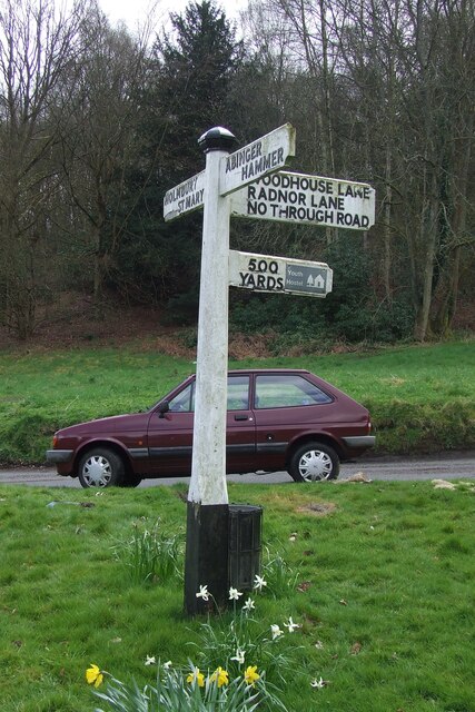
Parkhurst Wood

Wood, Forest in Surrey Mole Valley

England

Parkhurst Wood

Direction Sign – Signpost on the B2126 in Sutton Abinger Located in Sutton Abinger on a grass triangle in the centre of the junction of the B2126 Horsham Road and Radnor Lane, Shere parish. 3 arms and cap finial.

Milestone Society National ID: SY_TQ1045
Direction Sign – Signpost on the B2126 in Sutton Abinger Credit: John V Nicholls

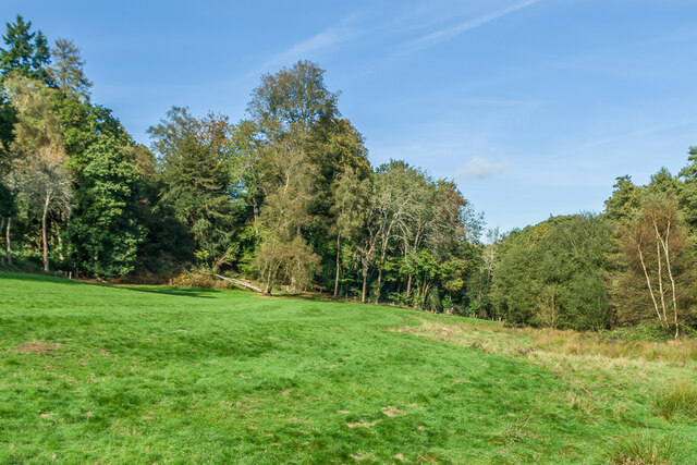
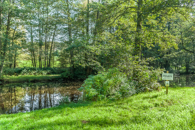
Parkhurst Wood is a picturesque woodland located in Surrey, England. Covering an area of approximately 100 acres, this ancient forest is a haven for nature lovers and those seeking tranquility amidst the bustling suburban landscape.

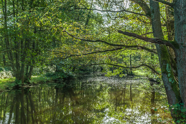
The wood is predominantly composed of towering oak trees, which are interspersed with a variety of other native tree species such as beech, birch, and chestnut. The dense canopy of foliage creates a cool and shaded environment, perfect for leisurely walks on hot summer days. Bluebells carpet the forest floor in spring, creating a stunning display of vibrant colors.

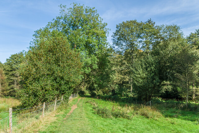
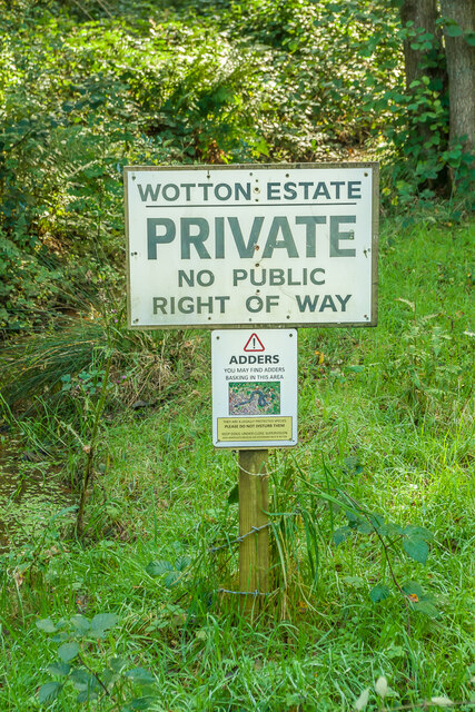
A network of well-maintained footpaths crisscrosses through the wood, allowing visitors to explore its natural beauty at their own pace. These paths lead to hidden clearings and secluded spots, where one can sit and soak in the serene atmosphere or observe the diverse wildlife that calls Parkhurst Wood home. Squirrels scamper through the trees, while birdsong fills the air, creating a melodic symphony.

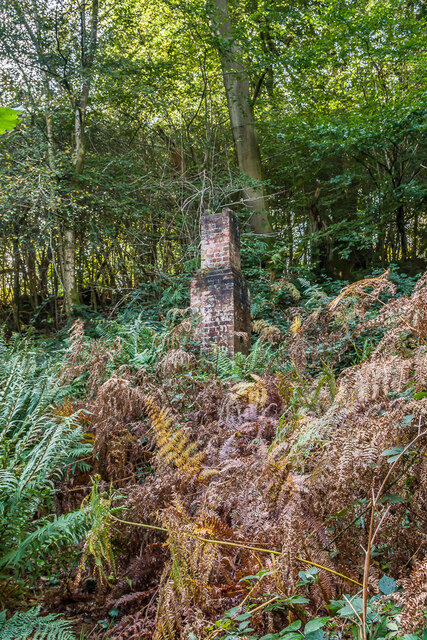
Parkhurst Wood is not only a haven for flora and fauna but also a site of historical significance. The wood has existed for centuries and has witnessed the passage of time. Ancient burial mounds and remnants of old settlements can be found within its boundaries, serving as a reminder of the area's rich past.

Managed by a local conservation group, Parkhurst Wood is a cherished community asset that welcomes visitors throughout the year. Its natural beauty, abundant wildlife, and historical significance make it an ideal destination for those seeking a peaceful escape from the modern world.

If you have any feedback on the listing, please let us know in the comments section below.

Parkhurst Wood Images

Images are sourced within 2km of 51.193287/-0.39823864 or Grid Reference TQ1245. Thanks to Geograph Open Source API. All images are credited.

Direction Sign – Signpost on the B2126 in Sutton Abinger Located in Sutton Abinger on a grass triangle in the centre of the junction of the B2126 Horsham Road and Radnor Lane, Shere parish. 3 arms and cap finial.

Milestone Society National ID: SY_TQ1045
Direction Sign – Signpost on the B2126 in Sutton Abinger
Located in Sutton Abinger on a grass triangle in the centre of the junction of the B2126 Horsham Road and Radnor Lane, Shere parish. 3 arms and cap finial. Milestone Society National ID: SY_TQ1045
Pasture Pastureland in the Tilling Bourne valley on the Wotton Estate.
Pasture
Pastureland in the Tilling Bourne valley on the Wotton Estate.
Footpath Footpath across pastureland in the Tilling Bourne valley on the Wotton Estate.  The stream itself runs through a chain of ponds in the woods in the background.
Footpath
Footpath across pastureland in the Tilling Bourne valley on the Wotton Estate. The stream itself runs through a chain of ponds in the woods in the background.
Tilling Bourne One of a chain of ponds on the Tilling Bourne.  These were created by Theodore Jacobsen, owner and architect of the long demolished Lonesome Lodge, in the mid 18th Century as part of the landscaping of his estate.
Tilling Bourne
One of a chain of ponds on the Tilling Bourne. These were created by Theodore Jacobsen, owner and architect of the long demolished Lonesome Lodge, in the mid 18th Century as part of the landscaping of his estate.
Tilling Bourne One of a chain of ponds on the Tilling Bourne.  These were created by Theodore Jacobsen, owner and architect of the long demolished Lonesome Lodge, in the mid 18th Century as part of the landscaping of his estate.  The sign on the right is stating that the land off the footpath is private, with one below warning of adders.  For another example nearby see <a href="https://www.geograph.org.uk/photo/7009486">TQ1346 : Private</a>.
Tilling Bourne
One of a chain of ponds on the Tilling Bourne. These were created by Theodore Jacobsen, owner and architect of the long demolished Lonesome Lodge, in the mid 18th Century as part of the landscaping of his estate. The sign on the right is stating that the land off the footpath is private, with one below warning of adders. For another example nearby see TQ1346 : Private.
Private Sign off a public path in the Tilling Bourne valley.  The top one warns that this is private land, and below it is one warning of adders in the area.  It did strike me, though, that if they are saying that the public shouldn't be entering the land in the first place, why the need to alert them to the presence of adders?
Private
Sign off a public path in the Tilling Bourne valley. The top one warns that this is private land, and below it is one warning of adders in the area. It did strike me, though, that if they are saying that the public shouldn't be entering the land in the first place, why the need to alert them to the presence of adders?
Track Track in the Tilling Bourne valley.  The hedge on the right is along the garden of Mandrakes (see <a href="https://www.geograph.org.uk/photo/7009500">TQ1346 : Mandrakes</a>).
Track
Track in the Tilling Bourne valley. The hedge on the right is along the garden of Mandrakes (see TQ1346 : Mandrakes).
Mandrakes House in the Tilling Bourne valley.
Mandrakes
House in the Tilling Bourne valley.
Tillingbourne Waterfall Artificial waterfall in the Tilling Bourne valley, fed by a leat coming off the main stream around 1km south of here.  The waterfall was created by Theodore Jacobsen, owner and architect of the now long demolished Lonesome Lodge, in the mid 18th Century as part of the landscaping of his estate.  It is the highest waterfall in Surrey.  There is no access, although it is viewable from the nearby bridleway, as here.
Tillingbourne Waterfall
Artificial waterfall in the Tilling Bourne valley, fed by a leat coming off the main stream around 1km south of here. The waterfall was created by Theodore Jacobsen, owner and architect of the now long demolished Lonesome Lodge, in the mid 18th Century as part of the landscaping of his estate. It is the highest waterfall in Surrey. There is no access, although it is viewable from the nearby bridleway, as here.
Tillingbourne Waterfall Artificial waterfall in the Tilling Bourne valley, fed by a leat coming off the main stream around 1km south of here.  The waterfall was created by Theodore Jacobsen, owner and architect of the now long demolished Lonesome Lodge, in the mid 18th Century as part of the landscaping of his estate.  It is the highest waterfall in Surrey.  

There is no public access, as clearly stated on the gate off the passing bridleway, seen here.  A piece of material snagged on the barbed wire on the adjacent fence would suggest that someone had attempted a closer view!
Tillingbourne Waterfall
Artificial waterfall in the Tilling Bourne valley, fed by a leat coming off the main stream around 1km south of here. The waterfall was created by Theodore Jacobsen, owner and architect of the now long demolished Lonesome Lodge, in the mid 18th Century as part of the landscaping of his estate. It is the highest waterfall in Surrey. There is no public access, as clearly stated on the gate off the passing bridleway, seen here. A piece of material snagged on the barbed wire on the adjacent fence would suggest that someone had attempted a closer view!
Track Track in the Tilling Bourne valley.  Behind the fence on the right is the Tillingbourne Waterfall - see <a href="https://www.geograph.org.uk/photo/7009511">TQ1345 : Tillingbourne Waterfall</a>.
Track
Track in the Tilling Bourne valley. Behind the fence on the right is the Tillingbourne Waterfall - see TQ1345 : Tillingbourne Waterfall.
Track Track leading along the Tilling Bourne valley from Broadmoor.
Track
Track leading along the Tilling Bourne valley from Broadmoor.
The Old Cottage 17th Century cottage in the small hamlet of Broadmoor.  Grade II listed - see <span class="nowrap"><a title="www.historicengland.org.uk/listing/the-list/list-entry/1028797" rel="nofollow ugc noopener" href="http://www.historicengland.org.uk/listing/the-list/list-entry/1028797">Link</a><img style="margin-left:2px;" alt="External link" title="External link - shift click to open in new window" src="https://s1.geograph.org.uk/img/external.png" width="10" height="10"/></span>.
The Old Cottage
17th Century cottage in the small hamlet of Broadmoor. Grade II listed - see LinkExternal link.
The Old Cottage 17th Century cottage in the small hamlet of Broadmoor.  Grade II listed - see <span class="nowrap"><a title="www.historicengland.org.uk/listing/the-list/list-entry/1028797" rel="nofollow ugc noopener" href="http://www.historicengland.org.uk/listing/the-list/list-entry/1028797">Link</a><img style="margin-left:2px;" alt="External link" title="External link - shift click to open in new window" src="https://s1.geograph.org.uk/img/external.png" width="10" height="10"/></span>.  On the right is Home Farm.
The Old Cottage
17th Century cottage in the small hamlet of Broadmoor. Grade II listed - see LinkExternal link. On the right is Home Farm.
Broadmoor Cottages Late 19th Century terrace of 7 cottages in the small hamlet of Broadmoor.  Seen here is the southern end of the terrace.
Broadmoor Cottages
Late 19th Century terrace of 7 cottages in the small hamlet of Broadmoor. Seen here is the southern end of the terrace.
Whiteberry Cottage House in the small hamlet of Broadmoor.  Older maps suggest that it might once have been a terrace of 4 cottages.
Whiteberry Cottage
House in the small hamlet of Broadmoor. Older maps suggest that it might once have been a terrace of 4 cottages.
Bridleway Bridleway south of Broadmoor.
Bridleway
Bridleway south of Broadmoor.
Chimney What looks like the only remnant of a cottage or other building among bracken south of Broadmoor.  Current and old maps show the outline of a building here, with a small reservoir marked nearby and the 1914 1:2,500 map referring to two hydraulic rams, suggesting it may be connected with water supply.
Chimney
What looks like the only remnant of a cottage or other building among bracken south of Broadmoor. Current and old maps show the outline of a building here, with a small reservoir marked nearby and the 1914 1:2,500 map referring to two hydraulic rams, suggesting it may be connected with water supply.
Show me another place!

Parkhurst Wood is located at Grid Ref: TQ1245 (Lat: 51.193287, Lng: -0.39823864)

Administrative County: Surrey

District: Mole Valley

Police Authority: Surrey

What 3 Words

///comb.costs.vast. Near Peaslake, Surrey

Related Wikis

Goddards

Goddards is a Grade II*-listed house in Abinger Common, Surrey, England. It was designed by Edwin Lutyens in 1898–1900 in the ideals of the Arts and Crafts...

Belmont School, Surrey

Belmont is an independent co-educational school in Surrey which takes pupils from the ages of 3 to 16. The school is a charitable trust, administered...

Abinger

Abinger is a large, well-wooded and mostly rural civil parish that lies between the settlements of Dorking, Shere and Ewhurst in the district of Mole Valley...

Friday Street

Friday Street is a hamlet on the gentle lower north slope of Leith Hill in Surrey, England. It is in a wooded headwater ravine, just to the south of Wotton...

Abinger Common War Memorial

Abinger Common War Memorial is a First World War memorial in the village of Abinger Common in Surrey, south-eastern England. The memorial was destroyed...

St James's Church, Abinger Common

St James's Church stands on Abinger Lane in Abinger Common, a small village within the civil parish of Abinger in Surrey, south-eastern England. The church...

Holmbury St Mary

Holmbury St Mary is a village in Surrey, England centered on shallow upper slopes of the Greensand Ridge. Its developed area is a nucleated village, 4...

Woodhouse Copse, Holmbury St Mary

Woodhouse Copse is an Arts and Crafts style house in the village of Holmbury St Mary, Surrey, England. It is a Grade II listed building, with gardens originally...

Related Videos

Winter Walk - English Country Estate - Wotton House

Sharing our winter walk in the UK's first Italian garden, located in Surrey at Wotton House, English Country Estate, UK. #wotton ...

Avoid holiday weight gain: 3 tips to achieve success

Dr Joes best ways to maintain or lose weight this Christmas holiday. So often the Christmas holidays help us make the wrong ...

Tillingbourne waterfall

A lovely walk through the Surrey hills from Broadmoor car park walking through the Wotton estate woodland and down to ...

Nearby Amenities

Located within 500m of 51.193287,-0.39823864
Bus Stop
Feldmore Corner
Naptan AtcoCode: 40004408091A
Naptan Bearing: NE
Naptan CommonName: Feldmore Corner
Naptan Indicator: Just Before
Naptan Landmark: Feldmore Corner
Naptan NaptanCode: surdadmg
Naptan Street: Pasture Wood Road
Naptan Verified: no
Public Transport: platform
Source: naptan_import
Lat/Long: 51.1907969/-0.4025239
Bus Stop
Feldmore Corner
Naptan AtcoCode: 40004408091B
Naptan Bearing: S
Naptan CommonName: Feldmore Corner
Naptan Indicator: Just after
Naptan Landmark: Feldmore Corner
Naptan NaptanCode: surdadmj
Naptan Street: Pasture Wood Road
Naptan Verified: no
Public Transport: platform
Source: naptan_import
Lat/Long: 51.1906804/-0.4024043
Historic: memorial
Lat/Long: 51.1970013/-0.3977759
Abinger Common
Natural: wood
Lat/Long: 51.1969344/-0.3941568
Bus Stop
Friday Street Turning
Naptan AtcoCode: 40004408093A
Naptan Bearing: N
Naptan CommonName: Friday Street Turning
Naptan Indicator: Just Before
Naptan Landmark: Abinger Common
Naptan NaptanCode: surdadmt
Naptan Street: Hollow Lane
Naptan Verified: no
Public Transport: platform
Source: naptan_import
Lat/Long: 51.1976653/-0.3978458
The data included in this document is from www.openstreetmap.org. The data is made available under ODbL.

Have you been to Parkhurst Wood?

Leave your review of Parkhurst Wood below (or comments, questions and feedback).