Egham

Settlement in Surrey Runnymede

England

Egham

The Beehive Pub sign: Fuller's pub on Middle Hill
The Beehive Credit: John Myers

Egham is a small town located in the Runnymede borough of Surrey, England. Situated on the banks of the River Thames, it is approximately 20 miles southwest of central London. Egham is known for its historical significance and picturesque surroundings.

The town is home to the prestigious Royal Holloway, University of London, which is renowned for its stunning Victorian architecture and sprawling campus. The Founder's Building, an iconic landmark, dominates the skyline and is a popular tourist attraction.

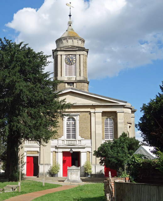
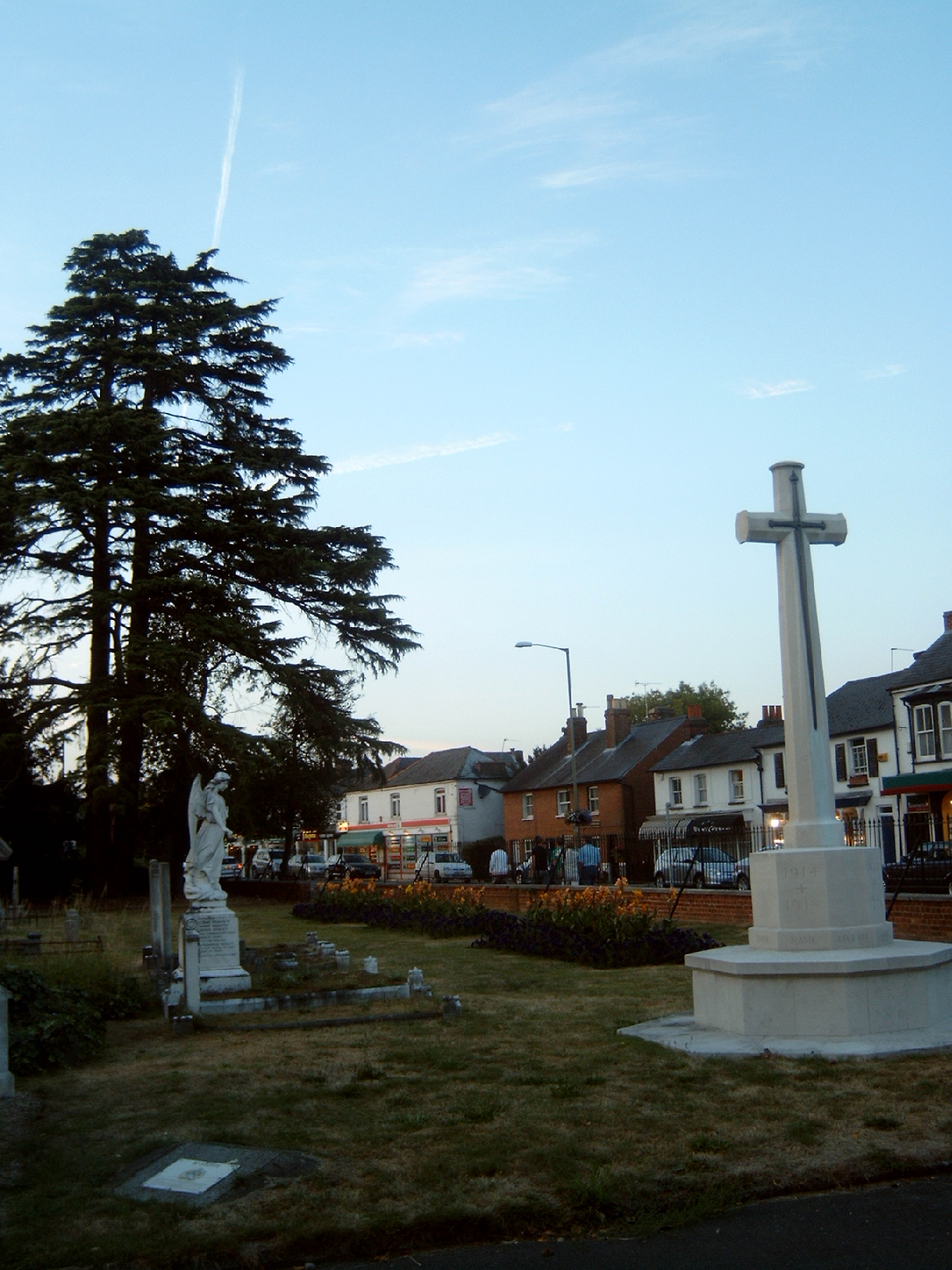
Egham has a rich history dating back to the Roman era. It was an important coaching stop on the London to Windsor route and served as a hub for trade and commerce. Today, the town retains its historic charm with several well-preserved buildings, including the 13th-century St. John's Church and the 18th-century Egham Museum.

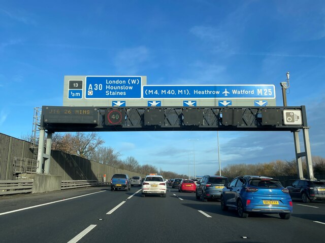
The town center offers a range of amenities, including shops, restaurants, and cafes. Egham is well-connected, with excellent transport links. The M25 motorway is easily accessible, providing convenient access to London and other parts of the country. Egham railway station connects the town to London Waterloo in just under an hour.

Egham is surrounded by natural beauty, with the River Thames flowing nearby and the stunning Windsor Great Park just a short distance away. The park offers ample opportunities for leisure activities such as walking, cycling, and picnicking.

Overall, Egham is a charming town that seamlessly blends history, education, and natural beauty, making it an attractive place to live, visit, and study.

If you have any feedback on the listing, please let us know in the comments section below.

Egham Images

Images are sourced within 2km of 51.429435/-0.557914 or Grid Reference TQ0071. Thanks to Geograph Open Source API. All images are credited.

The Beehive Pub sign: Fuller's pub on Middle Hill
The Beehive
Pub sign: Fuller's pub on Middle Hill
Egham station This shows the up-side frontage as rebuilt in 1985.
Egham station
This shows the up-side frontage as rebuilt in 1985.
St John the Baptist, Egham - south elevation
St John the Baptist, Egham - north elevation
High Street, Egham This is the north side looking east.
High Street, Egham
This is the north side looking east.
Ongoing construction work, Egham This was taken where Church Road (running left-right) is met by Station Road (foreground).
Ongoing construction work, Egham
This was taken where Church Road (running left-right) is met by Station Road (foreground).
Remains of Ankerwycke Priory - looking south-east
Remains of Ankerwycke Priory - looking south-west
Remains of Ankerwycke Priory - looking north-west
Typical conditions on the M25
St John the Baptist Church, Egham Egham's Georgian parish church dates from 1820.
St John the Baptist Church, Egham
Egham's Georgian parish church dates from 1820.
Bad place for Boats A silted up backwater with several old boats looking in a bit of a state.
Bad place for Boats
A silted up backwater with several old boats looking in a bit of a state.
M25 congestion near Egham This is a north-south stretch of the M25 west of London, between junctions 12 and 13, at 16:40 on a Friday afternoon. A sign warns to expect delays the following day in connection with rugby at Twickenham.
Image reference: 7556608
M25 congestion near Egham
This is a north-south stretch of the M25 west of London, between junctions 12 and 13, at 16:40 on a Friday afternoon. A sign warns to expect delays the following day in connection with rugby at Twickenham. Image reference: 7556608
Motel and Restaurant At the complex interchange with the M25 near Egham and Staines. Taken from the shelter of the cyclist and pedestrian underpass of the M25 during a downpour.
Motel and Restaurant
At the complex interchange with the M25 near Egham and Staines. Taken from the shelter of the cyclist and pedestrian underpass of the M25 during a downpour.
Jumbo Subway This enormous pedestrian and cyclist subway under the M25 motorway on the outskirts of Staines, is the biggest pedestrian subway I know.
Jumbo Subway
This enormous pedestrian and cyclist subway under the M25 motorway on the outskirts of Staines, is the biggest pedestrian subway I know.
Runnymede
Runnymede
River Thames: Bellweir Lock, Egham Viewed looking westwards and upstream.
River Thames: Bellweir Lock, Egham
Viewed looking westwards and upstream.
River Thames: M25 / A30 road bridge The graceful span of the M25 / A30 road bridge crossing the River Thames, viewed looking eastwards and downstream from Bellweir Lock.
River Thames: M25 / A30 road bridge
The graceful span of the M25 / A30 road bridge crossing the River Thames, viewed looking eastwards and downstream from Bellweir Lock.
Show me another place!

Egham is located at Grid Ref: TQ0071 (Lat: 51.429435, Lng: -0.557914)

Administrative County: Surrey

District: Runnymede

Police Authority: Surrey

What 3 Words

///sailor.patrol.inspector. Near Egham, Surrey

Related Wikis

Church of Our Lady of the Assumption, Englefield Green

The Church of Our Lady of the Assumption is a Roman Catholic church in Englefield Green, Surrey. It is situated on St Cuthbert's Close and faces Harvest...
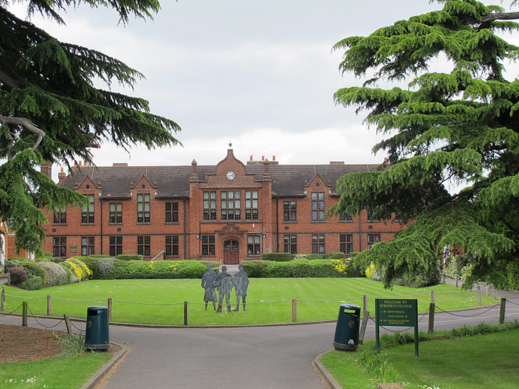
Strode's College

Strode's College is a sixth form college located in Egham, Surrey. It was founded in 1704, when Henry Strode bequeathed £6,000 to set up a free school...

Egham

Egham ( EG-əm) is a town in the Borough of Runnymede in Surrey, England, approximately 19 miles (31 km) west of central London. First settled in the Bronze...

Egham railway station

Egham railway station serves the town of Egham in Surrey, England. The station is owned by Network Rail and managed by South Western Railway, which also...
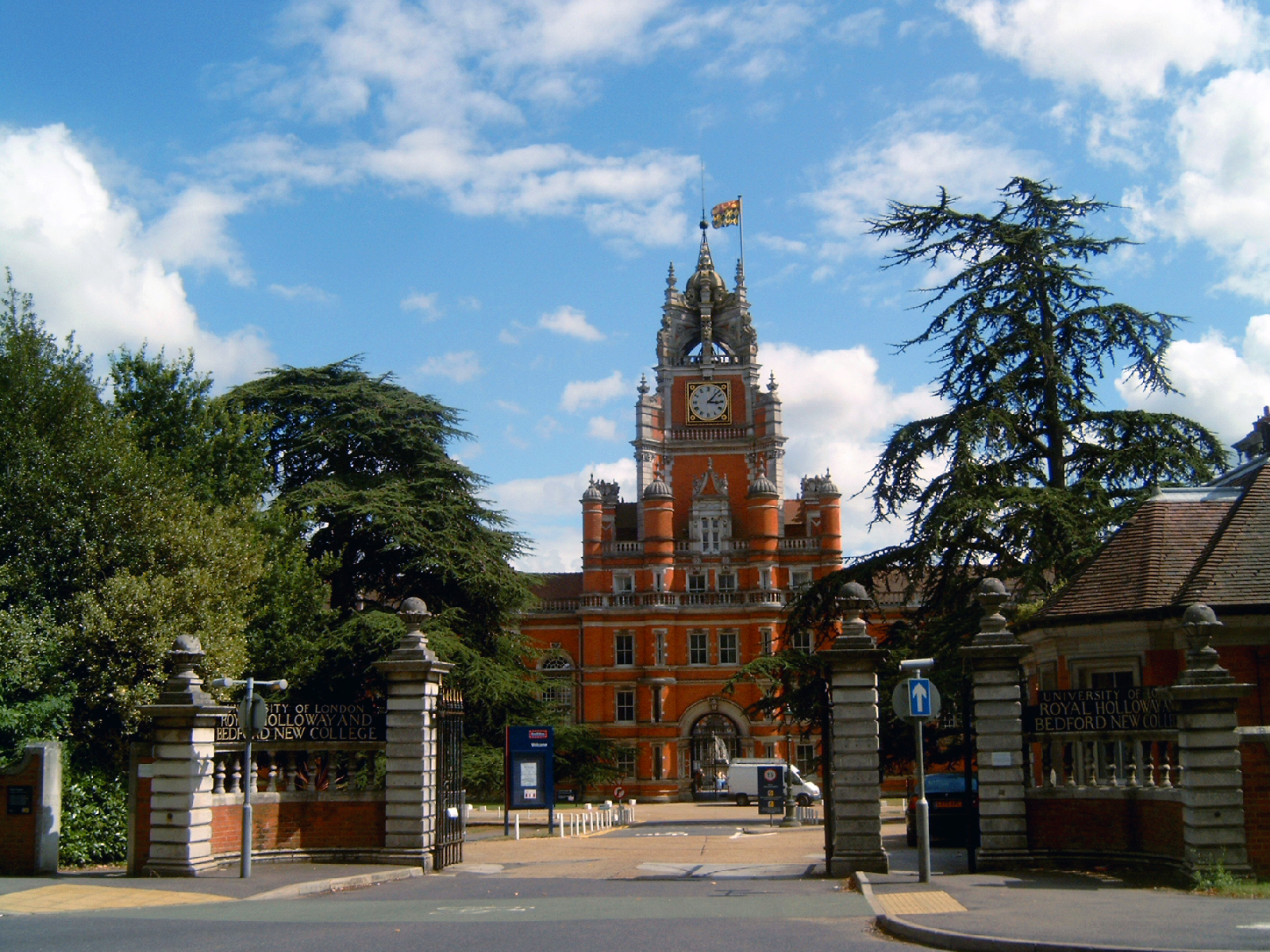
Founder's Building

The Founder's Building is the original building of Royal Holloway College, University of London (RHUL), in Egham, Surrey, England. It is an example of...

Royal Holloway, University of London

Royal Holloway, University of London (RHUL), formally incorporated as Royal Holloway and Bedford New College, is a public research university and a member...

Englefield Green

Englefield Green is a large village in the Borough of Runnymede, Surrey, England, approximately 20 miles (32 km) west of central London. It is home to...

Langham Pond

Langham Pond is a 26.7-hectare (66-acre) biological Site of Special Scientific Interest north of Egham in Surrey.The pond and its surrounding alluvial...

Nearby Amenities

Located within 500m of 51.429435,-0.557914
Created By: YahooApplet 1.0
Lat/Long: 51.4290278/-0.5591537
Created By: YahooApplet 1.0
Lat/Long: 51.4324626/-0.5530007
Mini Roundabout
Direction: clockwise
Lat/Long: 51.427455/-0.5625402
Man Made: surveillance
Lat/Long: 51.4265677/-0.5632108
Man Made: surveillance
Lat/Long: 51.4267582/-0.5610293
Man Made: surveillance
Lat/Long: 51.4287015/-0.5621702
Man Made: surveillance
Lat/Long: 51.4257989/-0.5600689
Bicycle Parking
Covered: yes
Fee: no
Lat/Long: 51.425697/-0.5599755
Bicycle Parking
Bicycle Parking: stands
Capacity: 12
Covered: no
Created By: Potlatch 0.8c
Lat/Long: 51.4252301/-0.5602185
Post Box
Collection Times: Mo-Fr 09:00, Sa 07:00
Ref: TW20 343D
Royal Cypher: EIIR
Royal Cypher Wikidata: Q33102113
Lat/Long: 51.4280712/-0.5574969
Post Box
Collection Times: Mo-Fr 17:30, Sa 11:00
Ref: TW20 332
Royal Cypher: GR
Royal Cypher Wikidata: Q33102273
Source: survey
Lat/Long: 51.4263462/-0.5548173
Post Box
Collection Times: Mo-Fr 09:00, Sa 07:00
Ref: TW20 303D
Royal Cypher: VR
Royal Cypher Wikidata: Q33102356
Lat/Long: 51.4289225/-0.552402
Post Box
Check Date: 2021-07-11
Collection Times: Mo-Fr 09:00, Sa 07:00
Ref: TW20 302D
Royal Cypher: VR
Royal Cypher Wikidata: Q33102356
Lat/Long: 51.4302473/-0.5509958
Telephone
Booth: KX100
Check Date: 2022-07-10
Covered: booth
Lat/Long: 51.4316302/-0.5520475
Post Box
Collection Times: Mo-Fr 16:30; Sa 11:00
Operator: Royal Mail
Operator Wikidata: Q638098
Post Box Type: pillar
Ref: TW20 315
Royal Cypher: EIIR
Royal Cypher Wikidata: Q33102113
Lat/Long: 51.4316238/-0.5520493
Turning Circle
Lat/Long: 51.4311243/-0.5578748
Turning Circle
Lat/Long: 51.4305106/-0.5633687
Turning Circle
Lat/Long: 51.4311192/-0.5625433
Turning Circle
Lat/Long: 51.4312671/-0.5635556
Turning Circle
Lat/Long: 51.4293742/-0.5634329
Turning Circle
Lat/Long: 51.4302269/-0.5556947
Turning Circle
Lat/Long: 51.430627/-0.5549169
Crossing
Crossing: uncontrolled
Crossing Island: no
Crossing Ref: zebra
Direction: both
Tactile Paving: yes
Traffic Calming: table
Lat/Long: 51.4272916/-0.5637109
Bus Stop
Chestnut Drive
Naptan AtcoCode: 40004401023B
Naptan Bearing: E
Naptan CommonName: Chestnut Drive
Naptan Indicator: adj
Naptan Landmark: Chestnut Drive
Naptan NaptanCode: suragawg
Naptan Street: Egham Hill
Naptan Verified: no
Public Transport: platform
Source: naptan_import
Lat/Long: 51.4278889/-0.5637609
Bus Stop
Middle Hill
Bench: no
Bin: yes
Bus: yes
Lit: yes
Naptan AtcoCode: 40004401024A
Naptan Bearing: SW
Naptan CommonName: Middle Hill
Naptan Indicator: Just after
Naptan Landmark: Middle Hill
Naptan NaptanCode: suragawj
Naptan Street: Egham Hill
Naptan Verified: no
Public Transport: platform
Shelter: no
Source: naptan_import
Tactile Paving: no
Lat/Long: 51.4301089/-0.5573536
Bus Stop
Middle Hill
Bench: no
Bus: yes
Lit: yes
Naptan AtcoCode: 40004401024B
Naptan Bearing: NE
Naptan CommonName: Middle Hill
Naptan Indicator: Just Before
Naptan Landmark: Middle Hill
Naptan NaptanCode: suragawm
Naptan Street: Egham Hill
Naptan Verified: no
Public Transport: platform
Shelter: no
Source: naptan_import
Tactile Paving: no
Lat/Long: 51.4299934/-0.5579862
Bus Stop
Langham Place
Bench: no
Bin: no
Bus: yes
Naptan AtcoCode: 40004401025A
Naptan Bearing: W
Naptan CommonName: Langham Place
Naptan Indicator: Opp
Naptan Landmark: Langham Place
Naptan NaptanCode: suragdgd
Naptan Street: High Street
Naptan Verified: no
Public Transport: platform
Shelter: no
Source: naptan_import
Wheelchair: limited
Wheelchair Description: No obvious step-free route to stop opposite.
Lat/Long: 51.4316714/-0.5533229
Bus Stop
Langham Place
Bench: no
Bin: no
Bus: yes
Naptan AtcoCode: 40004401025B
Naptan Bearing: E
Naptan CommonName: Langham Place
Naptan Indicator: Just after
Naptan Landmark: Langham Place
Naptan NaptanCode: suragdgj
Naptan Street: High Street
Naptan Verified: no
Public Transport: platform
Shelter: no
Source: naptan_import
Wheelchair: limited
Wheelchair Description: No obvious step-free route to stop opposite.
Lat/Long: 51.4317604/-0.55313
Barrier: kerb
Kerb: lowered
Tactile Paving: yes
Lat/Long: 51.4323848/-0.553819
Traffic Signals
Traffic Signals Direction: forward
Lat/Long: 51.4321256/-0.5540197
Crossing
Crossing: uncontrolled
Crossing Island: yes
Kerb: lowered
Lat/Long: 51.4317086/-0.5539095
Crossing
Crossing: uncontrolled
Crossing Island: yes
Kerb: lowered
Lat/Long: 51.4318677/-0.5546152
Direction: both
Traffic Calming: bump
Lat/Long: 51.4319015/-0.5549223
Crossing
Crossing: uncontrolled
Crossing Island: yes
Kerb: lowered
Lat/Long: 51.4317518/-0.55389
Crossing
Crossing: uncontrolled
Crossing Island: yes
Kerb: lowered
Lat/Long: 51.4319203/-0.5545907
Crossing
Bicycle: yes
Crossing: uncontrolled
Crossing Island: yes
Kerb: lowered
Lat/Long: 51.4315197/-0.5544604
Crossing
Bicycle: yes
Crossing: unmarked
Crossing Markings: no
Kerb: lowered
Lat/Long: 51.4314225/-0.5545127
Crossing
Bicycle: yes
Crossing: uncontrolled
Crossing Island: yes
Kerb: lowered
Lat/Long: 51.4315612/-0.5545806
Crossing
Bicycle: yes
Button Operated: yes
Crossing: traffic_signals
Crossing Ref: toucan
Kerb: lowered
Tactile Paving: yes
Traffic Signals Vibration: yes
Lat/Long: 51.4321625/-0.5539705
Barrier: kerb
Kerb: lowered
Tactile Paving: yes
Lat/Long: 51.4324912/-0.5537181
Crossing
Bicycle: yes
Crossing: unmarked
Crossing Markings: no
Kerb: lowered
Lat/Long: 51.432434/-0.5537724
Crossing
Bicycle: yes
Button Operated: yes
Crossing: traffic_signals
Crossing Ref: toucan
Kerb: lowered
Tactile Paving: yes
Traffic Signals Vibration: yes
Lat/Long: 51.4320461/-0.5539184
Crossing
Bicycle: yes
Crossing: unmarked
Crossing Markings: no
Kerb: lowered
Lat/Long: 51.4327905/-0.5534328
Crossing
Crossing: unmarked
Crossing Markings: no
Kerb: lowered
Lat/Long: 51.431776/-0.5534094
Crossing
Crossing: unmarked
Crossing Markings: no
Kerb: lowered
Lat/Long: 51.4310727/-0.5556932
Crossing
Crossing: unmarked
Crossing Markings: no
Tactile Paving: yes
Lat/Long: 51.4307389/-0.5562663
Crossing
Crossing: unmarked
Crossing Island: yes
Crossing Markings: no
Kerb: lowered
Source: Surrey Air Survey
Tactile Paving: no
Lat/Long: 51.4296998/-0.5587492
Crossing
Crossing: unmarked
Crossing Markings: no
Tactile Paving: yes
Lat/Long: 51.4307132/-0.5561674
Crossing
Bicycle: dismount
Crossing Island: yes
Kerb: lowered
Lat/Long: 51.4288227/-0.5610078
Crossing
Crossing: unmarked
Kerb: lowered
Lat/Long: 51.4285444/-0.5618952
Crossing
Crossing: unmarked
Crossing Markings: no
Kerb: lowered
Lat/Long: 51.4297553/-0.558545
Crossing
Bicycle: yes
Crossing: unmarked
Kerb: lowered
Lat/Long: 51.4285347/-0.5615969
Piggery Gate
Access: no
Barrier: cycle_barrier
Bicycle: yes
Cycle Barrier: tilted
Foot: yes
Horse: yes
Motor Vehicle: no
Note: There is currently no gate, just a gap in the wall with a cycle barrier behind it
Lat/Long: 51.4285441/-0.5615195
Direction: both
Traffic Calming: hump
Lat/Long: 51.4252/-0.5601633
Direction: both
Traffic Calming: hump
Lat/Long: 51.4255945/-0.5615188
Crossing
Crossing: uncontrolled
Crossing Island: no
Tactile Paving: yes
Traffic Calming: table
Lat/Long: 51.4274867/-0.5634303
Man Made: surveillance
Lat/Long: 51.4260707/-0.5626449
Man Made: surveillance
Lat/Long: 51.4266035/-0.5620977
Man Made: surveillance
Lat/Long: 51.4250484/-0.5590182
Entrance: yes
Lat/Long: 51.4268566/-0.5634075
Man Made: surveillance
Lat/Long: 51.4270605/-0.5633395
Man Made: surveillance
Lat/Long: 51.4268625/-0.5637768
Fixme: continue
Lat/Long: 51.4268771/-0.5626779
Crossing
Crossing: uncontrolled
Crossing Island: no
Tactile Paving: yes
Traffic Calming: table
Lat/Long: 51.4271348/-0.5625958
Man Made: surveillance
Lat/Long: 51.4273002/-0.5627229
Entrance: yes
Lat/Long: 51.4272525/-0.563042
Bicycle Parking
Bicycle Parking: stands
Capacity: 15
Covered: yes
Lat/Long: 51.4261222/-0.5610951
Insanity Radio 1287AM
Height: 11
Man Made: communications_transponder
Operator: Insanity Radio/Student's Union, Royal Holloway, University of London
Url: http://www.insanityradio.com
Lat/Long: 51.4267429/-0.5600587
Entrance: main
Lat/Long: 51.4265528/-0.5616586
Toilets
Wheelchair: yes
Lat/Long: 51.4265874/-0.5614814
Toilets
Wheelchair: yes
Lat/Long: 51.426355/-0.5610925
Addr Flats: J
Entrance: staircase
Wheelchair: yes
Lat/Long: 51.4254885/-0.5613753
Entrance: main
Fixme: Should be shifted to be about 2/3 to the right along this side of the building
Wheelchair: yes
Lat/Long: 51.4258908/-0.5615764
Entrance: emergency
Wheelchair: no
Lat/Long: 51.4264108/-0.5606762
Entrance: yes
Wheelchair: yes
Lat/Long: 51.4263317/-0.5612038
Entrance: emergency
Lat/Long: 51.4274923/-0.563286
Entrance: yes
Wheelchair: yes
Lat/Long: 51.4269518/-0.5633431
Entrance: yes
Wheelchair: yes
Lat/Long: 51.4274488/-0.5640054
Bicycle Parking
Bicycle Parking: stands
Capacity: 24
Covered: no
Lat/Long: 51.4274515/-0.563909
Toilets
Wheelchair: yes
Lat/Long: 51.4276543/-0.5637143
Grit Bin
Lat/Long: 51.4275805/-0.5634466
Crossing
Crossing: uncontrolled
Crossing Island: yes
Tactile Paving: yes
Traffic Calming: table
Lat/Long: 51.426497/-0.5617585
Crossing
Crossing: uncontrolled
Crossing Island: no
Tactile Paving: no
Lat/Long: 51.4260715/-0.5618142
Crossing
Crossing: uncontrolled
Crossing Island: no
Crossing Ref: zebra
Tactile Paving: yes
Lat/Long: 51.4258795/-0.5618658
Entrance: yes
Lat/Long: 51.4268088/-0.5632888
Turning Circle
Lat/Long: 51.4314463/-0.5559377
Check Date: 2021-06-21
Surface: paving_stones
Traffic Calming: table
Lat/Long: 51.4285096/-0.5582156
Ripley Springs
Place: neighbourhood
Source: OS
Lat/Long: 51.4272903/-0.5562152
Turning Circle
Lat/Long: 51.4251637/-0.5577305
Barrier: cycle_barrier
Cycle Barrier: double
Cycle Barrier Installation: fixed
Material: metal
Lat/Long: 51.4292868/-0.5509484
Turning Circle
Lat/Long: 51.4256604/-0.554591
Bicycle Parking
Bicycle Parking: stands
Capacity: 4
Covered: no
Lat/Long: 51.4300821/-0.553697
Atm
NatWest
Brand: NatWest
Brand Wikidata: Q2740021
Check Date: 2022-08-20
Fee: no
Operator: NatWest
Operator Wikidata: Q2740021
Lat/Long: 51.4272982/-0.5631715
Crossing
Crossing: unmarked
Crossing Island: no
Crossing Markings: no
Kerb: lowered
Tactile Paving: yes
Lat/Long: 51.430636/-0.5565576
Man Made: surveillance
Lat/Long: 51.426294/-0.5614073
Waste Basket
Colour: black
Material: metal
Waste: trash;mixed
Lat/Long: 51.427514/-0.5635044
Waste Basket
Lat/Long: 51.4276376/-0.5626467
Waste Basket
Colour: black
Material: metal
Waste: trash;mixed
Lat/Long: 51.42732/-0.5634392
Waste Basket
Colour: black
Material: metal
Waste: trash;mixed
Lat/Long: 51.427188/-0.563164
Waste Basket
Lat/Long: 51.4276459/-0.5634809
Waste Basket
Colour: black
Material: metal
Waste: trash;mixed
Lat/Long: 51.4272326/-0.5633434
Waste Basket
Fixme: Pretty sure this is incorrect? Please survey
Lat/Long: 51.4270694/-0.5612614
Bench
Lat/Long: 51.4261655/-0.5605919
Bench
Lat/Long: 51.4259614/-0.5605006
Man Made: surveillance
Lat/Long: 51.426578/-0.5616587
Crossing
Crossing: unmarked
Crossing Markings: no
Kerb: lowered
Lat/Long: 51.4315496/-0.5523962
Crossing
Crossing: unmarked
Crossing Markings: no
Kerb: lowered
Lat/Long: 51.4316047/-0.5527408
Crossing
Crossing: unmarked
Crossing Island: no
Crossing Markings: no
Kerb: lowered
Tactile Paving: no
Lat/Long: 51.4315186/-0.5521476
Post Box
Collection Times: Mo-Fr 09:00; Sa 07:00
Post Box Type: wall
Ref: TW20 316D
Royal Cypher: EIIR
Royal Cypher Wikidata: Q33102113
Lat/Long: 51.4298585/-0.5594706
Waste Basket
Colour: red
Waste: dog_excrement
Lat/Long: 51.4262673/-0.5548808
Atm
Check Date: 2022-06-26
Lat/Long: 51.4314492/-0.5527747
Crossing
Crossing: unmarked
Crossing Island: no
Kerb: lowered
Sloped Curb: yes
Tactile Paving: yes
Lat/Long: 51.4300929/-0.5640015
Crossing
Crossing: unmarked
Crossing Island: no
Kerb: lowered
Sloped Curb: yes
Tactile Paving: yes
Lat/Long: 51.4298296/-0.5626604
Barrier: kerb
Kerb: lowered
Tactile Paving: no
Lat/Long: 51.429717/-0.5587102
Barrier: kerb
Kerb: lowered
Tactile Paving: no
Lat/Long: 51.4296229/-0.5589532
Crossing
Bicycle: yes
Crossing: unmarked
Kerb: lowered
Lat/Long: 51.4277012/-0.5645317
Barrier: kerb
Kerb: flush
Tactile Paving: yes
Lat/Long: 51.4306766/-0.5564887
Crossing
Bicycle: yes
Crossing: unmarked
Crossing Markings: no
Kerb: lowered
Lat/Long: 51.4313021/-0.5547821
Barrier: kerb
Kerb: lowered
Tactile Paving: yes
Lat/Long: 51.4315553/-0.5541747
Traffic Signals
Traffic Signals Direction: forward
Lat/Long: 51.4320851/-0.5538695
Barrier: kerb
Kerb: lowered
Tactile Paving: yes
Lat/Long: 51.4328356/-0.5533904
Barrier: kerb
Kerb: lowered
Tactile Paving: yes
Lat/Long: 51.4327527/-0.5534684
Barrier: kerb
Kerb: lowered
Tactile Paving: yes
Lat/Long: 51.431615/-0.5528248
Crossing
Crossing: unmarked
Crossing Island: yes
Crossing Markings: no
Kerb: lowered
Tactile Paving: yes
Lat/Long: 51.4315601/-0.5519879
Crossing
Crossing: unmarked
Crossing Island: no
Crossing Markings: no
Kerb: lowered
Tactile Paving: no
Lat/Long: 51.4316541/-0.5522544
Barrier: kerb
Kerb: lowered
Tactile Paving: yes
Lat/Long: 51.4316649/-0.5523418
Barrier: kerb
Kerb: lowered
Tactile Paving: yes
Lat/Long: 51.4317736/-0.5533538
Crossing
Crossing: unmarked
Crossing Island: no
Crossing Markings: no
Kerb: lowered
Tactile Paving: no
Lat/Long: 51.4314289/-0.5540227
Device Charging Station
Level: 0
Lockable: yes
Lat/Long: 51.427315/-0.5631765
Restaurant
Tommy's Kitchen
Fhrs Id: 315654
Opening Hours: Mo-Fr 11:00-15:00, 18:00-22:00
Lat/Long: 51.4272701/-0.5629187
Public Bookcase
Little Free Library
Books: adults
Brand: Little Free Library
Brand Wikidata: Q6650101
Capacity: 15
Charter No: 27626
Website: https://www.littlefreelibrary.org/
Lat/Long: 51.4265304/-0.5632619
Entrance: main
Lat/Long: 51.4258318/-0.561699
Exit: emergency
Lat/Long: 51.4256373/-0.5615758
Exit: emergency
Lat/Long: 51.4256303/-0.5614232
Exit: emergency
Lat/Long: 51.4258141/-0.5609431
Exit: emergency
Lat/Long: 51.4258228/-0.5612191
Crossing
Bicycle: yes
Crossing: unmarked
Kerb: lowered
Lat/Long: 51.4278309/-0.56404
Crossing
Bicycle: yes
Crossing: unmarked
Kerb: lowered
Lat/Long: 51.4279157/-0.5636237
Traffic Signals
Traffic Signals Direction: forward
Lat/Long: 51.429531/-0.5590429
Crossing
Crossing: uncontrolled
Crossing Island: yes
Kerb: lowered
Source: Surrey Air Survey
Tactile Paving: no
Lat/Long: 51.4296507/-0.5588813
Traffic Signals
Traffic Signals Direction: forward
Lat/Long: 51.4295202/-0.5589351
Barrier: bollard
Bollard: fixed
Lat/Long: 51.430016/-0.5573177
Crossing
Crossing: unmarked
Crossing Markings: no
Kerb: lowered
Lat/Long: 51.4318768/-0.5547906
Crossing
Bicycle: yes
Crossing: unmarked
Crossing Markings: no
Kerb: lowered
Lat/Long: 51.4314973/-0.5547659
Crossing
Bicycle: yes
Crossing: unmarked
Crossing Markings: no
Kerb: lowered
Tactile Paving: yes
Lat/Long: 51.4315757/-0.5541275
Crossing
Bicycle: yes
Crossing: unmarked
Crossing Markings: no
Kerb: lowered
Lat/Long: 51.4315935/-0.5540862
Barrier: kerb
Kerb: raised
Tactile Paving: no
Lat/Long: 51.4300978/-0.5573311
Barrier: kerb
Kerb: flush
Tactile Paving: yes
Lat/Long: 51.430602/-0.5566154
Direction: both
Traffic Calming: hump
Lat/Long: 51.4274979/-0.5626537
Direction: both
Traffic Calming: hump
Lat/Long: 51.4276465/-0.5622511
Direction: both
Traffic Calming: hump
Lat/Long: 51.4268408/-0.5621781
Direction: both
Was Traffic Calming: hump
Lat/Long: 51.4255552/-0.5605865
Generator Method: photovoltaic
Generator Output Electricity: yes
Generator Source: solar
Generator Type: solar_photovoltaic_panel
Location: roof
Power: generator
Lat/Long: 51.4318087/-0.5635509
Generator Method: photovoltaic
Generator Output Electricity: yes
Generator Source: solar
Generator Type: solar_photovoltaic_panel
Location: roof
Power: generator
Lat/Long: 51.431603/-0.5636877
Generator Method: photovoltaic
Generator Output Electricity: yes
Generator Source: solar
Generator Type: solar_photovoltaic_panel
Location: roof
Power: generator
Lat/Long: 51.4316565/-0.5641142
Generator Method: photovoltaic
Generator Output Electricity: yes
Generator Source: solar
Generator Type: solar_photovoltaic_panel
Location: roof
Power: generator
Lat/Long: 51.4312167/-0.5630708
Generator Method: photovoltaic
Generator Output Electricity: yes
Generator Source: solar
Generator Type: solar_photovoltaic_panel
Location: roof
Power: generator
Lat/Long: 51.4306047/-0.5607024
Generator Method: photovoltaic
Generator Output Electricity: yes
Generator Source: solar
Generator Type: solar_photovoltaic_panel
Location: roof
Power: generator
Lat/Long: 51.4303104/-0.5615446
Man Made: surveillance
Lat/Long: 51.4260814/-0.5621209
Barrier: bollard
Bollard: fixed
Lat/Long: 51.4270822/-0.5569424
Crossing
Crossing: unmarked
Crossing Markings: no
Tactile Paving: no
Lat/Long: 51.4313557/-0.5538263
Man Made: surveillance
Lat/Long: 51.4253936/-0.5607486
Man Made: surveillance
Lat/Long: 51.4261343/-0.5605475
Man Made: surveillance
Lat/Long: 51.4266398/-0.5626807
Man Made: surveillance
Lat/Long: 51.4274487/-0.5633005
Man Made: surveillance
Lat/Long: 51.4272361/-0.5629611
Man Made: surveillance
Lat/Long: 51.4263204/-0.5621595
Man Made: surveillance
Lat/Long: 51.4256218/-0.5612342
Waste Basket
Colour: black
Material: plastic
Waste: mixed;trash
Lat/Long: 51.4253476/-0.5601662
Bicycle Parking
Covered: yes
Fee: no
Lat/Long: 51.4257343/-0.5599734
Entrance: main
Lat/Long: 51.4273675/-0.5632445
Entrance: yes
Lat/Long: 51.4269034/-0.5634145
Insanity Radio 103.2FM
Contact Instagram: insanityradio
Email: studio@insanityradio.com
Office: radio_station
Phone: +44 1784276734
Service Times: Mo-Su 00:00-02:00,08:00-24:00
Website: https://insanityradio.com
Lat/Long: 51.4272571/-0.5627563
Waste Basket
Waste: dog_excrement
Lat/Long: 51.4296904/-0.559081
Waste Basket
Colour: black
Material: plastic
Waste: trash
Lat/Long: 51.4283065/-0.5572645
Waste Basket
Waste: dog_excrement
Lat/Long: 51.4294005/-0.5543582
Grit Bin
Lat/Long: 51.4267689/-0.558007
Waste Basket
Waste: dog_excrement
Lat/Long: 51.4297405/-0.5529453
Man Made: surveillance
Surveillance Type: camera
Lat/Long: 51.4249791/-0.5586369
Grit Bin
Lat/Long: 51.4284815/-0.5580845
Grit Bin
Lat/Long: 51.4290664/-0.5593077
Grit Bin
Lat/Long: 51.4278499/-0.5583239
Waste Basket
Colour: black
Material: plastic
Waste: trash
Lat/Long: 51.4264473/-0.5633073
Bicycle Parking
Bicycle Parking: wall_loops
Capacity: 20
Covered: yes
Lat/Long: 51.4265109/-0.5631964
Artwork Type: sculpture
Tourism: artwork
Lat/Long: 51.4271409/-0.5641177
Best-one
Addr Housenumber: 186-187
Addr Postcode: TW20 9ED
Addr Street: High Street
Brand: Best-one
Brand Wikidata: Q4896532
Check Date: 2022-06-26
Fhrs Id: 315631
Shop: convenience
Source Addr: FHRS Open Data
Lat/Long: 51.4313983/-0.5527389
Scuderia
Addr Housenumber: 8
Addr Street: High Street
Check Date: 2022-06-26
Shop: car_parts
Website: https://www.scuderiacarparts.com/
Lat/Long: 51.4318088/-0.5532163
Addr Housename: Fagins Cottage
Lat/Long: 51.4302545/-0.5642977
Direction: both
Traffic Calming: bump
Lat/Long: 51.4319772/-0.5566431
Direction: both
Traffic Calming: bump
Lat/Long: 51.4316251/-0.5583144
Grit Bin
Lat/Long: 51.4315373/-0.5585244
Waste Basket
Waste: dog_excrement
Lat/Long: 51.4315245/-0.5585559
Barrier: cycle_barrier
Lat/Long: 51.4303381/-0.5633982
Addr Housename: Olivers Cottage
Lat/Long: 51.430241/-0.5641956
Direction: both
Traffic Calming: bump
Lat/Long: 51.431625/-0.5613642
Direction: both
Traffic Calming: bump
Lat/Long: 51.4314542/-0.5592137
Waste Basket
Waste: trash
Lat/Long: 51.4297262/-0.5557138
Grit Bin
Colour: yellow
Material: plastic
Lat/Long: 51.429753/-0.5557158
Compressed Air
Lat/Long: 51.4314986/-0.5527926
Addr Flats: 9,10,11
Entrance: yes
Lat/Long: 51.4287267/-0.5524952
Addr Flats: 3,4,7,8
Entrance: yes
Lat/Long: 51.4288471/-0.5522379
Addr Flats: 4
Entrance: yes
Lat/Long: 51.4293944/-0.5509708
Addr Flats: 3,5-14
Entrance: yes
Lat/Long: 51.4293902/-0.5509123
Man Made: pumping_station
Operator: Thames Water
Ref: NOBEP1ZZ
Lat/Long: 51.4256786/-0.5550227
Addr Flats: 2
Entrance: yes
Lat/Long: 51.4288232/-0.5520295
Addr Flats: 1,5,6
Entrance: yes
Lat/Long: 51.4287742/-0.5519932
P. Hutchinson & Son Motor Mechanic
Check Date: 2022-08-15
Phone: +44 1784 431570
Shop: car_repair
Lat/Long: 51.4292651/-0.5508375
Entrance: yes
Lat/Long: 51.4293334/-0.5510998
Entrance: yes
Lat/Long: 51.429297/-0.551211
Entrance: yes
Lat/Long: 51.4292868/-0.5512457
Entrance: yes
Lat/Long: 51.4292563/-0.5513415
Entrance: yes
Lat/Long: 51.429244/-0.5513852
Entrance: yes
Lat/Long: 51.4292086/-0.5514807
Addr Flats: 22a
Entrance: yes
Lat/Long: 51.4292345/-0.5515831
Addr Flats: 22b
Entrance: yes
Lat/Long: 51.4292488/-0.5515932
Entrance: yes
Lat/Long: 51.4291161/-0.5517033
Entrance: yes
Lat/Long: 51.4290522/-0.5519243
Entrance: yes
Lat/Long: 51.4290828/-0.5520424
Barrier: bollard
Bollard: removable
Material: metal
Lat/Long: 51.4263395/-0.5527419
Addr Flats: 21a
Entrance: yes
Lat/Long: 51.4291866/-0.5517446
Addr Flats: 21b
Entrance: yes
Lat/Long: 51.4292011/-0.551755
Crossing
Crossing: uncontrolled
Crossing Island: no
Tactile Paving: no
Lat/Long: 51.426755/-0.5620456
Crossing
Crossing: uncontrolled
Tactile Paving: yes
Lat/Long: 51.4260572/-0.5613824
Noexit: yes
Lat/Long: 51.4260141/-0.5617484
Barrier: bollard
Bollard: removable
Colour: grey
Material: metal
Lat/Long: 51.4255819/-0.5604683
Waste Basket
Colour: black
Material: plastic
Waste: trash;mixed
Lat/Long: 51.4255188/-0.5605295
Bench
Backrest: yes
Material: wood
Lat/Long: 51.429003/-0.5628681
Bench
Backrest: yes
Material: wood
Lat/Long: 51.4290155/-0.5628519
Bench
Backrest: yes
Material: wood
Lat/Long: 51.429026/-0.5628164
Bench
Backrest: no
Material: wood
Lat/Long: 51.4289724/-0.5639134
Bench
Backrest: yes
Material: wood
Lat/Long: 51.429449/-0.5651147
The Arboretum
Board Type: nature
Information: board
Operator: Royal Holloway, University of London
Tourism: information
Lat/Long: 51.4288679/-0.5626316
Entrance: main
Lat/Long: 51.426284/-0.5618889
Entrance: emergency
Lat/Long: 51.42752/-0.5631683
Entrance: emergency
Lat/Long: 51.4274873/-0.5627779
Entrance: main
Lat/Long: 51.4260697/-0.5625626
Bench: yes
Leisure: picnic_table
Material: wood
Lat/Long: 51.4262112/-0.5611454
Bench: yes
Leisure: picnic_table
Material: wood
Lat/Long: 51.4261926/-0.5610945
MRI Unit
Entrance: yes
Lat/Long: 51.4261815/-0.5621878
Entrance: staircase
Lat/Long: 51.4262623/-0.5621124
Bicycle Parking
Access: private
Bicycle Parking: wall_loops
Capacity: 8
Covered: yes
Locked: yes
Lat/Long: 51.4255176/-0.5606219
Bicycle Parking
Access: private
Bicycle Parking: wall_loops
Capacity: 8
Covered: yes
Locked: yes
Lat/Long: 51.4255217/-0.5607536
Waste Basket
Colour: black
Material: plastic
Waste: trash;mixed
Lat/Long: 51.4255285/-0.5608534
Addr Flats: H
Entrance: staircase
Lat/Long: 51.4255334/-0.5611065
Addr Flats: G
Entrance: staircase
Lat/Long: 51.425525/-0.5608813
Shelter
Bin: yes
Shelter Type: picnic_shelter
Lat/Long: 51.425763/-0.5619795
Bench: yes
Leisure: picnic_table
Material: plastic
Lat/Long: 51.4258782/-0.5619543
Waste Basket
Colour: black
Material: plastic
Waste: trash
Lat/Long: 51.425898/-0.5617949
Smoking Area
Bench: yes
Bin: no
Check Date: 2023-05-02
Shelter: yes
Lat/Long: 51.4266739/-0.562095
Waste Basket
Colour: black
Material: plastic
Waste: trash;mixed
Lat/Long: 51.4269081/-0.5621802
Shelter
Bin: yes
Shelter Type: picnic_shelter
Lat/Long: 51.427319/-0.5633844
Crossing
Lat/Long: 51.4293181/-0.5597263
Bench
Material: wood
Lat/Long: 51.4291791/-0.5641106
Bench: yes
Leisure: picnic_table
Lit: no
Material: wood
Lat/Long: 51.4294052/-0.5641373
The data included in this document is from www.openstreetmap.org. The data is made available under ODbL.

Have you been to Egham?

Leave your review of Egham below (or comments, questions and feedback).