Runnymede

Heritage Site in Surrey Runnymede

England

Runnymede

The Beehive Pub sign: Fuller's pub on Middle Hill
The Beehive Credit: John Myers

Runnymede, located in Surrey, England, is a historically significant site that holds great importance in the country's history. It is renowned worldwide as the place where the Magna Carta, a crucial document in the development of democracy, was signed in 1215.

Situated alongside the River Thames, Runnymede boasts stunning natural beauty, with lush meadows, wooded areas, and picturesque views of the river. The site covers an area of approximately 200 acres, including the memorial area and the surrounding fields.

The centerpiece of Runnymede is the Magna Carta Memorial, erected in 1957 to commemorate the 750th anniversary of the signing. This memorial, designed by Sir Edward Maufe, features a stone canopy supported by pillars, beneath which stands a bronze statue of King John. The memorial stands on the actual spot where the historic document was sealed.

In addition to the Magna Carta Memorial, Runnymede also hosts several other notable monuments and memorials. The John F. Kennedy Memorial, dedicated in 1965, stands as a tribute to the late American president. The Commonwealth Air Forces Memorial, unveiled in 1953, honors the airmen from Commonwealth countries who lost their lives during World War II.

Runnymede is open to the public and offers visitors the opportunity to explore its rich historical significance and enjoy the tranquility of its surroundings. The site is maintained by the National Trust and offers guided tours, educational programs, and a visitor center with exhibits that delve into the history and importance of the Magna Carta. Runnymede is not only a heritage site of national significance but also a symbol of freedom and democracy for people around the world.

If you have any feedback on the listing, please let us know in the comments section below.

Runnymede Images

Images are sourced within 2km of 51.438/-0.553 or Grid Reference TQ0071. Thanks to Geograph Open Source API. All images are credited.

The Beehive Pub sign: Fuller's pub on Middle Hill
The Beehive
Pub sign: Fuller's pub on Middle Hill
Egham station This shows the up-side frontage as rebuilt in 1985.
Egham station
This shows the up-side frontage as rebuilt in 1985.
St John the Baptist, Egham - south elevation
St John the Baptist, Egham - north elevation
High Street, Egham This is the north side looking east.
High Street, Egham
This is the north side looking east.
Ongoing construction work, Egham This was taken where Church Road (running left-right) is met by Station Road (foreground).
Ongoing construction work, Egham
This was taken where Church Road (running left-right) is met by Station Road (foreground).
House on Staines Road, Wraysbury
Bus stop on Staines Road (B376), Wraysbury
Staines Road (B376)
Staines Road (B376)
Road to sailing club Off Staines Road (B376).
Road to sailing club
Off Staines Road (B376).
Houses on Staines Road (B376)
B376 towards Staines
Spice Village Indian Restaurant & Bar, Hythe End
Sign for the Spice Village Indian Restaurant & Bar, Hythe End
Houses on Wraysbury Road
A30 / M25 Motorway bridge over Wraysbury Road (B376)
George V postbox on Wraysbury Road, Hythe End Postbox No. TW189 605.
George V postbox on Wraysbury Road, Hythe End
Postbox No. TW189 605.
Remains of Ankerwycke Priory - looking south-east
Show me another place!

Runnymede is located at Grid Ref: TQ0071 (Lat: 51.438, Lng: -0.553)

Administrative County: Surrey

District: Runnymede

Police Authority: Surrey

What 3 Words

///rash.rotate.origin. Near Egham, Surrey

Related Wikis

Langham Pond

Langham Pond is a 26.7-hectare (66-acre) biological Site of Special Scientific Interest north of Egham in Surrey.The pond and its surrounding alluvial...

Wraysbury Skiff and Punting Club

Wraysbury Skiff and Punting Club (WSPC) is an English skiff and punting club founded in 1931 based on the River Thames at the start of the Surrey section...
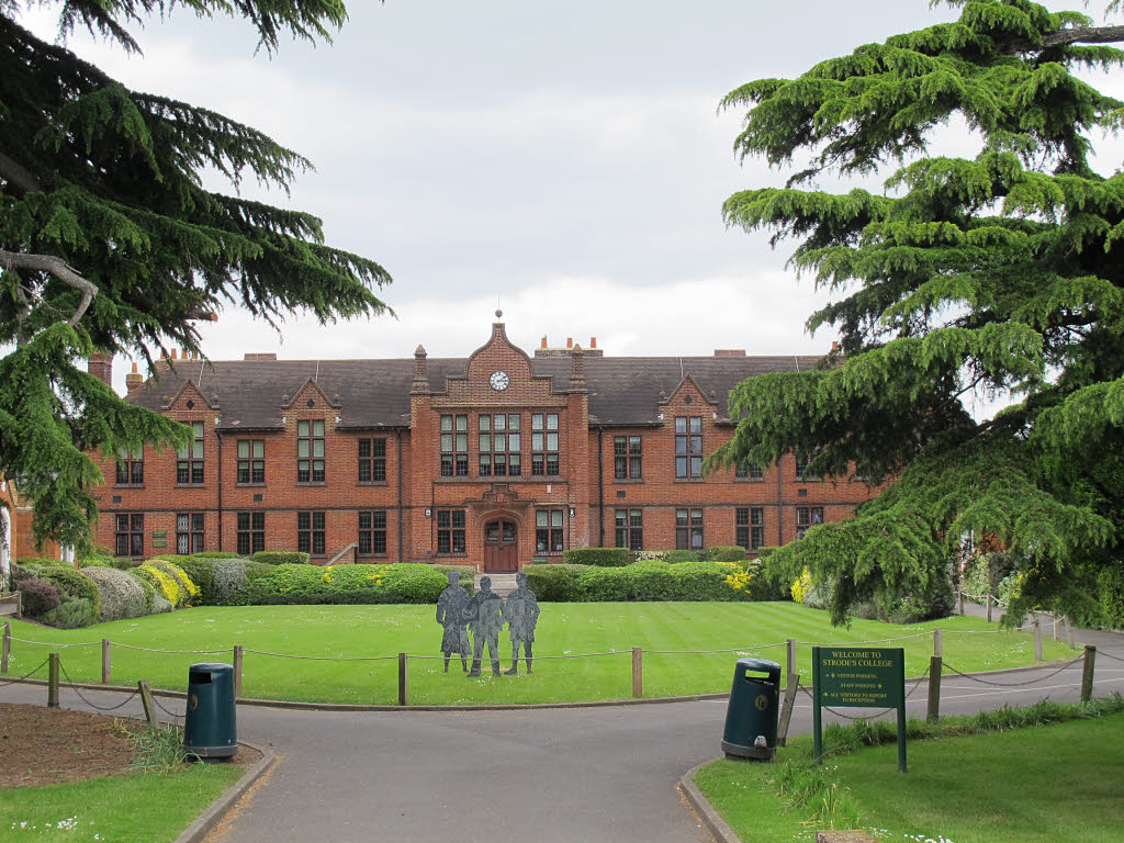
Strode's College

Strode's College is a sixth form college located in Egham, Surrey. It was founded in 1704, when Henry Strode bequeathed £6,000 to set up a free school...

The Island, Hythe End

The Island is an inhabited island in the River Thames in England on the reach above Bell Weir Lock, a part of the Hythe End part of Wraysbury village...

Ankerwycke Priory

Ankerwycke Priory was a priory of Benedictine nuns in Buckinghamshire, England. It was established around 1160 and dissolved in 1536. Excavations were...

Ankerwycke Yew

The Ankerwycke Yew is an ancient yew tree close to the ruins of St Mary's Priory, the site of a Benedictine nunnery built in the 12th century, near Wraysbury...

Air Forces Memorial

The Air Forces Memorial, or Runnymede Memorial, in Englefield Green, near Egham, Surrey, England is a memorial dedicated to some 20,456 men and women from...

St John's Church, Egham

St. John's Church, Egham or St. John the Baptist, Egham or St. John's Church is an evangelical Anglican church located in the centre of Egham, Surrey,...

Nearby Amenities

Located within 500m of 51.438,-0.553
Crossing
Crossing: uncontrolled
Tactile Paving: yes
Lat/Long: 51.4353873/-0.548733
Crossing
Crossing: unmarked
Crossing Island: yes
Tactile Paving: no
Lat/Long: 51.4412014/-0.5561276
Barrier: stile
Lat/Long: 51.4394242/-0.5470068
Restaurant
Runnymede Cafe
Addr Postcode: TW20 0AE
Addr Street: Windsor Road
Fhrs Id: 315364
Indoor Seating: yes
Outdoor Seating: yes
Source Addr: FHRS Open Data
Lat/Long: 51.4408401/-0.5501171
Barrier: kissing_gate
Lat/Long: 51.4365258/-0.5549705
Barrier: bollard
Bicycle: yes
Bollard: removable
Colour: yellow
Foot: yes
Material: metal
Lat/Long: 51.4336511/-0.5535802
Barrier: bollard
Lat/Long: 51.4373619/-0.5590857
Crossing
Bicycle: yes
Crossing: unmarked
Crossing Island: no
Kerb: lowered
Tactile Paving: yes
Lat/Long: 51.4351973/-0.5487266
Barrier: stile
Material: wood
Step Count: 2
Stile: stepover
Lat/Long: 51.4397622/-0.5571595
Barrier: kerb
Kerb: lowered
Lat/Long: 51.4354311/-0.5487512
Barrier: kerb
Kerb: lowered
Lat/Long: 51.4352123/-0.5486103
Barrier: kerb
Kerb: lowered
Lat/Long: 51.4351867/-0.5488144
Crossing
Crossing: uncontrolled
Tactile Paving: yes
Lat/Long: 51.4352268/-0.5490477
Hiking: yes
Information: guidepost
Source: GPS survey
Tourism: information
Lat/Long: 51.441244/-0.5539513
Covered: no
Leisure: picnic_table
Lat/Long: 51.4413008/-0.5536026
HM Queen Elizabeth II
Historic: memorial
Material: metal
Memorial: statue
Source: GPS survey
Wheelchair: yes
Lat/Long: 51.4416452/-0.5530635
Bench
Backrest: yes
Source: GPS survey
Lat/Long: 51.4421819/-0.5528274
Toilets
Fee: no
Wheelchair: yes
Lat/Long: 51.4408829/-0.549885
Crossing
Crossing: unmarked
Kerb: lowered
Sloped Curb: yes
Source: survey
Lat/Long: 51.4395828/-0.5469542
Crossing
Bicycle: yes
Crossing: unmarked
Kerb: lowered
Sloped Curb: yes
Lat/Long: 51.4354264/-0.5471894
Crossing
Bicycle: yes
Crossing: unmarked
Kerb: lowered
Sloped Curb: yes
Lat/Long: 51.4353928/-0.5473939
Crossing
Bicycle: yes
Crossing: unmarked
Kerb: lowered
Sloped Curb: yes
Lat/Long: 51.4353046/-0.5479463
Crossing
Bicycle: yes
Crossing: unmarked
Kerb: lowered
Sloped Curb: yes
Lat/Long: 51.4352798/-0.548123
Ferry: yes
Operator: French Brothers Ltd
Public Transport: stop_position
Lat/Long: 51.4416801/-0.5533713
Bench
Backrest: yes
Material: concrete
Seats: 5
Lat/Long: 51.4417044/-0.5533029
Bench
Backrest: yes
Material: concrete
Seats: 5
Lat/Long: 51.4417099/-0.5531042
Waste Basket
Waste: trash
Lat/Long: 51.4413852/-0.553463
Bench
Backrest: yes
Material: concrete
Seats: 5
Lat/Long: 51.4416246/-0.553148
Bench
Backrest: yes
Material: wood
Seats: 5
Lat/Long: 51.4413698/-0.5535619
Bench
Backrest: yes
Material: wood
Seats: 5
Lat/Long: 51.4414436/-0.5534766
Barrier: kissing_gate
Material: wood
Lat/Long: 51.4410706/-0.5559972
Bench
Backrest: yes
Material: wood
Seats: 4
Lat/Long: 51.4340025/-0.5518938
Waste Basket
Colour: black
Material: plastic
Waste: trash
Lat/Long: 51.4340096/-0.5518833
The data included in this document is from www.openstreetmap.org. The data is made available under ODbL.

Have you been to Runnymede?

Leave your review of Runnymede below (or comments, questions and feedback).