Bacon's Land

Wood, Forest in Sussex Horsham

England

Bacon's Land

Naldretts Farmhouse The farmhouse viewed from roadside. It is a Grade II listed building. See <span class="nowrap"><a title="https://historicengland.org.uk/listing/the-list/list-entry/1027174" rel="nofollow ugc noopener" href="https://historicengland.org.uk/listing/the-list/list-entry/1027174">Link</a><img style="margin-left:2px;" alt="External link" title="External link - shift click to open in new window" src="https://s1.geograph.org.uk/img/external.png" width="10" height="10"/></span>
Naldretts Farmhouse Credit: Chris Thomas-Atkin

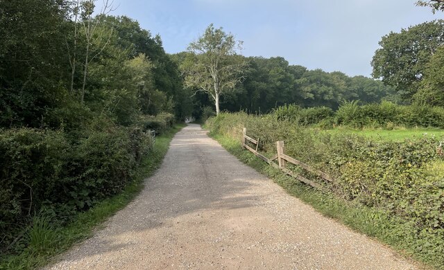
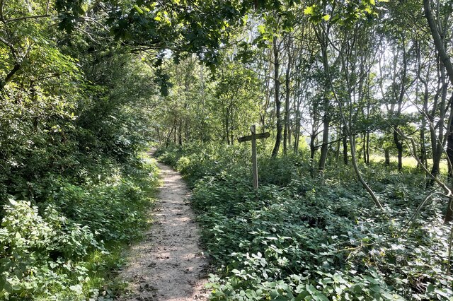
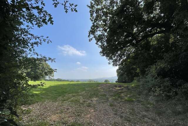
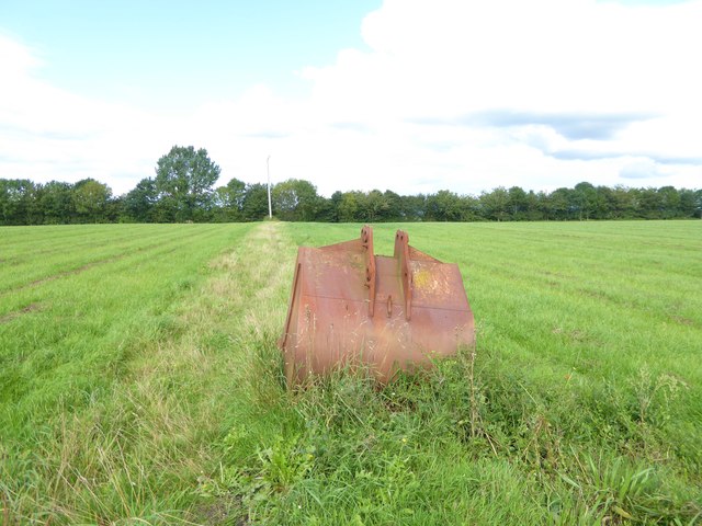
Bacon's Land is a picturesque woodland area located in Sussex, England. Nestled amidst the rolling hills and lush greenery of the county, this serene forest is renowned for its natural beauty and rich historical significance.

Spanning over a vast area, Bacon's Land is home to a diverse range of flora and fauna. The woodland is dominated by towering oak, beech, and ash trees, their branches reaching towards the sky, creating a dense canopy that filters the sunlight, casting a mesmerizing dappled light on the forest floor. The undergrowth is adorned with a variety of wildflowers, including bluebells, primroses, and foxgloves, adding bursts of color to the already enchanting landscape.

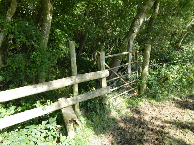
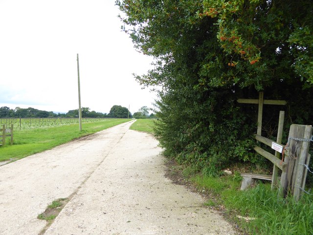
The woodland is crisscrossed with a network of well-maintained footpaths, inviting visitors to explore its hidden corners and discover its many delights. The tranquil atmosphere and abundant wildlife make it a popular spot for nature lovers, hikers, and photographers alike. From deer and badgers to a myriad of bird species, the forest teems with life, offering a glimpse into the region's natural heritage.

Aside from its natural beauty, Bacon's Land holds significant historical importance. The forest has been a part of Sussex's landscape for centuries, and remnants of ancient settlements and burial mounds can still be found within its boundaries. The area is steeped in folklore and legends, adding an air of mystery to the already captivating surroundings.

In summary, Bacon's Land in Sussex is a breathtaking woodland area that offers a tranquil escape from the hustle and bustle of everyday life. With its stunning scenery, abundant wildlife, and rich historical heritage, it is a place that truly captivates and enchants all who visit.

If you have any feedback on the listing, please let us know in the comments section below.
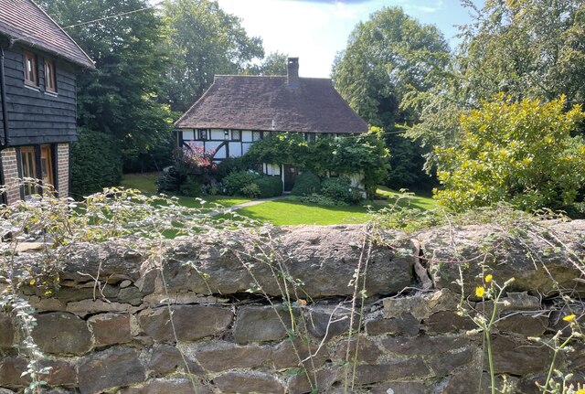
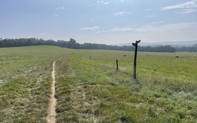
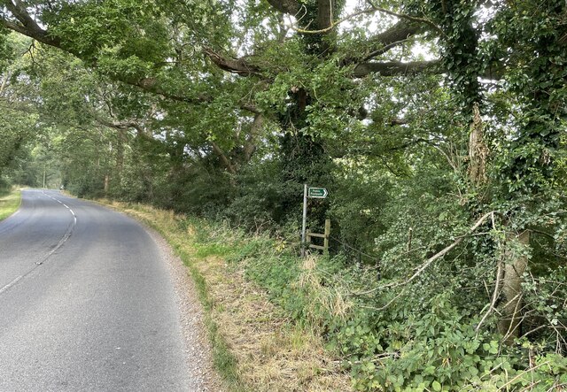
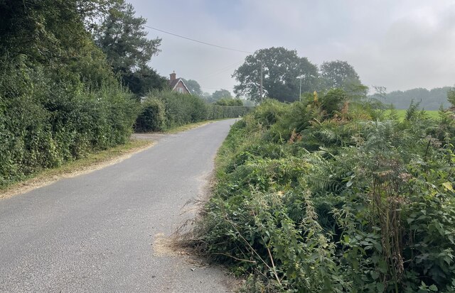
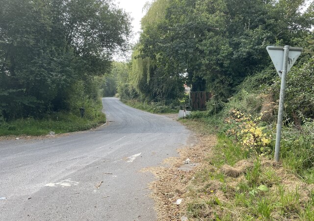
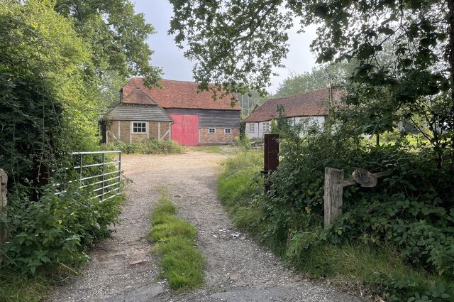
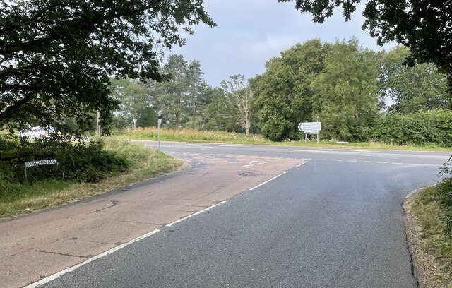
Bacon's Land Images

Images are sourced within 2km of 50.951347/-0.42102 or Grid Reference TQ1118. Thanks to Geograph Open Source API. All images are credited.

Naldretts Farmhouse The farmhouse viewed from roadside. It is a Grade II listed building. See <span class="nowrap"><a title="https://historicengland.org.uk/listing/the-list/list-entry/1027174" rel="nofollow ugc noopener" href="https://historicengland.org.uk/listing/the-list/list-entry/1027174">Link</a><img style="margin-left:2px;" alt="External link" title="External link - shift click to open in new window" src="https://s1.geograph.org.uk/img/external.png" width="10" height="10"/></span>
Naldretts Farmhouse
The farmhouse viewed from roadside. It is a Grade II listed building. See LinkExternal link
Path Junction On bridleway number 2404 heading towards Thakeham with footpath number 2403 joining from the left.
Path Junction
On bridleway number 2404 heading towards Thakeham with footpath number 2403 joining from the left.
Public footpath Public footpath number 2364 leaving Billingshurst Road near Bennetts Farm.
Public footpath
Public footpath number 2364 leaving Billingshurst Road near Bennetts Farm.
Bridleway at Goose Green Bridleway number 2362 leaves Billingshurst Road at the junction with Goose Green Lane and Cray’s Lane.
Bridleway at Goose Green
Bridleway number 2362 leaves Billingshurst Road at the junction with Goose Green Lane and Cray’s Lane.
Peacocks Lane Peacocks Lane viewed from the junction with Goose Green Lane.
Peacocks Lane
Peacocks Lane viewed from the junction with Goose Green Lane.
Sir Robert’s Farm Viewed from Goose Green Lane.
Sir Robert’s Farm
Viewed from Goose Green Lane.
Coolham Road The junction of Goose Green Lane with Coolham Road.
Coolham Road
The junction of Goose Green Lane with Coolham Road.
Track to Great Danhill Wood The track viewed from Harbolets Road.
Track to Great Danhill Wood
The track viewed from Harbolets Road.
Path Junction Paths in woodland near Town House Farm.
Path Junction
Paths in woodland near Town House Farm.
The Parish Church of St Mary The church is a Grade I listed building. See <span class="nowrap"><a title="https://historicengland.org.uk/listing/the-list/list-entry/1354080" rel="nofollow ugc noopener" href="https://historicengland.org.uk/listing/the-list/list-entry/1354080">Link</a><img style="margin-left:2px;" alt="External link" title="External link - shift click to open in new window" src="https://s1.geograph.org.uk/img/external.png" width="10" height="10"/></span>
At the time the photo was taken building work to provide an extension was in progress.
The Parish Church of St Mary
The church is a Grade I listed building. See LinkExternal link At the time the photo was taken building work to provide an extension was in progress.
Thakeham Place Cottage The cottage at Thakeham Place viewed from the passing public footpath number 2481.
Thakeham Place Cottage
The cottage at Thakeham Place viewed from the passing public footpath number 2481.
Approaching Warminghurst On public footpath number 2481 heading eastwards.
Approaching Warminghurst
On public footpath number 2481 heading eastwards.
The Church of the Holy Sepulchre Viewed from Rectory Lane the church is a Grade I listed building. See <span class="nowrap"><a title="https://historicengland.org.uk/listing/the-list/list-entry/1027448" rel="nofollow ugc noopener" href="https://historicengland.org.uk/listing/the-list/list-entry/1027448">Link</a><img style="margin-left:2px;" alt="External link" title="External link - shift click to open in new window" src="https://s1.geograph.org.uk/img/external.png" width="10" height="10"/></span>
The church is no longer used for services and is under the care of the Churches Conservation Trust.
The Church of the Holy Sepulchre
Viewed from Rectory Lane the church is a Grade I listed building. See LinkExternal link The church is no longer used for services and is under the care of the Churches Conservation Trust.
View beside Rectory Lane Looking towards the South Downs at Warminghurst.
View beside Rectory Lane
Looking towards the South Downs at Warminghurst.
Footpath enters London Copse
Large barn by footpath between fields See <a title="https://www.geograph.org.uk/photo/1689998" href="https://www.geograph.org.uk/photo/1689998">Link</a> for a picture from 2010.
Large barn by footpath between fields
See Link for a picture from 2010.
Footpath going west to Broadford Bridge Road A muddier version is at <a title="https://www.geograph.org.uk/photo/3898494" href="https://www.geograph.org.uk/photo/3898494">Link</a>.
Footpath going west to Broadford Bridge Road
A muddier version is at Link.
Path across field with pole and abandoned bucket from digger I wonder why that bucket has been left here.
Path across field with pole and abandoned bucket from digger
I wonder why that bucket has been left here.
Show me another place!

Bacon's Land is located at Grid Ref: TQ1118 (Lat: 50.951347, Lng: -0.42102)

Administrative County: West Sussex

District: Horsham

Police Authority: Sussex

What 3 Words

///mostly.swept.lightens. Near Ashington, West Sussex

Related Wikis

Thakeham

Thakeham is a village and civil parish located north of the South Downs in the Horsham District of West Sussex, England. The village is situated approximately...

Warminghurst

Warminghurst is a village and former civil parish, now in the parish of Thakeham, in the Horsham district of West Sussex, England. It lies on the Ashington...

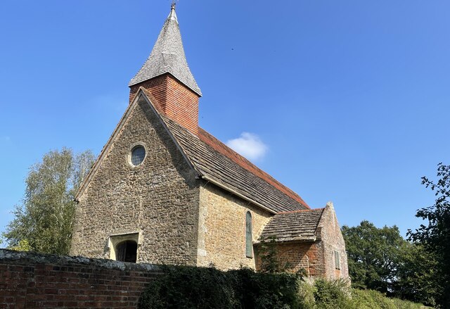
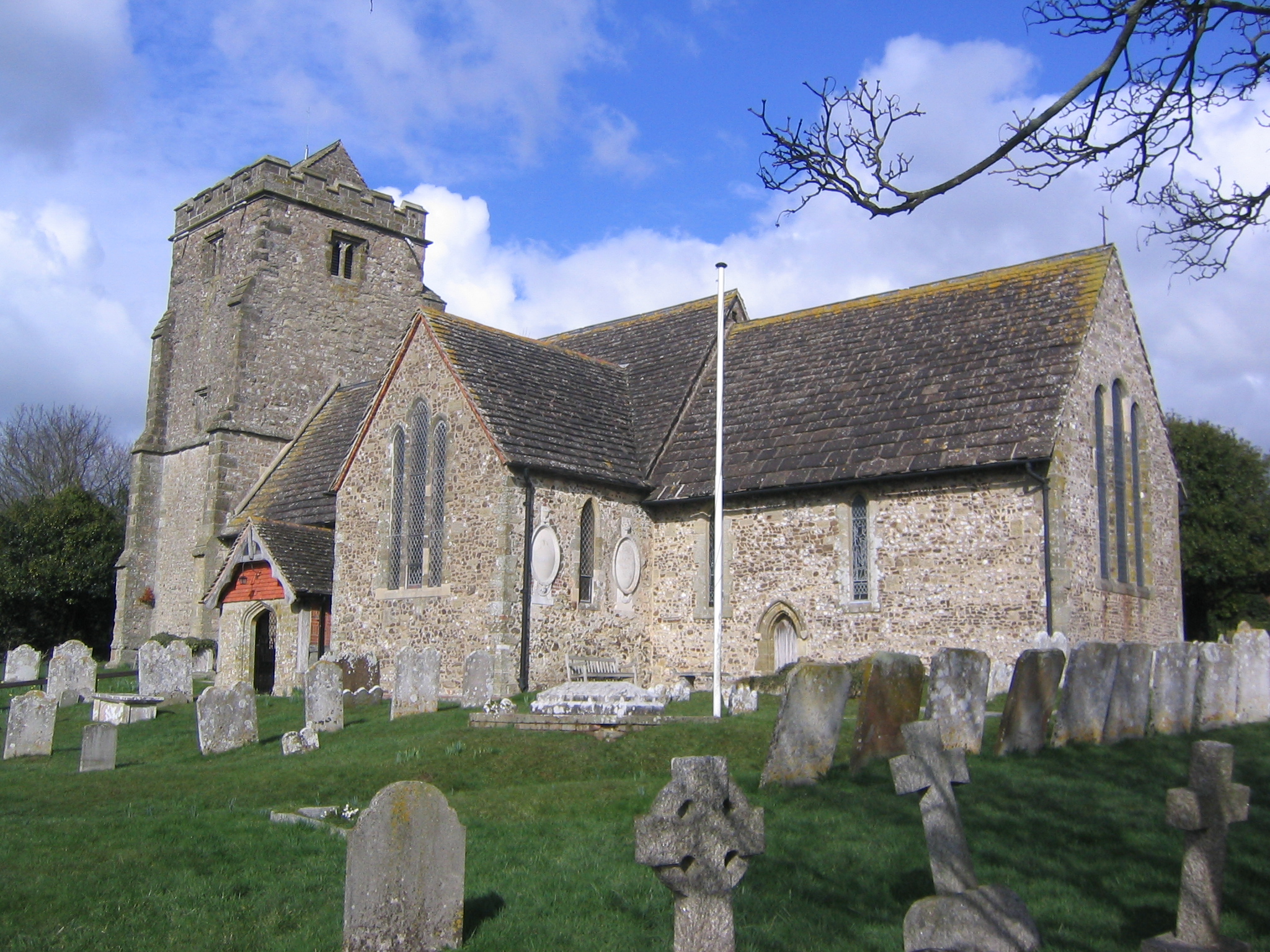
Church of the Holy Sepulchre, Warminghurst

The Church of the Holy Sepulchre is a former Anglican church in the hamlet of Warminghurst in the district of Horsham, one of seven local government districts...

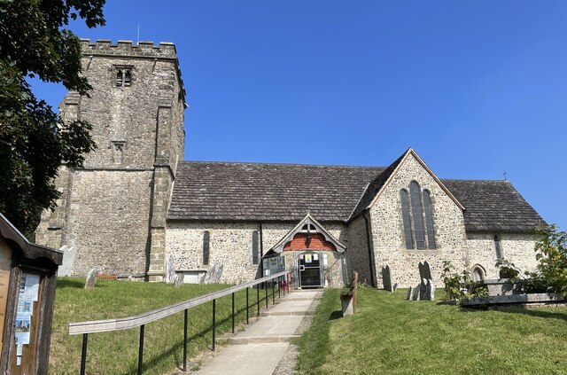
St Mary's Church, West Chiltington

St Mary's Church is the Grade I listed Anglican parish church of West Chiltington, a village in the Horsham district of West Sussex, England. The 12th...

West Chiltington

West Chiltington is a village and civil parish in the Horsham district of West Sussex, England. It lies on the Storrington to Broadford Bridge road, 2...

Geoffrey Woolley

Geoffrey Harold Woolley, (14 May 1892 – 10 December 1968) was a British Army infantry officer, Church of England priest, and Second World War military...

Henry Bowreman Foote

Major General Henry Robert Bowreman Foote, (5 December 1904 – 11 November 1993) was a British Army officer and a recipient of the Victoria Cross, the...

Brightling Park

Brightling Park (previously known as Rose Hill) is a country estate which lies in the parishes of Brightling and Dallington in the Rother district of East...

Nearby Amenities

Located within 500m of 50.951347,-0.42102
Dukes Rough
Naptan AtcoCode: 4400HR0607
Naptan Bearing: N
Naptan BusStopType: CUS
Naptan CommonName: Dukes Rough
Naptan Indicator: opp
Naptan Landmark: Hail & Ride
Naptan NaptanCode: wsxdtpam
Naptan Street: Coolham Road
Naptan Verified: no
Source: naptan_import
Lat/Long: 50.9537118/-0.4270853
Dukes Rough
Naptan AtcoCode: 4400HR0634
Naptan Bearing: S
Naptan BusStopType: CUS
Naptan CommonName: Dukes Rough
Naptan Indicator: adj
Naptan Landmark: Hail & Ride
Naptan NaptanCode: wsxdtpmg
Naptan Street: Coolham Road
Naptan Verified: no
Source: naptan_import
Lat/Long: 50.9536988/-0.4269691
Power: pole
Lat/Long: 50.9501002/-0.4142028
Power: pole
Lat/Long: 50.9505784/-0.4158068
Power: pole
Lat/Long: 50.9510059/-0.4173464
Power: pole
Lat/Long: 50.9527328/-0.4193339
Power: pole
Lat/Long: 50.9536672/-0.4204041
Power: pole
Lat/Long: 50.9542147/-0.4210129
Power: pole
Lat/Long: 50.9544225/-0.4228368
Power: pole
Lat/Long: 50.9546269/-0.4245856
Power: pole
Lat/Long: 50.9545779/-0.4247063
Power: pole
Lat/Long: 50.9543633/-0.4228663
Power: pole
Lat/Long: 50.9541454/-0.4210666
Power: pole
Lat/Long: 50.9536841/-0.4205757
Power: pole
Lat/Long: 50.9519066/-0.4184729
Power: pole
Lat/Long: 50.9509552/-0.4173973
Power: pole
Lat/Long: 50.9504939/-0.4157773
Lower Cray's Farm
Place: farm
Lat/Long: 50.951912/-0.4164398
Power: pole
Lat/Long: 50.9480052/-0.4172858
Power: pole
Lat/Long: 50.9483724/-0.4184859
Power: pole
Lat/Long: 50.9486766/-0.4195534
Power: pole
Lat/Long: 50.9489672/-0.4205851
Power: pole
Lat/Long: 50.9495895/-0.4226772
Power: pole
Lat/Long: 50.949869/-0.4236906
Power: pole
Lat/Long: 50.9501021/-0.4245919
The data included in this document is from www.openstreetmap.org. The data is made available under ODbL.

Have you been to Bacon's Land?

Leave your review of Bacon's Land below (or comments, questions and feedback).