Pickenswood Copse

Wood, Forest in Surrey Waverley

England

Pickenswood Copse

Bungalows on Loxwood Road, Alfold Crossways
Bungalows on Loxwood Road, Alfold Crossways Credit: David Howard

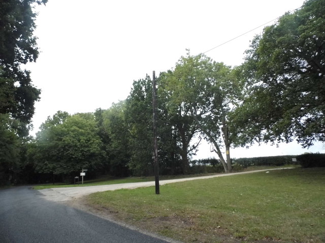
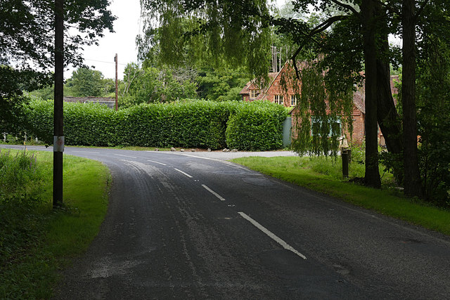
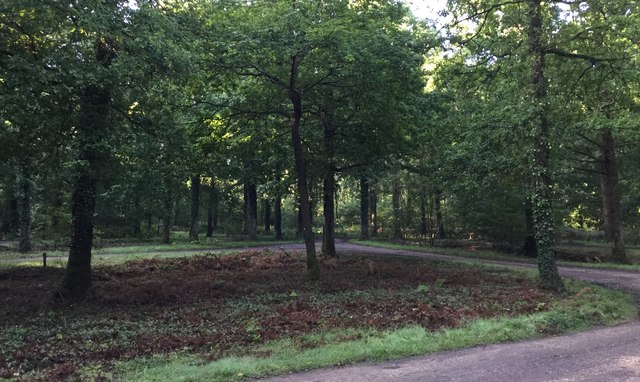
Pickenswood Copse is a picturesque woodland located in Surrey, England. Nestled in the heart of the county, this enchanting forest covers an area of approximately 50 acres, providing a tranquil retreat for nature lovers and outdoor enthusiasts.

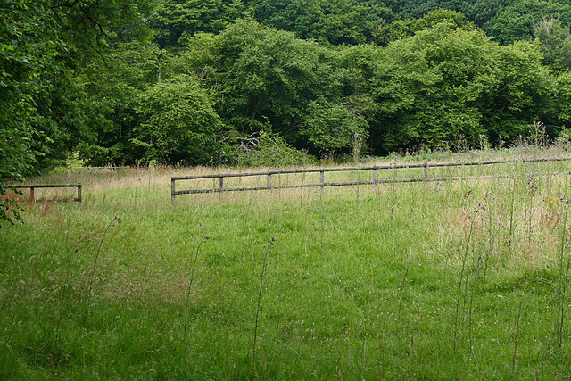
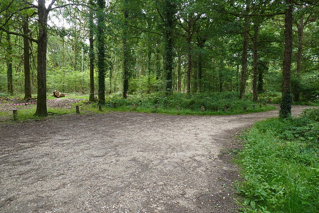
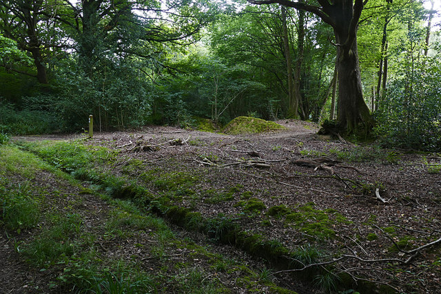
The copse is predominantly made up of native broadleaf trees, including oak, beech, and birch, which create a dense canopy that filters sunlight and casts dappled shadows on the forest floor. The rich biodiversity of Pickenswood Copse supports a wide variety of wildlife, with numerous bird species, such as woodpeckers and song thrushes, calling the forest home. Additionally, mammals like squirrels, foxes, and deer can often be spotted foraging amongst the undergrowth.

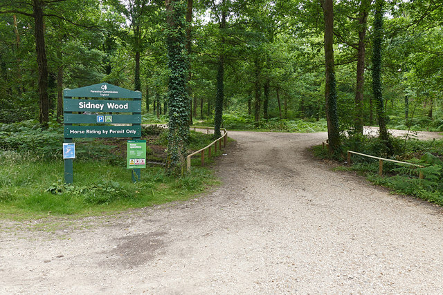
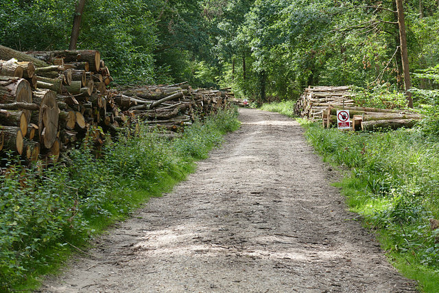
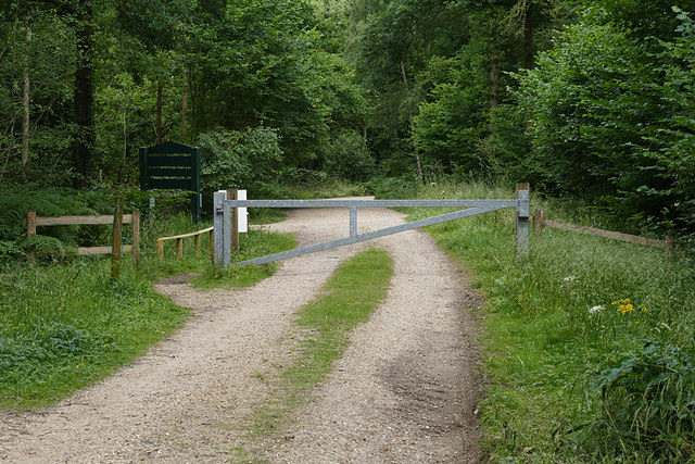
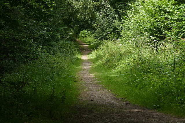
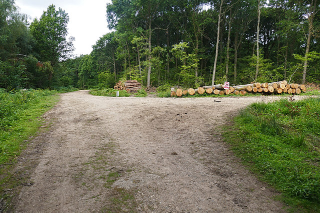
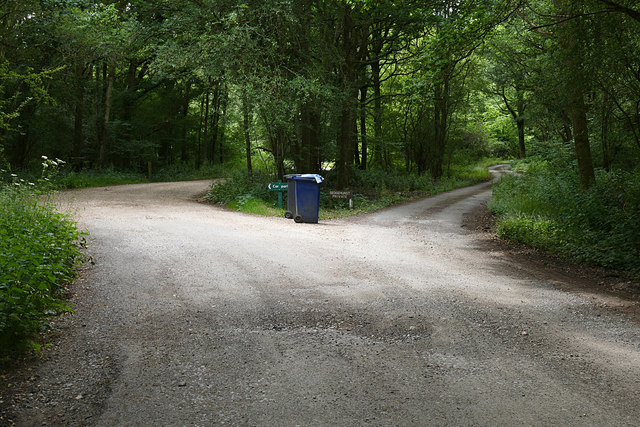
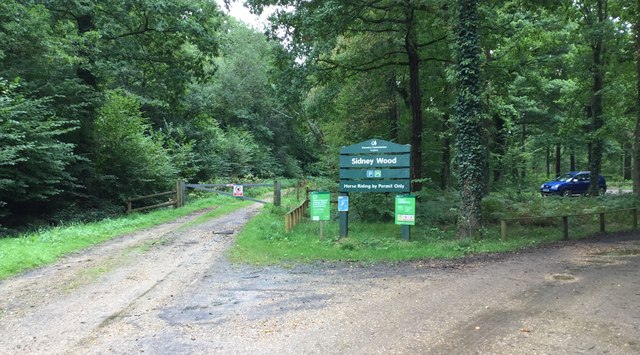
There are several well-maintained footpaths that wind their way through the copse, allowing visitors to explore its beauty at their own pace. These trails lead to hidden clearings, where patches of wildflowers bloom in vibrant colors during the spring and summer months. The forest also features a small stream that meanders through its heart, adding to the serenity and natural charm of the surroundings.

Pickenswood Copse is a popular destination for outdoor activities such as hiking, birdwatching, and photography. The peaceful atmosphere and stunning scenery make it an ideal location for nature enthusiasts seeking solace in the beauty of the natural world. It also serves as an educational resource for local schools and wildlife organizations, providing valuable insights into the importance of preserving and protecting woodland habitats.

Overall, Pickenswood Copse is a captivating woodland that showcases the natural beauty of Surrey. With its diverse flora and fauna, serene trails, and idyllic setting, it is a haven for those seeking a peaceful escape into nature.

If you have any feedback on the listing, please let us know in the comments section below.

Pickenswood Copse Images

Images are sourced within 2km of 51.108327/-0.50940156 or Grid Reference TQ0435. Thanks to Geograph Open Source API. All images are credited.

Bungalows on Loxwood Road, Alfold Crossways
Loxwood Road, Alfold Crossways
Alfold Road south of Cranleigh
Sidney Wood car park The entrance to the car park in Sidney Wood, part of the Forest Enterprise Chiddingfold Forest complex.
Sidney Wood car park
The entrance to the car park in Sidney Wood, part of the Forest Enterprise Chiddingfold Forest complex.
Wood piles, Sidney Wood A track lined with recently harvested wood in this Forest Enterprise wood near Dunsfold.
Wood piles, Sidney Wood
A track lined with recently harvested wood in this Forest Enterprise wood near Dunsfold.
Dunsfold Road The rural road running south of the airfield from the entrance to Sidney Wood.
Dunsfold Road
The rural road running south of the airfield from the entrance to Sidney Wood.
Barrier, Sidney Wood A barrier across the track into Sidney Wood with the entrance to the carpark on the left just beyond.
Barrier, Sidney Wood
A barrier across the track into Sidney Wood with the entrance to the carpark on the left just beyond.
Overgrown track, Sidney Wood A shaded track through Sidney Wood. The left hand side was clear felled in the 1990s, now it is impenetrable.
Overgrown track, Sidney Wood
A shaded track through Sidney Wood. The left hand side was clear felled in the 1990s, now it is impenetrable.
Old paddock, Sidney Wood One of the paddocks off Sachell Hill, a public right of way near Sidney Wood.
Old paddock, Sidney Wood
One of the paddocks off Sachell Hill, a public right of way near Sidney Wood.
Sidney Wood car park The car park in the Forest Enterprise Sidney Wood.
Sidney Wood car park
The car park in the Forest Enterprise Sidney Wood.
Dunsfold Road Looking north towards Tickners Heath Farm.
Dunsfold Road
Looking north towards Tickners Heath Farm.
Forest Tracks, Sidney Wood The junction of two of the main forest tracks through Sidney Wood.
Forest Tracks, Sidney Wood
The junction of two of the main forest tracks through Sidney Wood.
Sachellhill Lane The junction of Sachelhill Lane, a footpath running along the east side of Sidney Wood, with the footpath off to the right towards Alfold.
Sachellhill Lane
The junction of Sachelhill Lane, a footpath running along the east side of Sidney Wood, with the footpath off to the right towards Alfold.
The road to Sedgehurst The private road to Sedgehurst, a smallholding in Sidney Wood branching off from the car park access track.
The road to Sedgehurst
The private road to Sedgehurst, a smallholding in Sidney Wood branching off from the car park access track.
Sidney Wood Car Park Early morning at the car park.
Sidney Wood Car Park
Early morning at the car park.
Entrance to Sidney Wood Car Park The Forestry Commission Car Park at Sidney Wood.
Entrance to Sidney Wood Car Park
The Forestry Commission Car Park at Sidney Wood.
Road Junction at Laker's Green Approaching the road junction where the Wey-South Path turns off.
Road Junction at Laker's Green
Approaching the road junction where the Wey-South Path turns off.
Roadside Sign for the Public House At the road junction at Laker's Green a roadside sign for the local inn nearby. Note the rubbish left at the time.
Roadside Sign for the Public House
At the road junction at Laker's Green a roadside sign for the local inn nearby. Note the rubbish left at the time.
Show me another place!

Pickenswood Copse is located at Grid Ref: TQ0435 (Lat: 51.108327, Lng: -0.50940156)

Administrative County: Surrey

District: Waverley

Police Authority: Surrey

What 3 Words

///imposes.ladders.paddlers. Near Cranleigh, Surrey

Related Wikis

Alfold F.C.

Alfold Football Club is a football club based in Alfold, Surrey, England. They are currently members of the Southern Combination Division One and play...

Wey and Arun Canal

The Wey and Arun Canal is a partially open, 23-mile-long (37 km) canal in the southeast of England. It runs southwards from the River Wey at Gunsmouth...

London to Portsmouth canal

The London to Portsmouth canal was a concept for the construction of a secure inland canal route from the British capital of London to the headquarters...

Alfold

Alfold is a village and civil parish in Surrey, England on the West Sussex border. Alfold is a dispersed or polyfocal village in the Green Belt, which...

Dunsfold Aerodrome

Dunsfold Aerodrome (former ICAO code EGTD) is an unlicensed airfield in Surrey, England, near the village of Cranleigh. It extends across land in the villages...

Rikkyo School in England

Rikkyo School in England (立教英国学院, Rikkyō Eikoku Gakuin) is a Japanese boarding primary and secondary school in Rudgwick, Horsham District, West Sussex...

Fir Tree Copse

Fir Tree Copse is a 6-hectare (15-acre) nature reserve south-east of Dunsfold in Surrey. It is managed by the Surrey Wildlife Trust and is part of the...

Top Gear test track

The Top Gear test track is used by the BBC automotive television programme Top Gear. It is located at Dunsfold Aerodrome in Surrey, United Kingdom. The...

Nearby Amenities

Located within 500m of 51.108327,-0.50940156
Alfold Crossways
Is In: Surrey
Place: village
Lat/Long: 51.1079195/-0.51503
Great Wildwood Farm
Note Retag: CS #48756035
Place: farm
Source: npe
Lat/Long: 51.1072189/-0.5069372
Bus Stop
Alfold Crossways
Naptan AtcoCode: 40004411042A
Naptan Bearing: SW
Naptan CommonName: Crossways
Naptan Indicator: Just after
Naptan Landmark: Alfold Crossways
Naptan NaptanCode: surdtgtp
Naptan Street: Loxwood Road
Naptan Verified: no
Public Transport: platform
Source: naptan_import
Lat/Long: 51.1067346/-0.5150469
Bus Stop
Alfold Crossways
Naptan AtcoCode: 40004411042B
Naptan Bearing: NW
Naptan BusStopType: CUS
Naptan CommonName: Crossways
Naptan Indicator: adj
Naptan Landmark: Alfold Crossways
Naptan NaptanCode: surdtgtw
Naptan Street: Loxwood Road
Naptan Verified: no
Public Transport: platform
Source: naptan_import
Lat/Long: 51.1078485/-0.5152054
Bus Stop
Alfold Crossways
Naptan AtcoCode: 40004411042C
Naptan Bearing: SE
Naptan BusStopType: CUS
Naptan CommonName: Crossways
Naptan Indicator: Just Before
Naptan Landmark: Alfold Crossways
Naptan NaptanCode: surdtgwa
Naptan Street: Dunsfold Road
Naptan Verified: no
Public Transport: platform
Source: naptan_import
Lat/Long: 51.1084252/-0.5156989
Alford Mower Centre
Shop: lawn_mower
Lat/Long: 51.1083467/-0.515501
Post Box
Collection Plate: CP7
Collection Times: Mo-Fr 16:45; Sa 10:30
Operator: Royal Mail
Post Box Type: lamp
Ref: GU6 225
Royal Cypher: EIIR
Royal Cypher Wikidata: Q33102113
Lat/Long: 51.1082094/-0.5155863
Power: substation
Lat/Long: 51.1084309/-0.5160355
Give Way
Direction: forward
Lat/Long: 51.1081153/-0.515305
M&S Simply Food
Brand: M&S Simply Food
Brand Wikidata: Q714491
Contact Website: https://www.marksandspencer.com/stores/alfold-bp-2049
Shop: convenience
Lat/Long: 51.1048602/-0.510182
Atm
Note: Charges for cash withdrawal
Lat/Long: 51.1048248/-0.5102222
Addr Housename: Brockhurst Cottages
Lat/Long: 51.1092955/-0.5163605
Addr Housenumber: 5
Lat/Long: 51.1094039/-0.5162072
Addr Housenumber: 10
Lat/Long: 51.1089734/-0.5161249
Addr Housenumber: 16-17
Lat/Long: 51.1096715/-0.5158888
Addr Housenumber: 14-15
Lat/Long: 51.1096769/-0.5157544
Addr Housenumber: 1
Lat/Long: 51.1089777/-0.5150041
Addr Housenumber: 6
Lat/Long: 51.109373/-0.5148361
Addr Housename: Welby Cottage
Lat/Long: 51.1088169/-0.515084
Addr Housename: Carters Croft
Lat/Long: 51.1087379/-0.5151319
Addr Housenumber: 1
Lat/Long: 51.1086849/-0.5157924
Addr Housenumber: 4
Lat/Long: 51.1085736/-0.5156382
Addr Housenumber: 2
Lat/Long: 51.108595/-0.5162318
Addr Housenumber: 1
Lat/Long: 51.1085407/-0.5161566
The data included in this document is from www.openstreetmap.org. The data is made available under ODbL.

Have you been to Pickenswood Copse?

Leave your review of Pickenswood Copse below (or comments, questions and feedback).