Eastwood
Settlement in Yorkshire
England
Eastwood
Eastwood is a small village located in the East Riding of Yorkshire, England. Situated approximately 7 miles east of the city of Hull, it falls within the parish of Cottingham. Eastwood is a predominantly residential area, characterized by its peaceful and picturesque surroundings.
The village is known for its close-knit community and friendly atmosphere. Its housing primarily consists of traditional brick-built houses, many of which date back several decades. The architecture reflects the area's rich history, with a mix of Victorian and Edwardian styles.
Eastwood benefits from its proximity to nearby amenities and services. The village is conveniently located near Cottingham, which offers a range of shops, supermarkets, and restaurants. It also has easy access to the nearby Humber Bridge, making it a desirable location for commuters to Hull or other parts of Yorkshire.
The area surrounding Eastwood boasts beautiful natural landscapes, including open countryside and farmland. The village is situated in close proximity to the Yorkshire Wolds, an area renowned for its stunning rolling hills and scenic walking trails. Nature enthusiasts can also enjoy the nearby Cottingham Parks Golf and Leisure Club, which offers a range of recreational activities.
In terms of transportation, Eastwood is well-connected. The village has good road links, with the A164 and A1079 nearby, providing access to Hull, Beverley, and the wider region. There are also regular bus services connecting Eastwood to the surrounding areas.
Overall, Eastwood offers a charming and peaceful place to live, combining the benefits of rural living with the convenience of nearby amenities.
If you have any feedback on the listing, please let us know in the comments section below.
Eastwood Images
Images are sourced within 2km of 53.872722/-1.898826 or Grid Reference SE0641. Thanks to Geograph Open Source API. All images are credited.
![East Riddlesden Hall and grounds [1] The south front of the hall.
Built on the site of an earlier building, the hall was erected in the 1640s and added to in 1692. Constructed of ashlar under stone slate roofs, the hall has two two-storey porches with wheel (or Yorkshire rose) windows. Many original internal features and fittings remain. Listed, grade I, with details at:
<span class="nowrap"><a title="https://historicengland.org.uk/listing/the-list/list-entry/1283478" rel="nofollow ugc noopener" href="https://historicengland.org.uk/listing/the-list/list-entry/1283478">Link</a><img style="margin-left:2px;" alt="External link" title="External link - shift click to open in new window" src="https://s1.geograph.org.uk/img/external.png" width="10" height="10"/></span>
East Riddlesden Hall is sited on the banks of the River Aire, in Riddlesden, about 1¼ miles northeast of Keighley. Once the centre of a thriving agricultural estate, the grounds of the hall include a tithe barn. Saved from demolition by two local men in 1934, the house and grounds are now in the care of the National Trust.](https://s3.geograph.org.uk/geophotos/07/02/14/7021447_f9e03490.jpg)
![East Riddlesden Hall and grounds [2] The entrance porch in the south front.
Built on the site of an earlier building, the hall was erected in the 1640s and added to in 1692. Constructed of ashlar under stone slate roofs, the hall has two two-storey porches with wheel (or Yorkshire rose) windows. Many original internal features and fittings remain. Listed, grade I, with details at:
<span class="nowrap"><a title="https://historicengland.org.uk/listing/the-list/list-entry/1283478" rel="nofollow ugc noopener" href="https://historicengland.org.uk/listing/the-list/list-entry/1283478">Link</a><img style="margin-left:2px;" alt="External link" title="External link - shift click to open in new window" src="https://s1.geograph.org.uk/img/external.png" width="10" height="10"/></span>
East Riddlesden Hall is sited on the banks of the River Aire, in Riddlesden, about 1¼ miles northeast of Keighley. Once the centre of a thriving agricultural estate, the grounds of the hall include a tithe barn. Saved from demolition by two local men in 1934, the house and grounds are now in the care of the National Trust.](https://s3.geograph.org.uk/geophotos/07/02/14/7021451_f4beef7d.jpg)
![East Riddlesden Hall and grounds [3] The north front of the hall.
Built on the site of an earlier building, the hall was erected in the 1640s and added to in 1692. Constructed of ashlar under stone slate roofs, the hall has two two-storey porches with wheel (or Yorkshire rose) windows. Many original internal features and fittings remain. Listed, grade I, with details at:
<span class="nowrap"><a title="https://historicengland.org.uk/listing/the-list/list-entry/1283478" rel="nofollow ugc noopener" href="https://historicengland.org.uk/listing/the-list/list-entry/1283478">Link</a><img style="margin-left:2px;" alt="External link" title="External link - shift click to open in new window" src="https://s1.geograph.org.uk/img/external.png" width="10" height="10"/></span>
East Riddlesden Hall is sited on the banks of the River Aire, in Riddlesden, about 1¼ miles northeast of Keighley. Once the centre of a thriving agricultural estate, the grounds of the hall include a tithe barn. Saved from demolition by two local men in 1934, the house and grounds are now in the care of the National Trust.](https://s2.geograph.org.uk/geophotos/07/02/14/7021454_c4022af1.jpg)
![East Riddlesden Hall and grounds [4] The south front of the hall.
Built on the site of an earlier building, the hall was erected in the 1640s and added to in 1692. Constructed of ashlar under stone slate roofs, the hall has two two-storey porches with wheel (or Yorkshire rose) windows. Many original internal features and fittings remain. Listed, grade I, with details at:
<span class="nowrap"><a title="https://historicengland.org.uk/listing/the-list/list-entry/1283478" rel="nofollow ugc noopener" href="https://historicengland.org.uk/listing/the-list/list-entry/1283478">Link</a><img style="margin-left:2px;" alt="External link" title="External link - shift click to open in new window" src="https://s1.geograph.org.uk/img/external.png" width="10" height="10"/></span>
East Riddlesden Hall is sited on the banks of the River Aire, in Riddlesden, about 1¼ miles northeast of Keighley. Once the centre of a thriving agricultural estate, the grounds of the hall include a tithe barn. Saved from demolition by two local men in 1934, the house and grounds are now in the care of the National Trust.](https://s3.geograph.org.uk/geophotos/07/02/14/7021455_f86a2c1a.jpg)
![East Riddlesden Hall and grounds [5] One of the rooms of the hall.
Built on the site of an earlier building, the hall was erected in the 1640s and added to in 1692. Constructed of ashlar under stone slate roofs, the hall has two two-storey porches with wheel (or Yorkshire rose) windows. Many original internal features and fittings remain. Listed, grade I, with details at:
<span class="nowrap"><a title="https://historicengland.org.uk/listing/the-list/list-entry/1283478" rel="nofollow ugc noopener" href="https://historicengland.org.uk/listing/the-list/list-entry/1283478">Link</a><img style="margin-left:2px;" alt="External link" title="External link - shift click to open in new window" src="https://s1.geograph.org.uk/img/external.png" width="10" height="10"/></span>
East Riddlesden Hall is sited on the banks of the River Aire, in Riddlesden, about 1¼ miles northeast of Keighley. Once the centre of a thriving agricultural estate, the grounds of the hall include a tithe barn. Saved from demolition by two local men in 1934, the house and grounds are now in the care of the National Trust.](https://s3.geograph.org.uk/geophotos/07/02/14/7021459_7feb94f1.jpg)
Eastwood is located at Grid Ref: SE0641 (Lat: 53.872722, Lng: -1.898826)
Division: West Riding
Unitary Authority: Bradford
Police Authority: West Yorkshire
What 3 Words
///tops.salads.tame. Near Keighley, West Yorkshire
Nearby Locations
Related Wikis

Cougar Park
Cougar Park is a rugby league stadium in Keighley, England, which is the home stadium of the Keighley Cougars. Its capacity is 7,800 people. It also hosted...
Dalton Mills
Dalton Mills is a 19th century Grade II* Victorian former textile mill located in Keighley, West Yorkshire, England. It was roughly 45,681 sq ft (4,243...
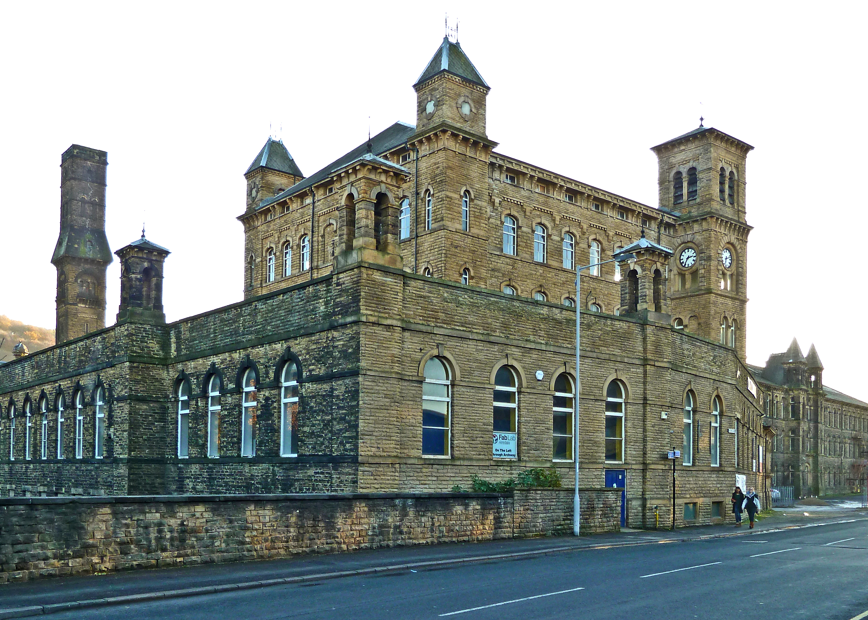
Keighley College
Keighley College is a further education college in Keighley, West Yorkshire, England. It traces its origins to Keighley Mechanics' Institute, founded in...

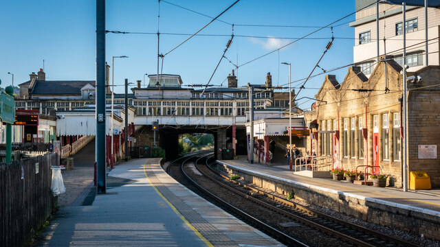
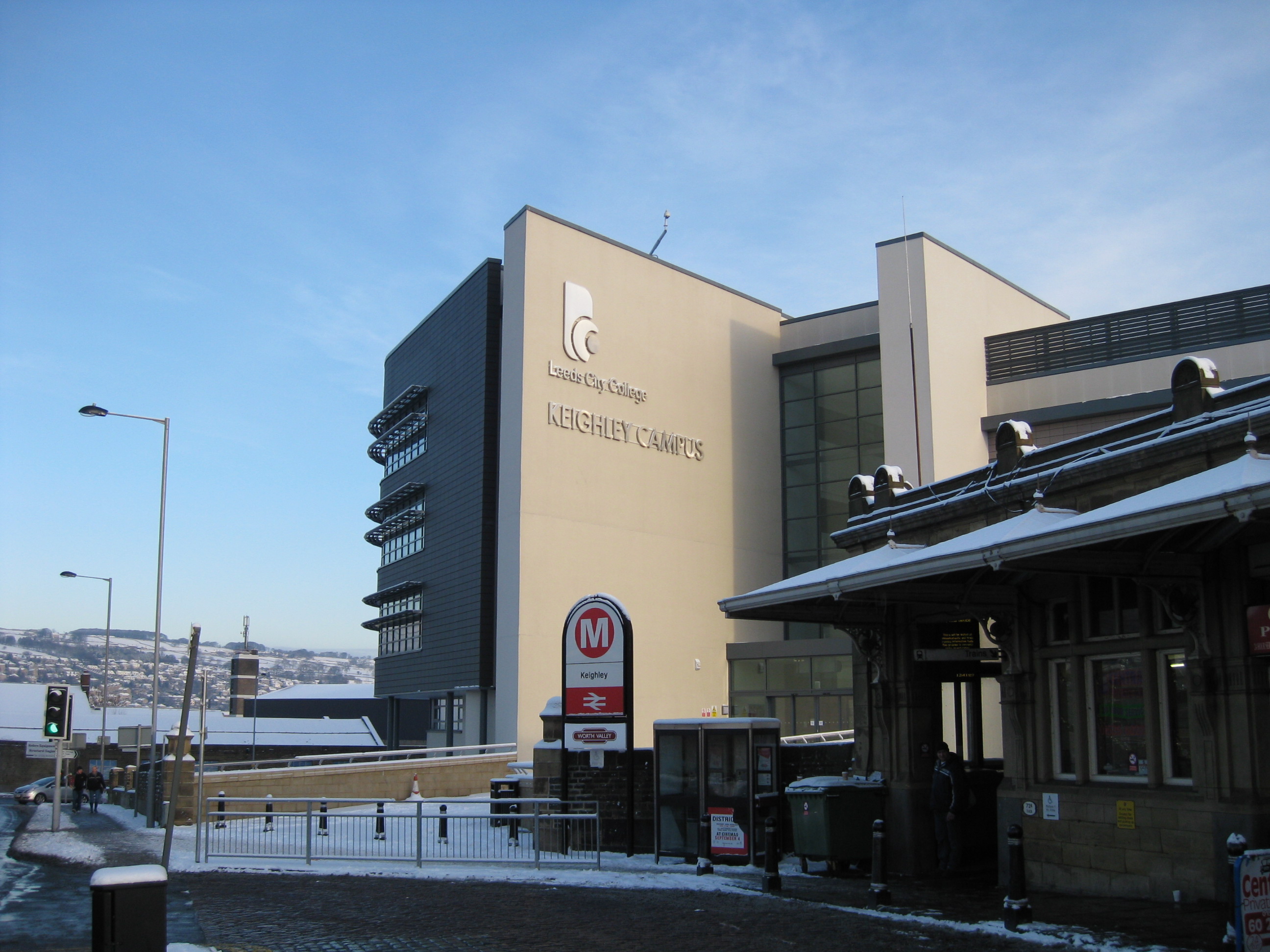
Keighley railway station
Keighley railway station serves the market town of Keighley in West Yorkshire, England. The station is located on the Airedale line, with electric services...
Nearby Amenities
Located within 500m of 53.872722,-1.898826Have you been to Eastwood?
Leave your review of Eastwood below (or comments, questions and feedback).