Eastwood

Settlement in Yorkshire

England

Eastwood

Lobb Mill The Rochdale Canal locks to the right of view from Halifax Road
Lobb Mill Credit: Raymond Knapman

Eastwood is a small village located in the county of Yorkshire, England. Situated in the East Riding of Yorkshire, it is nestled between the picturesque towns of Beverley and Driffield. With a population of around 1,500 residents, it retains a charming rural character.

Eastwood is known for its idyllic countryside, featuring rolling hills, meandering streams, and lush greenery. The village is renowned for its tranquil atmosphere, making it a popular destination for those seeking a peaceful retreat. Its close proximity to the Yorkshire Wolds offers residents and visitors ample opportunities for outdoor activities such as hiking, cycling, and horse riding.

The village itself boasts a variety of amenities to cater to the needs of its residents. These include a village hall, a primary school, a post office, and a local pub. The community spirit in Eastwood is strong, with regular events and gatherings organized by various local groups.

Eastwood's history can be traced back to the medieval period, with evidence of human settlement found in the surrounding area. The village has several historic buildings, including a 13th-century church that serves as a reminder of its rich heritage.

Transport links in Eastwood are convenient, with regular bus services connecting the village to nearby towns and cities. The A164 road passes through Eastwood, providing easy access to the wider road network.

Overall, Eastwood offers a peaceful and picturesque retreat in the heart of Yorkshire, combining natural beauty with a strong sense of community.

If you have any feedback on the listing, please let us know in the comments section below.
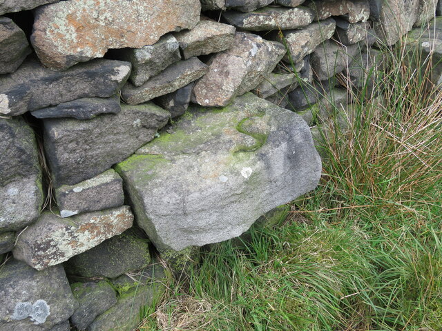
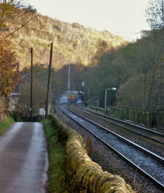
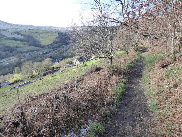
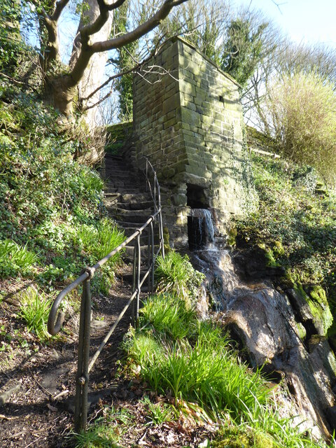
Eastwood Images

Images are sourced within 2km of 53.726786/-2.051499 or Grid Reference SD9625. Thanks to Geograph Open Source API. All images are credited.

Lobb Mill The Rochdale Canal locks to the right of view from Halifax Road
Lobb Mill
The Rochdale Canal locks to the right of view from Halifax Road
Rodwell End Clough View from Lobb Mill Viaduct
Rodwell End Clough
View from Lobb Mill Viaduct
Halifax Road at Calderside View from rail line on Whiteley Arches
Halifax Road at Calderside
View from rail line on Whiteley Arches
Oakville Road at Calderside View from Rochdale to Leeds railway
Oakville Road at Calderside
View from Rochdale to Leeds railway
Chinook Helicopter passing close to Stoodley Pike Monument A close encounter!
Chinook Helicopter passing close to Stoodley Pike Monument
A close encounter!
Pennine Way at Doe Stones & view towards Edge End Moor
View towards Stoodley Pike Monument from Dick's Lane
Old Boundary Marker in Stoodley Glen, Calderdale Township Boundary Marker above Stoodley Glen and south of Stoodley Lane. Formerly on the boundary of Langfield and Sowerby townships in Halifax parish. It marked the boundary of the Sowerby Ramble, a narrow strip of land along the Calder valley and up Stoodley Glen between Erringden and Stansfield townships and Erringden and Langfield township. Sowerby Ramble was part of Sowerby township but in 1850 it became part of Erringden township, later parish. In 1897 Langfield and Stansfield became part of Todmorden parish and in 1937 this part of Erringden parish also became part of Todmorden parish. 

Milestone Society National ID: YW_LANSOW02pb
Old Boundary Marker in Stoodley Glen, Calderdale
Township Boundary Marker above Stoodley Glen and south of Stoodley Lane. Formerly on the boundary of Langfield and Sowerby townships in Halifax parish. It marked the boundary of the Sowerby Ramble, a narrow strip of land along the Calder valley and up Stoodley Glen between Erringden and Stansfield townships and Erringden and Langfield township. Sowerby Ramble was part of Sowerby township but in 1850 it became part of Erringden township, later parish. In 1897 Langfield and Stansfield became part of Todmorden parish and in 1937 this part of Erringden parish also became part of Todmorden parish. Milestone Society National ID: YW_LANSOW02pb
Old Boundary Marker between Higher Moor and Sunderland Pasture in Hebden Royd parish Township Boundary Marker built into a wall adjacent to a stile between Higher Moor and Sunderland Pasture. On the former boundary of the Sowerby Ramble between Erringden and Sowerby townships in Halifax parish but now entirely in Hebden Royd parish. Inscribed S for Sowerby township.

Milestone Society National ID: YW_HEBR02pb
Old Boundary Marker between Higher Moor and Sunderland Pasture in Hebden Royd parish
Township Boundary Marker built into a wall adjacent to a stile between Higher Moor and Sunderland Pasture. On the former boundary of the Sowerby Ramble between Erringden and Sowerby townships in Halifax parish but now entirely in Hebden Royd parish. Inscribed S for Sowerby township. Milestone Society National ID: YW_HEBR02pb
Old Boundary Marker in Stoodley Glen, Calderdale Parish Boundary Marker in Stoodley Glen below Height Wood. Formerly on the boundary of Langfield and Sowerby townships in Halifax parish. It marked the boundary of the Sowerby Ramble, a narrow strip of land along the Calder valley and up Stoodley Glen between Erringden and Stansfield townships and Erringden and Langfield township. Sowerby Ramble was part of Sowerby township but in 1850 it became part of Erringden township, later parish. In 1897 Langfield and Stansfield became part of Todmorden parish and in 1937 this part of Erringden parish also became part of Todmorden parish..

Milestone Society National ID: YW_SOWERR01pb
Old Boundary Marker in Stoodley Glen, Calderdale
Parish Boundary Marker in Stoodley Glen below Height Wood. Formerly on the boundary of Langfield and Sowerby townships in Halifax parish. It marked the boundary of the Sowerby Ramble, a narrow strip of land along the Calder valley and up Stoodley Glen between Erringden and Stansfield townships and Erringden and Langfield township. Sowerby Ramble was part of Sowerby township but in 1850 it became part of Erringden township, later parish. In 1897 Langfield and Stansfield became part of Todmorden parish and in 1937 this part of Erringden parish also became part of Todmorden parish.. Milestone Society National ID: YW_SOWERR01pb
Old Boundary Marker Estate Boundary Marker set in a stone wall on Matthew Lane, a green lane. In the former Stansfield township and parish, absorbed into Todmorden parish in 1897. Not on any township or parish boundary so is thought to mark an estate boundary.

Milestone Society National ID: YW_TOD10em
Old Boundary Marker
Estate Boundary Marker set in a stone wall on Matthew Lane, a green lane. In the former Stansfield township and parish, absorbed into Todmorden parish in 1897. Not on any township or parish boundary so is thought to mark an estate boundary. Milestone Society National ID: YW_TOD10em
Old Boundary Marker on Baulk Head Lane, Todmorden Estate Boundary Marker set in a stone wall on Baulk Head Lane, a green lane. In the former Stansfield township and parish, absorbed into Todmorden parish in 1897. Not on any township or parish boundary so is thought to mark an estate boundary.

Milestone Society National ID: YW_TOD11em
Old Boundary Marker on Baulk Head Lane, Todmorden
Estate Boundary Marker set in a stone wall on Baulk Head Lane, a green lane. In the former Stansfield township and parish, absorbed into Todmorden parish in 1897. Not on any township or parish boundary so is thought to mark an estate boundary. Milestone Society National ID: YW_TOD11em
Oakville Road and Railway View towards Hebden Bridge where road and rail are hardly separated. A rail track cleaning train is going over Whiteley Arches
Oakville Road and Railway
View towards Hebden Bridge where road and rail are hardly separated. A rail track cleaning train is going over Whiteley Arches
The Pennine Way and Bridleway crossing the A646
The Pennine Way leaving the A646
The Pennine Way near Higher Underbank Farm
The Pennine Way near Knott Wood
Show me another place!

Eastwood is located at Grid Ref: SD9625 (Lat: 53.726786, Lng: -2.051499)

Division: West Riding

Unitary Authority: Calderdale

Police Authority: West Yorkshire

What 3 Words

///allow.highlight.claps. Near Hebden Bridge, West Yorkshire

Related Wikis

Eastwood, West Yorkshire

Eastwood is a place within the civil parish of Todmorden and Metropolitan Borough of Calderdale, in West Yorkshire, England. It lies 8 miles (12.9 km)...

Eastwood (L&Y) railway station

Eastwood Railway Station served the village of Eastwood in the civil parish of Todmorden, West Yorkshire, England. The station opened with the line on...

South Pennines Regional Park

The South Pennines Regional Park (or South Pennines Park) is a proposed national park that would cover the South Pennines area in Northern England, encompassing...

Stoodley Pike

Stoodley Pike is a 1,300-foot (400 m) hill in the south Pennines in West Yorkshire in northern England. It is noted for the 121-foot (37 m) Stoodley Pike...

Mankinholes

Mankinholes is a hamlet in the Metropolitan Borough of Calderdale, in West Yorkshire, England. It is situated in the Pennines and the nearest town is Todmorden...

Erringden

Erringden is a civil parish in the Metropolitan Borough of Calderdale in West Yorkshire, England. Previously it was a township within the chapelry of Heptonstall...

Blackshaw

Blackshaw is a civil parish in the Calderdale metropolitan borough of West Yorkshire, England. It contains the village of Blackshaw Head. According to...

Colden, West Yorkshire

Colden is a hamlet in the civil parish of Heptonstall in Calderdale, West Yorkshire, England. Historically part of the West Riding of Yorkshire, the hamlet...

Nearby Amenities

Located within 500m of 53.726786,-2.051499
Waterway: turning_point
Lat/Long: 53.7255957/-2.0540169
Seamark Type: gate
Waterway: lock_gate
Lat/Long: 53.724326/-2.0544607
Seamark Type: gate
Waterway: lock_gate
Lat/Long: 53.7240914/-2.0545244
Bus Stop
Halifax Road
Bus: yes
Local Ref: 45019827
Naptan AtcoCode: 450019827
Naptan Bearing: NE
Naptan CommonName: Halifax Road
Naptan Crossing: Nr-Opp Burnt Acre Lane
Naptan Indicator: Stop 45019827
Naptan Landmark: Common Bank Wood
Naptan PlusbusZoneRef: LEEDS
Naptan ShortCommonName: Halifax Road Works
Naptan Street: Halifax Road
Naptan Verified: no
Public Transport: platform
Source: naptan_import
Lat/Long: 53.7297751/-2.0511267
Bus Stop
Halifax Road
Bus: yes
Local Ref: 45019828
Naptan AtcoCode: 450019828
Naptan Bearing: NE
Naptan CommonName: Halifax Road
Naptan Crossing: Adj Burnt Acres Lane
Naptan Indicator: Stop 45019828
Naptan Landmark: Burnt Acres Wood
Naptan PlusbusZoneRef: LEEDS
Naptan ShortCommonName: Halifax Road
Naptan Street: Halifax Road
Naptan Verified: no
Public Transport: platform
Source: naptan_import
Lat/Long: 53.7282462/-2.0530498
Bus Stop
Halifax Road
Bus: yes
Local Ref: 45019829
Naptan AtcoCode: 450019829
Naptan Bearing: SW
Naptan CommonName: Halifax Road
Naptan Crossing: Nr-Opp Eastwood Lane
Naptan Indicator: Stop 45019829
Naptan Landmark: Burnt Acres Wood
Naptan PlusbusZoneRef: LEEDS
Naptan ShortCommonName: Steel Works
Naptan Street: Halifax Road
Naptan Verified: no
Public Transport: platform
Source: naptan_import
Lat/Long: 53.7281384/-2.052989
Bus Stop
Eastwood
Bus: yes
Local Ref: 45019830
Naptan AtcoCode: 450019830
Naptan Bearing: N
Naptan CommonName: Eastwood
Naptan Crossing: Nr-At Eastwood Lane
Naptan Indicator: Stop 45019830
Naptan Notes: Trueform installed 220208
Naptan PlusbusZoneRef: LEEDS
Naptan ShortCommonName: Eastwood Lane
Naptan Street: Halifax Road
Naptan Verified: no
Public Transport: platform
Source: naptan_import
Lat/Long: 53.7265197/-2.0548512
Bus Stop
Eastwood Halifax Road
Bus: yes
Local Ref: 45019831
Naptan AtcoCode: 450019831
Naptan Bearing: N
Naptan CommonName: Eastwood Halifax Road
Naptan Crossing: Eastwood Lane
Naptan Indicator: Stop 45019831
Naptan PlusbusZoneRef: LEEDS
Naptan ShortCommonName: Eastwood Lane
Naptan Street: Halifax Road
Naptan Verified: no
Public Transport: platform
Source: naptan_import
Lat/Long: 53.7262051/-2.0548508
Bus Stop
Halifax Road
Bus: yes
Local Ref: 45019832
Naptan AtcoCode: 450019832
Naptan Bearing: NE
Naptan CommonName: Halifax Road
Naptan Crossing: Nr-At Eastwood Lane
Naptan Indicator: Stop 45019832
Naptan Landmark: Holmecoat Bridge
Naptan PlusbusZoneRef: LEEDS
Naptan ShortCommonName: Hfx Rd Holmcoat Br
Naptan Street: Halifax Road
Naptan Verified: no
Public Transport: platform
Source: naptan_import
Lat/Long: 53.7250362/-2.0557738
Bus Stop
Halifax Road
Bus: yes
Local Ref: 45019833
Naptan AtcoCode: 450019833
Naptan Bearing: SW
Naptan CommonName: Halifax Road
Naptan Crossing: Duke Street
Naptan Indicator: Stop 45019833
Naptan Landmark: The Hall
Naptan PlusbusZoneRef: LEEDS
Naptan ShortCommonName: Hfx Rd Holmcoat Br
Naptan Street: Halifax Road
Naptan Verified: no
Public Transport: platform
Source: naptan_import
Lat/Long: 53.7248744/-2.0557129
Barrier: stile
Material: wood
Stile: stepover
Lat/Long: 53.7249047/-2.0518889
Barrier: stile
Material: wood
Stile: stepover
Lat/Long: 53.7248453/-2.0520404
Barrier: bollard
Lat/Long: 53.7243516/-2.0545647
The data included in this document is from www.openstreetmap.org. The data is made available under ODbL.

Have you been to Eastwood?

Leave your review of Eastwood below (or comments, questions and feedback).