Height Wood

Wood, Forest in Yorkshire

England

Height Wood

Lobb Mill The Rochdale Canal locks to the right of view from Halifax Road
Lobb Mill Credit: Raymond Knapman

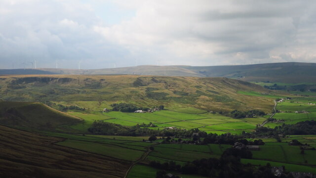
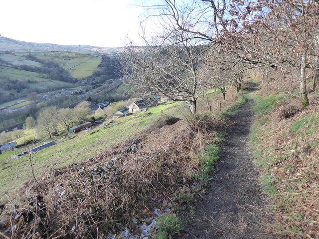
Height Wood is a picturesque woodland area located in the county of Yorkshire, England. Situated near the town of Wood and surrounded by lush greenery, it is a popular destination for nature enthusiasts and hikers alike.

Covering an area of approximately 100 acres, Height Wood boasts a diverse range of flora and fauna. The woodland is predominantly composed of deciduous trees such as oak, birch, and beech, which provide a stunning display of colors during the autumn months. The forest floor is covered in a carpet of wildflowers and ferns, creating a serene and tranquil atmosphere.

Several well-marked trails meander through Height Wood, offering visitors the opportunity to explore its beauty at their own pace. These trails range in difficulty, catering to both casual walkers and more experienced hikers. Along the way, there are plenty of benches and picnic areas where visitors can rest and take in the stunning views.

The woodland is also home to a variety of wildlife, including deer, rabbits, squirrels, and a wide array of bird species. Birdwatchers will delight in the chance to spot woodpeckers, owls, and even the occasional elusive red kite.

Height Wood is easily accessible by both car and public transport, with ample parking available nearby. It is open to the public year-round, although it is particularly popular during the spring and summer months when the woodland is at its most vibrant. For those seeking a peaceful retreat in the heart of nature, Height Wood is a must-visit destination in Yorkshire.

If you have any feedback on the listing, please let us know in the comments section below.
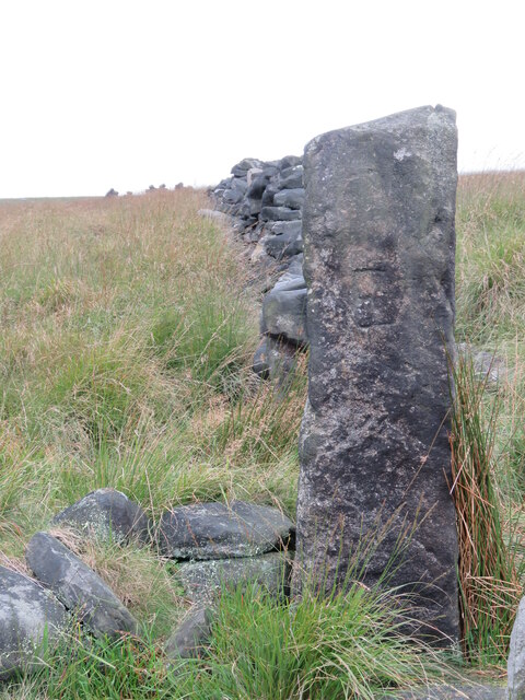
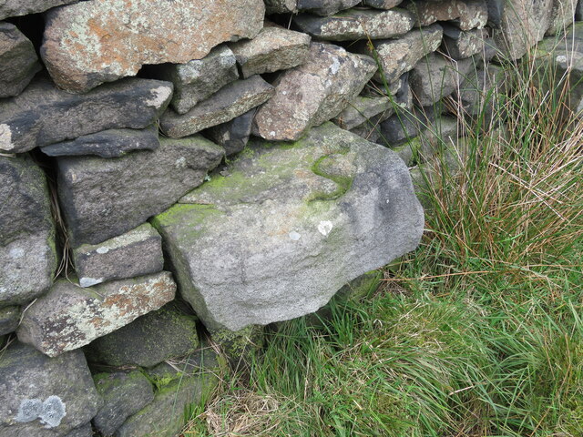
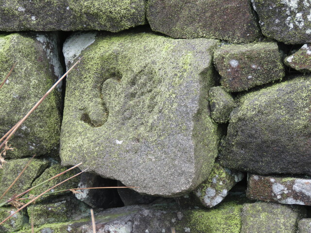
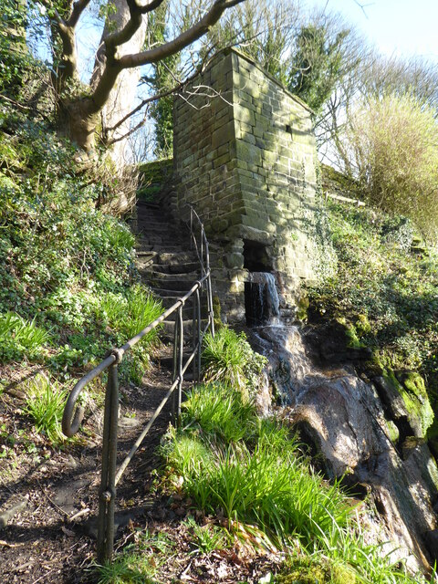
Height Wood Images

Images are sourced within 2km of 53.722699/-2.0533676 or Grid Reference SD9625. Thanks to Geograph Open Source API. All images are credited.

Lobb Mill The Rochdale Canal locks to the right of view from Halifax Road
Lobb Mill
The Rochdale Canal locks to the right of view from Halifax Road
Rodwell End Clough View from Lobb Mill Viaduct
Rodwell End Clough
View from Lobb Mill Viaduct
Lumbutts from Stoodley Pike Monument
Chinook Helicopter passing close to Stoodley Pike Monument A close encounter!
Chinook Helicopter passing close to Stoodley Pike Monument
A close encounter!
Pennine Way at Doe Stones & view towards Edge End Moor
View towards Stoodley Pike Monument from Dick's Lane
Old Boundary Marker in Stoodley Glen, Calderdale Township Boundary Marker above Stoodley Glen and south of Stoodley Lane. Formerly on the boundary of Langfield and Sowerby townships in Halifax parish. It marked the boundary of the Sowerby Ramble, a narrow strip of land along the Calder valley and up Stoodley Glen between Erringden and Stansfield townships and Erringden and Langfield township. Sowerby Ramble was part of Sowerby township but in 1850 it became part of Erringden township, later parish. In 1897 Langfield and Stansfield became part of Todmorden parish and in 1937 this part of Erringden parish also became part of Todmorden parish. 

Milestone Society National ID: YW_LANSOW02pb
Old Boundary Marker in Stoodley Glen, Calderdale
Township Boundary Marker above Stoodley Glen and south of Stoodley Lane. Formerly on the boundary of Langfield and Sowerby townships in Halifax parish. It marked the boundary of the Sowerby Ramble, a narrow strip of land along the Calder valley and up Stoodley Glen between Erringden and Stansfield townships and Erringden and Langfield township. Sowerby Ramble was part of Sowerby township but in 1850 it became part of Erringden township, later parish. In 1897 Langfield and Stansfield became part of Todmorden parish and in 1937 this part of Erringden parish also became part of Todmorden parish. Milestone Society National ID: YW_LANSOW02pb
Old Boundary Marker between Higher Moor and Sunderland Pasture in Hebden Royd parish Township Boundary Marker beside a track between Higher Moor and Sunderland Pasture. On the former boundary of the Sowerby Ramble between Erringden and Sowerby townships in Halifax parish but now entirely in Hebden Royd parish. Inscribed E for Erringden on its face and S for Sowerby on top.

Milestone Society National ID: YW_HEBR01pb
Old Boundary Marker between Higher Moor and Sunderland Pasture in Hebden Royd parish
Township Boundary Marker beside a track between Higher Moor and Sunderland Pasture. On the former boundary of the Sowerby Ramble between Erringden and Sowerby townships in Halifax parish but now entirely in Hebden Royd parish. Inscribed E for Erringden on its face and S for Sowerby on top. Milestone Society National ID: YW_HEBR01pb
Old Boundary Marker between Higher Moor and Sunderland Pasture in Hebden Royd parish Township Boundary Marker built into a wall adjacent to a stile between Higher Moor and Sunderland Pasture. On the former boundary of the Sowerby Ramble between Erringden and Sowerby townships in Halifax parish but now entirely in Hebden Royd parish. Inscribed S for Sowerby township.

Milestone Society National ID: YW_HEBR02pb
Old Boundary Marker between Higher Moor and Sunderland Pasture in Hebden Royd parish
Township Boundary Marker built into a wall adjacent to a stile between Higher Moor and Sunderland Pasture. On the former boundary of the Sowerby Ramble between Erringden and Sowerby townships in Halifax parish but now entirely in Hebden Royd parish. Inscribed S for Sowerby township. Milestone Society National ID: YW_HEBR02pb
Old Boundary Marker between Higher Moor and Sunderland Pasture in Hebden Royd parish Township Boundary Marker built into a wall adjacent to a stile between Higher Moor and Sunderland Pasture. On the former boundary of the Sowerby Ramble between Erringden and Sowerby townships in Halifax parish but now entirely in Hebden Royd parish. Inscribed S for Sowerby township.

Milestone Society National ID: YW_HEBR03pb
Old Boundary Marker between Higher Moor and Sunderland Pasture in Hebden Royd parish
Township Boundary Marker built into a wall adjacent to a stile between Higher Moor and Sunderland Pasture. On the former boundary of the Sowerby Ramble between Erringden and Sowerby townships in Halifax parish but now entirely in Hebden Royd parish. Inscribed S for Sowerby township. Milestone Society National ID: YW_HEBR03pb
Old Boundary Marker in Stoodley Glen, Calderdale Parish Boundary Marker in Stoodley Glen below Height Wood. Formerly on the boundary of Langfield and Sowerby townships in Halifax parish. It marked the boundary of the Sowerby Ramble, a narrow strip of land along the Calder valley and up Stoodley Glen between Erringden and Stansfield townships and Erringden and Langfield township. Sowerby Ramble was part of Sowerby township but in 1850 it became part of Erringden township, later parish. In 1897 Langfield and Stansfield became part of Todmorden parish and in 1937 this part of Erringden parish also became part of Todmorden parish..

Milestone Society National ID: YW_SOWERR01pb
Old Boundary Marker in Stoodley Glen, Calderdale
Parish Boundary Marker in Stoodley Glen below Height Wood. Formerly on the boundary of Langfield and Sowerby townships in Halifax parish. It marked the boundary of the Sowerby Ramble, a narrow strip of land along the Calder valley and up Stoodley Glen between Erringden and Stansfield townships and Erringden and Langfield township. Sowerby Ramble was part of Sowerby township but in 1850 it became part of Erringden township, later parish. In 1897 Langfield and Stansfield became part of Todmorden parish and in 1937 this part of Erringden parish also became part of Todmorden parish.. Milestone Society National ID: YW_SOWERR01pb
Old Boundary Marker Estate Boundary Marker set in a stone wall on Matthew Lane, a green lane. In the former Stansfield township and parish, absorbed into Todmorden parish in 1897. Not on any township or parish boundary so is thought to mark an estate boundary.

Milestone Society National ID: YW_TOD10em
Old Boundary Marker
Estate Boundary Marker set in a stone wall on Matthew Lane, a green lane. In the former Stansfield township and parish, absorbed into Todmorden parish in 1897. Not on any township or parish boundary so is thought to mark an estate boundary. Milestone Society National ID: YW_TOD10em
Old Boundary Marker on Baulk Head Lane, Todmorden Estate Boundary Marker set in a stone wall on Baulk Head Lane, a green lane. In the former Stansfield township and parish, absorbed into Todmorden parish in 1897. Not on any township or parish boundary so is thought to mark an estate boundary.

Milestone Society National ID: YW_TOD11em
Old Boundary Marker on Baulk Head Lane, Todmorden
Estate Boundary Marker set in a stone wall on Baulk Head Lane, a green lane. In the former Stansfield township and parish, absorbed into Todmorden parish in 1897. Not on any township or parish boundary so is thought to mark an estate boundary. Milestone Society National ID: YW_TOD11em
The Pennine Way and Bridleway crossing the A646
The Pennine Way leaving the A646
The Pennine Way near Higher Underbank Farm
The Pennine Way near Knott Wood
Show me another place!

Height Wood is located at Grid Ref: SD9625 (Lat: 53.722699, Lng: -2.0533676)

Division: West Riding

Unitary Authority: Calderdale

Police Authority: West Yorkshire

What 3 Words

///iteration.sprains.silver. Near Todmorden, West Yorkshire

Related Wikis

Eastwood, West Yorkshire

Eastwood is a place within the civil parish of Todmorden and Metropolitan Borough of Calderdale, in West Yorkshire, England. It lies 8 miles (12.9 km)...

Eastwood (L&Y) railway station

Eastwood Railway Station served the village of Eastwood in the civil parish of Todmorden, West Yorkshire, England. The station opened with the line on...

Stoodley Pike

Stoodley Pike is a 1,300-foot (400 m) hill in the south Pennines in West Yorkshire in northern England. It is noted for the 121-foot (37 m) Stoodley Pike...

South Pennines Regional Park

The South Pennines Regional Park (or South Pennines Park) is a proposed national park that would cover the South Pennines area in Northern England, encompassing...

Mankinholes

Mankinholes is a hamlet in the Metropolitan Borough of Calderdale, in West Yorkshire, England. It is situated in the Pennines and the nearest town is Todmorden...

Stansfield Hall railway station

Stansfield Hall railway station (English: ) was the second station in Stansfield, Todmorden in West Yorkshire, England and was situated on the Copy Pit...

Todmorden Markets

Todmorden Markets consist of an indoor market held in the Public Market Hall and an outdoor open air market held to the front of the Public Market Hall...

Todmorden bus station

Todmorden bus station serves the town of Todmorden, West Yorkshire, England. The bus station is owned and managed by West Yorkshire Metro and was opened...

Nearby Amenities

Located within 500m of 53.722699,-2.0533676
Waterway: turning_point
Lat/Long: 53.7255957/-2.0540169
Seamark Type: gate
Waterway: lock_gate
Lat/Long: 53.724326/-2.0544607
Seamark Type: gate
Waterway: lock_gate
Lat/Long: 53.7240914/-2.0545244
Waterway: turning_point
Lat/Long: 53.7220455/-2.0565625
Bus Stop
Eastwood
Bus: yes
Local Ref: 45019830
Naptan AtcoCode: 450019830
Naptan Bearing: N
Naptan CommonName: Eastwood
Naptan Crossing: Nr-At Eastwood Lane
Naptan Indicator: Stop 45019830
Naptan Notes: Trueform installed 220208
Naptan PlusbusZoneRef: LEEDS
Naptan ShortCommonName: Eastwood Lane
Naptan Street: Halifax Road
Naptan Verified: no
Public Transport: platform
Source: naptan_import
Lat/Long: 53.7265197/-2.0548512
Bus Stop
Eastwood Halifax Road
Bus: yes
Local Ref: 45019831
Naptan AtcoCode: 450019831
Naptan Bearing: N
Naptan CommonName: Eastwood Halifax Road
Naptan Crossing: Eastwood Lane
Naptan Indicator: Stop 45019831
Naptan PlusbusZoneRef: LEEDS
Naptan ShortCommonName: Eastwood Lane
Naptan Street: Halifax Road
Naptan Verified: no
Public Transport: platform
Source: naptan_import
Lat/Long: 53.7262051/-2.0548508
Bus Stop
Halifax Road
Bus: yes
Local Ref: 45019832
Naptan AtcoCode: 450019832
Naptan Bearing: NE
Naptan CommonName: Halifax Road
Naptan Crossing: Nr-At Eastwood Lane
Naptan Indicator: Stop 45019832
Naptan Landmark: Holmecoat Bridge
Naptan PlusbusZoneRef: LEEDS
Naptan ShortCommonName: Hfx Rd Holmcoat Br
Naptan Street: Halifax Road
Naptan Verified: no
Public Transport: platform
Source: naptan_import
Lat/Long: 53.7250362/-2.0557738
Bus Stop
Halifax Road
Bus: yes
Local Ref: 45019833
Naptan AtcoCode: 450019833
Naptan Bearing: SW
Naptan CommonName: Halifax Road
Naptan Crossing: Duke Street
Naptan Indicator: Stop 45019833
Naptan Landmark: The Hall
Naptan PlusbusZoneRef: LEEDS
Naptan ShortCommonName: Hfx Rd Holmcoat Br
Naptan Street: Halifax Road
Naptan Verified: no
Public Transport: platform
Source: naptan_import
Lat/Long: 53.7248744/-2.0557129
Bus Stop
Halifax Road Stoodley Lane
Bus: yes
Local Ref: 45019834
Naptan AtcoCode: 450019834
Naptan Bearing: NE
Naptan CommonName: Halifax Road Stoodley Lane
Naptan Crossing: Stoodley Lane
Naptan Indicator: Stop 45019834
Naptan PlusbusZoneRef: LEEDS
Naptan ShortCommonName: Stoodley Lane
Naptan Street: Halifax Road
Naptan Verified: no
Public Transport: platform
Source: naptan_import
Lat/Long: 53.7227342/-2.0578015
Bus Stop
Halifax Road Stoodley Lane
Bus: yes
Local Ref: 45019835
Naptan AtcoCode: 450019835
Naptan Bearing: SW
Naptan CommonName: Halifax Road Stoodley Lane
Naptan Crossing: Stoodley Lane
Naptan Indicator: Stop 45019835
Naptan Landmark: Recycle Tip
Naptan PlusbusZoneRef: LEEDS
Naptan ShortCommonName: Stoodley Bridge
Naptan Street: Halifax Road
Naptan Verified: no
Public Transport: platform
Source: naptan_import
Lat/Long: 53.7221317/-2.0582856
Barrier: stile
Lat/Long: 53.7211233/-2.0464184
Ford: yes
Lat/Long: 53.7204648/-2.0499887
Barrier: stile
Material: wood
Stile: stepover
Lat/Long: 53.7249047/-2.0518889
Barrier: stile
Material: wood
Stile: stepover
Lat/Long: 53.7248453/-2.0520404
Barrier: cattle_grid
Lat/Long: 53.7199548/-2.0512636
Barrier: bollard
Lat/Long: 53.7243516/-2.0545647
The data included in this document is from www.openstreetmap.org. The data is made available under ODbL.

Have you been to Height Wood?

Leave your review of Height Wood below (or comments, questions and feedback).