Burnt Acres Wood Bottom

Valley in Yorkshire

England

Burnt Acres Wood Bottom

Rodwell End Clough View from Lobb Mill Viaduct
Rodwell End Clough Credit: Raymond Knapman

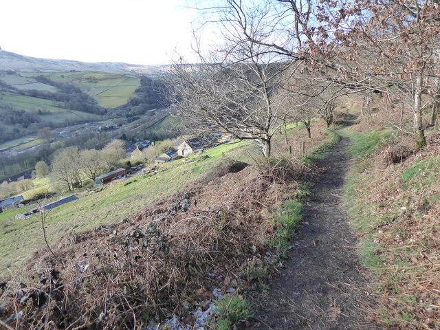
Burnt Acres Wood Bottom is a picturesque valley located in the heart of Yorkshire, England. Situated in the southern part of the county, it covers an area of approximately 100 acres, making it a relatively small but charming natural landscape.

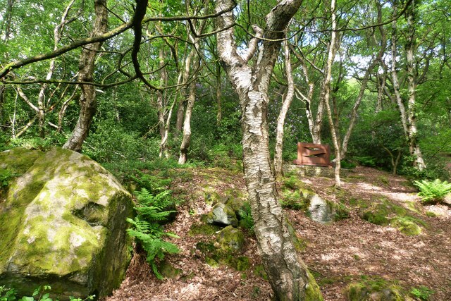
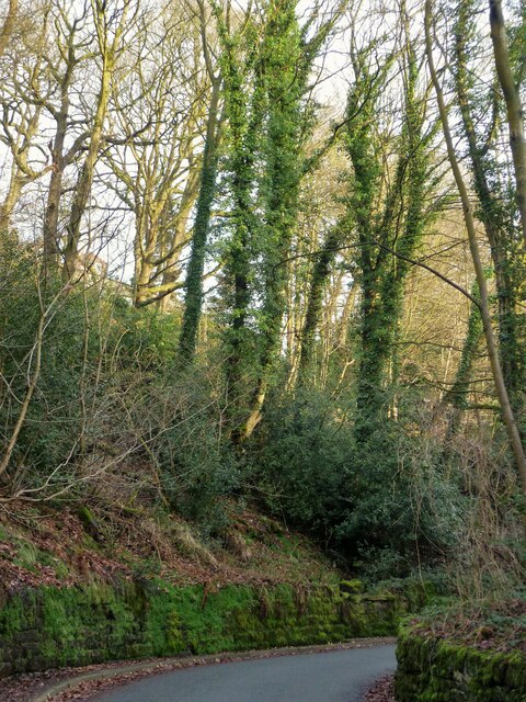
The valley is characterized by its dense woodland, which primarily consists of mature oak and beech trees. These majestic trees create a vibrant and lush canopy that provides shade and shelter to a diverse range of flora and fauna. The woodland floor is carpeted with an array of wildflowers and ferns, adding to the area's natural beauty.

Burnt Acres Wood Bottom is crisscrossed by several small streams that meander through the valley, creating a tranquil atmosphere. These streams, fed by the nearby hills, provide a source of water for the various wildlife that call this valley home. It is not uncommon to spot a variety of bird species, including woodpeckers, owls, and thrushes, as well as small mammals like squirrels and rabbits.

The valley is a popular destination for nature enthusiasts and hikers, who come to explore its well-maintained footpaths. These paths wind through the woodland, offering breathtaking views of the surrounding countryside. Visitors can also enjoy a picnic or simply relax in the peaceful surroundings.

Overall, Burnt Acres Wood Bottom is a hidden gem in Yorkshire, offering a tranquil escape from the hustle and bustle of everyday life. Its natural beauty, diverse wildlife, and well-preserved woodland make it a must-visit destination for those seeking a slice of nature's tranquility.

If you have any feedback on the listing, please let us know in the comments section below.

Burnt Acres Wood Bottom Images

Images are sourced within 2km of 53.730323/-2.0480419 or Grid Reference SD9625. Thanks to Geograph Open Source API. All images are credited.

Rodwell End Clough View from Lobb Mill Viaduct
Rodwell End Clough
View from Lobb Mill Viaduct
Halifax Road at Calderside View from rail line on Whiteley Arches
Halifax Road at Calderside
View from rail line on Whiteley Arches
Oakville Road at Calderside View from Rochdale to Leeds railway
Oakville Road at Calderside
View from Rochdale to Leeds railway
Chinook Helicopter passing close to Stoodley Pike Monument A close encounter!
Chinook Helicopter passing close to Stoodley Pike Monument
A close encounter!
Pennine Way at Doe Stones & view towards Edge End Moor
Seat at eastern end of Horsehold Wood & view over Calderside A seat with a view.
Seat at eastern end of Horsehold Wood & view over Calderside
A seat with a view.
View towards Stoodley Pike Monument from Dick's Lane
Old Boundary Marker in Stoodley Glen, Calderdale Township Boundary Marker above Stoodley Glen and south of Stoodley Lane. Formerly on the boundary of Langfield and Sowerby townships in Halifax parish. It marked the boundary of the Sowerby Ramble, a narrow strip of land along the Calder valley and up Stoodley Glen between Erringden and Stansfield townships and Erringden and Langfield township. Sowerby Ramble was part of Sowerby township but in 1850 it became part of Erringden township, later parish. In 1897 Langfield and Stansfield became part of Todmorden parish and in 1937 this part of Erringden parish also became part of Todmorden parish. 

Milestone Society National ID: YW_LANSOW02pb
Old Boundary Marker in Stoodley Glen, Calderdale
Township Boundary Marker above Stoodley Glen and south of Stoodley Lane. Formerly on the boundary of Langfield and Sowerby townships in Halifax parish. It marked the boundary of the Sowerby Ramble, a narrow strip of land along the Calder valley and up Stoodley Glen between Erringden and Stansfield townships and Erringden and Langfield township. Sowerby Ramble was part of Sowerby township but in 1850 it became part of Erringden township, later parish. In 1897 Langfield and Stansfield became part of Todmorden parish and in 1937 this part of Erringden parish also became part of Todmorden parish. Milestone Society National ID: YW_LANSOW02pb
Old Boundary Marker in Stoodley Glen, Calderdale Parish Boundary Marker in Stoodley Glen below Height Wood. Formerly on the boundary of Langfield and Sowerby townships in Halifax parish. It marked the boundary of the Sowerby Ramble, a narrow strip of land along the Calder valley and up Stoodley Glen between Erringden and Stansfield townships and Erringden and Langfield township. Sowerby Ramble was part of Sowerby township but in 1850 it became part of Erringden township, later parish. In 1897 Langfield and Stansfield became part of Todmorden parish and in 1937 this part of Erringden parish also became part of Todmorden parish..

Milestone Society National ID: YW_SOWERR01pb
Old Boundary Marker in Stoodley Glen, Calderdale
Parish Boundary Marker in Stoodley Glen below Height Wood. Formerly on the boundary of Langfield and Sowerby townships in Halifax parish. It marked the boundary of the Sowerby Ramble, a narrow strip of land along the Calder valley and up Stoodley Glen between Erringden and Stansfield townships and Erringden and Langfield township. Sowerby Ramble was part of Sowerby township but in 1850 it became part of Erringden township, later parish. In 1897 Langfield and Stansfield became part of Todmorden parish and in 1937 this part of Erringden parish also became part of Todmorden parish.. Milestone Society National ID: YW_SOWERR01pb
Old Boundary Marker Estate Boundary Marker set in a stone wall on Matthew Lane, a green lane. In the former Stansfield township and parish, absorbed into Todmorden parish in 1897. Not on any township or parish boundary so is thought to mark an estate boundary.

Milestone Society National ID: YW_TOD10em
Old Boundary Marker
Estate Boundary Marker set in a stone wall on Matthew Lane, a green lane. In the former Stansfield township and parish, absorbed into Todmorden parish in 1897. Not on any township or parish boundary so is thought to mark an estate boundary. Milestone Society National ID: YW_TOD10em
Old Boundary Marker on Baulk Head Lane, Todmorden Estate Boundary Marker set in a stone wall on Baulk Head Lane, a green lane. In the former Stansfield township and parish, absorbed into Todmorden parish in 1897. Not on any township or parish boundary so is thought to mark an estate boundary.

Milestone Society National ID: YW_TOD11em
Old Boundary Marker on Baulk Head Lane, Todmorden
Estate Boundary Marker set in a stone wall on Baulk Head Lane, a green lane. In the former Stansfield township and parish, absorbed into Todmorden parish in 1897. Not on any township or parish boundary so is thought to mark an estate boundary. Milestone Society National ID: YW_TOD11em
Rawtonstall Wood The wood with a view to the memorial to Jeffery Stinson, an architect
Rawtonstall Wood
The wood with a view to the memorial to Jeffery Stinson, an architect
Oakville Road and Railway View towards Hebden Bridge where road and rail are hardly separated. A rail track cleaning train is going over Whiteley Arches
Oakville Road and Railway
View towards Hebden Bridge where road and rail are hardly separated. A rail track cleaning train is going over Whiteley Arches
Savile Road The road is cut into the hillside of Rawtonstall Wood
Savile Road
The road is cut into the hillside of Rawtonstall Wood
The Pennine Way and Bridleway crossing the A646
The Pennine Way leaving the A646
The Pennine Way near Higher Underbank Farm
Show me another place!

Burnt Acres Wood Bottom is located at Grid Ref: SD9625 (Lat: 53.730323, Lng: -2.0480419)

Division: West Riding

Unitary Authority: Calderdale

Police Authority: West Yorkshire

What 3 Words

///rucksack.hurray.success. Near Hebden Bridge, West Yorkshire

Related Wikis

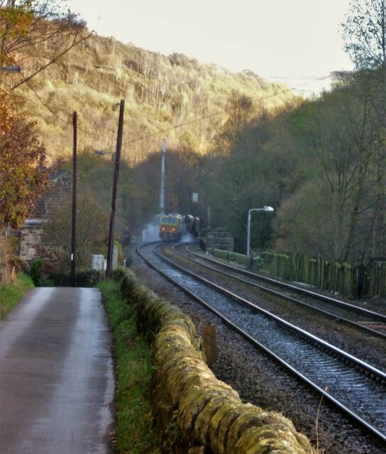
Eastwood (L&Y) railway station

Eastwood Railway Station served the village of Eastwood in the civil parish of Todmorden, West Yorkshire, England. The station opened with the line on...

Eastwood, West Yorkshire

Eastwood is a place within the civil parish of Todmorden and Metropolitan Borough of Calderdale, in West Yorkshire, England. It lies 8 miles (12.9 km)...

South Pennines Regional Park

The South Pennines Regional Park (or South Pennines Park) is a proposed national park that would cover the South Pennines area in Northern England, encompassing...

Stoodley Pike

Stoodley Pike is a 1,300-foot (400 m) hill in the south Pennines in West Yorkshire in northern England. It is noted for the 121-foot (37 m) Stoodley Pike...

Erringden

Erringden is a civil parish in the Metropolitan Borough of Calderdale in West Yorkshire, England. Previously it was a township within the chapelry of Heptonstall...

Colden, West Yorkshire

Colden is a hamlet in the civil parish of Heptonstall in Calderdale, West Yorkshire, England. Historically part of the West Riding of Yorkshire, the hamlet...

Hebden Bridge Picture House

Hebden Bridge Picture House in Hebden Bridge, West Yorkshire, is one of the last remaining council-owned cinemas in Britain. Together with the adjacent...

Battle of Heptonstall

The Battle of Heptonstall occurred in November 1643 during the First English Civil War at Hebden Bridge and Heptonstall, Yorkshire. During the battle,...

Nearby Amenities

Located within 500m of 53.730323,-2.0480419
Seamark Type: gate
Waterway: lock_gate
Lat/Long: 53.7333192/-2.0441606
Seamark Type: gate
Waterway: lock_gate
Lat/Long: 53.7331196/-2.0443141
Traffic Signals
Crossing Ref: pegasus
Traffic Signals: traffic_lights
Traffic Signals Direction: both
Lat/Long: 53.734179/-2.0447188
Bus Stop
Halifax Road Wood Villas
Bus: yes
Local Ref: 45019823
Naptan AtcoCode: 450019823
Naptan Bearing: SW
Naptan CommonName: Halifax Road Wood Villas
Naptan Crossing: Nr-At Pennine Way
Naptan Indicator: Stop 45019823
Naptan PlusbusZoneRef: LEEDS
Naptan ShortCommonName: Wood Villas
Naptan Street: Halifax Road
Naptan Verified: no
Public Transport: platform
Source: naptan_import
Lat/Long: 53.7336304/-2.0451365
Bus Stop
Halifax Road Wood Villas
Bus: yes
Departures Board: no
Local Ref: 45019824
Naptan AtcoCode: 450019824
Naptan Bearing: NE
Naptan CommonName: Halifax Road Wood Villas
Naptan Crossing: Wood Villas
Naptan Indicator: Stop 45019824
Naptan Landmark: Motor Centre
Naptan Notes: OSR taken place 051005
Naptan PlusbusZoneRef: LEEDS
Naptan ShortCommonName: Wood Villas
Naptan Street: Halifax Road
Naptan Verified: no
Public Transport: platform
Shelter: yes
Source: naptan_import
Lat/Long: 53.7336218/-2.0452872
Bus Stop
Halifax Road Jumble Hole Road
Bus: yes
Local Ref: 45019825
Naptan AtcoCode: 450019825
Naptan Bearing: SW
Naptan CommonName: Halifax Road Jumble Hole Road
Naptan Crossing: Jumble Hole Road
Naptan Indicator: Stop 45019825
Naptan PlusbusZoneRef: LEEDS
Naptan ShortCommonName: Jumble Hole Road
Naptan Street: Halifax Road
Naptan Verified: no
Public Transport: platform
Source: naptan_import
Lat/Long: 53.7322036/-2.0470823
Bus Stop
Sand Bed Bridge
Bus: yes
Local Ref: 45019826
Naptan AtcoCode: 450019826
Naptan Bearing: NE
Naptan CommonName: Sand Bed Bridge
Naptan Indicator: Stop 45019826
Naptan Landmark: Sewage Plant
Naptan PlusbusZoneRef: LEEDS
Naptan ShortCommonName: Sand Bed Bridge
Naptan Street: Halifax Road
Naptan Verified: no
Public Transport: platform
Source: naptan_import
Lat/Long: 53.7321315/-2.0474309
Bus Stop
Halifax Road
Bus: yes
Local Ref: 45019827
Naptan AtcoCode: 450019827
Naptan Bearing: NE
Naptan CommonName: Halifax Road
Naptan Crossing: Nr-Opp Burnt Acre Lane
Naptan Indicator: Stop 45019827
Naptan Landmark: Common Bank Wood
Naptan PlusbusZoneRef: LEEDS
Naptan ShortCommonName: Halifax Road Works
Naptan Street: Halifax Road
Naptan Verified: no
Public Transport: platform
Source: naptan_import
Lat/Long: 53.7297751/-2.0511267
Bus Stop
Halifax Road
Bus: yes
Local Ref: 45019828
Naptan AtcoCode: 450019828
Naptan Bearing: NE
Naptan CommonName: Halifax Road
Naptan Crossing: Adj Burnt Acres Lane
Naptan Indicator: Stop 45019828
Naptan Landmark: Burnt Acres Wood
Naptan PlusbusZoneRef: LEEDS
Naptan ShortCommonName: Halifax Road
Naptan Street: Halifax Road
Naptan Verified: no
Public Transport: platform
Source: naptan_import
Lat/Long: 53.7282462/-2.0530498
Bus Stop
Halifax Road
Bus: yes
Local Ref: 45019829
Naptan AtcoCode: 450019829
Naptan Bearing: SW
Naptan CommonName: Halifax Road
Naptan Crossing: Nr-Opp Eastwood Lane
Naptan Indicator: Stop 45019829
Naptan Landmark: Burnt Acres Wood
Naptan PlusbusZoneRef: LEEDS
Naptan ShortCommonName: Steel Works
Naptan Street: Halifax Road
Naptan Verified: no
Public Transport: platform
Source: naptan_import
Lat/Long: 53.7281384/-2.052989
Information: guidepost
Tourism: information
Lat/Long: 53.7342376/-2.0448068
Advertising: board
Lit: no
Lat/Long: 53.7336668/-2.0452581
Generator Method: photovoltaic
Generator Output Electricity: yes
Generator Source: solar
Generator Type: solar_photovoltaic_panel
Power: generator
Lat/Long: 53.7322533/-2.0465993
Barrier: height_restrictor
Maxheight: 2.1
Lat/Long: 53.7340937/-2.0451944
Barrier: bollard
Lat/Long: 53.7340996/-2.0451849
Baby: yes
Capacity: 2
Playground: swing
Wheelchair: no
Lat/Long: 53.7340426/-2.0453924
Playground: slide
Lat/Long: 53.7340091/-2.0454797
Waste Basket
Lat/Long: 53.7340541/-2.0454828
Bench
Backrest: yes
Lat/Long: 53.734014/-2.0453205
Baby: no
Capacity: 2
Playground: swing
Wheelchair: no
Lat/Long: 53.7340547/-2.0453719
The data included in this document is from www.openstreetmap.org. The data is made available under ODbL.

Have you been to Burnt Acres Wood Bottom?

Leave your review of Burnt Acres Wood Bottom below (or comments, questions and feedback).