Ashton under Hill

Settlement in Gloucestershire Wychavon

England

Ashton under Hill

Bredon Hill crest path, 13 Gradual descent south-east towards Ashton.
The distinctive outline of Dumbleton/Alderton Hill can be seen clearly as well as the Cotswold crest beyond.
This picture represents the completion of Hectad SO93 by the photographer, ie. a Geograph in every one of the 100 squares.
Bredon Hill crest path, 13 Credit: Jonathan Billinger

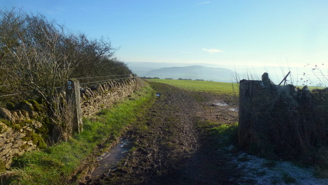
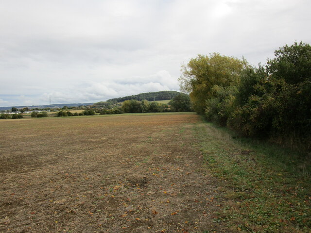
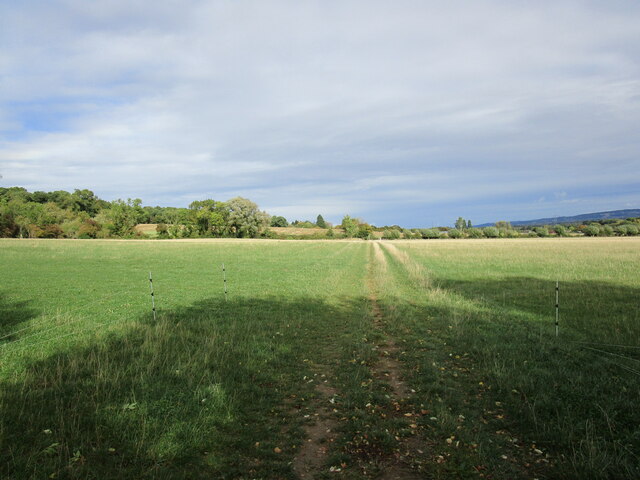
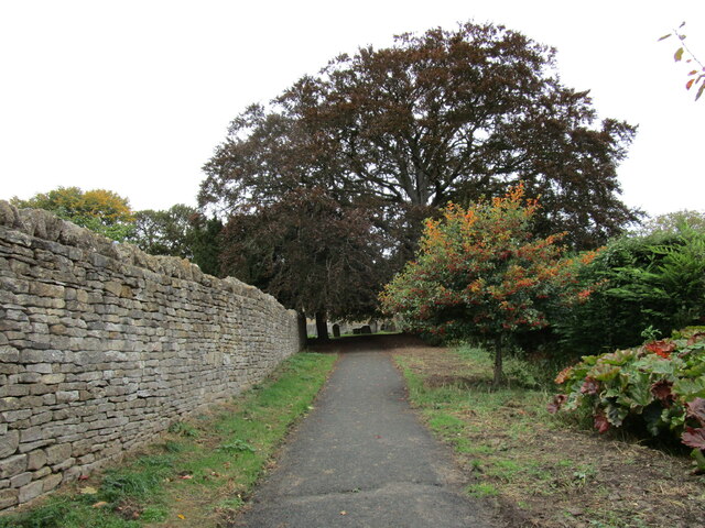
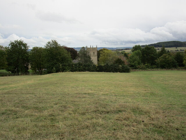
Ashton under Hill is a small village located in the county of Gloucestershire, England. Situated on the northern edge of the Cotswolds, it is surrounded by picturesque countryside and offers stunning views of the nearby Bredon Hill. The village is part of the Wychavon district and lies approximately seven miles southeast of Evesham.

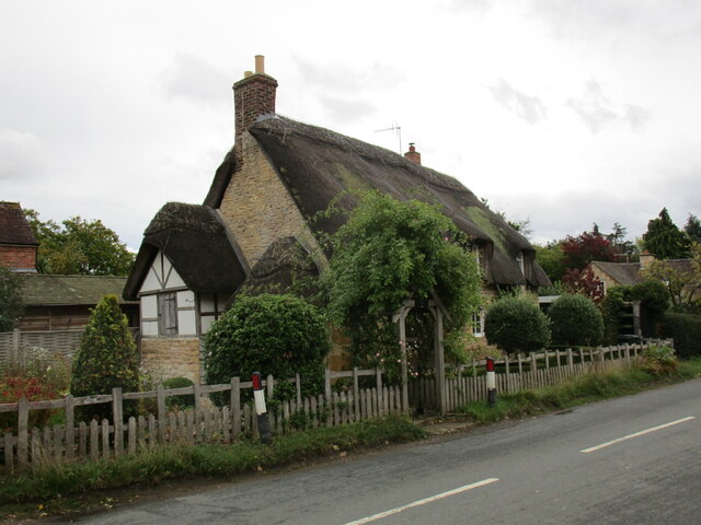
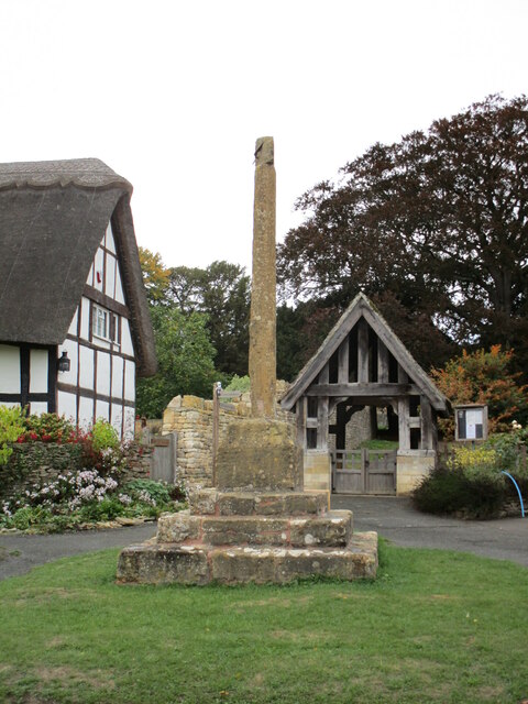
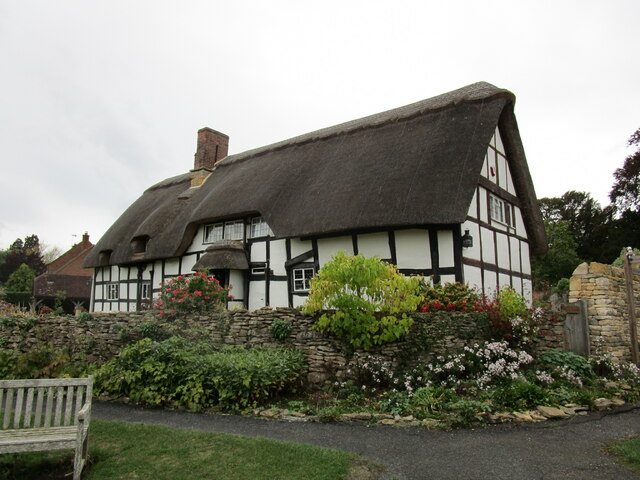
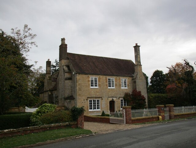
With a population of around 400 residents, Ashton under Hill has a close-knit community feel. The village boasts a charming mix of traditional stone-built cottages and more modern houses, creating a unique architectural blend. Its quaint streets are lined with well-maintained gardens and flower displays, adding to its overall visual appeal.

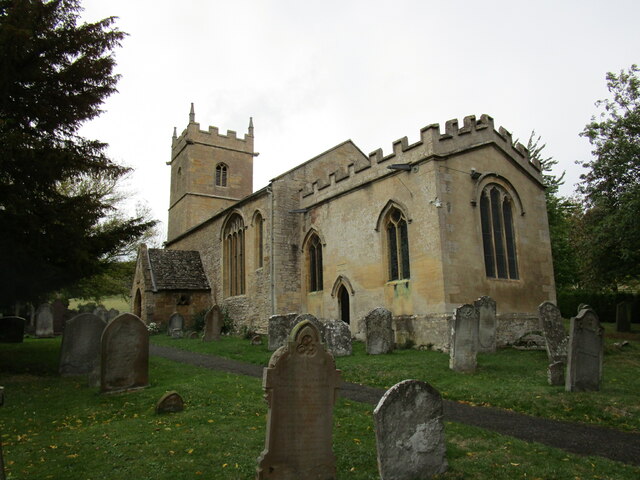
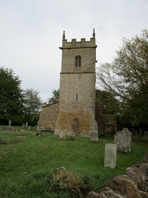
The heart of the village is centered around the village green, which is a focal point for community events and activities. Ashton under Hill also features a beautiful Norman church, St. Barbara's, which dates back to the 12th century and is known for its impressive architecture.

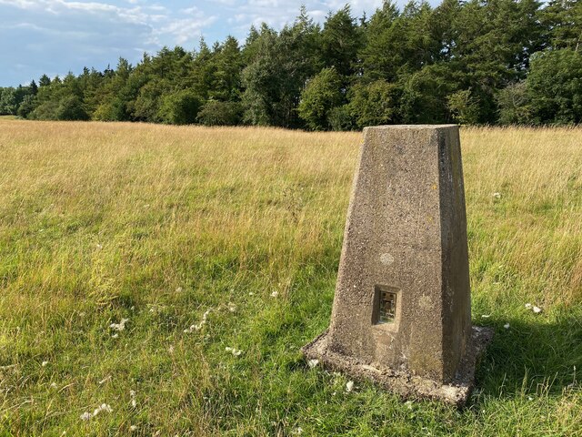
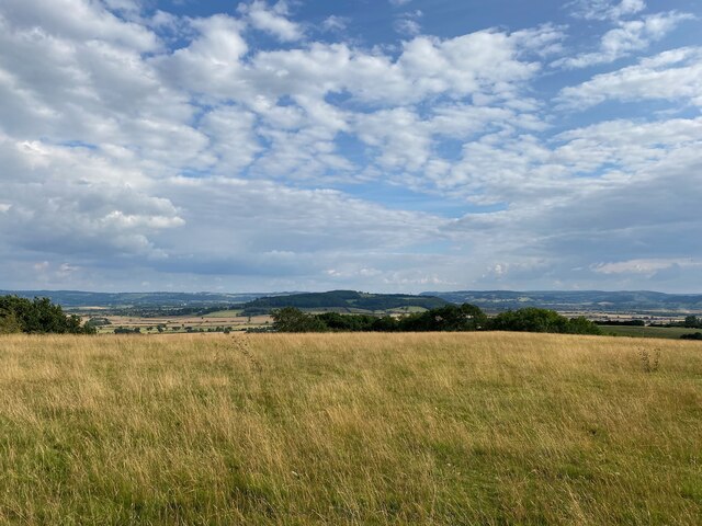
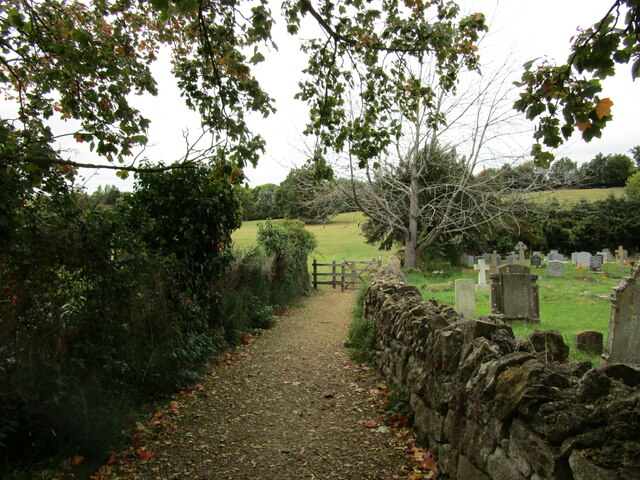
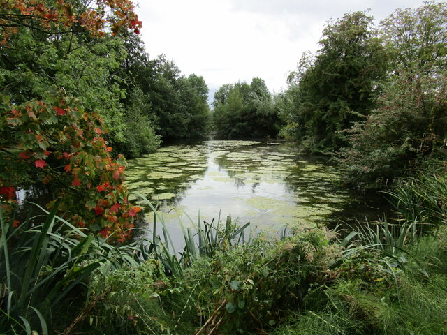
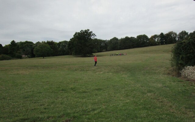
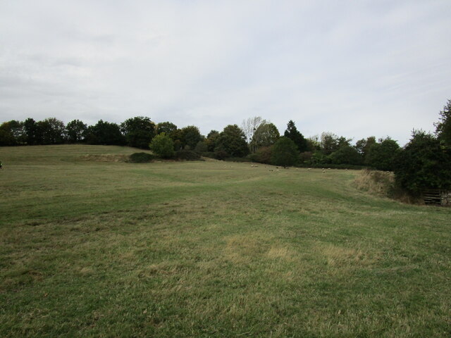
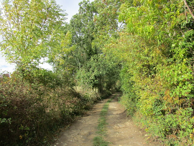
Nature enthusiasts will find plenty to explore in the surrounding area. Bredon Hill, just a short distance from the village, offers numerous walking paths and trails, providing stunning panoramic views of the Worcestershire countryside. The hill is also home to an abundance of wildlife, including rare plant species and a variety of birdlife.

Overall, Ashton under Hill is a charming and picturesque village nestled in the Cotswolds, offering a peaceful and idyllic setting for its residents and visitors alike.

If you have any feedback on the listing, please let us know in the comments section below.

Ashton under Hill Images

Images are sourced within 2km of 52.041818/-2.005567 or Grid Reference SO9938. Thanks to Geograph Open Source API. All images are credited.

Bredon Hill crest path, 13 Gradual descent south-east towards Ashton.
The distinctive outline of Dumbleton/Alderton Hill can be seen clearly as well as the Cotswold crest beyond.
This picture represents the completion of Hectad SO93 by the photographer, ie. a Geograph in every one of the 100 squares.
Bredon Hill crest path, 13
Gradual descent south-east towards Ashton. The distinctive outline of Dumbleton/Alderton Hill can be seen clearly as well as the Cotswold crest beyond. This picture represents the completion of Hectad SO93 by the photographer, ie. a Geograph in every one of the 100 squares.
Holcomb Nap Trig Point Flush Bracket S3790
View from Holcomb Nap Trig Point Flush Bracket S3790
Cross Cottage, Ashton under Hill Dates from the seventeenth century <span class="nowrap"><a title="https://historicengland.org.uk/listing/the-list/list-entry/1349961?section=official-list-entry" rel="nofollow ugc noopener" href="https://historicengland.org.uk/listing/the-list/list-entry/1349961?section=official-list-entry">Link</a><img style="margin-left:2px;" alt="External link" title="External link - shift click to open in new window" src="https://s1.geograph.org.uk/img/external.png" width="10" height="10"/></span>
Cross Cottage, Ashton under Hill
Dates from the seventeenth century LinkExternal link
Field edge near Ashton under Hill Looking towards Dumbleton Hill.
Field edge near Ashton under Hill
Looking towards Dumbleton Hill.
Footpath to Ashton under Hill
Village cross, Ashton under Hill Dates from the fifteenth century <span class="nowrap"><a title="https://historicengland.org.uk/listing/the-list/list-entry/1167161?section=official-list-entry" rel="nofollow ugc noopener" href="https://historicengland.org.uk/listing/the-list/list-entry/1167161?section=official-list-entry">Link</a><img style="margin-left:2px;" alt="External link" title="External link - shift click to open in new window" src="https://s1.geograph.org.uk/img/external.png" width="10" height="10"/></span>
Village cross, Ashton under Hill
Dates from the fifteenth century LinkExternal link
Walnut Thatch, Ashton under Hill Dates from the sixteenth century <span class="nowrap"><a title="https://historicengland.org.uk/listing/the-list/list-entry/1349960?section=official-list-entry" rel="nofollow ugc noopener" href="https://historicengland.org.uk/listing/the-list/list-entry/1349960?section=official-list-entry">Link</a><img style="margin-left:2px;" alt="External link" title="External link - shift click to open in new window" src="https://s1.geograph.org.uk/img/external.png" width="10" height="10"/></span>
Walnut Thatch, Ashton under Hill
Dates from the sixteenth century LinkExternal link
Footpath to the church, Ashton under Hill
St Barbara's church, Ashton under Hill Has twelfth century origins though most of what is visible in this picture dates from the early sixteenth and seventeenth centuries <span class="nowrap"><a title="https://historicengland.org.uk/listing/the-list/list-entry/1081663?section=official-list-entry" rel="nofollow ugc noopener" href="https://historicengland.org.uk/listing/the-list/list-entry/1081663?section=official-list-entry">Link</a><img style="margin-left:2px;" alt="External link" title="External link - shift click to open in new window" src="https://s1.geograph.org.uk/img/external.png" width="10" height="10"/></span>
St Barbara's church, Ashton under Hill
Has twelfth century origins though most of what is visible in this picture dates from the early sixteenth and seventeenth centuries LinkExternal link
Footpath alongside the churchyard, Ashton under Hill
Reservoir at Ashton under Hill
St Barbara's church, Ashton under Hill The west tower dates from the thirteenth century with an upper stage of about 1500 <span class="nowrap"><a title="https://historicengland.org.uk/listing/the-list/list-entry/1081663?section=official-list-entry" rel="nofollow ugc noopener" href="https://historicengland.org.uk/listing/the-list/list-entry/1081663?section=official-list-entry">Link</a><img style="margin-left:2px;" alt="External link" title="External link - shift click to open in new window" src="https://s1.geograph.org.uk/img/external.png" width="10" height="10"/></span>
St Barbara's church, Ashton under Hill
The west tower dates from the thirteenth century with an upper stage of about 1500 LinkExternal link
View over Ashton under Hill St Barbara's church in the centre of the picture.
View over Ashton under Hill
St Barbara's church in the centre of the picture.
Here they come! Children from Ashton under Hill First School about to race down the hill above the church. Some made spectacular dives and are clearly training to be professional footballers!
Here they come!
Children from Ashton under Hill First School about to race down the hill above the church. Some made spectacular dives and are clearly training to be professional footballers!
Grass field, Ashton under Hill
Middle Farmhouse, Ashton under Hill A later frontage to a seventeenth century house (visible on the left) <span class="nowrap"><a title="https://historicengland.org.uk/listing/the-list/list-entry/1081665?section=official-list-entry" rel="nofollow ugc noopener" href="https://historicengland.org.uk/listing/the-list/list-entry/1081665?section=official-list-entry">Link</a><img style="margin-left:2px;" alt="External link" title="External link - shift click to open in new window" src="https://s1.geograph.org.uk/img/external.png" width="10" height="10"/></span>
Middle Farmhouse, Ashton under Hill
A later frontage to a seventeenth century house (visible on the left) LinkExternal link
Footpath at Grafton
Footpath at Grafton
Show me another place!

Ashton under Hill is located at Grid Ref: SO9938 (Lat: 52.041818, Lng: -2.005567)

Administrative County: Worcestershire

District: Wychavon

Police Authority: West Mercia

What 3 Words

///sweetened.late.roosters. Near Evesham, Worcestershire

Related Wikis

Ashton under Hill

Ashton under Hill is a village and civil parish in the Wychavon district of Worcestershire in England. It is situated at the foot of Bredon Hill. According...

Ashton-under-Hill railway station

Ashton-under-Hill railway station was a station on the Midland Railway between Great Malvern and Evesham. It served Ashton under Hill in Worcestershire...

Grafton, Worcestershire

Grafton is a hamlet in Worcestershire, England, situated between the villages of Beckford and Ashton under Hill, south-east of Bredon Hill. The name Grafton...

Kersoe

Kersoe is a hamlet in Worcestershire, England. It is at the foot of Bredon Hill an area of outstanding natural beauty.

Sedgeberrow

Sedgeberrow is a village and civil parish in the Wychavon district of Worcestershire, England, about 3 miles (4.8 km) south of Evesham. It stands beside...

Elmley Castle (castle)

Elmley Castle was a late 11th-century earthwork and timber castle which received stone additions in the 12th and possibly 13th centuries, located 0.5 miles...

Dumbleton

Dumbleton is a village and civil parish in the Tewkesbury district, in the county of Gloucestershire, England. The village is roughly 20 miles from the...

Beckford Nature Reserve

Beckford Nature Reserve is near Beckford, in Worcestershire, England, situated immediately north of the village. The nature reserve was created from a...

Nearby Amenities

Located within 500m of 52.041818,-2.005567
Holloway Farm House
Addr City: Evesham
Addr Postcode: WR11 7SN
Addr Street: Elmley Road
Tourism: guest_house
Url: http://www.hollowayfarmhouse.co.uk/
Lat/Long: 52.041803/-2.0058288
Barrier: stile
Source: survey
Lat/Long: 52.0402164/-2.0115637
Ashton Under Hill
Place: village
Wikidata: Q2343819
Lat/Long: 52.0389111/-2.0041784
Grit Bin
Lat/Long: 52.0394234/-2.004965
Public Bookcase
Booth: K6
Covered: booth
Disused Amenity: telephone
Public Bookcase Type: phone_box
Source: survey
Lat/Long: 52.0388511/-2.004984
Post Box
Brand: Royal Mail
Brand Wikidata: Q638098
Collection Times: Mo-Fr 09:00; Sa 07:00; Su off
Drive Through: no
Operator: Royal Mail
Operator Wikidata: Q638098
Post Box Type: wall
Ref: WR11 158D
Royal Cypher: GVIR
Royal Cypher Wikidata: Q33102169
Source: bing;survey
Source Ref: survey
Lat/Long: 52.0388151/-2.004973
Turning Circle
Lat/Long: 52.0457698/-2.0063659
Bus Stop
Cross
Bus: yes
Naptan AtcoCode: 2000G073100
Naptan Bearing: E
Naptan CommonName: Cross
Naptan Indicator: Adj
Naptan Landmark: Shelter
Naptan NaptanCode: wocdadag
Naptan Street: Station Road
Naptan Verified: no
Public Transport: platform
Source: naptan_import
Lat/Long: 52.0377996/-2.0039654
Cottons Lane
Naptan AtcoCode: 2000G073101
Naptan Bearing: N
Naptan BusStopType: CUS
Naptan CommonName: Cottons Lane
Naptan Crossing: Cottons Lane
Naptan Indicator: Adj
Naptan NaptanCode: wocgmtwp
Naptan Street: Elmley Road
Naptan Verified: no
Source: naptan_import
Lat/Long: 52.0425197/-2.005453
Cornfield Way
Naptan AtcoCode: 2000G073102
Naptan Bearing: NW
Naptan BusStopType: CUS
Naptan CommonName: Cornfield Way
Naptan Crossing: Cornfield Way
Naptan Indicator: adj
Naptan NaptanCode: wocgmtwt
Naptan Street: Elmley Road
Naptan Verified: no
Source: naptan_import
Lat/Long: 52.0458464/-2.0036016
Elmley Road
Naptan AtcoCode: 2000G501690
Naptan Bearing: S
Naptan BusStopType: CUS
Naptan CommonName: Elmley Road
Naptan Indicator: adj
Naptan NaptanCode: wocgdgta
Naptan Street: Elmley Road
Naptan Verified: no
Source: naptan_import
Lat/Long: 52.0409643/-2.0049426
Bus Stop
Wood Lane
Bus: yes
Naptan AtcoCode: 2000G671004
Naptan Bearing: SW
Naptan CommonName: Wood Lane
Naptan Crossing: Wood Lane
Naptan Indicator: opp
Naptan NaptanCode: wocdpjgp
Naptan Street: Elmeley Road
Naptan Verified: no
Public Transport: platform
Source: naptan_import
Lat/Long: 52.0453069/-2.0043744
First School
Naptan AtcoCode: 2000G673005
Naptan Bearing: S
Naptan BusStopType: CUS
Naptan CommonName: First School
Naptan Indicator: Adj
Naptan Landmark: School
Naptan NaptanCode: wocdatwp
Naptan Street: Elmley Road
Naptan Verified: no
Source: naptan_import
Lat/Long: 52.0397416/-2.0048987
Turning Circle
Lat/Long: 52.0454685/-2.0018245
Turning Circle
Lat/Long: 52.0453828/-2.0018206
Barrier: kissing_gate
Lat/Long: 52.0423681/-2.0002988
Barrier: kissing_gate
Lat/Long: 52.0411287/-2.0039227
Barrier: kissing_gate
Lat/Long: 52.0377057/-2.0064482
Barrier: kissing_gate
Lat/Long: 52.037769/-2.0067278
Post Box
Collection Times: Mo-Fr 17:00; Sa 10:30
Post Box Type: lamp
Ref: WR11 68
Royal Cypher: EIIR
Royal Cypher Wikidata: Q33102113
Lat/Long: 52.0442989/-2.0050612
Barrier: stile
Foot: yes
Lat/Long: 52.0392703/-2.0083155
Barrier: stile
Foot: yes
Lat/Long: 52.0423596/-2.0085578
HE Ref: 148456
Heritage: 2
Heritage Operator: Historic England
Historic: wayside_cross
Listed Status: Grade II
Religion: christian
Source Listed Status: English Heritage
Lat/Long: 52.0376803/-2.0050795
War Memorial
Historic: memorial
Memorial: war_memorial
Lat/Long: 52.0396355/-2.0051405
Ashton Under Hill School
Location Transition: yes
Power: pole
Transformer: distribution
Voltage Primary: 11000
Lat/Long: 52.0403646/-2.0038634
Power: pole
Lat/Long: 52.0423473/-1.9994
Location Transition: yes
Power: pole
Lat/Long: 52.0423884/-1.998411
Power: pole
Lat/Long: 52.0427237/-2.001391
Power: pole
Lat/Long: 52.042972/-2.0027785
Ashton Under Hill North
Poles: bipole
Power: pole
Source: bing
Transformer: distribution
Voltage Primary: 11000
Lat/Long: 52.0432171/-2.0040674
Barrier: stile
Foot: yes
Lat/Long: 52.0461929/-2.0058403
HE Ref: 148476
Barrier: gate_piers
Historic: yes
Listed Status: Grade II
Source Listed Status: English Heritage
Lat/Long: 52.0424762/-2.0052938
Post Office
Ashton Under Hill Mobile Post Office Service
Addr City: Evesham
Addr Housename: Car Park Outside Free Church
Addr Postcode: WR11 7SJ
Addr Street: Elmley Road
Addr Village: Ashton Under Hill
Brand: Post Office
Brand Wikidata: Q1783168
Opening Hours: Tu 12:30-13:30
Ref Pol Id: 136431
Source: pol_branch_list_2018-01
Website: https://www.postoffice.co.uk/branch-finder/7142471/ashton-under-hill-mobile-service
Lat/Long: 52.0434897/-2.0053354
Fire Hydrant
Emergency: fire_hydrant
Fire Hydrant Type: underground
Source: survey
Lat/Long: 52.038659/-2.0049633
Fire Hydrant
Emergency: fire_hydrant
Fire Hydrant Type: underground
Source: survey
Lat/Long: 52.0379017/-2.004789
Bench
Source: survey
Lat/Long: 52.0377763/-2.0048037
Bench
Source: survey
Lat/Long: 52.037594/-2.0050317
Bench
Source: survey
Lat/Long: 52.0391729/-2.0082329
Barrier: stile
Source: survey
Lat/Long: 52.0397549/-2.0083563
Bench
Source: survey
Lat/Long: 52.0403938/-2.0116568
Power: pole
Source: bing
Lat/Long: 52.0437313/-2.0030496
Location Transition: yes
Power: pole
Lat/Long: 52.0448952/-2.0034814
Power: pole
Lat/Long: 52.0444564/-2.0033339
Ashton Under Hill
Location Transition: yes
Power: pole
Transformer: distribution
Voltage Primary: 11000
Lat/Long: 52.0386252/-2.0037992
Power: transformer
Transformer: distribution
Voltage Primary: 11000
Lat/Long: 52.042866/-2.0079929
Shaw Green
Power: pole
Transformer: distribution
Voltage Primary: 11000
Lat/Long: 52.0421599/-2.0119672
Power: pole
Lat/Long: 52.0456367/-2.0084864
Cornfield Way
Power: transformer
Transformer: distribution
Voltage Primary: 11000
Lat/Long: 52.0453123/-2.0030479
Entrance: main
Lat/Long: 52.0397067/-2.0048151
Defibrillator
Defibrillator Location: On exterior Wall of Ashton Village Hall, just to the left of the main entrance to the Hall and First School Reception.
Emergency: defibrillator
Lat/Long: 52.0397211/-2.0048288
The data included in this document is from www.openstreetmap.org. The data is made available under ODbL.

Have you been to Ashton under Hill?

Leave your review of Ashton under Hill below (or comments, questions and feedback).