Ashton Upon Mersey

Settlement in Cheshire

England

Ashton Upon Mersey

Trans Pennine Trail & R Mersey near New Croft Farm, Stretford
Trans Pennine Trail & R Mersey near New Croft Farm, Stretford Credit: Colin Park

Ashton upon Mersey is a suburban area located in the Metropolitan Borough of Trafford, Cheshire, England. Situated approximately five miles southwest of Manchester city center, it is a popular residential area known for its peaceful surroundings and excellent transport links.

The village of Ashton upon Mersey dates back to the medieval period and is steeped in history. It boasts several charming buildings, including St. Martin's Church, which dates back to the 13th century and is considered a fine example of Norman architecture.

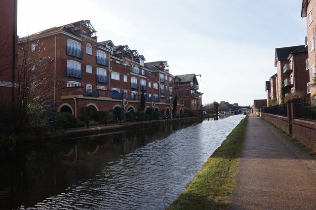
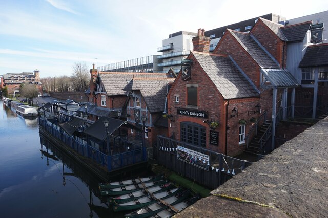
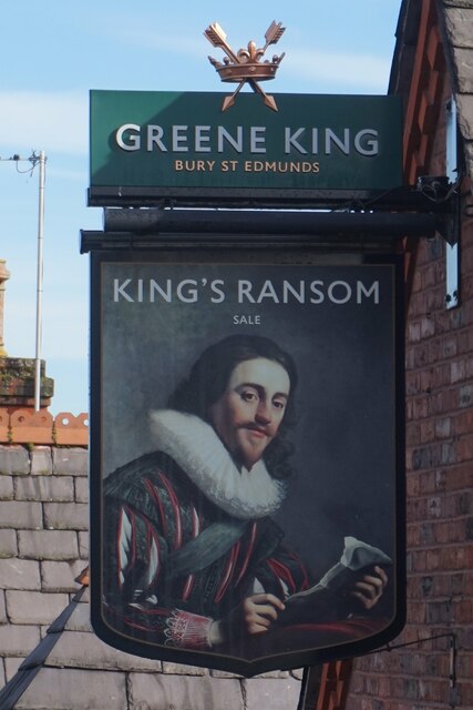
The area benefits from a range of amenities and facilities, making it an attractive place to live. There are numerous local shops, supermarkets, and restaurants, providing residents with convenient access to everyday necessities. Additionally, nearby Sale town center offers a wider range of retail options and entertainment venues.

Ashton upon Mersey is well-served by public transportation, with several bus routes connecting it to neighboring areas, including Altrincham and Manchester city center. The nearby Sale Metrolink station provides convenient access to the city's tram network, further enhancing the area's connectivity.

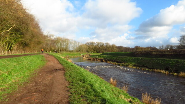
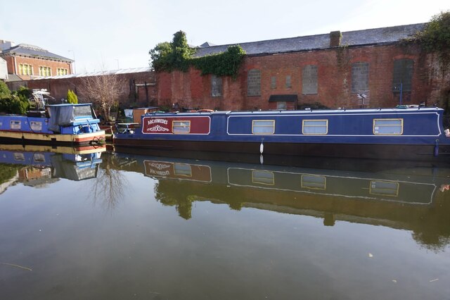
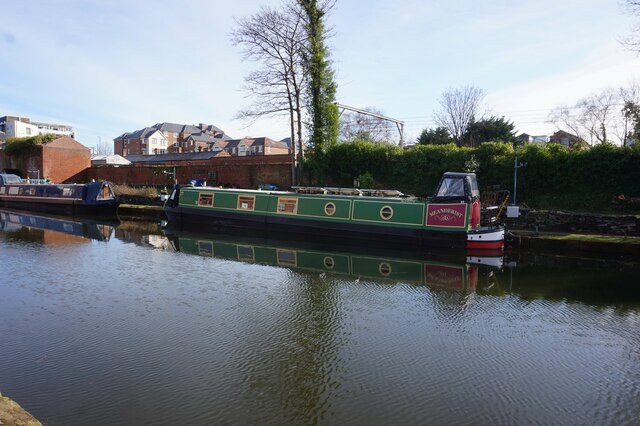
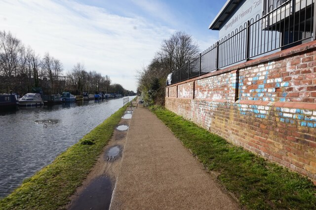
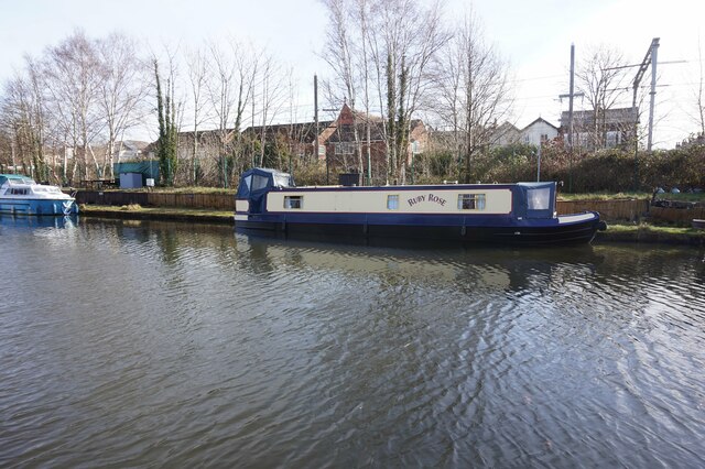
Nature enthusiasts will appreciate the green spaces in and around Ashton upon Mersey. The village is bordered by the picturesque Mersey River, which offers pleasant walking trails and opportunities for outdoor activities. The local parks, such as Ashton Park and Woodheys Park, provide ample space for recreation and relaxation.

With its historical charm, convenient amenities, and beautiful surroundings, Ashton upon Mersey offers a desirable residential location for individuals and families alike. Its proximity to Manchester city center and excellent transport links make it an ideal choice for those seeking a balance between suburban serenity and urban convenience.

If you have any feedback on the listing, please let us know in the comments section below.

Ashton Upon Mersey Images

Images are sourced within 2km of 53.425365/-2.344891 or Grid Reference SJ7792. Thanks to Geograph Open Source API. All images are credited.

Trans Pennine Trail & R Mersey near New Croft Farm, Stretford
Bridgewater Canal towards Sale Bridge
Canal boat Helsinki, Bridgewater Canal
Building on Tatton Place, Sale
The King's Ransom public house, Sale
Bridgewater Canal from Sale Bridge
Steamhouse on Northenden Road, Sale
The J P Joule public house, Sale
Sale Town Hall, School Road, Sale
Bridgewater Canal at Sale Bridge
Canal boat Archimedes, Bridgewater Canal
Canal boat Meanderist, Bridgewater Canal
Bridgewater Canal towards Marsland Bridge
Canal boat Ruby Rose, Bridgewater Canal
Show me another place!

Ashton Upon Mersey is located at Grid Ref: SJ7792 (Lat: 53.425365, Lng: -2.344891)

Unitary Authority: Trafford

Police Authority: Greater Manchester

What 3 Words

///twins.like.sample. Near Sale, Manchester

Nearby Locations

Ashton Upon Mersey

Related Wikis

Manor Academy

Manor Academy (formerly Manor High School) is a mixed secondary school for students with special needs. It is located in Sale and serves the whole borough...

Ashton-on-Mersey School

Ashton-on-Mersey School is a secondary school in Ashton upon Mersey, Greater Manchester, England. The school is an academy, part of The Dean Trust which...

St Martin's Church, Ashton upon Mersey

St Martin's Church is in Church Lane, Ashton upon Mersey, a district of Sale, Greater Manchester, England. It is recorded in the National Heritage List...

Ashton upon Mersey

Ashton upon Mersey is an area of the Metropolitan Borough of Trafford, Greater Manchester, England, with a population of 9,693 at the 2011 census. It lies...

Nearby Amenities

Located within 500m of 53.425365,-2.344891
Mini Roundabout
Direction: clockwise
Lat/Long: 53.4275604/-2.3440792
Traffic Calming: table
Lat/Long: 53.4244713/-2.3502247
Traffic Calming: table
Lat/Long: 53.4241669/-2.3508116
Turning Circle
Lat/Long: 53.4242775/-2.3486281
Turning Circle
Lat/Long: 53.4231725/-2.3469176
Give Way
Direction: forward
Lat/Long: 53.4298361/-2.3441033
Pharmacy
Hollowood Chemists
Healthcare: pharmacy
Website: https://hollowoodchemists.com/sale-pharmacy
Lat/Long: 53.4294972/-2.34217
Co-op Food
Addr City: Sale
Addr Housenumber: 12-16
Addr Postcode: M33 5PP
Addr Street: Green Lane
Brand: Co-op Food
Brand Wikidata: Q3277439
Operator: The Co-operative Group
Operator Wikidata: Q117202
Shop: convenience
Website: https://www.coop.co.uk/store-finder/M33-5PP/12-16-green-lane
Wheelchair: yes
Lat/Long: 53.4293054/-2.3415998
Bus Stop
Ashton upon Mersey, Ashton Lane / opposite Church Lane
Bench: yes
Bin: yes
Bus: yes
Lit: yes
Naptan AtcoCode: 1800SJ04241
Naptan Bearing: NW
Naptan CommonName: Ashton Lane/Church Lane
Naptan Indicator: Nr House 87
Naptan Landmark: HOUSE 87
Naptan NaptanCode: manjpjtp
Naptan PlusbusZoneRef: MNCRPIC
Naptan ShortCommonName: Church Lane
Naptan Street: ASHTON LANE
Naptan Verified: no
Network: TfGM
Operator: TfGM
Public Transport: platform
Route Ref: 16;19;252;260;262;GO1
Shelter: yes
Source: naptan_import
Tactile Paving: no
Lat/Long: 53.4276665/-2.3398238
Bus Stop
Ashton upon Mersey, Carrington Lane / near Ennerdale Drive
Bus: yes
Naptan AtcoCode: 1800SJ04251
Naptan Bearing: W
Naptan CommonName: Carrington Lane/Ennerdale Drive
Naptan Indicator: Methodist Chrch
Naptan Landmark: CHURCH
Naptan NaptanCode: manjpjtw
Naptan PlusbusZoneRef: MNCRPIC
Naptan ShortCommonName: Ennerdale Drive
Naptan Street: CARRINGTON LANE
Naptan Verified: no
Network: TfGM
Operator: TfGM
Public Transport: platform
Route Ref: 16;19;252;260;262;GO1
Source: naptan_import
Lat/Long: 53.4278619/-2.3432913
Bus Stop
Firs Road/Okehampton Crescent
Bench: no
Bin: no
Bus: yes
Lit: yes
Naptan AtcoCode: 1800SJ04271
Naptan Bearing: SW
Naptan CommonName: Firs Road/Okehampton Crescent
Naptan Indicator: O/s House 73
Naptan Landmark: HOUSE 73
Naptan NaptanCode: manjpjwa
Naptan PlusbusZoneRef: MNCRPIC
Naptan ShortCommonName: Okehampton Cres
Naptan Street: FIRS ROAD
Naptan Verified: no
Network: TfGM
Public Transport: platform
Route Ref: School Buses Only
Shelter: no
Source: naptan_import
Tactile Paving: no
Lat/Long: 53.425561/-2.3480002
Bus Stop
Firs Road/Sidmouth Road
Bench: no
Bin: no
Bus: yes
Lit: yes
Naptan AtcoCode: 1800SJ04281
Naptan Bearing: SW
Naptan CommonName: Firs Road/Sidmouth Road
Naptan Indicator: School
Naptan Landmark: SCHOOL
Naptan NaptanCode: manjpjwd
Naptan PlusbusZoneRef: MNCRPIC
Naptan ShortCommonName: Sidmouth Road
Naptan Street: FIRS ROAD
Naptan Verified: no
Network: TfGM
Note: no route references shown 17/10/10
Public Transport: platform
Shelter: no
Source: naptan_import
Tactile Paving: no
Lat/Long: 53.4241371/-2.3507033
Bus Stop
Sale, Firs Road / near Sidmouth Road
Bench: no
Bin: no
Bus: yes
Lit: no
Naptan AtcoCode: 1800SJ04291
Naptan Bearing: NE
Naptan CommonName: Firs Road/Sidmouth Road
Naptan Indicator: O/s House 94
Naptan Landmark: HOUSE 94
Naptan NaptanCode: manjpjwg
Naptan PlusbusZoneRef: MNCRPIC
Naptan ShortCommonName: Sidmouth Road
Naptan Street: FIRS ROAD
Naptan Verified: no
Network: TfGM
Operator: TfGM
Public Transport: platform
Route Ref: 262
Shelter: no
Source: naptan_import
Tactile Paving: no
Lat/Long: 53.4244327/-2.3504144
Bus Stop
Sale, Firs Road / near Okehampton Crescent
Bench: no
Bin: no
Bus: yes
Lit: no
Naptan AtcoCode: 1800SJ04301
Naptan Bearing: NE
Naptan CommonName: Firs Road/Okehampton Crescent
Naptan Indicator: O/s House 46
Naptan Landmark: HOUSE 46
Naptan NaptanCode: manjpjwj
Naptan PlusbusZoneRef: MNCRPIC
Naptan ShortCommonName: Okehampton Cres
Naptan Street: FIRS ROAD
Naptan Verified: no
Network: TfGM
Operator: TfGM
Public Transport: platform
Route Ref: 262
Shelter: no
Source: naptan_import
Tactile Paving: no
Lat/Long: 53.4259734/-2.3474559
Bus Stop
Ashton upon Mersey, Carrington Lane / opposite Buck Lane
Bus: yes
Naptan AtcoCode: 1800SJ04311
Naptan Bearing: W
Naptan CommonName: Carrington Lane/Buck Lane
Naptan Indicator: Nr House 49
Naptan Landmark: HOUSE 49
Naptan NaptanCode: manjpjwm
Naptan PlusbusZoneRef: MNCRPIC
Naptan ShortCommonName: Buck Lane
Naptan Street: CARRINGTON LANE
Naptan Verified: no
Network: TfGM
Operator: TfGM
Public Transport: platform
Source: naptan_import
Lat/Long: 53.4291859/-2.3455144
Bus Stop
Ashton upon Mersey, Carrington Lane / near Buck Lane
Bus: yes
Naptan AtcoCode: 1800SJ04341
Naptan Bearing: E
Naptan CommonName: Carrington Lane/Buck Lane
Naptan Indicator: O/s House 56b
Naptan Landmark: HOUSE 56B
Naptan NaptanCode: manjpmad
Naptan PlusbusZoneRef: MNCRPIC
Naptan ShortCommonName: Buck Lane
Naptan Street: CARRINGTON LANE
Naptan Verified: no
Network: TfGM
Operator: TfGM
Public Transport: platform
Route Ref: 16;19;252;260
Source: naptan_import
Lat/Long: 53.428973/-2.3446907
Bus Stop
Ashton upon Mersey, Ashton Lane / near Church Lane
Bench: yes
Bin: yes
Bus: yes
Lit: yes
Naptan AtcoCode: 1800SJ04351
Naptan Bearing: SE
Naptan CommonName: Ashton Lane/Church Lane
Naptan Indicator: O/s House 148
Naptan Landmark: HOUSE 148
Naptan NaptanCode: manjpmag
Naptan Notes: INDICATOR AMENDED
Naptan PlusbusZoneRef: MNCRPIC
Naptan ShortCommonName: Church Lane
Naptan Street: ASHTON LANE
Naptan Verified: no
Network: TfGM
Operator: TfGM
Public Transport: platform
Route Ref: 16;19;252;260;262;GO1
Shelter: yes
Source: naptan_import
Tactile Paving: no
Lat/Long: 53.4280689/-2.3400572
Bus Stop
Ashton upon Mersey, Firs Road / at Harboro Road
Bus: yes
Naptan AtcoCode: 1800SJ05861
Naptan Bearing: E
Naptan CommonName: Firs Road/Harboro Road
Naptan Indicator: Sub-station
Naptan Landmark: SUB-STATION
Naptan NaptanCode: manjpmjt
Naptan PlusbusZoneRef: MNCRPIC
Naptan ShortCommonName: Harboro Road
Naptan Street: FIRS ROAD
Naptan Verified: no
Network: TfGM
Operator: TfGM
Public Transport: platform
Route Ref: 262
Source: naptan_import
Lat/Long: 53.4277986/-2.3437591
Firs Road/Dawlish Road
Bench: no
Bus: yes
Disused: yes
Disused Highway: bus_stop
Lit: no
Naptan AtcoCode: 1800SJ12391
Naptan Bearing: SW
Naptan CommonName: Firs Road/Dawlish Road
Naptan Indicator: Park
Naptan Landmark: PARK
Naptan NaptanCode: manjtapg
Naptan Notes: INDICATOR AMENDED
Naptan PlusbusZoneRef: MNCRPIC
Naptan ShortCommonName: Dawlish Road
Naptan Street: FIRS ROAD
Naptan Verified: no
Network: TfGM
Note: flag says "not in service"
Public Transport: platform
Route Ref: School Buses Only
Shelter: no
Source: naptan_import
Tactile Paving: no
Lat/Long: 53.4269064/-2.3455317
Traffic Calming: hump
Lat/Long: 53.4249659/-2.3519239
Traffic Calming: hump
Lat/Long: 53.4287736/-2.3469223
Traffic Calming: hump
Lat/Long: 53.4270713/-2.348954
Traffic Calming: hump
Lat/Long: 53.4274657/-2.3453186
Turning Circle
Lat/Long: 53.4225899/-2.3443127
Barrier: height_restrictor
Maxheight: below_default
Lat/Long: 53.4269732/-2.3453344
Barrier: kissing_gate
Lat/Long: 53.4266627/-2.3440068
Barrier: cycle_barrier
Cycle Barrier: tilted
Lat/Long: 53.4267349/-2.3450497
Post Box
Collection Times: Mo-Fr 07:00; Sa 09:00
Ref: M33 326
Royal Cypher: GVIR
Lat/Long: 53.4262711/-2.3466718
Power: substation
Ref: 171779
Lat/Long: 53.4265566/-2.3509655
Post Box
Ref: M33 290
Lat/Long: 53.4268236/-2.3519011
Hall
3rd Ashton Scout Group
Club: scout
Website: https://3rdashton.com/
Lat/Long: 53.4280575/-2.3506673
Fast Food
Wing Hing
Cuisine: chinese
Phone: +44 161 962 3364
Lat/Long: 53.427049/-2.3514924
Disused Shop: convenience
Old Name: McColl's
Lat/Long: 53.4268584/-2.3518766
Revive
Addr Housenumber: 18
Addr Postcode: M33 5JD
Addr Street: Plymouth Road
Phone: +44 161 973 8789
Shop: hairdresser
Website: https://www.revivehairstudio.co.uk/
Lat/Long: 53.4270524/-2.3516013
Pharmacy
Rowlands Pharmacy
Addr Housenumber: 6
Addr Street: Plymouth Road
Brand: Rowlands Pharmacy
Brand Wikidata: Q62663235
Dispensing: yes
Drive Through: no
Healthcare: pharmacy
Opening Hours: Mo-Fr 09:00-17:30, Sa 09:00-12:00
Website: https://rowlandspharmacy.co.uk/find-local-pharmacy#!/l/sale/16-plymouth-road/1369
Lat/Long: 53.4270559/-2.3517102
Fast Food
Freddy's Kitchen
Addr Housenumber: 22
Addr Street: Plymouth Road
Phone: +44 161 611 0000
Lat/Long: 53.4270455/-2.3513836
Disused Amenity: post_office
Old Name: Sidmouth Road Post Office
Lat/Long: 53.4268568/-2.3517991
Shop: hairdresser
Lat/Long: 53.4270571/-2.3518812
Power: substation
Lat/Long: 53.4229013/-2.3493439
Telephone
Booth: KX100
Check Date: 2023-09-15
Covered: booth
Phone: +44 161 962 5810
Postal Code: M33 5JD
Lat/Long: 53.4271956/-2.3513371
Man Made: surveillance
Surveillance: outdoor
Lat/Long: 53.4265988/-2.3520488
Kindergarten
Chestnuts Day Nursery
Phone: +44 161 973 1403
Lat/Long: 53.4226413/-2.3393168
Post Box
Ref: M33 327
Lat/Long: 53.4225722/-2.3406522
Recycling
Lat/Long: 53.4286768/-2.3418415
Telephone
Booth: KX100
Covered: booth
Phone: +44 161 905 3534
Postal Code: M33 5PN
Lat/Long: 53.4295135/-2.3420371
Power: substation
Ref: 171544
Lat/Long: 53.4242863/-2.3377468
Foster Care
Lorimer Foster Services
Description: https://www.lorimerfostering.com/
Lat/Long: 53.4285029/-2.3417741
Power: substation
Ref: 171051
Lat/Long: 53.4272529/-2.338624
Beauty in Elysium
Addr Housename: Merseybank House
Addr Street: Greenbank Road
Contact Facebook: https://www.facebook.com/beautyinelysium/
Shop: beauty
Lat/Long: 53.4289883/-2.3420245
The loft
Addr Housenumber: 9
Addr Street: Green Lane
Shop: gift
Lat/Long: 53.4291837/-2.3419134
Give Way
Direction: backward
Lat/Long: 53.4290542/-2.3415259
Bench
Backrest: yes
Lat/Long: 53.4261428/-2.3443478
Barrier: kissing_gate
Lat/Long: 53.4244026/-2.3432221
Car Wash
Village Car Wash
Automated: no
Self Service: no
Lat/Long: 53.4290757/-2.3411772
Compressed Air
Lat/Long: 53.4288542/-2.3411079
Give Way
Direction: forward
Lat/Long: 53.4290357/-2.3416716
Crossing
Crossing: unmarked
Lat/Long: 53.4290317/-2.341683
Crossing
Crossing: unmarked
Lat/Long: 53.4285254/-2.3410243
Crossing
Crossing: unmarked
Lat/Long: 53.4290601/-2.3415054
Give Way
Direction: forward
Lat/Long: 53.4285389/-2.3409731
Bus Stop
Sale, SW-bound Moss Lane
Bus: yes
Network: TfGM
Operator: TfGM
Public Transport: platform
Lat/Long: 53.4245166/-2.337539
Bus Stop
Sale, NE-bound Moss Lane
Bus: yes
Network: TfGM
Operator: TfGM
Public Transport: platform
Lat/Long: 53.4245772/-2.3377563
Childcare
Invitation 2 Play
Website: https://www.invitation2play.com/
Lat/Long: 53.4277397/-2.3429483
Traffic Calming: hump
Lat/Long: 53.4243116/-2.3510134
Traffic Calming: hump
Lat/Long: 53.4246389/-2.3514699
Traffic Calming: hump
Lat/Long: 53.4248152/-2.3514468
Traffic Calming: hump
Lat/Long: 53.4251117/-2.3508705
Traffic Calming: hump
Lat/Long: 53.4254454/-2.3502221
Traffic Calming: hump
Lat/Long: 53.4260236/-2.3519496
Traffic Calming: hump
Lat/Long: 53.4264432/-2.3516993
Traffic Calming: hump
Lat/Long: 53.4264235/-2.3510522
Traffic Calming: hump
Lat/Long: 53.4264356/-2.3497655
Traffic Calming: hump
Lat/Long: 53.4267183/-2.3493717
Traffic Calming: hump
Lat/Long: 53.4267735/-2.3480501
Traffic Calming: hump
Lat/Long: 53.4262639/-2.3473312
Traffic Calming: hump
Lat/Long: 53.4261271/-2.3488564
Traffic Calming: hump
Lat/Long: 53.4257469/-2.3482688
Traffic Calming: hump
Lat/Long: 53.4279221/-2.3494876
Traffic Calming: hump
Lat/Long: 53.4284689/-2.3497469
Traffic Calming: hump
Lat/Long: 53.4278018/-2.3493194
Traffic Calming: hump
Lat/Long: 53.4277637/-2.3478768
Traffic Calming: hump
Lat/Long: 53.4277825/-2.3486079
Traffic Calming: hump
Lat/Long: 53.4277789/-2.3470614
Traffic Calming: hump
Lat/Long: 53.4281054/-2.3469623
Traffic Calming: hump
Lat/Long: 53.4292992/-2.3470465
Traffic Calming: hump
Lat/Long: 53.4273417/-2.3464221
Traffic Calming: cushion
Lat/Long: 53.4266176/-2.3460795
Traffic Calming: cushion
Lat/Long: 53.4274283/-2.3446444
Traffic Calming: cushion
Lat/Long: 53.4279819/-2.3454604
Traffic Calming: cushion
Lat/Long: 53.4285394/-2.3456135
Traffic Calming: cushion
Lat/Long: 53.429154/-2.3457773
Clock
Date: no
Display: analog
Faces: 3
Inscription: This tower and clock were erected by Ellen Daine in affection of her father Peter Daine Esquire of Moorfield, Ashton-Upon-Mersey and of her mother and three sisters Elizabeth, Mary and Jane 9th June 1877
Start Date: 1877-06-09
Support: tower
Visibility: area
Lat/Long: 53.4289005/-2.3415202
Shop: variety_store
Lat/Long: 53.4291981/-2.3415347
Fast Food
Seaway
Cuisine: fish_and_chips
Lat/Long: 53.4293899/-2.3416763
Sayers
Shop: bakery
Lat/Long: 53.4294436/-2.3417139
Atm
Lat/Long: 53.4292702/-2.3416535
Restaurant
néel panéer
Cuisine: indian
Old Name: Princess of Hearts
Website: https://neelpaneer.co.uk/
Lat/Long: 53.4292885/-2.3419928
Restaurant
Green Pepper
Cuisine: indian
Website: https://greenpepperrestaurant.co.uk/green-pepper-sale
Lat/Long: 53.4292256/-2.3419452
Shelley K
Clothes: women
Shop: clothes
Website: https://www.shelleyk.co.uk/
Lat/Long: 53.4290718/-2.3418286
Steele Hair Company
Addr Housenumber: 5
Addr Street: Green Lane
Contact Facebook: https://www.facebook.com/thesteelehaircompany
Shop: hairdresser
Lat/Long: 53.4291104/-2.3418579
Cafe
Orchard Cafe
Addr Housenumber: 7
Addr Street: Green Lane
Lat/Long: 53.4291478/-2.3418862
Defibrillator
Defibrillator Location: outside pharmacy, Green Lane, Ashton
Emergency: defibrillator
Indoor: no
Lat/Long: 53.4294977/-2.3421296
Stop
Direction: forward
Lat/Long: 53.4266244/-2.3377827
Grit Bin
Lat/Long: 53.4291419/-2.3413707
Childcare
4 Cheeky Monkeys
Addr Housenumber: 1A
Addr Postcode: M33 5FQ
Addr Street: Dawlish Road
Phone: +447952 590940
Website: https://4cheekymonkeys.co.uk/
Lat/Long: 53.4272767/-2.3476992
Traffic Calming: hump
Lat/Long: 53.4262375/-2.3503802
Traffic Calming: hump
Lat/Long: 53.4258553/-2.3500781
Doctors
The Professional Clinic
Healthcare: doctor
Healthcare Speciality: plastic_surgery
Lat/Long: 53.4270605/-2.3518233
Playground: slide
Lat/Long: 53.4262854/-2.3440259
Baby: yes
Capacity: 3
Playground: swing
Lat/Long: 53.4262175/-2.3440487
Playground: seesaw
Lat/Long: 53.4261871/-2.3441493
Playground: roundabout
Lat/Long: 53.4261088/-2.3443009
Crossing
Crossing: unmarked
Crossing Island: no
Crossing Markings: no
Tactile Paving: yes
Lat/Long: 53.4277958/-2.3441523
David Arnold
Addr Housenumber: 17
Addr Postcode: M33 5PN
Addr Street: Green Lane
Phone: +44 161 973 3674
Shop: optician
Website: https://www.david-arnold.co.uk/
Lat/Long: 53.4293428/-2.342034
Parking Space
Capacity: 1
Parking Space: disabled
Lat/Long: 53.4288373/-2.341976
Restaurant
Sorento
Addr Housenumber: 19
Addr Postcode: M33 5PN
Addr Street: Green Lane
Cuisine: pizza
Opening Hours: Su-Th 16:00-22:40; Fr-Sa 16:00-23:40
Phone: +44 161 973 3674
Website: https://www.sorentopizzeria.co.uk/
Lat/Long: 53.4293722/-2.3420563
Bench
Backrest: yes
Material: wood
Lat/Long: 53.4293445/-2.3419814
Camera Mount: pole
Camera Type: dome
Man Made: surveillance
Surveillance: outdoor
Surveillance Type: camera
Lat/Long: 53.4294604/-2.3420062
Plan A
Addr Housename: Merseybank House
Addr Postcode: M33 5PL
Addr Street: Greenbank Road
Old Name: PMQ
Shop: clothes
Website: https://www.plana.sale/
Lat/Long: 53.4289749/-2.3420681
Crossing
Crossing: uncontrolled
Crossing Island: yes
Crossing Markings: yes
Tactile Paving: yes
Lat/Long: 53.4231249/-2.3398789
Disused Playground: basketswing
Lat/Long: 53.4261197/-2.3447289
Playground: climbingframe
Lat/Long: 53.4262243/-2.3445637
Playground: balancebeam
Lat/Long: 53.4264121/-2.3448091
Playground: balance
Lat/Long: 53.4264153/-2.3445945
Playground: horizontal_bar
Lat/Long: 53.4263961/-2.3450009
Bicycle Parking
Bicycle Parking: stands
Capacity: 6
Covered: no
Lat/Long: 53.427167/-2.3517941
Traffic Calming: hump
Lat/Long: 53.4272358/-2.3508519
Waste Basket
Colour: black
Lat/Long: 53.4277725/-2.3473327
The data included in this document is from www.openstreetmap.org. The data is made available under ODbL.

Have you been to Ashton Upon Mersey?

Leave your review of Ashton Upon Mersey below (or comments, questions and feedback).