Little Hill

Hill, Mountain in Gloucestershire Wychavon

England

Little Hill

Bredon Hill crest path, 13 Gradual descent south-east towards Ashton.
The distinctive outline of Dumbleton/Alderton Hill can be seen clearly as well as the Cotswold crest beyond.
This picture represents the completion of Hectad SO93 by the photographer, ie. a Geograph in every one of the 100 squares.
Bredon Hill crest path, 13 Credit: Jonathan Billinger

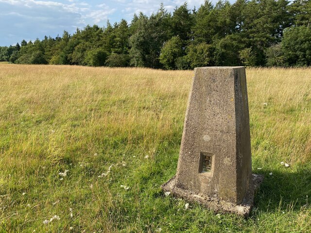
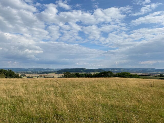
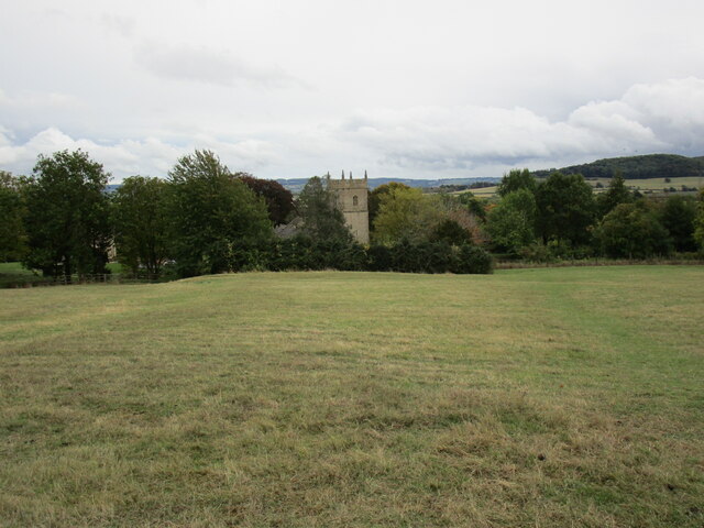
Little Hill is a prominent hill located in the county of Gloucestershire, England. Situated in the southern part of the county, this geographical feature is classified as a hill rather than a mountain due to its relatively modest elevation. Little Hill reaches a height of approximately 180 meters (590 feet) above sea level, offering picturesque views of the surrounding countryside.

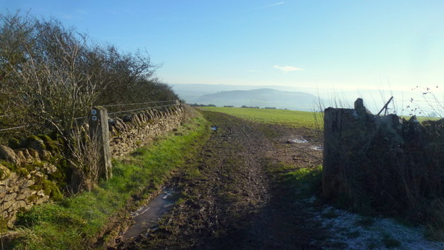
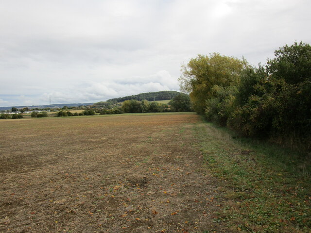
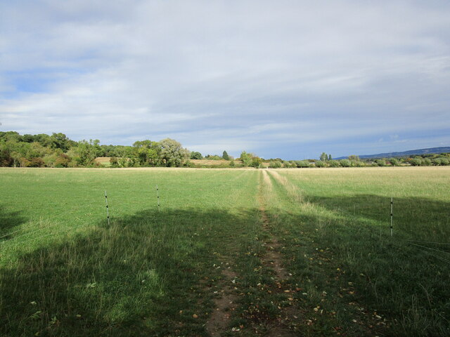
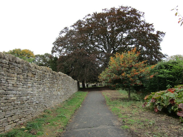
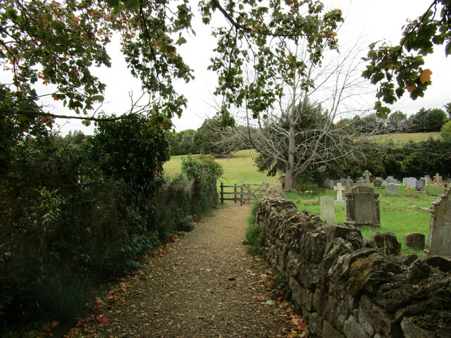
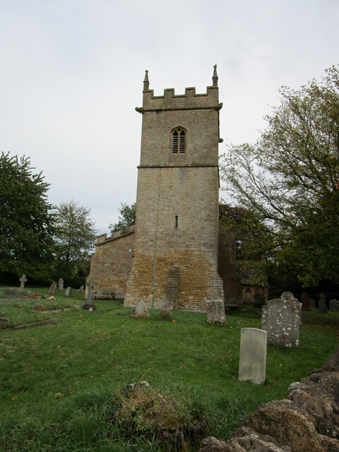
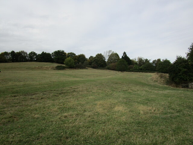
Covered in lush greenery, Little Hill is part of the Cotswolds Area of Outstanding Natural Beauty, a designation that recognizes its exceptional scenic value. The hill is predominantly composed of limestone, a characteristic feature of the Cotswolds region. The limestone formations contribute to the unique landscape, creating picturesque valleys and rolling hillsides that are a delight for hikers, nature enthusiasts, and photographers.

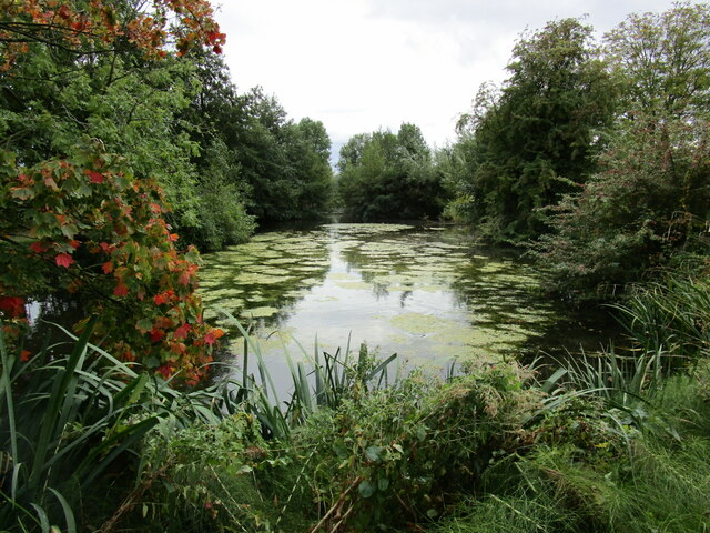
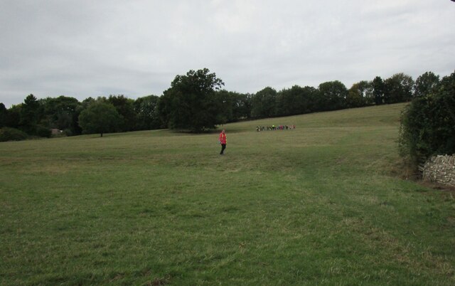
Little Hill is home to a variety of plant and animal species, including wildflowers, grasses, and small mammals. The diverse flora and fauna found on the hill make it an important ecological area, contributing to the overall biodiversity of Gloucestershire.

Accessible by footpaths and bridleways, Little Hill attracts outdoor enthusiasts who enjoy walking, hiking, and horseback riding. The hill offers a range of trails, suitable for both beginners and experienced adventurers. Many visitors are drawn to the peaceful and tranquil atmosphere that accompanies a visit to Little Hill, making it a popular destination for those seeking a break from the bustling city life.

Overall, Little Hill in Gloucestershire is a natural gem that showcases the beauty of the Cotswolds region. Its stunning views, diverse wildlife, and recreational opportunities make it a cherished destination for locals and tourists alike.

If you have any feedback on the listing, please let us know in the comments section below.

Little Hill Images

Images are sourced within 2km of 52.041361/-2.013236 or Grid Reference SO9938. Thanks to Geograph Open Source API. All images are credited.

Bredon Hill crest path, 13 Gradual descent south-east towards Ashton.
The distinctive outline of Dumbleton/Alderton Hill can be seen clearly as well as the Cotswold crest beyond.
This picture represents the completion of Hectad SO93 by the photographer, ie. a Geograph in every one of the 100 squares.
Bredon Hill crest path, 13
Gradual descent south-east towards Ashton. The distinctive outline of Dumbleton/Alderton Hill can be seen clearly as well as the Cotswold crest beyond. This picture represents the completion of Hectad SO93 by the photographer, ie. a Geograph in every one of the 100 squares.
Holcomb Nap Trig Point Flush Bracket S3790
View from Holcomb Nap Trig Point Flush Bracket S3790
Cross Cottage, Ashton under Hill Dates from the seventeenth century <span class="nowrap"><a title="https://historicengland.org.uk/listing/the-list/list-entry/1349961?section=official-list-entry" rel="nofollow ugc noopener" href="https://historicengland.org.uk/listing/the-list/list-entry/1349961?section=official-list-entry">Link</a><img style="margin-left:2px;" alt="External link" title="External link - shift click to open in new window" src="https://s1.geograph.org.uk/img/external.png" width="10" height="10"/></span>
Cross Cottage, Ashton under Hill
Dates from the seventeenth century LinkExternal link
Field edge near Ashton under Hill Looking towards Dumbleton Hill.
Field edge near Ashton under Hill
Looking towards Dumbleton Hill.
Footpath to Ashton under Hill
Harrowed field near Grafton
Village cross, Ashton under Hill Dates from the fifteenth century <span class="nowrap"><a title="https://historicengland.org.uk/listing/the-list/list-entry/1167161?section=official-list-entry" rel="nofollow ugc noopener" href="https://historicengland.org.uk/listing/the-list/list-entry/1167161?section=official-list-entry">Link</a><img style="margin-left:2px;" alt="External link" title="External link - shift click to open in new window" src="https://s1.geograph.org.uk/img/external.png" width="10" height="10"/></span>
Village cross, Ashton under Hill
Dates from the fifteenth century LinkExternal link
Walnut Thatch, Ashton under Hill Dates from the sixteenth century <span class="nowrap"><a title="https://historicengland.org.uk/listing/the-list/list-entry/1349960?section=official-list-entry" rel="nofollow ugc noopener" href="https://historicengland.org.uk/listing/the-list/list-entry/1349960?section=official-list-entry">Link</a><img style="margin-left:2px;" alt="External link" title="External link - shift click to open in new window" src="https://s1.geograph.org.uk/img/external.png" width="10" height="10"/></span>
Walnut Thatch, Ashton under Hill
Dates from the sixteenth century LinkExternal link
Footpath to the church, Ashton under Hill
St Barbara's church, Ashton under Hill Has twelfth century origins though most of what is visible in this picture dates from the early sixteenth and seventeenth centuries <span class="nowrap"><a title="https://historicengland.org.uk/listing/the-list/list-entry/1081663?section=official-list-entry" rel="nofollow ugc noopener" href="https://historicengland.org.uk/listing/the-list/list-entry/1081663?section=official-list-entry">Link</a><img style="margin-left:2px;" alt="External link" title="External link - shift click to open in new window" src="https://s1.geograph.org.uk/img/external.png" width="10" height="10"/></span>
St Barbara's church, Ashton under Hill
Has twelfth century origins though most of what is visible in this picture dates from the early sixteenth and seventeenth centuries LinkExternal link
Footpath alongside the churchyard, Ashton under Hill
Reservoir at Ashton under Hill
St Barbara's church, Ashton under Hill The west tower dates from the thirteenth century with an upper stage of about 1500 <span class="nowrap"><a title="https://historicengland.org.uk/listing/the-list/list-entry/1081663?section=official-list-entry" rel="nofollow ugc noopener" href="https://historicengland.org.uk/listing/the-list/list-entry/1081663?section=official-list-entry">Link</a><img style="margin-left:2px;" alt="External link" title="External link - shift click to open in new window" src="https://s1.geograph.org.uk/img/external.png" width="10" height="10"/></span>
St Barbara's church, Ashton under Hill
The west tower dates from the thirteenth century with an upper stage of about 1500 LinkExternal link
View over Ashton under Hill St Barbara's church in the centre of the picture.
View over Ashton under Hill
St Barbara's church in the centre of the picture.
Here they come! Children from Ashton under Hill First School about to race down the hill above the church. Some made spectacular dives and are clearly training to be professional footballers!
Here they come!
Children from Ashton under Hill First School about to race down the hill above the church. Some made spectacular dives and are clearly training to be professional footballers!
Grass field, Ashton under Hill
Middle Farmhouse, Ashton under Hill A later frontage to a seventeenth century house (visible on the left) <span class="nowrap"><a title="https://historicengland.org.uk/listing/the-list/list-entry/1081665?section=official-list-entry" rel="nofollow ugc noopener" href="https://historicengland.org.uk/listing/the-list/list-entry/1081665?section=official-list-entry">Link</a><img style="margin-left:2px;" alt="External link" title="External link - shift click to open in new window" src="https://s1.geograph.org.uk/img/external.png" width="10" height="10"/></span>
Middle Farmhouse, Ashton under Hill
A later frontage to a seventeenth century house (visible on the left) LinkExternal link
Show me another place!

Little Hill is located at Grid Ref: SO9938 (Lat: 52.041361, Lng: -2.013236)

Administrative County: Worcestershire

District: Wychavon

Police Authority: West Mercia

What 3 Words

///scouts.remotes.routs. Near Bredon, Worcestershire

Related Wikis

Ashton under Hill

Ashton under Hill is a village and civil parish in the Wychavon district of Worcestershire in England. It is situated at the foot of Bredon Hill. According...

Grafton, Worcestershire

Grafton is a hamlet in Worcestershire, England, situated between the villages of Beckford and Ashton under Hill, south-east of Bredon Hill. The name Grafton...

Ashton-under-Hill railway station

Ashton-under-Hill railway station was a station on the Midland Railway between Great Malvern and Evesham. It served Ashton under Hill in Worcestershire...

Kersoe

Kersoe is a hamlet in Worcestershire, England. It is at the foot of Bredon Hill an area of outstanding natural beauty.

Elmley Castle (castle)

Elmley Castle was a late 11th-century earthwork and timber castle which received stone additions in the 12th and possibly 13th centuries, located 0.5 miles...

Beckford Nature Reserve

Beckford Nature Reserve is near Beckford, in Worcestershire, England, situated immediately north of the village. The nature reserve was created from a...

Beckford Priory

Beckford Priory was a medieval house of Augustinian Canons, historically within Gloucestershire, presently in Worcestershire, England. It was founded in...

Beckford railway station

Beckford railway station was a station on the Midland Railway between Great Malvern and Evesham. It was designed by the architect George Hunt and opened...

Nearby Amenities

Located within 500m of 52.041361,-2.013236
Barrier: kissing_gate
Source: survey
Lat/Long: 52.0424514/-2.0180347
Barrier: stile
Lat/Long: 52.0422048/-2.0165678
Barrier: stile
Lat/Long: 52.0417079/-2.0156385
Barrier: stile
Source: survey
Lat/Long: 52.0402164/-2.0115637
Barrier: stile
Foot: yes
Lat/Long: 52.0392703/-2.0083155
Barrier: stile
Foot: yes
Lat/Long: 52.0423596/-2.0085578
Fixme: Does a public Footpaths head south-east from here?
Note: Definitive Statement and historic OS 1:25k suggest Ashton FP 17 starts here
Lat/Long: 52.0373993/-2.0109889
Bench
Source: survey
Lat/Long: 52.0391729/-2.0082329
Barrier: stile
Source: survey
Lat/Long: 52.0397549/-2.0083563
Bench
Source: survey
Lat/Long: 52.0403938/-2.0116568
Power: transformer
Transformer: distribution
Voltage Primary: 11000
Lat/Long: 52.042866/-2.0079929
Shaw Green
Power: pole
Transformer: distribution
Voltage Primary: 11000
Lat/Long: 52.0421599/-2.0119672
Location Transition: yes
Power: pole
Lat/Long: 52.0446395/-2.0116192
Power: pole
Lat/Long: 52.0453909/-2.0113228
The data included in this document is from www.openstreetmap.org. The data is made available under ODbL.

Have you been to Little Hill?

Leave your review of Little Hill below (or comments, questions and feedback).