Trap Nook Hill

Hill, Mountain in Yorkshire

England

Trap Nook Hill

The Pennine Way near Old Bess Hill
The Pennine Way near Old Bess Hill Credit: Dave Kelly

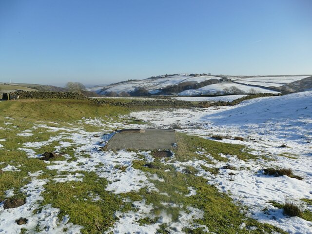
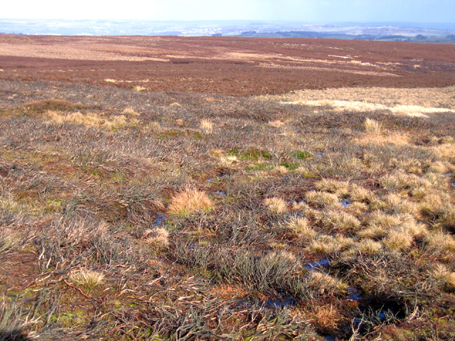
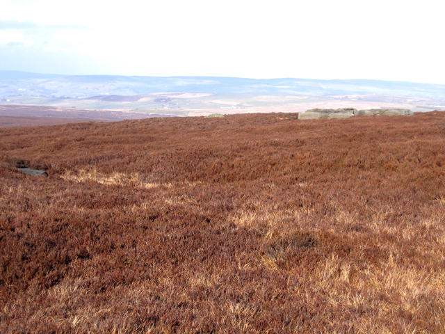
Trap Nook Hill is a prominent hill located in the Yorkshire Dales National Park, in Yorkshire, England. Situated in the northern part of the park, it stands at an elevation of approximately 450 meters (1476 feet) above sea level. This hill is a popular destination for outdoor enthusiasts, offering stunning panoramic views of the surrounding countryside.

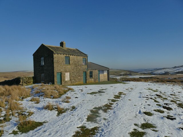
The hill gets its name from the nearby Trap Nook Farm, which lies at the base of the slope. It is known for its distinctive shape, with a gently sloping eastern side and a steeper western face. The hill is predominantly composed of limestone, which gives it a unique character and provides a habitat for a variety of flora and fauna.

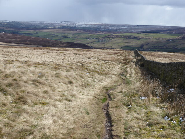
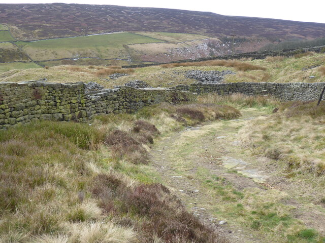
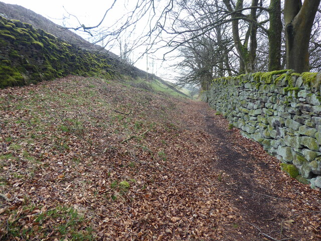
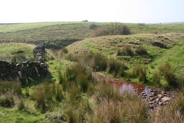
Access to Trap Nook Hill is relatively straightforward, with several footpaths leading to its summit. The most popular route starts at a nearby village and follows a well-marked trail that winds its way through picturesque meadows and past charming stone walls. The ascent is moderate, making it suitable for hikers of all abilities.

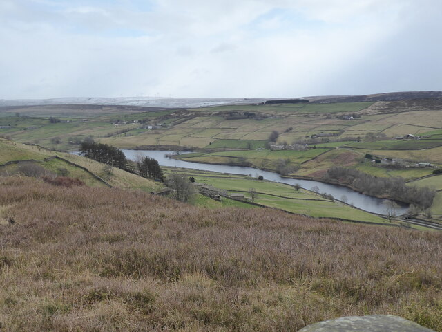
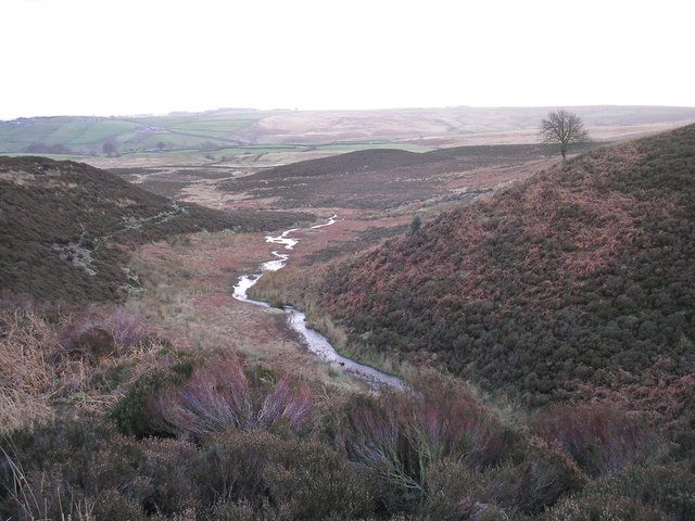
At the top of Trap Nook Hill, visitors are rewarded with breathtaking views of the surrounding landscape, including the rolling hills, quaint villages, and patchwork fields of the Yorkshire Dales. On clear days, it is even possible to see as far as the distant peaks of the Pennines and the Lake District.

Overall, Trap Nook Hill is a beautiful and accessible natural attraction, offering a peaceful retreat and a chance to appreciate the stunning scenery of Yorkshire.

If you have any feedback on the listing, please let us know in the comments section below.

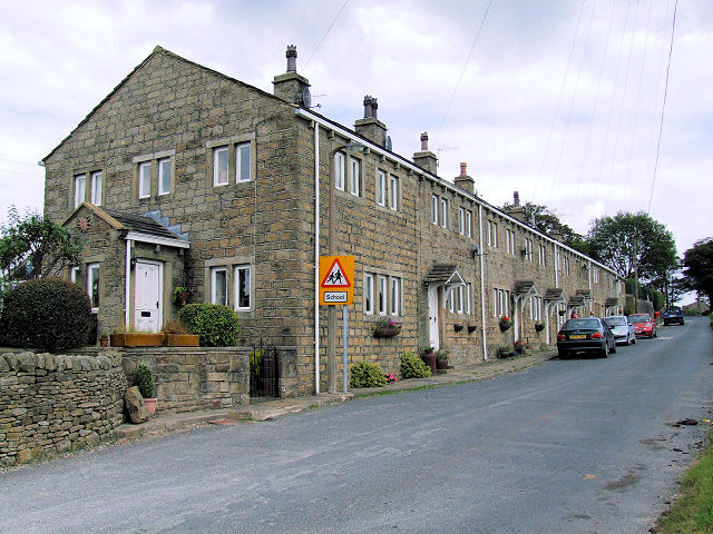
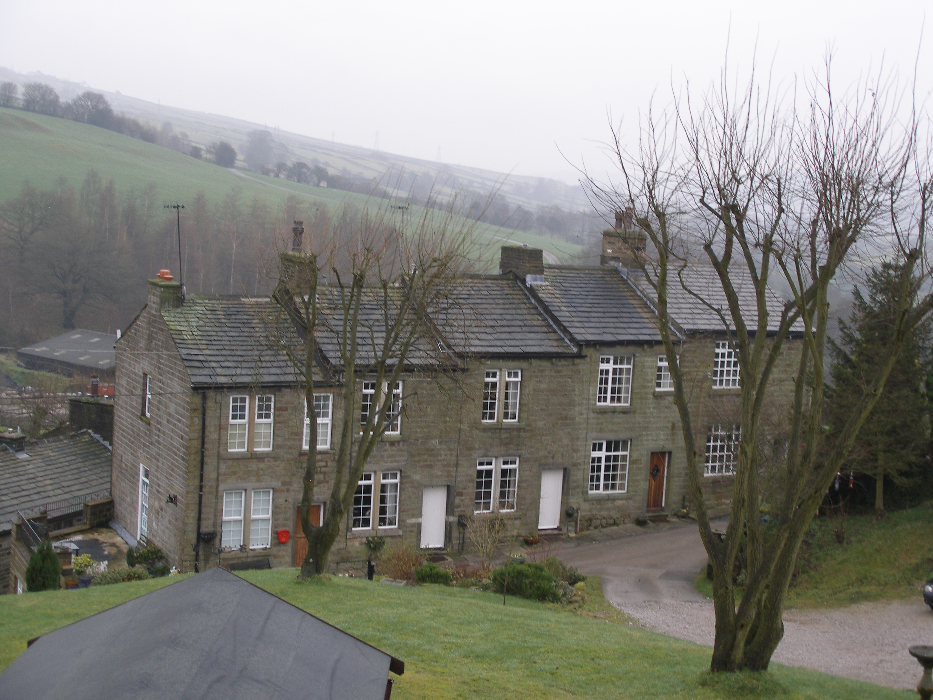
Trap Nook Hill Images

Images are sourced within 2km of 53.853566/-2.0137058 or Grid Reference SD9939. Thanks to Geograph Open Source API. All images are credited.

The Pennine Way near Old Bess Hill
The Pennine Way near Thornton Hill
View from the Pennine Way on Thornton Hill
The Pennine Way near Crag Bottom
Valve chamber on Keighley Moor I'm presuming this is a valve chamber on a water main, most likely a raw water supply from Keighley Moor Reservoir. The reservoir was originally built by the Duke of Devonshire to supply water to mills down Newsholme Dean, so the original pipeline would have headed this way. But the reservoir now supplies water into public supply via Oldfield treatment works to the south-east (source: <span class="nowrap"><a title="https://www.keighleynews.co.uk/news/18905714.memory-lane-keighley-reservoir-answer-mills-drought-threat/" rel="nofollow ugc noopener" href="https://www.keighleynews.co.uk/news/18905714.memory-lane-keighley-reservoir-answer-mills-drought-threat/">Link</a><img style="margin-left:2px;" alt="External link" title="External link - shift click to open in new window" src="https://s1.geograph.org.uk/img/external.png" width="10" height="10"/></span> ). In which case, this original pipeline may be redundant.

A note on access: there is no public footpath through this field, but as the official route along the walled track was blocked by farming activities, the farmer (or his employee) gave me permission to divert through this field to regain access to the track further along.
Valve chamber on Keighley Moor
I'm presuming this is a valve chamber on a water main, most likely a raw water supply from Keighley Moor Reservoir. The reservoir was originally built by the Duke of Devonshire to supply water to mills down Newsholme Dean, so the original pipeline would have headed this way. But the reservoir now supplies water into public supply via Oldfield treatment works to the south-east (source: LinkExternal link ). In which case, this original pipeline may be redundant. A note on access: there is no public footpath through this field, but as the official route along the walled track was blocked by farming activities, the farmer (or his employee) gave me permission to divert through this field to regain access to the track further along.
Shooting lodge above Smallden Clough See also <a href="https://www.geograph.org.uk/photo/2509812">SD9940 : Shooting Lodge on edge of Keighley Moor</a>.
Shooting lodge above Smallden Clough
Shooting butt no. 3 Presumably associated with the nearby lodge <a href="https://www.geograph.org.uk/photo/7393536">SD9940 : Shooting lodge above Smallden Clough</a>; this was the nearest of the butts to the stone track.
Shooting butt no. 3
Presumably associated with the nearby lodge SD9940 : Shooting lodge above Smallden Clough; this was the nearest of the butts to the stone track.
Cleared area at the head of a track Where a patch of heather has been cleared, it's usually just to encourage new growth that the birds can feed on. But this one is at the end of a vehicle track (beyond to the north-west is only a foot track to the grouse butts) so I presume it's been cleared as a parking area for SUVs.
Cleared area at the head of a track
Where a patch of heather has been cleared, it's usually just to encourage new growth that the birds can feed on. But this one is at the end of a vehicle track (beyond to the north-west is only a foot track to the grouse butts) so I presume it's been cleared as a parking area for SUVs.
Crystalline snow on Keighley Moor A macro photograph of snow covering a moorland track. The scale of the photo is probably about 5-10 centimetres across. I have rarely seen this form of snow, the formation of which must be related to the temperature when it fell and afterwards. See <a href="https://www.geograph.org.uk/photo/1742465">NO1585 : Large snow crystals on Sron nan Gabhar</a> for another contributor's similar photo, while the description at <a href="https://www.geograph.org.uk/photo/2188648">SY6989 : Frozen Leaf</a> explains the growth of ice crystals.
Crystalline snow on Keighley Moor
A macro photograph of snow covering a moorland track. The scale of the photo is probably about 5-10 centimetres across. I have rarely seen this form of snow, the formation of which must be related to the temperature when it fell and afterwards. See NO1585 : Large snow crystals on Sron nan Gabhar for another contributor's similar photo, while the description at SY6989 : Frozen Leaf explains the growth of ice crystals.
Grouse butt no.2 on Keighley Moor The GPS co-ordinates put this as near as makes no difference on the county boundary between West and North Yorkshire (right & left respectively).
Grouse butt no.2 on Keighley Moor
The GPS co-ordinates put this as near as makes no difference on the county boundary between West and North Yorkshire (right & left respectively).
Brown Edge, Keighley Moor, W Yorks view NE from below Maw Stones Hill, with degraded burnt heather moor in the foreground.
Brown Edge, Keighley Moor, W Yorks
view NE from below Maw Stones Hill, with degraded burnt heather moor in the foreground.
Maw Stones Hill, Keighley Moor, W Yorks view N across heather moorland from West Yorkshire into North Yorkshire, with some of the flat maw stones on the right.
Maw Stones Hill, Keighley Moor, W Yorks
view N across heather moorland from West Yorkshire into North Yorkshire, with some of the flat maw stones on the right.
Cinder Sike and dry stone walls near Oakworth, Yorkshire This photograph was taken only a couple of metres or so west of the 2 degree meridien which separates SD and SE.  The word SIKE is a Yorkshire term meaning 'streamlet'.
Cinder Sike and dry stone walls near Oakworth, Yorkshire
This photograph was taken only a couple of metres or so west of the 2 degree meridien which separates SD and SE. The word SIKE is a Yorkshire term meaning 'streamlet'.
The New Allotment Not an allotment for growing runner beans and prize marrows, but part of Keighley Moor.
The New Allotment
Not an allotment for growing runner beans and prize marrows, but part of Keighley Moor.
Fencing wire and sheep, Higher Intake Looking up to Higher Intake Rough from the track below Higher Intake Farm.
Fencing wire and sheep, Higher Intake
Looking up to Higher Intake Rough from the track below Higher Intake Farm.
The track down to Morkin Bridge The track is in good condition thanks to the water authority.
The track down to Morkin Bridge
The track is in good condition thanks to the water authority.
Where the fields meet the moor I think the building is used as a shooting hut.
Where the fields meet the moor
I think the building is used as a shooting hut.
Moorland near The New Allotment I took this because I was trying to catch some curlews, but they wouldn't come near enough. There are a couple in the centre of this shot.
Moorland near The New Allotment
I took this because I was trying to catch some curlews, but they wouldn't come near enough. There are a couple in the centre of this shot.
Show me another place!

Trap Nook Hill is located at Grid Ref: SD9939 (Lat: 53.853566, Lng: -2.0137058)

Division: West Riding

Unitary Authority: Bradford

Police Authority: West Yorkshire

What 3 Words

///confetti.telephone.snooping. Near Haworth, West Yorkshire

Related Wikis

The Hitching Stone

The Hitching Stone is a gritstone erratic block on Keighley Moor, North Yorkshire, near Earl Crag and the village of Cowling. It is very close to the...

Oldfield, West Yorkshire

Oldfield is a small hamlet within the county of West Yorkshire, England, situated north of Stanbury and near to Oakworth. It is approximately 6 miles...

Scar Top

Scar Top is a farming hamlet near the tourist village of Haworth in the City of Bradford metropolitan borough, West Yorkshire in England. It is in the...

Ponden Hall

Ponden Hall is a farmhouse near Stanbury in West Yorkshire, England. It is famous for reputedly being the inspiration for Thrushcross Grange, the home...

Ponden Reservoir

Ponden Reservoir is an artificial upland lake in the Worth Valley, near Stanbury, West Yorkshire, England. Ponden was built as a compensation reservoir...

Scholes, Bradford

Scholes is a hamlet on Oldfield Lane and Hob Cote Lane, in the City of Bradford district, in the county of West Yorkshire, England. Nearby settlements...

Watersheddles Reservoir

Watersheddles Reservoir is an upland artificial lake in Lancashire, England. The reservoir was opened in 1877 by the Keighley Corporation Water Works,...

Lumbfoot

Lumbfoot or Lumb Foot is a hamlet in the Haworth, Cross Roads and Stanbury civil parish, and the City of Bradford metropolitan district, England. It is...

Nearby Amenities

Located within 500m of 53.853566,-2.0137058
The data included in this document is from www.openstreetmap.org. The data is made available under ODbL.

Have you been to Trap Nook Hill?

Leave your review of Trap Nook Hill below (or comments, questions and feedback).