Eastfield

Settlement in Midlothian

Scotland

Eastfield

River North Esk at Valleyfield, Penicuik Looking upstream where the river bends on its way alongside the housing development at Valleyfield, a former mill site.
River North Esk at Valleyfield, Penicuik Credit: Jim Barton

Eastfield is a small residential area located in Midlothian, Scotland. Situated approximately nine miles south of the city of Edinburgh, it forms part of the larger town of Dalkeith. The area is characterized by its quiet and peaceful atmosphere, making it an ideal place for families and individuals seeking a suburban lifestyle.

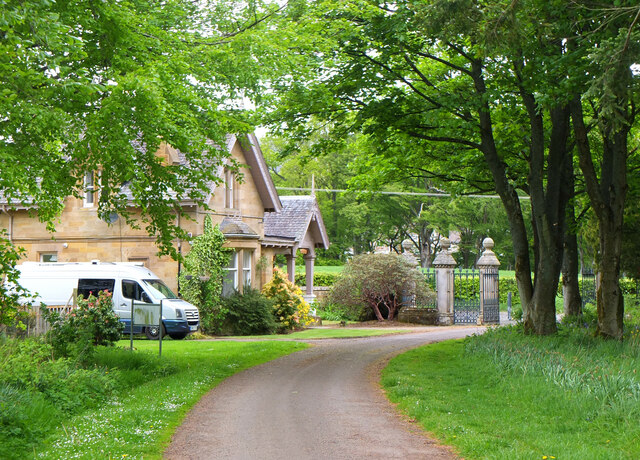
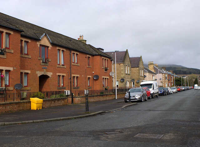
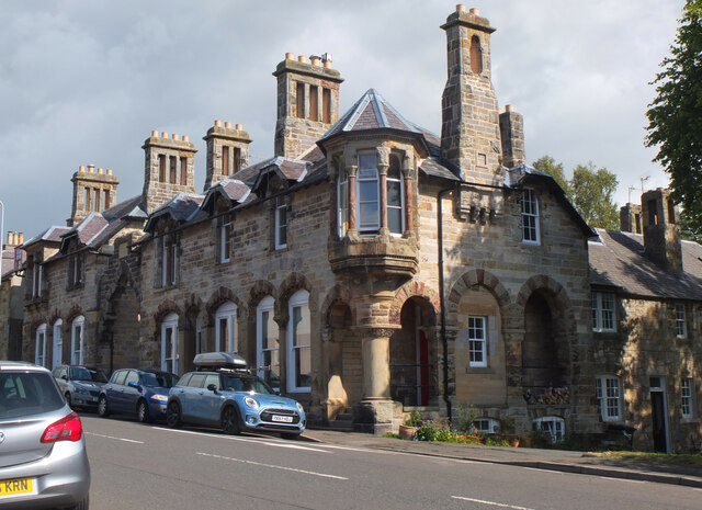
The housing in Eastfield primarily consists of detached and semi-detached houses, with well-maintained gardens and ample parking spaces. The properties range in size and style, offering a mix of traditional and modern architecture. Many of the houses in the area have been built in recent years, contributing to the overall sense of freshness and modernity.

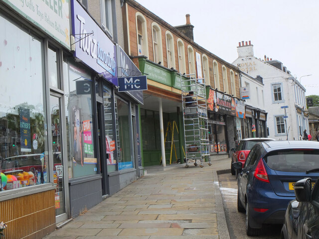
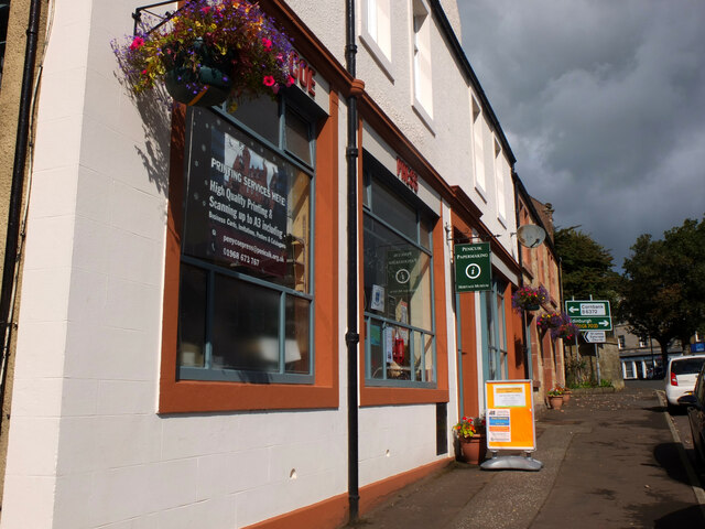
Eastfield benefits from its close proximity to a range of amenities. Within a short distance, residents can find local shops, supermarkets, and leisure facilities. The area is also well-served by public transportation, with regular bus services connecting it to nearby towns and the city center of Edinburgh.

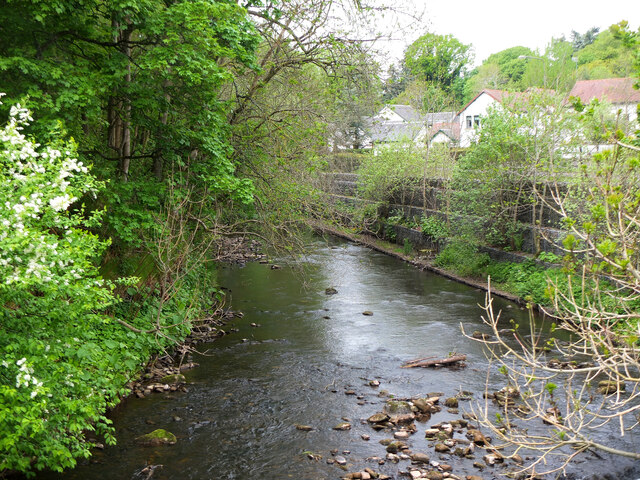
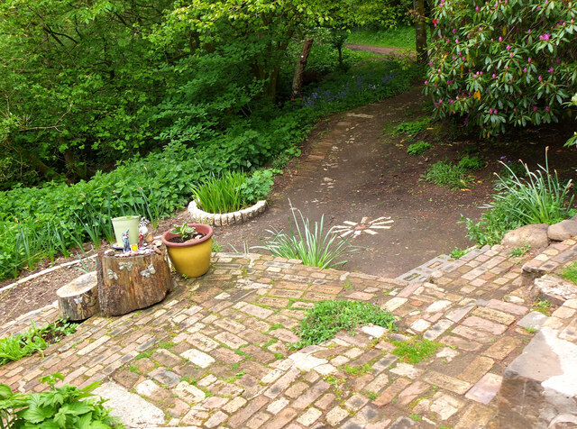
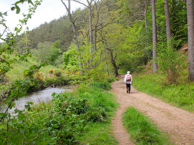
Nature enthusiasts will appreciate the abundance of green spaces surrounding Eastfield. The area is blessed with several parks and open areas, providing opportunities for outdoor activities such as walking, jogging, and picnicking. Nearby Vogrie Country Park, just a short drive away, offers even more extensive recreational opportunities, including woodland walks, a golf course, and a children's play area.

In conclusion, Eastfield is a charming residential area in Midlothian, offering a peaceful suburban lifestyle with easy access to amenities and natural beauty. Its location makes it an attractive choice for those seeking a tranquil living environment while still being well-connected to the wider region.

If you have any feedback on the listing, please let us know in the comments section below.

Eastfield Images

Images are sourced within 2km of 55.836189/-3.2168227 or Grid Reference NT2360. Thanks to Geograph Open Source API. All images are credited.

River North Esk at Valleyfield, Penicuik Looking upstream where the river bends on its way alongside the housing development at Valleyfield, a former mill site.
River North Esk at Valleyfield, Penicuik
Looking upstream where the river bends on its way alongside the housing development at Valleyfield, a former mill site.
Decorated space, path to Penicuik Estate Brick steps and plant pots on the path by the North Esk from the A701 to Penicuik Estate grounds.
Decorated space, path to Penicuik Estate
Brick steps and plant pots on the path by the North Esk from the A701 to Penicuik Estate grounds.
Path by the North Esk, Penicuik A path on the north side of the river to the surroundings of Penicuik House.
Path by the North Esk, Penicuik
A path on the north side of the river to the surroundings of Penicuik House.
Spear Gate Lodge, Penicuik Estate A lodge house where one of the estate access roads meets the A766.
Spear Gate Lodge, Penicuik Estate
A lodge house where one of the estate access roads meets the A766.
Shopfront refurbishment, Penicuik High Street The Penicuik Storehouse undergoing renovation as part of a programme to improve the appearance of shops in the town.
Shopfront refurbishment, Penicuik High Street
The Penicuik Storehouse undergoing renovation as part of a programme to improve the appearance of shops in the town.
Vaucluse Place, Penicuik A block of flats in Jackson Street.
Vaucluse Place, Penicuik
A block of flats in Jackson Street.
Pen-y-Coe Press, Penicuik A long-established stationery and printing shop with an adjoining museum of papermaking in Bridge Street. In the early 19th century Penicuik became an important centre for papermaking, with mills along the River North Esk.
Pen-y-Coe Press, Penicuik
A long-established stationery and printing shop with an adjoining museum of papermaking in Bridge Street. In the early 19th century Penicuik became an important centre for papermaking, with mills along the River North Esk.
Parkend, Penicuik A striking corner terrace by the architect Thomas Pilkington c. 1860. He also designed the nearby Penicuik South Kirk and terraced cottages in the mill village of Walkerburn - see <a href="https://www.geograph.org.uk/photo/2231809">NT3537 : Millworkers' cottages, Walkerburn</a>.
Parkend, Penicuik
A striking corner terrace by the architect Thomas Pilkington c. 1860. He also designed the nearby Penicuik South Kirk and terraced cottages in the mill village of Walkerburn - see NT3537 : Millworkers' cottages, Walkerburn.
Demolition and rebuilding, Penicuik Old premises on Bridge Street are being demolished and construction appears to be the next step. The flag is flying from the Belgian Consulate on the corner with West Street - see also <a href="https://www.geograph.org.uk/photo/3332421">NT2359 : Belgian Consulate, Penicuik</a>.
Demolition and rebuilding, Penicuik
Old premises on Bridge Street are being demolished and construction appears to be the next step. The flag is flying from the Belgian Consulate on the corner with West Street - see also NT2359 : Belgian Consulate, Penicuik.
Papermaking Museum, Penicuik The museum is next door to the Pen-y-Coe Press on Bridge Street.  It is currently open on Saturday afternoons or at other times by arrangement for groups and entry is free. See the museum's website at <span class="nowrap"><a title="https://penicuikcdt.co.uk/index.php/penicuik-papermaking-heritage-museum/" rel="nofollow ugc noopener" href="https://penicuikcdt.co.uk/index.php/penicuik-papermaking-heritage-museum/">Link</a><img style="margin-left:2px;" alt="External link" title="External link - shift click to open in new window" src="https://s1.geograph.org.uk/img/external.png" width="10" height="10"/></span>.
Papermaking Museum, Penicuik
The museum is next door to the Pen-y-Coe Press on Bridge Street. It is currently open on Saturday afternoons or at other times by arrangement for groups and entry is free. See the museum's website at LinkExternal link.
Making paper by hand (1) Visitors to the Papermaking Museum at Penicuik have a chance to help make a sheet of paper. Pulp is caught on a rectangular mesh and carefully removed and transferred to the screw press to squeeze out the excess water.
Making paper by hand (1)
Visitors to the Papermaking Museum at Penicuik have a chance to help make a sheet of paper. Pulp is caught on a rectangular mesh and carefully removed and transferred to the screw press to squeeze out the excess water.
Making paper by hand (2) The process of making a sheet of paper from pulp being demonstrated at the Papermaking Museum, Penicuik. The sheet is being separated from its carrying cloth and is ready for drying.
Making paper by hand (2)
The process of making a sheet of paper from pulp being demonstrated at the Papermaking Museum, Penicuik. The sheet is being separated from its carrying cloth and is ready for drying.
Printing press demonstration A small press being demonstrated at the Papermaking Museum, Penicuik. The gear wheel carries the makers name 'Josiah Wade Ltd Halifax Eng.' It can be powered by a belt drive or, as here, by the treadle. Cases carrying the type letters can be seen to the right.
Printing press demonstration
A small press being demonstrated at the Papermaking Museum, Penicuik. The gear wheel carries the makers name 'Josiah Wade Ltd Halifax Eng.' It can be powered by a belt drive or, as here, by the treadle. Cases carrying the type letters can be seen to the right.
South Kirk, Penicuik The church has a very distinctive cylindrical tower, seen here from the small car park by the North Esk.
South Kirk, Penicuik
The church has a very distinctive cylindrical tower, seen here from the small car park by the North Esk.
Landslide area above the North Esk A substantial landslip has left this bare area in the woods on the S bank of the North Esk. The Pentland Hills are in the background, Turnhouse Hill on the left.
Landslide area above the North Esk
A substantial landslip has left this bare area in the woods on the S bank of the North Esk. The Pentland Hills are in the background, Turnhouse Hill on the left.
French PoWs Memorial at Valleyfield A substantial monument built in 1830 to mark and commemorate the burial place of 309 French prisoners of war who died in captivity at Penicuik between 1811 and 1814. It was paid for by Alexander Cowan, owner of the Valleyfield Mill which was used as one of the 'prisoner depots' of the Napoleonic Wars and stood near the spot where the monument stands. A local watchmaker contributed five shillings, allowing the inscription to state that it had been erected by "certain inhabitants of this parish". Cowan was responsible for the inscribed sentiment that enjoins us to "Remember That All Men Are Brethren".

<a href="https://www.geograph.org.uk/photo/2326591">NT2359 : French PoWs Memorial at Valleyfield</a>
French PoWs Memorial at Valleyfield
A substantial monument built in 1830 to mark and commemorate the burial place of 309 French prisoners of war who died in captivity at Penicuik between 1811 and 1814. It was paid for by Alexander Cowan, owner of the Valleyfield Mill which was used as one of the 'prisoner depots' of the Napoleonic Wars and stood near the spot where the monument stands. A local watchmaker contributed five shillings, allowing the inscription to state that it had been erected by "certain inhabitants of this parish". Cowan was responsible for the inscribed sentiment that enjoins us to "Remember That All Men Are Brethren". NT2359 : French PoWs Memorial at Valleyfield
French PoWs Memorial - English inscription The Latin sentence is a quotation of the Roman poet Sannazarius, suggested by Sir Walter Scott:
"Pleasing it is to lie at rest in one's own country, but all the world is a tomb."
French PoWs Memorial - English inscription
The Latin sentence is a quotation of the Roman poet Sannazarius, suggested by Sir Walter Scott: "Pleasing it is to lie at rest in one's own country, but all the world is a tomb."
French PoWs Memorial - French inscription The French poet, Alphonse de Lamartine, contributed the lines:

"Born to bless the marriage vows of mothers growing old.
Called away by Fate,
To become lovers, loved, spouses and fathers,
They died in exile."
French PoWs Memorial - French inscription
The French poet, Alphonse de Lamartine, contributed the lines: "Born to bless the marriage vows of mothers growing old. Called away by Fate, To become lovers, loved, spouses and fathers, They died in exile."
Show me another place!

Eastfield is located at Grid Ref: NT2360 (Lat: 55.836189, Lng: -3.2168227)

Unitary Authority: Midlothian

Police Authority: The Lothians and Scottish Borders

What 3 Words

///refer.roses.giggled. Near Penicuik, Midlothian

Related Wikis

Esk Bridge railway station

Esk Bridge railway station served the settlement of Esk Bridge, Midlothian, Scotland from 1874 to 1930 on the Penicuik Railway. == History == The station...

Mauricewood Colliery disaster

The Mauricewood Colliery Disaster, occurred at the Mauricewood pit, near Penicuik, Midlothian, Scotland on 5 September 1889. A total of 63 miners were...

Penicuik Athletic F.C.

Penicuik Athletic Football Club are a Scottish football club. They were formed in 1888 and are based at Montgomery Park (formerly known as Penicuik Park...

Penicuik Town Hall

Penicuik Town Hall, formerly the Cowan Institute, is a municipal building in the High Street, Penicuik, Midlothian, Scotland. The structure, which was...

Penicuik

Penicuik ( PEN-i-kuuk; Scots: Penicuik; Scottish Gaelic: Peighinn na Cuthaig) is a town and former burgh in Midlothian, Scotland, lying on the west bank...

Glencorse railway station

Glencorse railway station served the parish of Glencorse, Midlothian, Scotland, from 1877 to 1959 on the Edinburgh, Loanhead and Roslin Railway. ��2�...
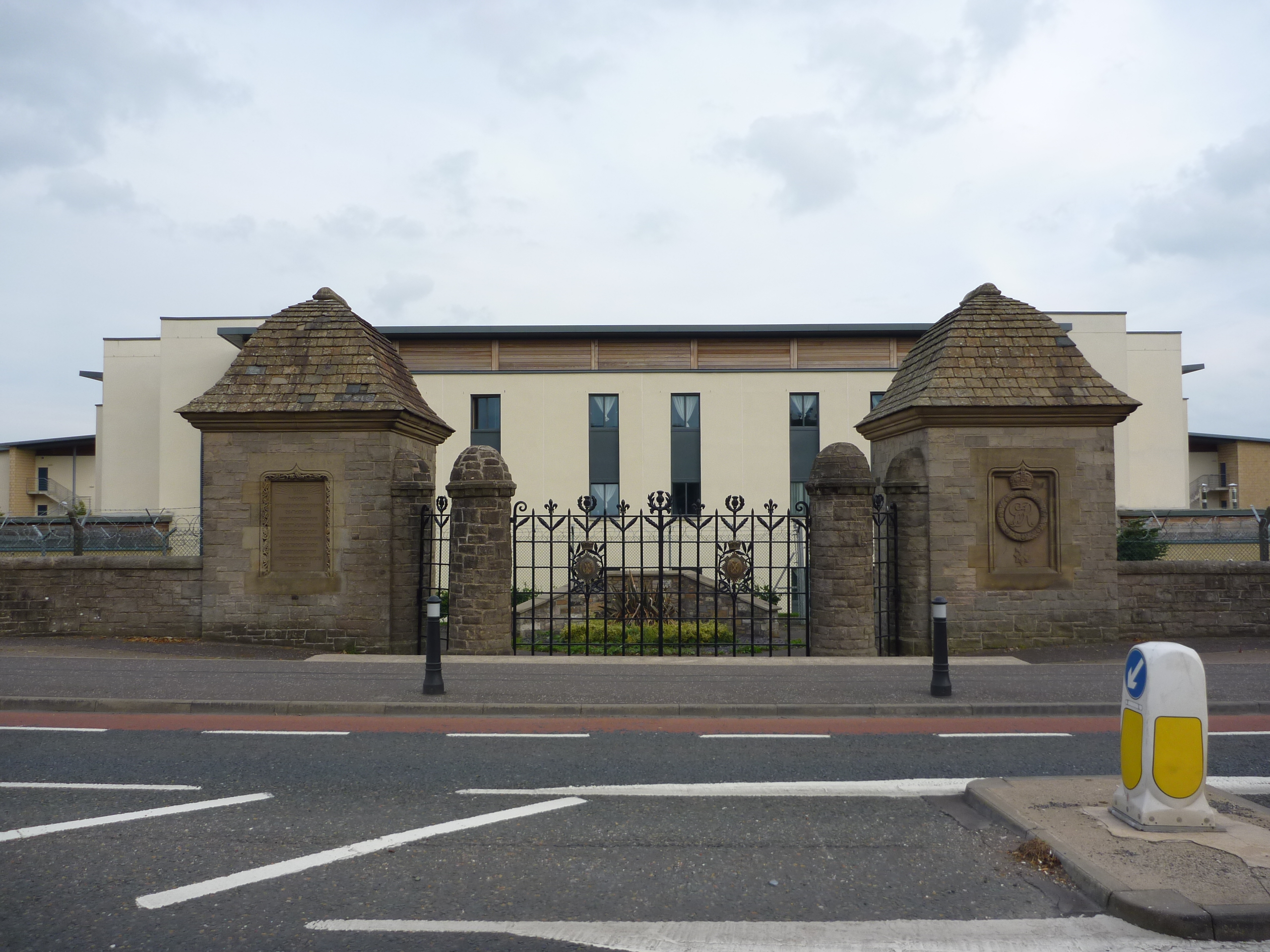
Glencorse Barracks

Glencorse Barracks is a British Army barracks situated in Glencorse just outside the town of Penicuik in Midlothian, Scotland. It is one of the three barracks...

Penicuik railway station

Penicuik railway station served the town of Penicuik, Midlothian, Scotland from 1872 to 1951 on the Penicuik Railway. == History == The station opened...

Nearby Amenities

Located within 500m of 55.836189,-3.2168227
Traffic Signals
Lat/Long: 55.8359601/-3.2202969
Traffic Signals
Traffic Signals: signal
Lat/Long: 55.8389134/-3.216798
Traffic Calming: bump
Lat/Long: 55.8329553/-3.2164997
Traffic Calming: hump
Lat/Long: 55.8364075/-3.2186719
Traffic Calming: hump
Lat/Long: 55.8362077/-3.2176449
Crossing
Bicycle: no
Crossing: traffic_signals
Crossing Ref: pelican
Lat/Long: 55.8360979/-3.2152428
Traffic Calming: hump
Lat/Long: 55.8356948/-3.2121962
Traffic Calming: hump
Lat/Long: 55.8346197/-3.2106936
Atm
Operator: Tesco
Source: survey
Lat/Long: 55.8355378/-3.2203318
Fast Food
The Penny Cook
Addr Housenumber: 3
Addr Postcode: EH26 8NP
Addr Street: Edinburgh Road
Fhrs Id: 158803
Source: survey
Source Addr: FHRS Open Data
Lat/Long: 55.834905/-3.220928
Traffic Calming: cushion
Lat/Long: 55.8354042/-3.2169687
Traffic Calming: cushion
Lat/Long: 55.8359113/-3.2168057
Stop
Direction: forward
Lat/Long: 55.8362491/-3.2180811
Traffic Calming: hump
Lat/Long: 55.8369491/-3.2154274
Traffic Calming: hump
Lat/Long: 55.8373234/-3.2152491
Traffic Calming: hump
Lat/Long: 55.8378611/-3.2143854
Traffic Calming: cushion
Lat/Long: 55.8379679/-3.2129323
Traffic Calming: cushion
Lat/Long: 55.8376683/-3.2118533
Traffic Calming: cushion
Lat/Long: 55.8375011/-3.211325
Traffic Calming: bump
Lat/Long: 55.832473/-3.2133583
Traffic Calming: bump
Lat/Long: 55.8325928/-3.2138829
Barrier: bollard
Bicycle: yes
Foot: yes
Lat/Long: 55.8328246/-3.2145715
Traffic Calming: bump
Lat/Long: 55.8328287/-3.2139106
Traffic Calming: bump
Lat/Long: 55.833496/-3.2133125
Traffic Calming: bump
Lat/Long: 55.8337608/-3.2125452
Traffic Calming: bump
Lat/Long: 55.8335487/-3.2116278
Traffic Calming: bump
Lat/Long: 55.8335389/-3.2111533
Traffic Calming: cushion
Lat/Long: 55.8352448/-3.2133983
Traffic Calming: cushion
Lat/Long: 55.8349707/-3.2141145
Give Way
Lat/Long: 55.8344907/-3.2146879
Traffic Calming: cushion
Lat/Long: 55.8349464/-3.2122162
Traffic Calming: cushion
Lat/Long: 55.8346391/-3.2117267
Traffic Calming: cushion
Lat/Long: 55.834422/-3.2126672
Traffic Calming: cushion
Lat/Long: 55.8348986/-3.2127749
Give Way
Lat/Long: 55.8353021/-3.2130899
Post Box
Collection Times: Mo-Fr 17:15; Sa 12:00
Post Box Mounting: lamp_post
Post Box Type: lamp
Ref: EH26 196
Source: survey
Lat/Long: 55.8370497/-3.21004
Give Way
Lat/Long: 55.8331403/-3.2168814
Traffic Calming: cushion
Lat/Long: 55.8345248/-3.2149462
Entrance: main
Lat/Long: 55.8368395/-3.2122418
Recycling
Recycling Cans: yes
Recycling Clothes: yes
Recycling Glass Bottles: yes
Recycling Magazines: yes
Recycling Newspaper: yes
Recycling Paper: yes
Recycling Paper Packaging: yes
Recycling Shoes: yes
Lat/Long: 55.8353786/-3.2189751
Give Way
Lat/Long: 55.83205/-3.2169974
Bus Stop
Cuiken Avenue
Bin: yes
Bus: yes
Naptan AdministrativeAreaCode: 130
Naptan Area Name: Midlothian
Naptan AtcoAreaCode: 628
Naptan AtcoCode: 6280302450
Naptan Bearing: SW
Naptan CommonName: Cuiken Avenue
Naptan Indicator: opp
Naptan Landmark: The Quadrant
Naptan LocalityName: Penicuik
Naptan NaptanCode: 64324283
Naptan NptgLocalityCode: ES002994
Naptan SourceLocalityType: Lo
Naptan StopAreaCode: 628G325210
Naptan StopAreaType: GPBS
Naptan StopArea Name: Cuiken Avenue
Naptan Street: John Street
Naptan Verified: yes
Public Transport: platform
Shelter: yes
Source: NaPTAN + Survey
Stop Code: 643242683
Lat/Long: 55.8334071/-3.2225099
Fast Food
Jade Palace
Addr Housenumber: 5
Addr Postcode: EH26 8NP
Addr Street: Edinburgh Road
Cuisine: chinese
Fhrs Id: 158804
Phone: +44 1968 678 788
Source Addr: FHRS Open Data
Lat/Long: 55.8349954/-3.2208556
Old Phone: +44 1968 670083
Removed Amenity: telephone
Lat/Long: 55.8351383/-3.2209258
Bus Stop
East Queensway
Bus: yes
Naptan AdministrativeAreaCode: 130
Naptan Area Name: Midlothian
Naptan AtcoAreaCode: 628
Naptan AtcoCode: 6280302370
Naptan Bearing: NW
Naptan CommonName: East Queensway
Naptan Indicator: at
Naptan Landmark: -
Naptan LocalityName: Deanburn
Naptan NaptanCode: 64324293
Naptan NptgLocalityCode: N0071917
Naptan SourceLocalityType: Add
Naptan StopAreaCode: 628G325300
Naptan StopAreaType: GCLS
Naptan StopArea Name: Queensway
Naptan Street: Queensway
Naptan Verified: yes
Public Transport: platform
Source: NaPTAN + Survey
Lat/Long: 55.836328/-3.221719
Bus Stop
Queensway
Bin: yes
Bus: yes
Naptan AdministrativeAreaCode: 130
Naptan Area Name: Midlothian
Naptan AtcoAreaCode: 628
Naptan AtcoCode: 6280325300
Naptan Bearing: NE
Naptan CommonName: Queensway
Naptan Indicator: near
Naptan Landmark: Opp Tesco
Naptan LocalityName: Penicuik
Naptan NaptanCode: 64324358
Naptan NptgLocalityCode: ES002994
Naptan SourceLocalityType: Lo
Naptan StopAreaCode: 628G325300
Naptan StopAreaType: GCLS
Naptan StopArea Name: Queensway
Naptan Street: Edinburgh Road
Naptan Verified: yes
Passenger Information Display: yes
Public Transport: platform
Shelter: yes
Source: NaPTAN + Survey
Lat/Long: 55.8365149/-3.2199555
Bus Stop
Mauricewood Road
Bench: no
Bus: yes
Naptan AdministrativeAreaCode: 130
Naptan Area Name: Midlothian
Naptan AtcoAreaCode: 628
Naptan AtcoCode: 6280302280
Naptan Bearing: SW
Naptan CommonName: Mauricewood Road
Naptan Indicator: opp
Naptan Landmark: -
Naptan LocalityName: Mauricewood
Naptan NaptanCode: 64324346
Naptan NptgLocalityCode: N0071919
Naptan SourceLocalityType: Add
Naptan StopAreaCode: 628G325490
Naptan StopAreaType: GPBS
Naptan StopArea Name: Mauricewood Road
Naptan Street: Edinburgh Road
Naptan Verified: yes
Public Transport: platform
Shelter: yes
Source: NaPTAN + Survey
Lat/Long: 55.8386453/-3.217135
Bus Stop
Mauricewood Road
Bus: yes
Naptan AdministrativeAreaCode: 130
Naptan Area Name: Midlothian
Naptan AtcoAreaCode: 628
Naptan AtcoCode: 6280325490
Naptan Bearing: NE
Naptan CommonName: Mauricewood Road
Naptan Indicator: at
Naptan Landmark: -
Naptan LocalityName: Mauricewood
Naptan NaptanCode: 64324347
Naptan NptgLocalityCode: N0071919
Naptan SourceLocalityType: Add
Naptan StopAreaCode: 628G325490
Naptan StopAreaType: GPBS
Naptan StopArea Name: Mauricewood Road
Naptan Street: Edinburgh Road
Naptan Verified: yes
Public Transport: platform
Shelter: yes
Source: NaPTAN + Survey
Lat/Long: 55.8392223/-3.216367
Bus Stop
Mauricewood Avenue
Bus: yes
Naptan AtcoCode: 6280302275
Naptan Bearing: SE
Naptan CommonName: Mauricewood Avenue
Naptan Indicator: opp
Naptan NaptanCode: 64324648
Naptan Street: Mauricewood Road
Public Transport: platform
Ref: 6280302275
Source: NaPTAN
Stop Code: 64324648
Lat/Long: 55.8395689/-3.2183853
Kindergarten
Strathesk Nursery School
Addr City: Penicuik
Addr Country: GB
Addr Housenumber: 4
Addr Postcode: EH26 8EZ
Addr Street: Eastfield Farm Road
Fhrs Id: 157904
Lat/Long: 55.8344529/-3.2147077
Give Way
Lat/Long: 55.8350428/-3.2126087
Traffic Calming: cushion
Lat/Long: 55.8342919/-3.2118528
Give Way
Lat/Long: 55.8335333/-3.2108625
Bus Stop
Strathesk Road
Bus: yes
Naptan AdministrativeAreaCode: 130
Naptan Area Name: Midlothian
Naptan AtcoAreaCode: 628
Naptan AtcoCode: 6280302287
Naptan Bearing: S
Naptan CommonName: Strathesk Road
Naptan Indicator: opp
Naptan Landmark: -
Naptan LocalityName: Ladywood
Naptan NaptanCode: 64324375
Naptan NptgLocalityCode: N0071918
Naptan QualifierName: Penicuik
Naptan SourceLocalityType: Add
Naptan Street: Windsor Drive
Naptan Verified: yes
Public Transport: platform
Source: NaPTAN + Survey
Lat/Long: 55.8341511/-3.2105816
Bus Stop
Windsor Drive
Bus: yes
Naptan AdministrativeAreaCode: 130
Naptan Area Name: Midlothian
Naptan AtcoAreaCode: 628
Naptan AtcoCode: 6280302285
Naptan Bearing: SE
Naptan CommonName: Windsor Drive
Naptan Indicator: at
Naptan Landmark: Windsor Terrace
Naptan LocalityName: Ladywood
Naptan NaptanCode: 64324383
Naptan NptgLocalityCode: N0071918
Naptan QualifierName: Penicuik
Naptan SourceLocalityType: Add
Naptan Street: Windsor Drive
Naptan Verified: yes
Public Transport: platform
Shelter: yes
Source: NaPTAN + Survey
Lat/Long: 55.8356275/-3.2117154
Post Box
Collection Times: Mo-Fr 17:15; Sa 12:00
Operator: Royal Mail
Post Box Type: pillar
Ref: EH26 267
Royal Cypher: GVIR
Royal Cypher Wikidata: Q33102169
Lat/Long: 55.8331418/-3.2172064
Bicycle Parking
Capacity: 12
Lat/Long: 55.8356243/-3.2137858
Give Way
Lat/Long: 55.8378266/-3.2146642
Addr Housenumber: 15 - 20
Addr Street: Vorlich Crescent
Lat/Long: 55.837689/-3.2112424
Bus Stop
Yarrow Court
Bus: yes
Naptan AdministrativeAreaCode: 130
Naptan Area Name: Midlothian
Naptan AtcoAreaCode: 628
Naptan AtcoCode: 6280325370
Naptan Bearing: NW
Naptan CommonName: Yarrow Court
Naptan Indicator: at
Naptan Landmark: -
Naptan LocalityName: Ladywood
Naptan NaptanCode: 64324385
Naptan NptgLocalityCode: N0071918
Naptan QualifierName: Penicuik
Naptan SourceLocalityType: Add
Naptan Street: Eskvale Drive
Naptan Verified: yes
Public Transport: platform
Source: NaPTAN + Survey
Lat/Long: 55.8379595/-3.2130669
Bus Stop
Wyvis Park
Bus: yes
Naptan AdministrativeAreaCode: 130
Naptan Area Name: Midlothian
Naptan AtcoAreaCode: 628
Naptan AtcoCode: 6280325360
Naptan Bearing: NW
Naptan CommonName: Wyvis Park
Naptan Indicator: at
Naptan Landmark: -
Naptan LocalityName: Ladywood
Naptan NaptanCode: 64324384
Naptan NptgLocalityCode: N0071918
Naptan QualifierName: Penicuik
Naptan SourceLocalityType: Add
Naptan Street: Eskvale Drive
Naptan Verified: yes
Public Transport: platform
Shelter: yes
Source: NaPTAN + Survey
Lat/Long: 55.8371455/-3.2104395
Addr Housenumber: 4-7
Lat/Long: 55.8372472/-3.2097991
Addr Housenumber: 8 - 13
Addr Street: Lawers Square
Lat/Long: 55.8374884/-3.2096417
Post Box
Collection Times: Mo-Fr 16:45; Sa 12:00
Ref: EH26 130
Lat/Long: 55.8390603/-3.2176393
Mauricewood Colliery disaster memorial
Designation: mining monument
Historic: monument
Lat/Long: 55.8396012/-3.2178461
Bus Stop
Cuiken Avenue
Bin: yes
Bus: yes
Naptan AdministrativeAreaCode: 130
Naptan Area Name: Midlothian
Naptan AtcoAreaCode: 628
Naptan AtcoCode: 6280325210
Naptan Bearing: NE
Naptan CommonName: Cuiken Avenue
Naptan Indicator: at
Naptan Landmark: The Quadrant
Naptan LocalityName: Penicuik
Naptan NaptanCode: 64324284
Naptan NptgLocalityCode: ES002994
Naptan SourceLocalityType: Lo
Naptan StopAreaCode: 628G325210
Naptan StopAreaType: GPBS
Naptan StopArea Name: Cuiken Avenue
Naptan Street: John Street
Naptan Verified: yes
Public Transport: platform
Shelter: yes
Source: NaPTAN + Survey
Lat/Long: 55.8338666/-3.2222993
Bus Stop
Teviot Grove
Bus: yes
Naptan AdministrativeAreaCode: 130
Naptan Area Name: Midlothian
Naptan AtcoAreaCode: 628
Naptan AtcoCode: 6280325380
Naptan Bearing: S
Naptan CommonName: Teviot Grove
Naptan Indicator: opp
Naptan Landmark: -
Naptan LocalityName: Ladywood
Naptan NaptanCode: 64324294
Naptan NptgLocalityCode: N0071918
Naptan QualifierName: Penicuik
Naptan SourceLocalityType: Add
Naptan Street: Eskvale Drive
Naptan Verified: yes
Public Transport: platform
Shelter: yes
Source: NaPTAN + Survey
Lat/Long: 55.8367937/-3.2154083
Bus Stop
Queensway
Bus: yes
Naptan AdministrativeAreaCode: 130
Naptan Area Name: Midlothian
Naptan AtcoAreaCode: 628
Naptan AtcoCode: 6280302440
Naptan Bearing: SW
Naptan CommonName: Queensway
Naptan Indicator: opp
Naptan Landmark: Tesco
Naptan LocalityName: Penicuik
Naptan NaptanCode: 64324357
Naptan NptgLocalityCode: ES002994
Naptan SourceLocalityType: Lo
Naptan StopAreaCode: 628G325300
Naptan StopAreaType: GCLS
Naptan StopArea Name: Queensway
Naptan Street: Edinburgh Road
Naptan Verified: yes
Passenger Information Display: yes
Public Transport: platform
Shelter: yes
Source: NaPTAN + Survey
Lat/Long: 55.835552/-3.2205137
Bus Stop
Eastfield Farm Road
Bus: yes
Naptan AdministrativeAreaCode: 130
Naptan Area Name: Midlothian
Naptan AtcoAreaCode: 628
Naptan AtcoCode: 6280325385
Naptan Bearing: E
Naptan CommonName: Eastfield Farm Road
Naptan Indicator: at
Naptan Landmark: opp new Doctor Surgery
Naptan LocalityName: Ladywood
Naptan NaptanCode: 64324295
Naptan NptgLocalityCode: N0071918
Naptan QualifierName: Penicuik
Naptan SourceLocalityType: Add
Naptan Street: Eastfield Farm Road
Naptan Verified: yes
Public Transport: platform
Shelter: yes
Source: NaPTAN + Survey
Lat/Long: 55.8360769/-3.2145882
Restaurant
Little Italy
Cuisine: italian
Lat/Long: 55.8348349/-3.2209871
Addr City: Penicuik
Addr Housenumber: 1
Addr Street: Ladywood Court
Lat/Long: 55.8363903/-3.213625
Addr City: Penicuik
Addr Housenumber: 10
Addr Street: Ladywood Court
Lat/Long: 55.8366434/-3.2130126
Addr City: Penicuik
Addr Housenumber: 11
Addr Street: Ladywood Court
Lat/Long: 55.8366336/-3.212929
Addr City: Penicuik
Addr Housenumber: 12
Addr Street: Ladywood Court
Lat/Long: 55.8366218/-3.2128291
Addr City: Penicuik
Addr Housenumber: 13
Addr Street: Ladywood Court
Lat/Long: 55.8363522/-3.2126702
Addr City: Penicuik
Addr Housenumber: 14
Addr Street: Ladywood Court
Lat/Long: 55.8364058/-3.2126501
Addr City: Penicuik
Addr Housenumber: 15
Addr Street: Ladywood Court
Lat/Long: 55.8364615/-3.2126293
Addr City: Penicuik
Addr Housenumber: 16
Addr Street: Ladywood Court
Lat/Long: 55.8362855/-3.2123602
Addr City: Penicuik
Addr Housenumber: 2
Addr Street: Ladywood Court
Lat/Long: 55.8364722/-3.2135253
Addr City: Penicuik
Addr Housenumber: 3
Addr Street: Ladywood Court
Lat/Long: 55.836557/-3.2134936
Addr City: Penicuik
Addr Housenumber: 4
Addr Street: Ladywood Court
Lat/Long: 55.8365837/-3.2134836
Addr City: Penicuik
Addr Housenumber: 5
Addr Street: Ladywood Court
Lat/Long: 55.8366878/-3.2134393
Addr City: Penicuik
Addr Housenumber: 6
Addr Street: Ladywood Court
Lat/Long: 55.8367163/-3.2134286
Addr City: Penicuik
Addr Housenumber: 7
Addr Street: Ladywood Court
Lat/Long: 55.8368012/-3.2133968
Addr City: Penicuik
Addr Housenumber: 8A
Addr Street: Ladywood Court
Lat/Long: 55.8368778/-3.2133664
Addr City: Penicuik
Addr Housenumber: 8B
Addr Street: Ladywood Court
Lat/Long: 55.8368926/-3.2133608
Addr City: Penicuik
Addr Housenumber: 9A
Addr Street: Ladywood Court
Lat/Long: 55.8368559/-3.2130442
Addr City: Penicuik
Addr Housenumber: 9B
Addr Street: Ladywood Court
Lat/Long: 55.8368761/-3.2130366
Traffic Calming: cushion
Lat/Long: 55.8358873/-3.2135124
Traffic Calming: cushion
Lat/Long: 55.8359993/-3.2144332
Traffic Calming: cushion
Lat/Long: 55.8360166/-3.2131845
Traffic Calming: hump
Lat/Long: 55.8361827/-3.2162623
Traffic Calming: hump
Lat/Long: 55.8361827/-3.2171262
Barrier: bollard
Bicycle: yes
Foot: yes
Lat/Long: 55.8369192/-3.213115
Cafe
Copper Tree Cafe
Lat/Long: 55.8327663/-3.2156431
Kindergarten
Pinocchio's Childrens Nursery
Lat/Long: 55.8332581/-3.2164375
Crossing
Crossing: uncontrolled
Crossing Island: yes
Kerb: lowered
Tactile Paving: yes
Lat/Long: 55.8353415/-3.2208604
Encee
Shop: hairdresser
Lat/Long: 55.8350917/-3.220782
Screwfix
Addr City: Penicuik
Addr Postcode: EH26 8HA
Addr Street: Eastfield Industrial Estate
Brand: Screwfix
Brand Wikidata: Q7439115
Brand Wikipedia: en:Screwfix
Shop: doityourself
Website: https://www.screwfix.com/stores/KA2/penicuik
Lat/Long: 55.8341077/-3.2170704
Post Box
Collection Times: Mo-Fr 17:15; Sa 12:00
Operator: Royal Mail
Post Box Type: pillar
Ref: EH26 144
Royal Cypher: GR
Royal Cypher Wikidata: Q33102273
Lat/Long: 55.8351648/-3.2208194
Traffic Calming: bump
Lat/Long: 55.8340618/-3.2196734
Traffic Calming: bump
Lat/Long: 55.8338091/-3.2190357
Traffic Calming: bump
Lat/Long: 55.8331963/-3.2172006
Traffic Calming: bump
Lat/Long: 55.8324888/-3.2154737
Traffic Calming: bump
Lat/Long: 55.8321535/-3.2147505
Traffic Calming: bump
Lat/Long: 55.8333786/-3.2108195
Car Wash
Payment Coins: yes
Lat/Long: 55.8346786/-3.2211396
Waste Basket
Lat/Long: 55.8355491/-3.2230694
Crossing
Crossing: unmarked
Crossing Island: yes
Tactile Paving: no
Traffic Calming: island
Lat/Long: 55.8388311/-3.2169592
Give Way
Lat/Long: 55.8405539/-3.2173311
Give Way
Lat/Long: 55.8397292/-3.2190482
Give Way
Lat/Long: 55.8392471/-3.2218784
Give Way
Lat/Long: 55.8386473/-3.2208682
Give Way
Lat/Long: 55.8391398/-3.2176017
Give Way
Lat/Long: 55.8387577/-3.2183089
Give Way
Lat/Long: 55.8378407/-3.2125822
Give Way
Lat/Long: 55.837625/-3.2115824
Give Way
Lat/Long: 55.8380379/-3.2131845
Traffic Calming: hump
Lat/Long: 55.8354871/-3.2115872
Traffic Calming: hump
Lat/Long: 55.8351008/-3.2109971
Give Way
Lat/Long: 55.8372803/-3.2108416
Give Way
Lat/Long: 55.8357259/-3.2126561
Traffic Calming: hump
Lat/Long: 55.8339967/-3.2107142
Give Way
Lat/Long: 55.8331027/-3.2170697
Give Way
Lat/Long: 55.8323912/-3.2206122
Entrance: service
Lat/Long: 55.8349983/-3.2200868
Give Way
Lat/Long: 55.8373183/-3.2240216
Give Way
Lat/Long: 55.8370263/-3.2230621
Give Way
Lat/Long: 55.8367401/-3.2221527
Give Way
Lat/Long: 55.8365191/-3.2213343
Give Way
Lat/Long: 55.8363662/-3.2214142
Barrier: bollard
Lat/Long: 55.8357803/-3.2211547
Give Way
Lat/Long: 55.8350005/-3.2243599
Give Way
Lat/Long: 55.8346939/-3.2231564
Give Way
Lat/Long: 55.8343662/-3.2218408
Traffic Calming: hump
Lat/Long: 55.8349804/-3.2240111
Traffic Calming: hump
Lat/Long: 55.8346881/-3.2229642
Crossing
Crossing: traffic_signals
Tactile Paving: yes
Lat/Long: 55.8360086/-3.2204674
Crossing
Crossing: traffic_signals
Tactile Paving: yes
Lat/Long: 55.8360784/-3.2201886
Crossing
Crossing: traffic_signals
Tactile Paving: yes
Lat/Long: 55.8359086/-3.220125
Crossing
Crossing: traffic_signals
Tactile Paving: yes
Lat/Long: 55.8358586/-3.2203897
Bus Stop
Mauricewood Avenue
Bus: yes
Naptan AtcoCode: 6280302245
Naptan Bearing: NW
Naptan CommonName: Mauricewood Avenue
Naptan Indicator: at
Naptan NaptanCode: 64324647
Naptan Notes: reposition
Naptan Street: Mauricewood Road
Public Transport: platform
Ref: 6280302245
Source: NaPTAN
Stop Code: 64324648
Lat/Long: 55.8392396/-3.2178645
Barrier: cycle_barrier
Lat/Long: 55.8399888/-3.2192913
The data included in this document is from www.openstreetmap.org. The data is made available under ODbL.

Have you been to Eastfield?

Leave your review of Eastfield below (or comments, questions and feedback).