Penicuik

Settlement in Midlothian

Scotland

Penicuik

River North Esk at Valleyfield, Penicuik Looking upstream where the river bends on its way alongside the housing development at Valleyfield, a former mill site.
River North Esk at Valleyfield, Penicuik Credit: Jim Barton

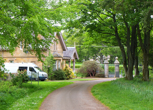
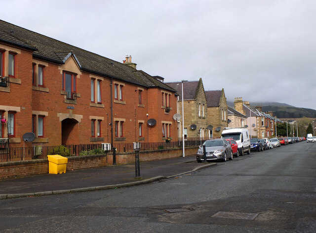
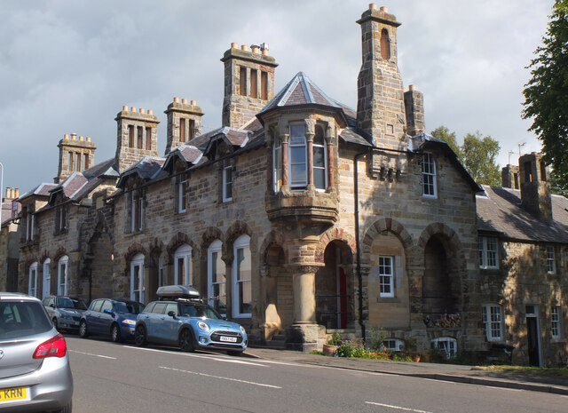
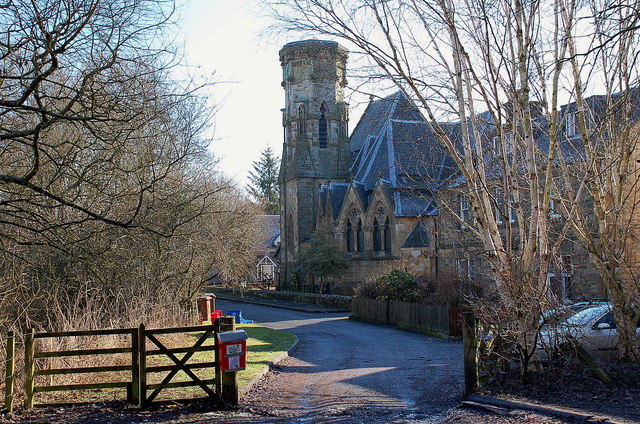
Penicuik is a town located in the county of Midlothian, Scotland. Situated about 10 miles south-west of Edinburgh, it is nestled among the stunning Pentland Hills. With a population of around 17,000 residents, Penicuik is known for its natural beauty and rich history.

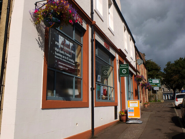
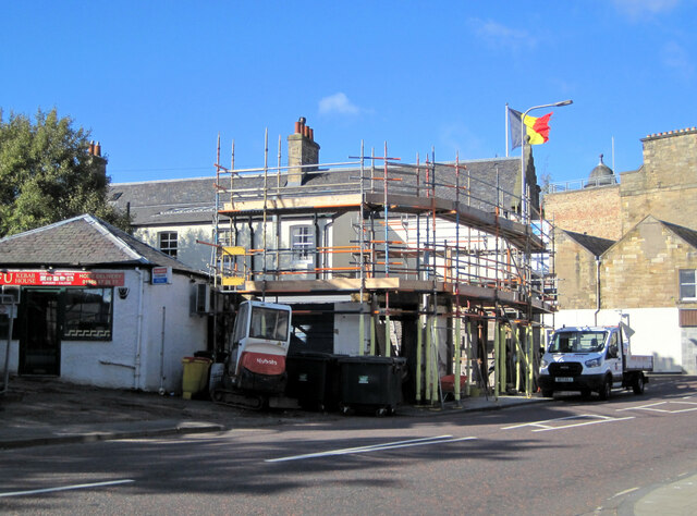
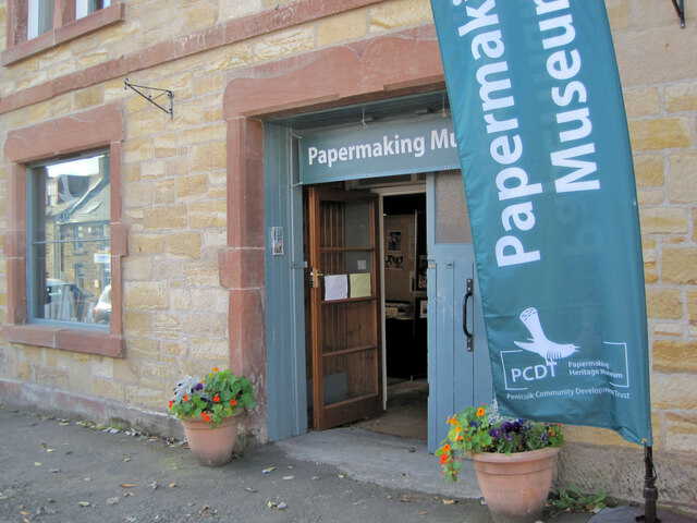
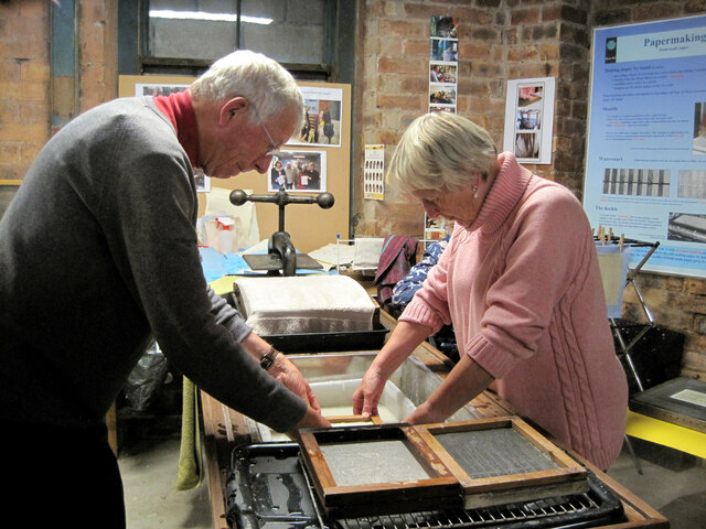
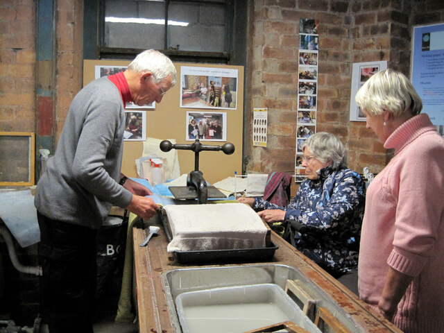
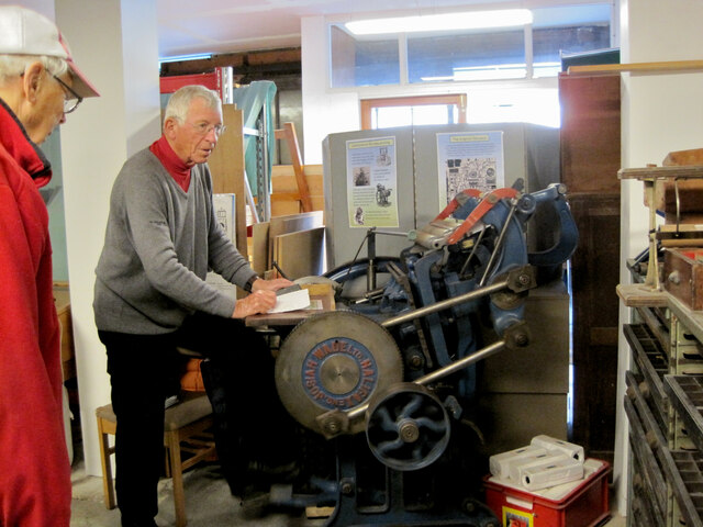
The town has a long-standing association with the paper industry, dating back to the 18th century when the first paper mills were established. Today, the paper industry still plays a significant role in the local economy, with the Tullis Russell paper mill being one of the largest employers in the area.

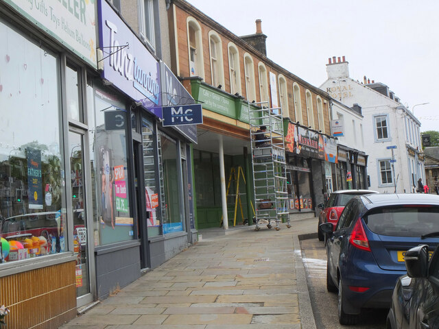
Penicuik boasts a range of amenities and facilities to cater to its residents and visitors. There are several primary and secondary schools, making it an ideal place for families. The town center offers a variety of shops, cafes, and restaurants, ensuring that residents have access to essential services and leisure activities. Additionally, Penicuik has a leisure center with a swimming pool, gym, and sports facilities, providing opportunities for health and fitness enthusiasts.

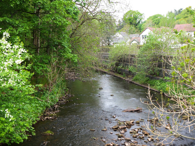
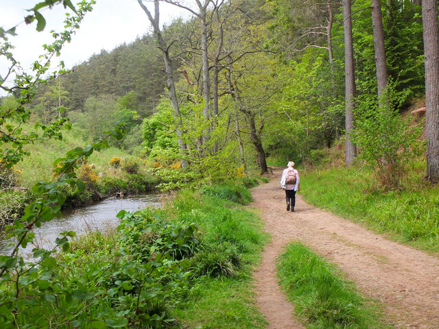
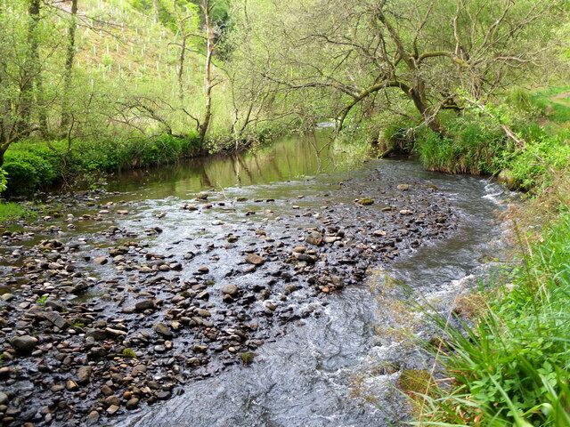
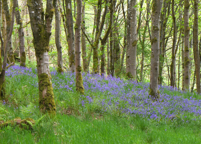
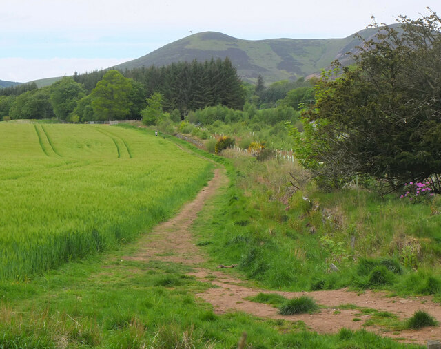
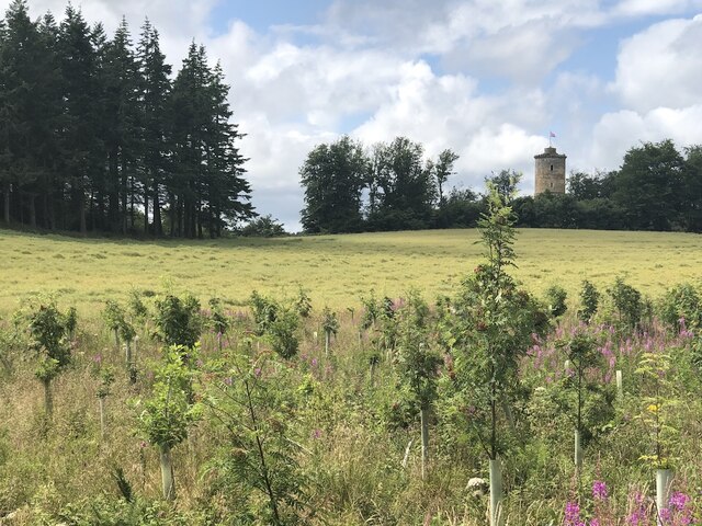
Nature lovers are drawn to Penicuik due to its proximity to the Pentland Hills Regional Park. The park offers numerous walking and cycling trails, offering breathtaking views of the surrounding landscapes. Visitors can also explore the nearby Glencorse Reservoir, which is a popular spot for fishing and birdwatching.

Overall, Penicuik is a picturesque town that seamlessly combines its industrial heritage with its natural surroundings, making it an attractive place to live and visit.

If you have any feedback on the listing, please let us know in the comments section below.

Penicuik Images

Images are sourced within 2km of 55.831868/-3.2239521 or Grid Reference NT2360. Thanks to Geograph Open Source API. All images are credited.

River North Esk at Valleyfield, Penicuik Looking upstream where the river bends on its way alongside the housing development at Valleyfield, a former mill site.
River North Esk at Valleyfield, Penicuik
Looking upstream where the river bends on its way alongside the housing development at Valleyfield, a former mill site.
Decorated space, path to Penicuik Estate Brick steps and plant pots on the path by the North Esk from the A701 to Penicuik Estate grounds.
Decorated space, path to Penicuik Estate
Brick steps and plant pots on the path by the North Esk from the A701 to Penicuik Estate grounds.
Path by the North Esk, Penicuik A path on the north side of the river to the surroundings of Penicuik House.
Path by the North Esk, Penicuik
A path on the north side of the river to the surroundings of Penicuik House.
River North Esk near Penicuik The North Esk rises in the Pentland Hills above Carlops. It joins the South Esk, which starts life in the Lammermuir Hills, at Dalkeith.
River North Esk near Penicuik
The North Esk rises in the Pentland Hills above Carlops. It joins the South Esk, which starts life in the Lammermuir Hills, at Dalkeith.
Bluebells in Serpentine Wood, Penicuik
Farmland on Penicuik Estate South Black Hill is in the background.
Farmland on Penicuik Estate
South Black Hill is in the background.
Spear Gate Lodge, Penicuik Estate A lodge house where one of the estate access roads meets the A766.
Spear Gate Lodge, Penicuik Estate
A lodge house where one of the estate access roads meets the A766.
Shopfront refurbishment, Penicuik High Street The Penicuik Storehouse undergoing renovation as part of a programme to improve the appearance of shops in the town.
Shopfront refurbishment, Penicuik High Street
The Penicuik Storehouse undergoing renovation as part of a programme to improve the appearance of shops in the town.
Vaucluse Place, Penicuik A block of flats in Jackson Street.
Vaucluse Place, Penicuik
A block of flats in Jackson Street.
Field, Penicuik Estate The roadside conifers are long gone allowing a view of the folly.
Field, Penicuik Estate
The roadside conifers are long gone allowing a view of the folly.
Pen-y-Coe Press, Penicuik A long-established stationery and printing shop with an adjoining museum of papermaking in Bridge Street. In the early 19th century Penicuik became an important centre for papermaking, with mills along the River North Esk.
Pen-y-Coe Press, Penicuik
A long-established stationery and printing shop with an adjoining museum of papermaking in Bridge Street. In the early 19th century Penicuik became an important centre for papermaking, with mills along the River North Esk.
Parkend, Penicuik A striking corner terrace by the architect Thomas Pilkington c. 1860. He also designed the nearby Penicuik South Kirk and terraced cottages in the mill village of Walkerburn - see <a href="https://www.geograph.org.uk/photo/2231809">NT3537 : Millworkers' cottages, Walkerburn</a>.
Parkend, Penicuik
A striking corner terrace by the architect Thomas Pilkington c. 1860. He also designed the nearby Penicuik South Kirk and terraced cottages in the mill village of Walkerburn - see NT3537 : Millworkers' cottages, Walkerburn.
Demolition and rebuilding, Penicuik Old premises on Bridge Street are being demolished and construction appears to be the next step. The flag is flying from the Belgian Consulate on the corner with West Street - see also <a href="https://www.geograph.org.uk/photo/3332421">NT2359 : Belgian Consulate, Penicuik</a>.
Demolition and rebuilding, Penicuik
Old premises on Bridge Street are being demolished and construction appears to be the next step. The flag is flying from the Belgian Consulate on the corner with West Street - see also NT2359 : Belgian Consulate, Penicuik.
Papermaking Museum, Penicuik The museum is next door to the Pen-y-Coe Press on Bridge Street.  It is currently open on Saturday afternoons or at other times by arrangement for groups and entry is free. See the museum's website at <span class="nowrap"><a title="https://penicuikcdt.co.uk/index.php/penicuik-papermaking-heritage-museum/" rel="nofollow ugc noopener" href="https://penicuikcdt.co.uk/index.php/penicuik-papermaking-heritage-museum/">Link</a><img style="margin-left:2px;" alt="External link" title="External link - shift click to open in new window" src="https://s1.geograph.org.uk/img/external.png" width="10" height="10"/></span>.
Papermaking Museum, Penicuik
The museum is next door to the Pen-y-Coe Press on Bridge Street. It is currently open on Saturday afternoons or at other times by arrangement for groups and entry is free. See the museum's website at LinkExternal link.
Making paper by hand (1) Visitors to the Papermaking Museum at Penicuik have a chance to help make a sheet of paper. Pulp is caught on a rectangular mesh and carefully removed and transferred to the screw press to squeeze out the excess water.
Making paper by hand (1)
Visitors to the Papermaking Museum at Penicuik have a chance to help make a sheet of paper. Pulp is caught on a rectangular mesh and carefully removed and transferred to the screw press to squeeze out the excess water.
Making paper by hand (2) The process of making a sheet of paper from pulp being demonstrated at the Papermaking Museum, Penicuik. The sheet is being separated from its carrying cloth and is ready for drying.
Making paper by hand (2)
The process of making a sheet of paper from pulp being demonstrated at the Papermaking Museum, Penicuik. The sheet is being separated from its carrying cloth and is ready for drying.
Printing press demonstration A small press being demonstrated at the Papermaking Museum, Penicuik. The gear wheel carries the makers name 'Josiah Wade Ltd Halifax Eng.' It can be powered by a belt drive or, as here, by the treadle. Cases carrying the type letters can be seen to the right.
Printing press demonstration
A small press being demonstrated at the Papermaking Museum, Penicuik. The gear wheel carries the makers name 'Josiah Wade Ltd Halifax Eng.' It can be powered by a belt drive or, as here, by the treadle. Cases carrying the type letters can be seen to the right.
South Kirk, Penicuik The church has a very distinctive cylindrical tower, seen here from the small car park by the North Esk.
South Kirk, Penicuik
The church has a very distinctive cylindrical tower, seen here from the small car park by the North Esk.
Show me another place!

Penicuik is located at Grid Ref: NT2360 (Lat: 55.831868, Lng: -3.2239521)

Unitary Authority: Midlothian

Police Authority: The Lothians and Scottish Borders

What 3 Words

///hammocks.nets.lightbulb. Near Penicuik, Midlothian

Related Wikis

Penicuik Athletic F.C.

Penicuik Athletic Football Club are a Scottish football club. They were formed in 1888 and are based at Montgomery Park (formerly known as Penicuik Park...

Penicuik Town Hall

Penicuik Town Hall, formerly the Cowan Institute, is a municipal building in the High Street, Penicuik, Midlothian, Scotland. The structure, which was...

Penicuik

Penicuik ( PEN-i-kuuk; Scots: Penicuik; Scottish Gaelic: Peighinn na Cuthaig) is a town and former burgh in Midlothian, Scotland, lying on the west bank...

Penicuik railway station

Penicuik railway station served the town of Penicuik, Midlothian, Scotland from 1872 to 1951 on the Penicuik Railway. == History == The station opened...

Nearby Amenities

Located within 500m of 55.831868,-3.2239521
Crossing
Crossing: unmarked
Crossing Island: yes
Crossing Markings: no
Kerb: lowered
Tactile Paving: yes
Lat/Long: 55.8317007/-3.2239999
Crossing
Crossing: uncontrolled
Crossing Ref: zebra
Lat/Long: 55.8278014/-3.2210559
Give Way
Lat/Long: 55.8319991/-3.2267709
Give Way
Lat/Long: 55.8323983/-3.2280543
Give Way
Direction: forward
Lat/Long: 55.8332111/-3.2229048
Give Way
Lat/Long: 55.8318703/-3.2289635
Traffic Calming: hump
Lat/Long: 55.8277771/-3.2267405
Post Office
Penicuik Post Office
Addr Postcode: EH26 8AA
Branch: Penicuik
Brand: Post Office
Brand Wikidata: Q1783168
Check Date: 2020-02-20
Contact Website: https://www.postoffice.co.uk/branch-finder/138824x/penicuik
Ref Pol Id: 2491
Lat/Long: 55.8280866/-3.2229717
Traffic Calming: bump
Lat/Long: 55.8329553/-3.2164997
Give Way
Lat/Long: 55.8306952/-3.2215858
Atm
Operator: Tesco
Source: survey
Lat/Long: 55.8355378/-3.2203318
Fast Food
The Penny Cook
Addr Housenumber: 3
Addr Postcode: EH26 8NP
Addr Street: Edinburgh Road
Fhrs Id: 158803
Source: survey
Source Addr: FHRS Open Data
Lat/Long: 55.834905/-3.220928
Give Way
Lat/Long: 55.8331403/-3.2168814
Recycling
Recycling Cans: yes
Recycling Clothes: yes
Recycling Glass Bottles: yes
Recycling Magazines: yes
Recycling Newspaper: yes
Recycling Paper: yes
Recycling Paper Packaging: yes
Recycling Shoes: yes
Lat/Long: 55.8353786/-3.2189751
Crossing
Crossing: uncontrolled
Crossing Ref: zebra
Lat/Long: 55.8279528/-3.2202742
Traffic Calming: hump
Lat/Long: 55.8354441/-3.2259708
Barrier: bollard
Lat/Long: 55.8314063/-3.223833
Barrier: bollard
Lat/Long: 55.8316584/-3.2234498
Fast Food
Tower FIsh and Chips
Addr Housenumber: 155
Addr Postcode: EH26 8AT
Addr Street: John Street
Cuisine: fish_and_chips
Fhrs Id: 158884
Source Addr: FHRS Open Data
Lat/Long: 55.8324005/-3.2232855
Stylix
Shop: hairdresser
Lat/Long: 55.8323033/-3.2231538
Barrier: bollard
Lat/Long: 55.831869/-3.2237456
Carnethy Electrical
Shop: electronics
Lat/Long: 55.8322653/-3.2230194
Maglin Domestics
Shop: hardware
Lat/Long: 55.8322356/-3.2229133
Veterinary
Carnethy Veterinary Clinic
Lat/Long: 55.8322094/-3.222832
Bus Stop
Angle Park
Bus: yes
Naptan AdministrativeAreaCode: 130
Naptan Area Name: Midlothian
Naptan AtcoAreaCode: 628
Naptan AtcoCode: 6280302460
Naptan Bearing: S
Naptan CommonName: Angle Park
Naptan Indicator: opp
Naptan Landmark: -
Naptan LocalityName: Penicuik
Naptan NaptanCode: 64324265
Naptan NptgLocalityCode: ES002994
Naptan SourceLocalityType: Lo
Naptan StopAreaCode: 628G325200
Naptan StopAreaType: GPBS
Naptan StopArea Name: Angle Park
Naptan Street: John Street
Naptan Verified: yes
Public Transport: platform
Source: NaPTAN + Survey
Lat/Long: 55.8312328/-3.2238523
Give Way
Lat/Long: 55.8317562/-3.2212461
Give Way
Lat/Long: 55.8315278/-3.2214401
Give Way
Lat/Long: 55.829612/-3.2223114
Give Way
Lat/Long: 55.8311629/-3.2184074
Give Way
Lat/Long: 55.83205/-3.2169974
Give Way
Lat/Long: 55.8316891/-3.2162948
Bus Stop
Town Centre
Bus: yes
Naptan AdministrativeAreaCode: 130
Naptan Area Name: Midlothian
Naptan AtcoAreaCode: 628
Naptan AtcoCode: 6280302490
Naptan Bearing: SE
Naptan CommonName: Town Centre
Naptan Indicator: Stop A
Naptan Landmark: At Health Centre
Naptan LocalityName: Penicuik
Naptan NaptanCode: 64324373
Naptan NptgLocalityCode: ES002994
Naptan ShortCommonName: Town Centre
Naptan SourceLocalityType: Lo
Naptan StopAreaCode: 628G302495
Naptan StopAreaType: GCLS
Naptan StopArea Name: Town Centre
Naptan Street: St Kentigern Way
Naptan Verified: yes
Public Transport: platform
Shelter: yes
Source: NaPTAN + Survey
Lat/Long: 55.8279798/-3.2217733
Bus Stop
Wilson Street
Bus: yes
Naptan AdministrativeAreaCode: 130
Naptan Area Name: Midlothian
Naptan AtcoAreaCode: 628
Naptan AtcoCode: 6280302470
Naptan Bearing: SE
Naptan CommonName: Wilson Street
Naptan Indicator: opp
Naptan Landmark: -
Naptan LocalityName: Penicuik
Naptan NaptanCode: 64324376
Naptan NptgLocalityCode: ES002994
Naptan SourceLocalityType: Lo
Naptan StopAreaCode: 628G325180
Naptan StopAreaType: GPBS
Naptan StopArea Name: Wilson Street
Naptan Street: John Street
Naptan Verified: yes
Public Transport: platform
Source: NaPTAN + Survey
Lat/Long: 55.8292636/-3.2231021
Pub
Stewart's Bar & Grill
Old Name: The Golden Goose
Lat/Long: 55.8308509/-3.2242698
Pub
The Roadhouse
Addr Housenumber: 136
Addr Postcode: EH26 8NJ
Addr Street: John Street
Fhrs Id: 159055
Source Addr: FHRS Open Data
Lat/Long: 55.8322557/-3.2239272
Bus Stop
Cuiken Avenue
Bin: yes
Bus: yes
Naptan AdministrativeAreaCode: 130
Naptan Area Name: Midlothian
Naptan AtcoAreaCode: 628
Naptan AtcoCode: 6280302450
Naptan Bearing: SW
Naptan CommonName: Cuiken Avenue
Naptan Indicator: opp
Naptan Landmark: The Quadrant
Naptan LocalityName: Penicuik
Naptan NaptanCode: 64324283
Naptan NptgLocalityCode: ES002994
Naptan SourceLocalityType: Lo
Naptan StopAreaCode: 628G325210
Naptan StopAreaType: GPBS
Naptan StopArea Name: Cuiken Avenue
Naptan Street: John Street
Naptan Verified: yes
Public Transport: platform
Shelter: yes
Source: NaPTAN + Survey
Stop Code: 643242683
Lat/Long: 55.8334071/-3.2225099
Shottstown Miners Welfare & Social Club
Addr Housenumber: 165
Addr Postcode: EH26 8AT
Addr Street: John Street
Club: yes
Fhrs Id: 158886
Source Addr: FHRS Open Data
Lat/Long: 55.832861/-3.2222797
Fast Food
Jade Palace
Addr Housenumber: 5
Addr Postcode: EH26 8NP
Addr Street: Edinburgh Road
Cuisine: chinese
Fhrs Id: 158804
Phone: +44 1968 678 788
Source Addr: FHRS Open Data
Lat/Long: 55.8349954/-3.2208556
Old Phone: +44 1968 670083
Removed Amenity: telephone
Lat/Long: 55.8351383/-3.2209258
Dentist
Ballantine Dental Practice
Email: Info@ballantinedental.co.uk
Opening Hours: Mo-Th 09:00-17:30; Fr 08:00-16:00
Phone: +44 1968 675586
Website: https://www.ballantinedental.co.uk/
Lat/Long: 55.8296146/-3.2229132
Pharmacy
Lloyds Pharmacy
Brand: Lloyds Pharmacy
Brand Wikidata: Q6662870
Brand Wikipedia: en:LloydsPharmacy
Dispensing: yes
Healthcare: pharmacy
Opening Hours: Mo-Fr 09:00-18:00; Sa 09:00-17:00
Lat/Long: 55.8275164/-3.2223507
Crossing
Bicycle: no
Crossing: traffic_signals
Crossing Ref: pelican
Lat/Long: 55.8279459/-3.2224013
Food Facts Friends
Addr City: Penicuik
Addr Country: GB
Addr Housenumber: 42
Addr Postcode: EH26 8AB
Addr Street: John Street
Old Name: Royal Bank of Scotland
Lat/Long: 55.8279412/-3.2226844
Telephone
Booth: KX100
Covered: booth
Operator: BT
Payment Coins: yes
Payment Credit Cards: yes
Payment Debit Cards: yes
Payment Telephone Cards: yes
Lat/Long: 55.8280193/-3.2226686
Post Box
Collection Times: Mo-Fr 18:00; Sa 13:00
Operator: Royal Mail
Post Box Type: pillar
Ref: EH26 126
Royal Cypher: scottish_crown
Lat/Long: 55.828132/-3.2227323
Atm
Operator: Post Office
Lat/Long: 55.8281724/-3.2228313
Post Box
Collection Times: Mo-Fr 17:15; Sa 12:00
Operator: Royal Mail
Post Box Type: pillar
Ref: EH26 267
Royal Cypher: GVIR
Royal Cypher Wikidata: Q33102169
Lat/Long: 55.8331418/-3.2172064
Give Way
Lat/Long: 55.8302749/-3.2175013
Broomhill
Place: suburb
Lat/Long: 55.8275485/-3.2260438
The Penicuik Centre
Leisure: sports_centre
Sport: swimming
Lat/Long: 55.8308746/-3.2300384
Bus Stop
Cuiken Avenue
Bin: yes
Bus: yes
Naptan AdministrativeAreaCode: 130
Naptan Area Name: Midlothian
Naptan AtcoAreaCode: 628
Naptan AtcoCode: 6280325210
Naptan Bearing: NE
Naptan CommonName: Cuiken Avenue
Naptan Indicator: at
Naptan Landmark: The Quadrant
Naptan LocalityName: Penicuik
Naptan NaptanCode: 64324284
Naptan NptgLocalityCode: ES002994
Naptan SourceLocalityType: Lo
Naptan StopAreaCode: 628G325210
Naptan StopAreaType: GPBS
Naptan StopArea Name: Cuiken Avenue
Naptan Street: John Street
Naptan Verified: yes
Public Transport: platform
Shelter: yes
Source: NaPTAN + Survey
Lat/Long: 55.8338666/-3.2222993
Bus Stop
Queensway
Bus: yes
Naptan AdministrativeAreaCode: 130
Naptan Area Name: Midlothian
Naptan AtcoAreaCode: 628
Naptan AtcoCode: 6280302440
Naptan Bearing: SW
Naptan CommonName: Queensway
Naptan Indicator: opp
Naptan Landmark: Tesco
Naptan LocalityName: Penicuik
Naptan NaptanCode: 64324357
Naptan NptgLocalityCode: ES002994
Naptan SourceLocalityType: Lo
Naptan StopAreaCode: 628G325300
Naptan StopAreaType: GCLS
Naptan StopArea Name: Queensway
Naptan Street: Edinburgh Road
Naptan Verified: yes
Passenger Information Display: yes
Public Transport: platform
Shelter: yes
Source: NaPTAN + Survey
Lat/Long: 55.835552/-3.2205137
Bus Stop
Angle Park
Bin: yes
Bus: yes
Naptan AdministrativeAreaCode: 130
Naptan Area Name: Midlothian
Naptan AtcoAreaCode: 628
Naptan AtcoCode: 6280325200
Naptan Bearing: N
Naptan CommonName: Angle Park
Naptan Indicator: at
Naptan Landmark: -
Naptan LocalityName: Penicuik
Naptan NaptanCode: 64324267
Naptan NptgLocalityCode: ES002994
Naptan SourceLocalityType: Lo
Naptan StopAreaCode: 628G325200
Naptan StopAreaType: GPBS
Naptan StopArea Name: Angle Park
Naptan Street: John Street
Naptan Verified: yes
Public Transport: platform
Shelter: yes
Source: NaPTAN + Survey
Lat/Long: 55.831253/-3.2241451
Bus Stop
Town Centre
Bus: yes
Naptan AdministrativeAreaCode: 130
Naptan Area Name: Midlothian
Naptan AtcoAreaCode: 628
Naptan AtcoCode: 6280325170
Naptan Bearing: NW
Naptan CommonName: Town Centre
Naptan Indicator: Stop C
Naptan Landmark: opp Health Centre
Naptan LocalityName: Penicuik
Naptan NaptanCode: 64324374
Naptan NptgLocalityCode: ES002994
Naptan SourceLocalityType: Lo
Naptan StopAreaCode: 628G302495
Naptan StopAreaType: GCLS
Naptan StopArea Name: Town Centre
Naptan Street: St Kentigern Way
Naptan Verified: yes
Passenger Information Display: yes
Public Transport: platform
Shelter: yes
Source: NaPTAN
Lat/Long: 55.827734/-3.2214755
Restaurant
Little Italy
Cuisine: italian
Lat/Long: 55.8348349/-3.2209871
Kindergarten
Pinocchio's Childrens Nursery
Lat/Long: 55.8332581/-3.2164375
Pharmacy
Lloyds Pharmacy
Brand: Lloyds Pharmacy
Brand Wikidata: Q6662870
Brand Wikipedia: en:LloydsPharmacy
Healthcare: pharmacy
Lat/Long: 55.8277516/-3.2225424
Jobcentre Plus
Brand: Jobcentre Plus
Brand Wikidata: Q6206793
Brand Wikipedia: en:Jobcentre Plus
Office: employment_agency
Lat/Long: 55.8276819/-3.2221672
Oxfam
Brand: Oxfam
Brand Wikidata: Q267941
Brand Wikipedia: en:Oxfam
Contact Website: https://www.oxfam.org.uk/shops/oxfam-shop-penicuik/
Shop: charity
Lat/Long: 55.8275585/-3.2223885
Pharmacy
Rowlands Pharmacy
Brand: Rowlands Pharmacy
Brand Wikidata: Q62663235
Dispensing: yes
Healthcare: pharmacy
Opening Hours: Mo-Fr 09:00-18:00; Sa 09:00-17:00
Website: https://rowlandspharmacy.co.uk/find-local-pharmacy#!/l/midlothian/27-john-street/1439
Lat/Long: 55.8276264/-3.2221216
St Margaret of Scotland Hospice
Shop: charity
Lat/Long: 55.8276678/-3.2224717
The Salvation Army
Brand: The Salvation Army
Brand Wikidata: Q188307
Brand Wikipedia: en:The Salvation Army
Shop: charity
Lat/Long: 55.8275399/-3.2220337
Shop: vacant
Lat/Long: 55.827599/-3.2224309
Crossing
Crossing: uncontrolled
Crossing Island: yes
Kerb: lowered
Tactile Paving: yes
Lat/Long: 55.8353415/-3.2208604
Encee
Shop: hairdresser
Lat/Long: 55.8350917/-3.220782
Entrance: yes
Lat/Long: 55.8282382/-3.2214502
William Purves
Shop: funeral_directors
Lat/Long: 55.8278732/-3.2226454
Fast Food
Yu
Addr Housenumber: 44B
Addr Postcode: EH26 8AB
Addr Street: John Street
Cuisine: chinese
Fhrs Id: 772998
Phone: +44 1968 678890
Source Addr: FHRS Open Data
Lat/Long: 55.827834/-3.2226219
Bus Stop
Wilson Street
Bin: yes
Bus: yes
Naptan AdministrativeAreaCode: 130
Naptan Area Name: Midlothian
Naptan AtcoAreaCode: 628
Naptan AtcoCode: 6280325180
Naptan Bearing: NW
Naptan CommonName: Wilson Street
Naptan Indicator: at
Naptan Landmark: -
Naptan LocalityName: Penicuik
Naptan NaptanCode: 64324378
Naptan NptgLocalityCode: ES002994
Naptan SourceLocalityType: Lo
Naptan StopAreaCode: 628G325180
Naptan StopAreaType: GPBS
Naptan StopArea Name: Wilson Street
Naptan Street: John Street
Naptan Verified: yes
Public Transport: platform
Shelter: yes
Source: NaPTAN + Survey
Lat/Long: 55.8287354/-3.2230512
Crossing
Bicycle: yes
Button Operated: yes
Crossing: traffic_signals
Crossing Island: no
Crossing Ref: toucan
Kerb: lowered
Tactile Paving: yes
Lat/Long: 55.830425/-3.2285082
Crossing
Crossing: zebra
Lat/Long: 55.830384/-3.2287692
Entrance: yes
Lat/Long: 55.8308461/-3.2296866
Access: private
Barrier: bollard
Lat/Long: 55.8304819/-3.2286068
Bicycle Parking
Lat/Long: 55.8309173/-3.2294033
Entrance: yes
Lat/Long: 55.8281419/-3.2214221
Parking
Capacity: 15
Parking: surface
Lat/Long: 55.82744/-3.222801
Addr City: Penicuick
Addr Housenumber: 41
Addr Street: John Street
Lat/Long: 55.8280188/-3.2223132
Addr City: Penicuick
Addr Housenumber: 43
Addr Street: John Street
Lat/Long: 55.828082/-3.2223495
Addr City: Penicuick
Addr Housenumber: 45
Addr Street: John Street
Lat/Long: 55.828165/-3.2223972
Addr City: Penicuick
Addr Housenumber: 47
Addr Street: John Street
Lat/Long: 55.8282438/-3.2224426
Addr City: Penicuick
Addr Housenumber: 51
Addr Street: John Street
Lat/Long: 55.8283635/-3.2225076
Addr City: Penicuick
Addr Housenumber: 53
Addr Street: John Street
Lat/Long: 55.8284885/-3.2225801
Addr City: Penicuick
Addr Housenumber: 55
Addr Street: John Street
Lat/Long: 55.8286207/-3.222656
Addr City: Penicuick
Addr Housenumber: 57
Addr Street: John Street
Lat/Long: 55.8287318/-3.2227158
Addr City: Penicuick
Addr Housenumber: 59
Addr Street: John Street
Lat/Long: 55.8288376/-3.2227824
Addr City: Penicuick
Addr Housenumber: 61
Addr Street: John Street
Lat/Long: 55.8289374/-3.222849
Addr City: Penicuick
Addr Housenumber: 91
Addr Street: John Street
Lat/Long: 55.8296005/-3.2231202
William Hill
Brand: William Hill
Brand Wikidata: Q4053147
Brand Wikipedia: en:William Hill (bookmaker)
Shop: bookmaker
Lat/Long: 55.8313997/-3.2242674
Give Way
Direction: forward
Lat/Long: 55.8318494/-3.2240998
Historic: memorial
Memorial: war_memorial
Wikidata: Q114169273
Lat/Long: 55.8295212/-3.2257124
Stop
Direction: backward
Stop: minor
Lat/Long: 55.8276525/-3.2264829
Give Way
Direction: backward
Lat/Long: 55.8280384/-3.2253142
Give Way
Direction: forward
Lat/Long: 55.8281519/-3.2254418
Give Way
Direction: backward
Lat/Long: 55.8284947/-3.2243694
Give Way
Direction: forward
Lat/Long: 55.8285831/-3.2244706
Give Way
Direction: forward
Lat/Long: 55.8289615/-3.2231381
Screwfix
Addr City: Penicuik
Addr Postcode: EH26 8HA
Addr Street: Eastfield Industrial Estate
Brand: Screwfix
Brand Wikidata: Q7439115
Brand Wikipedia: en:Screwfix
Shop: doityourself
Website: https://www.screwfix.com/stores/KA2/penicuik
Lat/Long: 55.8341077/-3.2170704
Defibrillator
Emergency: defibrillator
Opening Hours: 24/7
Lat/Long: 55.8328989/-3.2224486
Crossing
Button Operated: yes
Crossing: traffic_signals
Crossing Ref: pelican
Tactile Paving: no
Lat/Long: 55.8329014/-3.2230398
Ladbrokes
Brand: Ladbrokes
Brand Wikidata: Q1799875
Brand Wikipedia: en:Ladbrokes Coral
Shop: bookmaker
Lat/Long: 55.8327894/-3.2229303
Lothian Grocers
Addr Housenumber: 163D
Addr Postcode: EH26 8AT
Addr Street: John Street
Fhrs Id: 158885
Shop: convenience
Source Addr: FHRS Open Data
Lat/Long: 55.8327261/-3.2229786
Edward (Peebles) Ltd
Shop: hardware
Lat/Long: 55.8326771/-3.2230148
Atm
Bank of Scotland
Brand: Bank of Scotland
Brand Wikidata: Q627381
Opening Hours: 24/7
Operator: Bank of Scotland
Operator Wikidata: Q627381
Lat/Long: 55.8326402/-3.2230816
Bank
Bank of Scotland
Addr Country: GB
Atm: yes
Brand: Bank of Scotland
Brand Wikidata: Q627381
Brand Wikipedia: en:Bank of Scotland
Contact Website: https://branches.bankofscotland.co.uk/penicuik/163a-john-street
Operator: Bank of Scotland
Lat/Long: 55.8326026/-3.2230738
Cafe
Brunch Box
Addr City: Penicuik
Addr Country: GB
Addr Housenumber: 161
Addr Postcode: EH26 8AT
Addr Street: John Street
Fhrs Id: 1396670
Lat/Long: 55.8325175/-3.2231542
Pentland Sweets
Shop: confectionery
Lat/Long: 55.832467/-3.2232146
Post Box
Collection Times: Mo-Fr 17:15; Sa 12:00
Operator: Royal Mail
Operator Wikidata: Q638098
Post Box Design: type_b
Post Box Type: pillar
Ref: EH26 139
Royal Cypher: GVIR
Royal Cypher Wikidata: Q33102169
Lat/Long: 55.8325404/-3.2232508
Post Box
Collection Times: Mo-Fr 09:00; Sa 07:00
Operator: Royal Mail
Post Box Type: lamp
Ref: EH26 8D
Royal Cypher: GVIR
Royal Cypher Wikidata: Q33102169
Lat/Long: 55.8344855/-3.227482
Pentland Bakery & Newsmarket
Addr City: Penicuik
Addr Country: GB
Addr Housenumber: 80A
Addr Postcode: EH26 0EE
Addr Street: Pentland Terrace
Fhrs Id: 158970
Shop: convenience
Lat/Long: 55.8341872/-3.226739
Post Box
Collection Times: Mo-Fr 17:15; Sa 12:00
Operator: Royal Mail
Post Box Type: pillar
Ref: EH26 144
Royal Cypher: GR
Royal Cypher Wikidata: Q33102273
Lat/Long: 55.8351648/-3.2208194
Atm
Brand: Post Office
Lat/Long: 55.8281817/-3.2227883
Traffic Calming: bump
Lat/Long: 55.8340618/-3.2196734
Traffic Calming: bump
Lat/Long: 55.8338091/-3.2190357
Traffic Calming: bump
Lat/Long: 55.8331963/-3.2172006
Car Wash
Payment Coins: yes
Lat/Long: 55.8346786/-3.2211396
Waste Basket
Lat/Long: 55.8355491/-3.2230694
Bus Stop
Town Centre
Bin: yes
Bus: yes
Naptan AdministrativeAreaCode: 130
Naptan Area Name: Midlothian
Naptan AtcoAreaCode: 628
Naptan AtcoCode: 6280302495
Naptan Bearing: SE
Naptan CommonName: Town Centre
Naptan Indicator: Stop B
Naptan Landmark: near Health Centre
Naptan LocalityName: Penicuik
Naptan NaptanCode: 64329264
Naptan NptgLocalityCode: ES002994
Naptan SourceLocalityType: Lo
Naptan StopAreaCode: 628G302495
Naptan StopAreaType: GCLS
Naptan StopArea Name: Town Centre
Naptan Street: St Kentigern Way
Naptan Verified: yes
Passenger Information Display: yes
Public Transport: platform
Shelter: yes
Source: NaPTAN + Survey
Lat/Long: 55.8279129/-3.2213921
Bus Stop
John Street Lane
Bus: yes
Naptan AdministrativeAreaCode: 130
Naptan Area Name: Midlothian
Naptan AtcoAreaCode: 628
Naptan AtcoCode: 6280325190
Naptan Bearing: N
Naptan CommonName: John Street Lane
Naptan Indicator: at
Naptan Landmark: -
Naptan LocalityName: Penicuik
Naptan NaptanCode: 64324328
Naptan NptgLocalityCode: ES002994
Naptan SourceLocalityType: Lo
Naptan Street: John Street
Naptan Verified: yes
Public Transport: platform
Source: NaPTAN + Survey
Lat/Long: 55.8302605/-3.2239273
Bus Stop
Craigiebield Crescent
Bus: yes
Naptan AdministrativeAreaCode: 130
Naptan Area Name: Midlothian
Naptan AtcoAreaCode: 628
Naptan AtcoCode: 6280325060
Naptan Bearing: SE
Naptan CommonName: Craigiebield Crescent
Naptan Indicator: opp
Naptan Landmark: -
Naptan LocalityName: Penicuik
Naptan NaptanCode: 64324279
Naptan NptgLocalityCode: ES002994
Naptan SourceLocalityType: Lo
Naptan StopAreaCode: 628G302610
Naptan StopAreaType: GPBS
Naptan StopArea Name: Craigiebield Crescent
Naptan Street: Bog Road
Naptan Verified: yes
Public Transport: platform
Source: NaPTAN + Survey
Lat/Long: 55.8279847/-3.2269228
Barrier: swing_gate
Lat/Long: 55.8317148/-3.2283618
Give Way
Lat/Long: 55.8331027/-3.2170697
Entrance: yes
Lat/Long: 55.8310832/-3.222093
Entrance: yes
Lat/Long: 55.8311466/-3.2222649
Give Way
Direction: backward
Lat/Long: 55.8323019/-3.2234944
Give Way
Lat/Long: 55.8323912/-3.2206122
Give Way
Lat/Long: 55.8316786/-3.2214562
Entrance: service
Lat/Long: 55.8349983/-3.2200868
Addr City: Penicuik
Addr Housenumber: 209
Addr Street: Eskhill
Lat/Long: 55.8303143/-3.2165279
Location: outdoor
Power: substation
Substation: minor_distribution
Lat/Long: 55.8296434/-3.219425
Traffic Calming: hump
Lat/Long: 55.8283383/-3.2278221
Barrier: bollard
Lat/Long: 55.8357803/-3.2211547
Give Way
Lat/Long: 55.8321312/-3.2297632
Give Way
Lat/Long: 55.8342467/-3.2292509
Give Way
Lat/Long: 55.8346994/-3.2296197
Give Way
Lat/Long: 55.8312031/-3.2272285
Give Way
Lat/Long: 55.8314449/-3.2265124
Fixme: does this continue?
Lat/Long: 55.8334378/-3.2289411
Traffic Calming: hump
Lat/Long: 55.8352431/-3.2274236
Traffic Calming: hump
Lat/Long: 55.8346544/-3.2300464
Traffic Calming: hump
Lat/Long: 55.8348493/-3.2290984
Traffic Calming: hump
Lat/Long: 55.8350422/-3.2281604
Traffic Calming: hump
Lat/Long: 55.8353041/-3.22519
Give Way
Lat/Long: 55.8344235/-3.2273448
Give Way
Lat/Long: 55.8352996/-3.2267057
Give Way
Lat/Long: 55.835316/-3.2254739
Give Way
Lat/Long: 55.8342439/-3.226462
Give Way
Lat/Long: 55.8341318/-3.2265662
Give Way
Lat/Long: 55.8350005/-3.2243599
Give Way
Lat/Long: 55.8339485/-3.2253462
Give Way
Lat/Long: 55.833832/-3.2254569
Give Way
Lat/Long: 55.8335019/-3.224244
Give Way
Lat/Long: 55.8336072/-3.2241466
Give Way
Lat/Long: 55.8346939/-3.2231564
Give Way
Lat/Long: 55.8343662/-3.2218408
Traffic Calming: hump
Lat/Long: 55.8349804/-3.2240111
Traffic Calming: hump
Lat/Long: 55.8346881/-3.2229642
Crossing
Crossing: traffic_signals
Tactile Paving: yes
Lat/Long: 55.8358586/-3.2203897
Drinking Water
Top Up Tap
Access: yes
Bottle: yes
Fee: no
Operator: Scottish Water
Operator Wikidata: Q7438022
Lat/Long: 55.829484/-3.22592
Telephone
Booth: KX100
Covered: booth
Lat/Long: 55.8280528/-3.2226875
The data included in this document is from www.openstreetmap.org. The data is made available under ODbL.

Have you been to Penicuik?

Leave your review of Penicuik below (or comments, questions and feedback).