Peniel

Settlement in Denbighshire

Wales

Peniel

Dr Johnson's Monument, valley of Afon Ystrad Dr Johnson's monument was erected in 1775 by Colonel John Myddleton of Gwaenanog to commemorate a visit made to the house by Samuel Johnson in the company of Mrs Thrale in 1774. Johnson was unimpressed by his erstwhile host's sycophancy and is said to have remarked 'it looks like an intention to bury me alive!' The monument was restored in 1975.
Dr Johnson's Monument, valley of Afon Ystrad Credit: Colin Park

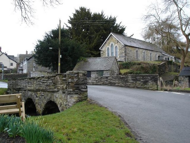
Peniel is a small village located in Denbighshire, Wales. Situated in the picturesque Vale of Clwyd, it is nestled between the towns of Denbigh and Ruthin. The name "Peniel" is derived from the biblical place mentioned in the Book of Genesis, meaning "face of God."

With a population of around 500 residents, Peniel is characterized by its peaceful and rural setting. The village is surrounded by rolling hills, lush green fields, and scenic landscapes, making it an ideal destination for nature lovers and outdoor enthusiasts. The nearby Clwydian Range, an Area of Outstanding Natural Beauty, offers stunning walks and hiking trails for visitors to explore.

Peniel is primarily a residential area, with a close-knit community that takes pride in its Welsh heritage. The village features a few amenities, including a local pub and a community center, serving as a focal point for social gatherings and events. The village has a strong sense of community spirit, and residents often organize various activities and initiatives to bring neighbors together.

The village is well-connected to the surrounding areas by road, with easy access to the A525 and A543 highways. The larger towns of Denbigh and Ruthin offer a wider range of amenities, including shops, schools, and healthcare facilities, all within a short drive from Peniel.

Overall, Peniel offers a tranquil and picturesque setting, making it an attractive place to live for those seeking a peaceful countryside lifestyle, while still being within reach of nearby towns and amenities.

If you have any feedback on the listing, please let us know in the comments section below.

Peniel Images

Images are sourced within 2km of 53.155619/-3.451646 or Grid Reference SJ0363. Thanks to Geograph Open Source API. All images are credited.

Dr Johnson's Monument, valley of Afon Ystrad Dr Johnson's monument was erected in 1775 by Colonel John Myddleton of Gwaenanog to commemorate a visit made to the house by Samuel Johnson in the company of Mrs Thrale in 1774. Johnson was unimpressed by his erstwhile host's sycophancy and is said to have remarked 'it looks like an intention to bury me alive!' The monument was restored in 1975.
Dr Johnson's Monument, valley of Afon Ystrad
Dr Johnson's monument was erected in 1775 by Colonel John Myddleton of Gwaenanog to commemorate a visit made to the house by Samuel Johnson in the company of Mrs Thrale in 1774. Johnson was unimpressed by his erstwhile host's sycophancy and is said to have remarked 'it looks like an intention to bury me alive!' The monument was restored in 1975.
Footbridge across the Afon Ystrad near Denbigh A fairly new footbridge at a lovely spot. Ideal for a snack break and a birdwatch.
Footbridge across the Afon Ystrad near Denbigh
A fairly new footbridge at a lovely spot. Ideal for a snack break and a birdwatch.
Part of the bed of the Afon Ystrad near Denbigh Looking downstream from the little narrow footbridge.
Part of the bed of the Afon Ystrad near Denbigh
Looking downstream from the little narrow footbridge.
Plas Captain Entrance and drive to Plas Captain farm near Peniel.
Plas Captain
Entrance and drive to Plas Captain farm near Peniel.
Farmland near Saron Farmland in the Vale of Clwyd near Saron.
Farmland near Saron
Farmland in the Vale of Clwyd near Saron.
Steep hill to College Farm On a minor road to Denbigh from Peniel
Steep hill to College Farm
On a minor road to Denbigh from Peniel
Bryn-y-Gwynt Uchaf Farm between Prion and Denbigh
Bryn-y-Gwynt Uchaf
Farm between Prion and Denbigh
Lane leading down to Prion Isa The Clwydian Hills form the backdrop.
Lane leading down to Prion Isa
The Clwydian Hills form the backdrop.
Supplementary feeding for steers Young Charolais beef cattle at Prion Isa
Supplementary feeding for steers
Young Charolais beef cattle at Prion Isa
Farmland south of Denbigh In the hills, looking east, between Peniel and Prion
Farmland south of Denbigh
In the hills, looking east, between Peniel and Prion
Sharp bend on a country road In the hills between Prion and Peniel
Sharp bend on a country road
In the hills between Prion and Peniel
Pen-y-Gerddi farm In the hills south of Denbigh
Pen-y-Gerddi farm
In the hills south of Denbigh
Peniel chapel and manse Non-conformist mid-Victorian rural chapel founded in 1837 and rebuilt in its present form in 1866. The manse is attached.
Peniel chapel and manse
Non-conformist mid-Victorian rural chapel founded in 1837 and rebuilt in its present form in 1866. The manse is attached.
Peniel hillside Looking south west towards Foel Gasyth
Peniel hillside
Looking south west towards Foel Gasyth
The B5401 heading northeast towards Peniel The tiny hamlet consists of a chapel and a few houses.
The B5401 heading northeast towards Peniel
The tiny hamlet consists of a chapel and a few houses.
Garnedd Isa Farm, Peniel Looking north west from the B4501 towards Garnedd Isa
Garnedd Isa Farm, Peniel
Looking north west from the B4501 towards Garnedd Isa
College Farm, Peniel Appearing in the dip beyond the field
College Farm, Peniel
Appearing in the dip beyond the field
Lane leading to Plas Captain Plas Captain is a Grade II listed farmhouse southwest of Denbigh
Lane leading to Plas Captain
Plas Captain is a Grade II listed farmhouse southwest of Denbigh
Show me another place!

Peniel is located at Grid Ref: SJ0363 (Lat: 53.155619, Lng: -3.451646)

Unitary Authority: Denbighshire

Police Authority: North Wales

What 3 Words

///slick.positive.elect. Near Denbigh, Denbighshire

Nearby Locations

Peniel

Related Wikis

Clwyd West (Senedd constituency)

Clwyd West (Welsh: Gorllewin Clwyd) is a constituency of the Senedd. It elects one Member of the Senedd by the first past the post method of election....

Clwyd West (UK Parliament constituency)

Clwyd West (Welsh: Gorllewin Clwyd) is a constituency of the House of Commons of the Parliament of the United Kingdom (at Westminster). It elects one Member...

Gwaenynog

Gwaenynog is a small estate about 1 km (0.62 mi) to the south-west of the town of Denbigh, Wales. Its origins are mediaeval when it was built as a house...

Nantglyn

Nantglyn is a small village and community in Denbighshire, Wales. The population of the community taken at the 2011 census was 323. It is situated in a...

Nearby Amenities

Located within 500m of 53.155619,-3.451646
Peniel
Place: village
Lat/Long: 53.1552359/-3.4518941
Power: pole
Lat/Long: 53.1596541/-3.4515363
Power: pole
Lat/Long: 53.1592585/-3.4508497
Power: pole
Lat/Long: 53.158731/-3.4500289
Power: pole
Lat/Long: 53.1583611/-3.4494388
Power: pole
Lat/Long: 53.1579976/-3.4488165
Power: pole
Lat/Long: 53.157573/-3.4481406
Power: pole
Lat/Long: 53.1569586/-3.4478402
Power: pole
Lat/Long: 53.1562638/-3.4476256
Power: pole
Lat/Long: 53.1555883/-3.447395
Power: pole
Lat/Long: 53.1549546/-3.4471428
Power: pole
Lat/Long: 53.1543466/-3.44688
Power: pole
Lat/Long: 53.1536389/-3.4468156
Power: pole
Lat/Long: 53.1531789/-3.4467888
Power: pole
Lat/Long: 53.1525001/-3.4467298
Telephone
Booth: K6
Covered: booth
Listed Status: Grade II
Phone: +44 1745 550315
Lat/Long: 53.155394/-3.4528431
Post Box
Collection Times: Mo-Fr 09:00; Sa 07:00
Operator: Royal Mail
Post Box Type: wall
Ref: LL16 28D
Royal Cypher: GR
Royal Cypher Wikidata: Q33102273
Lat/Long: 53.1553778/-3.45291
Direction: ESE
Generator Method: photovoltaic
Generator Output Electricity: yes
Generator Solar Modules: 16
Generator Source: solar
Generator Type: solar_photovoltaic_panel
Location: roof
Power: generator
Lat/Long: 53.157647/-3.4451982
Direction: 125
Generator Method: photovoltaic
Generator Output Electricity: yes
Generator Solar Modules: 15
Generator Source: solar
Generator Type: solar_photovoltaic_panel
Location: roof
Power: generator
Lat/Long: 53.1554122/-3.4523986
The data included in this document is from www.openstreetmap.org. The data is made available under ODbL.

Have you been to Peniel?

Leave your review of Peniel below (or comments, questions and feedback).