Broomhill

Settlement in Midlothian

Scotland

Broomhill

River North Esk at Valleyfield, Penicuik Looking upstream where the river bends on its way alongside the housing development at Valleyfield, a former mill site.
River North Esk at Valleyfield, Penicuik Credit: Jim Barton

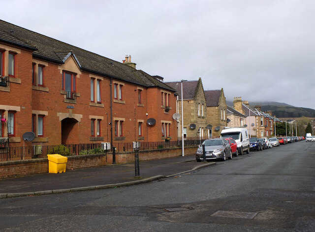
Broomhill is a small village located in Midlothian, Scotland. Situated approximately 10 miles south of Edinburgh, it is nestled within the picturesque countryside and offers a peaceful and rural setting for its residents. The village is part of the larger Penicuik area and benefits from its proximity to various amenities and attractions.

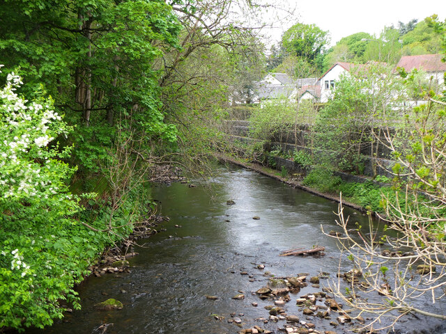
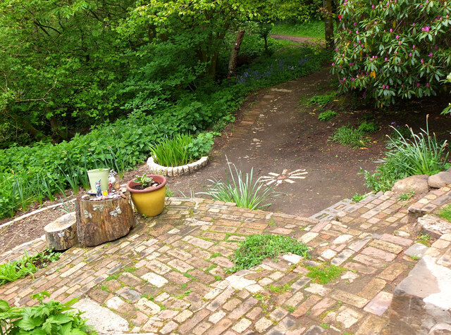
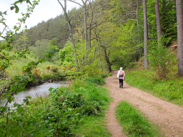
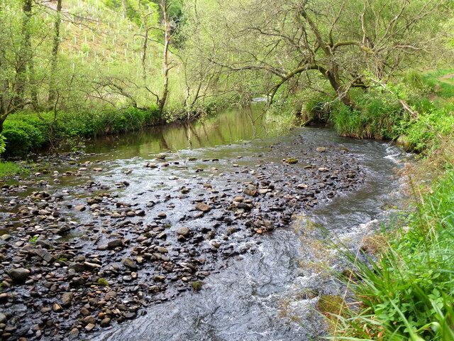
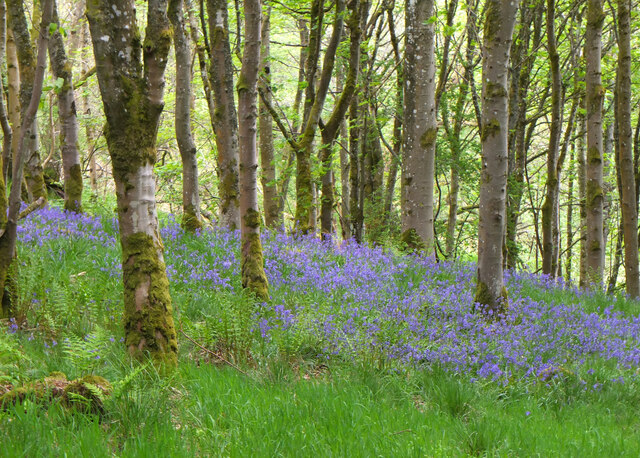
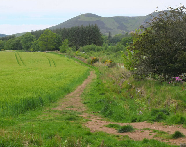
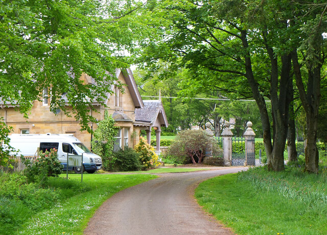
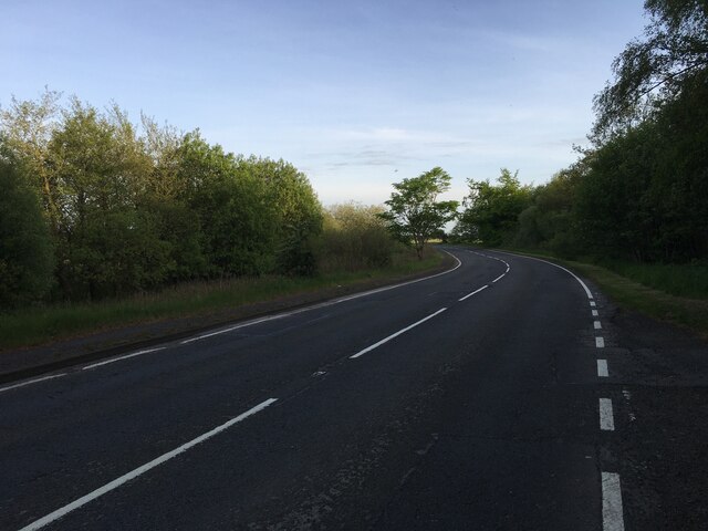
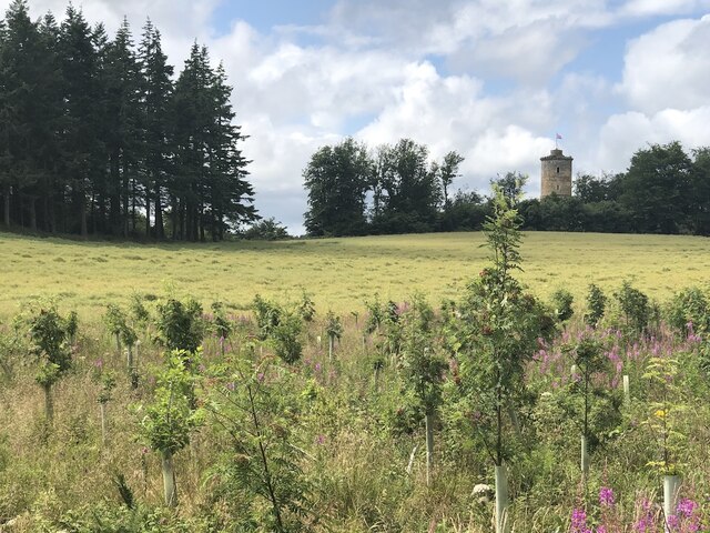
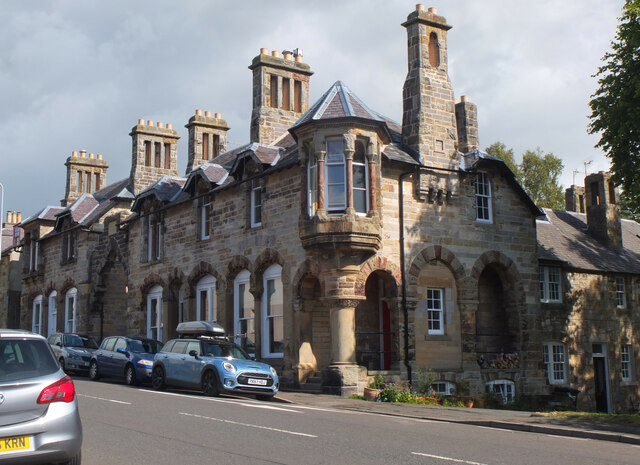
Broomhill is characterized by its charming traditional stone cottages, which contribute to its quaint and timeless appeal. The village is surrounded by lush green fields and rolling hills, providing breathtaking views of the surrounding landscape. The nearby Pentland Hills Regional Park is a popular destination for outdoor enthusiasts, offering a range of activities such as walking, hiking, and cycling.

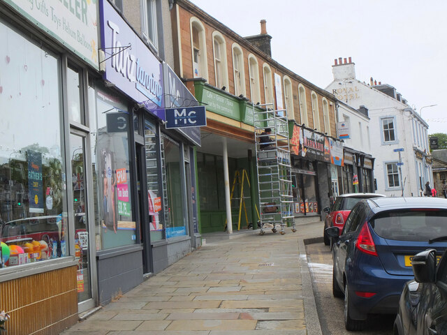
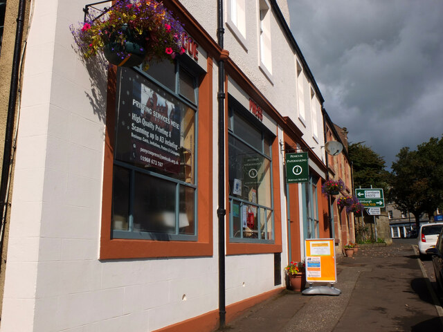
While Broomhill itself is relatively small, it benefits from its close proximity to the larger towns of Penicuik and Edinburgh. Penicuik offers a range of amenities including supermarkets, shops, restaurants, and leisure facilities. Edinburgh, Scotland's capital city, is easily accessible by car or public transport, providing residents with a wider array of services, entertainment, and cultural opportunities.

The village has a strong sense of community, with local events and activities organized throughout the year. The Broomhill Inn, a traditional pub located in the heart of the village, serves as a gathering place for locals and visitors alike. Additionally, the village has a primary school, providing education for the younger residents.

Overall, Broomhill offers a peaceful and picturesque setting with easy access to both rural and urban amenities. Its charming character and convenient location make it an attractive place to live for those seeking a balance between countryside tranquility and city convenience.

If you have any feedback on the listing, please let us know in the comments section below.

Broomhill Images

Images are sourced within 2km of 55.827628/-3.2265646 or Grid Reference NT2360. Thanks to Geograph Open Source API. All images are credited.

River North Esk at Valleyfield, Penicuik Looking upstream where the river bends on its way alongside the housing development at Valleyfield, a former mill site.
River North Esk at Valleyfield, Penicuik
Looking upstream where the river bends on its way alongside the housing development at Valleyfield, a former mill site.
Decorated space, path to Penicuik Estate Brick steps and plant pots on the path by the North Esk from the A701 to Penicuik Estate grounds.
Decorated space, path to Penicuik Estate
Brick steps and plant pots on the path by the North Esk from the A701 to Penicuik Estate grounds.
Path by the North Esk, Penicuik A path on the north side of the river to the surroundings of Penicuik House.
Path by the North Esk, Penicuik
A path on the north side of the river to the surroundings of Penicuik House.
River North Esk near Penicuik The North Esk rises in the Pentland Hills above Carlops. It joins the South Esk, which starts life in the Lammermuir Hills, at Dalkeith.
River North Esk near Penicuik
The North Esk rises in the Pentland Hills above Carlops. It joins the South Esk, which starts life in the Lammermuir Hills, at Dalkeith.
Bluebells in Serpentine Wood, Penicuik
Farmland on Penicuik Estate South Black Hill is in the background.
Farmland on Penicuik Estate
South Black Hill is in the background.
Spear Gate Lodge, Penicuik Estate A lodge house where one of the estate access roads meets the A766.
Spear Gate Lodge, Penicuik Estate
A lodge house where one of the estate access roads meets the A766.
Shopfront refurbishment, Penicuik High Street The Penicuik Storehouse undergoing renovation as part of a programme to improve the appearance of shops in the town.
Shopfront refurbishment, Penicuik High Street
The Penicuik Storehouse undergoing renovation as part of a programme to improve the appearance of shops in the town.
Vaucluse Place, Penicuik A block of flats in Jackson Street.
Vaucluse Place, Penicuik
A block of flats in Jackson Street.
A701 south of Penicuik
Field, Penicuik Estate The roadside conifers are long gone allowing a view of the folly.
Field, Penicuik Estate
The roadside conifers are long gone allowing a view of the folly.
Pen-y-Coe Press, Penicuik A long-established stationery and printing shop with an adjoining museum of papermaking in Bridge Street. In the early 19th century Penicuik became an important centre for papermaking, with mills along the River North Esk.
Pen-y-Coe Press, Penicuik
A long-established stationery and printing shop with an adjoining museum of papermaking in Bridge Street. In the early 19th century Penicuik became an important centre for papermaking, with mills along the River North Esk.
Parkend, Penicuik A striking corner terrace by the architect Thomas Pilkington c. 1860. He also designed the nearby Penicuik South Kirk and terraced cottages in the mill village of Walkerburn - see <a href="https://www.geograph.org.uk/photo/2231809">NT3537 : Millworkers' cottages, Walkerburn</a>.
Parkend, Penicuik
A striking corner terrace by the architect Thomas Pilkington c. 1860. He also designed the nearby Penicuik South Kirk and terraced cottages in the mill village of Walkerburn - see NT3537 : Millworkers' cottages, Walkerburn.
Demolition and rebuilding, Penicuik Old premises on Bridge Street are being demolished and construction appears to be the next step. The flag is flying from the Belgian Consulate on the corner with West Street - see also <a href="https://www.geograph.org.uk/photo/3332421">NT2359 : Belgian Consulate, Penicuik</a>.
Demolition and rebuilding, Penicuik
Old premises on Bridge Street are being demolished and construction appears to be the next step. The flag is flying from the Belgian Consulate on the corner with West Street - see also NT2359 : Belgian Consulate, Penicuik.
Papermaking Museum, Penicuik The museum is next door to the Pen-y-Coe Press on Bridge Street.  It is currently open on Saturday afternoons or at other times by arrangement for groups and entry is free. See the museum's website at <span class="nowrap"><a title="https://penicuikcdt.co.uk/index.php/penicuik-papermaking-heritage-museum/" rel="nofollow ugc noopener" href="https://penicuikcdt.co.uk/index.php/penicuik-papermaking-heritage-museum/">Link</a><img style="margin-left:2px;" alt="External link" title="External link - shift click to open in new window" src="https://s1.geograph.org.uk/img/external.png" width="10" height="10"/></span>.
Papermaking Museum, Penicuik
The museum is next door to the Pen-y-Coe Press on Bridge Street. It is currently open on Saturday afternoons or at other times by arrangement for groups and entry is free. See the museum's website at LinkExternal link.
Making paper by hand (1) Visitors to the Papermaking Museum at Penicuik have a chance to help make a sheet of paper. Pulp is caught on a rectangular mesh and carefully removed and transferred to the screw press to squeeze out the excess water.
Making paper by hand (1)
Visitors to the Papermaking Museum at Penicuik have a chance to help make a sheet of paper. Pulp is caught on a rectangular mesh and carefully removed and transferred to the screw press to squeeze out the excess water.
Making paper by hand (2) The process of making a sheet of paper from pulp being demonstrated at the Papermaking Museum, Penicuik. The sheet is being separated from its carrying cloth and is ready for drying.
Making paper by hand (2)
The process of making a sheet of paper from pulp being demonstrated at the Papermaking Museum, Penicuik. The sheet is being separated from its carrying cloth and is ready for drying.
Printing press demonstration A small press being demonstrated at the Papermaking Museum, Penicuik. The gear wheel carries the makers name 'Josiah Wade Ltd Halifax Eng.' It can be powered by a belt drive or, as here, by the treadle. Cases carrying the type letters can be seen to the right.
Printing press demonstration
A small press being demonstrated at the Papermaking Museum, Penicuik. The gear wheel carries the makers name 'Josiah Wade Ltd Halifax Eng.' It can be powered by a belt drive or, as here, by the treadle. Cases carrying the type letters can be seen to the right.
Show me another place!

Broomhill is located at Grid Ref: NT2360 (Lat: 55.827628, Lng: -3.2265646)

Unitary Authority: Midlothian

Police Authority: The Lothians and Scottish Borders

What 3 Words

///secret.parsnip.pylons. Near Penicuik, Midlothian

Related Wikis

Penicuik Athletic F.C.

Penicuik Athletic Football Club are a Scottish football club. They were formed in 1888 and are based at Montgomery Park (formerly known as Penicuik Park...

Penicuik Town Hall

Penicuik Town Hall, formerly the Cowan Institute, is a municipal building in the High Street, Penicuik, Midlothian, Scotland. The structure, which was...

Penicuik

Penicuik ( PEN-i-kuuk; Scots: Penicuik; Scottish Gaelic: Peighinn na Cuthaig) is a town and former burgh in Midlothian, Scotland, lying on the west bank...

Penicuik railway station

Penicuik railway station served the town of Penicuik, Midlothian, Scotland from 1872 to 1951 on the Penicuik Railway. == History == The station opened...

Uttershill Castle

Uttershill Castle is a ruinous 16th-century tower house, about 0.5 miles (0.80 km) south of Penicuik, Midlothian, Scotland, south of the river North Esk...

Pomathorn Halt railway station

Pomathorn Halt railway station served the town of Penicuik, Midlothian, Scotland from 1855 to 1962 on the Peebles Railway. == History == The station opened...

Esk Bridge railway station

Esk Bridge railway station served the settlement of Esk Bridge, Midlothian, Scotland from 1874 to 1930 on the Penicuik Railway. == History == The station...

Mauricewood Colliery disaster

The Mauricewood Colliery Disaster, occurred at the Mauricewood pit, near Penicuik, Midlothian, Scotland on 5 September 1889. A total of 63 miners were...

Nearby Amenities

Located within 500m of 55.827628,-3.2265646
Crossing
Crossing: unmarked
Crossing Island: yes
Crossing Markings: no
Kerb: lowered
Tactile Paving: yes
Lat/Long: 55.8317007/-3.2239999
Crossing
Crossing: uncontrolled
Crossing Ref: zebra
Lat/Long: 55.8278014/-3.2210559
Crossing
Crossing: uncontrolled
Crossing Ref: zebra
Lat/Long: 55.8276419/-3.2203186
Penicuik
Alt Name Gd: Ceann na Cuthaige
Is In: Midlothian, Scotland, UK
Loc Name: The Cuik;Peni
Name Cy: Pen y Gog
Name En: Penicuik
Name Fa: پنیکوک
Name Gd: Peighinn na Cuthaig
Name Uk: Пенік'юїк
Place: town
Population: 15926
Wikidata: Q1011428
Wikipedia: en:Penicuik
Lat/Long: 55.827236/-3.2218145
Give Way
Lat/Long: 55.8319991/-3.2267709
Give Way
Lat/Long: 55.8318703/-3.2289635
Give Way
Direction: backward
Lat/Long: 55.8291635/-3.2306813
Traffic Calming: hump
Lat/Long: 55.8277771/-3.2267405
Post Office
Penicuik Post Office
Addr Postcode: EH26 8AA
Branch: Penicuik
Brand: Post Office
Brand Wikidata: Q1783168
Check Date: 2020-02-20
Contact Website: https://www.postoffice.co.uk/branch-finder/138824x/penicuik
Ref Pol Id: 2491
Lat/Long: 55.8280866/-3.2229717
Give Way
Lat/Long: 55.8306952/-3.2215858
Noexit: yes
Lat/Long: 55.8256961/-3.2196451
Give Way
Lat/Long: 55.825951/-3.2264016
Give Way
Lat/Long: 55.8253509/-3.2255797
Give Way
Lat/Long: 55.8243498/-3.2253239
B&M Bargains
Brand: B&M Bargains
Brand Wikidata: Q4836931
Brand Wikipedia: en:B & M
Contact Website: https://www.bmstores.co.uk/stores/penicuik-707
Shop: variety_store
Lat/Long: 55.8273039/-3.220914
Crossing
Crossing: uncontrolled
Crossing Ref: zebra
Lat/Long: 55.8279528/-3.2202742
Barrier: bollard
Lat/Long: 55.8314063/-3.223833
Barrier: bollard
Lat/Long: 55.8316584/-3.2234498
Bus Stop
Angle Park
Bus: yes
Naptan AdministrativeAreaCode: 130
Naptan Area Name: Midlothian
Naptan AtcoAreaCode: 628
Naptan AtcoCode: 6280302460
Naptan Bearing: S
Naptan CommonName: Angle Park
Naptan Indicator: opp
Naptan Landmark: -
Naptan LocalityName: Penicuik
Naptan NaptanCode: 64324265
Naptan NptgLocalityCode: ES002994
Naptan SourceLocalityType: Lo
Naptan StopAreaCode: 628G325200
Naptan StopAreaType: GPBS
Naptan StopArea Name: Angle Park
Naptan Street: John Street
Naptan Verified: yes
Public Transport: platform
Source: NaPTAN + Survey
Lat/Long: 55.8312328/-3.2238523
Give Way
Lat/Long: 55.829612/-3.2223114
Public Bookcase
Pandora's Box
Booth: K6
Disused Amenity: telephone
Man Made: telephone_box
Public Bookcase Type: phone_box
Lat/Long: 55.826264/-3.2216707
Post Box
Post Box Type: pillar
Ref: EH26 118
Royal Cypher: scottish_crown
Lat/Long: 55.8263758/-3.2211178
Bus Stop
Town Centre
Bus: yes
Naptan AdministrativeAreaCode: 130
Naptan Area Name: Midlothian
Naptan AtcoAreaCode: 628
Naptan AtcoCode: 6280302490
Naptan Bearing: SE
Naptan CommonName: Town Centre
Naptan Indicator: Stop A
Naptan Landmark: At Health Centre
Naptan LocalityName: Penicuik
Naptan NaptanCode: 64324373
Naptan NptgLocalityCode: ES002994
Naptan ShortCommonName: Town Centre
Naptan SourceLocalityType: Lo
Naptan StopAreaCode: 628G302495
Naptan StopAreaType: GCLS
Naptan StopArea Name: Town Centre
Naptan Street: St Kentigern Way
Naptan Verified: yes
Public Transport: platform
Shelter: yes
Source: NaPTAN + Survey
Lat/Long: 55.8279798/-3.2217733
Bus Stop
Wilson Street
Bus: yes
Naptan AdministrativeAreaCode: 130
Naptan Area Name: Midlothian
Naptan AtcoAreaCode: 628
Naptan AtcoCode: 6280302470
Naptan Bearing: SE
Naptan CommonName: Wilson Street
Naptan Indicator: opp
Naptan Landmark: -
Naptan LocalityName: Penicuik
Naptan NaptanCode: 64324376
Naptan NptgLocalityCode: ES002994
Naptan SourceLocalityType: Lo
Naptan StopAreaCode: 628G325180
Naptan StopAreaType: GPBS
Naptan StopArea Name: Wilson Street
Naptan Street: John Street
Naptan Verified: yes
Public Transport: platform
Source: NaPTAN + Survey
Lat/Long: 55.8292636/-3.2231021
Bus Stop
Imrie Place
Bus: yes
Mapillary: 463630184698037
Naptan AdministrativeAreaCode: 130
Naptan Area Name: Midlothian
Naptan AtcoAreaCode: 628
Naptan AtcoCode: 6280302510
Naptan Bearing: SW
Naptan CommonName: Imrie Place
Naptan Indicator: opp
Naptan Landmark: -
Naptan LocalityName: Penicuik
Naptan NaptanCode: 64324326
Naptan NptgLocalityCode: ES002994
Naptan SourceLocalityType: Lo
Naptan StopAreaCode: 628G325130
Naptan StopAreaType: GPBS
Naptan StopArea Name: Imrie Place
Naptan Street: Kirkhill Road
Naptan Verified: yes
Pole: yes
Public Transport: platform
Shelter: no
Source: NaPTAN + Survey
Survey Date: 2018-12-30
Lat/Long: 55.8275267/-3.219028
Pub
Stewart's Bar & Grill
Old Name: The Golden Goose
Lat/Long: 55.8308509/-3.2242698
Dentist
Ballantine Dental Practice
Email: Info@ballantinedental.co.uk
Opening Hours: Mo-Th 09:00-17:30; Fr 08:00-16:00
Phone: +44 1968 675586
Website: https://www.ballantinedental.co.uk/
Lat/Long: 55.8296146/-3.2229132
Crossing
Bicycle: no
Crossing: traffic_signals
Crossing Ref: pelican
Lat/Long: 55.8264583/-3.2210751
Bench
Lat/Long: 55.8273578/-3.221937
Fast Food
Greggs
Addr Postcode: EH26 8HN
Addr Street: John Street
Brand: Greggs
Brand Wikidata: Q3403981
Brand Wikipedia: en:Greggs
Contact Website: https://www.greggs.co.uk/shop-finder?shop-code=0215
Cuisine: sandwich;bakery
Fhrs Id: 158888
Source Addr: FHRS Open Data
Takeaway: yes
Lat/Long: 55.8274372/-3.2219256
Pharmacy
Lloyds Pharmacy
Brand: Lloyds Pharmacy
Brand Wikidata: Q6662870
Brand Wikipedia: en:LloydsPharmacy
Dispensing: yes
Healthcare: pharmacy
Opening Hours: Mo-Fr 09:00-18:00; Sa 09:00-17:00
Lat/Long: 55.8275164/-3.2223507
Crossing
Bicycle: no
Crossing: traffic_signals
Crossing Ref: pelican
Lat/Long: 55.8279459/-3.2224013
Food Facts Friends
Addr City: Penicuik
Addr Country: GB
Addr Housenumber: 42
Addr Postcode: EH26 8AB
Addr Street: John Street
Old Name: Royal Bank of Scotland
Lat/Long: 55.8279412/-3.2226844
Telephone
Booth: KX100
Covered: booth
Operator: BT
Payment Coins: yes
Payment Credit Cards: yes
Payment Debit Cards: yes
Payment Telephone Cards: yes
Lat/Long: 55.8280193/-3.2226686
Post Box
Collection Times: Mo-Fr 18:00; Sa 13:00
Operator: Royal Mail
Post Box Type: pillar
Ref: EH26 126
Royal Cypher: scottish_crown
Lat/Long: 55.828132/-3.2227323
Atm
Operator: Post Office
Lat/Long: 55.8281724/-3.2228313
Man Made: water_well
Lat/Long: 55.826172/-3.2221167
Atm
Operator: TSB
Source: survey
Lat/Long: 55.8267994/-3.2213839
Atm
Operator: Clydesdale Bank
Lat/Long: 55.826647/-3.2214343
Cafe
Han's Sweets'N'Eats
Addr City: Penicuik
Addr Housenumber: 3A
Addr Postcode: EH26 8HS
Addr Street: High Street
Cuisine: cake
Source Wheelchair: survey
Website: https://hanssweetsneats.com
Wheelchair: yes
Lat/Long: 55.8260517/-3.2219321
Bicycle Parking
Bicycle Parking: stands
Capacity: 10
Covered: no
Source Bicycle Parking: survey
Source Covered: survey
Lat/Long: 55.8265746/-3.2212827
Broomhill
Place: suburb
Lat/Long: 55.8275485/-3.2260438
Bicycle Parking
Capacity: 2
Covered: no
Lat/Long: 55.8263528/-3.2215289
Bicycle Parking
Capacity: 2
Covered: no
Source Covered: survey
Lat/Long: 55.826389/-3.2214485
Bicycle Parking
Bicycle Parking: stands
Capacity: 2
Covered: no
Lat/Long: 55.8261729/-3.2220188
Bicycle Parking
Bicycle Parking: stands
Capacity: 2
Covered: no
Source: survey
Lat/Long: 55.8262211/-3.2218844
Post Box
Collection Times: Mo-Fr 09:00; Sa 07:00
Operator: Royal Mail
Post Box Type: lamp
Ref: EH26 140D
Royal Cypher: scottish_crown
Lat/Long: 55.82896/-3.2327094
The Penicuik Centre
Leisure: sports_centre
Sport: swimming
Lat/Long: 55.8308746/-3.2300384
Parking
Lat/Long: 55.8279845/-3.2290812
Post Box
Collection Times: Mo-Fr 17:00; Sa 12:00
Operator: Royal Mail
Post Box Type: pillar
Ref: EH26 145
Royal Cypher: GVIR
Royal Cypher Wikidata: Q33102169
Lat/Long: 55.8244535/-3.2218922
Bus Stop
Imrie Place
Bus: yes
Mapillary: 507951633713260
Naptan AdministrativeAreaCode: 130
Naptan Area Name: Midlothian
Naptan AtcoAreaCode: 628
Naptan AtcoCode: 6280325130
Naptan Bearing: NE
Naptan CommonName: Imrie Place
Naptan Indicator: at
Naptan Landmark: -
Naptan LocalityName: Penicuik
Naptan NaptanCode: 64324327
Naptan NptgLocalityCode: ES002994
Naptan SourceLocalityType: Lo
Naptan StopAreaCode: 628G325130
Naptan StopAreaType: GPBS
Naptan StopArea Name: Imrie Place
Naptan Street: Kirkhill Road
Naptan Verified: yes
Public Transport: platform
Shelter: yes
Source: NaPTAN + Survey
Survey Date: 2018-12-30
Lat/Long: 55.8278205/-3.2186288
Bus Stop
Angle Park
Bin: yes
Bus: yes
Naptan AdministrativeAreaCode: 130
Naptan Area Name: Midlothian
Naptan AtcoAreaCode: 628
Naptan AtcoCode: 6280325200
Naptan Bearing: N
Naptan CommonName: Angle Park
Naptan Indicator: at
Naptan Landmark: -
Naptan LocalityName: Penicuik
Naptan NaptanCode: 64324267
Naptan NptgLocalityCode: ES002994
Naptan SourceLocalityType: Lo
Naptan StopAreaCode: 628G325200
Naptan StopAreaType: GPBS
Naptan StopArea Name: Angle Park
Naptan Street: John Street
Naptan Verified: yes
Public Transport: platform
Shelter: yes
Source: NaPTAN + Survey
Lat/Long: 55.831253/-3.2241451
Bus Stop
Town Centre
Bus: yes
Naptan AdministrativeAreaCode: 130
Naptan Area Name: Midlothian
Naptan AtcoAreaCode: 628
Naptan AtcoCode: 6280325170
Naptan Bearing: NW
Naptan CommonName: Town Centre
Naptan Indicator: Stop C
Naptan Landmark: opp Health Centre
Naptan LocalityName: Penicuik
Naptan NaptanCode: 64324374
Naptan NptgLocalityCode: ES002994
Naptan SourceLocalityType: Lo
Naptan StopAreaCode: 628G302495
Naptan StopAreaType: GCLS
Naptan StopArea Name: Town Centre
Naptan Street: St Kentigern Way
Naptan Verified: yes
Passenger Information Display: yes
Public Transport: platform
Shelter: yes
Source: NaPTAN
Lat/Long: 55.827734/-3.2214755
Bus Stop
Navaar House Hotel
Bus: yes
Naptan AdministrativeAreaCode: 130
Naptan Area Name: Midlothian
Naptan AtcoAreaCode: 628
Naptan AtcoCode: 6280302600
Naptan Bearing: NW
Naptan CommonName: Navaar House Hotel
Naptan Indicator: at
Naptan Landmark: Police Station
Naptan LocalityName: Penicuik
Naptan NaptanCode: 64324349
Naptan NptgLocalityCode: ES002994
Naptan SourceLocalityType: Lo
Naptan StopAreaCode: 628G302600
Naptan StopAreaType: GPBS
Naptan StopArea Name: Navaar House Hotel
Naptan Street: Bog Road
Naptan Verified: yes
Public Transport: platform
Source: NaPTAN + Survey
Lat/Long: 55.8260111/-3.2247258
Pub
The Old Crown Inn
Addr Housenumber: 13-13A
Addr Postcode: EH26 8HS
Addr Street: High Street
Fhrs Id: 158860
Source Addr: FHRS Open Data
Lat/Long: 55.826193/-3.2214897
McDougal Queen
Office: estate_agent
Lat/Long: 55.8264338/-3.2219374
Archies Barbers
Shop: hairdresser
Lat/Long: 55.8272172/-3.222007
Pharmacy
Lloyds Pharmacy
Brand: Lloyds Pharmacy
Brand Wikidata: Q6662870
Brand Wikipedia: en:LloydsPharmacy
Healthcare: pharmacy
Lat/Long: 55.8277516/-3.2225424
British Heart Foundation
Brand: British Heart Foundation
Brand Wikidata: Q4970039
Brand Wikipedia: en:British Heart Foundation
Shop: charity
Lat/Long: 55.8273883/-3.2218909
Caley Vapour
Shop: e-cigarette
Lat/Long: 55.8268636/-3.2216601
Castle Warehouse
Shop: furniture
Lat/Long: 55.8260485/-3.2224635
Cheque Centre
Shop: pawnbroker
Lat/Long: 55.8273354/-3.2218108
Advice
Citizen's Advice Bureau
Lat/Long: 55.8270655/-3.2218595
Tanz Tanning
Beauty: tanning
Shop: beauty
Lat/Long: 55.8264026/-3.2220207
Fast Food
Corfu Kebab House
Addr Housenumber: 2
Addr Postcode: EH26 8LJ
Addr Street: The Square
Fhrs Id: 159126
Source Addr: FHRS Open Data
Lat/Long: 55.8256926/-3.2223243
Enhance Beauty
Shop: beauty
Lat/Long: 55.826883/-3.2213335
Fishers
Shop: fishing
Lat/Long: 55.8269297/-3.2213524
Flowers by Lindsey
Shop: florist
Lat/Long: 55.8263477/-3.2221628
Restaurant
Food Lodge
Addr Housenumber: 1
Addr Postcode: EH26 8HS
Addr Street: High Street
Cuisine: chinese
Fhrs Id: 158854
Source Addr: FHRS Open Data
Lat/Long: 55.8259815/-3.2220349
Restaurant
Giovanni
Addr Housenumber: 7
Addr Postcode: EH26 8HS
Addr Street: High Street
Cuisine: italian
Fhrs Id: 781243
Source Addr: FHRS Open Data
Lat/Long: 55.8260883/-3.2217942
Headcases
Shop: hairdresser
Lat/Long: 55.8268239/-3.2216098
Jobcentre Plus
Brand: Jobcentre Plus
Brand Wikidata: Q6206793
Brand Wikipedia: en:Jobcentre Plus
Office: employment_agency
Lat/Long: 55.8276819/-3.2221672
Newsboyz
Addr Housenumber: 4
Addr Postcode: EH26 8LJ
Addr Street: The Square
Fhrs Id: 937426
Shop: convenience
Source Addr: FHRS Open Data
Lat/Long: 55.8256126/-3.2222992
Fast Food
Marmaris
Addr City: Penicuik
Addr Country: GB
Addr Housenumber: 24
Addr Postcode: EH26 8HW
Addr Street: High Street
Cuisine: kebab
Fhrs Id: 1499990
Takeaway: yes
Lat/Long: 55.8264898/-3.2217253
Optical Express
Brand: Optical Express
Brand Wikidata: Q7098810
Brand Wikipedia: en:Optical Express
Shop: optician
Website: https://www.opticalexpress.co.uk/clinic-finder/scotland/penicuik-john-street
Lat/Long: 55.8272498/-3.2220337
Oxfam
Brand: Oxfam
Brand Wikidata: Q267941
Brand Wikipedia: en:Oxfam
Contact Website: https://www.oxfam.org.uk/shops/oxfam-shop-penicuik/
Shop: charity
Lat/Long: 55.8275585/-3.2223885
Fast Food
Lord Of The Noodles
Addr City: Penicuik
Addr Country: GB
Addr Housenumber: 15
Addr Postcode: EH26 8HS
Addr Street: High Street
Fhrs Id: 999033
Old Name: Peni Wok
Lat/Long: 55.8262288/-3.2213631
Addr City: Penicuik
Addr Country: GB
Addr Housenumber: 12
Addr Postcode: EH26 8HW
Addr Street: High Street
Disused Amenity: restaurant
Old Name: Mother's Kitchen & Gin
Lat/Long: 55.8263066/-3.2222982
Pharmacy
Rowlands Pharmacy
Brand: Rowlands Pharmacy
Brand Wikidata: Q62663235
Dispensing: yes
Healthcare: pharmacy
Opening Hours: Mo-Fr 09:00-18:00; Sa 09:00-17:00
Website: https://rowlandspharmacy.co.uk/find-local-pharmacy#!/l/midlothian/27-john-street/1439
Lat/Long: 55.8276264/-3.2221216
Semichem
Shop: chemist
Lat/Long: 55.8274862/-3.2219741
St Margaret of Scotland Hospice
Shop: charity
Lat/Long: 55.8276678/-3.2224717
Stuart & Stuart
Office: estate_agent
Lat/Long: 55.826898/-3.2216899
The Best Seller
Shop: gift
Lat/Long: 55.8263708/-3.2221039
Cafe
The Brew and Blether
Addr City: Penicuik
Addr Country: GB
Addr Housenumber: 15
Addr Postcode: EH26 8HN
Addr Street: John Street
Fhrs Id: 1499985
Old Name: The Original Factory Shop
Lat/Long: 55.827062/-3.2215361
The Salvation Army
Brand: The Salvation Army
Brand Wikidata: Q188307
Brand Wikipedia: en:The Salvation Army
Shop: charity
Lat/Long: 55.8275399/-3.2220337
The Studio
Shop: hairdresser
Lat/Long: 55.8272825/-3.2220588
William Hill
Brand: William Hill
Brand Wikidata: Q4053147
Brand Wikipedia: en:William Hill (bookmaker)
Shop: bookmaker
Lat/Long: 55.8267269/-3.2212613
Cafe
Gravity Bottleshop
Addr City: Penicuik
Addr Country: GB
Addr Housenumber: 9-11
Addr Postcode: EH26 8HS
Addr Street: High Street
Fhrs Id: 895091
Lat/Long: 55.8261313/-3.2216566
Barrier: bollard
Bicycle: yes
Foot: yes
Lat/Long: 55.8265395/-3.2213141
Shop: vacant
Lat/Long: 55.827599/-3.2224309
Crossing
Crossing: uncontrolled
Crossing Ref: zebra
Lat/Long: 55.8276069/-3.2210425
Post Box
Collection Times: Mo-Fr 09:00; Sa 07:00
Operator: Royal Mail
Post Box Type: lamp
Ref: EH26 10D
Royal Cypher: scottish_crown
Lat/Long: 55.8254619/-3.2248326
Entrance: yes
Lat/Long: 55.8282382/-3.2214502
Graham Young
Office: estate_agent
Lat/Long: 55.8268423/-3.2219161
Luscious
Shop: beauty
Lat/Long: 55.8273631/-3.222139
Restaurant
Massaro's
Cuisine: italian
Lat/Long: 55.8266489/-3.2208487
Bank
TSB
Brand: TSB
Brand Wikidata: Q7671560
Brand Wikipedia: en:TSB Bank (United Kingdom)
Lat/Long: 55.8268074/-3.2212945
Restaurant
Gurkhas
Addr City: Penicuik
Addr Country: GB
Addr Housenumber: 26
Addr Postcode: EH26 8HW
Addr Street: High Street
Cuisine: indian
Fhrs Id: 1360197
Takeaway: yes
Wheelchair: no
Lat/Long: 55.8265076/-3.2216221
William Purves
Shop: funeral_directors
Lat/Long: 55.8278732/-3.2226454
Fast Food
Yu
Addr Housenumber: 44B
Addr Postcode: EH26 8AB
Addr Street: John Street
Cuisine: chinese
Fhrs Id: 772998
Phone: +44 1968 678890
Source Addr: FHRS Open Data
Lat/Long: 55.827834/-3.2226219
Bus Stop
Wilson Street
Bin: yes
Bus: yes
Naptan AdministrativeAreaCode: 130
Naptan Area Name: Midlothian
Naptan AtcoAreaCode: 628
Naptan AtcoCode: 6280325180
Naptan Bearing: NW
Naptan CommonName: Wilson Street
Naptan Indicator: at
Naptan Landmark: -
Naptan LocalityName: Penicuik
Naptan NaptanCode: 64324378
Naptan NptgLocalityCode: ES002994
Naptan SourceLocalityType: Lo
Naptan StopAreaCode: 628G325180
Naptan StopAreaType: GPBS
Naptan StopArea Name: Wilson Street
Naptan Street: John Street
Naptan Verified: yes
Public Transport: platform
Shelter: yes
Source: NaPTAN + Survey
Lat/Long: 55.8287354/-3.2230512
Crossing
Bicycle: yes
Button Operated: yes
Crossing: traffic_signals
Crossing Island: no
Crossing Ref: toucan
Kerb: lowered
Tactile Paving: yes
Lat/Long: 55.830425/-3.2285082
Crossing
Crossing: zebra
Lat/Long: 55.830384/-3.2287692
Entrance: yes
Lat/Long: 55.8308461/-3.2296866
Access: private
Barrier: bollard
Lat/Long: 55.8304819/-3.2286068
Bicycle Parking
Lat/Long: 55.8309173/-3.2294033
Entrance: yes
Lat/Long: 55.8281419/-3.2214221
Cornbank
Place: suburb
Lat/Long: 55.8298147/-3.2315862
Parking
Capacity: 15
Parking: surface
Lat/Long: 55.82744/-3.222801
Addr City: Penicuick
Addr Housenumber: 41
Addr Street: John Street
Lat/Long: 55.8280188/-3.2223132
Addr City: Penicuick
Addr Housenumber: 43
Addr Street: John Street
Lat/Long: 55.828082/-3.2223495
Addr City: Penicuick
Addr Housenumber: 45
Addr Street: John Street
Lat/Long: 55.828165/-3.2223972
Addr City: Penicuick
Addr Housenumber: 47
Addr Street: John Street
Lat/Long: 55.8282438/-3.2224426
Addr City: Penicuick
Addr Housenumber: 51
Addr Street: John Street
Lat/Long: 55.8283635/-3.2225076
Addr City: Penicuick
Addr Housenumber: 53
Addr Street: John Street
Lat/Long: 55.8284885/-3.2225801
Addr City: Penicuick
Addr Housenumber: 55
Addr Street: John Street
Lat/Long: 55.8286207/-3.222656
Addr City: Penicuick
Addr Housenumber: 57
Addr Street: John Street
Lat/Long: 55.8287318/-3.2227158
Addr City: Penicuick
Addr Housenumber: 59
Addr Street: John Street
Lat/Long: 55.8288376/-3.2227824
Addr City: Penicuick
Addr Housenumber: 61
Addr Street: John Street
Lat/Long: 55.8289374/-3.222849
Addr City: Penicuick
Addr Housenumber: 91
Addr Street: John Street
Lat/Long: 55.8296005/-3.2231202
William Hill
Brand: William Hill
Brand Wikidata: Q4053147
Brand Wikipedia: en:William Hill (bookmaker)
Shop: bookmaker
Lat/Long: 55.8313997/-3.2242674
Give Way
Direction: forward
Lat/Long: 55.8318494/-3.2240998
Historic: memorial
Memorial: war_memorial
Wikidata: Q114169273
Lat/Long: 55.8295212/-3.2257124
Give Way
Lat/Long: 55.8255864/-3.2241218
Stop
Direction: backward
Stop: minor
Lat/Long: 55.8275969/-3.2266272
Stop
Direction: backward
Stop: minor
Lat/Long: 55.8276525/-3.2264829
Give Way
Direction: backward
Lat/Long: 55.8280384/-3.2253142
Give Way
Direction: forward
Lat/Long: 55.8281519/-3.2254418
Give Way
Direction: backward
Lat/Long: 55.8284947/-3.2243694
Give Way
Direction: forward
Lat/Long: 55.8285831/-3.2244706
Give Way
Direction: forward
Lat/Long: 55.8289615/-3.2231381
Description: Mobile phone mast
Man Made: tower
Tower Type: communication
Lat/Long: 55.8241384/-3.2300134
Barrier: stile
Foot: yes
Material: wood
Stile: stepover
Lat/Long: 55.8247464/-3.2291067
Give Way
Lat/Long: 55.8232538/-3.2283473
Give Way
Lat/Long: 55.8241427/-3.2253409
Give Way
Lat/Long: 55.8246068/-3.2249922
Give Way
Lat/Long: 55.8247111/-3.2238073
Give Way
Lat/Long: 55.8242755/-3.2218957
Give Way
Lat/Long: 55.8240608/-3.2232368
Give Way
Lat/Long: 55.8253791/-3.2247746
Give Way
Lat/Long: 55.8249301/-3.2243964
Give Way
Lat/Long: 55.82397/-3.2249577
Turning Circle
Lat/Long: 55.8290085/-3.233863
Atm
Brand: Post Office
Lat/Long: 55.8281817/-3.2227883
Bus Stop
Lambs Pend
Bus: yes
Naptan AdministrativeAreaCode: 130
Naptan Area Name: Midlothian
Naptan AtcoAreaCode: 628
Naptan AtcoCode: 6280325110
Naptan Bearing: NE
Naptan CommonName: Lambs Pend
Naptan Indicator: at
Naptan Landmark: Old Crown PH
Naptan LocalityName: Penicuik
Naptan NaptanCode: 64324325
Naptan NptgLocalityCode: ES002994
Naptan SourceLocalityType: Lo
Naptan StopAreaCode: 628G325110
Naptan StopAreaType: GPBS
Naptan StopArea Name: Lambs Pend
Naptan Street: High Street
Naptan Verified: yes
Public Transport: platform
Shelter: yes
Source: NaPTAN + Survey
Lat/Long: 55.8262727/-3.2217562
Veterinary
Gordon Vets
Lat/Long: 55.826261/-3.2224341
The Storehouse
Addr Housenumber: 22
Addr Postcode: EH26 8HW
Addr Street: High Street
Fhrs Id: 1170630
Restaurant: cafe
Shop: deli
Source Addr Postcode: FHRS Open Data
Survey Date: 2022-02-20
Lat/Long: 55.8264674/-3.2218212
Noexit: yes
Lat/Long: 55.8259719/-3.2201255
Bus Stop
Town Centre
Bin: yes
Bus: yes
Naptan AdministrativeAreaCode: 130
Naptan Area Name: Midlothian
Naptan AtcoAreaCode: 628
Naptan AtcoCode: 6280302495
Naptan Bearing: SE
Naptan CommonName: Town Centre
Naptan Indicator: Stop B
Naptan Landmark: near Health Centre
Naptan LocalityName: Penicuik
Naptan NaptanCode: 64329264
Naptan NptgLocalityCode: ES002994
Naptan SourceLocalityType: Lo
Naptan StopAreaCode: 628G302495
Naptan StopAreaType: GCLS
Naptan StopArea Name: Town Centre
Naptan Street: St Kentigern Way
Naptan Verified: yes
Passenger Information Display: yes
Public Transport: platform
Shelter: yes
Source: NaPTAN + Survey
Lat/Long: 55.8279129/-3.2213921
Bus Stop
John Street Lane
Bus: yes
Naptan AdministrativeAreaCode: 130
Naptan Area Name: Midlothian
Naptan AtcoAreaCode: 628
Naptan AtcoCode: 6280325190
Naptan Bearing: N
Naptan CommonName: John Street Lane
Naptan Indicator: at
Naptan Landmark: -
Naptan LocalityName: Penicuik
Naptan NaptanCode: 64324328
Naptan NptgLocalityCode: ES002994
Naptan SourceLocalityType: Lo
Naptan Street: John Street
Naptan Verified: yes
Public Transport: platform
Source: NaPTAN + Survey
Lat/Long: 55.8302605/-3.2239273
Bus Stop
Lambs Pend
Bus: yes
Naptan AdministrativeAreaCode: 130
Naptan Area Name: Midlothian
Naptan AtcoAreaCode: 628
Naptan AtcoCode: 6280302560
Naptan Bearing: SW
Naptan CommonName: Lambs Pend
Naptan Indicator: opp
Naptan Landmark: Old Crown PH
Naptan LocalityName: Penicuik
Naptan NaptanCode: 64324324
Naptan NptgLocalityCode: ES002994
Naptan SourceLocalityType: Lo
Naptan StopAreaCode: 628G325110
Naptan StopAreaType: GPBS
Naptan StopArea Name: Lambs Pend
Naptan Street: High Street
Naptan Verified: yes
Pole: yes
Public Transport: platform
Shelter: no
Source: NaPTAN + Survey
Lat/Long: 55.8261857/-3.2215557
Bus Stop
Navaar House Hotel
Bus: yes
Naptan AdministrativeAreaCode: 130
Naptan Area Name: Midlothian
Naptan AtcoAreaCode: 628
Naptan AtcoCode: 6280302605
Naptan Bearing: SE
Naptan CommonName: Navaar House Hotel
Naptan Indicator: opp
Naptan Landmark: Police Station
Naptan LocalityName: Penicuik
Naptan NaptanCode: 64324352
Naptan NptgLocalityCode: ES002994
Naptan SourceLocalityType: Lo
Naptan StopAreaCode: 628G302600
Naptan StopAreaType: GPBS
Naptan StopArea Name: Navaar House Hotel
Naptan Street: Bog Road
Naptan Verified: yes
Public Transport: platform
Source: NaPTAN + Survey
Lat/Long: 55.8262875/-3.2248434
Bus Stop
Craigiebield Crescent
Bus: yes
Naptan AdministrativeAreaCode: 130
Naptan Area Name: Midlothian
Naptan AtcoAreaCode: 628
Naptan AtcoCode: 6280302610
Naptan Bearing: NW
Naptan CommonName: Craigiebield Crescent
Naptan Indicator: at
Naptan Landmark: -
Naptan LocalityName: Penicuik
Naptan NaptanCode: 64324278
Naptan NptgLocalityCode: ES002994
Naptan SourceLocalityType: Lo
Naptan StopAreaCode: 628G302610
Naptan StopAreaType: GPBS
Naptan StopArea Name: Craigiebield Crescent
Naptan Street: Bog Road
Naptan Verified: yes
Public Transport: platform
Source: NaPTAN + Survey
Lat/Long: 55.8273143/-3.2262939
Bus Stop
Craigiebield Crescent
Bus: yes
Naptan AdministrativeAreaCode: 130
Naptan Area Name: Midlothian
Naptan AtcoAreaCode: 628
Naptan AtcoCode: 6280325060
Naptan Bearing: SE
Naptan CommonName: Craigiebield Crescent
Naptan Indicator: opp
Naptan Landmark: -
Naptan LocalityName: Penicuik
Naptan NaptanCode: 64324279
Naptan NptgLocalityCode: ES002994
Naptan SourceLocalityType: Lo
Naptan StopAreaCode: 628G302610
Naptan StopAreaType: GPBS
Naptan StopArea Name: Craigiebield Crescent
Naptan Street: Bog Road
Naptan Verified: yes
Public Transport: platform
Source: NaPTAN + Survey
Lat/Long: 55.8279847/-3.2269228
Bus Stop
Harlaw Grove
Bus: yes
Naptan AdministrativeAreaCode: 130
Naptan Area Name: Midlothian
Naptan AtcoAreaCode: 628
Naptan AtcoCode: 6280302436
Naptan Bearing: NE
Naptan CommonName: Harlaw Grove
Naptan Indicator: at
Naptan Landmark: -
Naptan LocalityName: Penicuik
Naptan NaptanCode: 64324643
Naptan NptgLocalityCode: ES002994
Naptan SourceLocalityType: Lo
Naptan StopAreaCode: 628G325220
Naptan StopAreaType: GPBS
Naptan StopArea Name: Penicuik Carlops Road
Naptan Street: Carlops Road
Naptan Verified: yes
Public Transport: platform
Shelter: yes
Source: NaPTAN + Survey
Lat/Long: 55.8288573/-3.2321734
Bus Stop
Harlaw Grove
Bench: no
Bin: no
Bus: yes
Naptan AdministrativeAreaCode: 130
Naptan Area Name: Midlothian
Naptan AtcoAreaCode: 628
Naptan AtcoCode: 6280325220
Naptan Bearing: SW
Naptan CommonName: Harlaw Grove
Naptan Indicator: opp
Naptan Landmark: Rullion Road
Naptan LocalityName: Penicuik
Naptan NaptanCode: 64324368
Naptan NptgLocalityCode: ES002994
Naptan SourceLocalityType: Lo
Naptan StopAreaCode: 628G325220
Naptan StopAreaType: GPBS
Naptan StopArea Name: Penicuik Carlops Road
Naptan Street: Carlops Road
Naptan Verified: yes
Passenger Information Display: no
Public Transport: platform
Shelter: no
Source: NaPTAN + Survey
Lat/Long: 55.8287719/-3.2318444
Barrier: swing_gate
Lat/Long: 55.8317148/-3.2283618
Entrance: yes
Lat/Long: 55.8310832/-3.222093
Entrance: yes
Lat/Long: 55.8311466/-3.2222649
Location: outdoor
Power: substation
Substation: minor_distribution
Lat/Long: 55.8296434/-3.219425
Give Way
Lat/Long: 55.8272358/-3.2199302
Traffic Calming: hump
Lat/Long: 55.8270372/-3.2258733
Traffic Calming: hump
Lat/Long: 55.8283383/-3.2278221
Give Way
Direction: backward
Lat/Long: 55.827119/-3.2277228
Give Way
Direction: backward
Lat/Long: 55.8271959/-3.2278293
Give Way
Lat/Long: 55.8312031/-3.2272285
Give Way
Lat/Long: 55.8314449/-3.2265124
Drinking Water
Top Up Tap
Access: yes
Bottle: yes
Fee: no
Operator: Scottish Water
Operator Wikidata: Q7438022
Lat/Long: 55.829484/-3.22592
Fast Food
Domino's
Addr City: Penicuik
Addr Country: GB
Addr Housenumber: 9
Addr Postcode: EH26 8LE
Addr Street: Kentigern Mall
Brand: Domino's
Brand Wikidata: Q839466
Cuisine: pizza
Fhrs Id: 1026001
Takeaway: yes
Lat/Long: 55.8275213/-3.2212016
Cafe
The Cabin
Addr City: Penicuik
Addr Country: GB
Addr Housenumber: 4
Addr Postcode: EH26 8LE
Addr Street: Kentigern Mall
Fhrs Id: 1470034
Lat/Long: 55.827391/-3.2211922
Restaurant
Koshi
Addr City: Penicuik
Addr Country: GB
Addr Housenumber: 1
Addr Postcode: EH26 8HY
Addr Street: Imrie Place
Fhrs Id: 1470033
Lat/Long: 55.8278173/-3.2188681
Cafe
Deli-cious
Addr City: Penicuik
Addr Country: GB
Addr Housenumber: 6
Addr Postcode: EH26 8HR
Addr Street: Lamb's Pend
Fhrs Id: 564164
Lat/Long: 55.8265744/-3.2223549
Telephone
Booth: KX100
Covered: booth
Lat/Long: 55.8280528/-3.2226875
The data included in this document is from www.openstreetmap.org. The data is made available under ODbL.

Have you been to Broomhill?

Leave your review of Broomhill below (or comments, questions and feedback).