Alder Copse

Wood, Forest in Sussex Chichester

England

Alder Copse

View from Duncton Hill View Point
View from Duncton Hill View Point Credit: PAUL FARMER

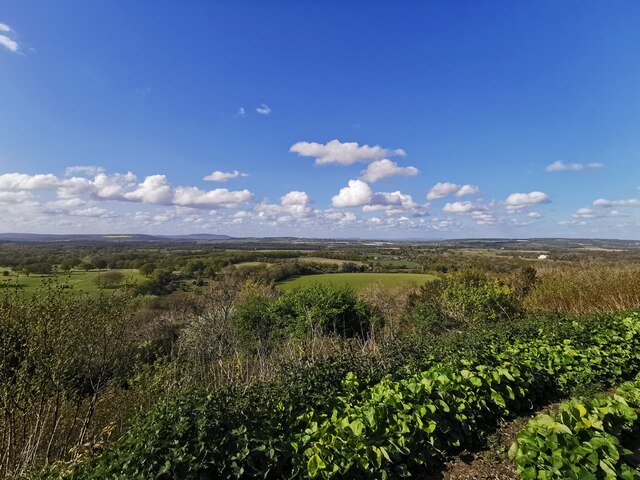
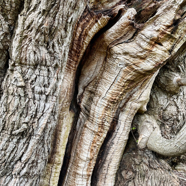
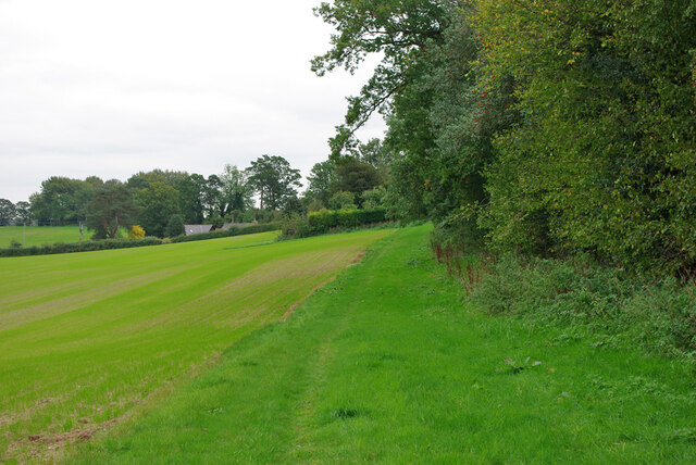
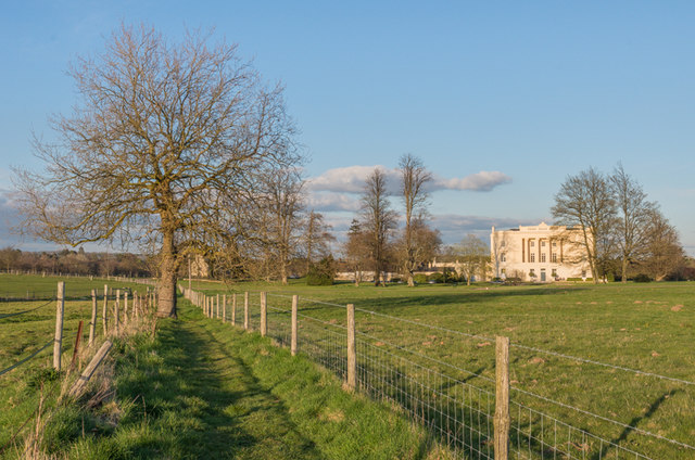
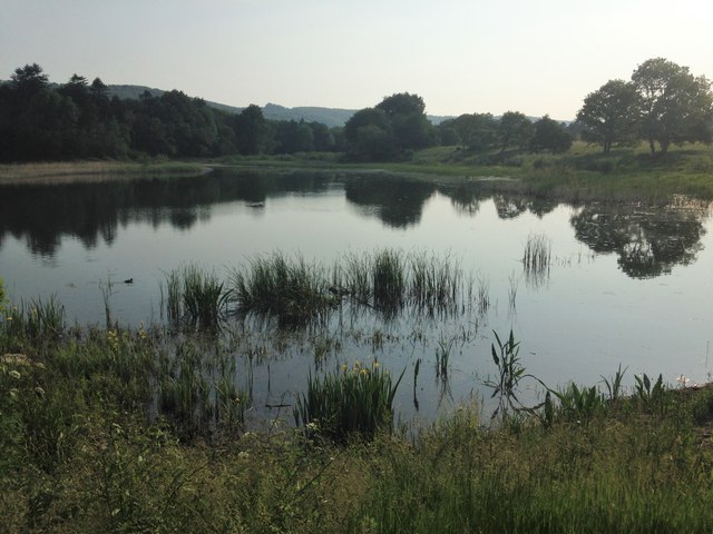
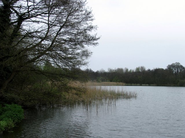
Alder Copse is a picturesque woodland located in Sussex, England. Spanning over an area of approximately 100 acres, it is known for its natural beauty and diverse ecosystem. The copse is predominantly composed of alder trees, which give it its name, along with a mix of other deciduous species such as oak, beech, and birch.

The woodland boasts a rich history, dating back several centuries. It is believed that Alder Copse was once part of a larger forest that covered the region during the medieval period. Over time, it has been managed and maintained by local authorities to preserve its unique character and ecological value.

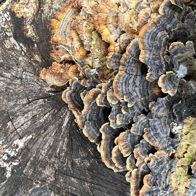
The copse is a haven for wildlife enthusiasts and nature lovers alike. Its dense vegetation and varied topography provide a habitat for a wide range of animal and plant species. Visitors can spot numerous bird species, including woodpeckers, owls, and songbirds, as well as mammals like foxes, badgers, and deer. In spring, the forest floor comes alive with a vibrant carpet of wildflowers, adding to the copse's natural charm.

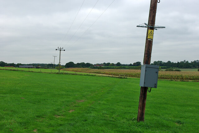
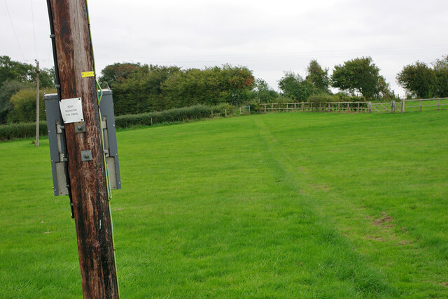
Alder Copse offers numerous recreational opportunities for visitors. There are well-marked trails that wind through the woodland, allowing hikers and walkers to explore its beauty at their own pace. Additionally, the copse has designated picnic areas and benches, making it an ideal spot for a leisurely lunch amidst nature.

Overall, Alder Copse is a captivating woodland that showcases the natural splendor of Sussex. With its ancient trees, abundant wildlife, and serene atmosphere, it offers a tranquil escape from the hustle and bustle of everyday life.

If you have any feedback on the listing, please let us know in the comments section below.
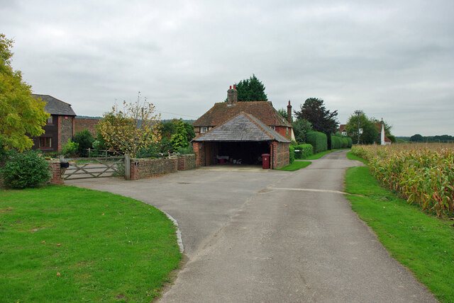
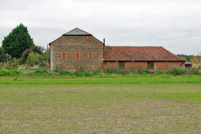
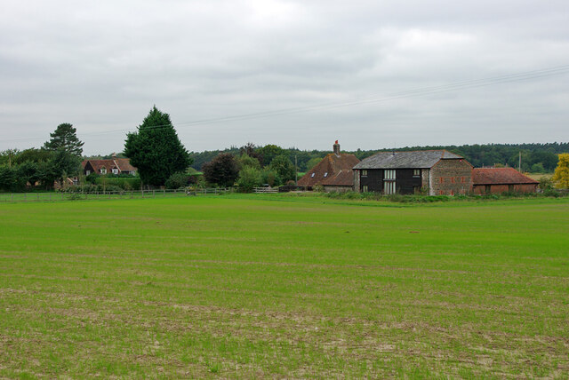
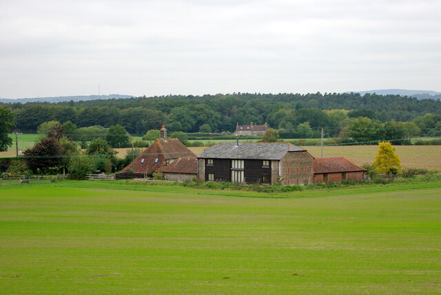
Alder Copse Images

Images are sourced within 2km of 50.939402/-0.61577915 or Grid Reference SU9716. Thanks to Geograph Open Source API. All images are credited.
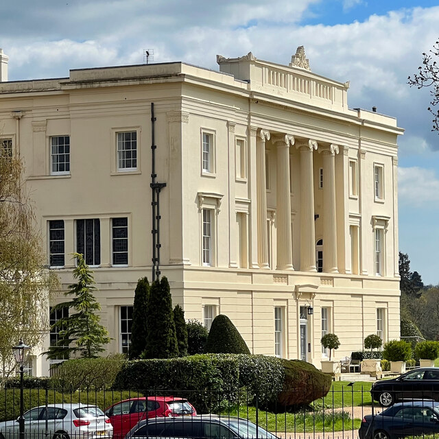
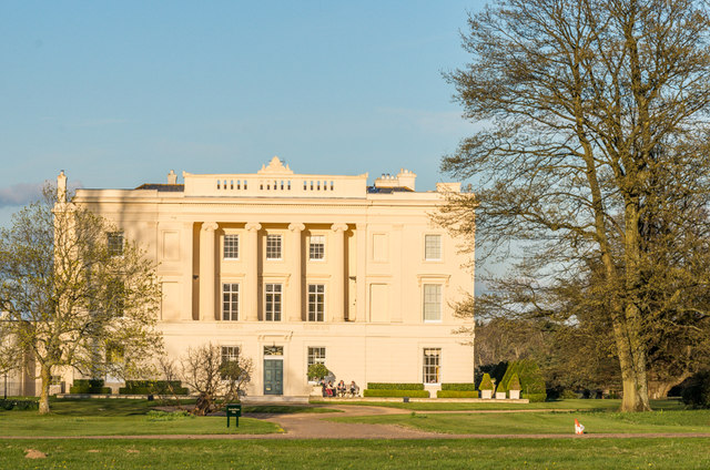
View from Duncton Hill View Point
Bracket fungus on a tree stump
Burton House Originally built in 1831 as a private residence for Henry Bassett, Burton Park [House] served for many years as a girl's school - St Michael's. The mansion, like many others in West Sussex, has been converted into luxury housing. Many of the grandest rooms in the building are now incorporated into spectacular apartments - and a cluster of very attractive houses have been built to the north and east of the building. [taken from WestSussex.info]
Burton House
Originally built in 1831 as a private residence for Henry Bassett, Burton Park [House] served for many years as a girl's school - St Michael's. The mansion, like many others in West Sussex, has been converted into luxury housing. Many of the grandest rooms in the building are now incorporated into spectacular apartments - and a cluster of very attractive houses have been built to the north and east of the building. [taken from WestSussex.info]
Gnarled tree trunk There are several of these trees hereabouts, with trunks of huge girth - maybe 3-4 metres in diameter. I think they may be sweet chestnuts.
Gnarled tree trunk
There are several of these trees hereabouts, with trunks of huge girth - maybe 3-4 metres in diameter. I think they may be sweet chestnuts.
Burton House I've taken photographs of this house before - but maybe not from exactly this angle!
Burton House
I've taken photographs of this house before - but maybe not from exactly this angle!
Private road by Redlands Farm It all seems residential now.
Private road by Redlands Farm
It all seems residential now.
Redlands Barn, Duncton Now residential.
Redlands Barn, Duncton
Now residential.
Redlands Farm, Duncton It all seems residential now.
Redlands Farm, Duncton
It all seems residential now.
Haymarsh and Redlands Barn Part of the now residential Redlands Farm.  Haymarsh, the house to the left, is a grade II listed building, 17th century or earlier.
Haymarsh and Redlands Barn
Part of the now residential Redlands Farm. Haymarsh, the house to the left, is a grade II listed building, 17th century or earlier.
Public footpath 718, Duncton Towards the A285 near the Roman Catholic church.
Public footpath 718, Duncton
Towards the A285 near the Roman Catholic church.
Public footpath 718, Duncton Towards Ridlington Farm. The box on the power pole is plated on the other side '9051 Ridlington 11 kV PMCB', that is, 'Pole mounted circuit breaker'. There also appears to be a manually operated circuit breaker on the next pole.
Public footpath 718, Duncton
Towards Ridlington Farm. The box on the power pole is plated on the other side '9051 Ridlington 11 kV PMCB', that is, 'Pole mounted circuit breaker'. There also appears to be a manually operated circuit breaker on the next pole.
Public footpath 718, Duncton Towards the A285 near the Roman Catholic church.  The box on the power pole is plated '9051 Ridlington 11 kV PMCB', that is, 'Pole mounted circuit breaker'.
Public footpath 718, Duncton
Towards the A285 near the Roman Catholic church. The box on the power pole is plated '9051 Ridlington 11 kV PMCB', that is, 'Pole mounted circuit breaker'.
Redlands Farm, Duncton Now residential.
Redlands Farm, Duncton
Now residential.
Burton Park Grade I listed mansion built in 1828 by architect Henry Bassett.  It was a private house until the Second World War, when it was requisitioned by the army.  After the war it housed a girls boarding scheme, St Michael's, until the 1980s, before becoming a police dog training centre.  In 1997 it was converted into apartments.

For listing particulars see <span class="nowrap"><a title="http://www.historicengland.org.uk/listing/the-list/list-entry/1274798" rel="nofollow ugc noopener" href="http://www.historicengland.org.uk/listing/the-list/list-entry/1274798">Link</a><img style="margin-left:2px;" alt="External link" title="External link - shift click to open in new window" src="https://s1.geograph.org.uk/img/external.png" width="10" height="10"/></span>.
Burton Park
Grade I listed mansion built in 1828 by architect Henry Bassett. It was a private house until the Second World War, when it was requisitioned by the army. After the war it housed a girls boarding scheme, St Michael's, until the 1980s, before becoming a police dog training centre. In 1997 it was converted into apartments. For listing particulars see LinkExternal link.
Burton Park Parkland in the Burton Park estate (see <a href="https://www.geograph.org.uk/photo/4693325">SU9617 : Burton Park</a>), with Duncton Down on the South Downs in the background.
Burton Park
Parkland in the Burton Park estate (see SU9617 : Burton Park), with Duncton Down on the South Downs in the background.
Burton Mill Pond A 16th century hammer pond used to power a water mill to forge iron.
Burton Mill Pond
A 16th century hammer pond used to power a water mill to forge iron.
Chingford Pond Situated within Burton Park just south west of Burton Mill Pond. It is designated a Sight Of Nature Conservation.
Chingford Pond
Situated within Burton Park just south west of Burton Mill Pond. It is designated a Sight Of Nature Conservation.
Show me another place!

Alder Copse is located at Grid Ref: SU9716 (Lat: 50.939402, Lng: -0.61577915)

Administrative County: West Sussex

District: Chichester

Police Authority: Sussex

What 3 Words

///hooks.emeralds.flooding. Near Petworth, West Sussex

Related Wikis

Barlavington

Barlavington is a small village and civil parish in the Chichester district of West Sussex, England. The village is situated about four miles (6.4 km)...

Burton Park

Burton Park is a 19th-century country house in the civil parish of Duncton in West Sussex, and is situated 1/2 a mile to the east of the village of Duncton...

Burton Park SSSI

Burton Park SSSI is a 57.7-hectare (143-acre) biological Site of Special Scientific Interest west of Pulborough in West Sussex. A larger area of 63 hectares...

Sutton, West Sussex

Sutton is a village and civil parish in the District of Chichester in West Sussex, England, located six kilometres (4 miles) south of Petworth and east...

Duncton

Duncton is a village and civil parish in the District of Chichester in West Sussex, England. The village is in the South Downs 3 miles (5 km) south of...

Bignor Park

Bignor Park is a privately owned country house and estate near the village of Bignor, in West Sussex, England, on the edge of the South Downs. The house...

Bignor

Bignor is a village and civil parish in the Chichester district of the English county of West Sussex, about six miles (9.7 km) north of Arundel. It is...

Duncton to Bignor Escarpment

Duncton to Bignor Escarpment is a 229-hectare (570-acre) biological Site of Special Scientific Interest west of Pulborough in West Sussex. It is a Special...

Nearby Amenities

Located within 500m of 50.939402,-0.61577915
Barrier: stile
Lat/Long: 50.935301/-0.6176026
Barrier: stile
Lat/Long: 50.9370261/-0.6211037
The data included in this document is from www.openstreetmap.org. The data is made available under ODbL.

Have you been to Alder Copse?

Leave your review of Alder Copse below (or comments, questions and feedback).