Mill Copse
Wood, Forest in Sussex Chichester
England
Mill Copse

Mill Copse is a picturesque woodland located in the county of Sussex in southeastern England. Spread over an area of approximately 50 acres, this enchanting forest is known for its serene beauty and diverse flora and fauna. The copse is situated near the village of Hartfield, which lies within the High Weald Area of Outstanding Natural Beauty.
The woodland is characterized by its dense canopy of tall oak, beech, and ash trees, which provide a sheltered habitat for a variety of wildlife. The forest floor is covered with a rich carpet of lush vegetation, including bluebells, wild garlic, and ferns, adding to the area's natural charm.
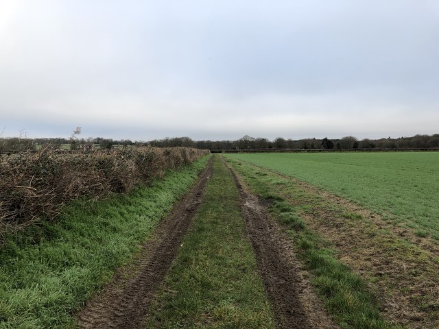
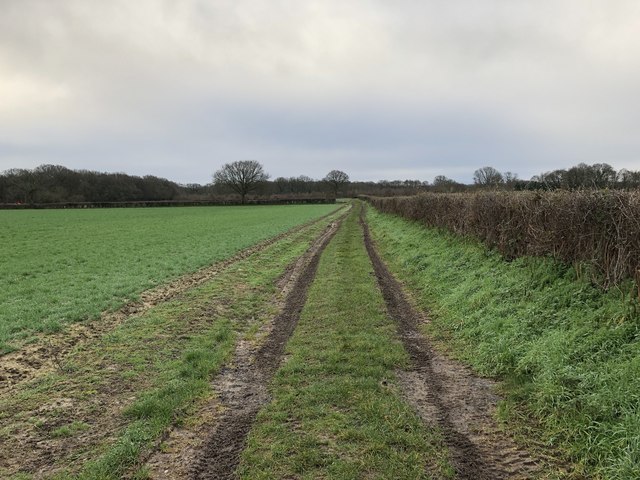
Visitors can explore Mill Copse through a network of well-maintained footpaths that wind their way through the woodland, offering stunning views of the surrounding countryside. These trails cater to both casual strollers and avid hikers, providing options for short leisurely walks or longer, more challenging treks.
Mill Copse is also home to a diverse range of wildlife, making it a haven for nature enthusiasts. Numerous bird species can be spotted here, including woodpeckers, owls, and various songbirds. The woodland is also inhabited by mammals such as deer, foxes, and badgers, which can occasionally be glimpsed by lucky visitors.
With its tranquil atmosphere and natural beauty, Mill Copse is a popular destination for nature lovers, photographers, and those seeking a peaceful escape from the hustle and bustle of everyday life. Whether it's a leisurely stroll or a wildlife-spotting adventure, this woodland offers a truly immersive experience in the heart of the Sussex countryside.
If you have any feedback on the listing, please let us know in the comments section below.
Mill Copse Images
Images are sourced within 2km of 51.067927/-0.61200623 or Grid Reference SU9730. Thanks to Geograph Open Source API. All images are credited.


Mill Copse is located at Grid Ref: SU9730 (Lat: 51.067927, Lng: -0.61200623)
Administrative County: West Sussex
District: Chichester
Police Authority: Sussex
What 3 Words
///nosedive.pickles.buckling. Near Chiddingfold, Surrey
Nearby Locations
Related Wikis

Shillinglee Lake
Shillinglee Lake is a 17-hectare (42-acre) biological Site of Special Scientific Interest west of Plaistow in West Sussex.The lake has been designated...

Shillinglee
Shillinglee is an 18th-century house and estate in West Sussex, England near the Surrey border, in between the villages of Chiddingfold and Plaistow. It...

The Farm (recording studio)
The Farm (also known as Fisher Lane Farm) was a recording studio in Chiddingfold, Surrey owned by the rock band Genesis. The group bought the property...

Northchapel
Northchapel is a village and civil parish in Chichester District in West Sussex, England. It stands on the A283 road just south of the Surrey border, around...

Ebernoe Horn Fair
Ebernoe Horn Fair is held in the small Sussex village of Ebernoe, the location of which is about five miles north of Petworth (grid reference SU975280...

Plaistow, West Sussex
Plaistow ( PLAST-oh) is a village and civil parish in the north of the Chichester District of West Sussex, England. There is a village green, a recreation...

Ebernoe
Ebernoe is a hamlet and civil parish in the District of Chichester in West Sussex, England, and 4 miles (6 km) north of Petworth near the A283 road. The...

Chiddingfold Forest
Chiddingfold Forest is a 542.5-hectare (1,341-acre) biological Site of Special Scientific Interest in Chiddingfold in Surrey and West Sussex. One part...
Nearby Amenities
Located within 500m of 51.067927,-0.61200623Have you been to Mill Copse?
Leave your review of Mill Copse below (or comments, questions and feedback).