Home Wood

Wood, Forest in Surrey Waverley

England

Home Wood

Pond beside Green Lane Beyond the pond lies the county border and the edge of the South Downs National Park.
Pond beside Green Lane Credit: Chris Thomas-Atkin

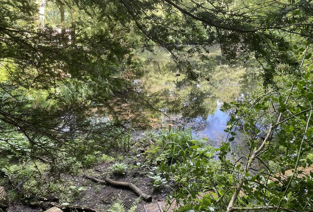
Home Wood, Surrey is a picturesque forest located in the county of Surrey in the southeastern part of England. Covering an area of approximately 200 hectares, this woodland is a popular destination for nature lovers and outdoor enthusiasts alike.

The woodland is predominantly composed of deciduous trees, including oak, beech, and birch, which create a vibrant and diverse ecosystem. These trees provide a habitat for a wide range of wildlife, including various bird species, deer, and small mammals.

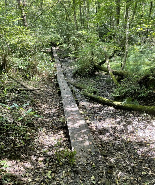
Home Wood is known for its well-maintained walking trails, allowing visitors to explore and enjoy the natural beauty of the area. These trails wind through the woodland, leading to scenic viewpoints and peaceful picnic spots. The forest is also home to a number of ancient trees, some of which are estimated to be several hundred years old.

In addition to its natural beauty, Home Wood holds historical significance. It is believed to have been part of the medieval Royal Forest of Windsor and has been protected as a Site of Special Scientific Interest since 1951. The woodland is managed by the Forestry Commission, which ensures the preservation and conservation of its unique flora and fauna.

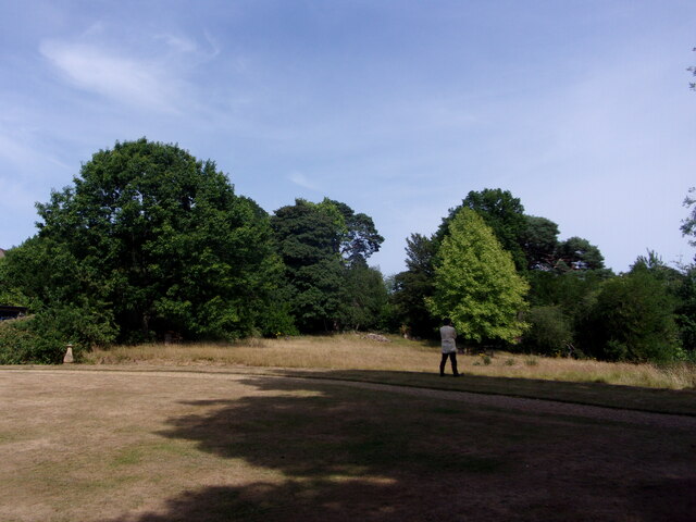
Visitors to Home Wood can experience a tranquil and serene atmosphere, away from the hustle and bustle of urban life. Whether it's a leisurely walk, birdwatching, or simply enjoying the peaceful surroundings, Home Wood offers a haven for those seeking a connection with nature.

If you have any feedback on the listing, please let us know in the comments section below.

Home Wood Images

Images are sourced within 2km of 51.076242/-0.68958483 or Grid Reference SU9131. Thanks to Geograph Open Source API. All images are credited.

Pond beside Green Lane Beyond the pond lies the county border and the edge of the South Downs National Park.
Pond beside Green Lane
Beyond the pond lies the county border and the edge of the South Downs National Park.
Valewood Farmhouse The farmhouse is a Grade II* (star) listed building. See <span class="nowrap"><a title="https://historicengland.org.uk/listing/the-list/list-entry/1354733" rel="nofollow ugc noopener" href="https://historicengland.org.uk/listing/the-list/list-entry/1354733">Link</a><img style="margin-left:2px;" alt="External link" title="External link - shift click to open in new window" src="https://s1.geograph.org.uk/img/external.png" width="10" height="10"/></span>
Valewood Farmhouse
The farmhouse is a Grade II* (star) listed building. See LinkExternal link
Gated Track On the Sussex Border Path in Chase Wood heading for Blackdown.
Gated Track
On the Sussex Border Path in Chase Wood heading for Blackdown.
Walking the planks The public footpath crosses a wet area near Lake House on a boardwalk.
Walking the planks
The public footpath crosses a wet area near Lake House on a boardwalk.
Path junction One of the many path options on Blackdown.
Path junction
One of the many path options on Blackdown.
Old Boundary Marker on Museum Hill, Haslemere Manor Boundary Marker in the rockery at the entrance to Museum Court, on the east side of Museum Hill. Haslemere parish. Inscribed 2 on the front and B H on the top. In 1814 the boundaries of the Old Manor of Haslemere were perambulated by the Leet Jury and surveyed by J. Perry. 31 Marker stones were set up, each one foot square and 3 ft 6 ins tall, marked B.H. on the top and numbered on outer face. 9 of these remain.

Milestone Society National ID: SY_HAS02em
Old Boundary Marker on Museum Hill, Haslemere
Manor Boundary Marker in the rockery at the entrance to Museum Court, on the east side of Museum Hill. Haslemere parish. Inscribed 2 on the front and B H on the top. In 1814 the boundaries of the Old Manor of Haslemere were perambulated by the Leet Jury and surveyed by J. Perry. 31 Marker stones were set up, each one foot square and 3 ft 6 ins tall, marked B.H. on the top and numbered on outer face. 9 of these remain. Milestone Society National ID: SY_HAS02em
Pond near the Pen-y-Bos Track The curious Welsh-sounding name "Pen-y-Bos" apparently comes from the Brythonic language spoken by the ancient Britons, which was obviously related to Welsh. (cf Pen-y-ghent in Yorkshire)
Pond near the Pen-y-Bos Track
The curious Welsh-sounding name "Pen-y-Bos" apparently comes from the Brythonic language spoken by the ancient Britons, which was obviously related to Welsh. (cf Pen-y-ghent in Yorkshire)
View SW from the Pen-y-Bos Track Something was burning down in the valley - hence the smoke. The curious Welsh-sounding name "Pen-y-Bos" apparently comes from the Brythonic language spoken by the ancient Britons, which was obviously related to Welsh. (cf Pen-y-ghent in Yorkshire)
View SW from the Pen-y-Bos Track
Something was burning down in the valley - hence the smoke. The curious Welsh-sounding name "Pen-y-Bos" apparently comes from the Brythonic language spoken by the ancient Britons, which was obviously related to Welsh. (cf Pen-y-ghent in Yorkshire)
New bike facility in West Street Car Park Overheard by me today. Car driver pulls into this part of the car park. "I always park there." So I say, "I think it's all part of the council's drive to be eco-friendly"
New bike facility in West Street Car Park
Overheard by me today. Car driver pulls into this part of the car park. "I always park there." So I say, "I think it's all part of the council's drive to be eco-friendly"
Haslemere Educational Museum: jubilee flags
Haslemere Educational Museum: garden
Haslemere Educational Museum: rear It was originally built for the first Vicar of Haslemere
Haslemere Educational Museum: rear
It was originally built for the first Vicar of Haslemere
Haslemere Educational Museum: stained glass window
Haslemere Educational Museum: The Haslemere Panel It was presented to the  museum by the Haslemere Branch of The Embroiderers' Guild on 3 December 1987
Haslemere Educational Museum: The Haslemere Panel
It was presented to the museum by the Haslemere Branch of The Embroiderers' Guild on 3 December 1987
Haslemere Educational Museum: plaque I also found this about Ponsonby
Haslemere Educational Museum: plaque
I also found this about Ponsonby
Haslemere Educational Museum: toll board This one stood at Chiddingfold
Haslemere Educational Museum: toll board
This one stood at Chiddingfold
Haslemere Educational Museum: entertainment provided
This year's creature is..... .... a bird. In previous years the High Street has seen cows, pigs and hares.
This year's creature is.....
.... a bird. In previous years the High Street has seen cows, pigs and hares.
Show me another place!

Home Wood is located at Grid Ref: SU9131 (Lat: 51.076242, Lng: -0.68958483)

Administrative County: Surrey

District: Waverley

Police Authority: Surrey

What 3 Words

///originals.group.photocopy. Near Haslemere, Surrey

Related Wikis

Haste Hill

Haste Hill is a hill near Haslemere, Surrey in England which was probably the original settlement of the town of Haslemere. It was used as the site of...

Haslemere Town Hall

Haslemere Town Hall is a municipal building in the High Street, Haslemere, Surrey, England. The structure, which serves as the meeting place of Haslemere...

Blackdown, West Sussex

Blackdown, or Black Down, summit elevation 279.7 metres (918 ft) AMSL, is the highest point in both the historic county of Sussex and the South Downs National...

The Curry Club

The Curry Club was founded by Pat Chapman in 1982, to further the understanding and appreciation of the cuisines of the Indian subcontinent. In 2007 it...

Haslemere Educational Museum

Haslemere Educational Museum was founded in 1888 by the eminent surgeon Sir Jonathan Hutchinson to display his growing collection of natural history specimens...

Haslemere

The town of Haslemere () and the villages of Shottermill and Grayswood are in south west Surrey, England, around 38 mi (62 km) south west of London. Together...

Serpent Trail

The Serpent Trail is a 64-mile (103 km) long distance footpath. It runs from Haslemere to Petersfield, which are 11 miles apart in a straight line, by...

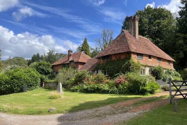
Church Hill House, Haslemere

Church Hill House is a grade II* listed house in Tanners Lane, Haslemere, Surrey. Parts of the walls are grade II listed as well as the adjoining Church...

Nearby Amenities

Located within 500m of 51.076242,-0.68958483
Home's Wood
Natural: wood
Source: npe
Lat/Long: 51.0746382/-0.6873135
The data included in this document is from www.openstreetmap.org. The data is made available under ODbL.

Have you been to Home Wood?

Leave your review of Home Wood below (or comments, questions and feedback).