The Roughs

Wood, Forest in Sussex Chichester

England

The Roughs

Old Boundary Marker on Museum Hill, Haslemere Manor Boundary Marker in the rockery at the entrance to Museum Court, on the east side of Museum Hill. Haslemere parish. Inscribed 2 on the front and B H on the top. In 1814 the boundaries of the Old Manor of Haslemere were perambulated by the Leet Jury and surveyed by J. Perry. 31 Marker stones were set up, each one foot square and 3 ft 6 ins tall, marked B.H. on the top and numbered on outer face. 9 of these remain.

Milestone Society National ID: SY_HAS02em
Old Boundary Marker on Museum Hill, Haslemere Credit: P le Page

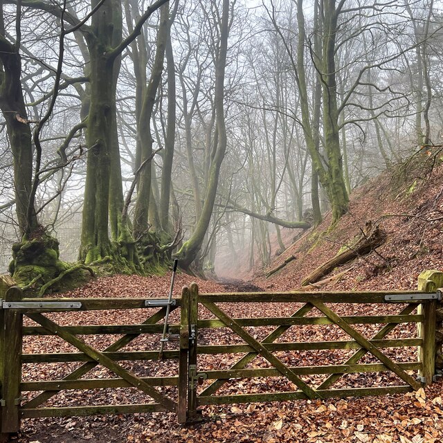
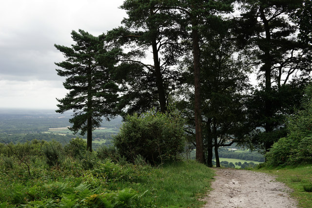
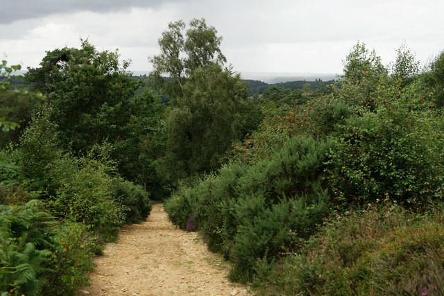
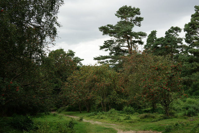
The Roughs, located in Sussex, England, is a picturesque woodland area that offers a serene and tranquil escape from the hustle and bustle of city life. Spanning over a vast expanse, The Roughs is a dense forest that boasts an abundance of diverse flora and fauna.

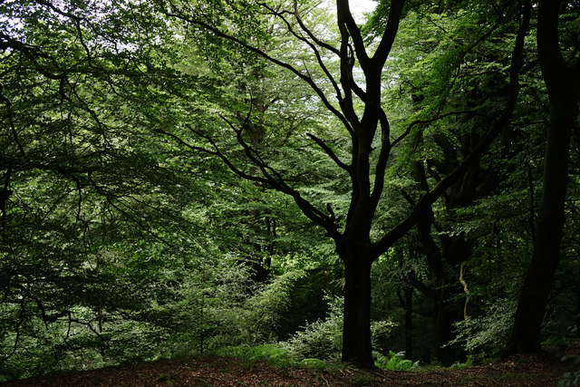
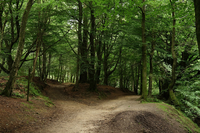
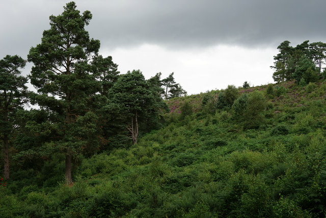
The woodland is primarily composed of a mixture of deciduous and coniferous trees, creating a rich tapestry of colors throughout the year. Ancient oaks, beeches, and birches dominate the landscape, providing shelter to a myriad of wildlife species. The forest floor is carpeted with vibrant wildflowers, such as bluebells and primroses, during the spring season.

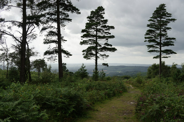
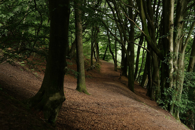
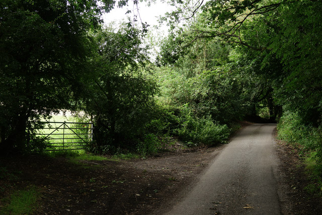
The Roughs is a haven for nature enthusiasts and outdoor adventurers alike. Numerous walking trails crisscross the forest, allowing visitors to explore its hidden gems and discover its hidden beauty. There are also designated areas for camping and picnicking, providing opportunities for visitors to immerse themselves in the natural surroundings.

The forest is home to a diverse range of wildlife, including deer, foxes, badgers, and various species of birds. Birdwatchers can spot rare species such as the woodpecker and nightingale, while animal lovers may catch a glimpse of the elusive red squirrel.

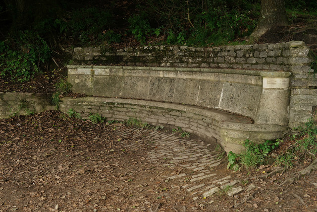
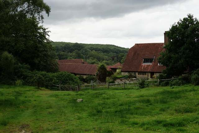
The Roughs is not only a place of natural beauty but also holds historical significance. The forest was once a popular hunting ground for nobility during the medieval period. Today, remnants of ancient deer enclosures and hunting lodges can still be seen, adding an element of historical charm to the woodland.

In summary, The Roughs in Sussex is a captivating woodland retreat, offering a blend of natural beauty, recreational opportunities, and historical intrigue. It is a sanctuary where visitors can escape the pressures of modern life and immerse themselves in the tranquility of nature.

If you have any feedback on the listing, please let us know in the comments section below.

The Roughs Images

Images are sourced within 2km of 51.0731/-0.68925962 or Grid Reference SU9131. Thanks to Geograph Open Source API. All images are credited.

Old Boundary Marker on Museum Hill, Haslemere Manor Boundary Marker in the rockery at the entrance to Museum Court, on the east side of Museum Hill. Haslemere parish. Inscribed 2 on the front and B H on the top. In 1814 the boundaries of the Old Manor of Haslemere were perambulated by the Leet Jury and surveyed by J. Perry. 31 Marker stones were set up, each one foot square and 3 ft 6 ins tall, marked B.H. on the top and numbered on outer face. 9 of these remain.

Milestone Society National ID: SY_HAS02em
Old Boundary Marker on Museum Hill, Haslemere
Manor Boundary Marker in the rockery at the entrance to Museum Court, on the east side of Museum Hill. Haslemere parish. Inscribed 2 on the front and B H on the top. In 1814 the boundaries of the Old Manor of Haslemere were perambulated by the Leet Jury and surveyed by J. Perry. 31 Marker stones were set up, each one foot square and 3 ft 6 ins tall, marked B.H. on the top and numbered on outer face. 9 of these remain. Milestone Society National ID: SY_HAS02em
Pond near the Pen-y-Bos Track The curious Welsh-sounding name "Pen-y-Bos" apparently comes from the Brythonic language spoken by the ancient Britons, which was obviously related to Welsh. (cf Pen-y-ghent in Yorkshire)
Pond near the Pen-y-Bos Track
The curious Welsh-sounding name "Pen-y-Bos" apparently comes from the Brythonic language spoken by the ancient Britons, which was obviously related to Welsh. (cf Pen-y-ghent in Yorkshire)
View SW from the Pen-y-Bos Track Something was burning down in the valley - hence the smoke. The curious Welsh-sounding name "Pen-y-Bos" apparently comes from the Brythonic language spoken by the ancient Britons, which was obviously related to Welsh. (cf Pen-y-ghent in Yorkshire)
View SW from the Pen-y-Bos Track
Something was burning down in the valley - hence the smoke. The curious Welsh-sounding name "Pen-y-Bos" apparently comes from the Brythonic language spoken by the ancient Britons, which was obviously related to Welsh. (cf Pen-y-ghent in Yorkshire)
Bridleway on the east side of Black Down
View SSW from the Serpent Trail
Wooded slope on the east side of Black Down
Black Down View towards the west.
Black Down
View towards the west.
Black Down View, through the beech trees, of a track which is not shown as a public right of way on the map.
Black Down
View, through the beech trees, of a track which is not shown as a public right of way on the map.
Dead and Alive On Black Down, a dead tree surrounded by many which are alive.
Dead and Alive
On Black Down, a dead tree surrounded by many which are alive.
Seat at the Temple of the Winds Giving good cover and protection for views, from Black Down, towards the east.
Seat at the Temple of the Winds
Giving good cover and protection for views, from Black Down, towards the east.
Black Down Junction of two major bridleways, close to the highest point on Black Down.
Black Down
Junction of two major bridleways, close to the highest point on Black Down.
Black Down Close to the Temple of the Winds.
Black Down
Close to the Temple of the Winds.
Black Down Bridleway down into the valley.
Black Down
Bridleway down into the valley.
Black Down As in common with all locations which I have seen, this summer, the rowans are heavily laden with berries.
Black Down
As in common with all locations which I have seen, this summer, the rowans are heavily laden with berries.
Black Down View of the ridge, from the bridleway.
Black Down
View of the ridge, from the bridleway.
Cotchet Farm Situated at the western edge of Black Down.
Cotchet Farm
Situated at the western edge of Black Down.
Fernden Lane Located at the western edge of Black Down, the view is towards Haslemere.
Fernden Lane
Located at the western edge of Black Down, the view is towards Haslemere.
Fernden Lane Located at the western edge of Black Down, the view is towards Haslemere.
Fernden Lane
Located at the western edge of Black Down, the view is towards Haslemere.
Show me another place!

The Roughs is located at Grid Ref: SU9131 (Lat: 51.0731, Lng: -0.68925962)

Administrative County: West Sussex

District: Chichester

Police Authority: Sussex

What 3 Words

///physics.garlic.tips. Near Haslemere, Surrey

Related Wikis

Haste Hill

Haste Hill is a hill near Haslemere, Surrey in England which was probably the original settlement of the town of Haslemere. It was used as the site of...

Blackdown, West Sussex

Blackdown, or Black Down, summit elevation 279.7 metres (918 ft) AMSL, is the highest point in both the historic county of Sussex and the South Downs National...

Haslemere Town Hall

Haslemere Town Hall is a municipal building in the High Street, Haslemere, Surrey, England. The structure, which serves as the meeting place of Haslemere...

Iberia Flight 062

Iberia Flight 062 was a twin-engined Sud Aviation Caravelle registered EC-BDD operating a scheduled flight from Málaga Airport, Spain, to London Heathrow...

Nearby Amenities

Located within 500m of 51.0731,-0.68925962
Boarden Door Bottom
Place: locality
Lat/Long: 51.0701281/-0.6919748
Home's Wood
Natural: wood
Source: npe
Lat/Long: 51.0746382/-0.6873135
Power: pole
Lat/Long: 51.0703763/-0.6865592
Parking
Lat/Long: 51.0701199/-0.6874325
Parking
Lat/Long: 51.0689131/-0.6873877
The data included in this document is from www.openstreetmap.org. The data is made available under ODbL.

Have you been to The Roughs?

Leave your review of The Roughs below (or comments, questions and feedback).