Black Dog Copse

Wood, Forest in Sussex Chichester

England

Black Dog Copse

Pond beside Green Lane Beyond the pond lies the county border and the edge of the South Downs National Park.
Pond beside Green Lane Credit: Chris Thomas-Atkin

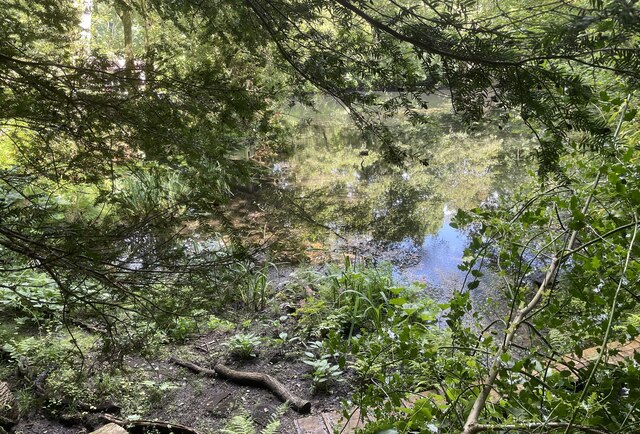
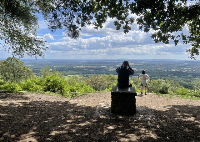
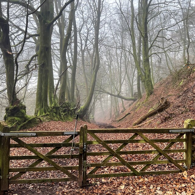
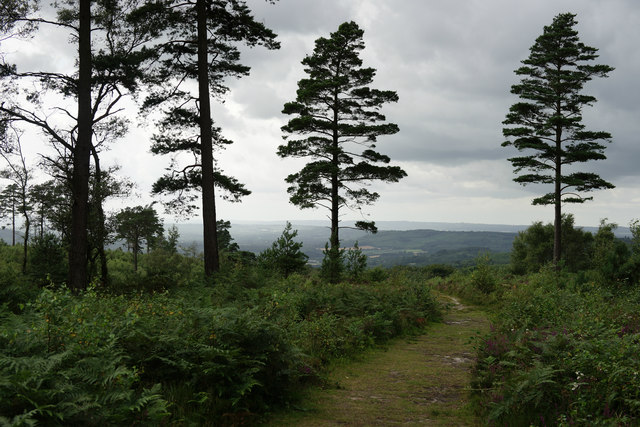
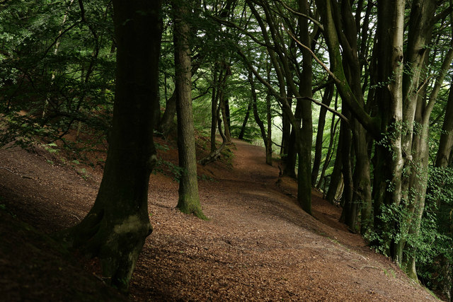
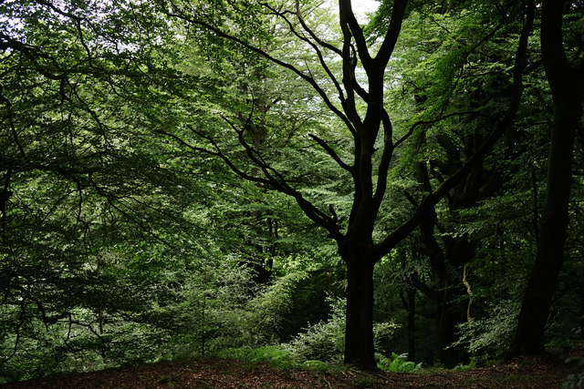
Black Dog Copse is a picturesque woodland located in Sussex, England. Spanning over an area of approximately 50 acres, it is a popular destination for nature enthusiasts and hikers alike. The copse is characterized by its dense canopy of tall, ancient trees that create a serene and peaceful atmosphere.

The woodland is predominantly made up of native tree species such as oak, beech, and birch, which provide a rich habitat for a variety of wildlife. The forest floor is adorned with a carpet of wildflowers and ferns, adding to the enchanting beauty of the copse.

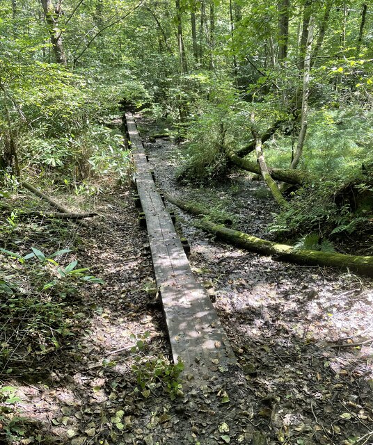
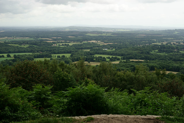
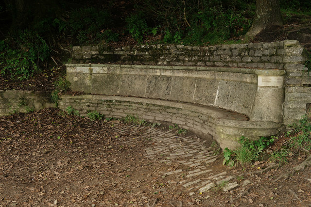
Traversing through the copse, visitors can explore a network of well-maintained footpaths that wind their way through the trees, allowing for a leisurely stroll or a more vigorous hike. These paths offer glimpses of hidden clearings, small ponds, and streams, enhancing the sense of discovery and adventure.

Black Dog Copse is also home to a diverse array of bird species, making it a haven for birdwatchers. Visitors may catch sight of woodland birds such as woodpeckers, nuthatches, and tawny owls, as well as rarer visitors like the lesser spotted woodpecker.

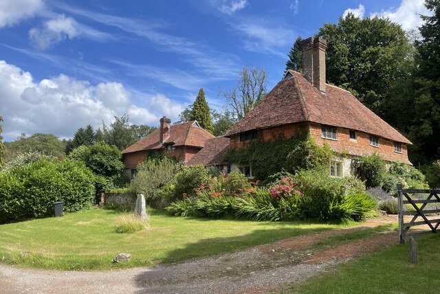
The copse is open to the public year-round and offers a tranquil escape from the hustle and bustle of everyday life. Whether it's a leisurely walk, a picnic amidst nature, or simply a quiet moment of reflection, Black Dog Copse provides a captivating natural setting that is sure to leave visitors feeling rejuvenated and connected to the beauty of the Sussex countryside.

If you have any feedback on the listing, please let us know in the comments section below.

Black Dog Copse Images

Images are sourced within 2km of 51.071393/-0.69510284 or Grid Reference SU9131. Thanks to Geograph Open Source API. All images are credited.

Pond beside Green Lane Beyond the pond lies the county border and the edge of the South Downs National Park.
Pond beside Green Lane
Beyond the pond lies the county border and the edge of the South Downs National Park.
Valewood Farmhouse The farmhouse is a Grade II* (star) listed building. See <span class="nowrap"><a title="https://historicengland.org.uk/listing/the-list/list-entry/1354733" rel="nofollow ugc noopener" href="https://historicengland.org.uk/listing/the-list/list-entry/1354733">Link</a><img style="margin-left:2px;" alt="External link" title="External link - shift click to open in new window" src="https://s1.geograph.org.uk/img/external.png" width="10" height="10"/></span>
Valewood Farmhouse
The farmhouse is a Grade II* (star) listed building. See LinkExternal link
Gated Track On the Sussex Border Path in Chase Wood heading for Blackdown.
Gated Track
On the Sussex Border Path in Chase Wood heading for Blackdown.
Walking the planks The public footpath crosses a wet area near Lake House on a boardwalk.
Walking the planks
The public footpath crosses a wet area near Lake House on a boardwalk.
Path junction One of the many path options on Blackdown.
Path junction
One of the many path options on Blackdown.
Old Boundary Marker on Museum Hill, Haslemere Manor Boundary Marker in the rockery at the entrance to Museum Court, on the east side of Museum Hill. Haslemere parish. Inscribed 2 on the front and B H on the top. In 1814 the boundaries of the Old Manor of Haslemere were perambulated by the Leet Jury and surveyed by J. Perry. 31 Marker stones were set up, each one foot square and 3 ft 6 ins tall, marked B.H. on the top and numbered on outer face. 9 of these remain.

Milestone Society National ID: SY_HAS02em
Old Boundary Marker on Museum Hill, Haslemere
Manor Boundary Marker in the rockery at the entrance to Museum Court, on the east side of Museum Hill. Haslemere parish. Inscribed 2 on the front and B H on the top. In 1814 the boundaries of the Old Manor of Haslemere were perambulated by the Leet Jury and surveyed by J. Perry. 31 Marker stones were set up, each one foot square and 3 ft 6 ins tall, marked B.H. on the top and numbered on outer face. 9 of these remain. Milestone Society National ID: SY_HAS02em
Pond near the Pen-y-Bos Track The curious Welsh-sounding name "Pen-y-Bos" apparently comes from the Brythonic language spoken by the ancient Britons, which was obviously related to Welsh. (cf Pen-y-ghent in Yorkshire)
Pond near the Pen-y-Bos Track
The curious Welsh-sounding name "Pen-y-Bos" apparently comes from the Brythonic language spoken by the ancient Britons, which was obviously related to Welsh. (cf Pen-y-ghent in Yorkshire)
View SW from the Pen-y-Bos Track Something was burning down in the valley - hence the smoke. The curious Welsh-sounding name "Pen-y-Bos" apparently comes from the Brythonic language spoken by the ancient Britons, which was obviously related to Welsh. (cf Pen-y-ghent in Yorkshire)
View SW from the Pen-y-Bos Track
Something was burning down in the valley - hence the smoke. The curious Welsh-sounding name "Pen-y-Bos" apparently comes from the Brythonic language spoken by the ancient Britons, which was obviously related to Welsh. (cf Pen-y-ghent in Yorkshire)
Black Down Trig Point A return visit to the trig point which marks the highest point in Sussex. For more details see <a href="https://www.geograph.org.uk/photo/6117646">SU9129 : Highest point in Sussex</a>
Black Down Trig Point
A return visit to the trig point which marks the highest point in Sussex. For more details see SU9129 : Highest point in Sussex
Temple of the Winds The viewpoint on Black Down provides stunning views across the Sussex Low Weald.
Temple of the Winds
The viewpoint on Black Down provides stunning views across the Sussex Low Weald.
Bridleway on the east side of Black Down
View SSW from the Serpent Trail
Wooded slope on the east side of Black Down
Black Down View towards the west.
Black Down
View towards the west.
Black Down View, through the beech trees, of a track which is not shown as a public right of way on the map.
Black Down
View, through the beech trees, of a track which is not shown as a public right of way on the map.
Dead and Alive On Black Down, a dead tree surrounded by many which are alive.
Dead and Alive
On Black Down, a dead tree surrounded by many which are alive.
Black Down View from the Temple of the Winds. The direction of view is towards Lewes. Both the North Downs and the South Downs can be seen from this location. I was told that the conditions were clearer before lunch; about 20 minutes later, rain started to fall.
Black Down
View from the Temple of the Winds. The direction of view is towards Lewes. Both the North Downs and the South Downs can be seen from this location. I was told that the conditions were clearer before lunch; about 20 minutes later, rain started to fall.
Seat at the Temple of the Winds Giving good cover and protection for views, from Black Down, towards the east.
Seat at the Temple of the Winds
Giving good cover and protection for views, from Black Down, towards the east.
Show me another place!

Black Dog Copse is located at Grid Ref: SU9131 (Lat: 51.071393, Lng: -0.69510284)

Administrative County: West Sussex

District: Chichester

Police Authority: Sussex

What 3 Words

///resettle.lump.lobster. Near Haslemere, Surrey

Related Wikis

Haste Hill

Haste Hill is a hill near Haslemere, Surrey in England which was probably the original settlement of the town of Haslemere. It was used as the site of...

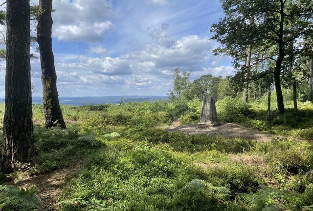
Blackdown, West Sussex

Blackdown, or Black Down, summit elevation 279.7 metres (918 ft) AMSL, is the highest point in both the historic county of Sussex and the South Downs National...

Haslemere Town Hall

Haslemere Town Hall is a municipal building in the High Street, Haslemere, Surrey, England. The structure, which serves as the meeting place of Haslemere...

Iberia Flight 062

Iberia Flight 062 was a twin-engined Sud Aviation Caravelle registered EC-BDD operating a scheduled flight from Málaga Airport, Spain, to London Heathrow...

The Curry Club

The Curry Club was founded by Pat Chapman in 1982, to further the understanding and appreciation of the cuisines of the Indian subcontinent. In 2007 it...

Haslemere Educational Museum

Haslemere Educational Museum was founded in 1888 by the eminent surgeon Sir Jonathan Hutchinson to display his growing collection of natural history specimens...

Haslemere

The town of Haslemere () and the villages of Shottermill and Grayswood are in south west Surrey, England, around 38 mi (62 km) south west of London. Together...

Serpent Trail

The Serpent Trail is a 64-mile (103 km) long distance footpath. It runs from Haslemere to Petersfield, which are 11 miles apart in a straight line, by...

Nearby Amenities

Located within 500m of 51.071393,-0.69510284
Boarden Door Bottom
Place: locality
Lat/Long: 51.0701281/-0.6919748
The data included in this document is from www.openstreetmap.org. The data is made available under ODbL.

Have you been to Black Dog Copse?

Leave your review of Black Dog Copse below (or comments, questions and feedback).