Begley Copse

Wood, Forest in Surrey Waverley

England

Begley Copse

Hindhead Common Pine trees and a clearing near the visitor centre at the Devil's Punch Bowl.
Hindhead Common Credit: Ian Taylor

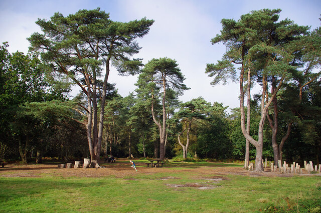
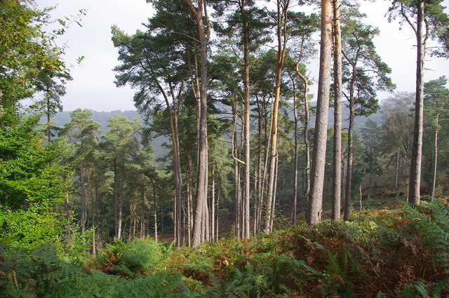
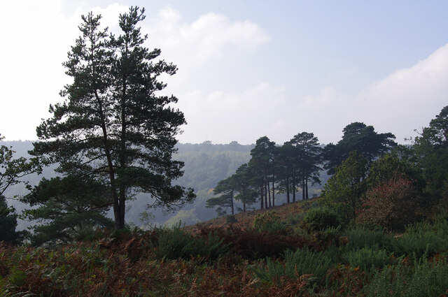
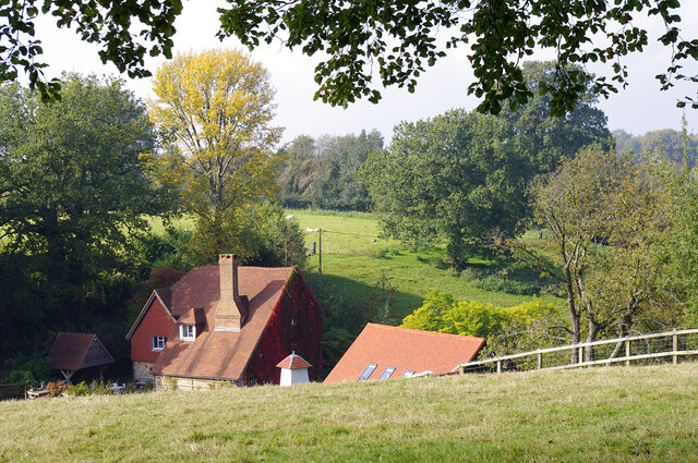
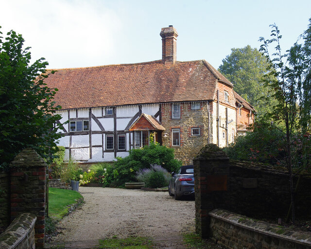
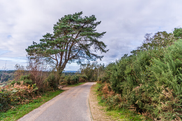
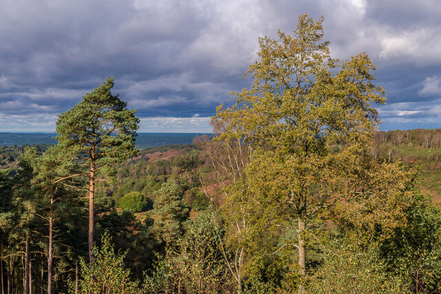
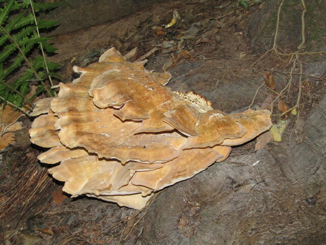
Begley Copse is a charming woodland area located in Surrey, England. Covering approximately 10 acres, it is a popular destination for nature lovers and outdoor enthusiasts. The copse, also known as Begley Wood, is characterized by its dense vegetation, diverse tree species, and peaceful ambiance.

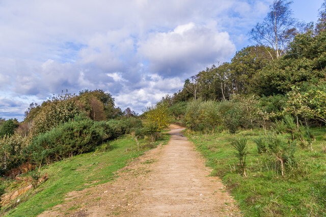
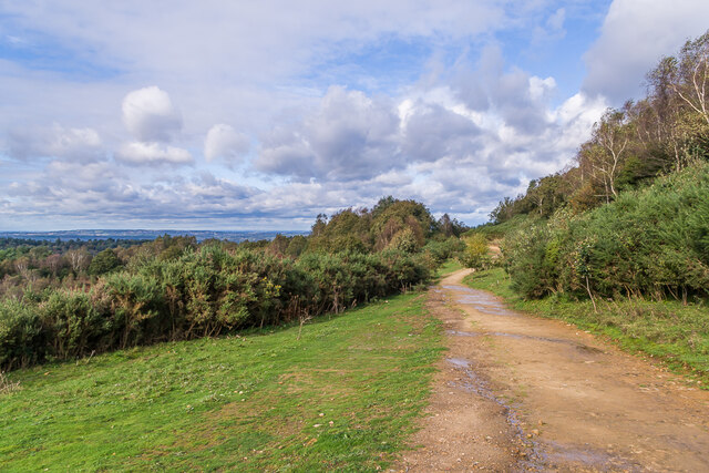
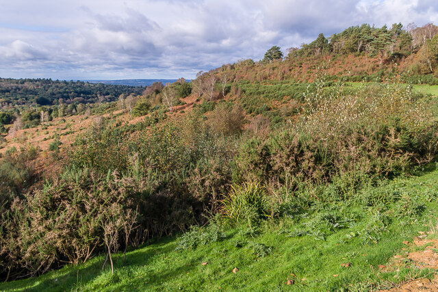
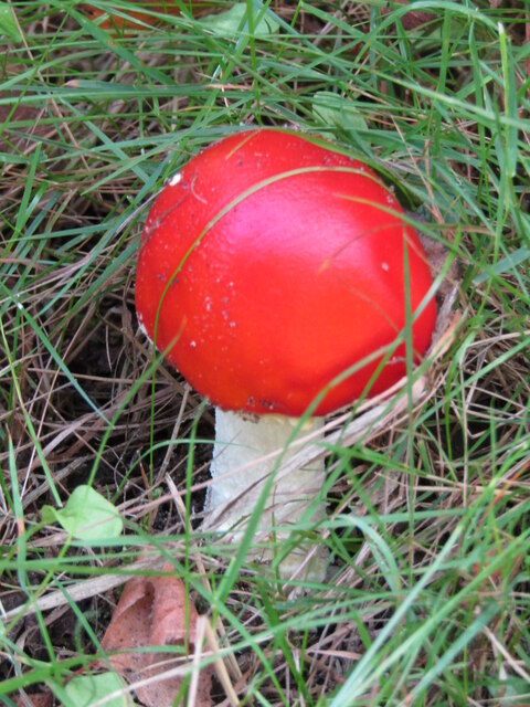
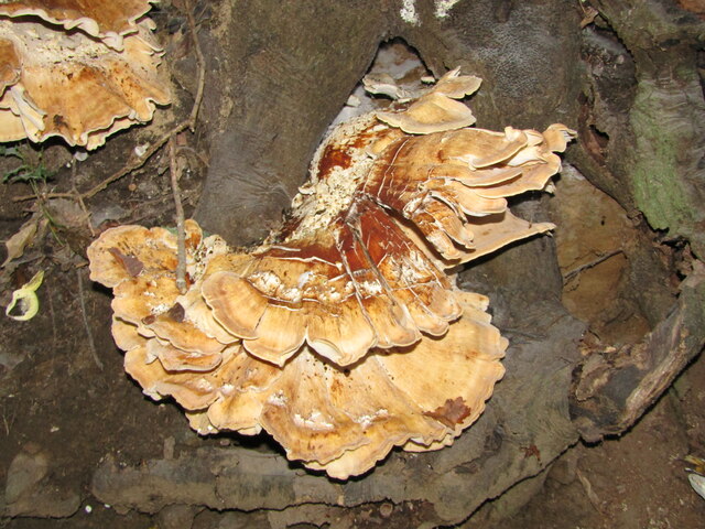
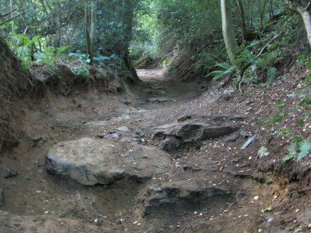
As visitors enter Begley Copse, they are greeted by a well-maintained footpath that meanders through the woodland. The path is surrounded by a rich variety of trees, including oak, beech, and sycamore, which provide an awe-inspiring canopy of greenery. The copse boasts a mix of ancient and younger trees, creating a balanced ecosystem that supports a wide range of flora and fauna.

Wildlife thrives within the copse, with an abundance of bird species, such as robins, blackbirds, and blue tits, filling the air with their melodious songs. Squirrels can often be spotted darting through the trees, while smaller creatures, like hedgehogs and voles, find refuge in the undergrowth.

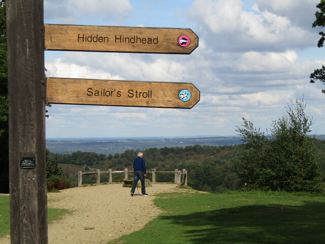
For those seeking tranquility and solitude, Begley Copse offers several peaceful spots where visitors can sit and appreciate the natural beauty surrounding them. The copse is also a fantastic location for photographers, providing endless opportunities to capture the changing seasons and the vibrant colors they bring.

Begley Copse is a beloved local gem, attracting both residents and tourists who wish to escape the hustle and bustle of everyday life. With its enchanting woodland setting, diverse wildlife, and peaceful atmosphere, it is no wonder that Begley Copse is a cherished natural haven in Surrey.

If you have any feedback on the listing, please let us know in the comments section below.

Begley Copse Images

Images are sourced within 2km of 51.125333/-0.70828817 or Grid Reference SU9037. Thanks to Geograph Open Source API. All images are credited.

Hindhead Common Pine trees and a clearing near the visitor centre at the Devil's Punch Bowl.
Hindhead Common
Pine trees and a clearing near the visitor centre at the Devil's Punch Bowl.
Devil's Punch Bowl Looking down into the natural bowl.
Devil's Punch Bowl
Looking down into the natural bowl.
Flush bracket S1535 On the trig point on Gibbet Hill (272m). See <a href="https://www.geograph.org.uk/photo/6696717">SU8935 : Gibbet Hill</a>.
Flush bracket S1535
On the trig point on Gibbet Hill (272m). See SU8935 : Gibbet Hill.
Valley at Highcomb Looking across the valley, north of the Devil's Punch Bowl.
Valley at Highcomb
Looking across the valley, north of the Devil's Punch Bowl.
Pitlands Farm Grade II listed building - <span class="nowrap"><a title="https://historicengland.org.uk/listing/the-list/list-entry/1240826" rel="nofollow ugc noopener" href="https://historicengland.org.uk/listing/the-list/list-entry/1240826">Link</a><img style="margin-left:2px;" alt="External link" title="External link - shift click to open in new window" src="https://s1.geograph.org.uk/img/external.png" width="10" height="10"/></span>
Pitlands Farm
Grade II listed building - LinkExternal link
Upper Highfield Farm House Grade II listed building - <span class="nowrap"><a title="https://historicengland.org.uk/listing/the-list/list-entry/1240875" rel="nofollow ugc noopener" href="https://historicengland.org.uk/listing/the-list/list-entry/1240875">Link</a><img style="margin-left:2px;" alt="External link" title="External link - shift click to open in new window" src="https://s1.geograph.org.uk/img/external.png" width="10" height="10"/></span>
Upper Highfield Farm House
Grade II listed building - LinkExternal link
Celtic cross Celtic cross on the summit of Gibbet Hill, erected in 1851 by Sir William Erle near the site of the gallows which were used to hang three sailors who in 1786  had murdered another while he was on his way to Portsmouth.  Grade II listed  - see <span class="nowrap"><a title="www.historicengland.org.uk/listing/the-list/list-entry/1260847" rel="nofollow ugc noopener" href="http://www.historicengland.org.uk/listing/the-list/list-entry/1260847">Link</a><img style="margin-left:2px;" alt="External link" title="External link - shift click to open in new window" src="https://s1.geograph.org.uk/img/external.png" width="10" height="10"/></span>.
Celtic cross
Celtic cross on the summit of Gibbet Hill, erected in 1851 by Sir William Erle near the site of the gallows which were used to hang three sailors who in 1786 had murdered another while he was on his way to Portsmouth. Grade II listed - see LinkExternal link.
Gibbet Hill Trig point on the summit of Gibbet Hill, with the North Downs in the centre background and Leith Hill to their right.  Although not apparent in this photo, very clear conditions on this occasion meant that the City of London skyscrapers could be seen through the Wey Gap, left of centre, a distance of almost 40 miles.
Gibbet Hill
Trig point on the summit of Gibbet Hill, with the North Downs in the centre background and Leith Hill to their right. Although not apparent in this photo, very clear conditions on this occasion meant that the City of London skyscrapers could be seen through the Wey Gap, left of centre, a distance of almost 40 miles.
Byway, Devil's Punchbowl Byway above the Devil's Punch Bowl, giving an alternative route for traffic prohibited from using the A3 Hindhead Tunnel.
Byway, Devil's Punchbowl
Byway above the Devil's Punch Bowl, giving an alternative route for traffic prohibited from using the A3 Hindhead Tunnel.
Old A3, Devil's Punch Bowl Part of the route of the former A3 above the Devil's Punch Bowl, restored to nature following the opening of the Hindhead Tunnel in 2011.
Old A3, Devil's Punch Bowl
Part of the route of the former A3 above the Devil's Punch Bowl, restored to nature following the opening of the Hindhead Tunnel in 2011.
Devil's Punch Bowl Looking along the rim of the Devil's Punch Bowl, with part of the route of the former A3 in the background, restored to nature following the opening of the Hindhead Tunnel in 2011.
Devil's Punch Bowl
Looking along the rim of the Devil's Punch Bowl, with part of the route of the former A3 in the background, restored to nature following the opening of the Hindhead Tunnel in 2011.
Devil's Punch Bowl Looking across the Devil's Punch Bowl.
Devil's Punch Bowl
Looking across the Devil's Punch Bowl.
Devil's Punch Bowl - Toadstool Red, waxy-looking toadstool, ca 3 inches high, in the grass beside a footpath.
Devil's Punch Bowl - Toadstool
Red, waxy-looking toadstool, ca 3 inches high, in the grass beside a footpath.
Devil's Punch Bowl - Viewpoint New wooden signposts for "Hidden Hindhead" and the "Sailor's Stroll" at the head of this large natural amphitheatre by Hindhead.
Devil's Punch Bowl - Viewpoint
New wooden signposts for "Hidden Hindhead" and the "Sailor's Stroll" at the head of this large natural amphitheatre by Hindhead.
Thursley - Fungus Large bracket fungus ca 1 foot from end to end in woodland close to Ridgeway Farm.
Thursley - Fungus
Large bracket fungus ca 1 foot from end to end in woodland close to Ridgeway Farm.
Thursley - Fungus Large bracket fungus ca 1 foot from end to end in woodland close to Ridgeway Farm.
Thursley - Fungus
Large bracket fungus ca 1 foot from end to end in woodland close to Ridgeway Farm.
Thursley - Byway Ancient and deeply incised trackway with exposed flat rocks in woodland close to Ridgeway Farm.
Thursley - Byway
Ancient and deeply incised trackway with exposed flat rocks in woodland close to Ridgeway Farm.
Show me another place!

Begley Copse is located at Grid Ref: SU9037 (Lat: 51.125333, Lng: -0.70828817)

Administrative County: Surrey

District: Waverley

Police Authority: Surrey

What 3 Words

///reckons.restrict.cheat. Near Hindhead, Surrey

Related Wikis

Gibbet Hill, Hindhead

Gibbet Hill, at Hindhead, Surrey, is the apex of the scarp surrounding the Devil's Punch Bowl, not far from the A3 London to Portsmouth road in England...

Devil's Punch Bowl

The Devil's Punch Bowl is a 282.2-hectare (697-acre) visitor attraction and biological Site of Special Scientific Interest situated just to the east of...

Hindhead

Hindhead is a village in the Waverley district of the ceremonial county of Surrey, England. It is the highest village in the county and its buildings are...

Undershaw

Undershaw is a former residence of the author Sir Arthur Conan Doyle, the creator of Sherlock Holmes. The house was built for Doyle at his order to accommodate...
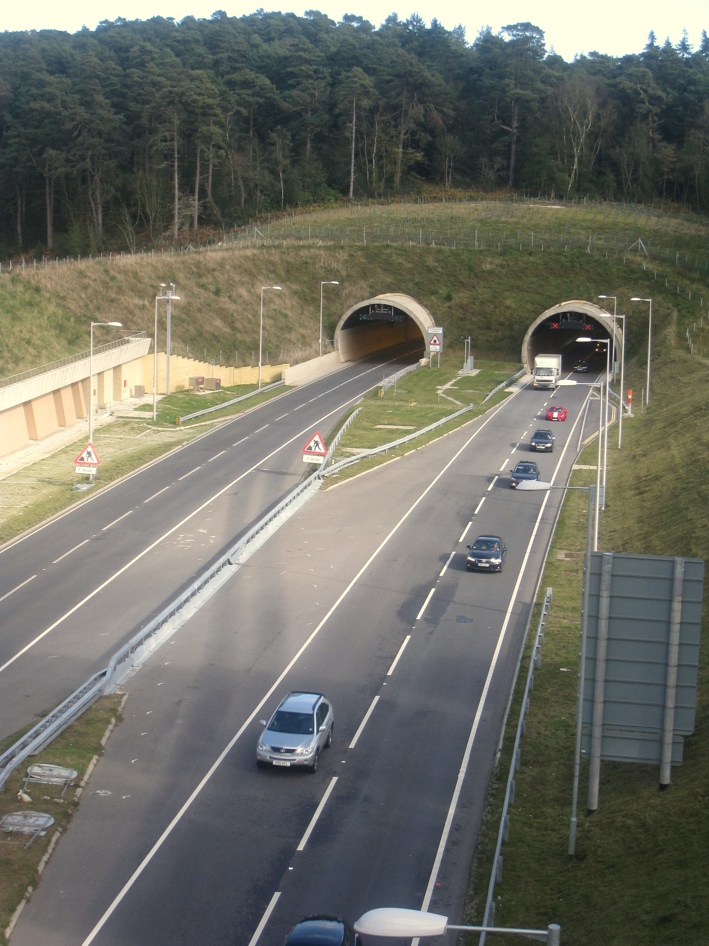
Hindhead Tunnel

The Hindhead Tunnel, opened in 2011, is part of the 4-mile (6.4 km) dual-carriageway that replaced one of the last remaining stretches of single-carriageway...

All Saints' Church, Grayswood

All Saints' Church is an active parish church in the village of Grayswood, Surrey, England. The church stands in the centre of the village and was built...

Thursley

Thursley is a village and civil parish in southwest Surrey, west of the A3 between Milford and Hindhead. An associated hamlet is Bowlhead Green. To the...

Brook Brick Pit

Brook Brick Pit is a 0.9-hectare (2.2-acre) geological Site of Special Scientific Interest west of Wormley Surrey. It is a Geological Conservation Review...

Nearby Amenities

Located within 500m of 51.125333,-0.70828817
Barrier: stile
Lat/Long: 51.1262792/-0.7050104
Barrier: stile
Lat/Long: 51.1264288/-0.7058076
Barrier: stile
Lat/Long: 51.1265744/-0.7066217
Barrier: stile
Lat/Long: 51.1267716/-0.7082832
Barrier: kissing_gate
Lat/Long: 51.12579/-0.7110052
The data included in this document is from www.openstreetmap.org. The data is made available under ODbL.

Have you been to Begley Copse?

Leave your review of Begley Copse below (or comments, questions and feedback).