Emley Farm

Heritage Site in Surrey Waverley

England

Emley Farm

St Michael & All Angels Church Grade I listed building - <span class="nowrap"><a title="https://historicengland.org.uk/listing/the-list/list-entry/1260876" rel="nofollow ugc noopener" href="https://historicengland.org.uk/listing/the-list/list-entry/1260876">Link</a><img style="margin-left:2px;" alt="External link" title="External link - shift click to open in new window" src="https://s1.geograph.org.uk/img/external.png" width="10" height="10"/></span>
St Michael & All Angels Church Credit: Ian Taylor

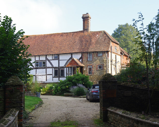
Emley Farm, located in the picturesque county of Surrey in England, is a renowned heritage site that offers a glimpse into the region's rich agricultural history. Dating back to the 18th century, this working farm has been meticulously preserved and showcases traditional farming practices that have been passed down through generations.

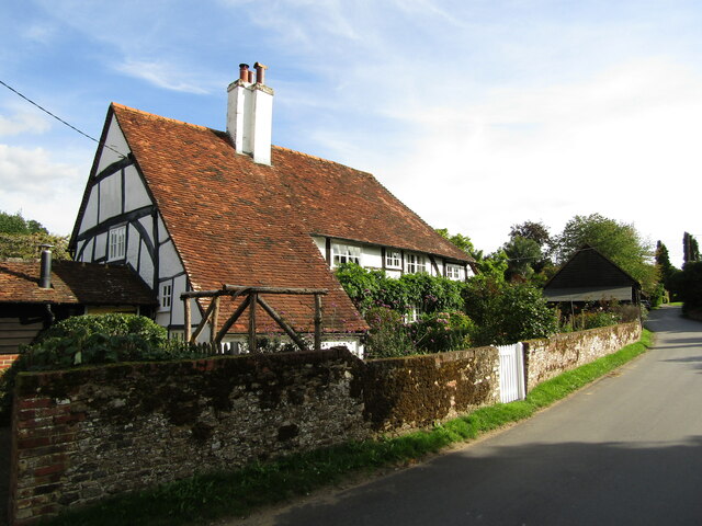
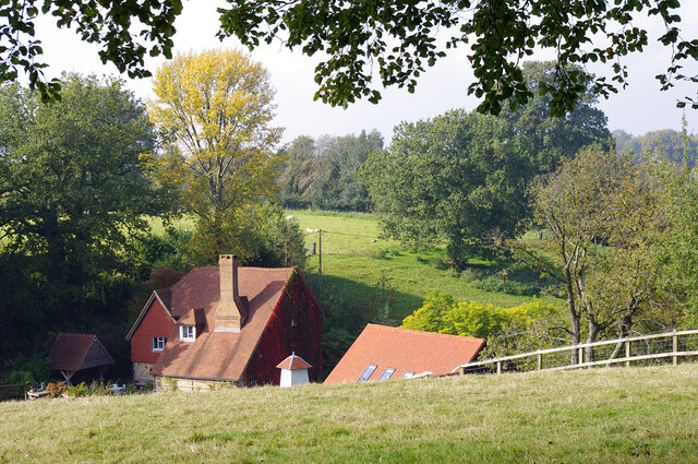
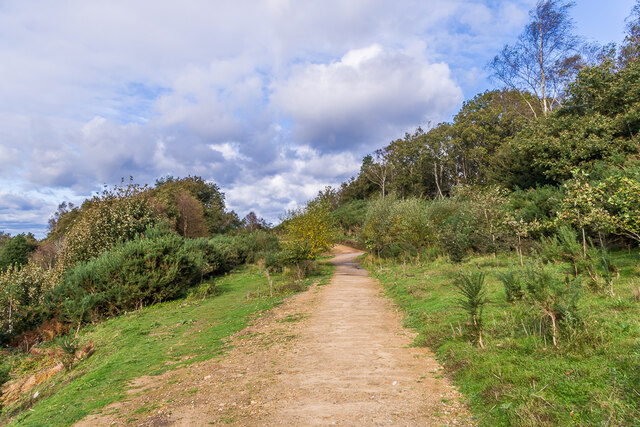
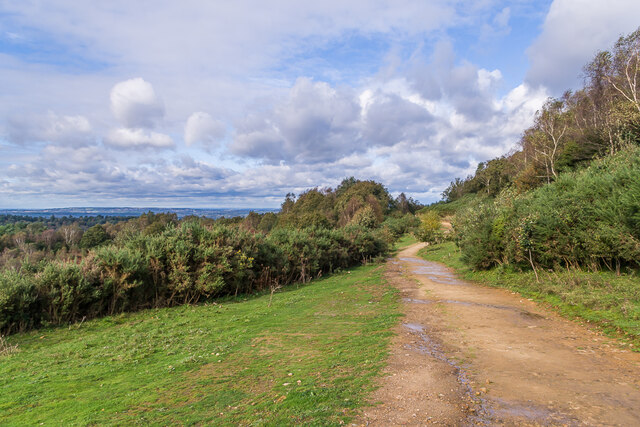
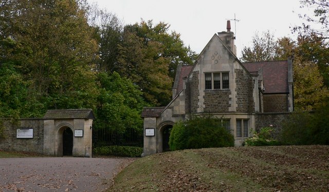
Spread across 50 acres, Emley Farm is a haven for nature enthusiasts and history buffs alike. Its well-maintained fields are home to various livestock, including cows, sheep, and pigs, providing visitors with an authentic rural experience. The farm also boasts a charming farmhouse, constructed in the classic Surrey style, which serves as a testament to the architectural heritage of the area.

Visitors to Emley Farm can partake in a range of activities, such as guided tours, where they can learn about the farm's history and witness daily farming activities. The knowledgeable staff is always available to answer questions and provide insights into the traditional farming techniques practiced here. Additionally, the farm hosts seasonal events and workshops, allowing visitors to engage in hands-on experiences like sheep shearing or milking cows.

Emley Farm is not only a place of historical significance but also a valuable educational resource. Local schools often organize field trips to introduce students to the agricultural practices that have shaped the countryside. This not only promotes an understanding of the farming industry but also fosters an appreciation for the rural way of life.

In conclusion, Emley Farm in Surrey is a cherished heritage site that preserves and celebrates the region's agricultural history. With its well-preserved buildings, working farm, and educational initiatives, it offers visitors a unique opportunity to experience the beauty of the countryside and connect with the past.

If you have any feedback on the listing, please let us know in the comments section below.
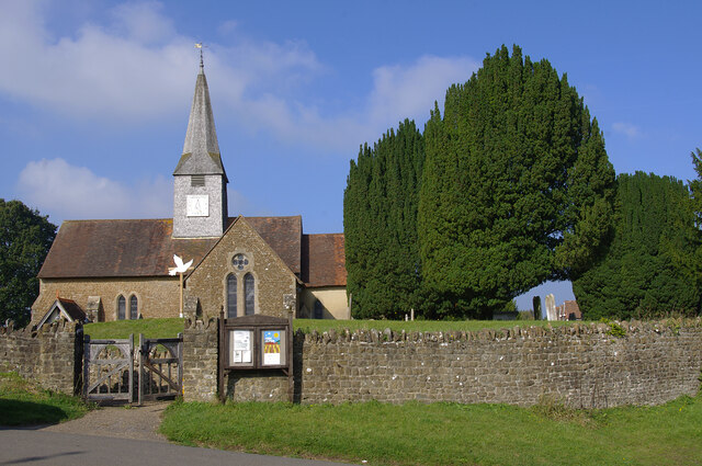
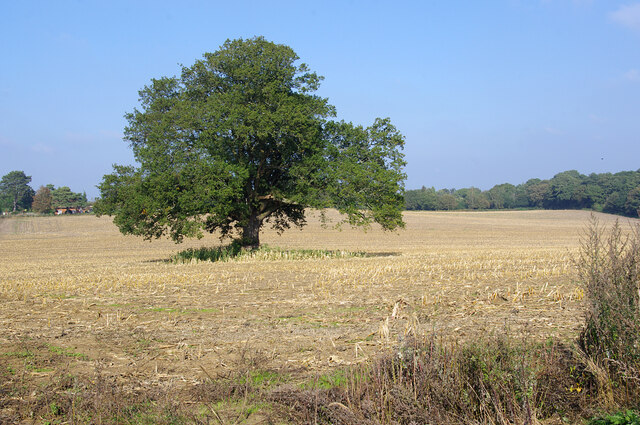
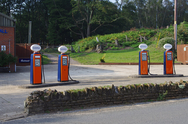
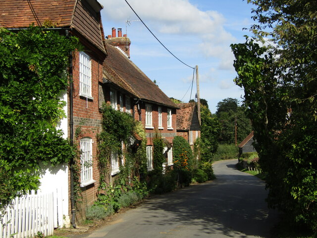
Emley Farm Images

Images are sourced within 2km of 51.131/-0.704 or Grid Reference SU9037. Thanks to Geograph Open Source API. All images are credited.

St Michael & All Angels Church Grade I listed building - <span class="nowrap"><a title="https://historicengland.org.uk/listing/the-list/list-entry/1260876" rel="nofollow ugc noopener" href="https://historicengland.org.uk/listing/the-list/list-entry/1260876">Link</a><img style="margin-left:2px;" alt="External link" title="External link - shift click to open in new window" src="https://s1.geograph.org.uk/img/external.png" width="10" height="10"/></span>
St Michael & All Angels Church
Grade I listed building - LinkExternal link
Farmland, Thursley The crop has been harvested.
Farmland, Thursley
The crop has been harvested.
Old petrol pumps, Thursley On the old A3, before it was upgraded to dual carriageway. No longer used but still surviving, and repainted since 2012.
Old petrol pumps, Thursley
On the old A3, before it was upgraded to dual carriageway. No longer used but still surviving, and repainted since 2012.
Thursley - The Street Old red brick cottages line the village's former main street, now a quiet lane.
<span class="nowrap"><a title="www.thursley-pc.gov.uk" rel="nofollow ugc noopener" href="http://www.thursley-pc.gov.uk">Link</a><img style="margin-left:2px;" alt="External link" title="External link - shift click to open in new window" src="https://s1.geograph.org.uk/img/external.png" width="10" height="10"/></span>
Thursley - The Street
Old red brick cottages line the village's former main street, now a quiet lane. LinkExternal link
Thursley - St Michael's Church Parts of St Michael and All Angels date back to Saxon times but much of the fabric is now Victorian.
Note the cross carries a black drape - mourning for Queen Elizabeth II (1926-2022).
<span class="nowrap"><a title="www.thursley-pc.gov.uk" rel="nofollow ugc noopener" href="http://www.thursley-pc.gov.uk">Link</a><img style="margin-left:2px;" alt="External link" title="External link - shift click to open in new window" src="https://s1.geograph.org.uk/img/external.png" width="10" height="10"/></span>
Thursley - St Michael's Church
Parts of St Michael and All Angels date back to Saxon times but much of the fabric is now Victorian. Note the cross carries a black drape - mourning for Queen Elizabeth II (1926-2022). LinkExternal link
Thursley - Font Original font of Bargate stone inside St Michael and All Angels Church which has Saxon roots.
Thursley - Font
Original font of Bargate stone inside St Michael and All Angels Church which has Saxon roots.
Thursley - Royal Arms Board with royal coat of arms dated 1783, realm of King George III, within the historic parish church.
Thursley - Royal Arms
Board with royal coat of arms dated 1783, realm of King George III, within the historic parish church.
Thursley - Sunset Cottage Timber-framed 16th century cottage with a distinctively large sloping roof on The Street.
Thursley - Sunset Cottage
Timber-framed 16th century cottage with a distinctively large sloping roof on The Street.
Daffodils in Thursley Churchyard
Flush bracket S1535 On the trig point on Gibbet Hill (272m). See <a href="https://www.geograph.org.uk/photo/6696717">SU8935 : Gibbet Hill</a>.
Flush bracket S1535
On the trig point on Gibbet Hill (272m). See SU8935 : Gibbet Hill.
Valley at Highcomb Looking across the valley, north of the Devil's Punch Bowl.
Valley at Highcomb
Looking across the valley, north of the Devil's Punch Bowl.
Pitlands Farm Grade II listed building - <span class="nowrap"><a title="https://historicengland.org.uk/listing/the-list/list-entry/1240826" rel="nofollow ugc noopener" href="https://historicengland.org.uk/listing/the-list/list-entry/1240826">Link</a><img style="margin-left:2px;" alt="External link" title="External link - shift click to open in new window" src="https://s1.geograph.org.uk/img/external.png" width="10" height="10"/></span>
Pitlands Farm
Grade II listed building - LinkExternal link
Upper Highfield Farm House Grade II listed building - <span class="nowrap"><a title="https://historicengland.org.uk/listing/the-list/list-entry/1240875" rel="nofollow ugc noopener" href="https://historicengland.org.uk/listing/the-list/list-entry/1240875">Link</a><img style="margin-left:2px;" alt="External link" title="External link - shift click to open in new window" src="https://s1.geograph.org.uk/img/external.png" width="10" height="10"/></span>
Upper Highfield Farm House
Grade II listed building - LinkExternal link
Celtic cross Celtic cross on the summit of Gibbet Hill, erected in 1851 by Sir William Erle near the site of the gallows which were used to hang three sailors who in 1786  had murdered another while he was on his way to Portsmouth.  Grade II listed  - see <span class="nowrap"><a title="www.historicengland.org.uk/listing/the-list/list-entry/1260847" rel="nofollow ugc noopener" href="http://www.historicengland.org.uk/listing/the-list/list-entry/1260847">Link</a><img style="margin-left:2px;" alt="External link" title="External link - shift click to open in new window" src="https://s1.geograph.org.uk/img/external.png" width="10" height="10"/></span>.
Celtic cross
Celtic cross on the summit of Gibbet Hill, erected in 1851 by Sir William Erle near the site of the gallows which were used to hang three sailors who in 1786 had murdered another while he was on his way to Portsmouth. Grade II listed - see LinkExternal link.
Gibbet Hill Trig point on the summit of Gibbet Hill, with the North Downs in the centre background and Leith Hill to their right.  Although not apparent in this photo, very clear conditions on this occasion meant that the City of London skyscrapers could be seen through the Wey Gap, left of centre, a distance of almost 40 miles.
Gibbet Hill
Trig point on the summit of Gibbet Hill, with the North Downs in the centre background and Leith Hill to their right. Although not apparent in this photo, very clear conditions on this occasion meant that the City of London skyscrapers could be seen through the Wey Gap, left of centre, a distance of almost 40 miles.
Byway, Devil's Punchbowl Byway above the Devil's Punch Bowl, giving an alternative route for traffic prohibited from using the A3 Hindhead Tunnel.
Byway, Devil's Punchbowl
Byway above the Devil's Punch Bowl, giving an alternative route for traffic prohibited from using the A3 Hindhead Tunnel.
Old A3, Devil's Punch Bowl Part of the route of the former A3 above the Devil's Punch Bowl, restored to nature following the opening of the Hindhead Tunnel in 2011.
Old A3, Devil's Punch Bowl
Part of the route of the former A3 above the Devil's Punch Bowl, restored to nature following the opening of the Hindhead Tunnel in 2011.
Show me another place!

Emley Farm is located at Grid Ref: SU9037 (Lat: 51.131, Lng: -0.704)

Administrative County: Surrey

District: Waverley

Police Authority: Surrey

What 3 Words

///chainsaw.muscular.office. Near Hindhead, Surrey

Related Wikis

Gibbet Hill, Hindhead

Gibbet Hill, at Hindhead, Surrey, is the apex of the scarp surrounding the Devil's Punch Bowl, not far from the A3 London to Portsmouth road in England...

Thursley

Thursley is a village and civil parish in southwest Surrey, west of the A3 between Milford and Hindhead. An associated hamlet is Bowlhead Green. To the...

South West Surrey (UK Parliament constituency)

South West Surrey is a constituency represented in the House of Commons of the UK Parliament. Since 2005, the seat has been represented by Conservative...

Brook Brick Pit

Brook Brick Pit is a 0.9-hectare (2.2-acre) geological Site of Special Scientific Interest west of Wormley Surrey. It is a Geological Conservation Review...

Brook, Surrey

Brook is a hamlet in the civil parish of Witley in the Waverley district in south-west Surrey. It is in the far west of Wormley, beyond Sandhills with...

Devil's Punch Bowl

The Devil's Punch Bowl is a 282.2-hectare (697-acre) visitor attraction and biological Site of Special Scientific Interest situated just to the east of...

Witley Park

Witley Park, formerly known as Lea Park, is an estate dating from the 19th-century between Godalming and Haslemere, Surrey, England. Its landscaped grounds...

Hindhead

Hindhead is a village in the Waverley district of the ceremonial county of Surrey, England. It is the highest village in the county and its buildings are...

Nearby Amenities

Located within 500m of 51.131,-0.704
Emley Farm
Landuse: farm
Note Retag: CS #48756035
Source: npe
Lat/Long: 51.1327275/-0.7021397
Barrier: stile
Lat/Long: 51.1300302/-0.7087419
Barrier: stile
Lat/Long: 51.130453/-0.7088349
Barrier: stile
Lat/Long: 51.1311926/-0.7081072
Barrier: stile
Lat/Long: 51.1331735/-0.7026704
Barrier: kissing_gate
Lat/Long: 51.1342512/-0.7036487
Barrier: stile
Lat/Long: 51.1292255/-0.7017784
Barrier: stile
Lat/Long: 51.1299669/-0.7016116
The data included in this document is from www.openstreetmap.org. The data is made available under ODbL.

Have you been to Emley Farm?

Leave your review of Emley Farm below (or comments, questions and feedback).