Ashington

Settlement in Sussex Horsham

England

Ashington

London Road London Road in Ashington near Church Lane looking northwards.
London Road Credit: Chris Thomas-Atkin

Ashington is a small village located in the county of Sussex, England. Situated approximately 12 miles north of the coastal city of Brighton and Hove, it is nestled in the heart of rural Sussex. With a population of around 6,500 residents, it retains a close-knit community atmosphere.

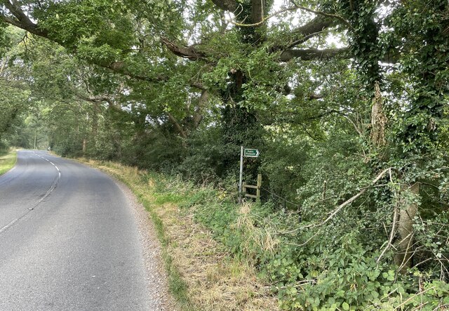
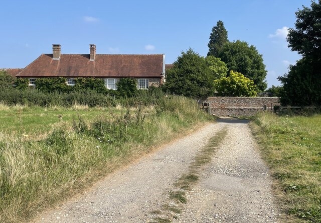
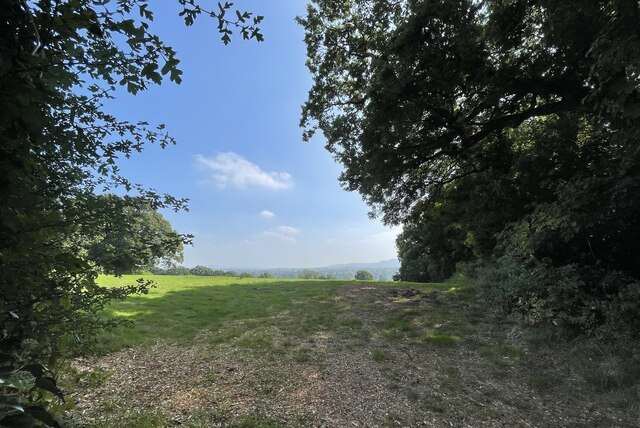
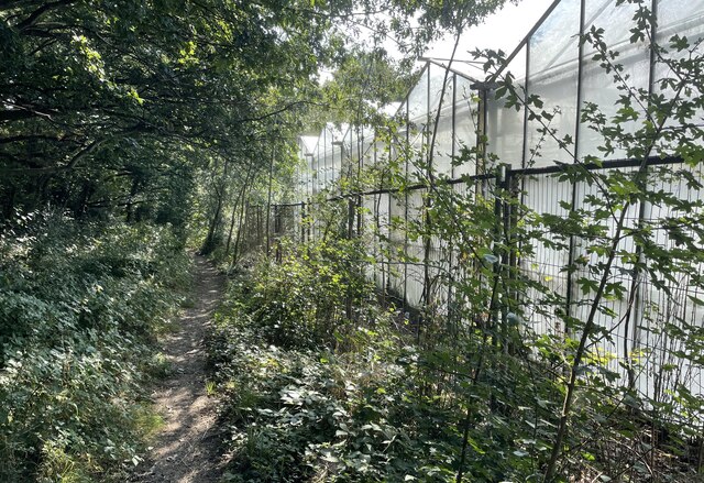
The village is known for its picturesque countryside and stunning natural beauty. Surrounded by rolling hills, Ashington offers breathtaking views and peaceful walks through its expansive farmlands and meadows. It is also home to a number of well-maintained parks and green spaces, providing ample opportunities for outdoor activities and leisurely picnics.

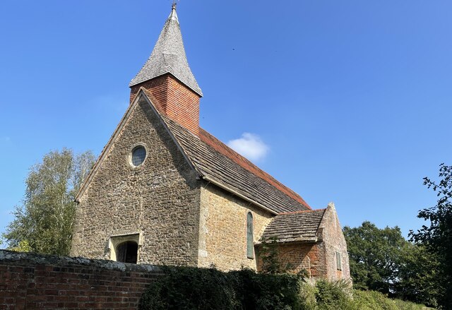
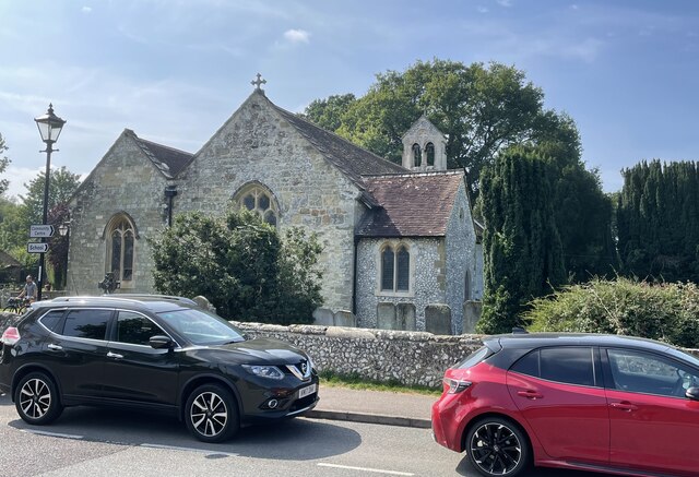
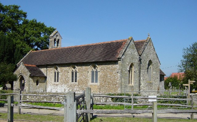
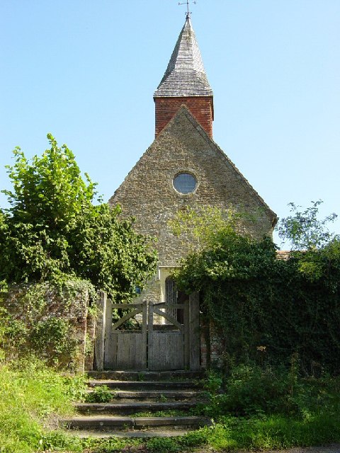
Ashington boasts a rich history, with evidence of habitation dating back to prehistoric times. The village is home to several historical landmarks, including St. Peter and St. Paul's Church, a medieval church that stands as a testament to the area's heritage. Additionally, a traditional windmill, known as Ashington Mill, can be found on the outskirts of the village, providing a glimpse into the region's agricultural past.

As for amenities, Ashington offers a range of essential services to its residents. The village has a primary school, a community center, a library, and a selection of local shops, including a supermarket and a post office. Public transportation links are available, allowing for easy access to nearby towns and cities.

Overall, Ashington, Sussex, is a charming village that combines natural beauty, a strong sense of community, and a rich history, making it an ideal place to live or visit for those seeking a peaceful, rural retreat in the heart of Sussex.

If you have any feedback on the listing, please let us know in the comments section below.
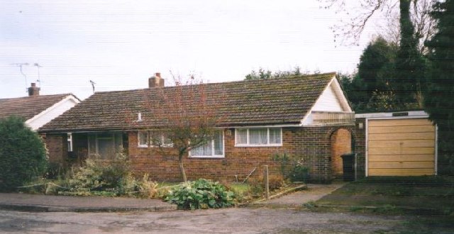
Ashington Images

Images are sourced within 2km of 50.933188/-0.390014 or Grid Reference TQ1316. Thanks to Geograph Open Source API. All images are credited.

London Road London Road in Ashington near Church Lane looking northwards.
London Road
London Road in Ashington near Church Lane looking northwards.
London Road roundabout The roundabout at the north end of Ashington where London Road meets Billingshurst Road and Ivy Lane.
London Road roundabout
The roundabout at the north end of Ashington where London Road meets Billingshurst Road and Ivy Lane.
Oast Cottage Viewed from the Billingshurst Road the cottage is a Grade II listed building. See <span class="nowrap"><a title="https://historicengland.org.uk/listing/the-list/list-entry/1182086" rel="nofollow ugc noopener" href="https://historicengland.org.uk/listing/the-list/list-entry/1182086">Link</a><img style="margin-left:2px;" alt="External link" title="External link - shift click to open in new window" src="https://s1.geograph.org.uk/img/external.png" width="10" height="10"/></span>
Oast Cottage
Viewed from the Billingshurst Road the cottage is a Grade II listed building. See LinkExternal link
Spear Hill The junction of Spear Hill with Billingshurst Road.
Spear Hill
The junction of Spear Hill with Billingshurst Road.
Public footpath Public footpath number 2364 leaving Billingshurst Road near Bennetts Farm.
Public footpath
Public footpath number 2364 leaving Billingshurst Road near Bennetts Farm.
Approaching Warminghurst On public footpath number 2481 heading eastwards.
Approaching Warminghurst
On public footpath number 2481 heading eastwards.
The Church of the Holy Sepulchre Viewed from Rectory Lane the church is a Grade I listed building. See <span class="nowrap"><a title="https://historicengland.org.uk/listing/the-list/list-entry/1027448" rel="nofollow ugc noopener" href="https://historicengland.org.uk/listing/the-list/list-entry/1027448">Link</a><img style="margin-left:2px;" alt="External link" title="External link - shift click to open in new window" src="https://s1.geograph.org.uk/img/external.png" width="10" height="10"/></span>
The church is no longer used for services and is under the care of the Churches Conservation Trust.
The Church of the Holy Sepulchre
Viewed from Rectory Lane the church is a Grade I listed building. See LinkExternal link The church is no longer used for services and is under the care of the Churches Conservation Trust.
View beside Rectory Lane Looking towards the South Downs at Warminghurst.
View beside Rectory Lane
Looking towards the South Downs at Warminghurst.
Footpath beside Nursery On footpath number 2607 as it passes the greenhouses of a Nursery on the outskirts of Ashington.
Footpath beside Nursery
On footpath number 2607 as it passes the greenhouses of a Nursery on the outskirts of Ashington.
The Parish Church of St Peter and St Paul The church is a Grade II* (star) listed building. See <span class="nowrap"><a title="https://historicengland.org.uk/listing/the-list/list-entry/1027442" rel="nofollow ugc noopener" href="https://historicengland.org.uk/listing/the-list/list-entry/1027442">Link</a><img style="margin-left:2px;" alt="External link" title="External link - shift click to open in new window" src="https://s1.geograph.org.uk/img/external.png" width="10" height="10"/></span>
The Parish Church of St Peter and St Paul
The church is a Grade II* (star) listed building. See LinkExternal link
St Peter and St Paul's Church, Ashington Extended in 1871. One of the bells (the stocks for which were renewed for the millennium) dates back to 1350.
St Peter and St Paul's Church, Ashington
Extended in 1871. One of the bells (the stocks for which were renewed for the millennium) dates back to 1350.
The Old School, Ashington Looking north. Built in 1872.
The Old School, Ashington
Looking north. Built in 1872.
The Old Mill Once a family owned water mill this is now a hotel.
The Old Mill
Once a family owned water mill this is now a hotel.
Holy Sepulchre Church, Warminghurst Dating from the 12th century this church held its last service in 1979. It is maintained by the Church Conservation Trust and is open to visitors during the week.
Holy Sepulchre Church, Warminghurst
Dating from the 12th century this church held its last service in 1979. It is maintained by the Church Conservation Trust and is open to visitors during the week.
London Road, Ashington Looking north from the southern end of the village. Once, as its name suggests, this was the main A24 London to Worthing road. Now the traffic has been diverted away onto a bypass and the main street has been traffic-calmed. In recent years the village has developed from being a straggle along the main road into a substantial dormitory village. Surprisingly, the church is on the outskirts of the village. This may be because a Roman building, possibly a villa, existed at Church Farm and maybe the original church was associated with it.
London Road, Ashington
Looking north from the southern end of the village. Once, as its name suggests, this was the main A24 London to Worthing road. Now the traffic has been diverted away onto a bypass and the main street has been traffic-calmed. In recent years the village has developed from being a straggle along the main road into a substantial dormitory village. Surprisingly, the church is on the outskirts of the village. This may be because a Roman building, possibly a villa, existed at Church Farm and maybe the original church was associated with it.
Ashington The A24 underpass at the south end of London Road looking south. The bypass skirts the eastern side of the village and joins up with the original main road just south of this point. The road under the underpass is the road to Hole Street and Wiston and also links up with the southbound carriageway.
Ashington
The A24 underpass at the south end of London Road looking south. The bypass skirts the eastern side of the village and joins up with the original main road just south of this point. The road under the underpass is the road to Hole Street and Wiston and also links up with the southbound carriageway.
Fields of Hole Street Farm A view across this entirely agricultural square: the fields of Hole Street Farm, looking towards Upper Chancton, with the trees of Birth Copse in the middle distance. The hedge line in the foreground is probably ancient; it marks the parish boundary.
Fields of Hole Street Farm
A view across this entirely agricultural square: the fields of Hole Street Farm, looking towards Upper Chancton, with the trees of Birth Copse in the middle distance. The hedge line in the foreground is probably ancient; it marks the parish boundary.
Rosewood Cottage Ivy Close, Ashington, W. Sussex.
Rosewood Cottage
Ivy Close, Ashington, W. Sussex.
Show me another place!

Ashington is located at Grid Ref: TQ1316 (Lat: 50.933188, Lng: -0.390014)

Administrative County: West Sussex

District: Horsham

Police Authority: Sussex

What 3 Words

///animals.tint.woke. Near Ashington, West Sussex

Related Wikis

Ashington, West Sussex

Ashington is a village and civil parish in the Horsham District of West Sussex, England. It lies on the A24 road 3 miles (4.8 km) north-east of Storrington...

Church of the Holy Sepulchre, Warminghurst

The Church of the Holy Sepulchre is a former Anglican church in the hamlet of Warminghurst in the district of Horsham, one of seven local government districts...

Warminghurst

Warminghurst is a village and former civil parish, now in the parish of Thakeham, in the Horsham district of West Sussex, England. It lies on the Ashington...

Wiston, West Sussex

Wiston is a scattered village and civil parish in the Horsham District of West Sussex, England. It lies on the A283 road 2.8 miles (4.5 km) northwest of...
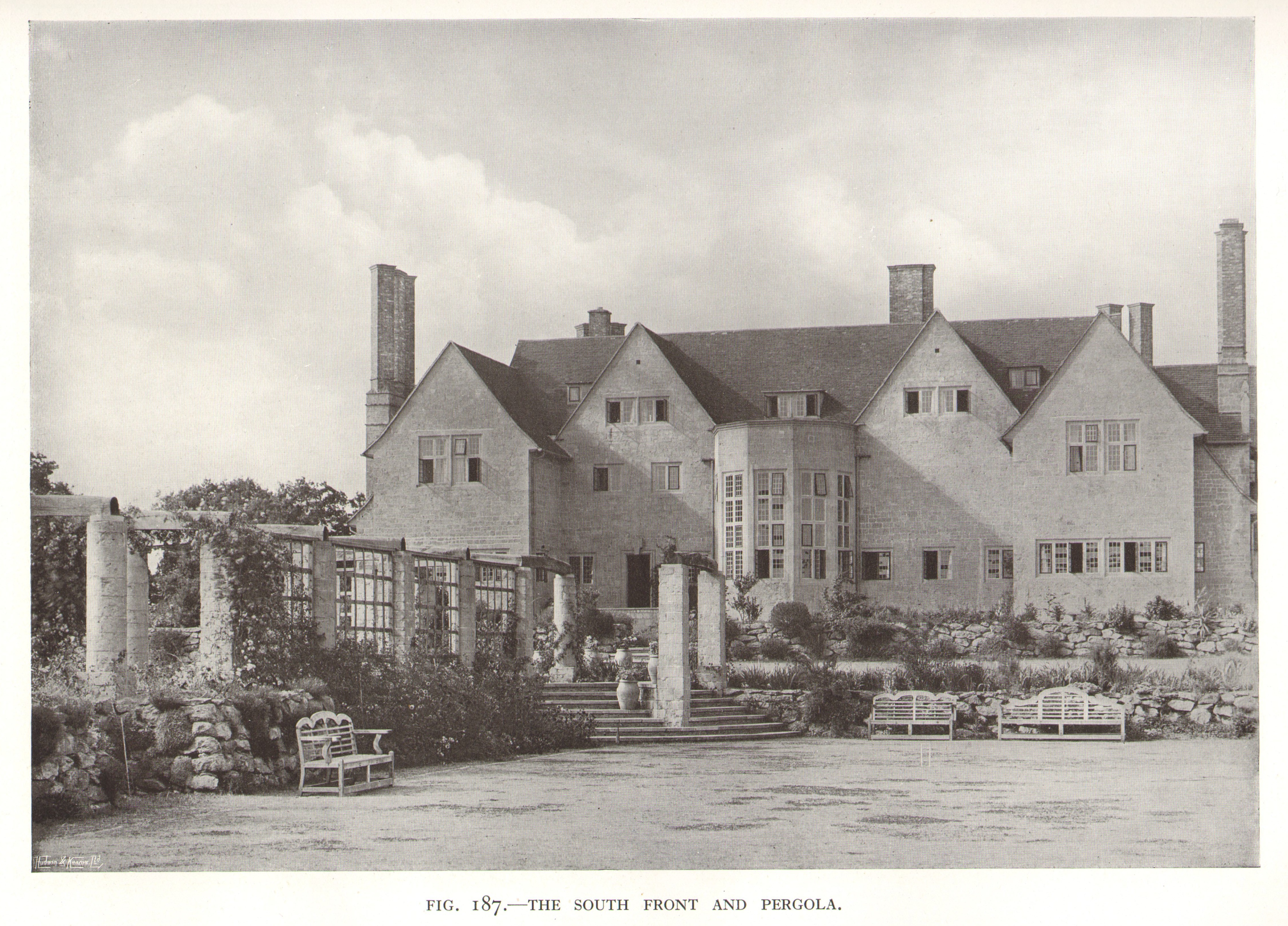
Little Thakeham

Little Thakeham is an Arts and Crafts style, Grade I listed private house in the parish of Thakeham, near the village of Storrington, in the Horsham district...

Heath Common

Heath Common is a settlement in the Horsham District of West Sussex, England. It lies on the Storrington to Ashington road 1.5 miles (2.4 km) east of Storrington...

Rock Mill, Washington

Rock Mill is a Grade II listed smock mill at Washington, West Sussex, England, which has been converted to residential use. == History == Rock Mill was...

Buncton

Buncton () is a small village in the Horsham District of West Sussex, England, part of the civil parish of Wiston 0.5 miles (0.80 km) north. It lies to...

Nearby Amenities

Located within 500m of 50.933188,-0.390014
Motorway Junction
Lat/Long: 50.9349768/-0.3872927
Ashington
Is In: West Sussex, England, UK
Place: village
Wikidata: Q647940
Lat/Long: 50.9356024/-0.3895218
Mini Roundabout
Direction: clockwise
Lat/Long: 50.9294379/-0.3904732
Bus Stop
Rectory Lane
Bus: yes
Departures Board: timetable
Naptan AtcoCode: 4400HR0324
Naptan Bearing: N
Naptan CommonName: Rectory Lane
Naptan Indicator: o/s Post Office
Naptan Landmark: Rectory Lane
Naptan NaptanCode: wsxawdaw
Naptan Street: London Road
Naptan Verified: no
Public Transport: platform
Shelter: yes
Source: naptan_import
Lat/Long: 50.9358562/-0.389706
Bus Stop
Rectory Lane
Bus: yes
Naptan AtcoCode: 4400HR0325
Naptan Bearing: S
Naptan CommonName: Rectory lane
Naptan Indicator: o/s Downview
Naptan Landmark: Rectory lane
Naptan NaptanCode: wsxawdga
Naptan Street: London Road
Naptan Verified: no
Public Transport: platform
Source: naptan_import
Lat/Long: 50.9350944/-0.3896582
Bus Stop
Hillcrest Drive
Bus: yes
Naptan AtcoCode: 4400HR0326
Naptan Bearing: N
Naptan CommonName: Hillcrest Drive
Naptan Indicator: adj Hillcrest Drive
Naptan Landmark: Hillcrest Drive
Naptan NaptanCode: wsxawdgd
Naptan Street: London Road
Naptan Verified: no
Public Transport: platform
Source: naptan_import
Lat/Long: 50.9339233/-0.3900021
Bus Stop
Hillcrest Drive
Bus: yes
Naptan AtcoCode: 4400HR0327
Naptan Bearing: S
Naptan CommonName: Hillcrest Drive
Naptan Indicator: Opp
Naptan Landmark: Hillcrest Drive
Naptan NaptanCode: wsxawdgj
Naptan Street: London Road
Naptan Verified: no
Public Transport: platform
Source: naptan_import
Lat/Long: 50.9334847/-0.3899061
Bus Stop
Red Lion
Bus: yes
Naptan AtcoCode: 4400HR0328
Naptan Bearing: S
Naptan CommonName: Red Lion
Naptan Indicator: opp
Naptan Landmark: Mill Lane
Naptan NaptanCode: wsxawdgm
Naptan ShortCommonName: Ashington Red Lion
Naptan Street: london Road
Naptan Verified: no
Public Transport: platform
Source: naptan_import
Lat/Long: 50.9300205/-0.3903263
Bus Stop
Red Lion
Bus: yes
Naptan AtcoCode: 4400HR0329
Naptan Bearing: N
Naptan CommonName: Red Lion
Naptan Indicator: o/s
Naptan Landmark: Mill Lane
Naptan NaptanCode: wsxawdgp
Naptan ShortCommonName: Ashington Red Lion
Naptan Street: London Road
Naptan Verified: no
Public Transport: platform
Source: naptan_import
Lat/Long: 50.9297895/-0.3904738
Turning Circle
Lat/Long: 50.9348124/-0.3909152
Post Office
Ashington Post Office
Addr City: Ashington
Addr Postcode: RH20 3RB
Addr Street: London Road
Ref Pol Id: 155
Source: OS_OpenData_StreetView
Lat/Long: 50.932574/-0.389678
Post Box
Collection Times: Mo-Fr 16:00; Sa 09:30
Operator: Royal Mail
Operator Wikidata: Q638098
Post Box Type: pillar
Ref: RH20 388D
Royal Cypher: EVIIR
Royal Cypher Wikidata: Q33102324
Lat/Long: 50.933183/-0.3951251
Noexit: yes
Lat/Long: 50.9375204/-0.389471
Post Box
Collection Times: Mo-Fr 09:00; Sa 07:00; Su off
Operator: Royal Mail
Operator Wikidata: Q638098
Post Box Type: wall
Ref: RH20 36D
Royal Cypher: GR
Royal Cypher Wikidata: Q33102273
Source: survey
Lat/Long: 50.930142/-0.3905438
Post Box
Collection Times: Mo-Fr 16:30; Sa 09:30; Su off
Operator: Royal Mail
Operator Wikidata: Q638098
Post Box Type: pillar
Ref: RH20 20
Royal Cypher: EIIR
Royal Cypher Wikidata: Q33102113
Source: survey
Lat/Long: 50.9324478/-0.3896884
Access: private
Booth: K6
Man Made: telephone_box
Lat/Long: 50.9347254/-0.3906891
Access: private
Booth: K8
Colour: red
Man Made: telephone_box
Lat/Long: 50.934724/-0.3906413
Access: private
Booth: K2
Colour: red
Man Made: telephone_box
Lat/Long: 50.933197/-0.3918627
Access: private
Booth: K6
Colour: red
Man Made: telephone_box
Lat/Long: 50.9331652/-0.3918712
Access: private
Booth: K8
Colour: red
Man Made: telephone_box
Lat/Long: 50.9331263/-0.3918238
Crossing
Crossing: marked
Traffic Calming: table
Lat/Long: 50.9323301/-0.3956197
Leisure: playground
Lat/Long: 50.933374/-0.3944321
Hiking: yes
Information: guidepost
Source: GPS
Tourism: information
Lat/Long: 50.931171/-0.3950889
Hiking: yes
Information: guidepost
Source: GPS
Tourism: information
Lat/Long: 50.932535/-0.394392
Bench
Lat/Long: 50.9365969/-0.3895305
Bench
Lat/Long: 50.935722/-0.3897156
Addr City: Pulborough
Addr Housename: Broadbridge Farm
Addr Postcode: RH20 3DE
Addr Street: Hole Street
Addr Suburb: Ashington
Lat/Long: 50.9340408/-0.385611
The data included in this document is from www.openstreetmap.org. The data is made available under ODbL.

Have you been to Ashington?

Leave your review of Ashington below (or comments, questions and feedback).