Ashington End

Settlement in Lincolnshire East Lindsey

England

Ashington End

Direction Sign – Signpost on Mill Road, Addlethorpe Located at Corner Farm, on the south side of the T junction of Mill Road and Chapel Lane in Addlethorpe parish. 3 arms and no finial. 

Milestone Society National ID: LI_TF5467A
Direction Sign – Signpost on Mill Road, Addlethorpe Credit: A Riley

Ashington End is a small village located in the county of Lincolnshire, in the East Midlands region of England. Situated approximately 10 miles north of the city of Lincoln, Ashington End is surrounded by picturesque countryside and is known for its tranquil and rural setting.

The village is characterized by its traditional architecture, with many of its buildings constructed from local materials such as limestone and red brick. The village center consists of a small cluster of houses, a church, and a village hall. The church, dedicated to St. Mary, dates back to the 12th century and is a prominent feature of the village.

Ashington End is home to a close-knit community, with a population of around 200 residents. The village is known for its friendly and welcoming atmosphere, and community events such as fairs and festivals are regularly organized to bring the residents together.

The surrounding countryside offers plenty of opportunities for outdoor activities, such as walking, cycling, and horse riding. The village is also located near several nature reserves and parks, providing further options for exploring the natural beauty of the area.

Although Ashington End is a small village, it benefits from its proximity to the city of Lincoln, which offers a wide range of amenities and services. In addition, the village is well-connected by road, with easy access to the nearby A15 and A46 highways.

Overall, Ashington End offers a peaceful and idyllic place to live, with its charming village setting, strong sense of community, and access to the beautiful Lincolnshire countryside.

If you have any feedback on the listing, please let us know in the comments section below.

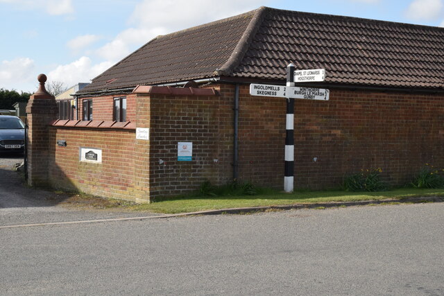
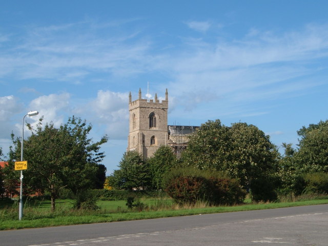
Ashington End Images

Images are sourced within 2km of 53.1768/0.3006 or Grid Reference TF5366. Thanks to Geograph Open Source API. All images are credited.

Direction Sign – Signpost on Mill Road, Addlethorpe Located at Corner Farm, on the south side of the T junction of Mill Road and Chapel Lane in Addlethorpe parish. 3 arms and no finial. 

Milestone Society National ID: LI_TF5467A
Direction Sign – Signpost on Mill Road, Addlethorpe
Located at Corner Farm, on the south side of the T junction of Mill Road and Chapel Lane in Addlethorpe parish. 3 arms and no finial. Milestone Society National ID: LI_TF5467A
Welcome to Fabulous Skeg Vegas Not in Nevada Tongue-in-cheek signpost outside Skegness (a.k.a. Skeg Vegas) Stadium.  Great for selfies.

Much better than Bosc Vegas! <a href="https://www.geograph.org.uk/photo/3701139">SZ1191 : Bosc Vegas</a> / <a href="https://www.geograph.org.uk/photo/2387453">SZ1191 : Viva Bosc Vegas</a>
Welcome to Fabulous Skeg Vegas Not in Nevada
Tongue-in-cheek signpost outside Skegness (a.k.a. Skeg Vegas) Stadium. Great for selfies. Much better than Bosc Vegas! SZ1191 : Bosc Vegas / SZ1191 : Viva Bosc Vegas
Heading south along Marsh Road
View east towards Fantasy Island Fantasy Island is an amusement park in Ingoldmells. This is the view east from Marsh Lane, the amusement park is 2 miles away.
View east towards Fantasy Island
Fantasy Island is an amusement park in Ingoldmells. This is the view east from Marsh Lane, the amusement park is 2 miles away.
Power lines crossing the farmland
Solitary tree along Marsh Road
House at Whitehouse Farm Along Marsh Road near Ashington End.
House at Whitehouse Farm
Along Marsh Road near Ashington End.
Bales in a field at Ashington End
Illinois Farm along Hide's Lane
Bales in a field at Ashington End In the distance (two miles away) is the Fantasy island amusement park at Ingoldmells.
Bales in a field at Ashington End
In the distance (two miles away) is the Fantasy island amusement park at Ingoldmells.
Bales in a field at Ashington End
Hide's Lane at Ashington End
Mast next to Hide's Lane The mast has been built on the site of the former Black House Farm.
Mast next to Hide's Lane
The mast has been built on the site of the former Black House Farm.
Hide's Lane towards Ashington End
Farmland and cattle next to Hide's Lane
Lane junction at Mill Hill Hide's Lane joins Everington's Lane.
Lane junction at Mill Hill
Hide's Lane joins Everington's Lane.
Postbox along Everington's Lane
Trike in a field entrance, Marsh Road near Addlethorpe
Show me another place!

Ashington End is located at Grid Ref: TF5366 (Lat: 53.1768, Lng: 0.3006)

Division: Parts of Lindsey

Administrative County: Lincolnshire

District: East Lindsey

Police Authority: Lincolnshire

What 3 Words

///reckoned.informed.copiers. Near Ingoldmells, Lincolnshire

Nearby Locations

Ashington End

Related Wikis

Ashington End

Ashington End is a hamlet in the East Lindsey district of Lincolnshire, England. It is situated 3 miles (5 km) north-west from Skegness.

Skegness Stadium

Skegness Stadium is a short tarmac oval racing circuit used for stock car, banger racing and former greyhound racing and speedway stadium on Marsh Lane...

Lincolnshire Coast Light Railway

The Lincolnshire Coast Light Railway is a 2 ft (610 mm) narrow gauge heritage railway built in 1960 using equipment from the Nocton Potato Estate railway...

Addlethorpe

Addlethorpe is a small village situated just off the A52 west of Ingoldmells in the East Lindsey district of Lincolnshire, England. Addlethorpe is recorded...

Winthorpe, Lincolnshire

Winthorpe is a small coastal village in the East Lindsey district of Lincolnshire, England. It is situated approximately 2 miles (3.2 km) north from Skegness...
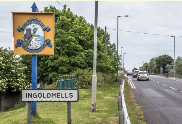
Ingoldmells

Ingoldmells ( ING-gə-melz) is a coastal village, civil parish and resort in the East Lindsey district of Lincolnshire, England. It is situated on the A52...
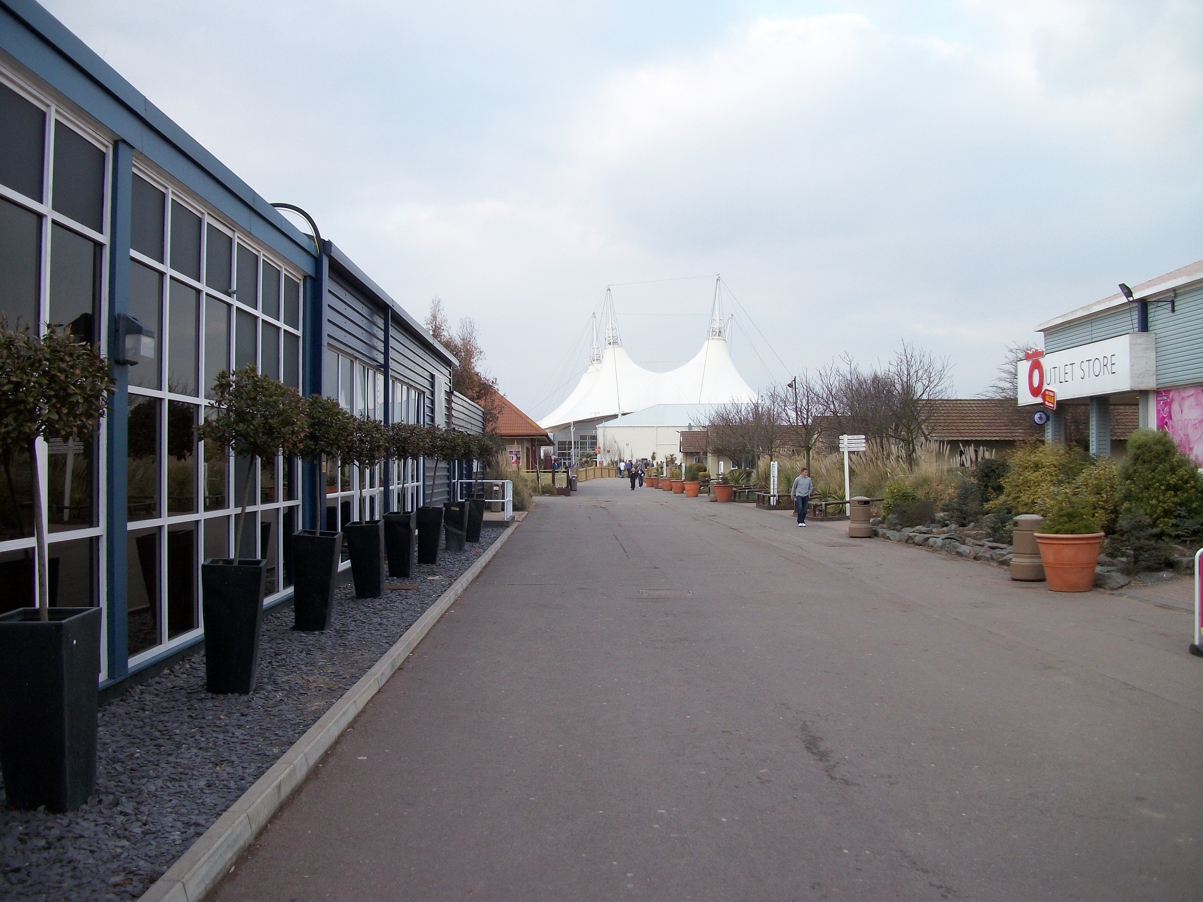
Butlins Skegness

Butlins Skegness (officially Butlins Resort Skegness), formerly Butlin's Skegness or Funcoast World; is a holiday camp located in Ingoldmells near Skegness...

Skegness Academy

Skegness Academy is a coeducational secondary school and sixth form with academy status, in Skegness, Lincolnshire, England. == History == === Secondary... ===

Nearby Amenities

Located within 500m of 53.1768,0.3006
Hide's Lane
Naptan AtcoCode: 270000010141
Naptan Bearing: E
Naptan BusStopType: CUS
Naptan CommonName: Hide's Lane
Naptan Indicator: opp
Naptan Landmark: Hide's Lane Teapot Hall
Naptan NaptanCode: linjgwmw
Naptan Street: Ingoldmells Road
Naptan Verified: no
Source: naptan_import
Lat/Long: 53.1805429/0.2992547
Hide's Lane
Naptan AtcoCode: 270000010142
Naptan Bearing: W
Naptan BusStopType: CUS
Naptan CommonName: Hide's Lane
Naptan Indicator: adj
Naptan Landmark: Hide's Lane
Naptan NaptanCode: linjgwpa
Naptan Street: Ingoldmells Road
Naptan Verified: no
Source: naptan_import
Lat/Long: 53.1805884/0.2996912
Illinois Farm
Place: farm
Source: Bing
Lat/Long: 53.1795476/0.3007086
Five Acres
Place: isolated_dwelling
Source: Bing
Lat/Long: 53.1766822/0.3015299
Rose Lea
Place: isolated_dwelling
Source: Bing
Lat/Long: 53.176891/0.3001221
The Willows
Place: isolated_dwelling
Source: Bing
Lat/Long: 53.1809063/0.2981188
Thepot Hall
Place: isolated_dwelling
Source: Bing
Lat/Long: 53.1809672/0.3000345
The data included in this document is from www.openstreetmap.org. The data is made available under ODbL.

Have you been to Ashington End?

Leave your review of Ashington End below (or comments, questions and feedback).