America Wood

Wood, Forest in Sussex Horsham

England

America Wood

Modern Waymarker The Modern Waymarker is located  on the road.  Parish of Ashington (Horsham District). Carved stone plaque laid inside brick semicircle, erected in the 20th Century. 

Inscription reads:-  
ASHINGTON / LONDON / () MILES / WORTHING / 10 MILES

Milestone Society National ID: SX_XASH
Modern Waymarker Credit: Janet Dowding

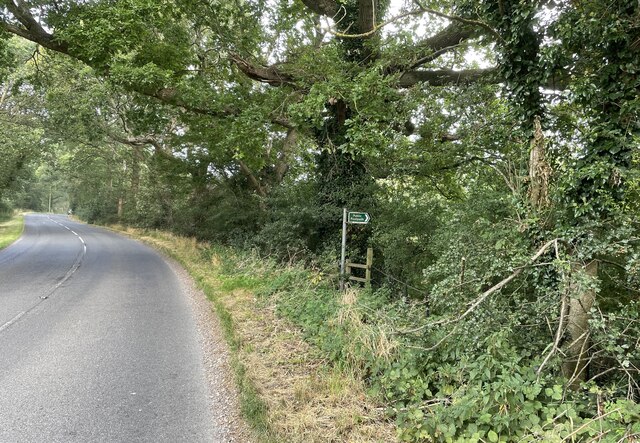
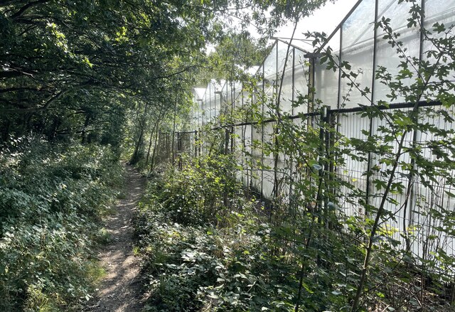
America Wood is a picturesque woodland area located in Sussex, England. Situated in the heart of the South Downs National Park, this forest is renowned for its natural beauty and diverse flora and fauna. Covering an area of approximately 100 acres, America Wood offers visitors a tranquil and peaceful escape from the hustle and bustle of city life.

The woodland is predominantly composed of mixed deciduous trees, including oak, beech, and ash, creating a stunning display of colors during the autumn months. The forest floor is covered in a rich carpet of bluebells in the spring, making it a popular destination for nature enthusiasts and photographers alike.

America Wood is also home to a wide variety of wildlife. Visitors may be lucky enough to spot deer, foxes, and badgers, as well as numerous bird species, including woodpeckers and owls. The woodland provides a vital habitat for these creatures, offering shelter and food throughout the year.

The forest is crisscrossed by a network of well-maintained footpaths and trails, making it the perfect location for walking, hiking, and exploring. There are also designated picnic areas where visitors can relax and enjoy the peaceful surroundings. Additionally, America Wood is often used as a venue for educational activities and guided nature walks, allowing visitors to learn more about the local ecosystem and conservation efforts.

Overall, America Wood is a true gem in the Sussex countryside, offering visitors a chance to connect with nature and enjoy the beauty of the British woodlands.

If you have any feedback on the listing, please let us know in the comments section below.

America Wood Images

Images are sourced within 2km of 50.934159/-0.38334714 or Grid Reference TQ1316. Thanks to Geograph Open Source API. All images are credited.

Modern Waymarker The Modern Waymarker is located  on the road.  Parish of Ashington (Horsham District). Carved stone plaque laid inside brick semicircle, erected in the 20th Century. 

Inscription reads:-  
ASHINGTON / LONDON / () MILES / WORTHING / 10 MILES

Milestone Society National ID: SX_XASH
Modern Waymarker
The Modern Waymarker is located on the road.  Parish of Ashington (Horsham District). Carved stone plaque laid inside brick semicircle, erected in the 20th Century.  Inscription reads:- ASHINGTON / LONDON / () MILES / WORTHING / 10 MILES Milestone Society National ID: SX_XASH
London Road London Road in Ashington near Church Lane looking northwards.
London Road
London Road in Ashington near Church Lane looking northwards.
London Road roundabout The roundabout at the north end of Ashington where London Road meets Billingshurst Road and Ivy Lane.
London Road roundabout
The roundabout at the north end of Ashington where London Road meets Billingshurst Road and Ivy Lane.
Oast Cottage Viewed from the Billingshurst Road the cottage is a Grade II listed building. See <span class="nowrap"><a title="https://historicengland.org.uk/listing/the-list/list-entry/1182086" rel="nofollow ugc noopener" href="https://historicengland.org.uk/listing/the-list/list-entry/1182086">Link</a><img style="margin-left:2px;" alt="External link" title="External link - shift click to open in new window" src="https://s1.geograph.org.uk/img/external.png" width="10" height="10"/></span>
Oast Cottage
Viewed from the Billingshurst Road the cottage is a Grade II listed building. See LinkExternal link
Spear Hill The junction of Spear Hill with Billingshurst Road.
Spear Hill
The junction of Spear Hill with Billingshurst Road.
Public footpath Public footpath number 2364 leaving Billingshurst Road near Bennetts Farm.
Public footpath
Public footpath number 2364 leaving Billingshurst Road near Bennetts Farm.
Footpath beside Nursery On footpath number 2607 as it passes the greenhouses of a Nursery on the outskirts of Ashington.
Footpath beside Nursery
On footpath number 2607 as it passes the greenhouses of a Nursery on the outskirts of Ashington.
The Parish Church of St Peter and St Paul The church is a Grade II* (star) listed building. See <span class="nowrap"><a title="https://historicengland.org.uk/listing/the-list/list-entry/1027442" rel="nofollow ugc noopener" href="https://historicengland.org.uk/listing/the-list/list-entry/1027442">Link</a><img style="margin-left:2px;" alt="External link" title="External link - shift click to open in new window" src="https://s1.geograph.org.uk/img/external.png" width="10" height="10"/></span>
The Parish Church of St Peter and St Paul
The church is a Grade II* (star) listed building. See LinkExternal link
St Peter and St Paul's Church, Ashington Extended in 1871. One of the bells (the stocks for which were renewed for the millennium) dates back to 1350.
St Peter and St Paul's Church, Ashington
Extended in 1871. One of the bells (the stocks for which were renewed for the millennium) dates back to 1350.
The Old School, Ashington Looking north. Built in 1872.
The Old School, Ashington
Looking north. Built in 1872.
The Old Mill Once a family owned water mill this is now a hotel.
The Old Mill
Once a family owned water mill this is now a hotel.
London Road, Ashington Looking north from the southern end of the village. Once, as its name suggests, this was the main A24 London to Worthing road. Now the traffic has been diverted away onto a bypass and the main street has been traffic-calmed. In recent years the village has developed from being a straggle along the main road into a substantial dormitory village. Surprisingly, the church is on the outskirts of the village. This may be because a Roman building, possibly a villa, existed at Church Farm and maybe the original church was associated with it.
London Road, Ashington
Looking north from the southern end of the village. Once, as its name suggests, this was the main A24 London to Worthing road. Now the traffic has been diverted away onto a bypass and the main street has been traffic-calmed. In recent years the village has developed from being a straggle along the main road into a substantial dormitory village. Surprisingly, the church is on the outskirts of the village. This may be because a Roman building, possibly a villa, existed at Church Farm and maybe the original church was associated with it.
Ashington The A24 underpass at the south end of London Road looking south. The bypass skirts the eastern side of the village and joins up with the original main road just south of this point. The road under the underpass is the road to Hole Street and Wiston and also links up with the southbound carriageway.
Ashington
The A24 underpass at the south end of London Road looking south. The bypass skirts the eastern side of the village and joins up with the original main road just south of this point. The road under the underpass is the road to Hole Street and Wiston and also links up with the southbound carriageway.
Fields of Hole Street Farm A view across this entirely agricultural square: the fields of Hole Street Farm, looking towards Upper Chancton, with the trees of Birth Copse in the middle distance. The hedge line in the foreground is probably ancient; it marks the parish boundary.
Fields of Hole Street Farm
A view across this entirely agricultural square: the fields of Hole Street Farm, looking towards Upper Chancton, with the trees of Birth Copse in the middle distance. The hedge line in the foreground is probably ancient; it marks the parish boundary.
Rosewood Cottage Ivy Close, Ashington, W. Sussex.
Rosewood Cottage
Ivy Close, Ashington, W. Sussex.
Footpath to Kensett's Corner Taken from North Lane bridleway.
Footpath to Kensett's Corner
Taken from North Lane bridleway.
Coppicing, Brickyard Copse Taken from North Lane bridleway.
Coppicing, Brickyard Copse
Taken from North Lane bridleway.
Basing Wood A lone oak stands guard over an army of firs. Taken from North Lane bridleway just north of Coombelands.
Basing Wood
A lone oak stands guard over an army of firs. Taken from North Lane bridleway just north of Coombelands.
Show me another place!

America Wood is located at Grid Ref: TQ1316 (Lat: 50.934159, Lng: -0.38334714)

Administrative County: West Sussex

District: Horsham

Police Authority: Sussex

What 3 Words

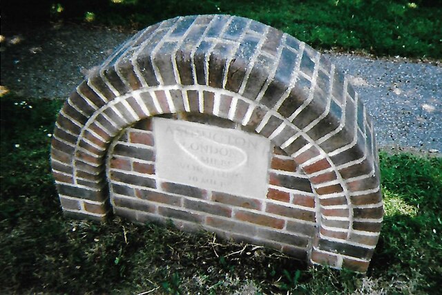
///retaliate.festivity.pampered. Near Ashington, West Sussex

Related Wikis

Ashington, West Sussex

Ashington is a village and civil parish in the Horsham District of West Sussex, England. It lies on the A24 road 3 miles (4.8 km) north-east of Storrington...

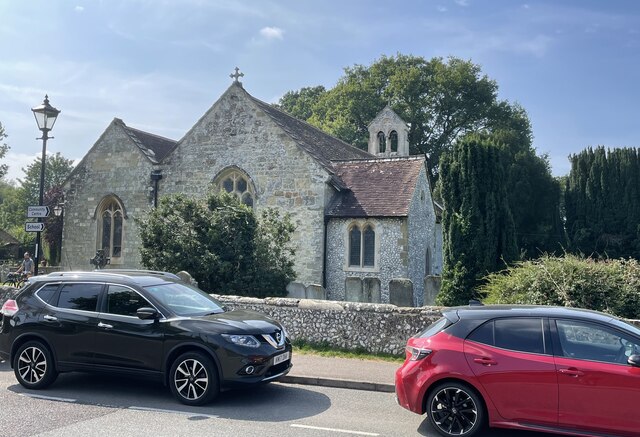
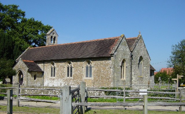
Church of the Holy Sepulchre, Warminghurst

The Church of the Holy Sepulchre is a former Anglican church in the hamlet of Warminghurst in the district of Horsham, one of seven local government districts...

Warminghurst

Warminghurst is a village and former civil parish, now in the parish of Thakeham, in the Horsham district of West Sussex, England. It lies on the Ashington...

Wiston, West Sussex

Wiston is a scattered village and civil parish in the Horsham District of West Sussex, England. It lies on the A283 road 2.8 miles (4.5 km) northwest of...

Buncton

Buncton () is a small village in the Horsham District of West Sussex, England, part of the civil parish of Wiston 0.5 miles (0.80 km) north. It lies to...

All Saints Church, Buncton

All Saints Church is an Anglican church in the hamlet of Buncton in the district of Horsham, one of seven local government districts in the English county...

Rock Mill, Washington

Rock Mill is a Grade II listed smock mill at Washington, West Sussex, England, which has been converted to residential use. == History == Rock Mill was...

South Downs National Park

The South Downs National Park is England's newest national park, designated on 31 March 2010. The park, covering an area of 1,627 square kilometres (628...

Nearby Amenities

Located within 500m of 50.934159,-0.38334714
Motorway Junction
Lat/Long: 50.9349768/-0.3872927
Ashington
Is In: West Sussex, England, UK
Place: village
Wikidata: Q647940
Lat/Long: 50.9356024/-0.3895218
Bus Stop
Rectory Lane
Bus: yes
Departures Board: timetable
Naptan AtcoCode: 4400HR0324
Naptan Bearing: N
Naptan CommonName: Rectory Lane
Naptan Indicator: o/s Post Office
Naptan Landmark: Rectory Lane
Naptan NaptanCode: wsxawdaw
Naptan Street: London Road
Naptan Verified: no
Public Transport: platform
Shelter: yes
Source: naptan_import
Lat/Long: 50.9358562/-0.389706
Bus Stop
Rectory Lane
Bus: yes
Naptan AtcoCode: 4400HR0325
Naptan Bearing: S
Naptan CommonName: Rectory lane
Naptan Indicator: o/s Downview
Naptan Landmark: Rectory lane
Naptan NaptanCode: wsxawdga
Naptan Street: London Road
Naptan Verified: no
Public Transport: platform
Source: naptan_import
Lat/Long: 50.9350944/-0.3896582
Bus Stop
Hillcrest Drive
Bus: yes
Naptan AtcoCode: 4400HR0326
Naptan Bearing: N
Naptan CommonName: Hillcrest Drive
Naptan Indicator: adj Hillcrest Drive
Naptan Landmark: Hillcrest Drive
Naptan NaptanCode: wsxawdgd
Naptan Street: London Road
Naptan Verified: no
Public Transport: platform
Source: naptan_import
Lat/Long: 50.9339233/-0.3900021
Bus Stop
Hillcrest Drive
Bus: yes
Naptan AtcoCode: 4400HR0327
Naptan Bearing: S
Naptan CommonName: Hillcrest Drive
Naptan Indicator: Opp
Naptan Landmark: Hillcrest Drive
Naptan NaptanCode: wsxawdgj
Naptan Street: London Road
Naptan Verified: no
Public Transport: platform
Source: naptan_import
Lat/Long: 50.9334847/-0.3899061
Post Office
Ashington Post Office
Addr City: Ashington
Addr Postcode: RH20 3RB
Addr Street: London Road
Ref Pol Id: 155
Source: OS_OpenData_StreetView
Lat/Long: 50.932574/-0.389678
Post Box
Collection Times: Mo-Fr 16:30; Sa 09:30; Su off
Operator: Royal Mail
Operator Wikidata: Q638098
Post Box Type: pillar
Ref: RH20 20
Royal Cypher: EIIR
Royal Cypher Wikidata: Q33102113
Source: survey
Lat/Long: 50.9324478/-0.3896884
Toilets
Lat/Long: 50.9377496/-0.387378
M&S Simply Food
Brand: M&S Simply Food
Brand Wikidata: Q714491
Contact Website: https://www.marksandspencer.com/stores/ashington-sf-connect-1911
Shop: convenience
Lat/Long: 50.9376685/-0.3873526
Cafe
M&S Wild Bean
Lat/Long: 50.9377868/-0.3873016
Bench
Lat/Long: 50.935722/-0.3897156
Power: pole
Lat/Long: 50.9369661/-0.3796982
Power: pole
Lat/Long: 50.9372612/-0.378411
Power: pole
Lat/Long: 50.9364288/-0.3806629
Charging Station
Lat/Long: 50.937431/-0.3873763
Charging Station
Lat/Long: 50.9374197/-0.3873361
Addr City: Pulborough
Addr Housename: Broadbridge Farm
Addr Postcode: RH20 3DE
Addr Street: Hole Street
Addr Suburb: Ashington
Lat/Long: 50.9340408/-0.385611
The data included in this document is from www.openstreetmap.org. The data is made available under ODbL.

Have you been to America Wood?

Leave your review of America Wood below (or comments, questions and feedback).