Ashington

Settlement in Dorset

England

Ashington

Netherwood Mead towards the River Stour
Netherwood Mead towards the River Stour Credit: James Emmans

Ashington is a small village located in the county of Dorset, in the south-west of England. Situated approximately 5 miles southeast of the town of Sherborne, Ashington is surrounded by picturesque countryside, offering a tranquil and idyllic setting for its residents.

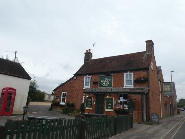
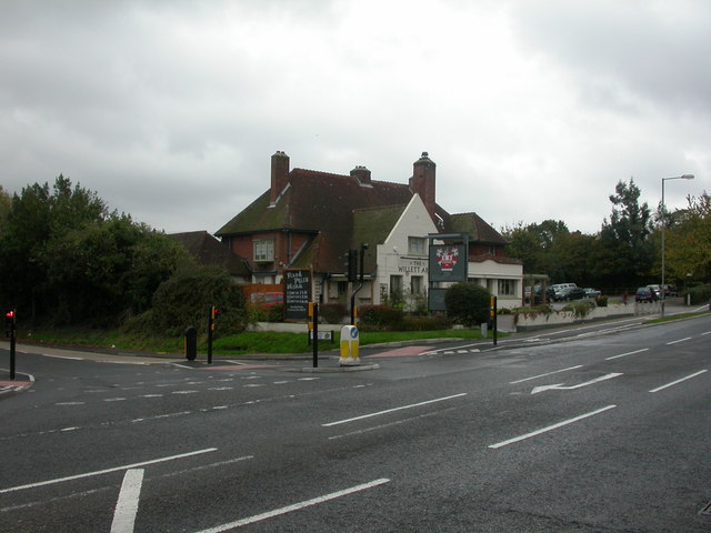
The village is characterized by its charming thatched-roof cottages, quaint traditional pubs, and a close-knit community atmosphere. It boasts a population of around 1,000 residents, giving it a peaceful and friendly ambiance.

Ashington is well-connected to nearby towns and cities, with good transport links including regular bus services and easy access to major road networks. The village is close to the A352 road, which provides convenient routes to destinations such as Dorchester and Yeovil.

Despite its small size, Ashington offers a range of amenities to cater to the needs of its residents. These include a primary school, a local convenience store, a post office, and a village hall. The community also benefits from a lively social scene, with regular events and activities organized by various local clubs and groups.

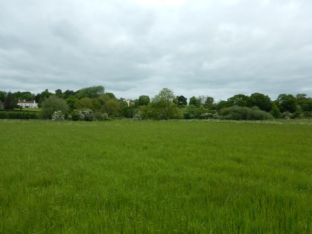
The village is surrounded by beautiful countryside, making it an ideal location for nature lovers and outdoor enthusiasts. There are numerous walking and cycling routes in the area, allowing residents to enjoy the stunning scenery and explore the nearby Dorset Area of Outstanding Natural Beauty.

Overall, Ashington is a charming and peaceful village that offers a close-knit community, convenient amenities, and easy access to the natural beauty of Dorset.

If you have any feedback on the listing, please let us know in the comments section below.
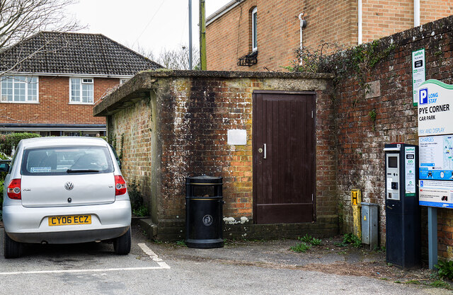
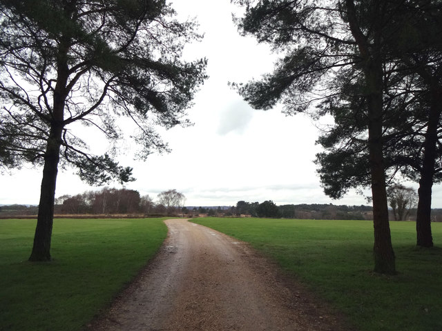
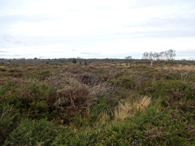
Ashington Images

Images are sourced within 2km of 50.78359/-2.000019 or Grid Reference SZ0098. Thanks to Geograph Open Source API. All images are credited.

Netherwood Mead towards the River Stour
Wimborne Minster: ...but not close enough Pictured about 10 minutes after kick-off of the World Cup semi-final between England and Croatia, which England would lose 2-1 after extra time.

Three Lions Close is a modern development of infill housing around the back of the pub on the corner of West Street and Victoria Road, currently called the Minster Arms. The name has nothing to do with the England football team: the pub was previously known as the Pudding and Pye, before that the Pye Corner (the name of the junction), and originally the Three Lions, hence the name of the close.

See <a href="https://www.geograph.org.uk/photo/2785664">SU0000 : Wimborne, The Pudding and Pye</a> for the pub in its Pudding & Pye guise (in 2012), and
<a href="https://www.geograph.org.uk/photo/334906">SU0000 : Pye Corner</a> when it was the Pye Corner (2007).
Wimborne Minster: ...but not close enough
Pictured about 10 minutes after kick-off of the World Cup semi-final between England and Croatia, which England would lose 2-1 after extra time. Three Lions Close is a modern development of infill housing around the back of the pub on the corner of West Street and Victoria Road, currently called the Minster Arms. The name has nothing to do with the England football team: the pub was previously known as the Pudding and Pye, before that the Pye Corner (the name of the junction), and originally the Three Lions, hence the name of the close. See SU0000 : Wimborne, The Pudding and Pye for the pub in its Pudding & Pye guise (in 2012), and SU0000 : Pye Corner when it was the Pye Corner (2007).
The Albion Inn, 19 High Street, Wimborne Minster Grade II Listed 18th century inn. A plaque on the wall reads 'THE ALBION INN Town's oldest surviving licensed house. Formerly THE NEW INN, a 17th century coaching halt. In 1834 the Tolpuddle Martyrs stopped here en route to transportation to Australia as convicts.' It has housed the magistrates’ court, a school house and reputedly was once a place of refreshment for King George III as he travelled to Weymouth. The 1777 refers to the establishment of Hall and Woodhouse Brewery. Searching my directories produces a confused picture. In 1842-1844 we have Edward White Bowles (& posting house), New Inn, High Street. In the 1850s two New Inns are listed, interestingly under 'Taverns & Public Houses' not 'Inns'. One is at 'Hill butts' that I'm ignoring but otherwise; 1851 Winter Lamiman, New Inn, Stocks; 1852 not listed with just the 'Bell' and 'Greyhound' in High Street; 1855 C Bagg, New Inn, Holt. By 1859 it is listed again in High Street and by 1889 as the Albion; 1859 Henry Braine, New Inn; 1889 Tom Coombs, Albion; 1895 Albion no victualler given; 1911-1915 Mrs A M Meek, Albion. Was the New Inn, apparently in a location named 'Holt' or 'Stocks', another pub and this one closed? I can't locate a Holt or Stocks on the Wimborne maps I have access to.
The Albion Inn, 19 High Street, Wimborne Minster
Grade II Listed 18th century inn. A plaque on the wall reads 'THE ALBION INN Town's oldest surviving licensed house. Formerly THE NEW INN, a 17th century coaching halt. In 1834 the Tolpuddle Martyrs stopped here en route to transportation to Australia as convicts.' It has housed the magistrates’ court, a school house and reputedly was once a place of refreshment for King George III as he travelled to Weymouth. The 1777 refers to the establishment of Hall and Woodhouse Brewery. Searching my directories produces a confused picture. In 1842-1844 we have Edward White Bowles (& posting house), New Inn, High Street. In the 1850s two New Inns are listed, interestingly under 'Taverns & Public Houses' not 'Inns'. One is at 'Hill butts' that I'm ignoring but otherwise; 1851 Winter Lamiman, New Inn, Stocks; 1852 not listed with just the 'Bell' and 'Greyhound' in High Street; 1855 C Bagg, New Inn, Holt. By 1859 it is listed again in High Street and by 1889 as the Albion; 1859 Henry Braine, New Inn; 1889 Tom Coombs, Albion; 1895 Albion no victualler given; 1911-1915 Mrs A M Meek, Albion. Was the New Inn, apparently in a location named 'Holt' or 'Stocks', another pub and this one closed? I can't locate a Holt or Stocks on the Wimborne maps I have access to.
The Green Man, Wimborne Minster
WW2 Air Raid Shelter - Pye Corner Car Park Wimborne (1) -
Civil Air Raid Shelter EDoB ID e48062
The only extant shelter I know of in the town, it's a standard civilian surface shelter.

<a href="https://www.geograph.org.uk/photo/6794321">SU0000 : WW2 Air Raid Shelter - Pye Corner Car Park Wimborne (2)</a>
WW2 Air Raid Shelter - Pye Corner Car Park Wimborne (1)
- Civil Air Raid Shelter EDoB ID e48062 The only extant shelter I know of in the town, it's a standard civilian surface shelter. SU0000 : WW2 Air Raid Shelter - Pye Corner Car Park Wimborne (2)
WW2 Air Raid Shelter - Pye Corner Car Park Wimborne (2) -
Civil Air Raid Shelter EDoB ID e48062

<a href="https://www.geograph.org.uk/photo/6794274">SZ0689 : WW2 Air Raid Shelters of Poole - Canford Cliffs Library (1)</a>
WW2 Air Raid Shelter - Pye Corner Car Park Wimborne (2)
The River Stour
The River Stour
Eye Bridge over the River Stour
Water meadow path Meadows on the floodplain of the River Stour, with a distant view of encroaching new development.
Water meadow path
Meadows on the floodplain of the River Stour, with a distant view of encroaching new development.
River Stour The River Stour flowing through vegetated banks.
River Stour
The River Stour flowing through vegetated banks.
West Street, Wimborne A double bend on West Street in the town of Wimborne Minster.
West Street, Wimborne
A double bend on West Street in the town of Wimborne Minster.
The Minster Arms
The Minster Arms
The Green Man
The Green Man
Sign for the Green Man
High street, Wimborne Minster
Salvation Army Church Hall, Wimborne Minster
Footpath across golf course fairway A public right-of-way across one of the fairways at Broadstone Golf Course, at Corfe Hills.
Footpath across golf course fairway
A public right-of-way across one of the fairways at Broadstone Golf Course, at Corfe Hills.
Corfe and Barrow Hills Nature Reserve Looking towards Rushcombe Bottom, from the footpath across the Corfe and Barrow Hills Nature Reserve.
Corfe and Barrow Hills Nature Reserve
Looking towards Rushcombe Bottom, from the footpath across the Corfe and Barrow Hills Nature Reserve.
Show me another place!

Ashington is located at Grid Ref: SZ0098 (Lat: 50.78359, Lng: -2.000019)

Unitary Authority: Bournemouth, Christchurch and Poole

Police Authority: Dorset

What 3 Words

///replayed.composes.forgot. Near Wimborne Minster, Dorset

Related Wikis

Ashington, Dorset

Ashington is a hamlet in Dorset, England. It lies within the unitary authority of Bournemouth, Christchurch and Poole, between the villages of Corfe Mullen...

Corfe Barrows Nature Park

Corfe Barrows Nature Park comprises around nine natural areas, covering an area of 90 hectares, within the Borough of Poole that are being managed for...

Corfe Mullen Halt railway station

Corfe Mullen Halt was a station in the English county of Dorset. It was located between Bailey Gate and Broadstone stations on the Somerset and Dorset...

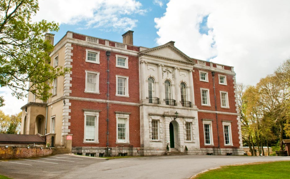
Merley House, Wimborne

Merley House in Wimborne, Dorset, England, is a building of historical significance and is Grade I listed on the English Heritage Register. It was built...

Corfe & Barrow Hills

Corfe & Barrow Hills is a 102.8 hectare biological Site of Special Scientific Interest in Dorset, notified in 1986. One part of it is a Local Nature Reserve...

Oakley, Dorset

Oakley is a village community in Dorset, England. Sitting just south of the River Stour it borders the suburb of Merley and the village of Canford Magna...

Corfe Hills School

Corfe Hills School is a co-educational upper school in Broadstone, Poole, Dorset, England, in the urban fringe between Poole and Wimborne. The school became...

Wimborne Model Town

Wimborne Model Town, situated on the edge of the town of Wimborne Minster, Dorset, England, is one of the largest and most established model towns in England...

Nearby Amenities

Located within 500m of 50.78359,-2.000019
Barrier: kissing_gate
Bicycle: no
Foot: yes
Lat/Long: 50.7847259/-2.0032821
Post Box
Description: West of old railway bridge, next to old church.
Operator: Royal Mail
Operator Wikidata: Q638098
Post Box Type: lamp
Ref: BH21 133
Ref GB Uprn: 10015364999
Lat/Long: 50.781033/-2.002087
Happy Bottom
Place: hamlet
Source: OS OpenData StreetView
Lat/Long: 50.7832281/-2.0065214
Ashington
Place: hamlet
Source: OS OpenData StreetView
Wikidata: Q4805102
Lat/Long: 50.7848291/-1.999153
Board Type: history
Description: Stone Post
Information: board
Tourism: information
Lat/Long: 50.7843051/-2.0049653
Information: board
Tourism: information
Lat/Long: 50.7847527/-2.0059142
Tourism: viewpoint
Lat/Long: 50.7847662/-2.0058973
Barrier: kissing_gate
Bicycle: no
Foot: yes
Lat/Long: 50.7793965/-2.0002792
Barrier: kissing_gate
Bicycle: no
Foot: yes
Lat/Long: 50.7809802/-2.0013713
Leisure: picnic_table
Lat/Long: 50.7810507/-2.0013091
Leisure: picnic_table
Lat/Long: 50.781052/-2.0012459
Barrier: kissing_gate
Bicycle: no
Foot: yes
Lat/Long: 50.7841105/-1.9994247
Power: pole
Lat/Long: 50.7846556/-2.0053679
Power: pole
Lat/Long: 50.7849949/-2.0063809
Power: pole
Lat/Long: 50.7858386/-2.0017435
Material: wood
Power: pole
Lat/Long: 50.7862075/-2.0005683
Material: wood
Power: pole
Lat/Long: 50.7862841/-1.9993167
Material: wood
Power: pole
Lat/Long: 50.7863282/-1.9987166
Material: wood
Power: pole
Lat/Long: 50.7870256/-1.9980651
Material: wood
Power: pole
Lat/Long: 50.7877063/-1.9974791
Power: pole
Lat/Long: 50.7795934/-2.0030233
Power: pole
Lat/Long: 50.78014/-2.0029374
Pole: transition
Power: pole
Lat/Long: 50.7808091/-2.0028071
Power: pole
Lat/Long: 50.781591/-2.0025458
Power: pole
Lat/Long: 50.7821646/-2.0022629
Power: pole
Lat/Long: 50.7826761/-2.0023775
Power: pole
Lat/Long: 50.7833525/-2.0024854
Power: pole
Lat/Long: 50.7840884/-2.0026404
Power: pole
Lat/Long: 50.7849302/-2.0027978
Power: pole
Lat/Long: 50.7854625/-2.0028958
The data included in this document is from www.openstreetmap.org. The data is made available under ODbL.

Have you been to Ashington?

Leave your review of Ashington below (or comments, questions and feedback).