Dumworth Copse

Wood, Forest in Berkshire

England

Dumworth Copse

The Ridge Way ascends to Streatley Warren Both the Ridge Way (ancient route) and the Ridgeway national trail (established in 1973) follow this byway uphill towards Streatley Warren from the western end of Rectory Road. Motor vehicles are prohibited on the byway (except for access) from 1 October to 30 April.
The Ridge Way ascends to Streatley Warren Credit: Jim Champion

Dumworth Copse is a picturesque wood located in the county of Berkshire, England. Situated near the small village of Dumworth, the copse covers an area of approximately 50 acres and is a notable natural feature of the region.

The copse is primarily composed of native broadleaf trees, including oak, beech, and ash. These majestic trees create a dense canopy, filtering the sunlight and providing a cool and tranquil atmosphere within the copse. The forest floor is covered in a thick carpet of moss and ferns, giving it a lush and verdant appearance.

Dumworth Copse is home to a diverse range of wildlife, making it a popular destination for nature enthusiasts and birdwatchers. The copse provides shelter and habitat for various bird species, including woodpeckers, nuthatches, and tawny owls. Squirrels can often be spotted darting through the trees, collecting nuts and acorns for their winter stash.

The copse is crisscrossed by a network of walking trails, allowing visitors to explore its natural beauty and enjoy the peacefulness of the surroundings. These trails meander through the wood, offering glimpses of a small stream that runs through the eastern part of the copse.

Dumworth Copse is a haven of tranquility, providing a welcome escape from the hustle and bustle of modern life. Its natural beauty and rich biodiversity make it a cherished natural resource for the residents of Berkshire and a valuable habitat for countless species of plants and animals.

If you have any feedback on the listing, please let us know in the comments section below.

Dumworth Copse Images

Images are sourced within 2km of 51.511728/-1.2083262 or Grid Reference SU5579. Thanks to Geograph Open Source API. All images are credited.

The Ridge Way ascends to Streatley Warren Both the Ridge Way (ancient route) and the Ridgeway national trail (established in 1973) follow this byway uphill towards Streatley Warren from the western end of Rectory Road. Motor vehicles are prohibited on the byway (except for access) from 1 October to 30 April.
The Ridge Way ascends to Streatley Warren
Both the Ridge Way (ancient route) and the Ridgeway national trail (established in 1973) follow this byway uphill towards Streatley Warren from the western end of Rectory Road. Motor vehicles are prohibited on the byway (except for access) from 1 October to 30 April.
St. Mary, Aldworth: war memorial
St. Mary, Aldworth: churchyard (i)
St. Mary, Aldworth: churchyard (ii)
St. Mary, Aldworth: churchyard (iii)
St. Mary, Aldworth: churchyard (iv)
St. Mary, Aldworth: churchyard (v)
St. Mary, Aldworth: churchyard (vi)
St. Mary, Aldworth: churchyard (vii)
St. Mary, Aldworth: churchyard (viii)
St. Mary, Aldworth: churchyard (ix)
St. Mary, Aldworth: churchyard (x)
St. Mary, Aldworth: ledger slab
St. Mary, Aldworth: font
St. Mary, Aldworth: Millennium Tapestry This was sewn by the parishioners of Aldworth to commemorate the Millennium. It depicts the village of Aldworth and events in its history.  The dimensions are 45 x 29 inches.
St. Mary, Aldworth: Millennium Tapestry
This was sewn by the parishioners of Aldworth to commemorate the Millennium. It depicts the village of Aldworth and events in its history. The dimensions are 45 x 29 inches.
St. Mary, Aldworth: lectern
St. Mary, Aldworth: ledger slab (2)
St. Mary, Aldworth: stained glass window
Show me another place!

Dumworth Copse is located at Grid Ref: SU5579 (Lat: 51.511728, Lng: -1.2083262)

Unitary Authority: West Berkshire

Police Authority: Thames Valley

What 3 Words

///installs.bravery.trendy. Near Compton, Berkshire

Related Wikis

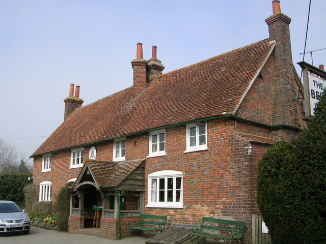
The Bell Inn, Aldworth

The Bell Inn is a pub at the village of Aldworth, in the English county of West Berkshire. It won CAMRA's National Pub of the Year in 1990, and received...

Aldworth

Aldworth is a village and mainly farmland civil parish in the English county of Berkshire, near the boundary with Oxfordshire. == Orthography and slight... ==

Streatley Warren

Streatley Warren is a 31.3-hectare (77-acre) biological Site of Special Scientific Interest west of Streatley in Berkshire. It is in the North Wessex Downs...

Battle of Ashdown

The Battle of Ashdown was a West Saxon victory over a Danish Viking army on about 8 January 871. The location of Ashdown is not known, but may be Kingstanding...

Nearby Amenities

Located within 500m of 51.511728,-1.2083262
Power: pole
Source: Bing
Lat/Long: 51.5099594/-1.2081181
Power: pole
Source: Bing
Lat/Long: 51.5095971/-1.2058436
Power: pole
Source: Bing
Lat/Long: 51.5114216/-1.2058946
Power: pole
Source: Bing
Lat/Long: 51.5099744/-1.2035074
Power: pole
Source: Bing
Lat/Long: 51.5102014/-1.206423
Power: pole
Source: Bing
Lat/Long: 51.5081347/-1.2058651
Power: pole
Source: Bing
Lat/Long: 51.5100862/-1.2072679
Power: pole
Source: Bing
Lat/Long: 51.5097207/-1.2098428
Power: pole
Source: Bing
Lat/Long: 51.5098442/-1.2089952
Power: pole
Source: Bing
Lat/Long: 51.5101947/-1.2043872
Power: pole
Source: Bing
Lat/Long: 51.5114968/-1.2052026
Power: pole
Source: Bing
Lat/Long: 51.5122312/-1.2043872
Power: pole
Source: Bing
Lat/Long: 51.512934/-1.2035423
Give Way
Source: Bing
Lat/Long: 51.5099862/-1.2022688
The data included in this document is from www.openstreetmap.org. The data is made available under ODbL.

Have you been to Dumworth Copse?

Leave your review of Dumworth Copse below (or comments, questions and feedback).