Nag's Head Wood
Wood, Forest in Yorkshire Ryedale
England
Nag's Head Wood
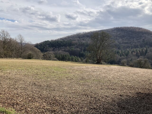
Nag's Head Wood is a picturesque forest located in the county of Yorkshire, England. Covering an area of approximately 400 acres, it is nestled within the scenic landscape of the North York Moors National Park. The wood is known for its diverse range of flora and fauna, making it a popular destination for nature enthusiasts and hikers alike.
The woodland is predominantly composed of broadleaf trees, including oak, beech, and birch, which provide a stunning display of colors throughout the seasons. The forest floor is carpeted with vibrant bluebells in the spring, creating a breathtaking sight for visitors.
Nag's Head Wood is crisscrossed by a network of well-maintained footpaths and trails, allowing visitors to explore its hidden treasures. The paths meander through the forest, leading to secluded glades, babbling brooks, and enchanting clearings. Wildlife is abundant in the wood, with sightings of deer, foxes, and a wide variety of bird species being common.
The wood is also home to a rich history, with remnants of ancient settlements and charcoal burning sites. Archaeological discoveries suggest human activity in the area dating back thousands of years.
In addition to its natural beauty, Nag's Head Wood offers various recreational activities. These include picnicking, camping, and birdwatching. There are designated camping areas for those who wish to spend the night and immerse themselves in the tranquility of the forest.
Nag's Head Wood is a true gem of Yorkshire, offering visitors an opportunity to escape the hustle and bustle of everyday life and connect with nature in a serene and captivating setting.
If you have any feedback on the listing, please let us know in the comments section below.
Nag's Head Wood Images
Images are sourced within 2km of 54.301506/-1.1933269 or Grid Reference SE5289. Thanks to Geograph Open Source API. All images are credited.
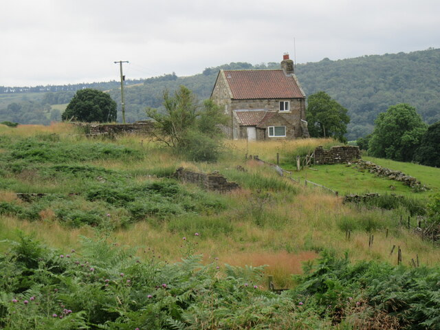


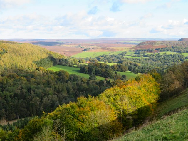
![View over Thorodale Beyond the wall the ground plunges steeply down into the well wooded valley of Thorodale where the hillsides echoed with the sound of gunfire from pheasant shooting [no Geograph contributors were harmed]. Mount Pleasant Farm is visible near the centre of the photo, whilst the northern prow of Hawnby Hill is prominent to the right.](https://s2.geograph.org.uk/geophotos/07/07/24/7072494_177776f2.jpg)


Nag's Head Wood is located at Grid Ref: SE5289 (Lat: 54.301506, Lng: -1.1933269)
Division: North Riding
Administrative County: North Yorkshire
District: Ryedale
Police Authority: North Yorkshire
What 3 Words
///void.regulator.jubilant. Near Bilsdale, North Yorkshire
Nearby Locations
Related Wikis

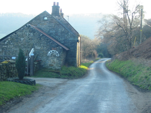
Hawnby
Hawnby is a small crossroads village and civil parish in Ryedale in the North York Moors National Park, North Yorkshire, England. The village is about...

Laskill
Laskill is a small hamlet in Bilsdale, 5 miles (8 km) north-west of Helmsley, North Yorkshire, England, on the road from Helmsley to Stokesley and is located...

Holy Trinity Church, Boltby
Holy Trinity Church, Boltby is a parish church in the Church of England: 81 in Boltby. == History == The first chapel was founded in 1409 and was rebuilt...

Boltby
Boltby is a village and civil parish in the Hambleton District of North Yorkshire, England. It is on the edge of the North York Moors National Park at...

Bilsdale
Bilsdale is a dale in the western part of the North York Moors in North Yorkshire, England. The head of the dale is at Hasty Bank, and the dale extends...

Kepwick
Kepwick is a village and civil parish in the Hambleton district of North Yorkshire, England, on the North York Moors and near the A19. The population according...

Cold Kirby
Cold Kirby is a village and civil parish in the Ryedale district of North Yorkshire, England. The population at the 2011 census (including Angram Grange...

Old Byland and Scawton
Old Byland and Scawton is a civil parish in the Ryedale district, in the county of North Yorkshire, England. The parish includes the villages of Old Byland...
Nearby Amenities
Located within 500m of 54.301506,-1.1933269Have you been to Nag's Head Wood?
Leave your review of Nag's Head Wood below (or comments, questions and feedback).