East Wood

Wood, Forest in Hampshire New Forest

England

East Wood

Farm Track and Bridleway A bit smart for just a bridleway, this is also a drive to East Hill Farm.
Farm Track and Bridleway Credit: Des Blenkinsopp

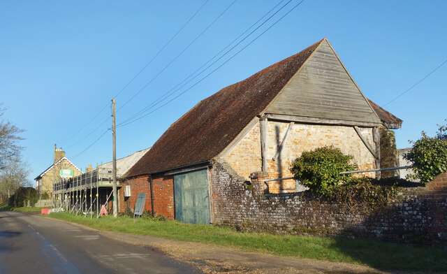
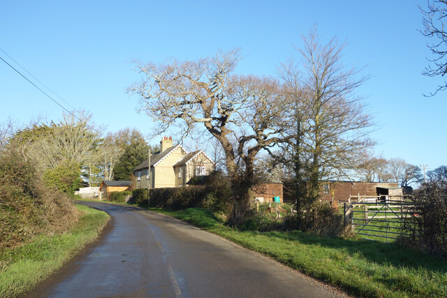
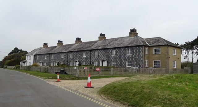
East Wood is a charming village located in the county of Hampshire, England. Situated in the heart of a dense forest, it is known for its natural beauty and tranquil surroundings. Covering an area of approximately 10 square kilometers, East Wood is home to a small population of around 500 residents.

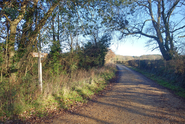
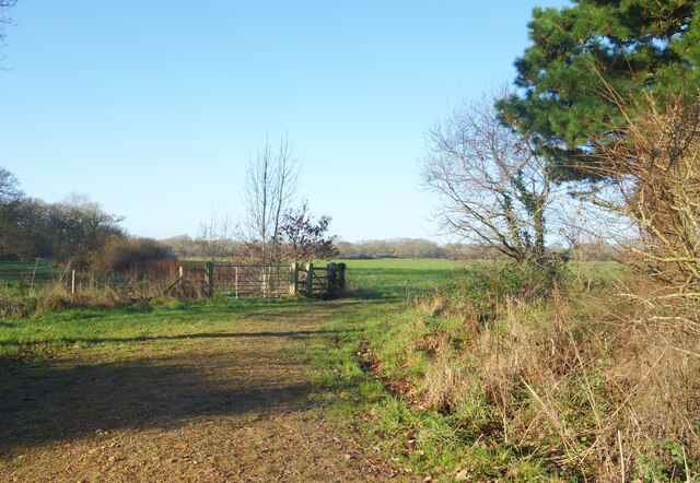
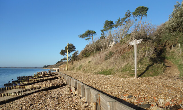
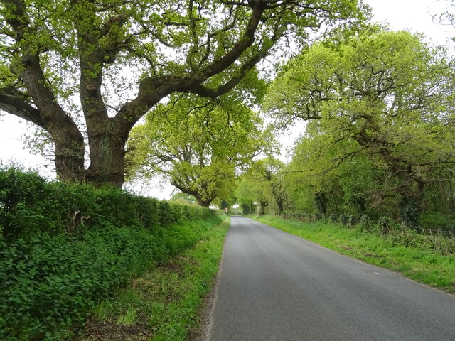
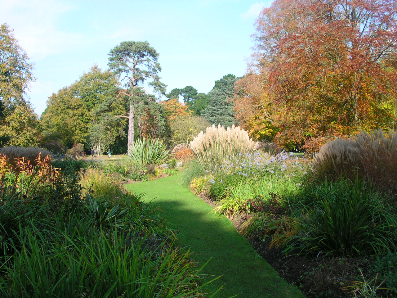
The village is nestled amidst a lush green landscape, comprising a mix of deciduous and coniferous trees that create a picturesque setting. The forest provides an ideal habitat for a diverse range of wildlife, including deer, foxes, and various bird species, making it a popular destination for nature enthusiasts and birdwatchers.

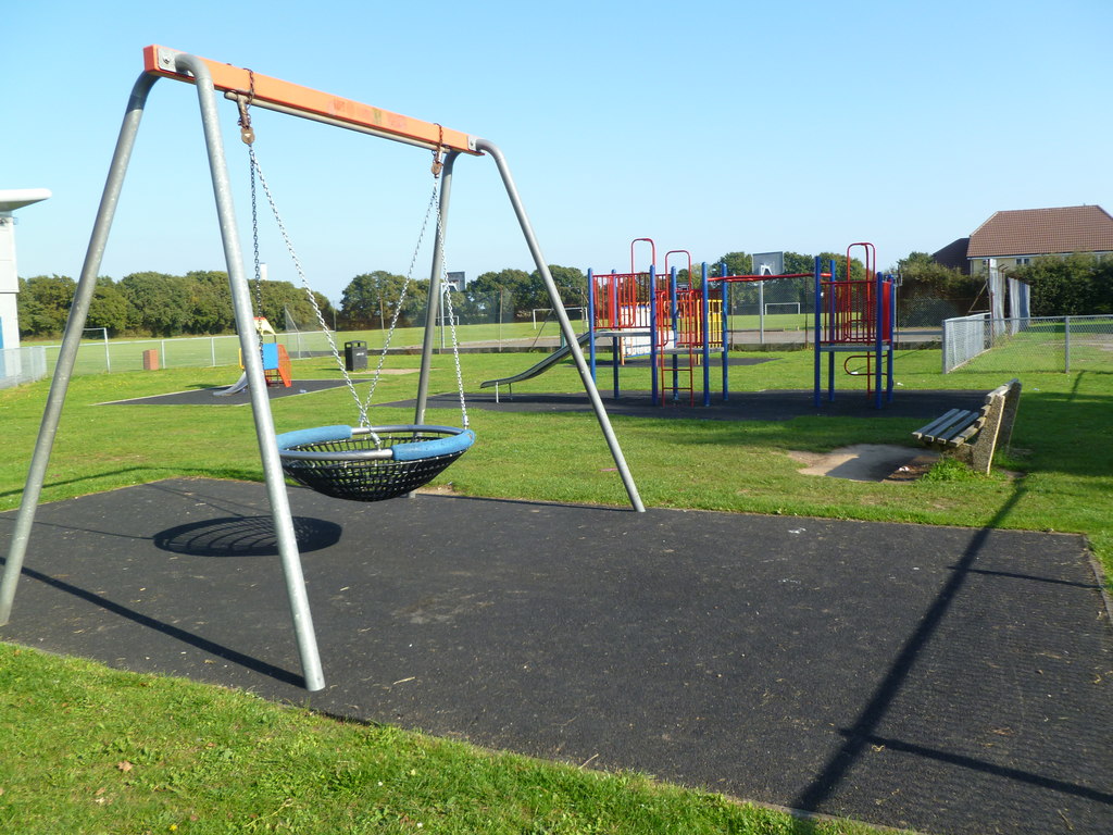
East Wood offers a range of outdoor activities for visitors and locals alike. The dense forest is crisscrossed with numerous walking trails, allowing visitors to explore the area's natural beauty at their own pace. The village also boasts a well-maintained park, perfect for picnics and outdoor games.

In terms of amenities, East Wood has a small convenience store that caters to the basic needs of the community. However, for a wider range of shopping options, residents often rely on nearby towns and cities. The village also has a primary school, ensuring that local children have access to quality education within their community.

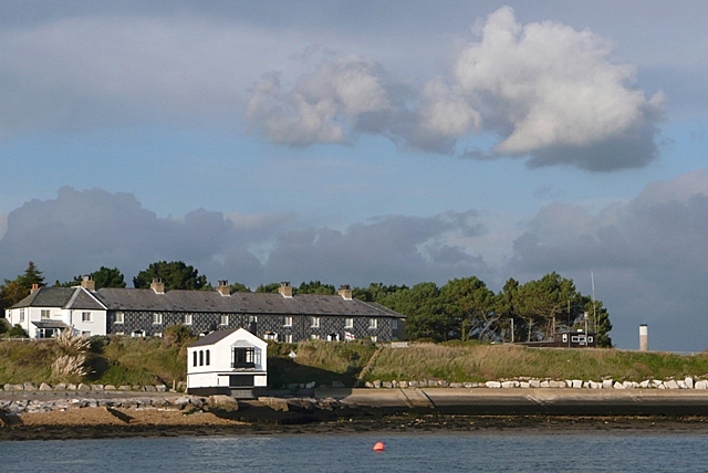
Overall, East Wood exudes a sense of peace and tranquility, offering a respite from the hustle and bustle of larger urban centers. Its idyllic setting and close proximity to nature make it an attractive place for those seeking a quiet and picturesque retreat in the heart of Hampshire.

If you have any feedback on the listing, please let us know in the comments section below.

East Wood Images

Images are sourced within 2km of 50.800876/-1.3704578 or Grid Reference SU4400. Thanks to Geograph Open Source API. All images are credited.

Farm Track and Bridleway A bit smart for just a bridleway, this is also a drive to East Hill Farm.
Farm Track and Bridleway
A bit smart for just a bridleway, this is also a drive to East Hill Farm.
Footpath to Cump Copse Public footpath through farmland near Exbury.
Footpath to Cump Copse
Public footpath through farmland near Exbury.
Old Barn at Lepe Farm Part of a group of farm buildings and houses at Lepe Farm.
Old Barn at Lepe Farm
Part of a group of farm buildings and houses at Lepe Farm.
Lepe Farm Lepe is described by Wikipedia as a linear hamlet. Since medieval times it has been part of the parish of Exbury and Lepe. <span class="nowrap"><a title="https://en.wikipedia.org/wiki/Lepe,_Hampshire" rel="nofollow ugc noopener" href="https://en.wikipedia.org/wiki/Lepe,_Hampshire">Link</a><img style="margin-left:2px;" alt="External link" title="External link - shift click to open in new window" src="https://s1.geograph.org.uk/img/external.png" width="10" height="10"/></span>
Lepe Farm
Lepe is described by Wikipedia as a linear hamlet. Since medieval times it has been part of the parish of Exbury and Lepe. LinkExternal link
Old Stick In The Mud Often used derogatively for someone who is a bit grumpy and set in their ways, in this case it can be taken at face value.
Mudflats are very good at preserving old remains of long gone structures.
Old Stick In The Mud
Often used derogatively for someone who is a bit grumpy and set in their ways, in this case it can be taken at face value. Mudflats are very good at preserving old remains of long gone structures.
Coastal Footpath at Lepe There is no path as such for some of the way, but most of the time you can walk along the top of the shoreline fairly easily. High tides can put parts of the route underwater though.
Coastal Footpath at Lepe
There is no path as such for some of the way, but most of the time you can walk along the top of the shoreline fairly easily. High tides can put parts of the route underwater though.
Crumbling Coastline at Lepe You can see the soft sandy stuff that makes up the cliffs along here. It is eroded very easily.
Crumbling Coastline at Lepe
You can see the soft sandy stuff that makes up the cliffs along here. It is eroded very easily.
Coastal Protection at Lepe The soft coastline is eroding. Protection here is provided by some fairly low key timberwork unlike nearby locations where more heavy duty concrete and boulders are used to try to limit the damage.
Coastal Protection at Lepe
The soft coastline is eroding. Protection here is provided by some fairly low key timberwork unlike nearby locations where more heavy duty concrete and boulders are used to try to limit the damage.
Houses by the sea, Lepe The Watch House and the Coastguard Cottages make up a large part of the housing in the scattered hamlet of Lepe.
Houses by the sea, Lepe
The Watch House and the Coastguard Cottages make up a large part of the housing in the scattered hamlet of Lepe.
Coastguard Cottages, Lepe A terrace of houses built in 1828 when smuggling was a problem around here.
Coastguard Cottages, Lepe
A terrace of houses built in 1828 when smuggling was a problem around here.
Dark Water Sluice, Lepe Outfall The Dark Water river flows into the sea at Lepe via a tidal lake on the other side of the road. The Environment Agency sluice here controls the flow either into or out of the lake depending on the state of the tide. Just now at high tide, sea water is going upstream into the lake.
The square thing on the horizon is a freight ship heading for Southampton loaded with containers.
Dark Water Sluice, Lepe Outfall
The Dark Water river flows into the sea at Lepe via a tidal lake on the other side of the road. The Environment Agency sluice here controls the flow either into or out of the lake depending on the state of the tide. Just now at high tide, sea water is going upstream into the lake. The square thing on the horizon is a freight ship heading for Southampton loaded with containers.
Parking Barrier, Lepe Country Park Hi-tech camera and gate equipment controls the parking access at Lepe Country Park, which is ok as long as it works. The seaside isn't the kindest environment for outdoor electronics though, so good luck with that.
Parking Barrier, Lepe Country Park
Hi-tech camera and gate equipment controls the parking access at Lepe Country Park, which is ok as long as it works. The seaside isn't the kindest environment for outdoor electronics though, so good luck with that.
Dark Water, Lepe Country Park The Dark Water is a short river flowing out of the New Forest which forms an expanse of tidal marshland here before entering the sea.
Dark Water, Lepe Country Park
The Dark Water is a short river flowing out of the New Forest which forms an expanse of tidal marshland here before entering the sea.
Cereal crop and pylon off Lepe Road
Lepe Road
Lepe Road
The Watch House, Lepe
Coastguard Cottages, Lepe
Pilot beacon and beach, Lepe
Show me another place!

East Wood is located at Grid Ref: SU4400 (Lat: 50.800876, Lng: -1.3704578)

Administrative County: Hampshire

District: New Forest

Police Authority: Hampshire

What 3 Words

///fronted.beaten.likewise. Near Gurnard, Isle of Wight

Related Wikis

Langley, Hampshire

Langley is a small village in the civil parish of Fawley in Hampshire, England. == History == The name Langley means "long wood/clearing". Langley is listed...

Exbury and Lepe

Exbury and Lepe is a civil parish in the New Forest in Hampshire, England. It is bounded to the west by the Beaulieu River, to the south by the shore...

Exbury

Exbury is a village in Hampshire, England. It is in the civil parish of Exbury and Lepe. It lies just in the New Forest, near the Beaulieu River and about...

Lepe, Hampshire

Lepe is a linear hamlet on the Solent in south-west Hampshire, England. In the civil parish of Exbury and Lepe, It is beside the Dark Water, and has Lepe...

Blackfield, Hampshire

Blackfield is a village in Hampshire, England. It is within the parish of Fawley, which is part of the ward of Fawley, Blackfield and Langley. == Schools... ==

Dark Water (river)

The Dark Water is a 5.5-mile (8.9 km) river in south-west Hampshire, England. It flows south from a source a few metres north-east of the New Forest, reaching...

Exbury House

Exbury House is an English country house in Exbury and Lepe, Hampshire, situated on the edge of the New Forest. It is a Grade II* listed building with...

Exbury Gardens

Exbury Gardens is a 200-acre (81 ha) informal woodland garden in Hampshire, England with large collections of rhododendrons, azaleas and camellias, and...

Nearby Amenities

Located within 500m of 50.800876,-1.3704578
Power: pole
Transformer: distribution
Lat/Long: 50.7969555/-1.3681585
Power: pole
Lat/Long: 50.7974226/-1.3674692
Power: pole
Lat/Long: 50.7979897/-1.3665988
Power: pole
Lat/Long: 50.7985364/-1.3657821
Power: pole
Lat/Long: 50.7981313/-1.3655065
Information: guidepost
Tourism: information
Lat/Long: 50.7969887/-1.3682098
The data included in this document is from www.openstreetmap.org. The data is made available under ODbL.

Have you been to East Wood?

Leave your review of East Wood below (or comments, questions and feedback).