Green Dick Wood
Wood, Forest in Yorkshire Harrogate
England
Green Dick Wood

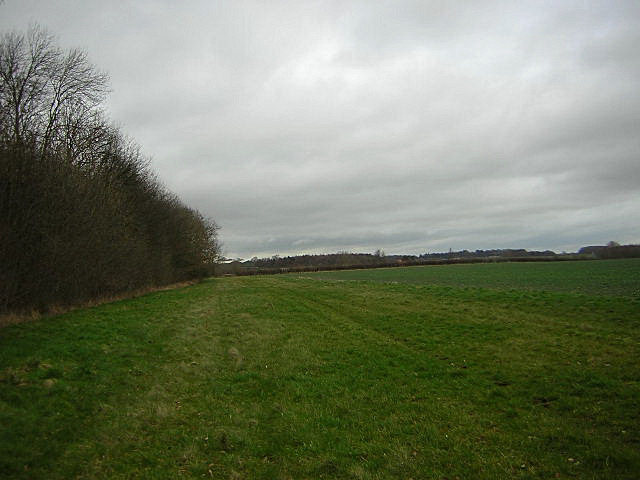
Green Dick Wood is a dense forest located in the region of Yorkshire, England. Situated amidst the rolling hills and picturesque landscapes, this woodland covers a significant area of approximately 500 acres. The forest is renowned for its abundant greenery, comprising a diverse range of tree species, including oak, beech, birch, and pine.
This woodland is a haven for nature enthusiasts and outdoor adventurers. Its well-maintained trails offer a perfect setting for hiking, walking, and exploring the natural beauty that Yorkshire has to offer. The forest is also home to a variety of wildlife, such as deer, foxes, rabbits, and numerous bird species, making it an ideal spot for birdwatching and wildlife spotting.
Green Dick Wood is not only treasured for its natural beauty but also for its historical significance. The forest has a rich history dating back centuries, with remnants of ancient settlements and burial sites scattered throughout the area. Archaeological excavations have revealed artifacts and evidence of human activity from the Bronze Age, highlighting the long-standing connection between humans and this woodland.
Visitors to Green Dick Wood can also find picnic spots and designated camping areas, allowing for a tranquil escape from the hustle and bustle of everyday life. The forest is easily accessible, with well-marked entrances and ample parking facilities nearby.
In summary, Green Dick Wood is a breathtaking forest in Yorkshire, offering a serene environment for outdoor activities, wildlife observation, and a glimpse into the region's fascinating history.
If you have any feedback on the listing, please let us know in the comments section below.
Green Dick Wood Images
Images are sourced within 2km of 53.999039/-1.3804769 or Grid Reference SE4056. Thanks to Geograph Open Source API. All images are credited.

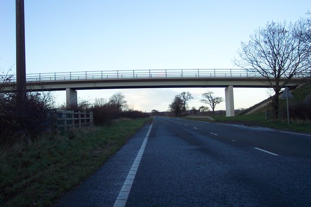
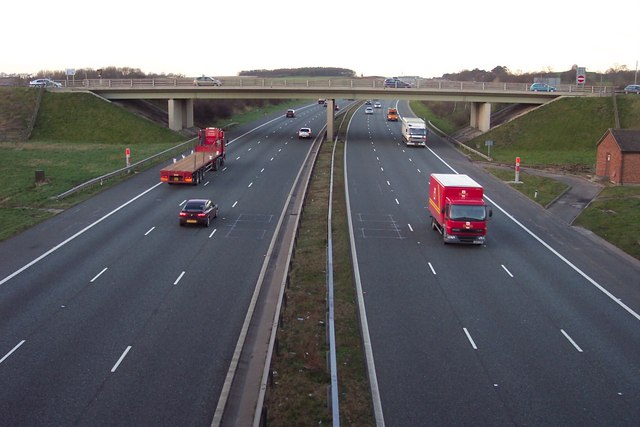

![A168 at Allerton Park The A168 runs parallel with the A1[M] at this point, using the south bound carriageway of the old A1. The wall to the right is the boundary of Allerton Park.](https://s2.geograph.org.uk/geophotos/01/06/31/1063142_0f4233fc.jpg)
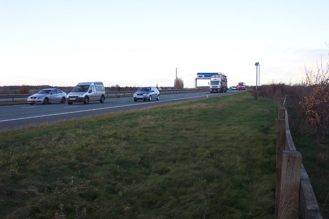
![Parallel roads Looking north from a farm access bridge with the A1[M] on the left and the A168, which uses the old southbound carriageway of the A1, to the right. Much of the trees and ground cover between the two roads is growing on spoil over the old ripped up northbound carriageway.](https://s2.geograph.org.uk/geophotos/01/11/69/1116906_89fcb502.jpg)
![A1[M] looking south A view south along the A1 motorway to the south of junction 47 near Walshford.](https://s2.geograph.org.uk/geophotos/01/11/69/1116914_0aa3bef1.jpg)

Green Dick Wood is located at Grid Ref: SE4056 (Lat: 53.999039, Lng: -1.3804769)
Division: West Riding
Administrative County: North Yorkshire
District: Harrogate
Police Authority: North Yorkshire
What 3 Words
///push.otherwise.loss. Near Knaresborough, North Yorkshire
Nearby Locations
Related Wikis

Hopperton railway station
Hopperton railway station served the village of Hopperton, North Yorkshire, England from 1848 to 1962 on the Harrogate line. == History == The station...

Hopperton
Hopperton is a village in the Harrogate district of North Yorkshire, England. It is part of the Allerton Mauleverer with Hopperton parish. The village...

Coneythorpe
Coneythorpe is a village in the civil parish of Coneythorpe and Clareton, in North Yorkshire, England. It is situated less than 1 mile (1.6 km) west from...

Allerton Mauleverer with Hopperton
Allerton Mauleverer with Hopperton is a civil parish in North Yorkshire, England. At the 2011 Census, the parish had a population of 150, an increase from...
Goldsborough railway station
Goldsborough railway station served the village of Goldsborough, North Yorkshire, England from 1850 to 1965 on the Harrogate line. The station was over...
St Martin's Church, Allerton Mauleverer
St Martin's Church is a historic Anglican church in the village of Allerton Mauleverer, North Yorkshire, England. It is recorded in the National Heritage...
Allerton Mauleverer
Allerton Mauleverer is a village in North Yorkshire, England. It is part of the Allerton Mauleverer with Hopperton parish. The parish is in the district...

Flaxby
Flaxby is a village and civil parish in the Harrogate district of North Yorkshire, England. It is close to the A1(M) motorway and 2 miles (3.2 km) east...
Nearby Amenities
Located within 500m of 53.999039,-1.3804769Have you been to Green Dick Wood?
Leave your review of Green Dick Wood below (or comments, questions and feedback).