Hunningham Coppice

Wood, Forest in Warwickshire Warwick

England

Hunningham Coppice

HS2 in the Leam Valley, June 2021 (2) HS2 will cross the picture in a cutting through the field second from the camera. This view is some way to the right of <a href="https://www.geograph.org.uk/photo/6902780">SP3568 : HS2 in the Leam Valley, June 2021 (1)</a>, from further up Welsh Road. Some field boundaries are missing.
HS2 in the Leam Valley, June 2021 (2) Credit: Robin Stott

Hunningham Coppice is a picturesque woodland located in the county of Warwickshire, England. Covering an area of approximately 50 hectares, this ancient coppice woodland is a testament to the rich natural heritage of the region.

The woodland is primarily composed of oak and hazel trees, which have been traditionally managed through a coppicing system. This involves periodically cutting back the trees to ground level to encourage new growth, resulting in a diverse and dense understory of shrubs and wildflowers. The coppicing cycle practiced in Hunningham Coppice is believed to date back several centuries, contributing to its designation as a Site of Special Scientific Interest (SSSI).

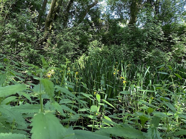
Within the woodland, visitors can find a wide array of flora and fauna, including rare species such as the silver-washed fritillary butterfly and lesser spotted woodpecker. The diverse habitat also provides a suitable home for mammals like badgers, foxes, and various bat species.

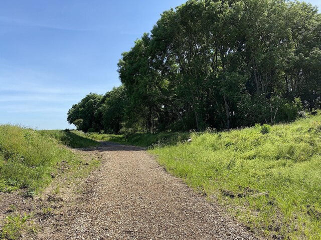
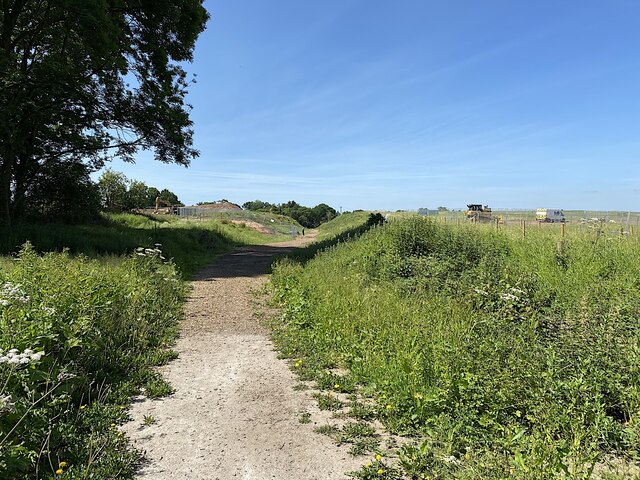
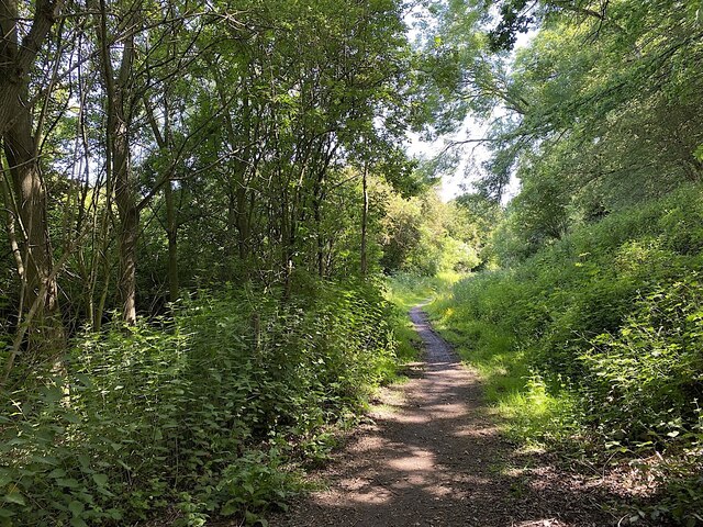
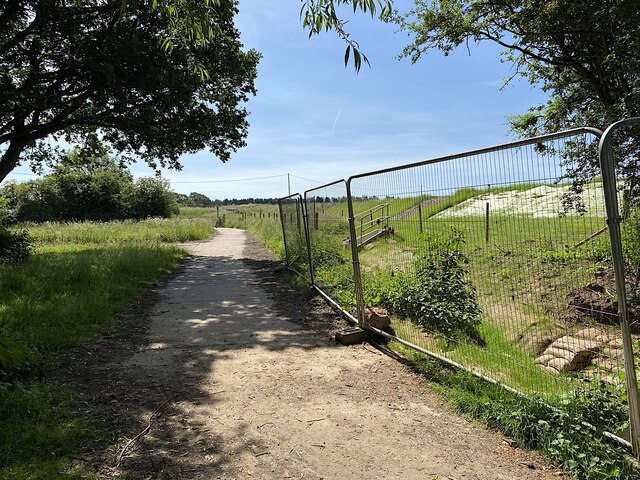
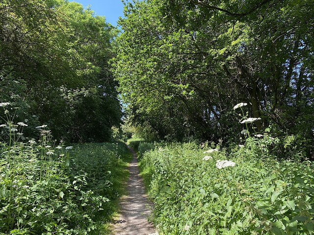
Hunningham Coppice is a popular destination for nature lovers and outdoor enthusiasts, offering a network of well-maintained footpaths that allow visitors to explore the woodland at their own pace. The serene atmosphere and abundance of wildlife make it an ideal spot for birdwatching, photography, and quiet contemplation.

Managed by the Warwickshire Wildlife Trust, Hunningham Coppice is a valuable ecological resource that showcases the importance of sustainable woodland management and conservation efforts. Its accessibility and natural beauty make it a beloved destination for both locals and tourists seeking a tranquil escape into nature.

If you have any feedback on the listing, please let us know in the comments section below.

Hunningham Coppice Images

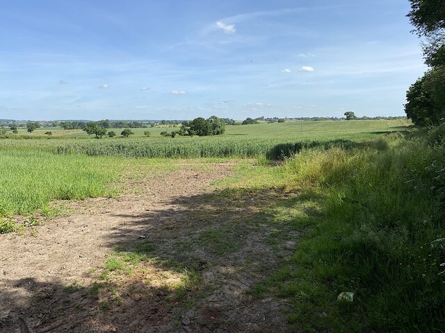
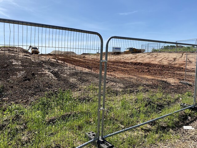
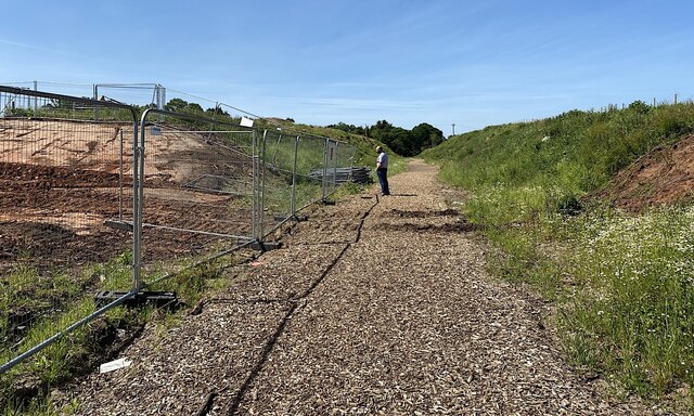
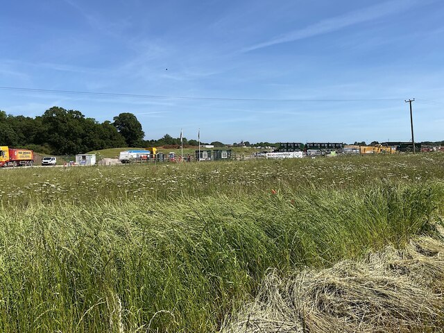
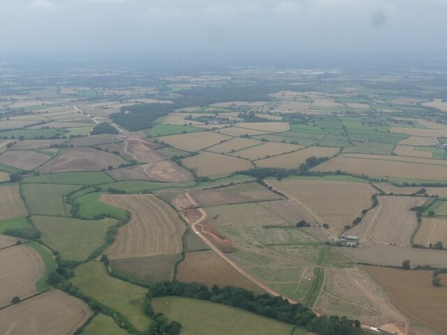
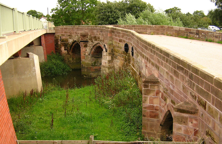
Images are sourced within 2km of 52.303669/-1.4433666 or Grid Reference SP3867. Thanks to Geograph Open Source API. All images are credited.

HS2 in the Leam Valley, June 2021 (2) HS2 will cross the picture in a cutting through the field second from the camera. This view is some way to the right of <a href="https://www.geograph.org.uk/photo/6902780">SP3568 : HS2 in the Leam Valley, June 2021 (1)</a>, from further up Welsh Road. Some field boundaries are missing.
HS2 in the Leam Valley, June 2021 (2)
HS2 will cross the picture in a cutting through the field second from the camera. This view is some way to the right of SP3568 : HS2 in the Leam Valley, June 2021 (1), from further up Welsh Road. Some field boundaries are missing.
HS2 enabling works, Welsh Road area, June 2021 (8) The plans show that HS2 will cross the Offchurch Greenway right here, just west of Sutton Spinney behind the camera. There is much earth to be moved to form a wide cutting. See <span class="nowrap"><a title="https://assets.publishing.service.gov.uk/government/uploads/system/uploads/attachment_data/file/532883/C223-CSI-CV-DPP-030-000003-FPD.pdf" rel="nofollow ugc noopener" href="https://assets.publishing.service.gov.uk/government/uploads/system/uploads/attachment_data/file/532883/C223-CSI-CV-DPP-030-000003-FPD.pdf">Link</a><img style="margin-left:2px;" alt="External link" title="External link - shift click to open in new window" src="https://s1.geograph.org.uk/img/external.png" width="10" height="10"/></span> just to the right of the 132+000 km mark. This view continues to the right with <a href="https://www.geograph.org.uk/photo/6907982">SP3665 : HS2 enabling works, Welsh Road area, June 2021 (9)</a>.
HS2 enabling works, Welsh Road area, June 2021 (8)
The plans show that HS2 will cross the Offchurch Greenway right here, just west of Sutton Spinney behind the camera. There is much earth to be moved to form a wide cutting. See LinkExternal link just to the right of the 132+000 km mark. This view continues to the right with SP3665 : HS2 enabling works, Welsh Road area, June 2021 (9).
HS2 enabling works, Welsh Road area, June 2021 (9) The plans show that HS2 will cross the Offchurch Greenway right here, just west of Sutton Spinney behind the camera. See <span class="nowrap"><a title="https://assets.publishing.service.gov.uk/government/uploads/system/uploads/attachment_data/file/532883/C223-CSI-CV-DPP-030-000003-FPD.pdf" rel="nofollow ugc noopener" href="https://assets.publishing.service.gov.uk/government/uploads/system/uploads/attachment_data/file/532883/C223-CSI-CV-DPP-030-000003-FPD.pdf">Link</a><img style="margin-left:2px;" alt="External link" title="External link - shift click to open in new window" src="https://s1.geograph.org.uk/img/external.png" width="10" height="10"/></span> just to the right of the 132+000 km mark The man observing the work was from one of the contractors. He was courteous, informed, and relaxed in talking about work in progress here and elsewhere including changes to the published plans. This view continues to the left with <a href="https://www.geograph.org.uk/photo/6907972">SP3665 : HS2 enabling works, Welsh Road area, June 2021 (8)</a>.
HS2 enabling works, Welsh Road area, June 2021 (9)
The plans show that HS2 will cross the Offchurch Greenway right here, just west of Sutton Spinney behind the camera. See LinkExternal link just to the right of the 132+000 km mark The man observing the work was from one of the contractors. He was courteous, informed, and relaxed in talking about work in progress here and elsewhere including changes to the published plans. This view continues to the left with SP3665 : HS2 enabling works, Welsh Road area, June 2021 (8).
Sutton Spinney, Offchurch Greenway HS2 will run just behind the camera. The Greenway will cross the line by a bike-friendly 'green overbridge', touching down somewhere ahead.
Sutton Spinney, Offchurch Greenway
HS2 will run just behind the camera. The Greenway will cross the line by a bike-friendly 'green overbridge', touching down somewhere ahead.
HS2 enabling works, Welsh Road area, June 2021 (10) HS2 will cross the picture in a cutting. Earthworks have some way to go. The Offchurch Greenway will cross the line by a 'green overbridge'.
HS2 enabling works, Welsh Road area, June 2021 (10)
HS2 will cross the picture in a cutting. Earthworks have some way to go. The Offchurch Greenway will cross the line by a 'green overbridge'.
Flag Iris in a pond by the Offchurch Greenway
Northeast on the Offchurch Greenway, northeast of Sutton Spinney
Northeastern end of the Offchurch Greenway The Greenway leaves the line of the former railway and turns southeast to exit on to the B4455 Fosse Way. To the right is the boundary of a large site occupied by HS2 contractors.
Northeastern end of the Offchurch Greenway
The Greenway leaves the line of the former railway and turns southeast to exit on to the B4455 Fosse Way. To the right is the boundary of a large site occupied by HS2 contractors.
Southwest on the Offchurch Greenway from its northeastern end
Northeast end of the Offchurch Greenway The approach from the small setback from the fast B4455 Fosse Way. In the background is the northeast end of a large site occupied by the HS2 contractors.
Northeast end of the Offchurch Greenway
The approach from the small setback from the fast B4455 Fosse Way. In the background is the northeast end of a large site occupied by the HS2 contractors.
HS2 enabling works, Welsh Road area, June 2021 (11) This is the northeast edge of what turned out to be a large compound for HS2 contractors, seen from Fosse Way verge.
HS2 enabling works, Welsh Road area, June 2021 (11)
This is the northeast edge of what turned out to be a large compound for HS2 contractors, seen from Fosse Way verge.
HS2 enabling works, Welsh Road area, June 2021 (12) Another view from beside the Fosse Way into the contractors' compound. The four giant dump trucks are a reminder of the amassing of machines seen up the line near the canal: <a href="https://www.geograph.org.uk/photo/6890450">SP3864 : HS2 enabling works, Welsh Road area, April 2021 (9)</a>.
HS2 enabling works, Welsh Road area, June 2021 (12)
Another view from beside the Fosse Way into the contractors' compound. The four giant dump trucks are a reminder of the amassing of machines seen up the line near the canal: SP3864 : HS2 enabling works, Welsh Road area, April 2021 (9).
HS2 enabling works, Welsh Road area, June 2021 (13) Another view from beside the Fosse Way into the contractors' compound. It felt like a village. With each laborious step along the verge my jaw dropped a little bit further. The site occupies much of the area bounded by the Offchurch Greenway, Fosse Way, and the Long Itchington Road – seven hectares at a rough estimate. Sutton Spinney does not appear to be included in the site. Are they offices in the distance, or accommodation?
HS2 enabling works, Welsh Road area, June 2021 (13)
Another view from beside the Fosse Way into the contractors' compound. It felt like a village. With each laborious step along the verge my jaw dropped a little bit further. The site occupies much of the area bounded by the Offchurch Greenway, Fosse Way, and the Long Itchington Road – seven hectares at a rough estimate. Sutton Spinney does not appear to be included in the site. Are they offices in the distance, or accommodation?
HS2 enabling works, Welsh Road area, June 2021 (14) Southwest on Fosse Way approaching the junction with the Long Itchington Road. The plans show realignments and new provision between the 131 and 132 kilometre marks <span class="nowrap"><a title="https://assets.publishing.service.gov.uk/government/uploads/system/uploads/attachment_data/file/532883/C223-CSI-CV-DPP-030-000003-FPD.pdf" rel="nofollow ugc noopener" href="https://assets.publishing.service.gov.uk/government/uploads/system/uploads/attachment_data/file/532883/C223-CSI-CV-DPP-030-000003-FPD.pdf">Link</a><img style="margin-left:2px;" alt="External link" title="External link - shift click to open in new window" src="https://s1.geograph.org.uk/img/external.png" width="10" height="10"/></span>
HS2 enabling works, Welsh Road area, June 2021 (14)
Southwest on Fosse Way approaching the junction with the Long Itchington Road. The plans show realignments and new provision between the 131 and 132 kilometre marks LinkExternal link
HS2 enabling works, Welsh Road area, June 2021 (15) This is the northern end of the large contractors' compound between the B4455 Fosse Way, right, and the Offchurch Greenway in the background. At a rough estimate it occupies seven hectares.
HS2 enabling works, Welsh Road area, June 2021 (15)
This is the northern end of the large contractors' compound between the B4455 Fosse Way, right, and the Offchurch Greenway in the background. At a rough estimate it occupies seven hectares.
HS2 enabling works, Welsh Road area, June 2021 (16) The camera is looking southwest from the northwest corner of a crossroads where the B4455 Fosse Way, left, is crossed by the Long Itchington Road from the direction of Offchurch. The battered sign relates to the Fosse and should be seen from across the busy, nerve-racking junction. HS2 will cross the Fosse down the road between here and the Welsh Road crossroads. The latter will be remodelled as a roundabout: much safer. This side of the Long Itchington Road will be stopped up and the eastern leg will turn off a realigned Fosse Way a little to the right of and behind the camera. <span class="nowrap"><a title="https://assets.publishing.service.gov.uk/government/uploads/system/uploads/attachment_data/file/532883/C223-CSI-CV-DPP-030-000003-FPD.pdf" rel="nofollow ugc noopener" href="https://assets.publishing.service.gov.uk/government/uploads/system/uploads/attachment_data/file/532883/C223-CSI-CV-DPP-030-000003-FPD.pdf">Link</a><img style="margin-left:2px;" alt="External link" title="External link - shift click to open in new window" src="https://s1.geograph.org.uk/img/external.png" width="10" height="10"/></span>
HS2 enabling works, Welsh Road area, June 2021 (16)
The camera is looking southwest from the northwest corner of a crossroads where the B4455 Fosse Way, left, is crossed by the Long Itchington Road from the direction of Offchurch. The battered sign relates to the Fosse and should be seen from across the busy, nerve-racking junction. HS2 will cross the Fosse down the road between here and the Welsh Road crossroads. The latter will be remodelled as a roundabout: much safer. This side of the Long Itchington Road will be stopped up and the eastern leg will turn off a realigned Fosse Way a little to the right of and behind the camera. LinkExternal link
HS2 enabling works, Welsh Road area, June 2021 (20) A view of the southern end of the contractors' compound that occupies much of the land between the Offchurch Greenway and the B4455 Fosse Way. The northern part of the compound is obscured by grassed mounds of soil. Sutton Spinney, left, untouched according to plans; dark-coloured contractors' offices or possibly accommodation, half right. This view continues to the left in <a href="https://www.geograph.org.uk/photo/6916995">SP3765 : HS2 enabling works, Welsh Road area, June 2021 (21)</a>.
HS2 enabling works, Welsh Road area, June 2021 (20)
A view of the southern end of the contractors' compound that occupies much of the land between the Offchurch Greenway and the B4455 Fosse Way. The northern part of the compound is obscured by grassed mounds of soil. Sutton Spinney, left, untouched according to plans; dark-coloured contractors' offices or possibly accommodation, half right. This view continues to the left in SP3765 : HS2 enabling works, Welsh Road area, June 2021 (21).
HS2 construction work north of Offchurch: aerial 2021 (1)
Show me another place!

Hunningham Coppice is located at Grid Ref: SP3867 (Lat: 52.303669, Lng: -1.4433666)

Administrative County: Warwickshire

District: Warwick

Police Authority: Warwickshire

What 3 Words

///allergy.caravan.digested. Near Long Itchington, Warwickshire

Related Wikis

Nearby Amenities

Located within 500m of 52.303669,-1.4433666
Cafe
Hilltop Farm
Cuisine: regional
Lat/Long: 52.3014253/-1.4497208
Barrier: stile
Stile: stepover
Lat/Long: 52.3049076/-1.4449509
Post Box
Collection Times: Mo-Fr 09:00; Sa 07:00
Operator: Royal Mail
Post Box Type: lamp
Ref: CV33 151
Royal Cypher: EIIR
Royal Cypher Wikidata: Q33102113
Source: survey
Lat/Long: 52.3032457/-1.4419789
Stop
Direction: backward
Source: survey
Lat/Long: 52.3036271/-1.4416438
Hunningham Hill
Place: locality
Source: OS-OpenData_StreetView
Lat/Long: 52.3035995/-1.4410952
Hilltop Farm Shop
Addr City: Leamington Spa
Addr Postcode: CV33 9EL
Opening Hours: Mo-Sa 09:00-17:00; Su 09:00-16:00
Phone: +441926632978
Shop: deli
Website: https://www.hilltopfarmshop.com
Lat/Long: 52.3013854/-1.4495999
Barrier: stile
Stile: stepover
Lat/Long: 52.3042351/-1.4428233
The data included in this document is from www.openstreetmap.org. The data is made available under ODbL.

Have you been to Hunningham Coppice?

Leave your review of Hunningham Coppice below (or comments, questions and feedback).