Coneyburrow Wood

Wood, Forest in Derbyshire South Derbyshire

England

Coneyburrow Wood

Royal Observer Corps Monitoring Post Entrance to the ROC bunker. It was featured in BBC news back in 2012.
Royal Observer Corps Monitoring Post Credit: Martin

Coneyburrow Wood is a picturesque woodland located in Derbyshire, England. Situated in the heart of the county, this woodland is a popular destination for nature enthusiasts and hikers alike. Covering an area of approximately 100 hectares, the wood is predominantly made up of native broadleaf trees such as oak, beech, and ash.

The woodland is known for its diverse flora and fauna, offering a habitat for a wide range of wildlife species. It is home to various bird species, including woodpeckers, owls, and thrushes, making it a haven for birdwatchers. Visitors may also spot mammals like squirrels, rabbits, and deer roaming freely in their natural habitat.

Coneyburrow Wood boasts several walking trails and footpaths, providing visitors with an opportunity to explore its beauty. The woodland's well-maintained paths ensure that visitors can navigate the area easily and enjoy its tranquil atmosphere. Along the way, hikers can admire the vibrant colors of wildflowers and listen to the gentle rustling of leaves in the breeze.

Furthermore, Coneyburrow Wood offers an ideal setting for recreational activities such as picnicking and photography. The peaceful surroundings and scenic views make it a popular spot for families and photographers alike.

Overall, Coneyburrow Wood is a captivating woodland that showcases the natural beauty of Derbyshire. With its diverse wildlife, well-maintained trails, and serene atmosphere, it offers a delightful experience for anyone seeking solace in nature.

If you have any feedback on the listing, please let us know in the comments section below.

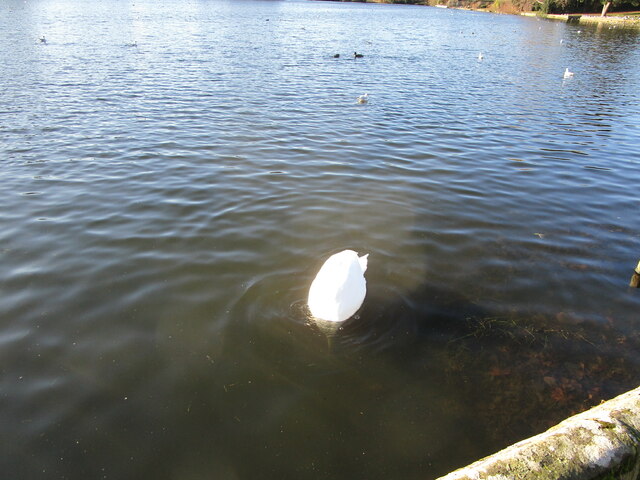
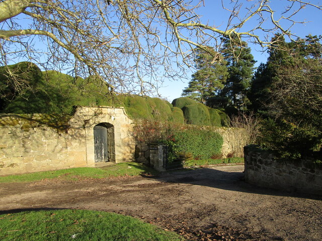
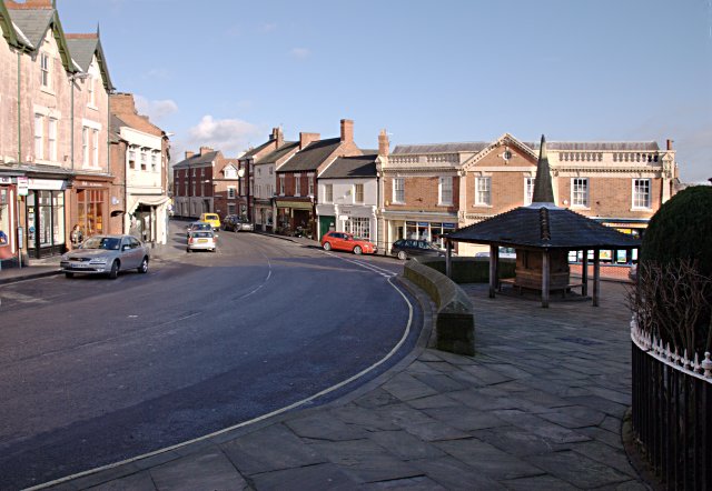
Coneyburrow Wood Images

Images are sourced within 2km of 52.817755/-1.4368837 or Grid Reference SK3824. Thanks to Geograph Open Source API. All images are credited.

Royal Observer Corps Monitoring Post Entrance to the ROC bunker. It was featured in BBC news back in 2012.
Royal Observer Corps Monitoring Post
Entrance to the ROC bunker. It was featured in BBC news back in 2012.
Cottages, Main Street, King's Newton That on the left is a much altered sixteenth century cottage <span class="nowrap"><a title="https://historicengland.org.uk/listing/the-list/list-entry/1204785?section=official-listing" rel="nofollow ugc noopener" href="https://historicengland.org.uk/listing/the-list/list-entry/1204785?section=official-listing">Link</a><img style="margin-left:2px;" alt="External link" title="External link - shift click to open in new window" src="https://s1.geograph.org.uk/img/external.png" width="10" height="10"/></span> That on the right is slightly older <span class="nowrap"><a title="https://historicengland.org.uk/listing/the-list/list-entry/1334625?section=official-listing" rel="nofollow ugc noopener" href="https://historicengland.org.uk/listing/the-list/list-entry/1334625?section=official-listing">Link</a><img style="margin-left:2px;" alt="External link" title="External link - shift click to open in new window" src="https://s1.geograph.org.uk/img/external.png" width="10" height="10"/></span>
Cottages, Main Street, King's Newton
That on the left is a much altered sixteenth century cottage LinkExternal link That on the right is slightly older LinkExternal link
Cross House, King's Newton Dates from the early nineteenth century <span class="nowrap"><a title="https://historicengland.org.uk/listing/the-list/list-entry/1096370?section=official-listing" rel="nofollow ugc noopener" href="https://historicengland.org.uk/listing/the-list/list-entry/1096370?section=official-listing">Link</a><img style="margin-left:2px;" alt="External link" title="External link - shift click to open in new window" src="https://s1.geograph.org.uk/img/external.png" width="10" height="10"/></span>
Cross House, King's Newton
Dates from the early nineteenth century LinkExternal link
Thatched Cottage, Castle Street, Melbourne Has sixteenth century origins <span class="nowrap"><a title="https://historicengland.org.uk/listing/the-list/list-entry/1204966?section=official-listing" rel="nofollow ugc noopener" href="https://historicengland.org.uk/listing/the-list/list-entry/1204966?section=official-listing">Link</a><img style="margin-left:2px;" alt="External link" title="External link - shift click to open in new window" src="https://s1.geograph.org.uk/img/external.png" width="10" height="10"/></span>
Thatched Cottage, Castle Street, Melbourne
Has sixteenth century origins LinkExternal link
The Tithe Cottage, Melbourne Largely of the seventeenth century <span class="nowrap"><a title="https://historicengland.org.uk/listing/the-list/list-entry/1096383?section=official-listing" rel="nofollow ugc noopener" href="https://historicengland.org.uk/listing/the-list/list-entry/1096383?section=official-listing">Link</a><img style="margin-left:2px;" alt="External link" title="External link - shift click to open in new window" src="https://s1.geograph.org.uk/img/external.png" width="10" height="10"/></span>
The Tithe Cottage, Melbourne
Largely of the seventeenth century LinkExternal link
Sluice and Weir. Melbourne Pond Control the flow of water into Carr Brook. Date from the nineteenth century <span class="nowrap"><a title="https://historicengland.org.uk/listing/the-list/list-entry/1204954?section=official-listing" rel="nofollow ugc noopener" href="https://historicengland.org.uk/listing/the-list/list-entry/1204954?section=official-listing">Link</a><img style="margin-left:2px;" alt="External link" title="External link - shift click to open in new window" src="https://s1.geograph.org.uk/img/external.png" width="10" height="10"/></span>
Sluice and Weir. Melbourne Pond
Control the flow of water into Carr Brook. Date from the nineteenth century LinkExternal link
Melbourne Senior Citizens Community Centre
Smithy, Melbourne Listed <span class="nowrap"><a title="https://historicengland.org.uk/listing/the-list/list-entry/1204658?section=official-listing" rel="nofollow ugc noopener" href="https://historicengland.org.uk/listing/the-list/list-entry/1204658?section=official-listing">Link</a><img style="margin-left:2px;" alt="External link" title="External link - shift click to open in new window" src="https://s1.geograph.org.uk/img/external.png" width="10" height="10"/></span>
Smithy, Melbourne
Listed LinkExternal link
War memorial, Melbourne
The north side of the church, Melbourne Melbourne has a 'close' without an adjacent burial ground which is unusual for a parish church in England.
The north side of the church, Melbourne
Melbourne has a 'close' without an adjacent burial ground which is unusual for a parish church in England.
Alleyway to Church Street, Melbourne
Footpath to Penn Lane, Melbourne
Roadway by the Pool, Melbourne
Muddying the waters Mute Swan at the Pool, Melbourne.
Muddying the waters
Mute Swan at the Pool, Melbourne.
The Pool, Melbourne A former mill pond extended as an ornament to Melbourne Hall.
The Pool, Melbourne
A former mill pond extended as an ornament to Melbourne Hall.
The Pool, Melbourne A former mill pond extended as an ornament to Melbourne Hall.
The Pool, Melbourne
A former mill pond extended as an ornament to Melbourne Hall.
Footpath by The Pool, Melbourne
Gate in the garden wall, Melbourne Hall
Show me another place!

Coneyburrow Wood is located at Grid Ref: SK3824 (Lat: 52.817755, Lng: -1.4368837)

Administrative County: Derbyshire

District: South Derbyshire

Police Authority: Derbyshire

What 3 Words

///wash.optimally.polished. Near Melbourne, Derbyshire

Nearby Locations

The Pool Coneyburrow Wood

Related Wikis

Melbourne, Derbyshire

Melbourne () is a market town and civil parish in South Derbyshire, England. It was home to Thomas Cook, and has a street named after him. It is 8 miles...

Staunton Harold Reservoir

Staunton Harold Reservoir is a large reservoir under the management of Severn Trent Water, located between Melbourne and Ticknall in Derbyshire, England...

Melbourne Hall

Melbourne Hall is a Georgian style country house in Melbourne, Derbyshire, previously owned by William Lamb, 2nd Viscount Melbourne, British Prime Minister...

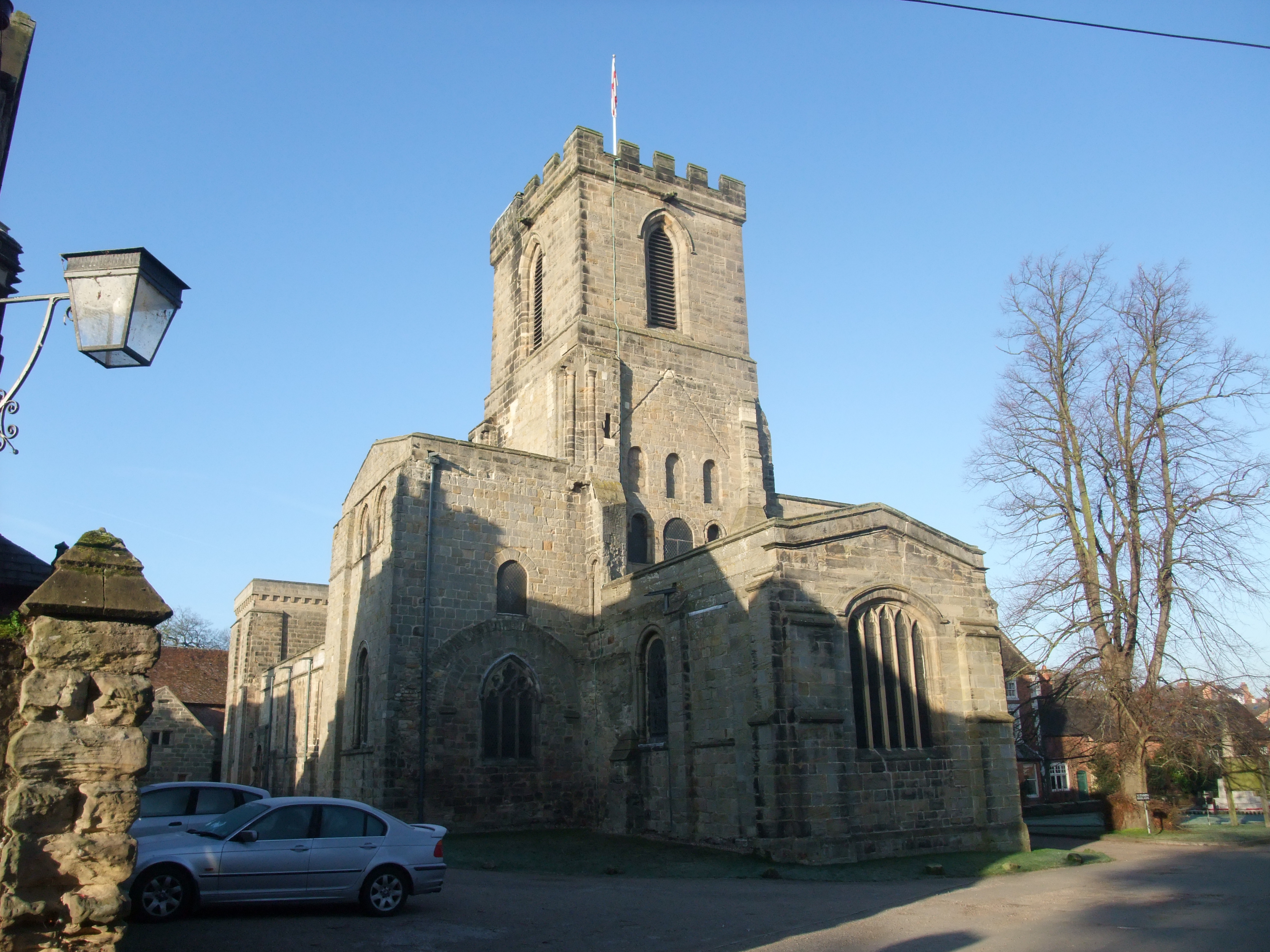
St Michael with St Mary's Church, Melbourne

St Michael and St Mary's Church, Melbourne is a Grade I listed parish church in the Church of England in Melbourne, Derbyshire. == History == The church...

Melbourne Castle

Melbourne Castle was a medieval castle in Melbourne, Derbyshire. It was built on the site of an earlier royal manor house that had provided accommodation...

Kings Newton

Kings Newton is a village in South Derbyshire. The population of the village is included in Melbourne. The Holy well (pictured) was constructed around...

Melbourne railway station (United Kingdom)

Melbourne railway station was a station at Kings Newton that served the adjacent town of Melbourne, Derbyshire, England. == History == It was opened in...

Melbourne line

The Melbourne Line was a railway line which ran from Derby to Ashby de la Zouch. It was used by the British Army and Allied engineers during the Second...

Nearby Amenities

Located within 500m of 52.817755,-1.4368837
Melbourne Arms
Disused Amenity: pub
Lat/Long: 52.8192213/-1.4352039
Post Box
Operator: Royal Mail
Ref: DE73 641
Lat/Long: 52.8152005/-1.4324452
Barrier: kissing_gate
Source: survey;gps
Lat/Long: 52.8198737/-1.4347215
Crossing
Crossing: marked
Crossing Ref: zebra
Lat/Long: 52.8169156/-1.4410661
Crossing
Lat/Long: 52.8166699/-1.4392833
Cafe
Addr City: Derby
Addr Postcode: DE73 8HU
Addr Village: Melbourne
Lat/Long: 52.8164242/-1.4410206
Toilets
Lat/Long: 52.8165117/-1.4410306
Check Date: 2021-04-05
Information: board
Tourism: information
Lat/Long: 52.8160377/-1.4412685
Information: map
Tourism: information
Lat/Long: 52.8161512/-1.4412902
Crossing
Lat/Long: 52.816683/-1.4393982
Bus Stop
Melbourne Arms
Naptan AtcoCode: 1000DMAR5034
Naptan NaptanCode: dbsdtmad
Public Transport: platform
Lat/Long: 52.8194376/-1.4350006
Bus Stop
Melbourne Arms
Naptan AtcoCode: 1000DMAR5033
Naptan NaptanCode: dbsdtjwt
Public Transport: platform
Lat/Long: 52.8198979/-1.434782
Bus Stop
Robinson's Hill
Bench: no
Bin: no
Lit: no
Naptan AtcoCode: 1000DMRH5031
Naptan NaptanCode: dbsdtgjd
Public Transport: platform
Shelter: no
Tactile Paving: no
Lat/Long: 52.819408/-1.440072
Bench
Lat/Long: 52.8158907/-1.4414442
Tourism: picnic_site
Lat/Long: 52.8156403/-1.4416909
Bench
Lat/Long: 52.816086/-1.4411062
Waste Basket
Lat/Long: 52.8158711/-1.4416286
Bench
Lat/Long: 52.8156654/-1.4417029
Bench
Lat/Long: 52.8157743/-1.4414843
Bench
Lat/Long: 52.815811/-1.4413836
Bench
Lat/Long: 52.8158398/-1.4413063
Bench
Backrest: yes
Lat/Long: 52.8179639/-1.4349841
Bench
Backrest: yes
Lat/Long: 52.8194849/-1.4400605
Tourism: picnic_site
Lat/Long: 52.8170845/-1.4405846
Bench
Lat/Long: 52.8169482/-1.4387372
Bench
Lat/Long: 52.8169565/-1.4392556
Tourism: picnic_site
Lat/Long: 52.817223/-1.4406732
Tourism: picnic_site
Lat/Long: 52.8173467/-1.4404862
Bench
Lat/Long: 52.8165208/-1.4411366
Bench
Lat/Long: 52.8164962/-1.4412366
Bench
Lat/Long: 52.8165472/-1.4411472
Entrance: yes
Lat/Long: 52.8163814/-1.4410679
Entrance: yes
Lat/Long: 52.816461/-1.4410624
The data included in this document is from www.openstreetmap.org. The data is made available under ODbL.

Have you been to Coneyburrow Wood?

Leave your review of Coneyburrow Wood below (or comments, questions and feedback).