Arthog

Settlement in Merionethshire

Wales

Arthog

Minor road near the Cregennan Lakes
Minor road near the Cregennan Lakes Credit: Steven Brown

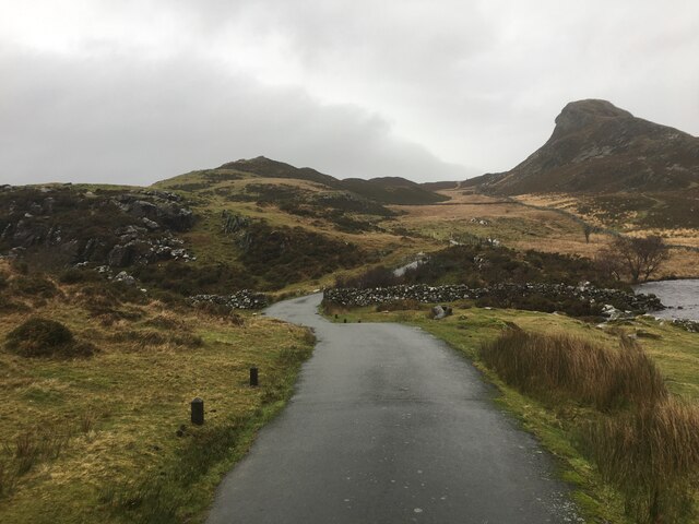
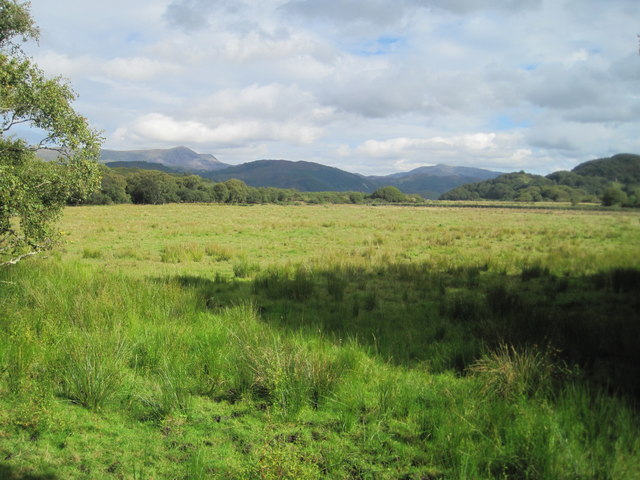
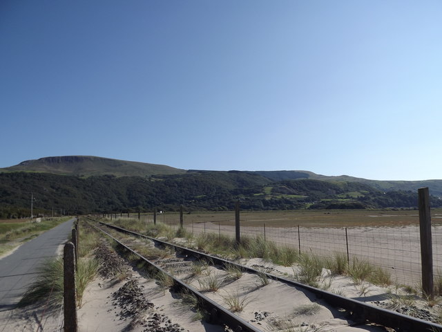
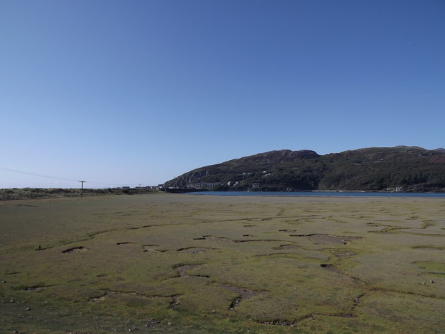
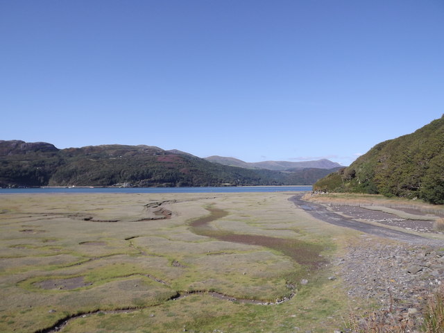
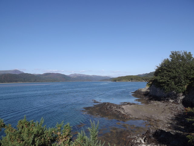
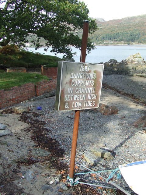
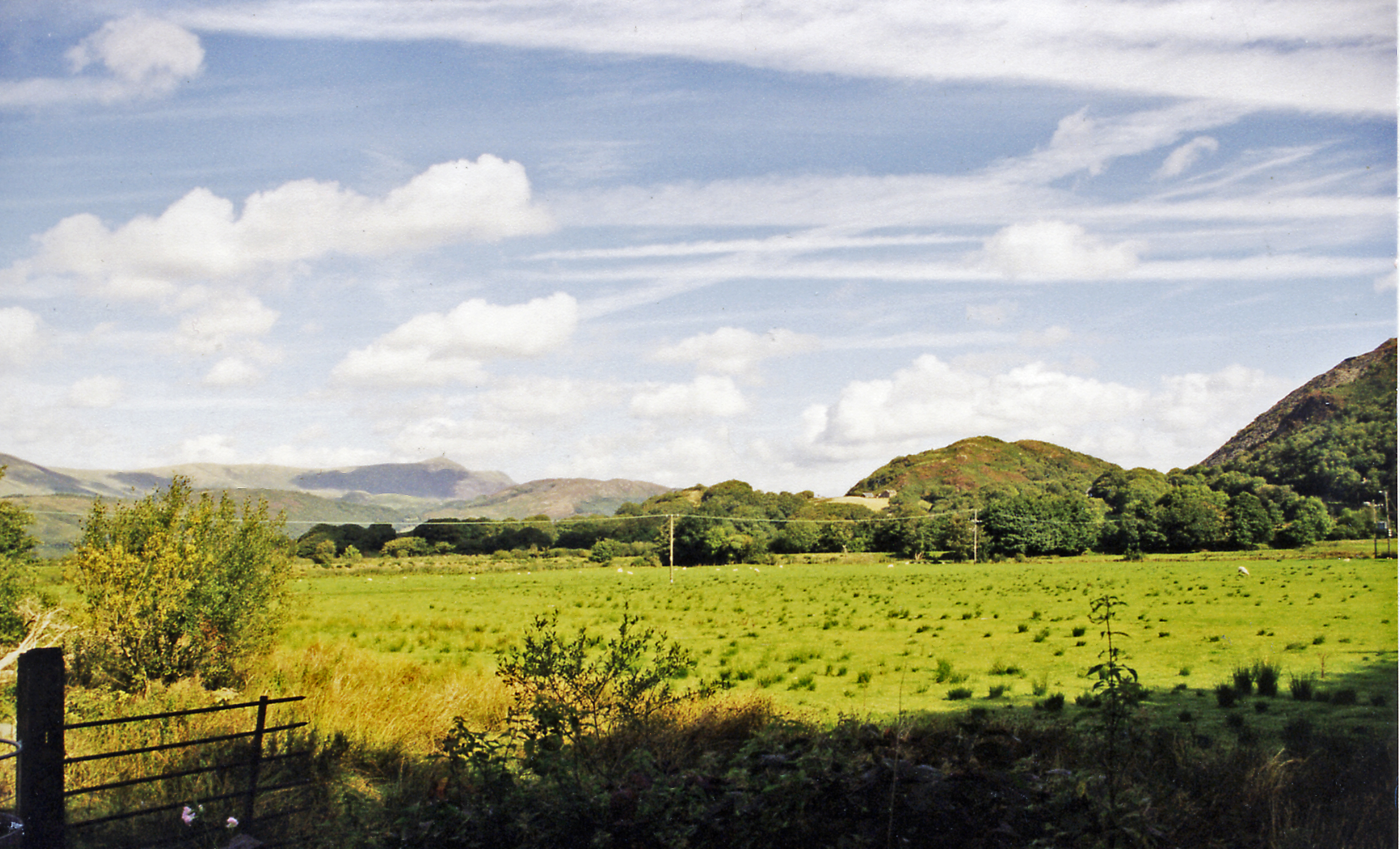
Arthog is a small village located in the county of Merionethshire, Wales, United Kingdom. It is situated on the southern banks of the Mawddach Estuary, offering stunning views of the surrounding Snowdonia National Park. With a population of around 300 people, Arthog is a peaceful and picturesque destination.

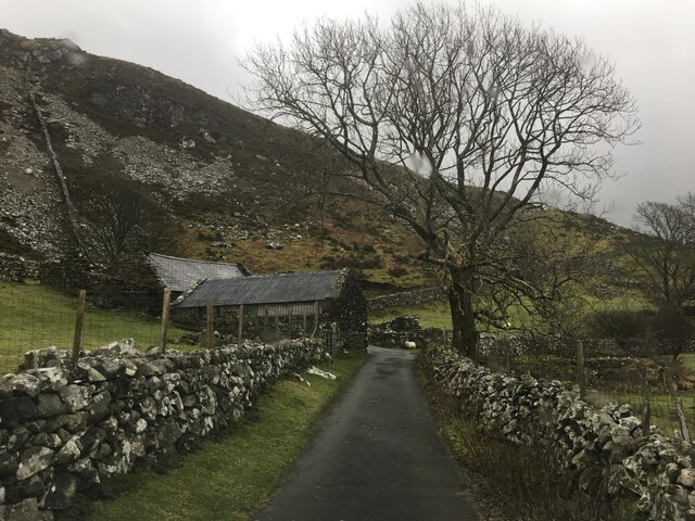
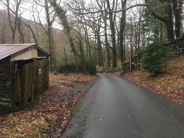
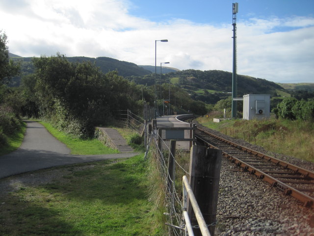
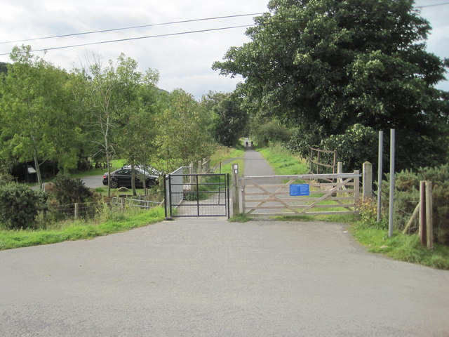
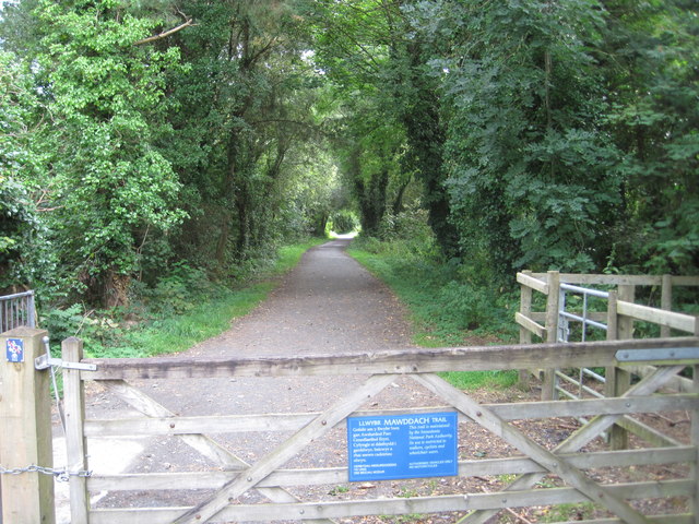
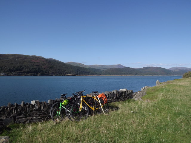
The village is known for its natural beauty and outdoor recreational activities. Visitors can explore the nearby Cader Idris mountain range, which offers various hiking trails of different difficulty levels. The Mawddach Trail, a popular cycling and walking path, runs through Arthog, providing a scenic route along the estuary.

Arthog is also home to the Arthog Outdoor Education Center, which offers a range of outdoor activities and adventure programs for all ages. The center provides opportunities for rock climbing, canoeing, abseiling, and team-building exercises.

In terms of amenities, Arthog has a few local shops and a pub, catering to the needs of both residents and tourists. The village has a strong sense of community, organizing events throughout the year, including a summer fair and a Christmas market.

The surrounding area of Arthog is rich in history, with ancient sites such as Castell-y-Bere and Cymer Abbey located nearby. These historical landmarks attract visitors interested in Welsh heritage and architecture.

Overall, Arthog is a tranquil village that offers a perfect escape for nature lovers and outdoor enthusiasts, with its breathtaking scenery, outdoor activities, and welcoming community.

If you have any feedback on the listing, please let us know in the comments section below.

Arthog Images

Images are sourced within 2km of 52.712428/-4.010113 or Grid Reference SH6414. Thanks to Geograph Open Source API. All images are credited.

Minor road near the Cregennan Lakes
Minor road near Gefnir Farm
Minor road near Arthog
Morfa Mawddach railway station, Gwynedd Opened in 1865 on the Aberystwyth & Welsh Coast Railway's line from Machynlleth to Pwllheli, this soon became part of the Cambrian Railway's empire. The station was called Barmouth Junction until 1960.
View south towards Fairbourne and Machynlleth. There were previously four platforms here, two for Machynlleth to the right and two to the left for Dolgellau and Ruabon (closed in 1965). Taken from a similar position to <a href="https://www.geograph.org.uk/photo/1973689">SH6214 : Morfa Mawddach Station</a> some 53 years earlier.
Morfa Mawddach railway station, Gwynedd
Opened in 1865 on the Aberystwyth & Welsh Coast Railway's line from Machynlleth to Pwllheli, this soon became part of the Cambrian Railway's empire. The station was called Barmouth Junction until 1960. View south towards Fairbourne and Machynlleth. There were previously four platforms here, two for Machynlleth to the right and two to the left for Dolgellau and Ruabon (closed in 1965). Taken from a similar position to SH6214 : Morfa Mawddach Station some 53 years earlier.
Arthog railway station (site), Gwynedd Opened in 1879 on the Aberystwyth & Welsh Coast Railway's line from Barmouth Junction (now Morfa Mawddach) to Dolgellau, this soon became part of the Cambrian Railway's empire. The station closed in 1965.
View south west towards Morfa Mawddach. There was a single wooden platform beyond where the gate on the left now is.
Arthog railway station (site), Gwynedd
Opened in 1879 on the Aberystwyth & Welsh Coast Railway's line from Barmouth Junction (now Morfa Mawddach) to Dolgellau, this soon became part of the Cambrian Railway's empire. The station closed in 1965. View south west towards Morfa Mawddach. There was a single wooden platform beyond where the gate on the left now is.
Former Barmouth Junction to Dolgellau railway line Now the Mawddach Trail.
Former Barmouth Junction to Dolgellau railway line
Now the Mawddach Trail.
Marshland near Arthog
Railway line from Morfa Mawddach station towards Barmouth bridge The railway track just north of the station at Morfa Mawddach station, through the sand dunes as it heads towards Barmouth bridge and over the Afon Mawddach estuary.
This line is part of the Cambrian Coast Railway between Machynlleth and Pwllheli
Railway line from Morfa Mawddach station towards Barmouth bridge
The railway track just north of the station at Morfa Mawddach station, through the sand dunes as it heads towards Barmouth bridge and over the Afon Mawddach estuary. This line is part of the Cambrian Coast Railway between Machynlleth and Pwllheli
Railway line from Barmouth towards Morfa Mawddach station The railway track just north of the station at Morfa Mawddach.
It comes from Barmouth, over the bridge crossing the Afon Mawddach estuary; then runs alongside the sand dunes to Morfa Mawddach station  
This line is part of the Cambrian Coast Railway between Machynlleth and Pwllheli
Railway line from Barmouth towards Morfa Mawddach station
The railway track just north of the station at Morfa Mawddach. It comes from Barmouth, over the bridge crossing the Afon Mawddach estuary; then runs alongside the sand dunes to Morfa Mawddach station This line is part of the Cambrian Coast Railway between Machynlleth and Pwllheli
Mawddach estuary Grassland, often used for grazing sheep, on the south side of the Mawddach estuary near Barmouth bridge.
The Cambrian coast railway track acts as a barrier between the grassland and the sand dunes in the estuary mouth.
The Afon Mawddach (river Mawddach) is a tidal estuary; when there is a spring tide, or severe weather drives the tide higher inshore - this area often completely floods.
Mawddach estuary
Grassland, often used for grazing sheep, on the south side of the Mawddach estuary near Barmouth bridge. The Cambrian coast railway track acts as a barrier between the grassland and the sand dunes in the estuary mouth. The Afon Mawddach (river Mawddach) is a tidal estuary; when there is a spring tide, or severe weather drives the tide higher inshore - this area often completely floods.
Afon Mawddach estuary Grassland, often used for grazing sheep, on the south side of the Mawddach estuary near Barmouth bridge.
Looking north towards the mountains across the estuary.
Two hundred metres or so to the west, the Cambrian coast railway crosses the bridge between Barmouth and the Morfa Mawddach railway station.
The Afon Mawddach (river Mawddach) is a tidal estuary; when there is a spring tide, or severe weather drives the tide higher inshore - this area often completely floods.
Afon Mawddach estuary
Grassland, often used for grazing sheep, on the south side of the Mawddach estuary near Barmouth bridge. Looking north towards the mountains across the estuary. Two hundred metres or so to the west, the Cambrian coast railway crosses the bridge between Barmouth and the Morfa Mawddach railway station. The Afon Mawddach (river Mawddach) is a tidal estuary; when there is a spring tide, or severe weather drives the tide higher inshore - this area often completely floods.
Afon Mawddach estuary Grassland, often used for grazing sheep, on the south side of the Afon Mawddach estuary near Barmouth bridge.
The Afon Mawddach (river Mawddach) is a tidal estuary; when there is a spring tide, or severe weather drives the tide higher inshore - this area often completely floods.
The railway track acts as a barrier between the grassland and the sand dunes in the estuary mouth.
This line is part of the Cambrian Coast Railway between Machynlleth and Pwllheli and is famous for its scenic views of both coast and mountains.
The train is seen approaching the bridge. 
A footbridge is incorporated on the eastern side of the bridge and pedestrians, cyclists and motorcycles can cross the estuary by the side of the track.
Since 1996, this has formed part of the National Cycle Route that links North and South Wales
Afon Mawddach estuary
Grassland, often used for grazing sheep, on the south side of the Afon Mawddach estuary near Barmouth bridge. The Afon Mawddach (river Mawddach) is a tidal estuary; when there is a spring tide, or severe weather drives the tide higher inshore - this area often completely floods. The railway track acts as a barrier between the grassland and the sand dunes in the estuary mouth. This line is part of the Cambrian Coast Railway between Machynlleth and Pwllheli and is famous for its scenic views of both coast and mountains. The train is seen approaching the bridge. A footbridge is incorporated on the eastern side of the bridge and pedestrians, cyclists and motorcycles can cross the estuary by the side of the track. Since 1996, this has formed part of the National Cycle Route that links North and South Wales
Afon Mawddach estuary The south bank of the Afon Mawddach, just to the east of Barmouth railway and foot bridge.
Looking east north-east up the estuary towards Dolgellau.
Afon Mawddach estuary
The south bank of the Afon Mawddach, just to the east of Barmouth railway and foot bridge. Looking east north-east up the estuary towards Dolgellau.
Afon Mawddach estuary The south bank of the Afon Mawddach estuary.
To the west is Barmouth Bridge which, apart from the railway track, has a footbridge incorporated on the eastern side of the bridge and pedestrians, cyclists and motorcycles can cross the estuary by the side of the track.
Since 1996, this has formed part of the National Cycle Route that links North and South Wales.
Also, a few hundred metres to the south, the Mawddach Trail (footpath and cycle route) follows a disused railway line and runs for 9 miles along the estuary from Dolgellau to Barmouth.
So if you enjoy cycling - an ideal place to bring your bike!
Afon Mawddach estuary
The south bank of the Afon Mawddach estuary. To the west is Barmouth Bridge which, apart from the railway track, has a footbridge incorporated on the eastern side of the bridge and pedestrians, cyclists and motorcycles can cross the estuary by the side of the track. Since 1996, this has formed part of the National Cycle Route that links North and South Wales. Also, a few hundred metres to the south, the Mawddach Trail (footpath and cycle route) follows a disused railway line and runs for 9 miles along the estuary from Dolgellau to Barmouth. So if you enjoy cycling - an ideal place to bring your bike!
Barmouth Bridge Looking along the footpath on the Barmouth Bridge at Barmouth, Gwynedd.
Barmouth Bridge
Looking along the footpath on the Barmouth Bridge at Barmouth, Gwynedd.
Just Crossed Train on Barmouth Bridge now on the south side having just crossed the bridge.
Just Crossed
Train on Barmouth Bridge now on the south side having just crossed the bridge.
Gateposts Gateposts near to Arthog, Gwynedd.
Gateposts
Gateposts near to Arthog, Gwynedd.
Warning Sign Warning sign near to Arthog, Gwynedd.
Warning Sign
Warning sign near to Arthog, Gwynedd.
Show me another place!

Arthog is located at Grid Ref: SH6414 (Lat: 52.712428, Lng: -4.010113)

Unitary Authority: Gwynedd

Police Authority: North Wales

What 3 Words

///keep.thrashed.ranges. Near Barmouth, Gwynedd

Related Wikis

Arthog

Arthog () is a village, post town and community in the Meirionnydd area in Gwynedd, north Wales including the villages of Fairbourne and Friog. It is located...

Arthog railway station

Arthog railway station in Gwynedd, Wales, was a station on the Dolgelly [sic] branch of the Aberystwith and Welsh Coast Railway (part of the Ruabon to...

Morfa Mawddach railway station

Morfa Mawddach railway station (formerly Barmouth Junction) is an unstaffed station located on the outskirts of the village of Arthog in Gwynedd, Wales...
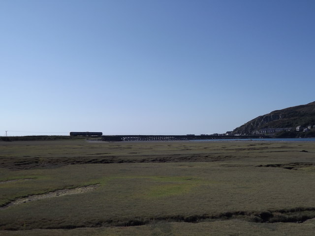
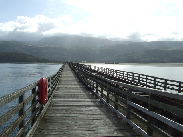
Barmouth Bridge

Barmouth Bridge (Welsh: Pont Abermaw), or Barmouth Viaduct is a Grade II* listed single-track wooden railway viaduct across the estuary of the River Mawddach...

St David's Church, Barmouth

St David's Church is a Church in Wales church by the harbour of Barmouth, Gwynedd, west Wales. It is part of the Bro Ardudwy Ministry Area. == History... ==

Fairbourne Spit

Fairbourne Spit (also known as Penrhyn Point) is a long spit of sand and shingle at the mouth of the River Mawddach where it reaches Cardigan Bay, on the...

Friog

Friog (Welsh: Y Friog) is a small village in North Wales, near Fairbourne. Its lake and beach are a tourist attraction to over 1,000 visitors a year. Friog...

Fairbourne railway station

Fairbourne railway station serves the village of Fairbourne in Gwynedd, Wales. It is an unstaffed station on the Cambrian Coast Railway with passenger...

Nearby Amenities

Located within 500m of 52.712428,-4.010113
Source: PGS
Lat/Long: 52.7168467/-4.0113419
Source: PGS
Lat/Long: 52.7153693/-4.0126347
Source: PGS
Lat/Long: 52.7150799/-4.0128866
Source: PGS
Lat/Long: 52.7148073/-4.0132108
Source: PGS
Lat/Long: 52.7150119/-4.0149003
Source: PGS
Lat/Long: 52.7152572/-4.0152187
Source: PGS
Lat/Long: 52.715628/-4.0151168
Source: PGS
Lat/Long: 52.7159273/-4.0147799
Source: www.npemap.org.uk
Uk Postcode Centroid: LL39
Lat/Long: 52.711284/-4.011874
Barrier: kissing_gate
Bicycle: yes
Foot: yes
Lat/Long: 52.7140094/-4.0140221
Barrier: stile
Foot: yes
Lat/Long: 52.713007/-4.0127697
Barrier: stile
Foot: yes
Lat/Long: 52.7131658/-4.0099871
Arthog
Is In: Gwynedd
Place: village
Wikidata: Q3396790
Lat/Long: 52.7116535/-4.0077788
Pont Pwll-Arthog
Place: locality
Lat/Long: 52.7122901/-4.0054979
Tourism: picnic_site
Lat/Long: 52.7135113/-4.0144451
Board Type: notice
Information: board
Tourism: information
Lat/Long: 52.7136044/-4.0141792
Arthog
Historic Railway: station
Railway: site
Wikidata: Q4797617
Wikipedia: en:Arthog railway station
Lat/Long: 52.7137045/-4.0143808
Post Box
Lat/Long: 52.7101173/-4.0144488
Bus Stop
Bus: yes
Naptan AtcoCode: 5400AWD71599
Naptan NaptanCode: gwnagmd
Public Transport: platform
Lat/Long: 52.710114/-4.0144797
Post Box
Lat/Long: 52.714295/-4.0043046
Bench
Lat/Long: 52.7118609/-4.0080625
The data included in this document is from www.openstreetmap.org. The data is made available under ODbL.

Have you been to Arthog?

Leave your review of Arthog below (or comments, questions and feedback).