Arthingworth
Settlement in Northamptonshire
England
Arthingworth
Arthingworth is a small village located in the county of Northamptonshire, England. Situated in the heart of the East Midlands, it is surrounded by picturesque countryside, offering residents and visitors a tranquil and idyllic setting.
The village is known for its historical significance, with evidence of human activity dating back to the Bronze Age. Arthingworth is home to several notable landmarks, including the St. Andrew's Church, a beautiful medieval structure that has stood since the 12th century. This architectural gem attracts history enthusiasts from far and wide.
Despite its modest size, Arthingworth boasts a strong sense of community spirit. The village has a local pub, The Bull's Head, which serves as a popular gathering spot for residents and visitors alike. The pub offers a warm and welcoming atmosphere, providing an opportunity for locals to socialize and forge connections.
Arthingworth is also known for its connection to the Nene Valley Railway, a heritage railway that runs for approximately seven miles from Northampton to Peterborough. The village is home to a station on this line, providing a unique opportunity for visitors to experience a nostalgic train journey through the picturesque countryside.
In terms of amenities, Arthingworth offers limited services. However, neighboring towns and villages provide easy access to everyday necessities, such as shops, schools, and healthcare facilities.
Overall, Arthingworth is a charming and historic village that offers a peaceful countryside escape. With its rich history, community spirit, and proximity to the Nene Valley Railway, it is a hidden gem for those seeking a taste of rural England.
If you have any feedback on the listing, please let us know in the comments section below.
Arthingworth Images
Images are sourced within 2km of 52.425315/-0.892104 or Grid Reference SP7581. Thanks to Geograph Open Source API. All images are credited.


Arthingworth is located at Grid Ref: SP7581 (Lat: 52.425315, Lng: -0.892104)
Unitary Authority: West Northamptonshire
Police Authority: Northamptonshire
What 3 Words
///shout.fetching.thrillers. Near Desborough, Northamptonshire
Nearby Locations
Related Wikis
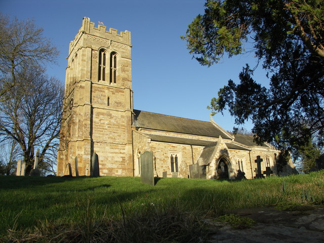
St Andrew's Church, Arthingworth
St Andrew's Church is an Anglican Church and the parish church of Arthingworth. It is a Grade II* listed building and stands on the north side of Braybrooke...
Arthingworth
Arthingworth is a civil parish and village in the West Northamptonshire area of the county of Northamptonshire, England. The population of the civil parish...
Arthingworth Manor
Arthingworth Manor is a Grade II listed country house in Arthingworth, Northamptonshire, England, about 5 miles (8.0 km) southeast of Market Harborough...
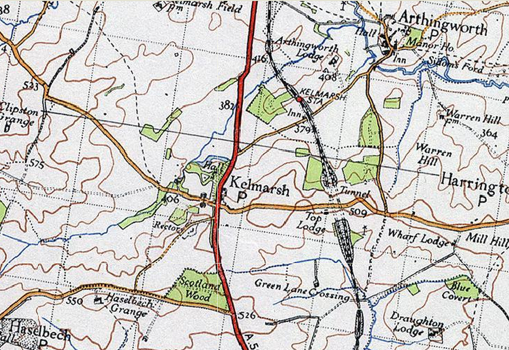
Kelmarsh railway station
Kelmarsh railway station on the Northampton and Market Harborough railway opened on 16 February 1859 serving the villages of Kelmarsh and Arthingworth...

Braybrooke
Braybrooke is a small village in north west Northamptonshire, England. The population of the civil parish at the 2011 census was 378. It is situated about...

Clipston and Oxendon railway station
Clipston and Oxendon railway station on the Northampton and Market Harborough railway opened in 1863 as a result of villagers' requests serving the villages...
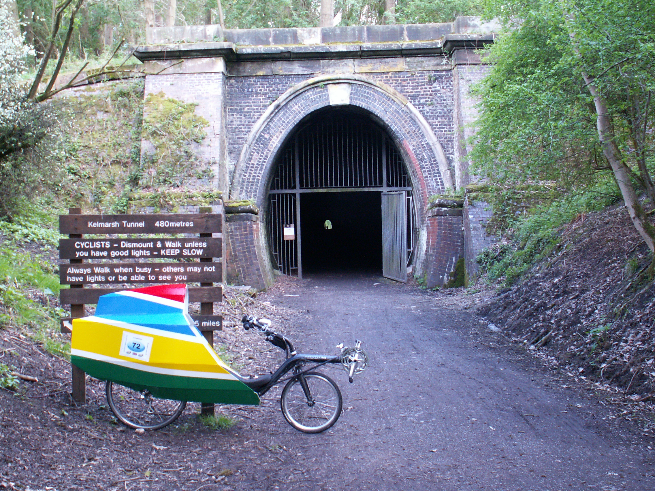
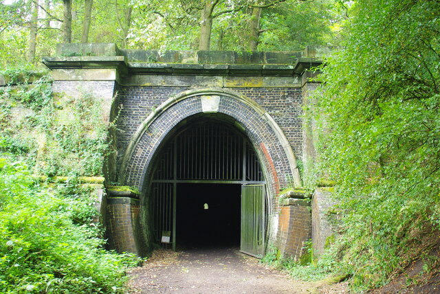
Kelmarsh Tunnel
The Kelmarsh Tunnels are disused railway tunnels in Northamptonshire, England. The Northampton to Market Harborough line opened in 1859 and had tunnels...

Harrington, Northamptonshire
Harrington is a village and civil parish in Northamptonshire, England, administered by North Northamptonshire council. At the time of the 2001 census,...
Nearby Amenities
Located within 500m of 52.425315,-0.892104Have you been to Arthingworth?
Leave your review of Arthingworth below (or comments, questions and feedback).