Sig's Wood

Wood, Forest in Yorkshire Harrogate

England

Sig's Wood

Grange Farm on Highmoor Lane
Grange Farm on Highmoor Lane Credit: Ian S

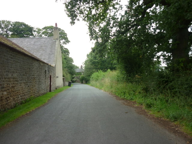
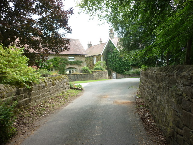
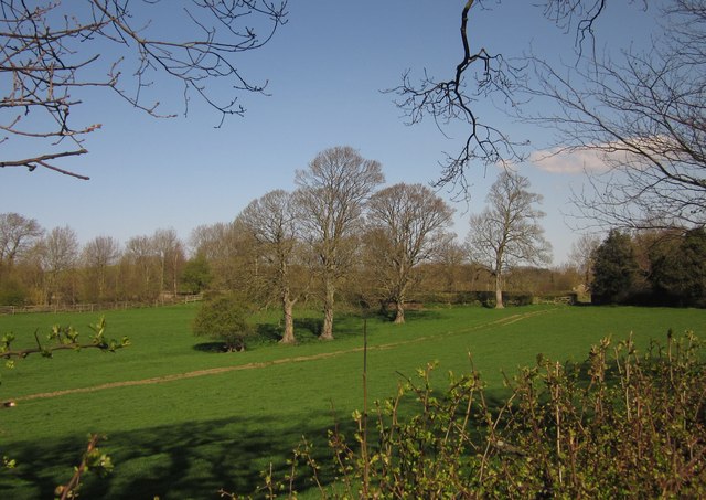
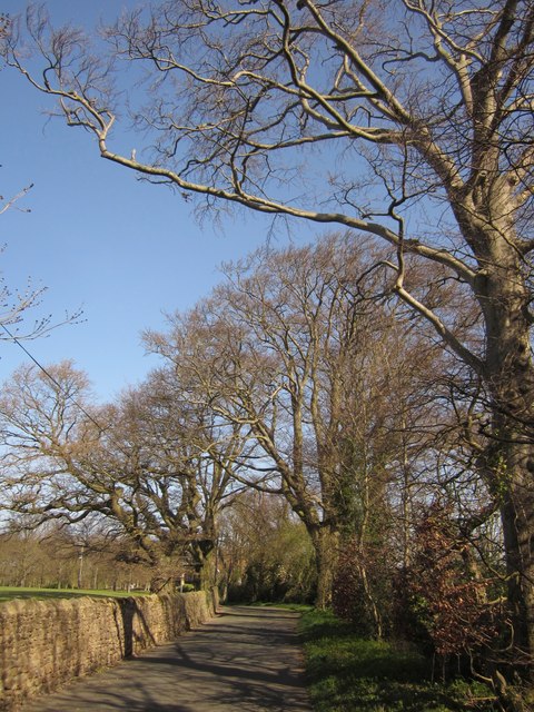
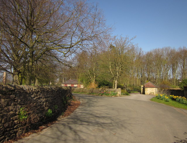
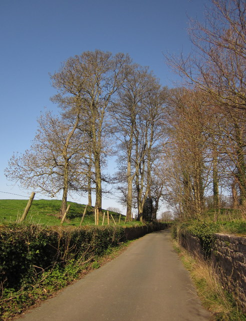
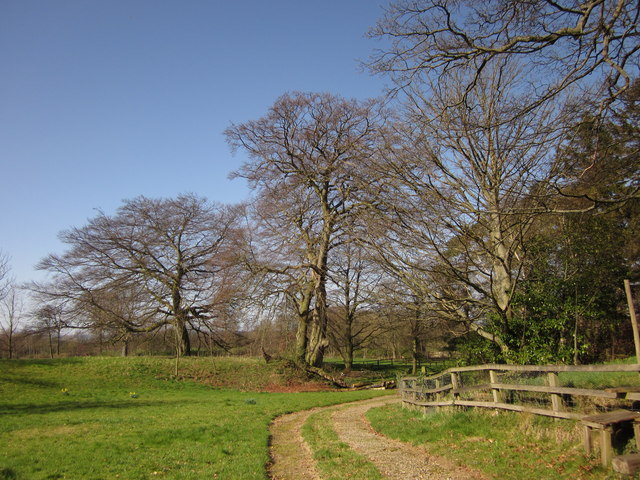
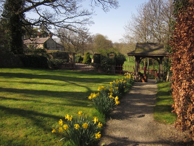
Sig's Wood is a picturesque forest located in the county of Yorkshire, England. Spread across a vast area, it is known for its stunning natural beauty and rich biodiversity. The wood is nestled amidst rolling hills and offers a serene and peaceful environment for visitors.

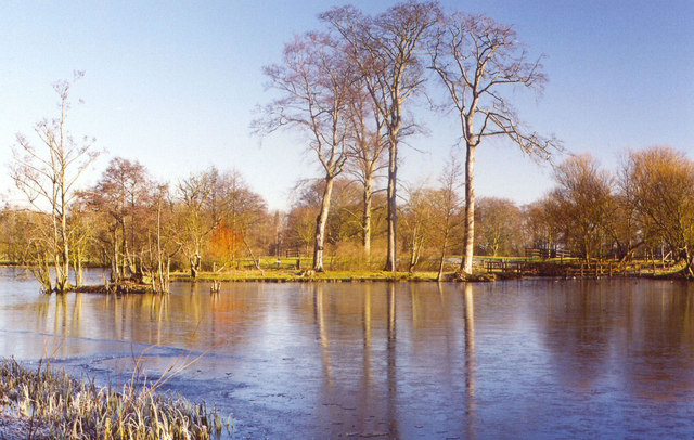
As one explores Sig's Wood, they are greeted by a canopy of towering trees, including oak, beech, and ash, which provide shelter and shade throughout the year. The forest floor is blanketed with a vibrant mix of wildflowers, ferns, and mosses, creating a carpet of colors that change with the seasons.

The wood is also home to a diverse range of wildlife, making it a favorite spot for nature enthusiasts and birdwatchers. Visitors may catch a glimpse of native species such as deer, foxes, badgers, and squirrels, as well as a variety of bird species including woodpeckers, owls, and thrushes.

Numerous walking trails wind through the wood, allowing visitors to immerse themselves in its natural wonders. These pathways offer breathtaking views of the surrounding countryside and provide an opportunity to connect with nature on a deeper level. There are also designated picnic areas and benches, inviting visitors to relax and enjoy a meal amidst the tranquil surroundings.

Sig's Wood offers a retreat from the hustle and bustle of everyday life, allowing visitors to reconnect with nature and enjoy the beauty of Yorkshire's woodlands. Whether it's a leisurely stroll, a birdwatching expedition, or a peaceful picnic, this enchanting forest has something to offer for everyone seeking solace in the great outdoors.

If you have any feedback on the listing, please let us know in the comments section below.
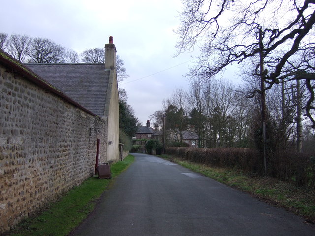
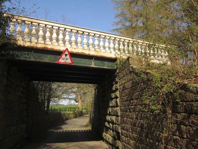
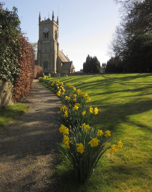
Sig's Wood Images

Images are sourced within 2km of 54.027466/-1.5359606 or Grid Reference SE3059. Thanks to Geograph Open Source API. All images are credited.

Grange Farm on Highmoor Lane
Town Street, Nidd, North Yorkshire
Home Farm, Town Street, Nidd
Lake at Nidd Hall
Lake at Nidd Hall
Parish church of St Paul & St Margaret, Nidd
Town Street, Nidd
Town Street, Nidd
Bridge, Nidd Hall The ornamental bridge also features at <a title="https://www.geograph.org.uk/search.php?i=30160879" href="https://www.geograph.org.uk/search.php?i=30160879">Link</a> . It's crossing the road that links the part of the village of Nidd on the B6165 with the church and the hall itself.
Bridge, Nidd Hall
The ornamental bridge also features at Link . It's crossing the road that links the part of the village of Nidd on the B6165 with the church and the hall itself.
Path to the church, Nidd Daffodils beside the path to the Victorian church (described at <span class="nowrap"><a title="http://www.britishlistedbuildings.co.uk/en-331558-church-of-st-paul-and-st-margaret-nidd" rel="nofollow ugc noopener" href="http://www.britishlistedbuildings.co.uk/en-331558-church-of-st-paul-and-st-margaret-nidd">Link</a><img style="margin-left:2px;" alt="External link" title="External link - shift click to open in new window" src="https://s1.geograph.org.uk/img/external.png" width="10" height="10"/></span> ), also shown at <a title="https://www.geograph.org.uk/gridref/SE3060?centi=SE301608" href="https://www.geograph.org.uk/gridref/SE3060?centi=SE301608">Link</a> .
Path to the church, Nidd
Daffodils beside the path to the Victorian church (described at LinkExternal link ), also shown at Link .
Trees, Nidd An intermittent line of trees follow a track across a field between Town Lane (from which the photo was taken) and the course of the former Leeds and Thirsk Railway (by the trees on the left). The gate on the right leads onto Nidd Lane, which crosses the old railway to join the A61.
Trees, Nidd
An intermittent line of trees follow a track across a field between Town Lane (from which the photo was taken) and the course of the former Leeds and Thirsk Railway (by the trees on the left). The gate on the right leads onto Nidd Lane, which crosses the old railway to join the A61.
Town Street, Nidd A little further along <a href="https://www.geograph.org.uk/photo/2920281">SE3059 : Town Street, Nidd</a>, and taken more or less on the northing gridline referred to. Beeches line this stretch of the lane.
Town Street, Nidd
A little further along SE3059 : Town Street, Nidd, and taken more or less on the northing gridline referred to. Beeches line this stretch of the lane.
By Home Farm, Nidd Town Street (see <a href="https://www.geograph.org.uk/photo/2920298">SE3060 : Town Street, Nidd</a>) passes Home Farm and Nidd Park House off to the right, about a third of the way between the two parts of Nidd.
By Home Farm, Nidd
Town Street (see SE3060 : Town Street, Nidd) passes Home Farm and Nidd Park House off to the right, about a third of the way between the two parts of Nidd.
Town Street, Nidd A little north of <a href="https://www.geograph.org.uk/photo/2889138">SE3060 : Bridge, Nidd Hall</a>, the lane passes a small clump of trees that form part of the landscaped grounds of Nidd Hall, which is off to the right.
Town Street, Nidd
A little north of SE3060 : Bridge, Nidd Hall, the lane passes a small clump of trees that form part of the landscaped grounds of Nidd Hall, which is off to the right.
Trees and track, Nidd A track curves around woodland after leaving Town Street, just south of the church. The beech on the left is across an easting gridline in <a href="https://www.geograph.org.uk/gridref/SE2960">SE2960</a>.
Trees and track, Nidd
A track curves around woodland after leaving Town Street, just south of the church. The beech on the left is across an easting gridline in SE2960.
Church path, Nidd A reverse view of <a href="https://www.geograph.org.uk/photo/2889152">SE3060 : Path to the church, Nidd</a>, with daffodils and last year's beech leaves framing the path to the lych gate. Across the road is Mulberry Manor.
Church path, Nidd
A reverse view of SE3060 : Path to the church, Nidd, with daffodils and last year's beech leaves framing the path to the lych gate. Across the road is Mulberry Manor.
Gate and field, Nidd The gate is visible in <a href="https://www.geograph.org.uk/photo/2889397">SE3060 : Trees, Nidd</a>, as is the tree. On the right is Nidd Lane, leading across the course of the former Leeds and Thirsk Railway.
Gate and field, Nidd
The gate is visible in SE3060 : Trees, Nidd, as is the tree. On the right is Nidd Lane, leading across the course of the former Leeds and Thirsk Railway.
South Susacres Farm Footpath number 15 16/2/1 follows this farm road which leads past South Susacres Farm to West Susacres Farm.
South Susacres Farm
Footpath number 15 16/2/1 follows this farm road which leads past South Susacres Farm to West Susacres Farm.
St. Paul's and St. Margaret's Church, Nidd Church built in mid Victorian Times for the occupants of nearby Nidd Hall - now a listed building.
St. Paul's and St. Margaret's Church, Nidd
Church built in mid Victorian Times for the occupants of nearby Nidd Hall - now a listed building.
Nidd Hall A Warner's hotel in North Yorkshire.
Nidd Hall
A Warner's hotel in North Yorkshire.
Show me another place!

Sig's Wood is located at Grid Ref: SE3059 (Lat: 54.027466, Lng: -1.5359606)

Division: West Riding

Administrative County: North Yorkshire

District: Harrogate

Police Authority: North Yorkshire

What 3 Words

///filed.fairly.supposing. Near Harrogate, North Yorkshire

Related Wikis

Nidd

Nidd is a small village and civil parish in the Harrogate district of North Yorkshire, England. The population of the village taken at the 2011 census...

Nidderdale Greenway

The Nidderdale Greenway is a 4-mile (6.4 km) path that runs between Harrogate and Ripley in North Yorkshire, England. It uses a former railway line that...

Nidd Bridge railway station

Nidd Bridge railway station served the village of Nidd, North Yorkshire, England from 1848 to 1964 on the Leeds-Northallerton Railway. == History == The...

Oak Beck

Oak Beck is a watercourse that flows eastwards across the northern part of Harrogate in North Yorkshire, England. The beck flows through a broad V-shaped...

Nearby Amenities

Located within 500m of 54.027466,-1.5359606
Ripley Junction
Historic Railway: junction
Railway: site
Lat/Long: 54.0282706/-1.5398281
The data included in this document is from www.openstreetmap.org. The data is made available under ODbL.

Have you been to Sig's Wood?

Leave your review of Sig's Wood below (or comments, questions and feedback).