Brick-kiln Covert

Wood, Forest in Derbyshire Amber Valley

England

Brick-kiln Covert

Track off Burland Green Lane This track leads off Burland Green Lane on the edge of Weston Underwood.
Track off Burland Green Lane Credit: Malcolm Neal

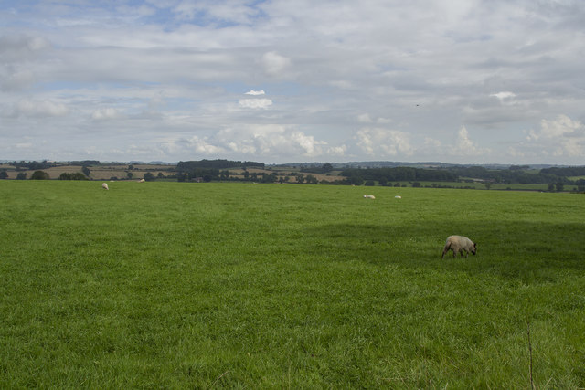
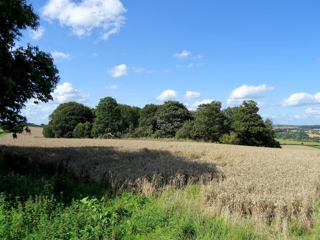
Brick-kiln Covert is a small woodland area located in Derbyshire, England. Situated near the town of Wood, the covert encompasses an area of approximately 10 acres and is known for its diverse range of plant and animal species.

The woodland is predominantly composed of deciduous trees, including oak, ash, and birch. These trees provide a dense canopy, creating a shaded and tranquil environment. The forest floor is covered in a thick layer of leaf litter, which supports a rich variety of ground-dwelling plants such as bluebells, wood sorrel, and wild garlic.

Brick-kiln Covert is renowned for its wildlife, attracting nature enthusiasts and birdwatchers alike. The woodland provides a habitat for a multitude of bird species, including woodpeckers, tawny owls, and various songbirds. Additionally, the covert is home to small mammals such as squirrels, rabbits, and foxes. Rare sightings of badgers and deer have also been reported in the area.

The woodland is crisscrossed by a network of walking trails, allowing visitors to explore the natural beauty of Brick-kiln Covert. These paths wind through the trees, offering glimpses of the surrounding countryside and providing opportunities for peaceful walks and picnics.

Brick-kiln Covert is a protected area, managed by the local authorities to preserve its natural integrity and promote biodiversity. It serves as an important ecological site, contributing to the overall environmental health of the region.

If you have any feedback on the listing, please let us know in the comments section below.

Brick-kiln Covert Images

Images are sourced within 2km of 52.970535/-1.5473533 or Grid Reference SK3041. Thanks to Geograph Open Source API. All images are credited.

Track off Burland Green Lane This track leads off Burland Green Lane on the edge of Weston Underwood.
Track off Burland Green Lane
This track leads off Burland Green Lane on the edge of Weston Underwood.
Burland Green Lane This is image is taken from just by the entrance to Ivy Green Farm, looking along the lane as it goes away from Weston Underwood.
Burland Green Lane
This is image is taken from just by the entrance to Ivy Green Farm, looking along the lane as it goes away from Weston Underwood.
The field by Burland Green Lane In late August almost all the fields in this area that were growing crops have already been harvested. This is quite early for this area.
The field by Burland Green Lane
In late August almost all the fields in this area that were growing crops have already been harvested. This is quite early for this area.
Mercaston Lane Yet another country lane bordered by high hedges that have been in place for a long time.
Mercaston Lane
Yet another country lane bordered by high hedges that have been in place for a long time.
Ploughing the fields When I first appeared the tractor was some way off and the field had many Lesser Black Backed Gulls and other species all investigating the turned over ground.
Ploughing the fields
When I first appeared the tractor was some way off and the field had many Lesser Black Backed Gulls and other species all investigating the turned over ground.
A country view Looking away from Kedleston this view across the grass towards the clouds that are piling up.
A country view
Looking away from Kedleston this view across the grass towards the clouds that are piling up.
Old Milepost in Weston Underwood Cast iron post by the UC road, in parish of Weston Underwood (Amber Valley District), Kedleston Road; just East of Weston Underwood village, on grass verge in front of hedge, on South side of road. Hulland iron casting, erected by the Wirksworth & Derby turnpike trust in the 19th century. 

Inscription reads:-
: HULL.ND / WARD / 3 / MILES : : 132 / LONDON : : DERBY / 6 / MILES : : J. HAYWOOD JUNᴿ. / PHOENIX FOUNDRY/ DERBY :

Grade II listed.
List Entry Number: 1335383 <span class="nowrap"><a title="https://historicengland.org.uk/listing/the-list/list-entry/1335383" rel="nofollow ugc noopener" href="https://historicengland.org.uk/listing/the-list/list-entry/1335383">Link</a><img style="margin-left:2px;" alt="External link" title="External link - shift click to open in new window" src="https://s1.geograph.org.uk/img/external.png" width="10" height="10"/></span>

Milestone Society National ID: DE_DEHW06
Old Milepost in Weston Underwood
Cast iron post by the UC road, in parish of Weston Underwood (Amber Valley District), Kedleston Road; just East of Weston Underwood village, on grass verge in front of hedge, on South side of road. Hulland iron casting, erected by the Wirksworth & Derby turnpike trust in the 19th century. Inscription reads:- : HULL.ND / WARD / 3 / MILES : : 132 / LONDON : : DERBY / 6 / MILES : : J. HAYWOOD JUNᴿ. / PHOENIX FOUNDRY/ DERBY : Grade II listed. List Entry Number: 1335383 LinkExternal link Milestone Society National ID: DE_DEHW06
Smith's Plantation A patch of woodland that's been here since at least the late 19th century.
Smith's Plantation
A patch of woodland that's been here since at least the late 19th century.
Salts Plantation A patch of woodland by Cutler Brook that's been here since at least the late 19th century.
Salts Plantation
A patch of woodland by Cutler Brook that's been here since at least the late 19th century.
Lodge Lane, Meynell Langley (1) Meandering downhill towards Kirk Langley.
Lodge Lane, Meynell Langley (1)
Meandering downhill towards Kirk Langley.
Lodge Lane, Meynell Langley (2) Looking towards Meynell Langley Garden Centre and Kedleston.
Lodge Lane, Meynell Langley (2)
Looking towards Meynell Langley Garden Centre and Kedleston.
Disused gravel pit Now overgrown with trees, the pit seems to have gone out of use some time in the mid 20th century.
Disused gravel pit
Now overgrown with trees, the pit seems to have gone out of use some time in the mid 20th century.
Rutted farm track crossing a stream After crossing an unnamed watercourse, the track becomes heavily rutted as it climbs out of the shallow valley.
Rutted farm track crossing a stream
After crossing an unnamed watercourse, the track becomes heavily rutted as it climbs out of the shallow valley.
Solar farming at Inn Farm The old farmhouse used to be a coaching inn called the Scarsdale Arms on the main route from Derby to Manchester. Over time, better routes over easier country took traffic away and the inn closed.
Solar farming at Inn Farm
The old farmhouse used to be a coaching inn called the Scarsdale Arms on the main route from Derby to Manchester. Over time, better routes over easier country took traffic away and the inn closed.
New house in Weston Underwood A bold modern design nearing completion on the edge of Weston Underwood.
New house in Weston Underwood
A bold modern design nearing completion on the edge of Weston Underwood.
Abandoned farm machinery by the Centenary Way A Bamfords No.2 Saw Bench and Howard Selectatilth rusting away at the edge of a field.
Abandoned farm machinery by the Centenary Way
A Bamfords No.2 Saw Bench and Howard Selectatilth rusting away at the edge of a field.
New woodland above Weston Underwood
Footbridge over Greenlane Brook This footbridge carries the Centenary Way over Greenlane Brook, between two sheep pastures.
Footbridge over Greenlane Brook
This footbridge carries the Centenary Way over Greenlane Brook, between two sheep pastures.
Show me another place!

Brick-kiln Covert is located at Grid Ref: SK3041 (Lat: 52.970535, Lng: -1.5473533)

Administrative County: Derbyshire

District: Amber Valley

Police Authority: Derbyshire

What 3 Words

///exile.input.usage. Near Duffield, Derbyshire

Related Wikis

Kedleston

Kedleston is a village and civil parish in the Amber Valley district of Derbyshire, approximately 4 miles (6.4 km) north-west of Derby. Nearby places include...

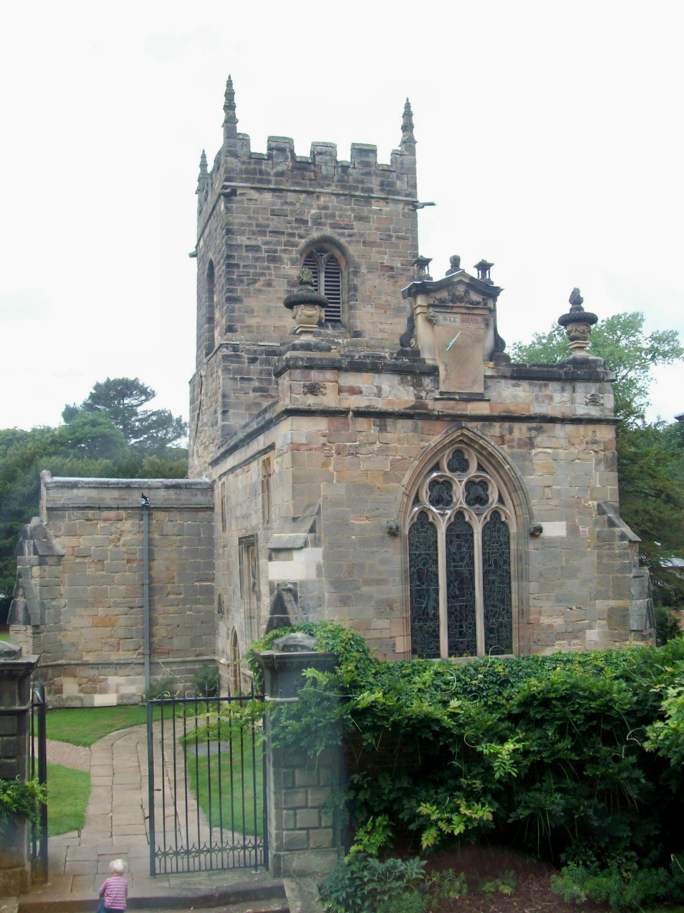
All Saints Church, Kedleston

All Saints' Church, Kedleston, is a redundant Anglican Church approx. 4 miles [6km] north-west of Derby, and all that remains of the medieval village of...

Kedleston Hall

Kedleston Hall is a neo-classical manor house owned by the National Trust, and seat of the Curzon family, located in Kedleston, Derbyshire, approximately...

Weston Underwood, Derbyshire

Weston Underwood is an agricultural village and civil parish in the Amber Valley district of Derbyshire. The population of the Civil Parish (comprising...

Meynell Langley

Meynell Langley is a small area of settlement in Derbyshire, England. It is located between Kirk Langley and Kedleston. Meynell Langley Hall is the ancestral...

All Saints' Church, Mugginton

All Saints’ Church, Mugginton is a Grade I listed parish church in the Church of England in Weston Underwood, Derbyshire. == History == The church dates...
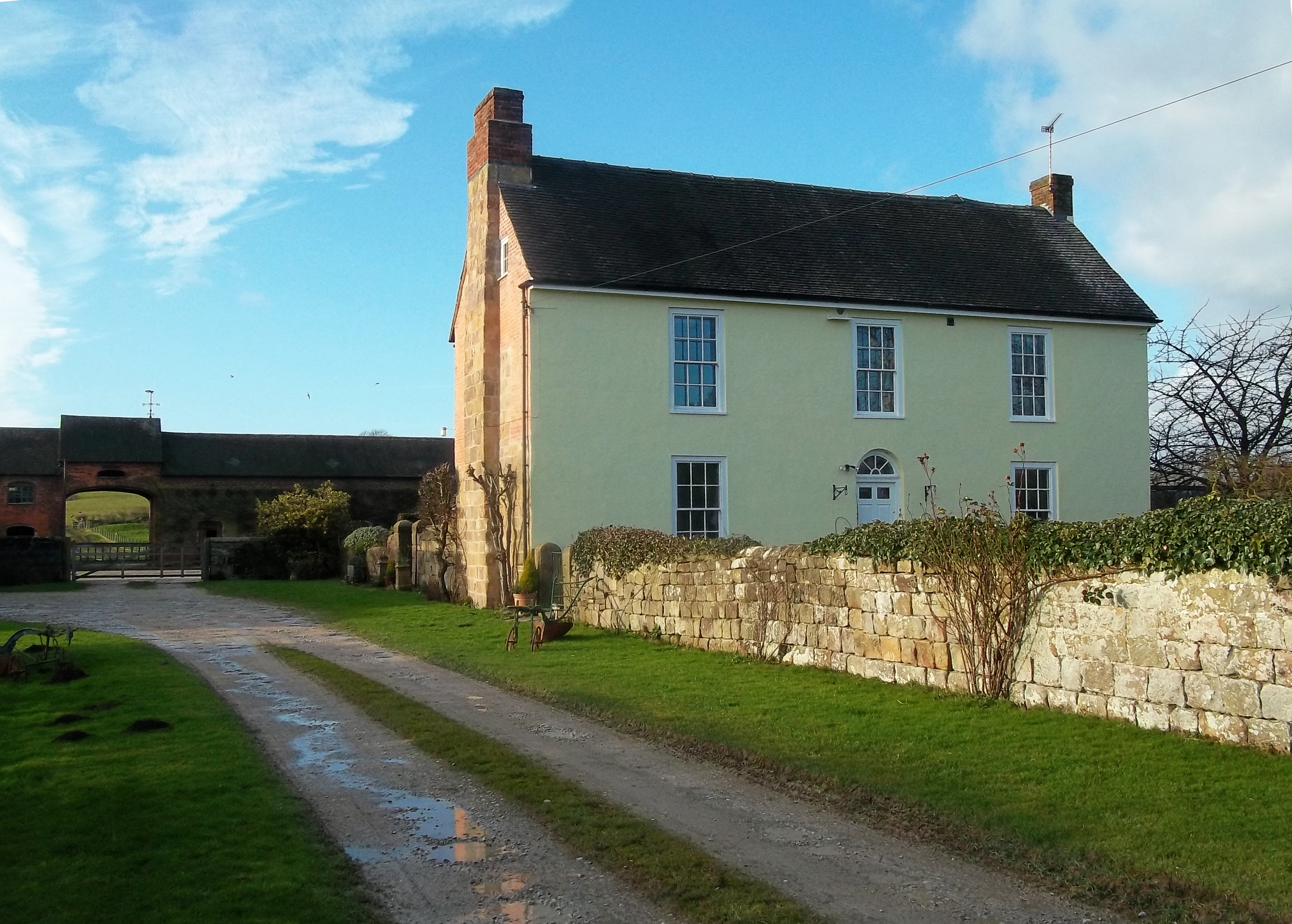
Mercaston Hall

Mercaston Hall is a 16th-century timber framed farmhouse within the hamlet of Mercaston, near the market town of Ashbourne, Derbyshire, England. It is...

Quarndon

Quarndon is a linear village in the south of the Amber Valley District of Derbyshire, England. It is spread along four minor upland roads, approximately...

Nearby Amenities

Located within 500m of 52.970535,-1.5473533
Barrier: cattle_grid
Lat/Long: 52.9670668/-1.5465442
Kedleston
Is In Country: UK
Is In County: Derbyshire
Place: hamlet
Source: NPE
Lat/Long: 52.968111/-1.5528275
Post Box
Operator: Royal Mail
Ref: DE6 86
Lat/Long: 52.9671061/-1.5467964
Ford: stepping_stones
Lat/Long: 52.9737566/-1.5422748
Barrier: stile
Lat/Long: 52.9737429/-1.5422348
Passing Place
Lat/Long: 52.9664331/-1.5453574
The data included in this document is from www.openstreetmap.org. The data is made available under ODbL.

Have you been to Brick-kiln Covert?

Leave your review of Brick-kiln Covert below (or comments, questions and feedback).