Crackley Wood

Wood, Forest in Warwickshire Warwick

England

Crackley Wood

Houses on Red Lane near Burton Green
Houses on Red Lane near Burton Green Credit: Ian S

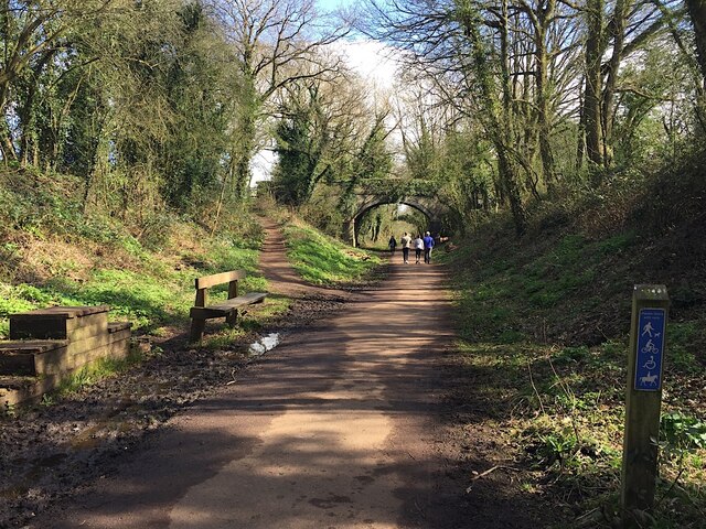
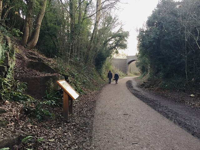
Crackley Wood is a picturesque woodland located in Warwickshire, England. Covering an area of approximately 115 acres, it is a popular destination for nature lovers and outdoor enthusiasts alike.

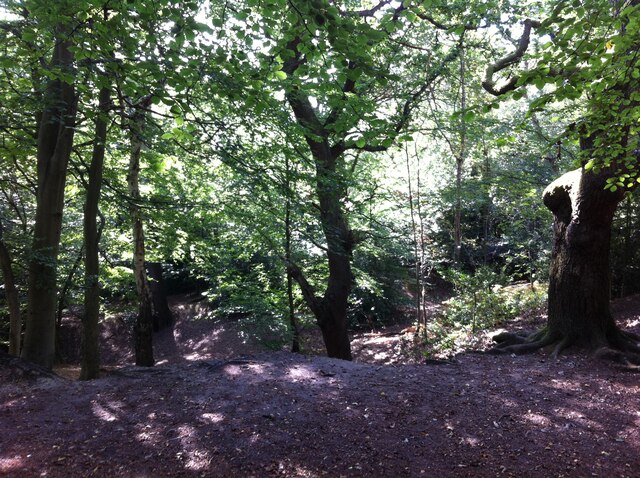
The wood is primarily composed of broadleaf trees such as oak, beech, and ash, which provide a diverse and vibrant canopy throughout the year. These trees create a tranquil and shady environment, perfect for leisurely walks or picnics with family and friends.

Crackley Wood boasts a rich biodiversity, with a variety of flora and fauna calling it home. The forest floor is carpeted with bluebells in the spring, creating a stunning display of color. Other wildflowers, such as wood anemones and primroses, can also be found scattered throughout the woodland.

A network of well-maintained footpaths winds its way through the wood, allowing visitors to explore its beauty at their own pace. These paths lead to hidden clearings, where visitors can relax and immerse themselves in the peaceful surroundings.

Wildlife enthusiasts will delight in the diverse range of animals that inhabit Crackley Wood. Deer, squirrels, and rabbits can often be spotted darting between the trees, while birdwatchers can enjoy the melodious songs of various species, including woodpeckers and thrushes.

Managed by the Warwickshire Wildlife Trust, Crackley Wood also serves as an educational resource, offering guided tours and nature workshops for schoolchildren and other interested groups. This ensures that future generations can appreciate and learn about the importance of woodland conservation.

Overall, Crackley Wood in Warwickshire is a delightful and enchanting forest, offering visitors a chance to escape the hustle and bustle of everyday life and reconnect with nature.

If you have any feedback on the listing, please let us know in the comments section below.

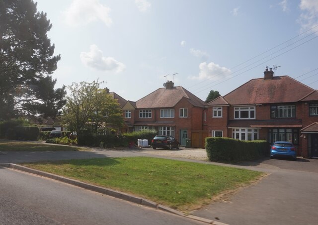
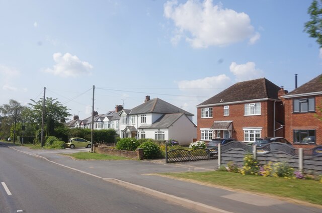
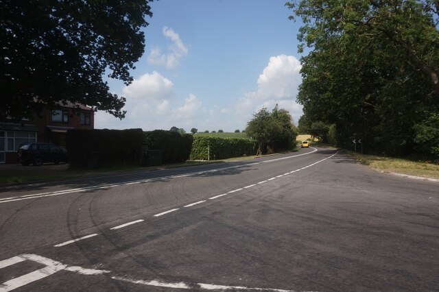
Crackley Wood Images

Images are sourced within 2km of 52.361619/-1.5751698 or Grid Reference SP2973. Thanks to Geograph Open Source API. All images are credited.

Houses on Red Lane near Burton Green
Red Lane near Long Meadow Barn Farm
A452 Birmingham Road at Red Lane
East on Kenilworth Greenway, Crackley The Greenway, a County Council amenity, follows the route of the former Kenilworth-Berkswell railway line. Here it is crossed by and connected to a public footpath, a track at this point, between north Kenilworth and south Coventry.
East on Kenilworth Greenway, Crackley
The Greenway, a County Council amenity, follows the route of the former Kenilworth-Berkswell railway line. Here it is crossed by and connected to a public footpath, a track at this point, between north Kenilworth and south Coventry.
Making a deck, The Engine public house, Mill End, Kenilworth In the later phase of the pandemic, pubs that had had to close invested in creating outdoor space so that they could safely serve socially-distanced patrons.
Making a deck, The Engine public house, Mill End, Kenilworth
In the later phase of the pandemic, pubs that had had to close invested in creating outdoor space so that they could safely serve socially-distanced patrons.
Kenilworth Greenway turns south, Crackley, Kenilworth The Greenway was created on a former railway line. The information board has accounts of the Kenilworth Sandstone, exposed here, and of the railway.
Kenilworth Greenway turns south, Crackley, Kenilworth
The Greenway was created on a former railway line. The information board has accounts of the Kenilworth Sandstone, exposed here, and of the railway.
Odibourne Allotments, Manor Road, Kenilworth The allotments were open to the public for the Heritage Open Days 2021 and Edible England events; members of the Kenilworth Allotment Tenants' Association (KATA) can be seen welcoming visitors. 

The Odibourne site was established in 1919, when Kenilworth Urban District Council bought land from the estate of the deceased William Thomas Pears. The council had recently decided to build on the 'Noah's Ark' allotments nearby, but was obliged under the 1908 Smallholding & Allotments Act to provide sufficient land for local people who wanted plots for growing food. The site is owned today by Kenilworth Town Council, but has been managed since 1983 by KATA (information taken from a notice board on the site).
Odibourne Allotments, Manor Road, Kenilworth
The allotments were open to the public for the Heritage Open Days 2021 and Edible England events; members of the Kenilworth Allotment Tenants' Association (KATA) can be seen welcoming visitors. The Odibourne site was established in 1919, when Kenilworth Urban District Council bought land from the estate of the deceased William Thomas Pears. The council had recently decided to build on the 'Noah's Ark' allotments nearby, but was obliged under the 1908 Smallholding & Allotments Act to provide sufficient land for local people who wanted plots for growing food. The site is owned today by Kenilworth Town Council, but has been managed since 1983 by KATA (information taken from a notice board on the site).
Plot 58a, Odibourne Allotments, Kenilworth These allotments, which to this city dweller appear impossibly idyllic, were open to the public for the Heritage Open Days 2021. Behind the idyll, of course, lies hard work and long term commitment, the challenge of group politics, the uncertainty of the weather and the threat, even here, of theft and vandalism. The Odibourne allotments were established in 1919.
Plot 58a, Odibourne Allotments, Kenilworth
These allotments, which to this city dweller appear impossibly idyllic, were open to the public for the Heritage Open Days 2021. Behind the idyll, of course, lies hard work and long term commitment, the challenge of group politics, the uncertainty of the weather and the threat, even here, of theft and vandalism. The Odibourne allotments were established in 1919.
I'm in the Green Zone A scarecrow, probably more decorative than functional, at the Odibourne allotments in Kenilworth, which were open to the public for the Heritage Open Days 2021.
I'm in the Green Zone
A scarecrow, probably more decorative than functional, at the Odibourne allotments in Kenilworth, which were open to the public for the Heritage Open Days 2021.
Apple Pressing at Odibourne Allotments, Kenilworth The allotment site was open to the public as part of the Heritage Open Days 2021 and Edible England events.
Apple Pressing at Odibourne Allotments, Kenilworth
The allotment site was open to the public as part of the Heritage Open Days 2021 and Edible England events.
'My Shed, My Rules' The sheds of the Odibourne Allotments, Kenilworth, are the subject of their own book, 'Odibourne Sheds: rural retreats in a Kenilworth allotment', by Peter James, published by the Bothy Press in 2020.
'My Shed, My Rules'
The sheds of the Odibourne Allotments, Kenilworth, are the subject of their own book, 'Odibourne Sheds: rural retreats in a Kenilworth allotment', by Peter James, published by the Bothy Press in 2020.
The Rules: Water butt on Odibourne Allotments, Kenilworth A water butt and rules governing its use, on the Odibourne Allotments, open to the public for the Heritage Open Days 2021 and Edible England events.
The Rules: Water butt on Odibourne Allotments, Kenilworth
A water butt and rules governing its use, on the Odibourne Allotments, open to the public for the Heritage Open Days 2021 and Edible England events.
Odibourne Allotments, Kenilworth, looking towards Lower Ladyes Hills Not normally open to the public, the allotments were welcoming visitors for the day as part of the Heritage Open Days 2021 and Edible England events. A scarecrow in the form of a Tokyo Olympics mascot can be seen to the right of the picture.
Odibourne Allotments, Kenilworth, looking towards Lower Ladyes Hills
Not normally open to the public, the allotments were welcoming visitors for the day as part of the Heritage Open Days 2021 and Edible England events. A scarecrow in the form of a Tokyo Olympics mascot can be seen to the right of the picture.
Bridge over the Finham Brook, Odibourne Allotments, Kenilworth No doubt flooding is another hazard of allotment life here, but the stream must have enriched the fertility of the valley over the years. Not normally accessible to the public, the allotments were open as part of the Heritage Open Days 2021 and Edible England events.
Bridge over the Finham Brook, Odibourne Allotments, Kenilworth
No doubt flooding is another hazard of allotment life here, but the stream must have enriched the fertility of the valley over the years. Not normally accessible to the public, the allotments were open as part of the Heritage Open Days 2021 and Edible England events.
Lower Ladyes Hills, Kenilworth, seen from the entrance to the Odibourne Allotments The allotments, which were established in the valley of the Finham Brook in 1919, were open to the public as part of the Heritage Open Days.
Lower Ladyes Hills, Kenilworth, seen from the entrance to the Odibourne Allotments
The allotments, which were established in the valley of the Finham Brook in 1919, were open to the public as part of the Heritage Open Days.
Kenilworth Common Once a heath used for grazing farm animals, the common was colonised by birch and oak trees once grazing stopped, and is now a wood with a few remnants of heathland. The land slopes down to the Finham Brook and is crossed by the Coventry to Leamington railway. The common is now a local nature reserve: see the website of the Warwickshire Wildlife Trust here <span class="nowrap"><a title="https://www.warwickshirewildlifetrust.org.uk/reserves/KenilworthCommon" rel="nofollow ugc noopener" href="https://www.warwickshirewildlifetrust.org.uk/reserves/KenilworthCommon">Link</a><img style="margin-left:2px;" alt="External link" title="External link - shift click to open in new window" src="https://s1.geograph.org.uk/img/external.png" width="10" height="10"/></span> .
Kenilworth Common
Once a heath used for grazing farm animals, the common was colonised by birch and oak trees once grazing stopped, and is now a wood with a few remnants of heathland. The land slopes down to the Finham Brook and is crossed by the Coventry to Leamington railway. The common is now a local nature reserve: see the website of the Warwickshire Wildlife Trust here LinkExternal link .
House on Castle Road, Kenilworth B4103 near Kenilworth.
House on Castle Road, Kenilworth
B4103 near Kenilworth.
Gatehouse, Kenilworth Castle
Show me another place!

Crackley Wood is located at Grid Ref: SP2973 (Lat: 52.361619, Lng: -1.5751698)

Administrative County: Warwickshire

District: Warwick

Police Authority: Warwickshire

What 3 Words

///cans.trace.means. Near Kenilworth, Warwickshire

Related Wikis

The Water Tower, Kenilworth

The Water Tower is a building in Kenilworth, Warwickshire, England. It is understood that the building was constructed as a windmill in the mid-18th century...

St Nicholas Church, Kenilworth

St Nicholas Church is a Church of England parish church in Kenilworth, Warwickshire, England. The church is built of local red sandstones. The main phases...

St Mary's Abbey, Kenilworth

The remains of St Mary's Abbey, of Kenilworth, Warwickshire, England are situated in the grounds of St Nicholas' Church and in an adjacent area of Abbey...

Priory Theatre

The Priory Theatre is an amateur theatre building and company located in Kenilworth, Warwickshire, England. There are 120 seats in a circle and stall layout...

Abbey Fields

Abbey Fields is a 68-acre (28 ha) park that is found in the centre of Kenilworth, Warwickshire, England. The park was once farmland belonging to St Mary...
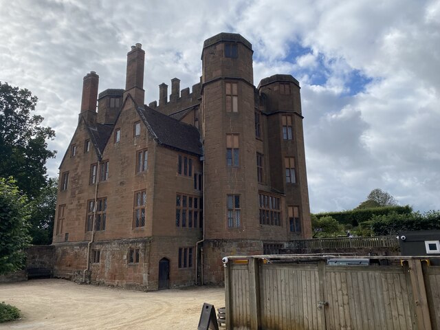
Kenilworth Castle

Kenilworth Castle is a castle in the town of Kenilworth in Warwickshire, England, managed by English Heritage; much of it is still in ruins. The castle...

Siege of Kenilworth

The siege of Kenilworth (21 June – December 1266), also known as the great siege of 1266, was a six-month siege of Kenilworth Castle and a battle of the...

Warwick Medical School

Warwick Medical School is the medical school of the University of Warwick and is located in Coventry, United Kingdom. It was opened in 2000 in partnership...

Nearby Amenities

Located within 500m of 52.361619,-1.5751698
Maxheight: 4.41
Source: Warwicks OpenData
Lat/Long: 52.3652978/-1.5789434
The data included in this document is from www.openstreetmap.org. The data is made available under ODbL.

Have you been to Crackley Wood?

Leave your review of Crackley Wood below (or comments, questions and feedback).