Little Hawksworth Wood

Wood, Forest in Yorkshire

England

Little Hawksworth Wood

Brick effect box, Landseer Road A recent addition to the Bramley Tate outdoor gallery.
Brick effect box, Landseer Road Credit: Stephen Craven

Little Hawksworth Wood is a charming woodland located in the county of Yorkshire, England. Situated in the heart of the picturesque Hawksworth village, this forested area covers approximately 50 acres of land. It is a popular destination for nature enthusiasts, hikers, and families seeking a tranquil escape from the hustle and bustle of urban life.

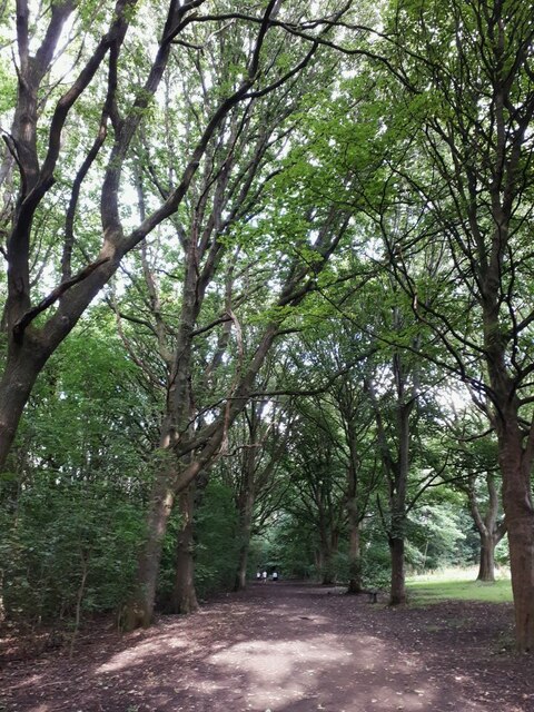
The wood boasts a diverse range of tree species, including oak, birch, beech, and ash, creating a rich and varied ecosystem. The dense canopy provides a home for numerous bird species, and visitors may be lucky enough to spot woodpeckers, jays, and various songbirds. The forest floor is also teeming with wildlife, with rabbits, squirrels, and deer frequently spotted by observant visitors.

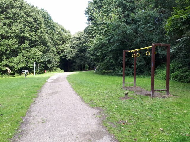
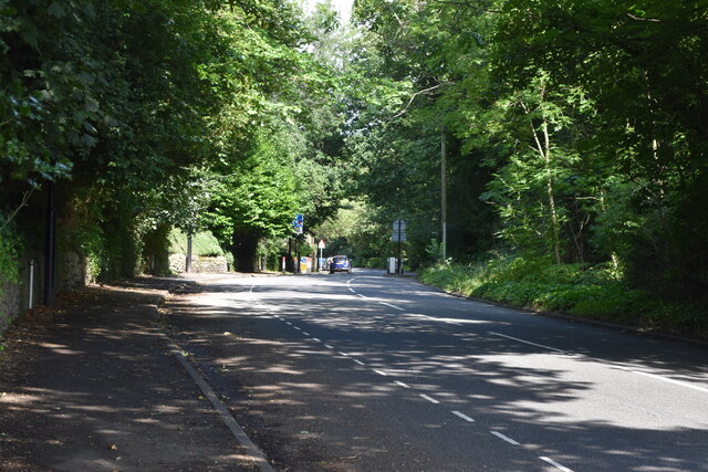
A network of well-maintained footpaths winds its way through Little Hawksworth Wood, allowing visitors to explore the area at their own pace. These paths lead to several scenic viewpoints, providing panoramic vistas of the surrounding countryside. Additionally, there are picnic areas dotted throughout the woodland, providing a perfect spot for visitors to relax and enjoy a bite to eat amidst the serene surroundings.

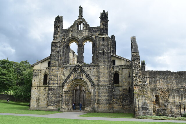
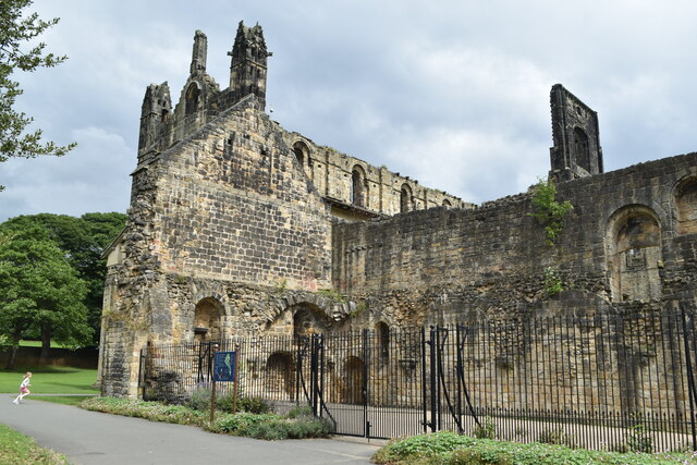
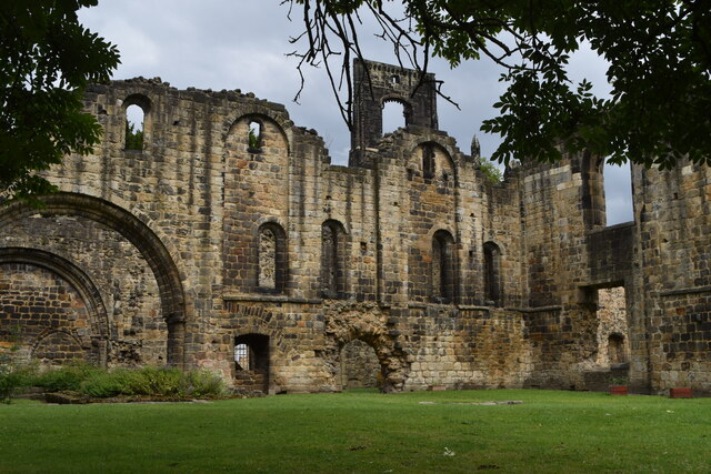
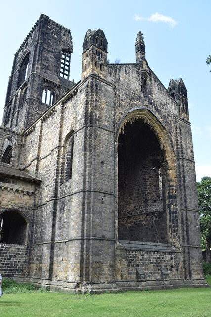
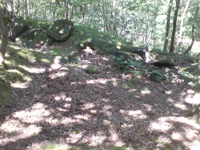
Little Hawksworth Wood is also steeped in history, with remnants of ancient earthworks and stone features scattered throughout the area. These archaeological sites serve as a reminder of the wood's rich heritage and provide an intriguing glimpse into the past.

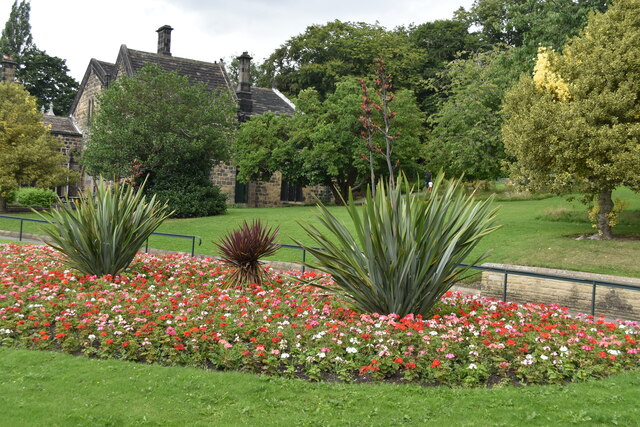
Overall, Little Hawksworth Wood offers a peaceful and idyllic setting for individuals to connect with nature. Whether it be a leisurely stroll, a picnic with loved ones, or a birdwatching expedition, this enchanting woodland provides a wonderful escape into the natural beauty of Yorkshire.

If you have any feedback on the listing, please let us know in the comments section below.

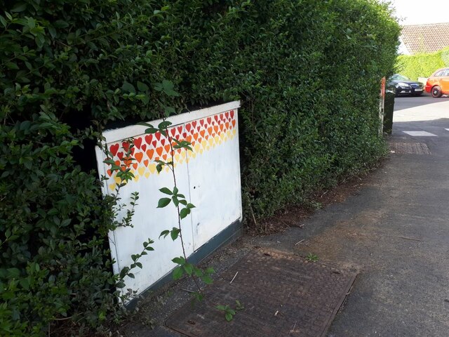
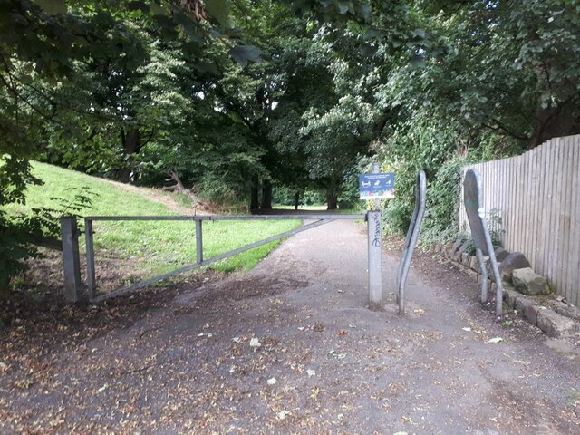
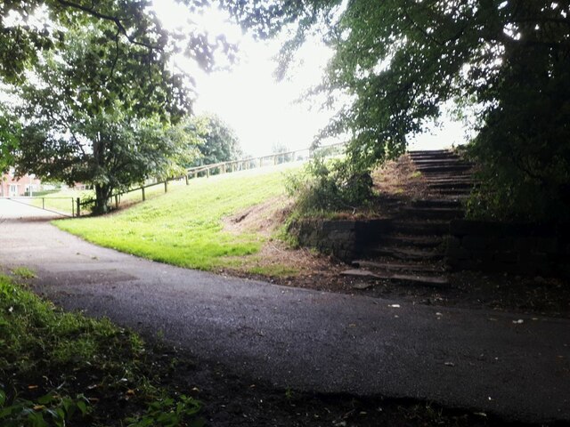
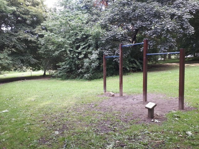
Little Hawksworth Wood Images

Images are sourced within 2km of 53.830951/-1.627489 or Grid Reference SE2437. Thanks to Geograph Open Source API. All images are credited.

Brick effect box, Landseer Road A recent addition to the Bramley Tate outdoor gallery.
Brick effect box, Landseer Road
A recent addition to the Bramley Tate outdoor gallery.
Sold: one garage The householder on Waterloo Lane is having an extension built, and there was a sign on the fence saying "Garage for sale". Obviously they found a buyer, as only the garage door and concrete floor slab panels remained, stacked against the side fence.

To the left is a path cutting through to Wellington Gardens <a href="https://www.geograph.org.uk/photo/4775123">SE2435 : Footpath from Waterloo Lane to Wellington Gardens</a>.
Sold: one garage
The householder on Waterloo Lane is having an extension built, and there was a sign on the fence saying "Garage for sale". Obviously they found a buyer, as only the garage door and concrete floor slab panels remained, stacked against the side fence. To the left is a path cutting through to Wellington Gardens SE2435 : Footpath from Waterloo Lane to Wellington Gardens.
Tutti Frutti A recent addition, I think, to the painted boxes in this area.  I've included it in the shared description for Bramley Tate but this one is credited to "Leeds West Rocks" which may be a different group of people. The artwork is to encourage healthy eating.
Tutti Frutti
A recent addition, I think, to the painted boxes in this area. I've included it in the shared description for Bramley Tate but this one is credited to "Leeds West Rocks" which may be a different group of people. The artwork is to encourage healthy eating.
Rainbow box A recent addition, I think, to the painted boxes in this area by Bramley Tate. This one is on the corner of Ganners Hill and Wellington Grove.
Rainbow box
A recent addition, I think, to the painted boxes in this area by Bramley Tate. This one is on the corner of Ganners Hill and Wellington Grove.
Box with coloured hearts A recent addition, I think, to the painted boxes in this area by Bramley Tate. This one is on the corner of Ganners Hill and Ganners Road.
Box with coloured hearts
A recent addition, I think, to the painted boxes in this area by Bramley Tate. This one is on the corner of Ganners Hill and Ganners Road.
Entrance to Bramley Fall woods  This entrance is off Leeds and Bradford Road, just east of the football pitches.
Entrance to Bramley Fall woods
This entrance is off Leeds and Bradford Road, just east of the football pitches.
Steps out of Bramley Fall woods  There was a deep contrast between the sunlit playing fields to the left, and the shade of the woods.  The steps are also seen in <a href="https://www.geograph.org.uk/photo/3477659">SE2436 : Steps - Bramley Fall Park</a>.
Steps out of Bramley Fall woods
There was a deep contrast between the sunlit playing fields to the left, and the shade of the woods. The steps are also seen in SE2436 : Steps - Bramley Fall Park.
Bramley Fall exercise trail: horizontal bars  One of several fitness stations around a trail through the wood. I presume these are for swinging by the arms.
Bramley Fall exercise trail: horizontal bars
One of several fitness stations around a trail through the wood. I presume these are for swinging by the arms.
Bramley Fall exercise trail: strap hangers One of several fitness stations around a trail through the wood. These look like essential training equipment for would-be London commuters.
Bramley Fall exercise trail: strap hangers
One of several fitness stations around a trail through the wood. These look like essential training equipment for would-be London commuters.
Bramley Fall : avenue of trees Part of the main bridleway circuit of the woods.
Bramley Fall : avenue of trees
Part of the main bridleway circuit of the woods.
Kirkstall Abbey, west front
Kirkstall Abbey, west side
Kirkstall Abbey, southwest corner
Kirkstall Abbey, east window
Hawksworth Road
Hawksworth Road
Flower bed, Kirkstall Abbey Park
Kirkstall Abbey ruins
Hawksworth Road
Hawksworth Road
Show me another place!

Little Hawksworth Wood is located at Grid Ref: SE2437 (Lat: 53.830951, Lng: -1.627489)

Division: West Riding

Unitary Authority: Leeds

Police Authority: West Yorkshire

What 3 Words

///safe.loud.racks. Near Horsforth, West Yorkshire

Related Wikis

Kirkstall Forge railway station

Kirkstall Forge railway station is a station serving the Kirkstall area of Leeds, West Yorkshire, England. It is on the Leeds to Bradford Line between...

Newlay

Newlay is a suburb of Horsforth, in West Yorkshire, England. Originally a hamlet, it is now part of Horsforth parish in the City of Leeds District, and...

Newlay and Horsforth railway station

Newlay and Horsforth railway station, until 1889 and from 1961 called Newlay station, was a station on the route of the former Leeds and Bradford Railway...

Bramley Fall stone

Bramley Fall Stone stone belongs to the Millstone Grit series, of the Namurian stage of the Carboniferous Period. It is one of the cheapest and best-adapted...

Hawksworth, Leeds

Hawksworth is a small, early twentieth-century council estate in the Kirkstall ward in Leeds, West Yorkshire, England. It is situated on a hill between...

Grove Methodist Church

The Grove Methodist Church is a Grade II listed Methodist church in the village of Horsforth, Leeds, England, part of the Leeds South and West Methodist...

Horsforth Woodside railway station

Horsforth Woodside was a proposed railway station that was to be built on the site of Woodside Quarry near Horsforth in West Yorkshire, England. It would...

Horsforth

Horsforth is a town and civil parish in the City of Leeds, West Yorkshire, England, five miles north-west of Leeds city centre. Historically a village...

Nearby Amenities

Located within 500m of 53.830951,-1.627489
Cycleway: asl
Lat/Long: 53.8282757/-1.6271031
New Road Side Hawksworth Road
Bus: yes
Public Transport: stop_position
Lat/Long: 53.8295325/-1.6297124
Waterway: weir
Lat/Long: 53.8278841/-1.6322773
Turning Circle
Lat/Long: 53.8321935/-1.6279835
Barrier: block
Bicycle: yes
Foot: yes
Horse: yes
Motor Vehicle: no
Lat/Long: 53.8341814/-1.6309057
Post Box
Check Date: 2021-01-23
Collection Times: Mo-Fr 09:00, Sa 07:00
Operator: Royal Mail
Post Box Type: wall
Ref: LS18 260
Royal Cypher: EIIR
Royal Cypher Wikidata: Q33102113
Lat/Long: 53.8293432/-1.6288338
Post Box
Operator: Royal Mail
Post Box Type: lamp
Ref: LS18 780
Lat/Long: 53.8313014/-1.6291811
Turning Circle
Lat/Long: 53.8306776/-1.6312534
Turning Circle
Lat/Long: 53.8309088/-1.6302043
Bus Stop
New Road Side Hawksworth Road
Bench: no
Bin: no
Bus: yes
Departures Board: timetable
Kerb: raised
Lit: no
Local Ref: 45011574
Naptan AtcoCode: 450011574
Naptan Bearing: NW
Naptan CommonName: New Road Side Hawksworth Road
Naptan Crossing: Hawksworth Road
Naptan Indicator: Stop 45011574
Naptan Notes: Pole re-located (stone shelter end dated) 020207
Naptan PlusbusZoneRef: LEEDS
Naptan ShortCommonName: Hawksworth Road
Naptan Street: New Road Side
Naptan Verified: yes
Public Transport: platform
Shelter: no
Source: naptan_import;photograph
Tactile Paving: no
Lat/Long: 53.8294841/-1.6297669
Bus Stop
New Road Side Oliver Hill
Bench: yes
Bin: yes
Bus: yes
Departures Board: realtime
Kerb: raised
Lit: yes
Local Ref: 45011576
Naptan AtcoCode: 450011576
Naptan Bearing: W
Naptan CommonName: New Road Side Oliver Hill
Naptan Crossing: Oliver Hill
Naptan Indicator: Stop 45011576
Naptan PlusbusZoneRef: LEEDS
Naptan ShortCommonName: Oliver Hill
Naptan Street: New Road Side
Naptan Verified: yes
Public Transport: platform
Shelter: yes
Source: naptan_import
Tactile Paving: no
Timetable: yes
Lat/Long: 53.8304665/-1.6327857
Bus Stop
New Road Side Hawksworth Road
Bench: yes
Bin: yes
Bus: yes
Departures Board: realtime
Kerb: raised
Lit: yes
Local Ref: 45011577
Naptan AtcoCode: 450011577
Naptan Bearing: SE
Naptan CommonName: New Road Side Hawksworth Road
Naptan Crossing: Hawksworth Road
Naptan Indicator: Stop 45011577
Naptan PlusbusZoneRef: LEEDS
Naptan ShortCommonName: Hawksworth Road
Naptan Street: New Road Side
Public Transport: platform
Shelter: yes
Source: naptan_import
Tactile Paving: no
Towards: Kirkstall, Leeds
Wheelchair: yes
Lat/Long: 53.829075/-1.628313
Bus Stop
New Road Side Oliver Hill
Bench: no
Bin: no
Bus: yes
Kerb: raised
Lit: yes
Local Ref: 45011578
Naptan AtcoCode: 450011578
Naptan Bearing: SE
Naptan CommonName: New Road Side Oliver Hill
Naptan Crossing: Oliver Hill
Naptan Indicator: Stop 45011578
Naptan Landmark: Nursing Home
Naptan PlusbusZoneRef: LEEDS
Naptan ShortCommonName: Oliver Hill
Naptan Street: New Road Side
Naptan Verified: no
Public Transport: platform
Shelter: no
Source: naptan_import
Tactile Paving: no
Lat/Long: 53.8304476/-1.6321539
Direction: both
Traffic Calming: hump
Lat/Long: 53.8294243/-1.6203404
Direction: both
Traffic Calming: hump
Lat/Long: 53.8280432/-1.6235974
Barrier: kissing_gate
Material: metal
Lat/Long: 53.8344562/-1.6276937
Turning Circle
Lat/Long: 53.8338097/-1.6324662
Post Box
Collection Times: Mo-Fr 09:00; Sa 07:00
Operator: Royal Mail
Post Box Type: wall
Ref: LS18 384
Royal Cypher: EIIR
Royal Cypher Wikidata: Q33102113
Lat/Long: 53.8308655/-1.6346315
Social Facility
Sandywood Court
Addr City: Leeds
Addr Housename: Sandywood Court
Addr Postcode: LS18 4JA
Addr Street: New Road Side
Addr Suburb: Horsforth
Operator: Headrow
Social Facility: group_home
Social Facility For: senior
Wheelchair: yes
Lat/Long: 53.8311741/-1.6340845
Direction: both
Traffic Calming: hump
Lat/Long: 53.8279274/-1.6219501
Barrier: kerb
Kerb: flush
Tactile Paving: yes
Lat/Long: 53.8284846/-1.6276114
Traffic Signals
Traffic Signals: signal
Lat/Long: 53.8284161/-1.6275524
Traffic Signals
Traffic Signals: signal
Lat/Long: 53.8283848/-1.6274934
Give Way
Lat/Long: 53.8275196/-1.6288501
Waste Basket
Collection Times: weekly
Ref UK Leedscc Bin: 2257
Lat/Long: 53.830521/-1.633138
Waste Basket
Collection Times: weekly
Ref UK Leedscc Bin: 2256
Lat/Long: 53.829989/-1.630675
Waste Basket
Collection Times: weekly
Ref UK Leedscc Bin: 2491
Lat/Long: 53.831384/-1.633974
Waste Basket
Collection Times: weekly
Ref UK Leedscc Bin: 2255
Lat/Long: 53.829148/-1.628995
Waste Basket
Collection Times: weekly
Ref UK Leedscc Bin: 2492
Lat/Long: 53.831466/-1.632117
Hawksworth Wood
Information: map
Tourism: information
Lat/Long: 53.8286668/-1.6272502
Bench
Backrest: no
Material: wood
Lat/Long: 53.8344815/-1.6277477
Barrier: kissing_gate
Material: metal
Lat/Long: 53.834404/-1.6269288
Information: map
Tourism: information
Lat/Long: 53.8339931/-1.6255748
Direction: 310
Tourism: viewpoint
Lat/Long: 53.8300511/-1.6224345
Bench
Backrest: no
Material: wood
Lat/Long: 53.8300308/-1.6224345
Waste Basket
Lat/Long: 53.8312884/-1.6289611
Information: board
Tourism: information
Lat/Long: 53.8311898/-1.6290367
Traffic Signals
Lat/Long: 53.8282401/-1.6270715
Cycleway: asl
Lat/Long: 53.8284129/-1.6274524
Cycleway: asl
Lat/Long: 53.8284533/-1.6275457
Cycleway: asl
Lat/Long: 53.8286108/-1.627378
Crossing
Button Operated: yes
Crossing: traffic_signals
Tactile Paving: yes
Traffic Signals Sound: no
Traffic Signals Vibration: yes
Lat/Long: 53.8285855/-1.6273418
Crossing
Button Operated: yes
Crossing: traffic_signals
Tactile Paving: yes
Traffic Signals Sound: no
Traffic Signals Vibration: yes
Lat/Long: 53.8285129/-1.627404
Turning Circle
Lat/Long: 53.8287586/-1.628974
Barrier: cycle_barrier
Cycle Barrier: triple
Cycle Barrier Installation: fixed
Lat/Long: 53.8280218/-1.6237326
Traffic Signals
Traffic Signals: signal
Lat/Long: 53.8286381/-1.6274236
New Road Side Oliver Hill
Bus: yes
Public Transport: stop_position
Lat/Long: 53.8305042/-1.6327738
New Road Side Oliver Hill
Bus: yes
Public Transport: stop_position
Lat/Long: 53.8303783/-1.6321958
New Road Side Hawksworth Road
Bus: yes
Public Transport: stop_position
Lat/Long: 53.8290115/-1.6283689
Crossing
Button Operated: yes
Crossing: traffic_signals
Crossing Island: yes
Cycleway: asl
Kerb: flush
Tactile Paving: yes
Traffic Signals Sound: no
Traffic Signals Vibration: yes
Lat/Long: 53.829324/-1.6291796
Generator Method: photovoltaic
Generator Output Electricity: yes
Generator Source: solar
Generator Type: solar_photovoltaic_panel
Power: generator
Lat/Long: 53.8294688/-1.6346272
Information: board
Tourism: information
Lat/Long: 53.8331336/-1.6336852
Crossing
Crossing: marked
Crossing Signals: no
Lat/Long: 53.829337/-1.6286427
Cragg Hill
Place: suburb
Lat/Long: 53.8311652/-1.6348351
The data included in this document is from www.openstreetmap.org. The data is made available under ODbL.

Have you been to Little Hawksworth Wood?

Leave your review of Little Hawksworth Wood below (or comments, questions and feedback).