Tolls Wood

Wood, Forest in Derbyshire Derbyshire Dales

England

Tolls Wood

A barn in a field of buttercup Late May and this stone barn opposite Haddon Hall is surrounded by a sea of yellow buttercups.
A barn in a field of buttercup Credit: Philip Halling

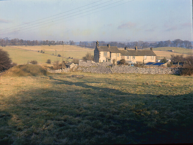
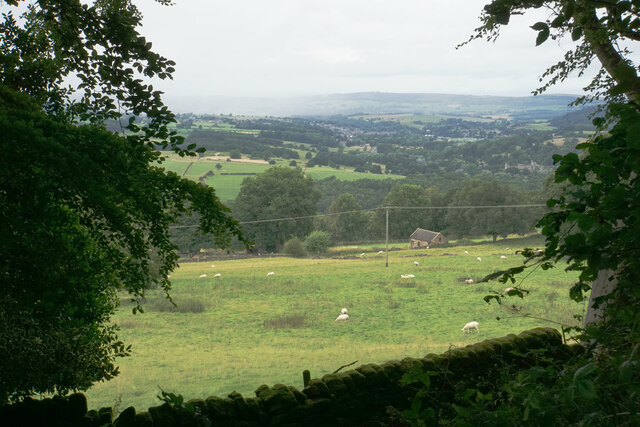
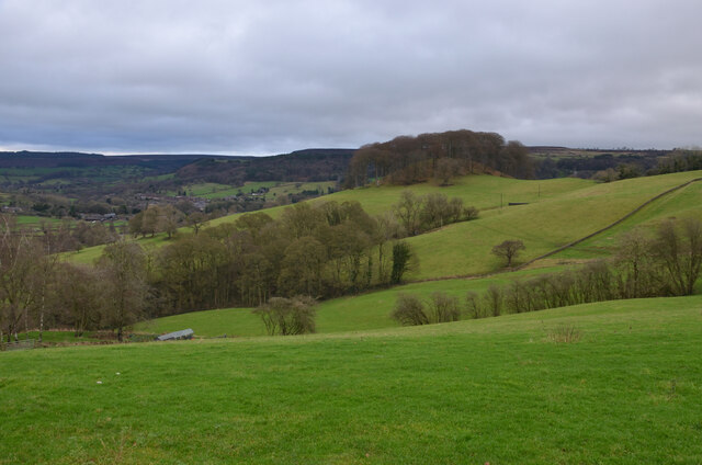
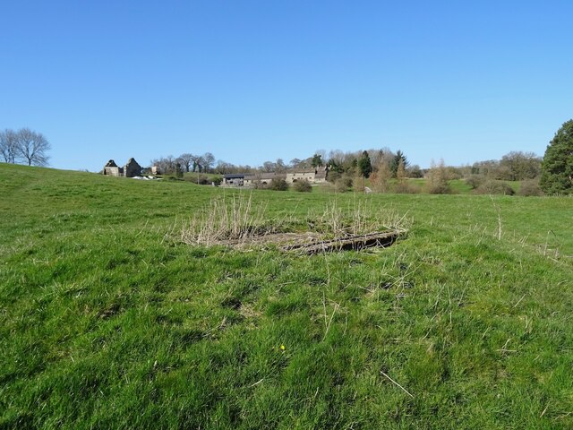
Tolls Wood, located in Derbyshire, is a picturesque woodland area known for its natural beauty and rich biodiversity. Spanning over a vast area, this forested land offers a serene escape from the hustle and bustle of city life.

The wood is predominantly composed of deciduous trees, creating a stunning display of vibrant colors during the autumn season. Oak, beech, and ash trees dominate the landscape, providing a dense canopy that filters sunlight, casting dappled shadows on the forest floor.

Tolls Wood is home to a diverse range of flora and fauna. Wildflowers such as bluebells, primroses, and wood anemones bloom in abundance during spring, creating a colorful tapestry. The forest floor is also carpeted with ferns and mosses, adding to the enchanting atmosphere.

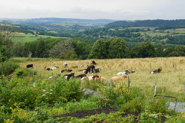
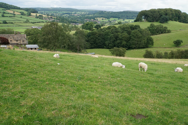
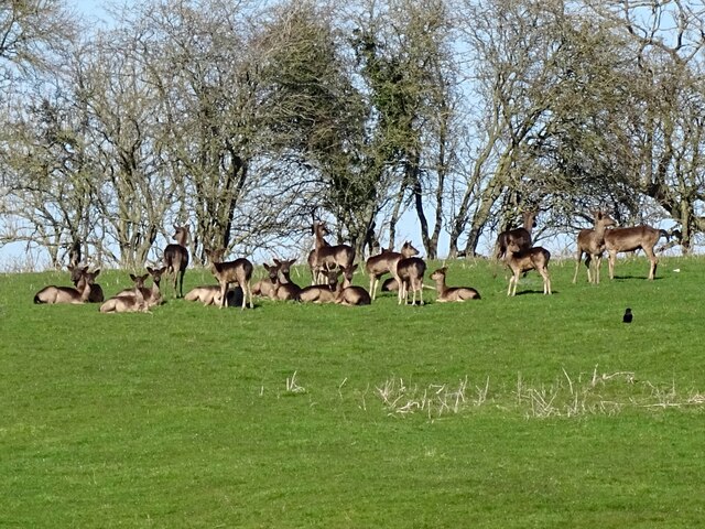
The woodland is a haven for wildlife, with various species making it their habitat. Visitors may spot native animals like deer, squirrels, birds, and, if lucky, even the elusive red fox. Birdwatchers often flock to the area to catch a glimpse of resident and migratory species, including woodpeckers, owls, and songbirds.

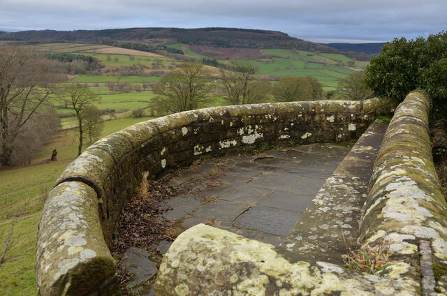
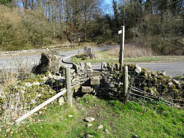
Tolls Wood offers several well-maintained walking trails that provide visitors with an opportunity to explore the forest at their own pace. These trails wind through the forest, allowing hikers to immerse themselves in the peaceful and tranquil surroundings. During the walk, visitors may come across babbling brooks, small ponds, and hidden clearings that add to the charm of the wood.

Overall, Tolls Wood is a natural gem, offering an idyllic setting for nature lovers, hikers, and those seeking solace in the beauty of the great outdoors.

If you have any feedback on the listing, please let us know in the comments section below.

Tolls Wood Images

Images are sourced within 2km of 53.18119/-1.6529349 or Grid Reference SK2364. Thanks to Geograph Open Source API. All images are credited.

A barn in a field of buttercup Late May and this stone barn opposite Haddon Hall is surrounded by a sea of yellow buttercups.
A barn in a field of buttercup
Late May and this stone barn opposite Haddon Hall is surrounded by a sea of yellow buttercups.
Broadmeadow Shaft Adjacent to the cottages here, which were once the offices of the Alport Mining Company, can be seen a large mound which marks the site of the Broadmeadow Shaft on the Alport mines. This company was an amalgamation of various separate mining concerns and operated the very rich lead mines of this area. They were classed as the most heavily watered mines in the country and suffered from inflows of more than 6000 gallons a minute. Consequently, heavy pumping was necessary, chiefly by water pressure engines which used a column of water to power them. The well known Cornish engineer, Richard Trevithick was consulted and he was responsible for the first of many such underground machines within this region. Water to power the engine in this shaft was taken from the River Lathkill and over Alport village in wooden launders and then by a tunnel to the shaft. All the pumped water, along with that used by the engines (of which there were upwards of seven scattered throughout the workings) was drained away by the deep Hillcarr Sough, a tunnel driven from the River Derwent near Darley Dale.
Broadmeadow Shaft
Adjacent to the cottages here, which were once the offices of the Alport Mining Company, can be seen a large mound which marks the site of the Broadmeadow Shaft on the Alport mines. This company was an amalgamation of various separate mining concerns and operated the very rich lead mines of this area. They were classed as the most heavily watered mines in the country and suffered from inflows of more than 6000 gallons a minute. Consequently, heavy pumping was necessary, chiefly by water pressure engines which used a column of water to power them. The well known Cornish engineer, Richard Trevithick was consulted and he was responsible for the first of many such underground machines within this region. Water to power the engine in this shaft was taken from the River Lathkill and over Alport village in wooden launders and then by a tunnel to the shaft. All the pumped water, along with that used by the engines (of which there were upwards of seven scattered throughout the workings) was drained away by the deep Hillcarr Sough, a tunnel driven from the River Derwent near Darley Dale.
Cottages in Stanton in Peak A long thin village climbing the hillside. A shower is passing a couple of miles to the north.
Cottages in Stanton in Peak
A long thin village climbing the hillside. A shower is passing a couple of miles to the north.
Field near Stanton in Peak A view from the top of the village, which is off to the left.
Field near Stanton in Peak
A view from the top of the village, which is off to the left.
Cottages in Stanton in Peak Near the bottom of the long thin village.
Cottages in Stanton in Peak
Near the bottom of the long thin village.
Field at Stanton in Peak Right at the bottom of the village.
Field at Stanton in Peak
Right at the bottom of the village.
Stanton in Peak From the bottom of the village looking up. The spire of Holy Trinity Church is seen but the village continues quite a long way past that.
Stanton in Peak
From the bottom of the village looking up. The spire of Holy Trinity Church is seen but the village continues quite a long way past that.
Stanton in Peak The village pub, the Flying Childers, is straight ahead, and the spire of Holy Trinity Church is behind.
Stanton in Peak
The village pub, the Flying Childers, is straight ahead, and the spire of Holy Trinity Church is behind.
Allotments and cattle at Stanton in Peak Looking down on the valley of the River Wye where Haddon Hall can be seen.
Allotments and cattle at Stanton in Peak
Looking down on the valley of the River Wye where Haddon Hall can be seen.
Sheep above Congreave Looking towards Rowsley down the Wye valley.
Sheep above Congreave
Looking towards Rowsley down the Wye valley.
Viewpoint by Pilhough Lane, near Stanton, Derbyshire A viewing point over the lower valley of the River Wye in the Derbyshire Peak District.
Viewpoint by Pilhough Lane, near Stanton, Derbyshire
A viewing point over the lower valley of the River Wye in the Derbyshire Peak District.
Pastures at Congreave, near Rowsley, Derbyshire
Old barn on the edge of Alport Not yet converted into a luxury residence.
Old barn on the edge of Alport
Not yet converted into a luxury residence.
A herd of deer
A herd of deer
Old lead shaft capped with concrete Harthill Hall is in the background
Old lead shaft capped with concrete
Harthill Hall is in the background
Step stile and fingerpost Off the B5056 at the junction with Birchover Road.
Step stile and fingerpost
Off the B5056 at the junction with Birchover Road.
Children's play area
Haddon Road (A6) The A6 is Britain's fourth longest road and one of the main historic north-south roads in England. It currently runs for 299 miles from Luton in Bedfordshire to Carlisle in Cumbria, although it formerly started at a junction with the A1 at Barnet.

Running north west from Luton, the road travels through Bedford, bypasses Rushden, Kettering and Market Harborough, continues through Leicester, Loughborough, Derby and Matlock before going through the Peak District to Bakewell, Buxton, Stockport, Manchester, Salford, Pendleton, Irlams o' th' Height, Pendlebury, Swinton, Walkden, Little Hulton, Bolton, Chorley, Preston, Lancaster, Kendal and Penrith before reaching Carlisle.

See <span class="nowrap"><a title="http://en.wikipedia.org/wiki/A6_road_(England)" rel="nofollow ugc noopener" href="http://en.wikipedia.org/wiki/A6_road_(England)">Link</a><img style="margin-left:2px;" alt="External link" title="External link - shift click to open in new window" src="https://s1.geograph.org.uk/img/external.png" width="10" height="10"/></span> (Wikipedia) and <span class="nowrap"><a title="http://www.sabre-roads.org.uk/wiki/index.php?title=A6" rel="nofollow ugc noopener" href="http://www.sabre-roads.org.uk/wiki/index.php?title=A6">Link</a><img style="margin-left:2px;" alt="External link" title="External link - shift click to open in new window" src="https://s1.geograph.org.uk/img/external.png" width="10" height="10"/></span> (SABRE) for more information.
Haddon Road (A6)
The A6 is Britain's fourth longest road and one of the main historic north-south roads in England. It currently runs for 299 miles from Luton in Bedfordshire to Carlisle in Cumbria, although it formerly started at a junction with the A1 at Barnet. Running north west from Luton, the road travels through Bedford, bypasses Rushden, Kettering and Market Harborough, continues through Leicester, Loughborough, Derby and Matlock before going through the Peak District to Bakewell, Buxton, Stockport, Manchester, Salford, Pendleton, Irlams o' th' Height, Pendlebury, Swinton, Walkden, Little Hulton, Bolton, Chorley, Preston, Lancaster, Kendal and Penrith before reaching Carlisle. See LinkExternal link (Wikipedia) and LinkExternal link (SABRE) for more information.
Show me another place!

Tolls Wood is located at Grid Ref: SK2364 (Lat: 53.18119, Lng: -1.6529349)

Administrative County: Derbyshire

District: Derbyshire Dales

Police Authority: Derbyshire

What 3 Words

///surveyors.tastes.path. Near Youlgreave, Derbyshire

Related Wikis

Harthill Hall

Harthill Hall was formerly the Manor House of a great 13th century Estate, and the hall is now a Grade II listed building within the civil parish of Harthill...

Stanton in Peak

Stanton in Peak (also written as Stanton-in-Peak) is a village in the Derbyshire Dales district of Derbyshire, It is about seven miles north-west of Matlock...

Holy Trinity Church, Stanton-in-Peak

Holy Trinity Church, Stanton-in-Peak is a Grade II listed parish church in the Church of England in Stanton in Peak, Derbyshire. == History == The church...

Stanton Hall, Stanton in Peak

Stanton Hall is a privately owned country house at Stanton in Peak in the Derbyshire Peak District, the home of the Davie-Thornhill family. It is a Grade...

Alport

Alport is a hamlet in the White Peak area of Derbyshire, England. It lies east of Youlgreave, at the confluence of the River Bradford and the River Lathkill...

Nether Haddon

Nether Haddon is a sparsely populated village and civil parish in Derbyshire, England. It is immediately downstream along the River Wye from the small...

River Lathkill

The River Lathkill is a river in the Peak District National Park in Derbyshire, England. First recorded in 1280, the name "Lathkill" possibly has Scandinavian...

River Bradford

The River Bradford is a river in the Peak District National Park in Derbyshire. Its source is on Gratton Moor and after passing below Youlgreave it joins...

Nearby Amenities

Located within 500m of 53.18119,-1.6529349
Fixme: Where does this path branch off north?
Lat/Long: 53.1817113/-1.655178
Stop
Direction: backward
Lat/Long: 53.1802714/-1.6552458
The data included in this document is from www.openstreetmap.org. The data is made available under ODbL.

Have you been to Tolls Wood?

Leave your review of Tolls Wood below (or comments, questions and feedback).