Arnaby

Settlement in Cumberland Copeland

England

Arnaby

A5093 at The Green village boundary
A5093 at The Green village boundary Credit: Colin Pyle

Arnaby is a small town located in the County of Cumberland, in the northwest region of England. Situated in the picturesque Cumbrian countryside, Arnaby boasts a population of around 2,000 residents. The town is nestled between rolling hills and enjoys easy access to the nearby Lake District National Park, making it an ideal destination for nature enthusiasts and outdoor lovers.

Historically, Arnaby was known for its thriving coal mining industry, which played a significant role in the town's development during the 19th and early 20th centuries. However, with the decline of the mining industry, Arnaby has shifted its focus towards tourism and agriculture.

Visitors to Arnaby can expect to find charming stone cottages, traditional pubs, and a friendly community. The town center features a variety of local shops, cafes, and restaurants, offering a range of shopping and dining options. The annual Arnaby Agricultural Show, held every summer, is a popular event that showcases the region's agricultural heritage, attracting visitors from near and far.

Outdoor activities are abundant in the surrounding area, with numerous walking trails, cycling routes, and fishing spots. The nearby Lake District National Park offers breathtaking landscapes, including serene lakes, rugged mountains, and picturesque villages. Visitors can take advantage of the park's many hiking trails, boat trips, and outdoor recreational activities.

In summary, Arnaby is a quaint town in Cumberland that offers a tranquil setting, rich history, and access to the stunning natural beauty of the Lake District National Park. Whether you are seeking a peaceful getaway or an adventurous outdoor experience, Arnaby is sure to captivate visitors with its charm and scenic surroundings.

If you have any feedback on the listing, please let us know in the comments section below.
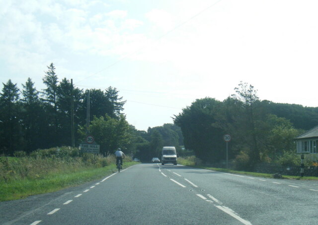
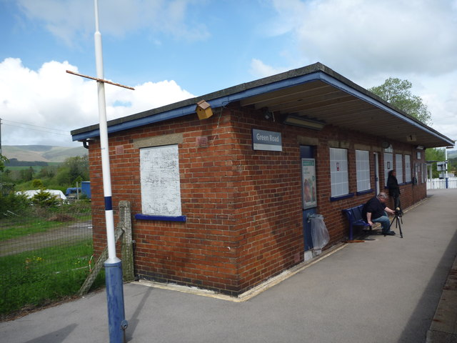
Arnaby Images

Images are sourced within 2km of 54.252162/-3.255344 or Grid Reference SD1884. Thanks to Geograph Open Source API. All images are credited.

A5093 at The Green village boundary
A5093 at The Hill village boundary
The Punch Bowl Inn, The Green, Millom
Ordnance Survey Cut Mark This OS cut mark can be found adjacent to the letter box at Broadgate. It marks a point 107.274m above mean sea level.
Ordnance Survey Cut Mark
This OS cut mark can be found adjacent to the letter box at Broadgate. It marks a point 107.274m above mean sea level.
Ordnance Survey Cut Mark This OS cut mark can be found on Old Hall Cottage. It marks a point 39.156m above mean sea level.
Ordnance Survey Cut Mark
This OS cut mark can be found on Old Hall Cottage. It marks a point 39.156m above mean sea level.
Ordnance Survey Cut Mark This OS cut mark can be found on Briar Dene. It marks a point 19.020m above mean sea level.
Ordnance Survey Cut Mark
This OS cut mark can be found on Briar Dene. It marks a point 19.020m above mean sea level.
SRPS Cumbrian Coast Railtour 2018 : Green Road Station
SRPS Cumbrian Coast Railtour 2018 : Signal Post Before Duddon Viaduct
SRPS Cumbrian Coast Railtour 2018 : Approaching Duddon Viaduct
Boundary Stone Toppled and damaged, over stream, south side of the A595.
Boundary Stone
Toppled and damaged, over stream, south side of the A595.
Ordnance Survey Cut Mark This OS cut mark can be found on the rock face NE side of the road. It marks a point 56.565m above mean sea level.
Ordnance Survey Cut Mark
This OS cut mark can be found on the rock face NE side of the road. It marks a point 56.565m above mean sea level.
Ordnance Survey Cut Mark This OS cut mark can be found on the Village Hall SE side of the road. It marks a point 51.075m above mean sea level.
Ordnance Survey Cut Mark
This OS cut mark can be found on the Village Hall SE side of the road. It marks a point 51.075m above mean sea level.
Ordnance Survey Cut Mark This OS cut mark can be found on the gatepost south side of the road. It marks a point 59.576m above mean sea level.
Ordnance Survey Cut Mark
This OS cut mark can be found on the gatepost south side of the road. It marks a point 59.576m above mean sea level.
Ordnance Survey Cut Mark This OS cut mark can be found on the large boulder in the wall SE side of the road. It marks a point 99.048m above mean sea level.
Ordnance Survey Cut Mark
This OS cut mark can be found on the large boulder in the wall SE side of the road. It marks a point 99.048m above mean sea level.
Ordnance Survey OSBM Bolt This OS Bolt can be found on the large boulder at the side of the barn at Low Broadgate. It marks a point 81.764m above mean sea level.
Ordnance Survey OSBM Bolt
This OS Bolt can be found on the large boulder at the side of the barn at Low Broadgate. It marks a point 81.764m above mean sea level.
Ordnance Survey Cut Mark This OS cut mark can be found on the wall NW side of the road. It marks a point 98.207m above mean sea level.
Ordnance Survey Cut Mark
This OS cut mark can be found on the wall NW side of the road. It marks a point 98.207m above mean sea level.
Ordnance Survey Cut Mark This OS cut mark can be found on the brick building at Waltham Nursery. It marks a point 5.925m above mean sea level.
Ordnance Survey Cut Mark
This OS cut mark can be found on the brick building at Waltham Nursery. It marks a point 5.925m above mean sea level.
Ordnance Survey Cut Mark This OS cut mark can be found on a gatepost SE side of the track. It marks a point 6.172m above mean sea level.
Ordnance Survey Cut Mark
This OS cut mark can be found on a gatepost SE side of the track. It marks a point 6.172m above mean sea level.
Show me another place!

Arnaby is located at Grid Ref: SD1884 (Lat: 54.252162, Lng: -3.255344)

Administrative County: Cumbria

District: Copeland

Police Authority: Cumbria

What 3 Words

///sundial.pins.spreading. Near Millom, Cumbria

Related Wikis

Nearby Amenities

Located within 500m of 54.252162,-3.255344
Traffic Signals
Traffic Signals: traffic_lights
Traffic Signals Direction: backward
Lat/Long: 54.2530966/-3.2624557
Bus Stop
Village Hall
Naptan AtcoCode: 090050164450
Naptan Bearing: E
Naptan BusStopType: CUS
Naptan CommonName: Village Hall
Naptan Indicator: near
Naptan Landmark: Village Hall
Naptan Street: Green Road
Naptan Verified: no
Source: naptan_import
Lat/Long: 54.2505831/-3.2619398
Power: tower
Lat/Long: 54.2498021/-3.2556996
Power: tower
Lat/Long: 54.2536523/-3.2503915
Power: tower
Lat/Long: 54.2516732/-3.2530925
Barrier: stile
Lat/Long: 54.2513619/-3.2589849
Post Box
The Old Post Office
Post Box Type: wall
Lat/Long: 54.2508839/-3.2617051
Power: pole
Lat/Long: 54.2480948/-3.2583151
Power: pole
Lat/Long: 54.2488592/-3.2592124
Power: pole
Lat/Long: 54.2492618/-3.2596698
Power: pole
Lat/Long: 54.249529/-3.2599766
Power: pole
Lat/Long: 54.2499927/-3.260562
Power: pole
Lat/Long: 54.2507331/-3.259554
Power: pole
Lat/Long: 54.2512912/-3.2589114
Power: pole
Lat/Long: 54.2521098/-3.259224
Power: pole
Lat/Long: 54.2527761/-3.2594498
Power: pole
Lat/Long: 54.2535946/-3.2591488
Power: pole
Lat/Long: 54.2541222/-3.2589635
Power: pole
Lat/Long: 54.2547512/-3.2587609
Power: pole
Lat/Long: 54.2555122/-3.2583672
Telephone
Defibrillator
Booth: K6
Colour: red
Covered: booth
Defibrillator Location: inside red phone box near Thwaites Village Hall, The Green
Emergency: defibrillator
Man Made: telephone_box
Lat/Long: 54.2508413/-3.2616009
Turning Circle
Lat/Long: 54.2525674/-3.2614398
Turning Circle
Lat/Long: 54.2514623/-3.2619
Power: pole
Lat/Long: 54.2504148/-3.2609893
Power: pole
Lat/Long: 54.2505323/-3.2617083
Power: pole
Lat/Long: 54.2510791/-3.2619111
Power: pole
Lat/Long: 54.2513031/-3.2620061
Lime Kiln
Historic: yes
Lat/Long: 54.2492873/-3.2573617
Power: pole
Lat/Long: 54.250198/-3.260315
Material: wood
Power: pole
Lat/Long: 54.2532352/-3.262585
Material: wood
Power: pole
Lat/Long: 54.2532806/-3.2622981
Power: pole
Lat/Long: 54.2531831/-3.2607615
Power: pole
Lat/Long: 54.2518658/-3.2549931
Power: pole
Lat/Long: 54.2519248/-3.2561305
Power: pole
Lat/Long: 54.2520096/-3.2576435
The Green
Place: village
Lat/Long: 54.2520418/-3.2619785
Arnaby
Place: hamlet
Source: OS_OpenData_StreetView
Lat/Long: 54.2513958/-3.2552952
Bus Stop
Village Hall
Naptan AtcoCode: 090050162865
Naptan Bearing: W
Naptan BusStopType: CUS
Naptan CommonName: Village Hall
Naptan Indicator: near
Naptan Landmark: Village Hall
Naptan NaptanCode: cumawdga
Naptan Street: Green Road
Naptan Verified: no
Shelter: yes
Source: naptan_import
Lat/Long: 54.2505161/-3.261774
Give Way
Direction: forward
Lat/Long: 54.2505577/-3.2618674
Give Way
Direction: forward
Lat/Long: 54.2508082/-3.2617927
Give Way
Direction: backward
Lat/Long: 54.2506794/-3.2615221
Charging Station
Authentication App: yes
Capacity: 1
Fee: yes
Motorcar: yes
Network: Charge My Street
Operator: Thwaites Village Hall
Parking Fee: no
Payment App: yes
Ref: EG-05724
Socket Type2: 1
Socket Type2 Current: 32
Socket Type2 Output: 22kW
Socket Type2 Voltage: 415
Lat/Long: 54.2502436/-3.2620045
Charging Station
Authentication App: yes
Capacity: 1
Fee: yes
Motorcar: yes
Network: Charge My Street
Operator: Thwaites Village Hall
Parking Fee: no
Payment App: yes
Ref: EG-05725
Socket Type2: 1
Socket Type2 Current: 32
Socket Type2 Output: 22kW
Socket Type2 Voltage: 415
Lat/Long: 54.2502487/-3.2619791
The data included in this document is from www.openstreetmap.org. The data is made available under ODbL.

Have you been to Arnaby?

Leave your review of Arnaby below (or comments, questions and feedback).