Arncliffe

Settlement in Yorkshire Craven

England

Arncliffe

View over bracken towards scars above Cowside Beck from moorland road
View over bracken towards scars above Cowside Beck from moorland road Credit: Roger Templeman

Arncliffe is a small village located in the Craven district of North Yorkshire, England. Situated in the Yorkshire Dales National Park, it lies approximately 10 miles north of Skipton. With a population of around 150 residents, Arncliffe is known for its picturesque setting and untouched natural beauty.

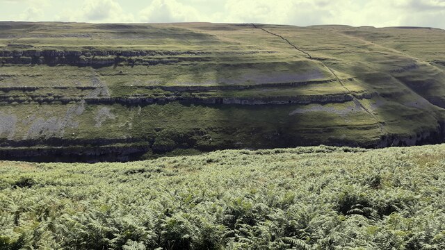
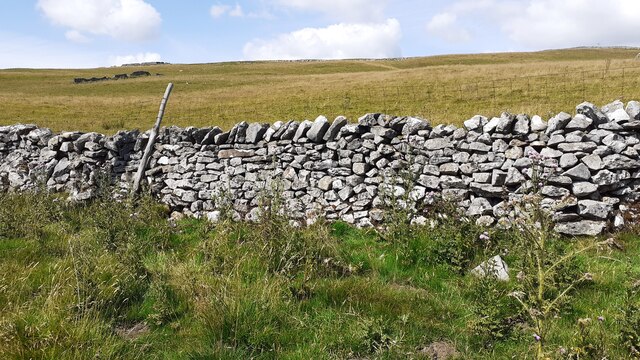
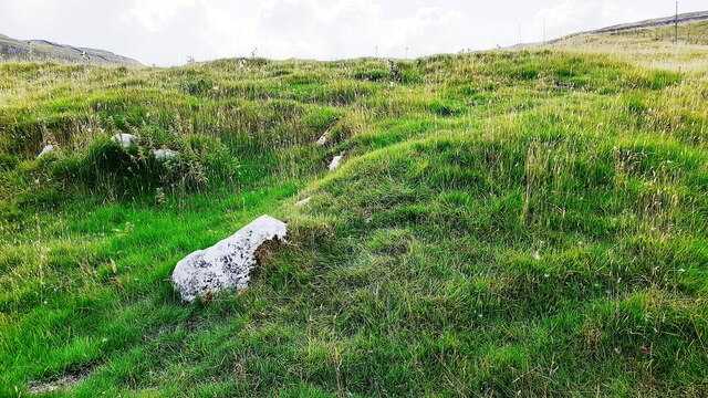
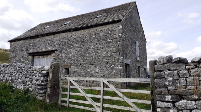
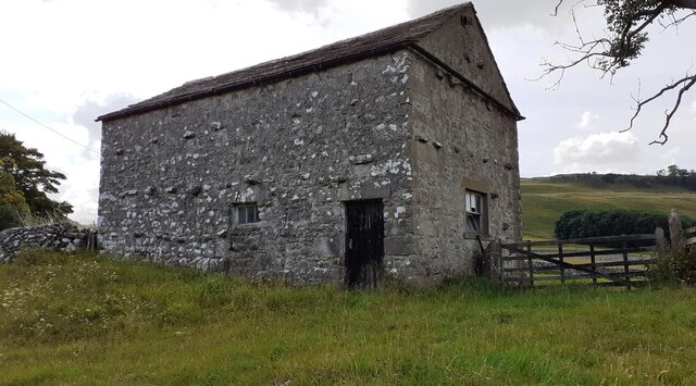
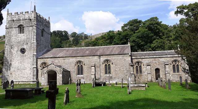
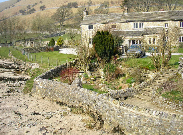
The village is nestled within a valley, surrounded by rolling hills and breathtaking landscapes. It is renowned for its traditional stone-built houses, many of which date back to the 17th and 18th centuries, giving the area a charming and historic ambiance. The local architecture showcases the region's rich cultural heritage.

Arncliffe is also famous for its connection to the popular television series "Emmerdale". The fictional village of Beckindale, where the show was set until 1994, was inspired by Arncliffe. Many fans of the show visit the village to see familiar locations and experience the idyllic countryside that served as a backdrop for the long-running soap opera.

The village offers a peaceful and tranquil atmosphere, making it a popular destination for those seeking a rural retreat. Its proximity to the Yorkshire Dales National Park provides ample opportunities for outdoor activities such as hiking, cycling, and birdwatching. The River Skirfare flows through the village, adding to its charm and providing a serene spot for relaxation.

Although small in size, Arncliffe boasts a strong sense of community. It has a local pub, The Falcon Inn, which serves as a hub for social gatherings and a place to enjoy traditional Yorkshire cuisine and ales. The village also has a primary school, St. Oswald's, which serves the educational needs of the local children.

In conclusion, Arncliffe is a picturesque village in Yorkshire, offering a glimpse into the region's rich history and natural beauty. Its traditional architecture, stunning landscapes, and close-knit community make it a hidden gem in the Yorkshire Dales.

If you have any feedback on the listing, please let us know in the comments section below.

Arncliffe Images

Images are sourced within 2km of 54.142164/-2.106233 or Grid Reference SD9371. Thanks to Geograph Open Source API. All images are credited.

View over bracken towards scars above Cowside Beck from moorland road
Benchmark on stone at base of wall on NW side of road above The Gill Ordnance Survey rivet benchmark levelled at 372.197m above Newlyn Datum verified 1954
Benchmark on stone at base of wall on NW side of road above The Gill
Ordnance Survey rivet benchmark levelled at 372.197m above Newlyn Datum verified 1954
View over roadside dry stone wall of moorland above The Gill There is an Ordnance Survey benchmark <a href="https://www.geograph.org.uk/photo/6924136">SD9170 : Benchmark on stone at base of wall on NW side of road above The Gill</a> on a stone at the base of the wall
View over roadside dry stone wall of moorland above The Gill
There is an Ordnance Survey benchmark SD9170 : Benchmark on stone at base of wall on NW side of road above The Gill on a stone at the base of the wall
Benchmark on boulder in field on SW side of road above Cowside Beck Ordnance Survey pivot benchmark levelled at  336.691m above Newlyn Datum verified 1954
Benchmark on boulder in field on SW side of road above Cowside Beck
Ordnance Survey pivot benchmark levelled at 336.691m above Newlyn Datum verified 1954
View from road SW of Arncliffe towards Cowside Beck valley There is an Ordnance Survey benchmark <a href="https://www.geograph.org.uk/photo/6924198">SD9271 : Benchmark on boulder in field on SW side of road above Cowside Beck</a> on the boulder in the middle foreground
View from road SW of Arncliffe towards Cowside Beck valley
There is an Ordnance Survey benchmark SD9271 : Benchmark on boulder in field on SW side of road above Cowside Beck on the boulder in the middle foreground
Benchmark on rock in NW verge of moorland road west of Brootes Barn Ordnance Survey rivet benchmark levelled at 285.461m above Newlyn Datum verified 1954
Benchmark on rock in NW verge of moorland road west of Brootes Barn
Ordnance Survey rivet benchmark levelled at 285.461m above Newlyn Datum verified 1954
Moorland NW of moorland road west of Brootes Barn There is an Ordnance Survey benchmark <a href="https://www.geograph.org.uk/photo/6924774">SD9271 : Benchmark on rock in NW verge of moorland road west of Brootes Barn</a> on the rock in the verge just left of centre of the image
Moorland NW of moorland road west of Brootes Barn
There is an Ordnance Survey benchmark SD9271 : Benchmark on rock in NW verge of moorland road west of Brootes Barn on the rock in the verge just left of centre of the image
Benchmark on rock in field off south side of road west of Brootes Barn Ordnance Survey pivot benchmark levelled at 268.108m above Newlyn Datum verified 1954
Benchmark on rock in field off south side of road west of Brootes Barn
Ordnance Survey pivot benchmark levelled at 268.108m above Newlyn Datum verified 1954
Grass moorland on south side of road west of Brootes Barn There is an Ordnance Survey benchmark <a href="https://www.geograph.org.uk/photo/6924811">SD9271 : Benchmark on rock in field off south side of road west of Brootes Barn</a> on the large rock in the foreground, left of centre
Grass moorland on south side of road west of Brootes Barn
There is an Ordnance Survey benchmark SD9271 : Benchmark on rock in field off south side of road west of Brootes Barn on the large rock in the foreground, left of centre
Benchmark on Brootes Barn Ordnance Survey cut mark benchmark levelled at 252.399m above Newlyn Datum verified 1954
Benchmark on Brootes Barn
Ordnance Survey cut mark benchmark levelled at 252.399m above Newlyn Datum verified 1954
Brootes Barn There is an Ordnance Survey benchmark <a href="https://www.geograph.org.uk/photo/6924875">SD9271 : Benchmark on Brootes Barn</a> on the right hand side of the barn at its front corner
Brootes Barn
There is an Ordnance Survey benchmark SD9271 : Benchmark on Brootes Barn on the right hand side of the barn at its front corner
Benchmark on Studdleber Barn, NW side Brootes Lane
Studdleber Barn, Brootes Lane There is an Ordnance Survey benchmark <a href="https://www.geograph.org.uk/photo/6924892">SD9271 : Benchmark on Studdleber Barn, NW side Brootes Lane</a> on the front of the barn on the left hand side of the wooden door
Studdleber Barn, Brootes Lane
There is an Ordnance Survey benchmark SD9271 : Benchmark on Studdleber Barn, NW side Brootes Lane on the front of the barn on the left hand side of the wooden door
Benchmark on NE parapet of bridge over Cowside Beck Ordnance Survey cut mark benchmark described on the Bench Mark Database at <span class="nowrap"><a title="www.bench-marks.org.uk/bm45300" rel="nofollow ugc noopener" href="http://www.bench-marks.org.uk/bm45300">Link</a><img style="margin-left:2px;" alt="External link" title="External link - shift click to open in new window" src="https://s1.geograph.org.uk/img/external.png" width="10" height="10"/></span>
Benchmark on NE parapet of bridge over Cowside Beck
Ordnance Survey cut mark benchmark described on the Bench Mark Database at LinkExternal link
NE parapet of bridge over Cowside Beck NW of centre of Arncliffe There is an Ordnance Survey benchmark <a href="https://www.geograph.org.uk/photo/6924903">SD9371 : Benchmark on NE parapet of bridge over Cowside Beck</a> on a stone in the parapet about 2m on the nearside of its apex
NE parapet of bridge over Cowside Beck NW of centre of Arncliffe
There is an Ordnance Survey benchmark SD9371 : Benchmark on NE parapet of bridge over Cowside Beck on a stone in the parapet about 2m on the nearside of its apex
Moorland road SW of Brootes Barn Ordnance Survey documents indicate that a benchmark levelled at 321.403m above Newlyn Datum was verified in 1954 on a boulder on the side of the road here
Moorland road SW of Brootes Barn
Ordnance Survey documents indicate that a benchmark levelled at 321.403m above Newlyn Datum was verified in 1954 on a boulder on the side of the road here
View over Cowside Beck
St Oswald's Church
St Oswald's Church
Show me another place!

Arncliffe is located at Grid Ref: SD9371 (Lat: 54.142164, Lng: -2.106233)

Division: West Riding

Administrative County: North Yorkshire

District: Craven

Police Authority: North Yorkshire

What 3 Words

///rigs.embellish.driven. Near Grassington, North Yorkshire

Related Wikis

Nearby Amenities

Located within 500m of 54.142164,-2.106233
Arncliffe
Place: village
Wikidata: Q2325119
Wikipedia: en:Arncliffe, North Yorkshire
Lat/Long: 54.1429579/-2.1070154
Barrier: stile
Stile: squeezer
Lat/Long: 54.1445434/-2.1013098
Barrier: stile
Lat/Long: 54.1455898/-2.1053478
Barrier: stile
Lat/Long: 54.144691/-2.1054104
Barrier: stile
Lat/Long: 54.1391607/-2.1097827
Bench
Lat/Long: 54.1435218/-2.1041686
Bench
Lat/Long: 54.1435649/-2.1038701
Barrier: stile
Stile: squeezer
Lat/Long: 54.1437327/-2.1051459
Telephone
Booth: K6
Covered: booth
Listed Status: Grade II
Lat/Long: 54.1421291/-2.1051026
Natural: spring
Source: OS 1851 Yorkshire 115
Lat/Long: 54.1382402/-2.108962
limekiln
Fixme: is there any structure left? Change to "ruins"
Historic: archaeological_site
Mineral: lime
Source: OS Yorkshire 115, 1851
Lat/Long: 54.1435454/-2.10731
Power: pole
Lat/Long: 54.1397511/-2.1003225
Power: pole
Lat/Long: 54.1422219/-2.1040294
Power: pole
Lat/Long: 54.1419351/-2.1032435
Power: pole
Lat/Long: 54.1416366/-2.1023905
Power: pole
Lat/Long: 54.140543/-2.1008188
Power: pole
Lat/Long: 54.1412493/-2.1012828
Power: pole
Lat/Long: 54.1419587/-2.1017414
Power: pole
Lat/Long: 54.1425432/-2.102125
Power: pole
Lat/Long: 54.143159/-2.1024388
Power: pole
Lat/Long: 54.1437718/-2.1027473
Power: pole
Lat/Long: 54.1442384/-2.1037343
Power: pole
Lat/Long: 54.1443327/-2.1048957
Power: pole
Lat/Long: 54.1444207/-2.1057326
Power: pole
Lat/Long: 54.1439493/-2.1092436
Power: pole
Lat/Long: 54.1445432/-2.1070254
Power: pole
Lat/Long: 54.1446563/-2.1082217
Power: pole
Lat/Long: 54.1447584/-2.1092168
Power: pole
Lat/Long: 54.1451653/-2.1092141
Power: pole
Lat/Long: 54.1457042/-2.1103621
The data included in this document is from www.openstreetmap.org. The data is made available under ODbL.

Have you been to Arncliffe?

Leave your review of Arncliffe below (or comments, questions and feedback).