Armthorpe

Settlement in Yorkshire

England

Armthorpe

West side of Linkswood Avenue, Doncaster Built in the 1960s.
West side of Linkswood Avenue, Doncaster Credit: Christine Johnstone

Armthorpe is a small village located in the Metropolitan Borough of Doncaster, South Yorkshire, England. It is situated approximately 5 miles southeast of the town of Doncaster and has a population of around 12,000 residents.

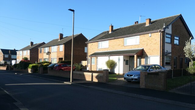
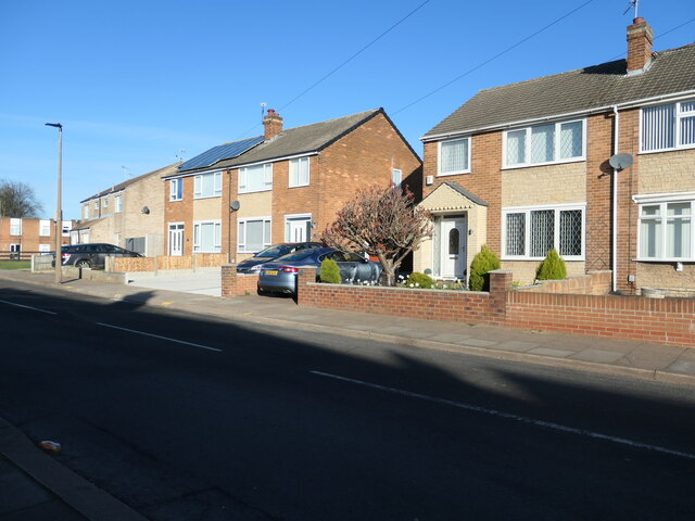
The village of Armthorpe has a rich history dating back to medieval times, with evidence of human settlement in the area since the Bronze Age. Today, it is predominantly a residential area with a mix of housing estates, ranging from traditional terraced houses to more modern developments.

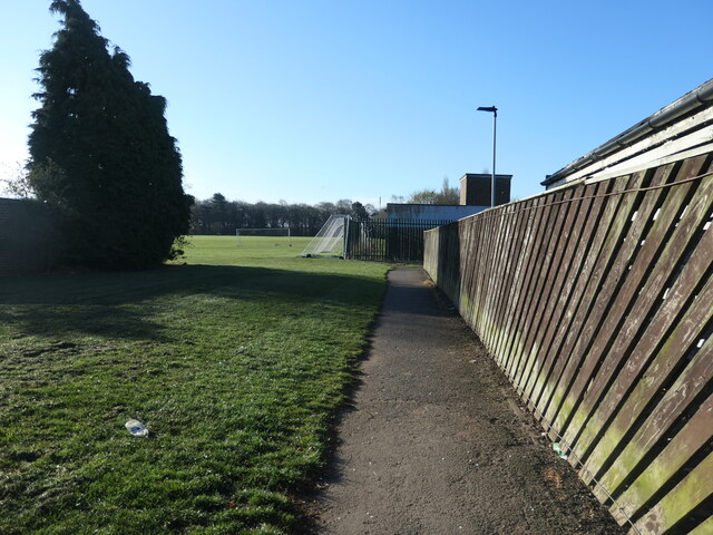
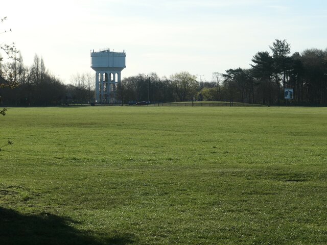
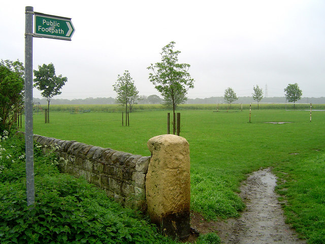
Armthorpe offers a range of amenities to its residents, including several primary schools, a secondary school, and a library. The village also has a medical center, a post office, and a number of shops and supermarkets that cater to the daily needs of its inhabitants. Additionally, there are several parks and green spaces, providing recreational opportunities for residents to enjoy.

Transport links in Armthorpe are well-developed, with regular bus services connecting the village to Doncaster and other nearby towns. The village is also conveniently located near the A630 road, allowing easy access to the wider region.

Overall, Armthorpe is a pleasant village that offers a peaceful and community-oriented lifestyle. Its convenient location, range of amenities, and historical significance make it an attractive place to live for individuals and families alike.

If you have any feedback on the listing, please let us know in the comments section below.
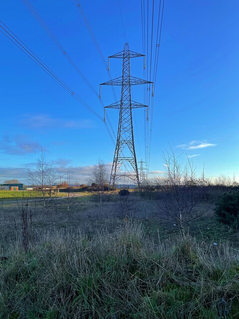
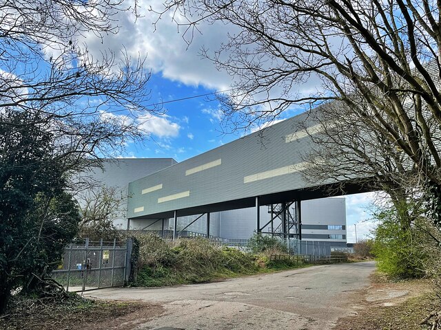
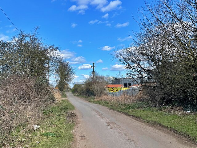
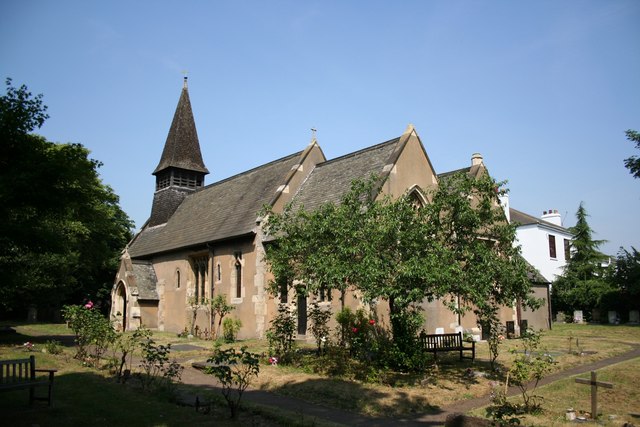
Armthorpe Images

Images are sourced within 2km of 53.536659/-1.061468 or Grid Reference SE6204. Thanks to Geograph Open Source API. All images are credited.

West side of Linkswood Avenue, Doncaster Built in the 1960s.
West side of Linkswood Avenue, Doncaster
Built in the 1960s.
North side of Fernhurst Road, Doncaster These houses were built in the 1960s.
North side of Fernhurst Road, Doncaster
These houses were built in the 1960s.
Path into the playing fields, Wheatley, Doncaster On the south side of Fernhurst Road.
Path into the playing fields, Wheatley, Doncaster
On the south side of Fernhurst Road.
Armthorpe water tower, from the north-west Built between 1904 and 1929 for Doncaster Corporation's Water Works.
Armthorpe water tower, from the north-west
Built between 1904 and 1929 for Doncaster Corporation's Water Works.
Parkside flats in Danesthorpe Close Built after 2000 on the north side of Doncaster's Armthorpe Road.
Parkside flats in Danesthorpe Close
Built after 2000 on the north side of Doncaster's Armthorpe Road.
Electricity pylon off Hatfield Lane
Church of Our Lady of Sorrows and St Francis Opened in 1959 to serve the growing population in Armthorpe
Church of Our Lady of Sorrows and St Francis
Opened in 1959 to serve the growing population in Armthorpe
The church of St Leonard & St Mary Grade II listed parish church dating from the 11th century.
The church of St Leonard & St Mary
Grade II listed parish church dating from the 11th century.
Modern housing development Built on the site of Markham Main Colliery which closed in 1996.
Modern housing development
Built on the site of Markham Main Colliery which closed in 1996.
Path in Hag Wood
Path in Hag Wood
Fence under construction The posts are formed from old telegraph poles so the fence should be very robust when it's finished.
Fence under construction
The posts are formed from old telegraph poles so the fence should be very robust when it's finished.
Green space on South Moor A good place to excercise your dogs. I believe this area of woodland and open spaces has been reclaimed from a colliery waste tip.
Green space on South Moor
A good place to excercise your dogs. I believe this area of woodland and open spaces has been reclaimed from a colliery waste tip.
Pond below South Moor Wood This area of woodland and open spaces has been reclaimed from a colliery waste tip.
Pond below South Moor Wood
This area of woodland and open spaces has been reclaimed from a colliery waste tip.
Path in Sandall Beat Wood
Distribution centre under construction on Yorkshire Way With convenient access to the M18 motorway this is one of several similar huge buildings which have been built here in recent years.
Distribution centre under construction on Yorkshire Way
With convenient access to the M18 motorway this is one of several similar huge buildings which have been built here in recent years.
Bridge between two large distribution centres It looks capable of enabling the movement of large items between two huge Next warehouses.
Bridge between two large distribution centres
It looks capable of enabling the movement of large items between two huge Next warehouses.
IKEA Distribution Centre With convenient access to the M18 motorway this is one of several similar huge buildings which have been built here in recent years.
IKEA Distribution Centre
With convenient access to the M18 motorway this is one of several similar huge buildings which have been built here in recent years.
West Moor Lane The lane has become a no through road to facilitate the development of the business estates in the area.
West Moor Lane
The lane has become a no through road to facilitate the development of the business estates in the area.
Show me another place!

Armthorpe is located at Grid Ref: SE6204 (Lat: 53.536659, Lng: -1.061468)

Division: West Riding

Unitary Authority: Doncaster

Police Authority: South Yorkshire

What 3 Words

///diner.void.belts. Near Armthorpe, South Yorkshire

Nearby Locations

Armthorpe

Related Wikis

Nearby Amenities

Located within 500m of 53.536659,-1.061468
Armthorpe
Place: village
Wikidata: Q2339006
Wikipedia: en:Armthorpe
Lat/Long: 53.5395185/-1.0598953
Bus Stop
Church Street/Woodlea Grove
Alt Name: Church Street/Woodlea Grove
Bench: yes
Naptan AltCommonName: Church Street/Woodlea Grove
Naptan AtcoCode: 370040378
Naptan Bearing: E
Naptan CommonName: Church Street/Woodlea Grove
Naptan Indicator: 40378
Naptan Landmark: 40378
Naptan PlusbusZoneRef: ROTHCEN
Naptan Street: Church Street
Naptan Verified: no
Shelter: yes
Source: naptan_import
Lat/Long: 53.5356356/-1.0560068
Bus Stop
Church Street/Barton Lane
Naptan AtcoCode: 370040379
Naptan Bearing: NW
Naptan CommonName: Church Street/Barton Lane
Naptan Indicator: 40379
Naptan Landmark: Outside Church
Naptan PlusbusZoneRef: ROTHCEN
Naptan Street: Church Street
Naptan Verified: no
Source: naptan_import
Lat/Long: 53.5370464/-1.0622853
Bus Stop
Church Street/Mere Lane
Alt Name: Church Street/Mere Lane
Naptan AltCommonName: Church Street/Mere Lane
Naptan AtcoCode: 370040380
Naptan Bearing: SE
Naptan CommonName: Church Street/Mere Lane
Naptan Indicator: 40380
Naptan Landmark: Church
Naptan PlusbusZoneRef: ROTHCEN
Naptan Street: Church Street
Naptan Verified: no
Source: naptan_import
Lat/Long: 53.5370617/-1.061953
Bus Stop
Doncaster Road/Mansfield Crescent
Alt Name: Doncaster Road/Mansfield Crescent
Naptan AltCommonName: Doncaster Road/Mansfield Crescent
Naptan AtcoCode: 370040381
Naptan Bearing: E
Naptan CommonName: Doncaster Road/Mansfield Crescent
Naptan Indicator: 40381
Naptan Landmark: CHURCH
Naptan PlusbusZoneRef: ROTHCEN
Naptan Street: Doncaster Road
Naptan Verified: no
Source: naptan_import
Lat/Long: 53.5376807/-1.064082
Bus Stop
Doncaster Road/Mansfield Crescent
Alt Name: Doncaster Road/Mansfield Crescent
Naptan AltCommonName: Doncaster Road/Mansfield Crescent
Naptan AtcoCode: 370040382
Naptan Bearing: W
Naptan CommonName: Doncaster Road/Mansfield Crescent
Naptan Indicator: 40382
Naptan Landmark: 40382
Naptan PlusbusZoneRef: ROTHCEN
Naptan Street: Doncaster Road
Naptan Verified: no
Source: naptan_import
Lat/Long: 53.5376027/-1.0656078
Bus Stop
Beech Road/Briar Road
Naptan AtcoCode: 370040502
Naptan Bearing: S
Naptan CommonName: Beech Road/Briar Road
Naptan Indicator: 40502
Naptan Landmark: 40502
Naptan PlusbusZoneRef: ROTHCEN
Naptan Street: Beech Road
Naptan Verified: no
Source: naptan_import
Lat/Long: 53.5389723/-1.0557239
Bus Stop
Elm Road/Mere Lane
Naptan AtcoCode: 370045407
Naptan Bearing: E
Naptan CommonName: Elm Road/Mere Lane
Naptan Indicator: 45407
Naptan Landmark: 45407
Naptan PlusbusZoneRef: ROTHCEN
Naptan Street: Elm Road
Naptan Verified: no
Source: naptan_import
Lat/Long: 53.5410312/-1.0603411
Bus Stop
Briar Road/Beech Road
Naptan AtcoCode: 370045408
Naptan Bearing: NW
Naptan CommonName: Briar Road/Beech Road
Naptan Indicator: 45408
Naptan Landmark: ELECTRICITY SUB STATION
Naptan PlusbusZoneRef: ROTHCEN
Naptan Street: Briar Road
Naptan Verified: no
Source: naptan_import
Lat/Long: 53.5392547/-1.0562005
Bus Stop
Church Street/Beech Road
Alt Name: Church Street/Beech Road
Bench: yes
Naptan AltCommonName: Church Street/Beech Road
Naptan AtcoCode: 370045409
Naptan Bearing: NW
Naptan CommonName: Church Street/Beech Road
Naptan Indicator: 45409
Naptan Landmark: PRESTO SUPERMARKET
Naptan PlusbusZoneRef: ROTHCEN
Naptan Street: Church Street
Naptan Verified: no
Shelter: yes
Source: naptan_import
Lat/Long: 53.5356108/-1.0569153
Bus Stop
Mere Lane/Glebe Farm Close
Naptan AtcoCode: 370046031
Naptan Bearing: S
Naptan CommonName: Mere Lane/Glebe Farm Close
Naptan Indicator: 46031
Naptan Landmark: Streetlight No 21218
Naptan PlusbusZoneRef: ROTHCEN
Naptan Street: Mere Lane
Naptan Verified: no
Source: naptan_import
Lat/Long: 53.5383408/-1.0622869
Bus Stop
Mere Lane/Elm Place
Naptan AtcoCode: 370046032
Naptan Bearing: SW
Naptan CommonName: Mere Lane/Elm Place
Naptan Indicator: 46032
Naptan Landmark: SCHOOL
Naptan PlusbusZoneRef: ROTHCEN
Naptan Street: Mere Lane
Naptan Verified: no
Source: naptan_import
Lat/Long: 53.5402179/-1.0609476
Bus Stop
Briar Road/Elm Road
Naptan AtcoCode: 370046033
Naptan Bearing: NW
Naptan CommonName: Briar Road/Elm Road
Naptan Indicator: 46033
Naptan Landmark: HIGH WALL
Naptan PlusbusZoneRef: ROTHCEN
Naptan Street: Briar Road
Naptan Verified: no
Source: naptan_import
Lat/Long: 53.5403361/-1.0588324
Bus Stop
Beech Road/Poplar Place
Naptan AtcoCode: 370046034
Naptan Bearing: N
Naptan CommonName: Beech Road/Poplar Place
Naptan Indicator: 46034
Naptan Landmark: 46034
Naptan PlusbusZoneRef: ROTHCEN
Naptan Street: Beech Road
Naptan Verified: no
Source: naptan_import
Lat/Long: 53.5370557/-1.0566115
Bus Stop
Mere Lane/The Practice
Alt Name: Mere Lane/The Practice
Naptan AltCommonName: Mere Lane/The Practice
Naptan AtcoCode: 370041163
Naptan Bearing: NE
Naptan CommonName: Mere Lane/The Practice
Naptan Indicator: 41163
Naptan Landmark: THE PRACTICE
Naptan PlusbusZoneRef: ROTHCEN
Naptan Street: Mere Lane
Naptan Verified: no
Source: naptan_import
Lat/Long: 53.5395856/-1.061701
Mere Lane/Our Lady of Sorrows RC School
Alt Name: Mere Lane/Our Lady of Sorrows RC School
Naptan AltCommonName: Mere Lane/Our Lady of Sorrows RC School
Naptan AtcoCode: 370045744
Naptan Bearing: W
Naptan BusStopType: CUS
Naptan CommonName: Mere Lane/Our Lady of Sorrows RC School
Naptan Indicator: 45744
Naptan Landmark: OUR LADY OF SORROWS RC SCHOOL
Naptan PlusbusZoneRef: ROTHCEN
Naptan Street: Mere Lane
Naptan Verified: no
Source: naptan_import
Lat/Long: 53.5390652/-1.062965
Briar Road/Elm Road
Naptan AtcoCode: 370046249
Naptan Bearing: SE
Naptan BusStopType: CUS
Naptan CommonName: Briar Road/Elm Road
Naptan Indicator: 46249
Naptan Landmark: 46249
Naptan PlusbusZoneRef: ROTHCEN
Naptan Street: Briar Road
Naptan Verified: no
Source: naptan_import
Lat/Long: 53.5403618/-1.0586658
Beech Road/Poplar Place
Naptan AtcoCode: 370046250
Naptan Bearing: N
Naptan BusStopType: CUS
Naptan CommonName: Beech Road/Poplar Place
Naptan Indicator: 46250
Naptan Landmark: 46250
Naptan PlusbusZoneRef: ROTHCEN
Naptan Street: Beech Road
Naptan Verified: no
Source: naptan_import
Lat/Long: 53.5370933/-1.056822
Turning Circle
Lat/Long: 53.5361448/-1.0554723
Bus Stop
Lat/Long: 53.5390071/-1.0619053
Crossing
Crossing: traffic_signals
Crossing Island: no
Crossing Ref: pelican
Tactile Paving: yes
Lat/Long: 53.5355717/-1.0562662
Crossing
Lat/Long: 53.5349417/-1.0551233
Crossing
Lat/Long: 53.5352552/-1.0550844
Generator Method: photovoltaic
Generator Output Electricity: yes
Generator Source: solar
Generator Type: solar_photovoltaic_panel
Location: roof
Power: generator
Lat/Long: 53.5368716/-1.0602759
Generator Method: photovoltaic
Generator Output Electricity: yes
Generator Source: solar
Generator Type: solar_photovoltaic_panel
Location: roof
Power: generator
Lat/Long: 53.5368476/-1.0601538
Generator Method: photovoltaic
Generator Output Electricity: yes
Generator Source: solar
Generator Type: solar_photovoltaic_panel
Location: roof
Power: generator
Lat/Long: 53.5368325/-1.0600425
Generator Method: photovoltaic
Generator Output Electricity: yes
Generator Source: solar
Generator Type: solar_photovoltaic_panel
Location: roof
Power: generator
Lat/Long: 53.5332904/-1.0571659
Generator Method: photovoltaic
Generator Output Electricity: yes
Generator Source: solar
Generator Type: solar_photovoltaic_panel
Location: roof
Power: generator
Lat/Long: 53.5333924/-1.0569996
Generator Method: photovoltaic
Generator Output Electricity: yes
Generator Source: solar
Generator Type: solar_photovoltaic_panel
Location: roof
Power: generator
Lat/Long: 53.5324056/-1.0617068
Generator Method: photovoltaic
Generator Output Electricity: yes
Generator Source: solar
Generator Type: solar_photovoltaic_panel
Location: roof
Power: generator
Lat/Long: 53.5329285/-1.059258
Generator Method: photovoltaic
Generator Output Electricity: yes
Generator Source: solar
Generator Type: solar_photovoltaic_panel
Location: roof
Power: generator
Lat/Long: 53.5342835/-1.0609075
Generator Method: photovoltaic
Generator Output Electricity: yes
Generator Source: solar
Generator Type: solar_photovoltaic_panel
Location: roof
Power: generator
Lat/Long: 53.5337941/-1.061267
Generator Method: photovoltaic
Generator Output Electricity: yes
Generator Source: solar
Generator Type: solar_photovoltaic_panel
Location: roof
Power: generator
Lat/Long: 53.5339392/-1.061165
Generator Method: photovoltaic
Generator Output Electricity: yes
Generator Source: solar
Generator Type: solar_photovoltaic_panel
Location: roof
Power: generator
Lat/Long: 53.5333111/-1.0600546
Generator Method: photovoltaic
Generator Output Electricity: yes
Generator Source: solar
Generator Type: solar_photovoltaic_panel
Location: roof
Power: generator
Lat/Long: 53.5331294/-1.0597381
Generator Method: photovoltaic
Generator Output Electricity: yes
Generator Source: solar
Generator Type: solar_photovoltaic_panel
Location: roof
Power: generator
Lat/Long: 53.5331581/-1.0596925
Generator Method: photovoltaic
Generator Output Electricity: yes
Generator Source: solar
Generator Type: solar_photovoltaic_panel
Location: roof
Power: generator
Lat/Long: 53.5333175/-1.0593089
Generator Method: photovoltaic
Generator Output Electricity: yes
Generator Source: solar
Generator Type: solar_photovoltaic_panel
Location: roof
Power: generator
Lat/Long: 53.5342835/-1.0599366
Generator Method: photovoltaic
Generator Output Electricity: yes
Generator Source: solar
Generator Type: solar_photovoltaic_panel
Location: roof
Power: generator
Lat/Long: 53.5339775/-1.0593089
Generator Method: photovoltaic
Generator Output Electricity: yes
Generator Source: solar
Generator Type: solar_photovoltaic_panel
Location: roof
Power: generator
Lat/Long: 53.5382719/-1.0547572
Generator Method: photovoltaic
Generator Output Electricity: yes
Generator Source: solar
Generator Type: solar_photovoltaic_panel
Location: roof
Power: generator
Lat/Long: 53.5379882/-1.0548994
Generator Method: photovoltaic
Generator Output Electricity: yes
Generator Source: solar
Generator Type: solar_photovoltaic_panel
Location: roof
Power: generator
Lat/Long: 53.537918/-1.054599
Generator Method: photovoltaic
Generator Output Electricity: yes
Generator Source: solar
Generator Type: solar_photovoltaic_panel
Location: roof
Power: generator
Lat/Long: 53.5375897/-1.05443
Generator Method: photovoltaic
Generator Output Electricity: yes
Generator Source: solar
Generator Type: solar_photovoltaic_panel
Location: roof
Power: generator
Lat/Long: 53.5370238/-1.0561842
Post Office
Armthorpe Post Office
Addr City: Doncaster
Addr Country: GB
Addr Housenumber: 10
Addr Postcode: DN3 3AL
Addr Street: Church Street
Addr Village: Armthorpe
Brand: Post Office
Brand Wikidata: Q1783168
Check Date: 2022-05-27
Check Date Opening Hours: 2022-05-27
Contact Website: https://www.postoffice.co.uk/branch-finder/1533118/armthorpe
Opening Hours: Mo-Th 08:30-17:30; Fr 09:00-17:30; Sa 09:00-12:30
Ref Pol Id: 3045
Lat/Long: 53.53633/-1.06117
Whitehouse Farm Medical Centre
Building: yes
Note: unknown tag whitehouse Farm Medical Centre = GP Practice
Lat/Long: 53.5364484/-1.058565
Generator Method: photovoltaic
Generator Output Electricity: yes
Generator Source: solar
Generator Type: solar_photovoltaic_panel
Location: roof
Power: generator
Lat/Long: 53.5399998/-1.0646251
Generator Method: photovoltaic
Generator Output Electricity: yes
Generator Source: solar
Generator Type: solar_photovoltaic_panel
Location: roof
Power: generator
Lat/Long: 53.5400237/-1.06455
Generator Method: photovoltaic
Generator Output Electricity: yes
Generator Source: solar
Generator Type: solar_photovoltaic_panel
Location: roof
Power: generator
Lat/Long: 53.5401576/-1.0617927
Generator Method: photovoltaic
Generator Output Electricity: yes
Generator Source: solar
Generator Type: solar_photovoltaic_panel
Location: roof
Power: generator
Lat/Long: 53.5374797/-1.0666126
Generator Method: photovoltaic
Generator Output Electricity: yes
Generator Source: solar
Generator Type: solar_photovoltaic_panel
Location: roof
Power: generator
Lat/Long: 53.5378272/-1.0613072
Generator Method: photovoltaic
Generator Output Electricity: yes
Generator Source: solar
Generator Type: solar_photovoltaic_panel
Location: roof
Power: generator
Lat/Long: 53.5379101/-1.061275
Generator Method: photovoltaic
Generator Output Electricity: yes
Generator Source: solar
Generator Type: solar_photovoltaic_panel
Location: roof
Power: generator
Lat/Long: 53.538044/-1.0615486
Generator Method: photovoltaic
Generator Output Electricity: yes
Generator Source: solar
Generator Type: solar_photovoltaic_panel
Location: roof
Power: generator
Lat/Long: 53.5381029/-1.0618678
Generator Method: photovoltaic
Generator Output Electricity: yes
Generator Source: solar
Generator Type: solar_photovoltaic_panel
Location: roof
Power: generator
Lat/Long: 53.5378814/-1.0619885
Generator Method: photovoltaic
Generator Output Electricity: yes
Generator Source: solar
Generator Type: solar_photovoltaic_panel
Location: roof
Power: generator
Lat/Long: 53.5378256/-1.0618517
Generator Method: photovoltaic
Generator Output Electricity: yes
Generator Source: solar
Generator Type: solar_photovoltaic_panel
Location: roof
Power: generator
Lat/Long: 53.5376311/-1.0620207
Generator Method: photovoltaic
Generator Output Electricity: yes
Generator Source: solar
Generator Type: solar_photovoltaic_panel
Location: roof
Power: generator
Lat/Long: 53.5394068/-1.0577211
Generator Method: photovoltaic
Generator Output Electricity: yes
Generator Source: solar
Generator Type: solar_photovoltaic_panel
Location: roof
Power: generator
Lat/Long: 53.539724/-1.0575628
Generator Method: photovoltaic
Generator Output Electricity: yes
Generator Source: solar
Generator Type: solar_photovoltaic_panel
Location: roof
Power: generator
Lat/Long: 53.5395774/-1.0567823
Generator Method: photovoltaic
Generator Output Electricity: yes
Generator Source: solar
Generator Type: solar_photovoltaic_panel
Location: roof
Power: generator
Lat/Long: 53.5395997/-1.0567743
The data included in this document is from www.openstreetmap.org. The data is made available under ODbL.

Have you been to Armthorpe?

Leave your review of Armthorpe below (or comments, questions and feedback).